TrainWeb.org Facebook Page
CTN Photo Tour


Canton Railroad
Modern day photo tour

Accompanying each photo below are:

Click a photo to see a larger view. Please send your comments and corrections to Steve.


<< Previous (south) | THIS PAGE: Canton west | Next (east) >>

To Lazaretto Point
Image courtesy Johns Hopkins University

To Lazaretto Point
Mile: 0.5 Date: 1928
Ease: View: N (up)
Area: T6:
Map: Ba 43 K 5 Topographic Maps

To represent Canton Railroad's (CTN's) K-shaped trackage, a large K is overlaid in red on this map. Let us resume near the center of that K which is in the top right part of this map near the I-95 label. This tour page follows the left side of the K in two stages: first from center to toward the lower left, then from the center to upper left. Both routes are employed by CTN trains from Penn Mary yard as of 2023, with the former seeing more action.

Most of the tracks in this 1928 depiction belong to Pennsylvania Railroad. CTN reached Lazaretto Point at a southwest corner of Canton via the line below the red B1 (and 1/2). During the 1980s, I-95 arrived and blocked the way with a tunnel toll plaza near the red B1. That forced CTN to subsequently employ a more circuitous route to industry at Lazaretto Point (bottom left) where a lighthouse once stood.

We'll follow that route by beginning where I-95 and I-895 now cross overhead near Holabird Avenue and Newkirk Street near the upper right of this map. To help untangle the many tracks here, arrows depict the direction of view of the matching photos below.


CTN 1906
Photo courtesy Dave Hiteshew

CTN 1906
Mile: 0.5 Date: 2021
Ease: A View: NW
Area: B- T6:
Map: Ba 44 A 3 Topographic Maps

CTN's Knoxville Locomotive Works model NZE15B switcher is a Net Zero Emissions unit. The unit's 1906 number recalls the year CTN began operation.

As seen from under the interstates, the warning flashers at distant right mark the grade crossing with Newkirk Street.


Dwarf CPL

Dwarf CPL
Mile: 0.5 Date: Nov 2016
Ease: A- View: NW
Area: B- T6:
Map: Ba 44 A 3 Topographic Maps

CTN's Newkirk Street grade crossing is adjacent CSX's where it shares warnings flashers. CTN also crosses CSX nearby. I suspect this is why CTN signals here are of B&O/CSX color position light design. Other CTN signals we'll see later resemble those used by Western Maryland Railway.

Newkirk Street is obscured by glare at photo top.


Newkirk Street

Newkirk Street
Mile: 0.6 Date: Nov 2016
Ease: A View: N
Area: C+ T6:
Map: Ba 44 A 3 Topographic Maps

The nearer two of the four tracks are CTN's, the farther ones CSX's.


CTN 1201
Photo credit HH Harwood

CTN 1201
Mile: 0.6 Date: Apr 1994
Ease: A View: E
Area: C+ HCR: 88
Map: Ba 44 A 3 Topographic Maps

CTN 1201, rented CR 8708, and CTN 1751 busy themselves switching cars at Newkirk Street. The big R covered hopper had belonged to Chicago, Rock Island and Pacific Railroad that, by photo time, had been sold off in pieces to other roads.


From I-95

From I-95
Mile: 0.5 Date: Mar 2023
Ease: A View: NW
Area: B T6:
Map: Ba 44 A 3 Topographic Maps

The four tracks we saw at the Newkirk Street grade crossing are the ones that enter from the right side of this photo. The yellow boxcar rests on one of CTN's tracks. To navigate to Rukert Marine Terminal at Lararetto Point, CTN pulls into the small yard beyond that boxcar, where it reverses and pushes cars off mid-photo left.


CRYX 6209

CRYX 6209
Mile: 1.6 Date: Mar 2023
Ease: A View: W
Area: B- T6:
Map: Ba 43 J 3 Topographic Maps

Along the way, CTN can deliver frozen concoctions to customers along the western part of Holabird Avenue.

Link: 2020


NS 7610

NS 7610
Mile: 1.4 Date: Mar 2023
Ease: A View: SE
Area: C+ T6:
Map: Ba 43 K 3 Topographic Maps

Around the time Fifth Avenue was renamed Holabird (1920s), its grade crossing began to peter out. Utility poles still trace its path where NS 7610 is jockeying CONSOL Energy coal hoppers.

To reach Lazaretto Point, CTN employs the foreground trackage.


Margaritaville

Margaritaville
Mile: 1.8 Date: Mar 2023
Ease: A View: W
Area: B T6:
Map: Ba 43 K 4 Topographic Maps

Next, CTN squeezes between I-95 and huge lost shakers of salt.


Wire MCU

Wire MCU
Mile: 2.1 Date: Mar 2023
Ease: A View: NE
Area: B- T6:
Map: Ba 43 J 5 Topographic Maps

Then it passes the building that appeared in The Wire as a Major Crimes Unit outpost.

Link: MCU building


Atlas 1894
Image courtesy Johns Hopkins University

Atlas 1894
Mile: Date: 1894
Ease: View: N (up)
Area: T6:
Map: Ba 43 J 5 Topographic Maps

11th Avenue is now Mertens Street. CTN did not yet exist, so the tracks to Stickney Iron Company Works are Northern Central's. The boundary stone that had marked Baltimore city's southeast corner is no longer to be found. Lazaretto Lighthouse stood at the waterfront.

Link: lighthouse photos


Lehigh Cement

Lehigh Cement
Mile: 2.2 Date: May 2023
Ease: A View: W
Area: B- T6:
Map: Ba 43 J 5 Topographic Maps

The cab of the truck at bottom center marks where the lighthouse had been. Lehigh Cement's elevators would tower over it. Sometimes CTN's ultimate destination is the adjacent shed. Barely visible between the two in the distance is a US flag flying over Fort McHenry.

Link: CTN 1204 here 2021


Lighthouse

Lighthouse
Mile: 2.2 Date: May 2023
Ease: A View: W
Area: B- T6:
Map: Ba 43 J 5 Topographic Maps

The lighthouse south of the shed (left) is a non-operational, decorative version erected by the Rukert family that owns the marine terminal in this area.

Maintenance crews were out on this day near the switch in the photo below.


Recessed Switch

Recessed Switch
Mile: 2.2 Date: May 2023
Ease: A View: S
Area: B- T6:
Map: Ba 43 J 5 Topographic Maps

When a switch shares a paved area, its mechanism must be recessed into the pavement like this. I do not know of another such survivor in the Baltimore area. They were more common prior to 1980 before most of Baltimore's street trackage was pulled up or paved over.

Links: CTN 1501 here 2017, Monumental City street trackage archive


Map 1970
Image courtesy Johns Hopkins University

Map 1970
Mile: Date: 1970
Ease: View: N (up)
Area: T6:
Map: Ba 43 K 2 Topographic Maps

Having reached the end of the line at Lazaretto Point, let us restart near the center of CTN's trackage K at the I-895 on this map, and this time proceed to the K's upper left. The green route to the upper right is also CTN's, and will be toured on the next page.


Boxcar

Boxcar
Mile: 0.5 Date: Mar 2023
Ease: A View: NW
Area: B T6: 305
Map: Ba 44 A 3 Topographic Maps

Instead of reversing south (left) toward Lazaretto Point, CTN can continue north (right) to the Boston Street grade crossing and beyond.

One-eyed Mr. Boh, mascot of National Bohemian Beer, stands tall in the distance near the Conkling Street peak of a revitalized Brewers Hill.

By the way, PRR's Fifth Avenue Station had been located between where I-95 now passes over Holabird Avenue, and the blue GATX boxcar below. NS still calls the area on the left its Fifth Avenue Yard.


North View

North View
Mile: 1.4 Date: Mar 2023
Ease: A View: N
Area: C+ HCR: 83
Map: Ba 43 K 3 Topographic Maps

Canton Company finally enticed a railroad, the Baltimore and Susquehanna (B&S), to build to Canton in 1850. Planning and grading were performed until B&S became distracted by Pennsylvanian efforts to stop its progress into that state. The solution involved B&S merging with certain Pennsylvania railroads to form Northern Central Railway (NC), which squelched the build to Canton.

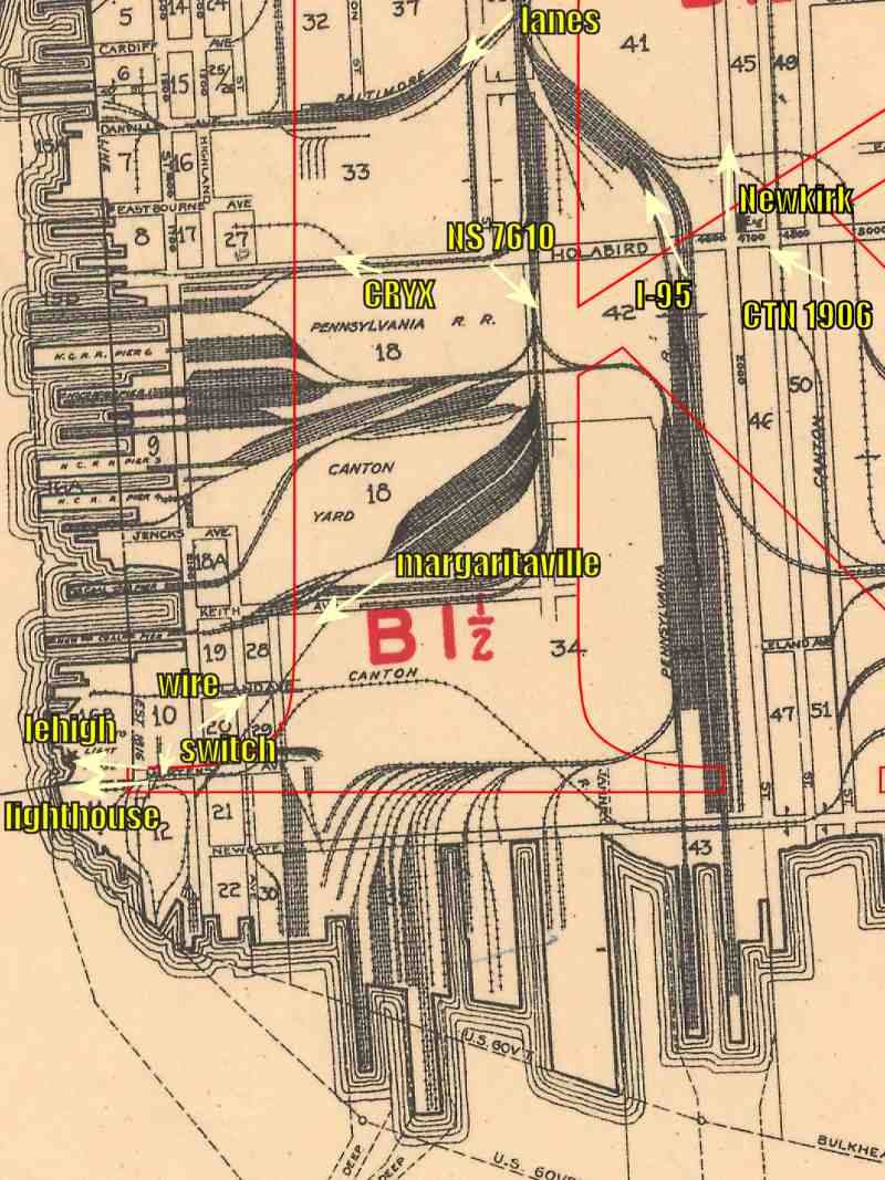
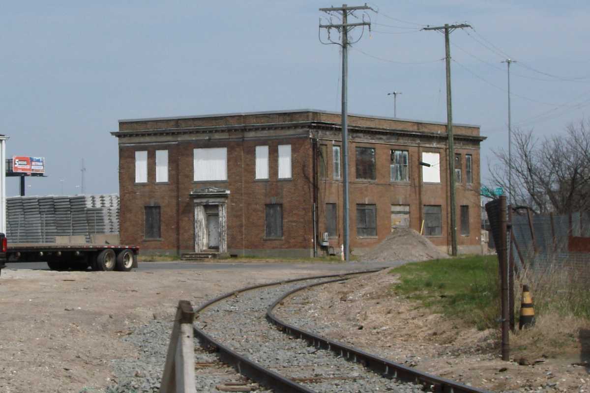
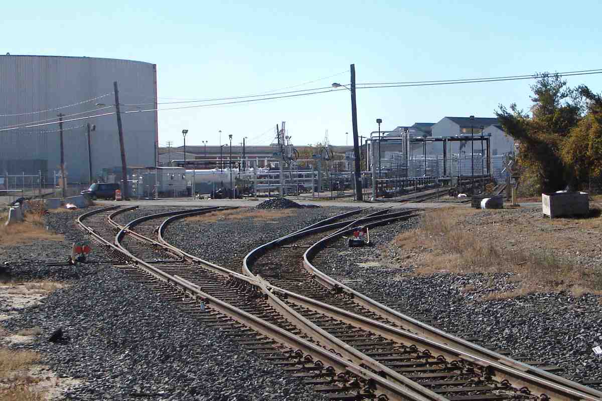
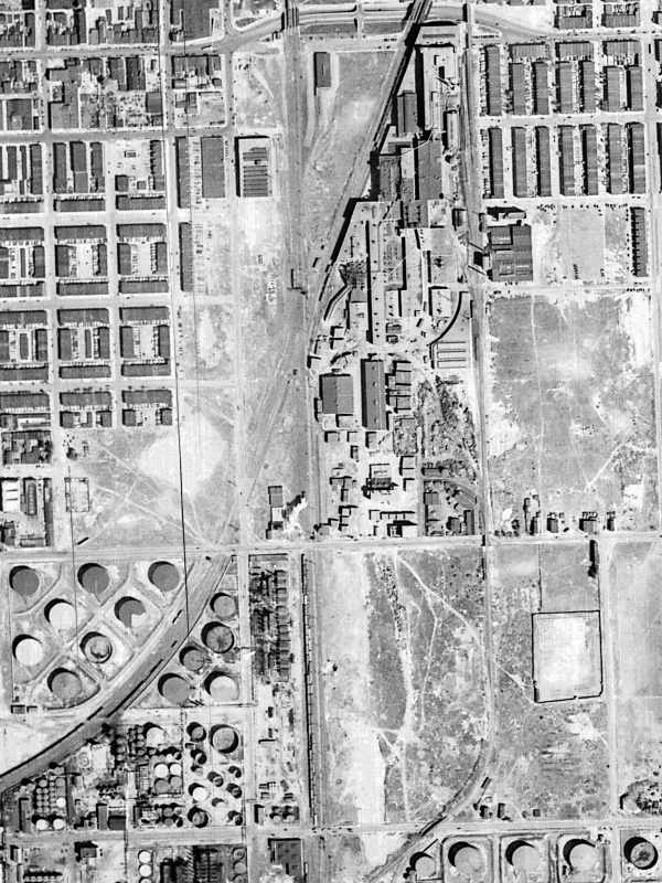
It was only after Canton Company owners pushed the formation of Union Railroad (URR) in 1870 that progress resumed. URR was in 1873 acquired by NC, and finally trains rolled in this part of Canton. During the early 
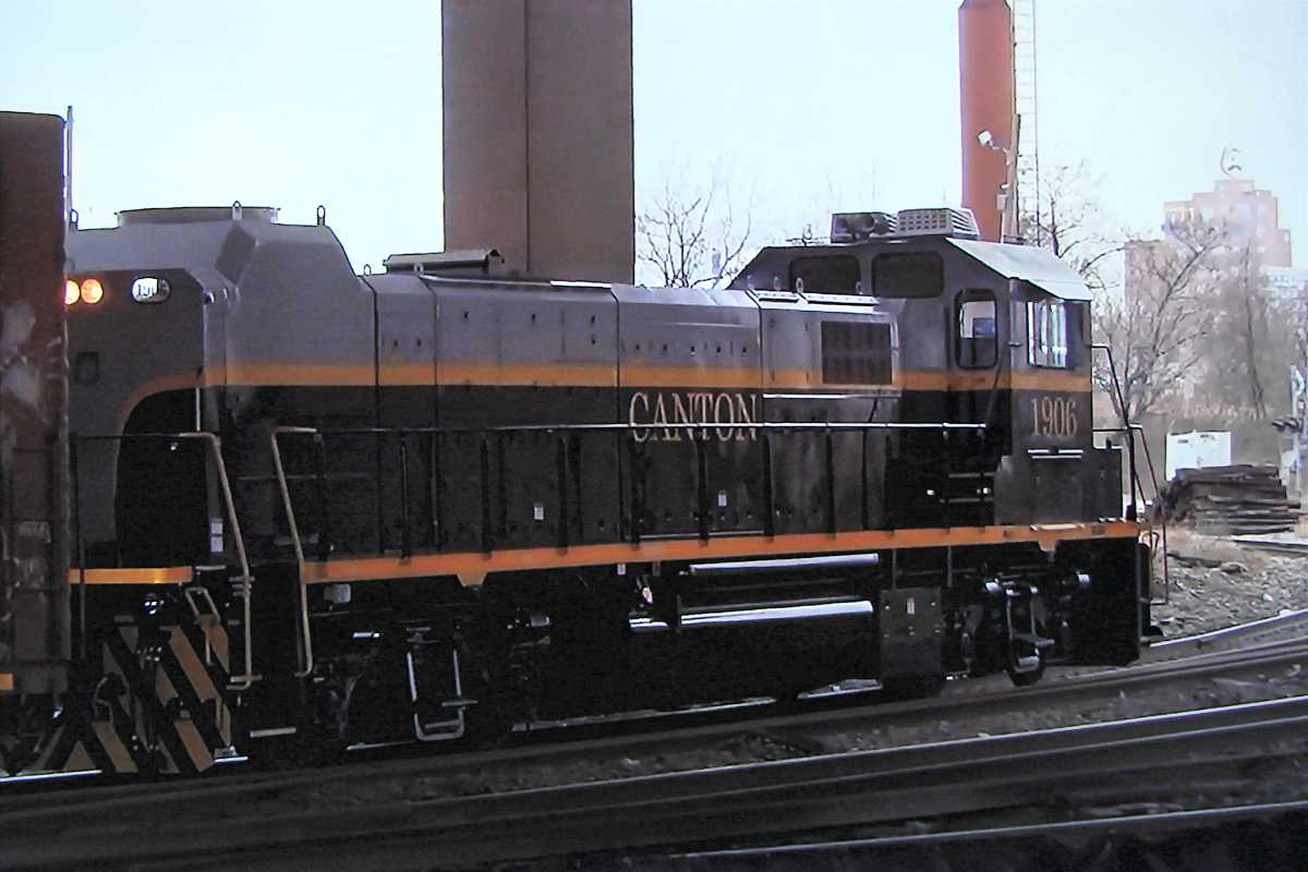
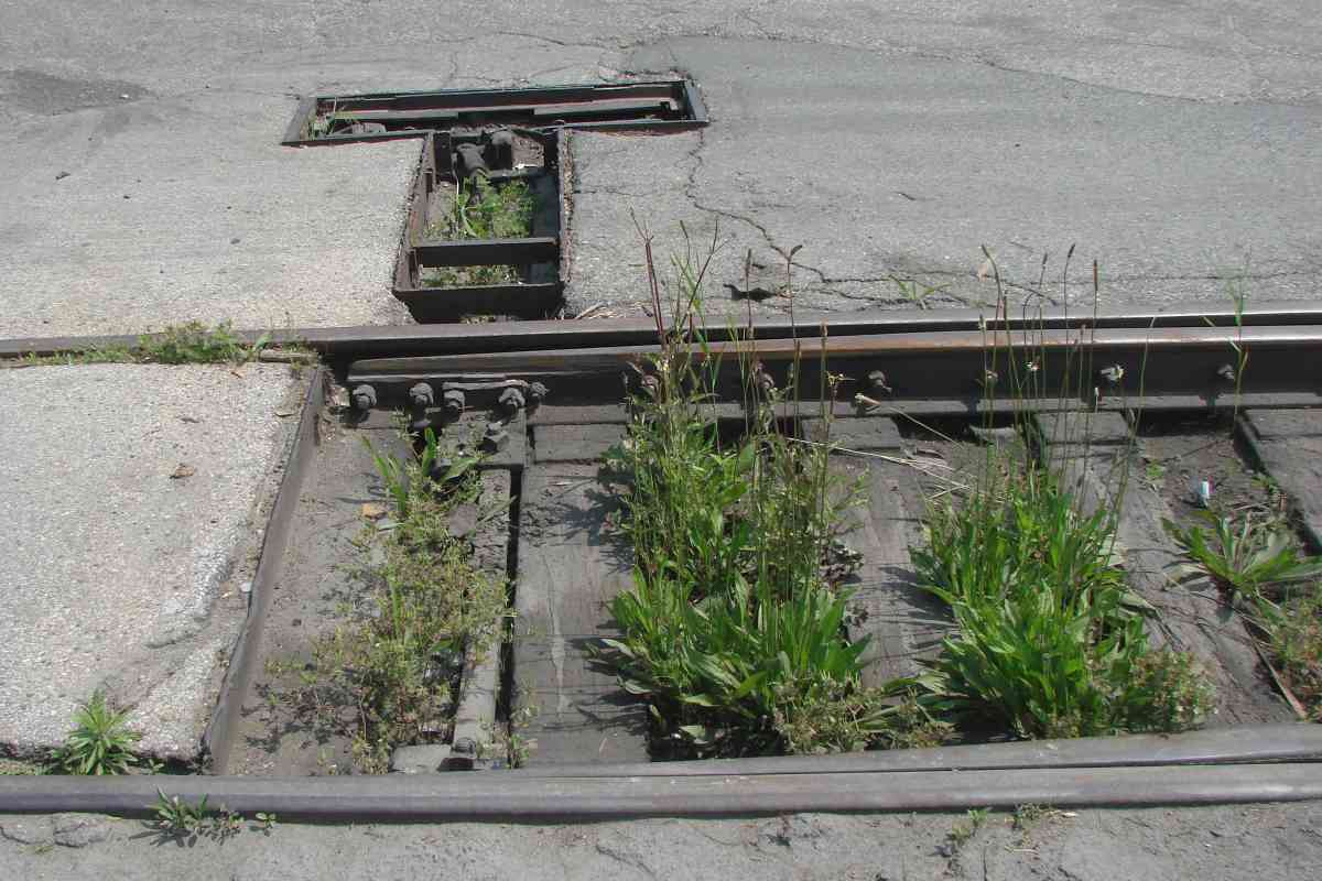
1900s, Canton Company added tracks along some of the former URR route as part of its new Canton Railroad (CTN). It is that route the remainder of this page tours.

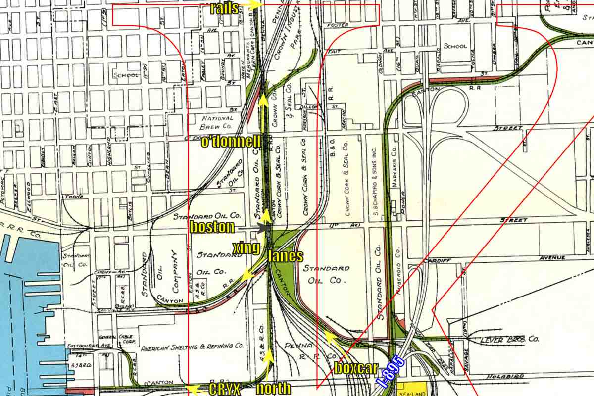
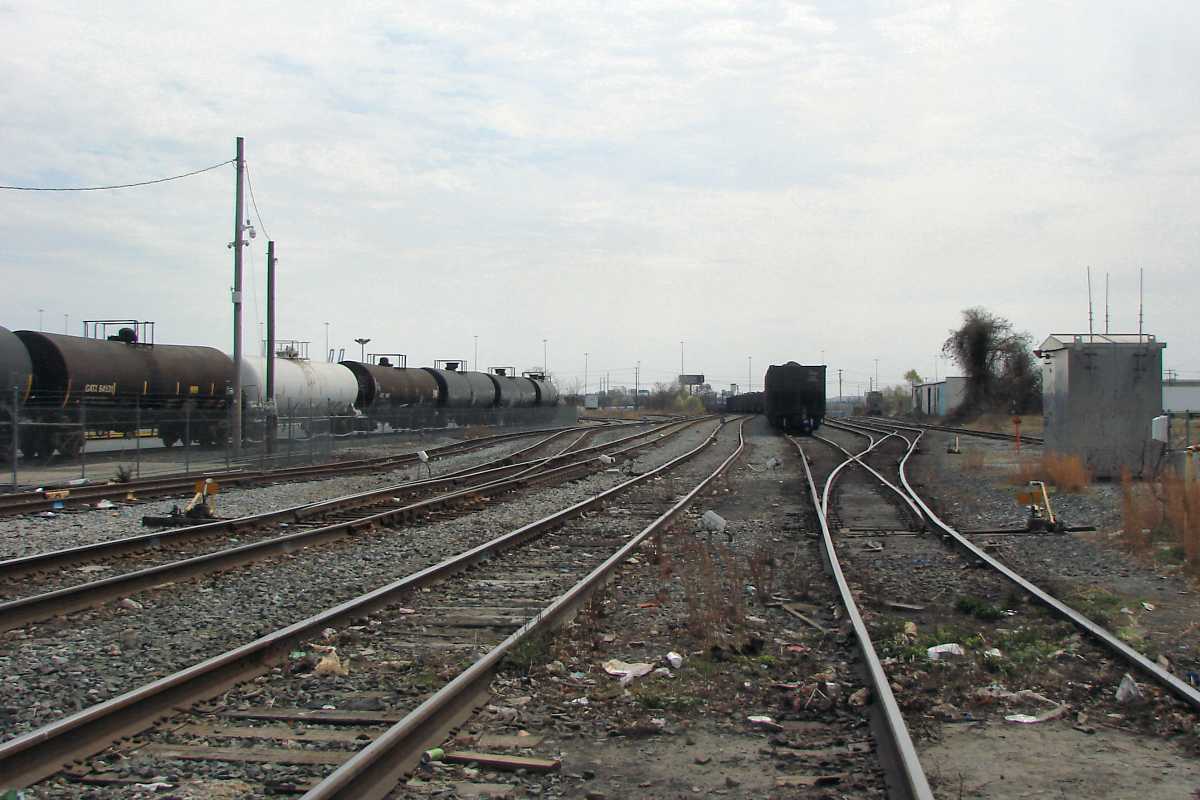
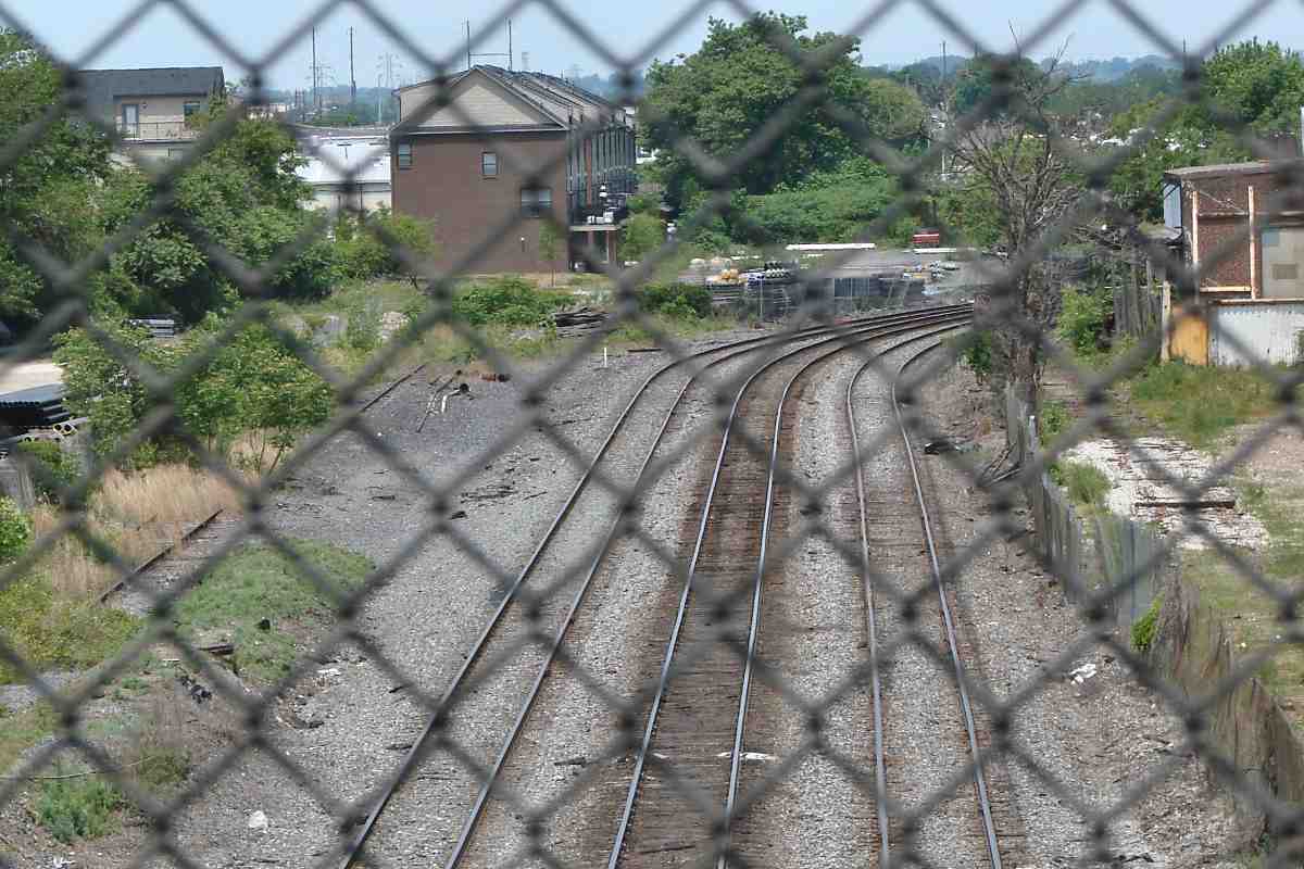
A view north from Holabird Avenue's western segment finds stationary NS 9788 and NS 4493 wastin' away. The distant overpass is O'Donnell Street, but closer, where the white truck trailer is found, is the Boston Street grade crossing.


Xing at Boston Street

Xing at Boston Street
Mile: 1.1 Date: Nov 2016
Ease: A- View: N
Area: C+ HCR:
Map: Ba 43 K 2 Topographic Maps

O'Donnell Street bridges in the distance but the nearer Boston Street has never been grade separated. The auto westbound on Boston Street has just crossed over the ex-NC track that leads toward Sparrows Point. The track at foreground left leads to the customer in the next photo.


Lanes

Lanes
Mile: 1.1 Date: Nov 2016
Ease: A- View: SW
Area: C+ HCR:
Map: Ba 43 K 2 Topographic Maps

Tank cars are sometimes seen crossing Haven Street to reach one of several stalls, or lanes, as CTN calls them. During the 19th century, this was part of B&O's car float route that connected to points northeast such as Philadelphia. Once B&O opened its Howard Street Tunnel in Baltimore, it had an overland route to the northeast, and regularly scheduled car floats soon ceased.

Link: 2016
Detour: B&O Sparrows Point Branch at this site


Standard Oil
Photo courtesy Maryland Historical Society

Standard Oil
Mile: 1.0 Date: 1945
Ease: A View: SE
Area: B- HCR:
Map: Ba 43 J 2 Topographic Maps

This part of Canton had been dominated by tanks of Standard Oil Company (now Exxon). CareFirst, Aug 2015 Its tall refinery seen in this photo along Boston Street east from Conkling Street was during the 21st century replaced by The Shops at Canton Crossing.

Arriving after the oil companies departed was the anatopistically-tall, brick 1st Mariner Bank building (right, now CareFirst), two blocks west of Conkling. The ramp on the right is part of CONSOL Energy.

Link: source photo


Boston Street

Boston Street
Mile: 1.0 Date: Mar 2023
Ease: A View: E
Area: B- HCR: 64-D
Map: Ba 43 K 2 Topographic Maps

Boston Street crosses five tracks -- there had been even more back when the warehouse at left still saw railcars enter through its tall doors.

Link: 2004


From Boston Street

From Boston Street
Mile: 1.0 Date: Mar 2023
Ease: A View: S
Area: B- HCR:
Map: Ba 43 K 1 Topographic Maps

The view south from the crossing is not very colorful during early spring.


Aerial 1938

Aerial 1938
Mile: Date: Apr 1938
Ease: View: N (up)
Area: T6:
Map: Ba 43 K 1 (center) Topographic Maps

The / diagonal originated with the Philadelphia, Wilmington and Baltimore Railroad (PW&B), the first to lay tracks in this area. Circa 1870, Union Railroad added the route that runs vertically through the center of this view. Both companies fell under PRR's iron horse curtain.

During the early 20th century, CTN retraced this part of Union Railroad's route from Boston Street (horizontal line at bottom), to O'Donnell Street (next horizontal line above), and into Crown Industrial Park that filled the area from O'Donnell up to Eastern Avenue (horizontal line at top).


From O'Donnell Street

From O'Donnell Street
Mile: 1.3 Date: May 2023
Ease: A View: N
Area: C T6:
Map: Ba 43 K 2 Topographic Maps

O'Donnell Street was grade separated around 1960. As seen from it, Crown Industrial Park had been on the right, along with the Crown Cork and Seal Company. Straight ahead, CTN had served Merchant's Terminal Corporation.

Union Railroad's tracks continued north, where the large deciduous tree is, before turning west to Union Tunnel and Station (now Penn Station). It became Northern Central (NC) Railway's primary route from Pennsylvania to Canton, until 1972's Tropical Storm Agnes washed out too many bridges for NC's successor, Penn Central, to repair. Norfolk Southern retains that disused route, but now reaches Canton from Bay View Yard via the ex-PW&B alignment seen here curving from the right.

Change for: PW&B tour at this site


Rails

Rails
Mile: 1.7 Date: May 2023
Ease: A- View: E
Area: C T6:
Map: Ba 43 K 1 Topographic Maps

North of O'Donnell Street, disused rails are hidden by brush, as are a few homeless. The old Crown Cork and Seal building (background) is being redeveloped. This spot at Eastern Avenue is to my knowledge about as far north on this branch as CTN ever operated.

When this tour resumes, we'll head northeast to CTN's farthest reaches from the waterfront.

Link: Crown Cork and Seal history


<< Previous (south) | THIS PAGE: Canton west | Next (east) >>

Or, return to main page

Copyright Notice