TrainWeb.org Facebook Page
Northern Central Railway Photo Tour


Northern Central Railway
Modern day photo tour

Accompanying each photo below are:

Click a photo to see a larger view. Please send your comments and corrections to Steve.


<< Previous (south) | THIS PAGE: Brooklandville to Garrison | Next (back to main line) >>

Brooklandville
Photo courtesy Google

Brooklandville
Mile: 3.1 Date: Feb 2017
Ease: View: N (up)
Area: T6:
Map: Ba 26 D 4 Topographic Maps

We resume at Brooklandville, Maryland, just outside the I-695 Baltimore Beltway, near I-83, part of the interchange of which is visible at lower right.

Though the south-north tan strip at right looks like it could be a former railroad right of way, the Baltimore & Susquehanna (B&S) and Northern Central (NC) had curved to the west. Their route has been disused long enough to be reclaimed by nature, but the strip of track bed can still be seen, even from space when shadows permit, as in this photo. The red arrows point to that strip.


Brooklandville 1915
Image courtesy Johns Hopkins University

Brooklandville 1915
Mile: 3.1 Date: 1915
Ease: View: N (up)
Area: T6:
Map: Ba 26 D 4 Topographic Maps

This century-older map of the same area more clearly illustrates the route. By 1915, ridership on the line had already peaked and was declining.

One of the two Brooklandville buildings depicted on the east side of Falls Road (the vertical green and pink line) survives as The Valley Inn, a restaurant.


Valley Inn
Photo credit HH Harwood

Valley Inn
Mile: 3.1 Date: Mar 2006
Ease: A View: NE
Area: A- T6:
Map: Ba 26 D 4 Topographic Maps

Though never directly associated with the railroad, Brooklandville House, now The Valley Inn, opened in 1832 to serve B&S customers, among others. The significance of the railroad is reflected by the orientation of the building: its front faces south, toward the railroad, rather than toward Falls Road.

For a period during the 1800s the building served as Brooklandville Station, as well as the town's post office. The railroad had crossed Falls Road at grade near the photographer's location.


Brooklandville Station
Photos courtesy HH Harwood collection

Brooklandville Station
Mile: 3.1 Date: ~1910
Ease: View: N
Area: A- T6:
Map: Ba 26 D 4 Topographic Maps

On the west side of Falls Road, in 1906 the NC built its last new station on the Green Spring Branch. Railroads had not anticipated how disruptive automobiles would be: just 10 years later dedicated passenger service along the Green Spring Branch would cease. Starting in the 1920s, a self-powered doodlebug shuttled branch passenger to Hollins Station where they could catch a train, such as the Parkton Local, for the trip to downtown Baltimore.

The station's Tudor style emulates that of the nearby mansion named Gramercy that AJ Cassatt, president of the Pennsylvania Railroad, had constructed as a wedding present for his daughter Eliza. Rail service here outlasted the marriage, but not by very much. Gramercy stands on land granted in 1698 by Lord Baltimore to Joshua Howard, grandfather of Colonel John Eager Howard, AJ Cassatt by Mary Cassatt he for whom Howard County is named.

AJ Cassatt appears at right as painted by his better-remembered sister Mary Cassatt. To date, Mary's impressionist art has appeared on seven different US postage stamps.

Link: MHT info (PDF)


Brooklandville Station 2019

Brooklandville Station 2019
Mile: 3.1 Date: Dec 2019
Ease: A View: NW
Area: A- T6:
Map: Ba 26 G 12 Topographic Maps

As of 2019, the former station served as a private home. The roof over the passenger platform (left) exhibits damage from a recent storm. It has since been repaired.

The building was sold in 2020. Its real estate listing has some photos of the interior. Apparently, it came with one of Stern's Big Game pinball machines in what may have been the passenger waiting room.

Link: 2020 sale


Brooklandville Station 1912
Photo courtesy Duke University

Brooklandville Station 1912
Mile: 3.1 Date: Jun 1912
Ease: A View: S
Area: A- T6:
Map: Ba 26 D 4 Topographic Maps

This view looks south along Falls Road to the station in 1912, a few years after the state assumed responsibility for Falls Road after its turnpike company failed.

Next, the tour bends west, which in this photo is to the right.

Link: source photo


Greenspring Avenue

Greenspring Avenue
Mile: 4.2 Date: Dec 2019
Ease: A- View: NE
Area: A- T6:
Map: Ba 26 A 4 Topographic Maps

Rogers Station 1927 At what had been a grade crossing of Greenspring Avenue, only the old track bed mound remains, all but obscured by plants. Rogers Station, (re)built 1905, was behind and left of the photog, in the northwest quadrant of the grade crossing, as seen in the 1927 aerial photo at left.

The NC rebuilt most of its stations along the line between 1890 and 1910.

Link: RR on left? 1912


Park School

Park School
Mile: 4.8 Date: Dec 2019
Ease: A View: S
Area: A T6:
Map: Ba 25 K 4 Topographic Maps

At an entrance to some of Park School's athletic facilities, there remains a rail embedded in pavement.


Culvert

Culvert
Mile: 4.8 Date: Dec 2019
Ease: A- View: N
Area: A T6:
Map: Ba 25 K 4 Topographic Maps

The masonry of a railroad culvert survives adjacent the Park School entrance.

Lystra Station was a short distance west.


Lystra Station
Photo courtesy Johns Hopkins University

Lystra Station
Mile: 4.9 Date: 1927
Ease: View: N (up)
Area: T6:
Map: Ba 25 K 4 Topographic Maps

Lystra Station, one of the branch's smallest stations, was the only one not located near a crossroads. As such, it was not busy and has largely been forgotten. I could find no photos of it other than this aerial in which the building appears above the R in ROAD. For a time, a spring water company shippped its product via Lystra Station.

The pointed shadows in the farm fields suggest those are corn shocks rather than hay bales.

At the left edge of the photo, the railroad and Hillside Road switch sides. Keller Avenue is just west of that transition point now.


Mossy Bridge

Mossy Bridge
Mile: 5.1 Date: Dec 2019
Ease: B+ View: N
Area: A T6:
Map: Ba 25 J 4 Topographic Maps

Not far west of Keller Avenue stands this more substantial relic. The concrete seen downstream supports Hillside Road. Other than repurposed stations, this is the line's largest artifact standing west of Rockland. During non-leat season you can see it from Hillside Road.


Cottage Avenue

Cottage Avenue
Mile: 5.4 Date: Dec 2019
Ease: A View: W
Area: A T6:
Map: Ba 25 H 4 Topographic Maps

As we approach Stevenson, the old right of way shifts back to the north of Hillside Road. Though Cottage Avenue has all the attributes of a former right-of-way, the railroad instead had followed a route through the trees on the left.


Stevenson Bridge

Stevenson Bridge
Mile: 5.6 Date: Dec 2019
Ease: B+ View: W
Area: A T6:
Map: Ba 25 H 4 Topographic Maps

looking NW This unusual bridge amalgam lies west of, but within sight of, the former Stevenson Road grade crossing. The concrete is modern, but the wood appears to date from the time of active railroading here. It was part of a walkway between Stevenson Road and the station.

This creek was adjacent a water tank, so the masonry here might have been associated with a pumping system that refilled the tank. Surface water was preferred since it typically contains less steam-engine-clogging minerals than groundwater.


Stevenson 1927
Photo courtesy Johns Hopkins University

Stevenson 1927
Mile: 5.7 Date: 1927
Ease: View: N (up)
Area: T6:
Map: Ba 25 H 4 Topographic Maps

Winter afternoon shadows help reveal structures in this aerial. Stevenson, one of the busier stops on the branch, in 1901 received the largest station on the branch. It's casting the large shadow near photo center, above the R.

Steveson's prior station was much smaller (it had one-eighth the square footage) yet was retained to handle freight. In this aerial, it is the first trackside structure southwest of the newer station.

The aforementioned trackside water tank casts a long, relatively thin shadow toward the upper-right.


Stevenson Station
Photo courtesy HH Harwood collection

Stevenson Station
Mile: 5.7 Date: ~1910
Ease: A View: NE
Area: A T6:
Map: Ba 25 G 3 Topographic Maps

In this circa 1910 view of the station, the water tank stands on the right. Note the siding on the left ends before the station. It probably hosted trains loading/unloading at the freight station behind, off photo-left.

The last train to stop here did so during 1955.

In the 1914 photo linked below, the station might be visually behind the hat of the leftmost of the two closest people walking.

Link: looking south to Stevenson 1914


Stevenson Station 2019

Stevenson Station 2019
Mile: 5.6 Date: Dec 2019
Ease: A View: NW
Area: A T6:
Map: Ba 25 G 4 Topographic Maps

The PRR sold the station in 1937 for $5000. It now houses offices, yet retains the distinctive roof over what had been the passenger platform.


Eccleston Map
Images courtesy Johns Hopkins University

Eccleston Map
Mile: 6.4 Date: 1915
Ease: View: N (up)
Area: T6:
Map: Ba 25 E 5 Topographic Maps

West from Stevenson, the next station was Eccleston, built 1900. A yellow box for the station building seems to be omitted from the map.

Eccleston Station 1927 In the 1927 aerial photo at right, the station is probably the rightmost structure close to the tracks. There appears to be a passgenger waiting shack across the tracks from it. The shadow of the tracks onto Park Heights Avenue at left reveals the line's only grade-separated road crossing.

Next is Chattalonee.

Link: Park Heights Avenue 1912


Spring Hill Road

Spring Hill Road
Mile: 7.1 Date: Dec 2019
Ease: A View: W
Area: A- T6:
Map: Ba 25 C 5 Topographic Maps

In this view toward Greenspring Valley Road, the mound and utility lines on the left tell you where trains had operated. Chattalonee Station was ahead on the left, beyond the white car.


Chattalonee Station
Photo courtesy Johns Hopkins University

Chattalonee Station
Mile: 7.3 Date: 1927
Ease: View: N (up)
Area: T6:
Map: Ba 25 C 5 Topographic Maps

Chattalonee Station is the building southwest of the grade crossing of the PENNSYLVANIA rail line and (Green Spring) VALLEY (Road). In 1890 it replaced Green Spring Station, with its new name coming from the nearby Chattolanee Hotel that opened the same year on the hill to the north. The adjacent Chattolanee Spring Water Company was at one time owned by a descendant of President James Monroe.

Eccleston Station 1927 The PRR deemed Chattolanee sufficiently worthy for inclusion on this 1893 system map (find it above BALTIMORE). With the coming of the automobile, plus the realization that mineral water did not cure all ills, the hotel declined quickly, and was demolished during the 1920s. A few of the hotel's cottage outbuildings have survived into the 2000s.

Links: Chattalonee Springs, view north from station 1912


Garrison
Image courtesy Johns Hopkins University

Garrison
Mile: 8.2 Date: 1915
Ease: View: N (up)
Area: T6:
Map: Ba 25 A 5 Topographic Maps

As we approach Garrison, we find development has erased most of the railroad. In fact, now one hole of the Green Spring Valley Country Club golf course, the one with the tee nearest Garrison Forest Road, spans the line. The site of Garrison Forest Station (built 1899) is now near a private home on the east of Garrison Forest Road.

At Garrison the branch crossed Reisterstown Road, a former turnpike. As of 2020 the site of Turnpike Station (built 1881) is occupied by the car lot of a Certified Preowned BMW car dealer. Garrison Forest and Turnpike Stations were less than a half mile apart.

West of Reisterstown Road the branch met the Western Maryland Railway (WM) at what was known as Green Spring Junction. The smallest track wye seen on the map likely originated when, during the 1870s, the WM completed its own line south to Fulton Junction where it paid a fee to share B&P Tunnel. That line extends to the bottom of the map, which is where this tour jumps to next.


Hanover Subdivision

Hanover Subdivision
Mile: 12.4 Date: Sep 2016
Ease: A- View: N
Area: B T6:
Map: Ba 24 K 8 Topographic Maps

The aforementioned Western Maryland line is now part of CSX's Hanover Subdivision. Ahead, under I-795, that track curves west at what had been the southernmost reach of the Green Spring Junction wye.


Green Spring Junction

Green Spring Junction
Mile: 8.4 Date: Dec 2019
Ease: B View: N
Area: B T6:
Map: Ba 24 K 6 Topographic Maps

I-795 is at the left edge. The thick pole marks where WM trains north from Baltimore could switch into the wye and turn to run east on the Green Spring Branch.


Aerial 1927
Photo courtesy Johns Hopkins University

Aerial 1927
Mile: 8.3 Date: 1926/1927
Ease: View: N (up)
Area: T6:
Map: Ba 24 K 5 Topographic Maps

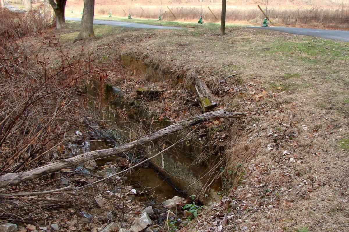
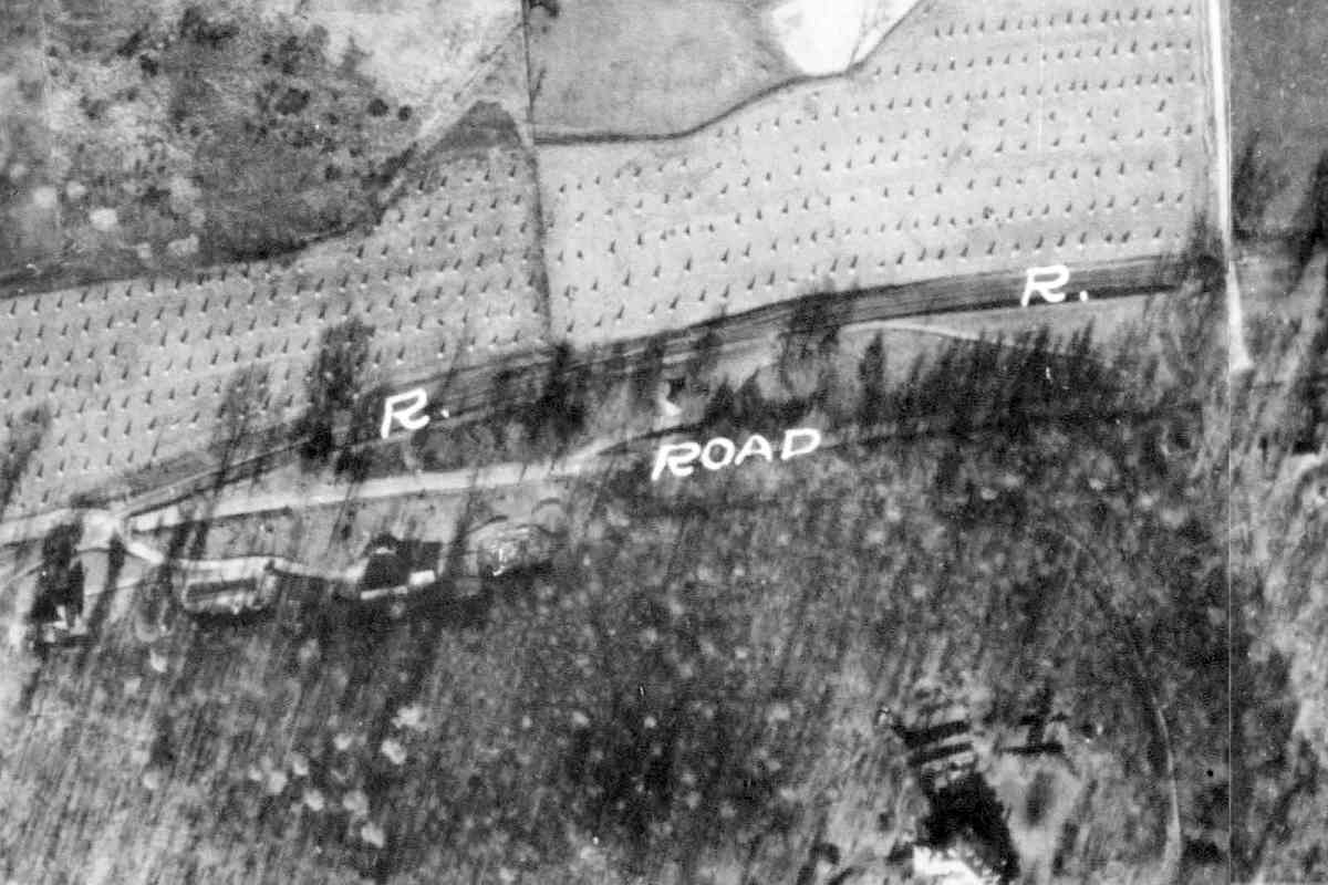
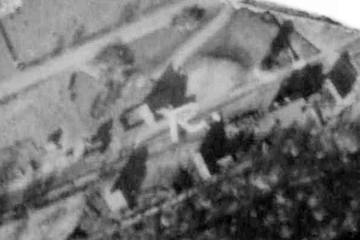
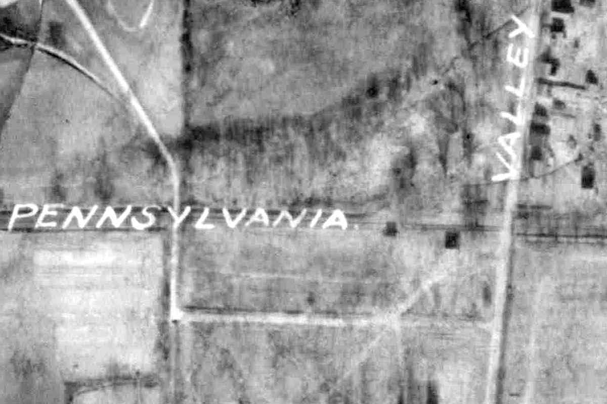
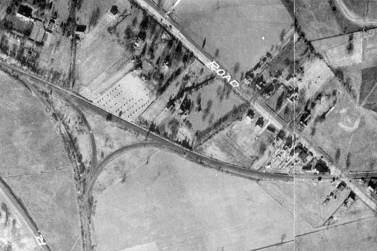
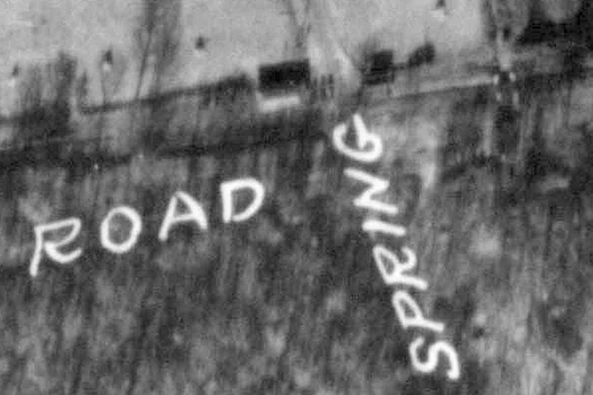
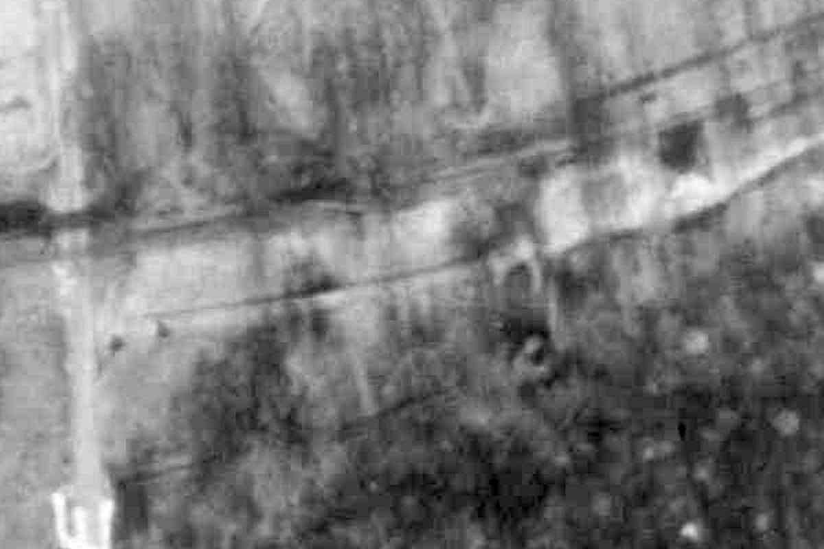
The western leg of the wye appears to have been straightened twice, with the final, and still-extant version, marked by R at the photo's 
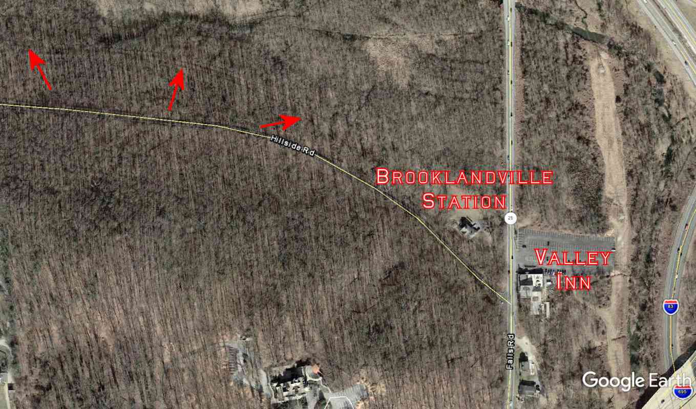
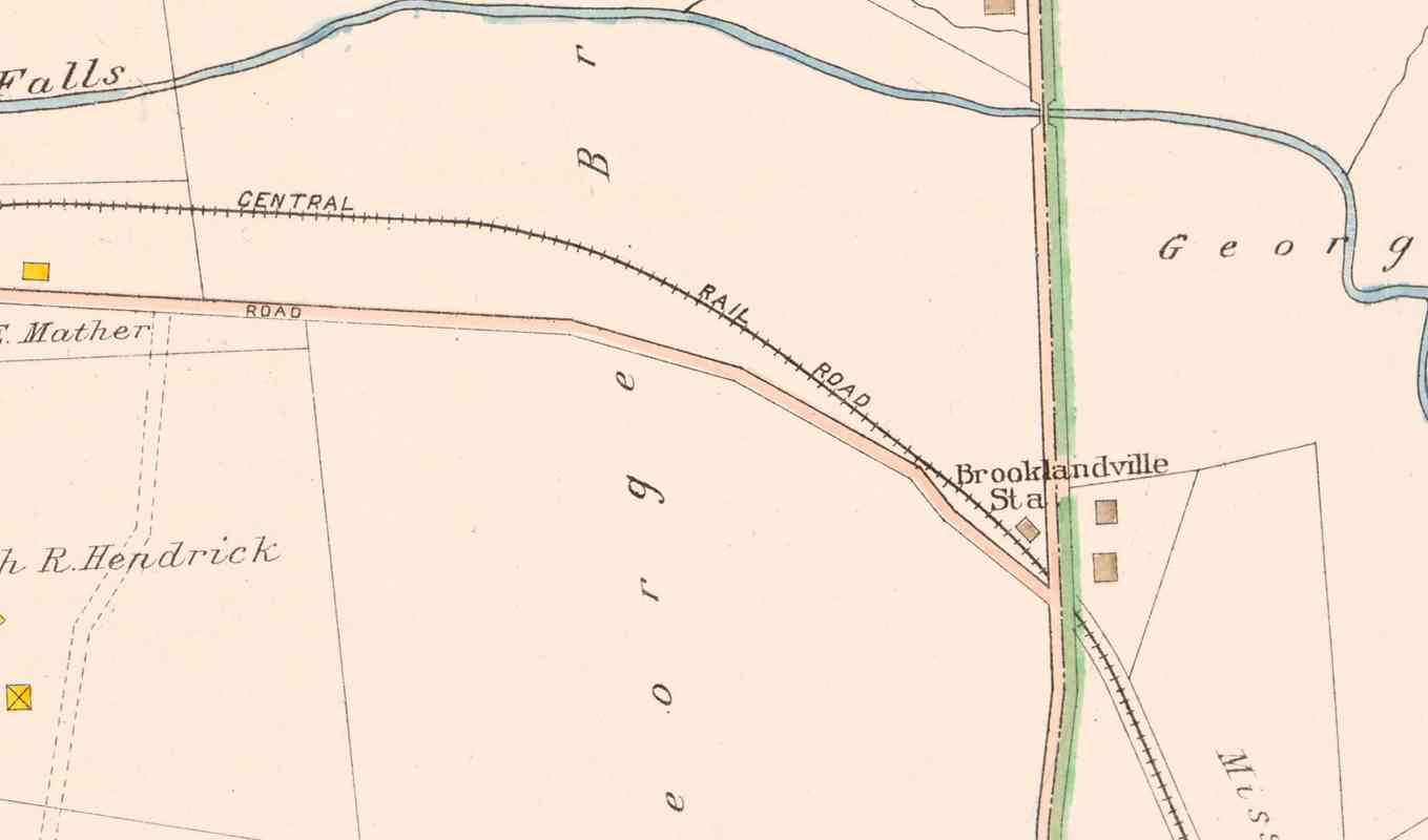
bottom-left corner. ROAD is Reisterstown Road.

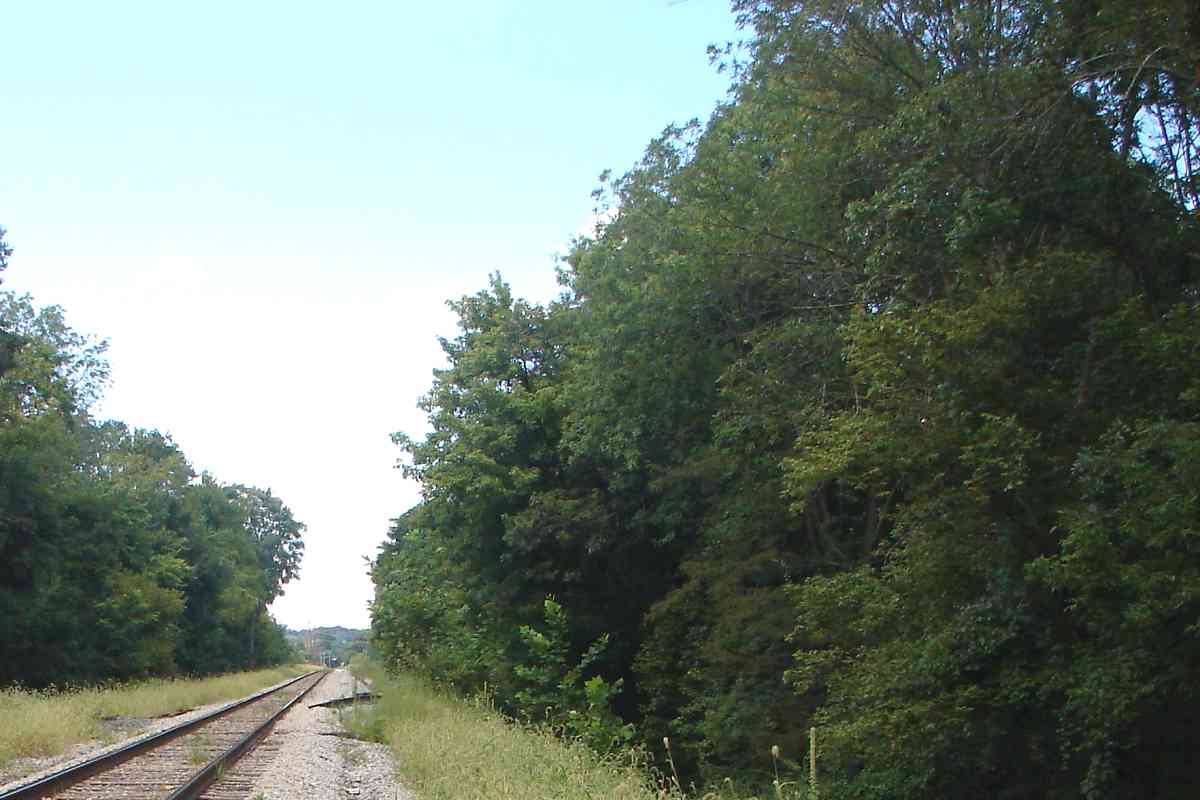
The trolley line that largely paralleled the WM and the GSB crossed each other at Reisterstown Road. As is visible in the photo, the trolley's double track ran along the north/east side of Reisterstown Road, but switched to single track for the railroad crossing.

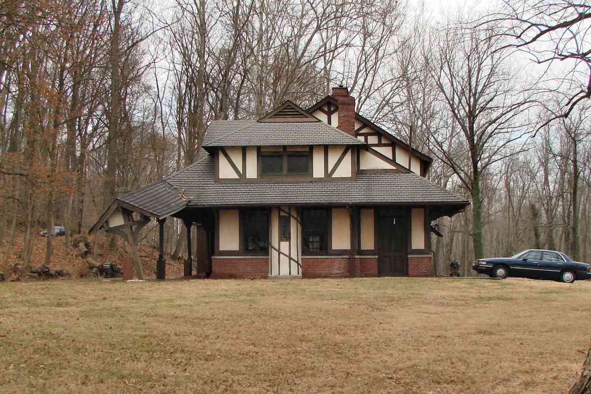
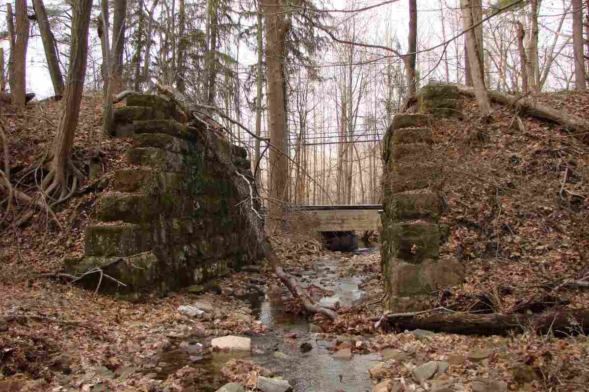
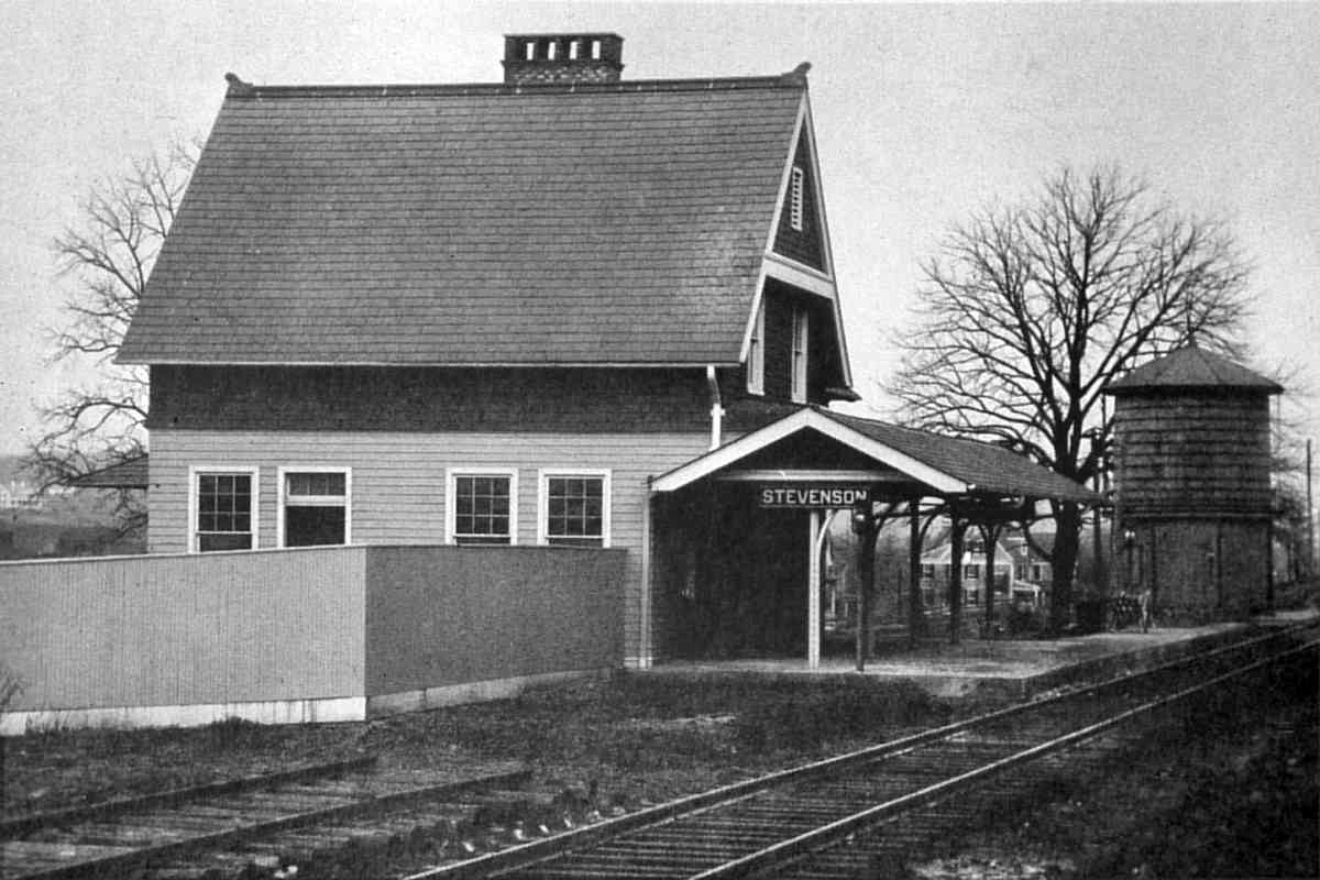
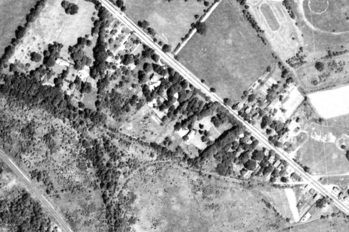
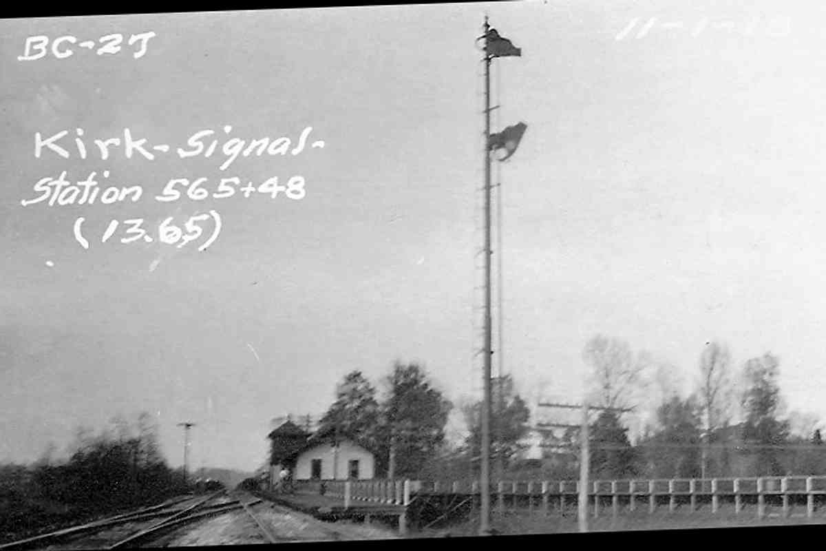
The structure casting a shadow inside the smallest of the wyes is JN Tower, built 1916 to oversee increased train activity: the Green Spring Branch handled traffic rerouted around Baltimore's B&P Tunnel while that tunnel was being renovated. 
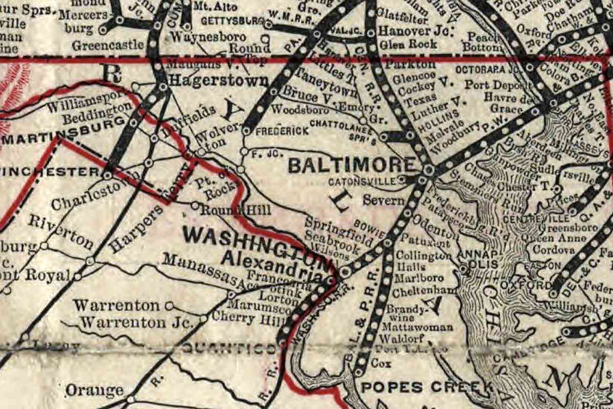
For about a year, while only one of the tunnel's two tracks was in service, the work forced some Pennsylvania RR Baltimore-to-Washington freight trains to follow a route north out of Baltimore on the NC, west on the Green Spring Branch, south on the WM to Walbrook Junction, then east to Fulton Junction where they switched back to the PRR main line. This convoluted route added over 20 miles to the usual 40 to Washington.


Aerial 1952
Photo courtesy Johns Hopkins University

Aerial 1952
Mile: 8.3 Date: Aug 1952
Ease: View: N (up)
Area: T6:
Map: Ba 24 K 5 Topographic Maps

This is roughly the same view in 1952. By this time the trolley had shuttered with Reisterstown Road widened in its place.

The tree and brush growth near the wye hint the end of the branch's usefulness is approaching.


Inside Wye

Inside Wye
Mile: 8.4 Date: Dec 2019
Ease: A View: NE
Area: A- T6:
Map: Ba 24 K 5 Topographic Maps

After Green Spring Branch train service ended, during the late 1950s the PRR sold the wye, with 6 acres of land around it, including that seen here, to Irvin Tillman for $2500. In 1961, the Valley Drive-In Theater opened in the foreground of the photo, where it operated into the 1970s. As of 2020 Walmart and a few other stores occupy the wye area.

The white car in the distance is following what had been the northern leg of the wye, approximately where JN Tower had been.

Links: Valley Drive-In, Valley Drive-In


Regraded

Regraded
Mile: 8.4 Date: Dec 2019
Ease: A View: NW
Area: A- T6:
Map: Ba 24 K 5 Topographic Maps

As seen from where JN Tower had been, this road within the shopping area parallels what had been the Green Spring Branch's connection northwest to the WM. The hill is the result of regrading: the track had run through a cut here.


Straight

Straight
Mile: 8.5 Date: Dec 2019
Ease: A View: NW
Area: A- T6:
Map: Ba 24 J 5 Topographic Maps

Atop the hill, the shopping center's main road continues to trace the GSB's wye. Kirk Station had been ahead on the left.


Kirk Then
Photo courtesy WM WestSub

Kirk Then
Mile: 8.5 Date: Nov 1918
Ease: B View: NW
Area: B+ T6: 248
Map: Ba 24 J 5 Topographic Maps

Coincident with the 1916/1917 B&P Tunnel renovation, the WM relocated its station from Green Spring Junction to this spot, named Kirk. Note the dual platforms, this side for the WM, that on the right for the NC.

While the B&P Tunnel was limited, the WM accessed its Hillen Station in Baltimore by rerouting trains over the Green Spring Branch. During that period Kirk acted as a transfer point for passengers that rode north from Baltimore city.


Kirk Now

Kirk Now
Mile: 8.5 Date: Sep 2016
Ease: B View: NW
Area: B+ T6:
Map: Ba 24 J 5 Topographic Maps

Kirk has been subsumed into the likes of Garrison, leaving ADC and Google maps to wonder where the town had been. The station site is behind the St. Thomas Shopping Center that is unseen on the right.


NC Remnant

NC Remnant
Mile: 8.6 Date: Sep 2016
Ease: B View: NW
Area: B+ T6:
Map: Ba 24 J 5 Topographic Maps

The NC and WM linked just northwest of Kirk Station at this spot. In fact the rightmost rusty rail is the westernmost remnant of the Green Spring Branch.

The Green Spring Branch originated as part of the Baltimore & Susquehanna Railroad's intended route to Gettysburg, Pennsylvania. In 1832, when most cities big and small lacked rail transport, the B&S got as far as Owings Mills via the alignment ahead, making this stretch some of the world's oldest railroad right-of-way still in use.

Continue to Owings Mills via the: Western Maryland Railway tour at this site

Links: Green Spring Branch at Todd's site, Monumental City archive


<< Previous (south) | THIS PAGE: Brooklandville to Garrison | Next (back to main line) >>

Or, return to main page

Copyright Notice