TrainWeb.org Facebook Page
Northern Central Railway Photo Tour


Northern Central Railway
Modern day photo tour

Accompanying each photo below are:

Click a photo to see a larger view. Please send your comments and corrections to Steve.


<< Previous (branch) | THIS PAGE: Lake Roland to Riderwood | Next (north) >>

Aerial 1952
Photo courtesy Johns Hopkins University

Aerial 1952
Mile: Date: Aug 1952
Ease: View: N (up)
Area: T6:
Map: Ba 26 Topographic Maps

This composite aerial covers this tour page's roughly four Northern Central (NC) track miles from Hollins, at the southern end of Lake Roland at bottom left, northward then northeastward into Lutherville at top center. Baltimore's Central Light Rail line repurposed the route starting around 1990.

Though the I-695 Baltimore Beltway had not yet cut a swath from left-to-right across this photo's top half, by 1952 the Baltimore-Harrisburg Expressway/JFX (later I-83) had put down its first pavement in Maryland, that between Timonium and Shawan Roads, just off the top edge of this photo. Not coincidentally, NC's passenger service would cease later that decade.


Hollins
Photo courtesy HH Harwood collection

Hollins
Mile: 7.1 Date: ~1930
Ease: B View: N
Area: B+ T6: 245
Map: Ba 26 H 10 Topographic Maps

By around 1830, NC's predecessor, the Baltimore & Susquehanna (B&S), had extended its line to Timonium. There it paused until permission came from Pennsylvania to also build in that state. Northward progress then resumed such that the B&S reached Cockeysville by 1836.

Despite the station's proximity to the lake, this version of Hollins Station would soon succumb to fire, as had its predecessor. That's a bit of Green Spring Branch track at left, but this tour page follows the main line on the right generally northward. The digit 8 on the milepost reflects the distance to the Green Spring Branch's western junction with the Western Maryland Railway.

As if the coming of the automobile were not enough, around the time of this photo the Great Depression had begun. Even the mighty Pennsylvania Railroad (PRR), and its number 5113 engine seen here, could sense the end of railroading's halcyon days. Painful change was ahead.

On the locomotive you may have noticed the PRR's keystone herald where you might expect to see NC. De-emphasis of the NC name began in 1914 when the PRR shed its camoflage of multiple corporate names.


Lake Roland

Lake Roland
Mile: 7.1 Date: Aug 2019
Ease: B View: N
Area: B+ T6:
Map: Ba 26 H 10 Topographic Maps

An earthen embankment extends from both the south and north sides to help trains cross Lake Roland. Only a segment in the middle, where you see the brighter fencing near photo center, is a traditional bridge.


Lake Roland
Photo credit HH Harwood

Lake Roland
Mile: 0.1 (branch) Date: ~2000
Ease: B View: NE
Area: B+ T6:
Map: Ba 26 G 9 Topographic Maps

This view looks from the Green Spring Branch, across Lake Roland waters.

The country's first wooden railroad bridge was constructed either here or along the Green Spring Branch in 1832 under the direction of Col. Stephen H. Long. An advocate of wooden bridges, Long teamed with the B&S after disagreements with the stone-bridge-favoring B&O. Long's one B&O wooden bridge was Jackson Bridge that carried a turnpike over the railroad at Morrell Park.

In 1854, the B&S merged with other lines to form Northern Central RR. Before that decade ended, NC upgraded the B&S bridge here to permit the then-new Lake Roland to flow under. The bridge and surrounding trackage were damaged by Confederate sympathizers during the Civil War of the 1860s to slow progress of Union troops from the north. After repair, the bridge was likely modified for heavier steam locomotives, then again around 1990 for light rail. Along the way, there may have been other modifications as well.

Links: Long's bridges here, Jackson Covered Bridge


MDOT 5007

MDOT 5007
Mile: 7.4 Date: Nov 2020
Ease: B View: S
Area: A T6:
Map: Ba 26 H 9 Topographic Maps

Every three months, light rail repaints its cars in colors that match the season (no, not really). Here MDOT 5007 is about to cross the bridged section of the stretch across Lake Roland.


Brightside 1927
Photo courtesy Johns Hopkins University

Brightside 1927
Mile: 7.4 Date: 1926/1927
Ease: View: N (up)
Area: T6:
Map: Ba 26 H 9 Topographic Maps

The oldest-known aerial photo of the area dates to winter of 1926-1927, while the lake looks to have been ice-covered. Brightside Station, a small but elegant structure, occupied some valuable lakefront property to serve the few customers who could afford homes here. Passenger rail service endured into the 1950s.

Per the photo linked below, in this area, and perhaps others, light rail catenary poles are located very close to where NC's trackside utility poles had been.

Link: Brightside Station 1880s


Brightside

Brightside
Mile: 7.4 Date: Nov 2020
Ease: B View: S
Area: A T6:
Map: Ba 26 H 9 Topographic Maps

After local homeowners had long ago purchased their owm transportation machines, Brightside was not thrilled to see the return of trains in the form of MTA 5046 and its bretheren. There are no light rail stops within a four-mile stretch here, the system's longest such gap. B+S culvert

At the bottom of the main photo is part of a culvert that may date to the 1830s. Due to sun glare and stone slabs on top, it is difficult to depict via photo (left). Its cut stone blocks exhibit the same style as the culvert found east of Falls Road station, one presumed to be of B&S origin. This one has been retired, replaced by a nearby modern piped culvert.

Brightside won't be lake side much longer: about half of Lake Roland's water surface has been replaced by silt during the past century. Silting up is a fate that awaits Lake Roland and all untended, artificial lakes like it.

Link: lakeside 1920


Unused Ma & Pa

Unused Ma & Pa
Mile: 7.7 Date: Nov 2020
Ease: A View: E
Area: A T6:
Map: Ba 26 H 8 Topographic Maps

When latecomer Maryland & Pennsylvania RR (not the better-known, later railroad by the same name) surveyed possible routes into Baltimore during the 1870s, it found all the good ones already taken. So, it arranged to share the Northern Central's line from downtown to here, where it would veer northeast toward Towson on its own trackage. After grading a route from here that follows Towson Run upstream, the company soon went bankrupt. Some of its assets were acquired by the Baltimore and Delta Railway (B&D), who decided to instead create its own alignment, a narrow gauge one, along Stony Run. In 1882, the B&D merged into the Maryland Central, which evolved through the Balitmore & Lehigh Railroad into the standard gauge Maryland & Pennsylvania Railroad.

Link: Maryland Central


Unused
Photo courtesy Google

Unused
Mile: 7.7 Date: Mar 2004
Ease: View: N (up)
Area: T6:
Map: Ba 26 J 8 Topographic Maps

From MD 134 at lower left, snow highlights the B&D's grading as it winds upstream along the northern bank of Towson Run to Charles Street (MD 139) at upper right. The grading had likely continued farther east, along present-day Towsontown Boulevard's route.

The B&D's decision to follow Stony Run left the western part of the grading along Towson Run unused, a condition in which it still exists some 150 years later. In this photo, a thin strip of snow highlights that grading. Some maps label this the "North Central Railroad (sic) Towson Spur (unbuilt)".


Lake Station Jct
Photo credit HH Harwood

Lake Station Jct
Mile: 7.7 Date: ~2000
Ease: A- View: W
Area: A T6:
Map: Ba 26 H 8 Topographic Maps

Before brush and trees had filled in, Harwood captured a light rail train as seen looking west across Bellona Avenue from the unused B&D route. For a time into the 1900s, the route may have served as a dirt road connecting Bellona Avenue and Charles Street.


Lake 1927
Photo courtesy Johns Hopkins University

Lake 1927
Mile: 8.1 Date: 1926/27
Ease: View: N (up)
Area: T6:
Map: Ba 26 H 7 Topographic Maps

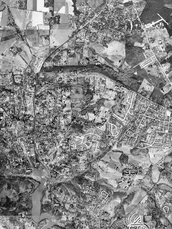
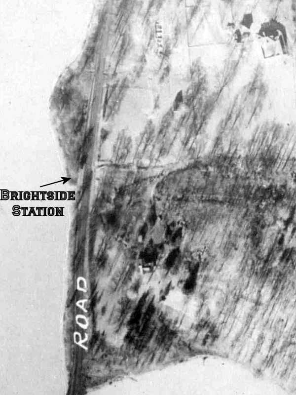
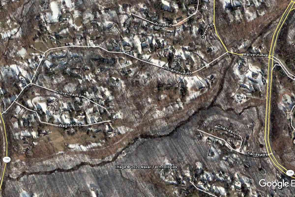
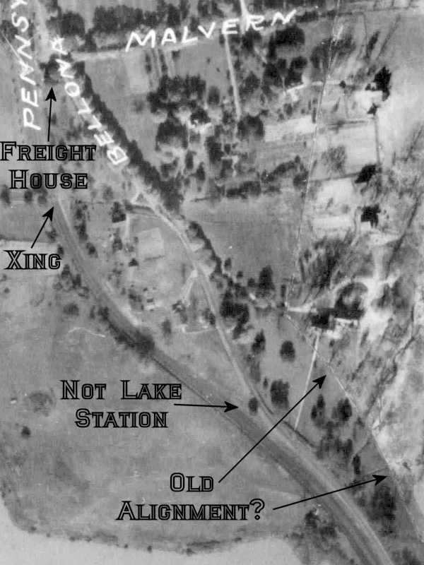
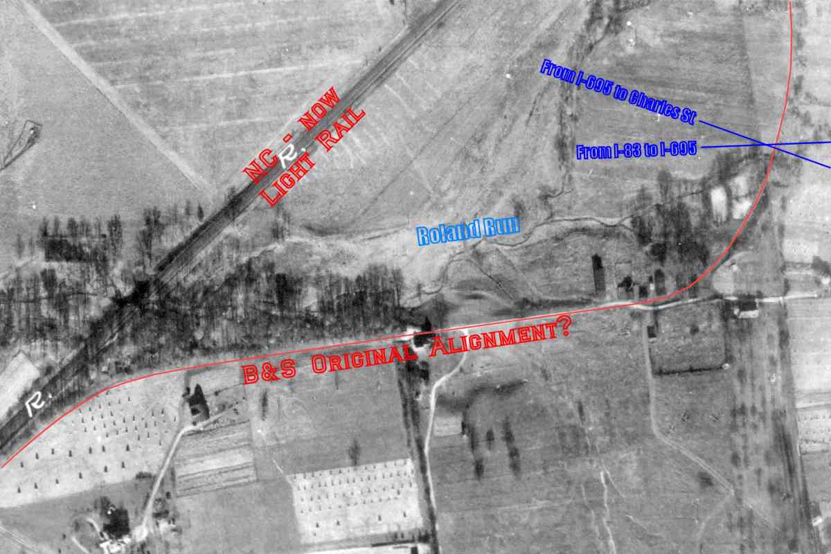
The structure that had stood where Bellona Avenue and the rails separate at lower right is sometimes mistaken for Lake Station. The actual NC Lake Station existed off photo-bottom, near the intersection of Rolandvue Road and Bellona Avenue, between the lake and railroad.

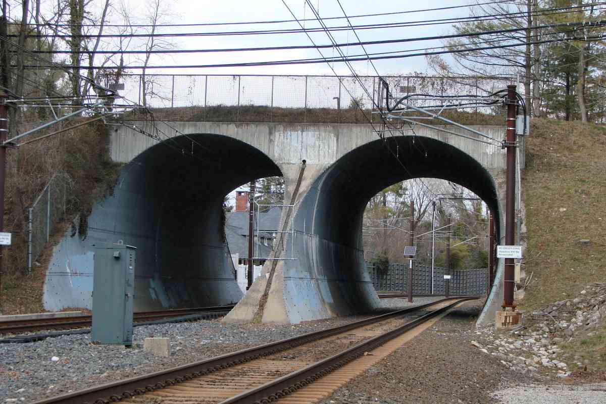
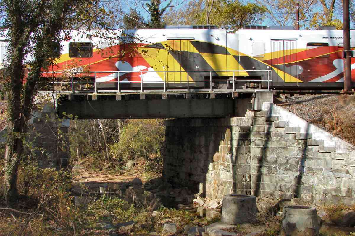
East of Not Lake Station, an arc traces a lighting change. Such often represent remnants of older railroad or road alignments, and indeed some topo maps from the 1800s place the railroad on the east side of Bellona Avenue, the reverse of the present. So, the arc visible in this photo may be the original path of the B&S, but unfortunately, too little detailed information about the B&S survives to confirm that.

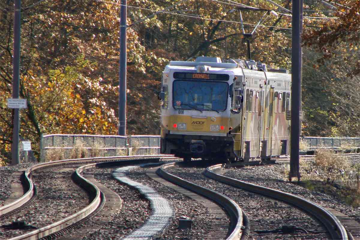
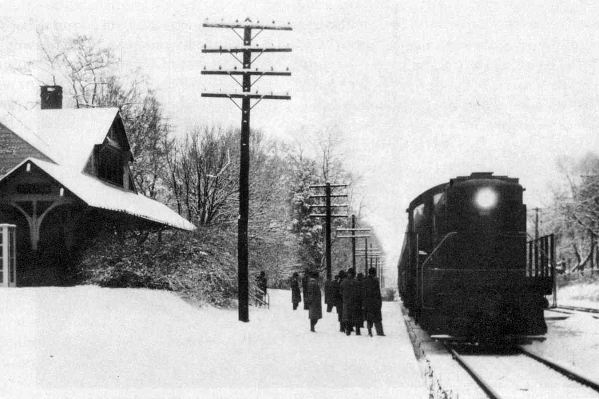
The grade crossing at "Xing" gave entry to the L'Hirondelle Club, a social and athletic group established in 1872. The club, which as of 2020 still exists, outlived that grade crossing.

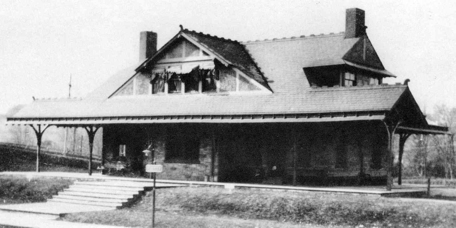
According to a 1915 atlas, north of that, at the intersection of Bellona and Malvern, NC had a freight house. It is no longer extant.


Wreck Site
Photo credit HH Harwood

Wreck Site
Mile: 8.0 Date: ~2000
Ease: A- View: S
Area: A T6:
Map: Ba 26 H 7 Topographic Maps

Near this curve the catastrophic head-on collision of July 4, 1854 occurred. At that time, the cash-strapped B&S was in the process of reorganizing into NC, and one can't help but wonder if safety standards were permitted to lapse. Thirty-five people died, plus over 100 were injured.

Link: 1930


Ruxton Road
Photo courtesy Baltimore Sun

Ruxton Road
Mile: 8.4 Date: ~1950
Ease: B View: NW
Area: A T6:
Map: Ba 26 H 7 Topographic Maps

NC's stone abutments have been topped by a variety of bridges through the years.

The passenger waiting platform of Ruxton Station can be glimpsed through the bridge underpass. Note the trackside switch stand under the bridge, and the start/end of a third track. This extra track had extended north to Riderwood, and is independent of a passing siding that had existed between the two mainline tracks into the 1920s.

Link: ~1950


Ruxton 1908
Photos courtesy HH Harwood collection

Ruxton 1908
Mile: 8.4 Date: 1908
Ease: A View: N
Area: A T6: 249
Map: Ba 26 H 7 Topographic Maps

looking west 1892 looking north 1956 Ruxton's beautiful station dates to around 1890. Prior to the automobile, the upper-classes of this area, and their staff, rode the trains to/from dowmtown Baltimore. From an early-1900s peak of 36 local trains daily, service slowly declined, reaching zero with the last day of passenger service on June 27, 1959.

Long-distance passenger (and freight) trains continued to roll through for another 13 years until flooding from Hurricane Agnes destroyed bridges north of Cockeysville. Those bridges were never put back in rail service.

Link: snowy Ruxton 1956/2016


Ruxton 2000
Photo credit HH Harwood

Ruxton 2000
Mile: 8.4 Date: ~2000
Ease: B View: N
Area: B T6:
Map: Ba 26 H 7 Topographic Maps

Ruxton Station was demolished within a few years of the end of its passenger duties. It made way for a stretch of rowhouses or apartments that opened of the left during 1963. The disused trackside platforms remained extant until cleared away for the arrival of light rail around 1990.

Link: 1961


Stone Arch

Stone Arch
Mile: 9.1 Date: Feb 2020
Ease: A View: SW
Area: A T6:
Map: Ba 26 H 5 Topographic Maps

While B&O favored stone arch bridges during the 19th century, NC built relatively few. This one can easily be seen from Bellona Avenue. Some of the mortar was likely refreshed for light rail purposes, but the rest resembles another NC stone arch that fell into disuse during the 1970s; it will be seen on the next tour page.


No Spray

No Spray
Mile: 9.2 Date: Feb 2020
Ease: A View: W
Area: A T6:
Map: Ba 26 H 5 Topographic Maps

All railroads must keep their right of way clear of brush that could catch fire from a wheel spark during a dry summer. This sign reminds crews to avoid spraying defoliant beyond the immediate trackage into the vegetable gardens of adjacent residents.


Joppa Road

Joppa Road
Mile: 9.3 Date: Feb 2020
Ease: A- View: N
Area: A T6:
Map: Ba 26 H 5 Topographic Maps

Aerial photos suggest the overpass for Joppa Road was rebuilt into this form, sometimes called the "Riderwood Tunnels", around 1960.

The brick chimney visible through the left tunnel belongs to what had been NC's Riderwood Station.


Riderwood 1964
Photo credit HH Harwood

Riderwood 1964
Mile: 9.3 Date: 1964
Ease: A- View: N
Area: A T6: 249
Map: Ba 26 H 5 Topographic Maps

A long-distance PRR passenger train rolls past Riderwood Station. What had been triple track between Ruxton and Riderwood by 1964 had been whittled to single track.

Riderwood is a portmanteau of the Rider's Switch and Sherwood community names.

Though the PRR operating in Maryland may make B&Oers want to scream "Cabotage!", strictly speaking, that term applies only to transport performed by one from another country. For a nearby example of cabotage, look no further than operation of MARC train service by Canada's Bombardier.

Link: 1901 station agent


Riderwood 2020

Riderwood 2020
Mile: 9.3 Date: Nov 2020
Ease: A- View: NE
Area: A T6:
Map: Ba 26 G 5 Topographic Maps

With its Frank Furness pedigree, Riderwood Station is the last surviving NC/PRR station of his design in Maryland. Furness also designed the (barely) surviving Aberdeen station of the B&O.

Stung by the swift loss of Ruxton Station, locals worked to have its beautiful Riderwood sibling landmarked.


Double Tracking
Photo credit Todd Sestero

Double Tracking
Mile: 9.4 Date: Dec 2004
Ease: B View: S
Area: A T6:
Map: Ba 26 H 4 Topographic Maps

This southbound light rail train on New Years Eve of 2004 was one of the last to make the trip before this segment was temporarily closed to permit more intensive work on the adjacent second track.

The extra width here arose a century or so earlier when a siding peeled off to the right to serve the Stebbins & Anderson Coal and Lumber Company. The last Stebbins Anderson store closed at the end of 2019.

Links: source photo, Stebbins Anderson


Roland Run

Roland Run
Mile: 9.9 Date: Nov 2020
Ease: A- View: NW
Area: A- T6:
Map: Ba 26 H 3 Topographic Maps

As seen from Ridervale Park, this bridge over Roland Run typifies the look of many NC-to-light-rail bridges. The stone masonry is likely NC, and probably dates from the 1870s. The steel components have an early 20th century appearance, and the bright concrete portions would appear to be light-rail additions from the 1990s or 2000s.


Rebar

Rebar
Mile: 9.9 Date: Nov 2020
Ease: A- View: NW
Area: A- T6:
Map: Ba 26 H 3 Topographic Maps

Older conrete cubes with rebar dot the embankment near several bridges. They are close to one foot in width and height, and appear to be disused. Their former purpose is unknown to me. I speculate they provided a way underground power and signal cables could emerge and be carried across the stream below via wooden utility poles. Another possibility is ventilation or drainage for underground cableways. Anyone know?


Original Alignment

Original Alignment
Mile: 9.9 Date: 1926/27
Ease: View: N (up)
Area: T6:
Map: Ba 26 J 3 Topographic Maps

There exists written record of a disused Baltimore & Susquehanna alignment near Lutherville but no known map of it. The thin red line is my estimate of that original route south of Lunterville Station based on paths and gentle curves typically left behind by such alignments. If this route is correct, the B&S would have spanned Worleys Run at the right, near where two present-day I-83/I-695 ramps (blue lines) cross.

zoom At right is an over-magnified zoom into that area. It appears to show two bridges, one a proposed B&S relic at photo center, and the other slightly downstream (left) of it. If these bridges were still extant when the interstate-to-be roads arrived during the 1950s, they were removed to make room. Maps say adjacent Worleys Run was rerouted south of its natural location and combined with a smaller feeder creek. A site visit found no railroad artifacts there.

The straighter NC alignment dates to the 1870s when the railroad was upgrading much of the line. Compared to this route, the one now used by light rail, the curving original required only one bridge across streams in this vicinity rather than two.

Beyond the top edge of this aerial, Front Avenue now follows some of the proposed original B&S alignment.


<< Previous (branch) | THIS PAGE: Lake Roland to Riderwood | Next (north) >>

Or, return to main page

Copyright Notice