TrainWeb.org Facebook Page
B&O Metropolitan Branch Photo Tour


B&O Metropolitan Branch
Modern day photo tour

Accompanying each photo below are:

Click a photo to see a larger view. Please send your comments and corrections to Steve.


<< Previous (east) | THIS PAGE: Silver Spring | Next (west) >>

1926 Bridge
Photo courtesy Richard Pearlman

1926 Bridge
Mile: 7.3 Date: ~1947
Ease: A View: SW
Area: B- IC2:
Map: Mo 37 A 10 Topographic Maps

Silver Spring's developent during the Roaring '20s brought more people, as well as more of that then-recent invention known as the automobile. Numerous automobile sales and repair shops opened in this area.

Two years of grade crossing elimination effort yielded the first railroad bridge over Georgia Avenue in 1926. Operation of Forest Glen trolley along that avenue had been halted by bridge construction, and was slated to resume under the east side (left) but never did.

Growth was such that within 20 years this bridge proved a bottleneck for Georgia Avenue traffic...


Construction
Photo courtesy Richard Pearlman

Construction
Mile: 7.3 Date: ~1947
Ease: A View: SE
Area: B- IC2:
Map: Mo 37 A 10 Topographic Maps

...so around 1947 work began on a new, longer bridge. Behind, a B&O train clatters over the old one to give passengers a glimpse of the future.


More Construction
Photo courtesy Richard Pearlman

More Construction
Mile: 7.3 Date: ~1947
Ease: B View: N
Area: B- IC2:
Map: Mo 37 A 10 Topographic Maps

Passengers saw views like this captured by photographer Ira W. Pearlman.

Longtime DC area residents may recall Gifford's Ice Cream. Gifford's first shop opened during 1938 in the brightly-painted building with awnings seen right of center.

Link: Gifford's


Removal
Photo courtesy Richard Pearlman

Removal
Mile: 7.3 Date: ~1948
Ease: B View: S
Area: B- IC2:
Map: Mo 37 A 10 Topographic Maps

When the new bridge opened in 1948, the original was quickly torn down.

In this view back to DC, the source of some of the new automobiles, a Sid Wellborn Chrysler Plymouth dealership, is on the right.


Same in 1920
Photo credit B&O Museum

Same in 1920
Mile: 7.3 Date: 1920
Ease: A View: S
Area: B- IC2: 222
Map: Mo 37 A 10 Topographic Maps

Incredibly, this is the same view as the prior, merely 28 years earlier, before grade separation. World War II, and its demand for additional workers in Washington, DC, helped fuel Silver Spring's rapid growth.

Of historical note is the Rail Crossing Warning signpost at left, a somewhat different style from current versions.


Completed
Photo courtesy Richard Pearlman

Completed
Mile: 7.3 Date: ~1948
Ease: A View: N
Area: B- IC2:
Map: Mo 37 A 10 Topographic Maps

The old, original bridge has been dismantled and its new, longer replacement is open for business. Georgia Avenue, though, needs finishing touches as a B&O steamer surveys from above.

Local residents called the new bridge underpass "The Tunnel" possibly because of the style of adjacent pedestrian passageways. Perpendicular to the passageways is a pedestrian walkway spanning the bridge on its north side, lit by lampposts that remained in service into the 21st century.

Silver Spring's second B&O station stands at upper left, then only a few years old.


Duplicated
NEW! mid-Feb 2024

Duplicated
Mile: 7.4 Date: Nov 2003
Ease: A View: N
Area: B- IC2:
Map: Mo 37 A 10 Topographic Maps

The photo location is much the same, but Silver Spring's skyline had changed significantly by 55 years later. The construction cranes reveal more changes were coming.

The rail bridge looks much the same as it did in 1948 -- except that's not the same bridge! A doppelgänger inserted itself during 1976 (see below).


1976 Bridge
Photo courtesy Dave Hiteshew

1976 Bridge
Mile: 7.3 Date: Sep 2008
Ease: A View: N
Area: B- IC2:
Map: Mo 37 A 10 Topographic Maps

Though the 1948 bridge was longer than the original 1926 edition, it was not wide enough for the arrival of the Washington Metro less than 30 years later. So, in the mid-1970s a separate but similarly-styled bridge was added on the south side, basically at the location spanned by the 1926 original. This effectively doubled the width on top, creating room for not only two B&O tracks but also two Metro Red Line tracks.


Plus Metro
Photo credit HH Harwood
NEW! mid-Feb 2024

Plus Metro
Mile: 7.3 Date: 1994
Ease: B+ View: NW
Area: B- IC2:
Map: Mo 37 A 10 Topographic Maps

By 1994, B&O's 1945 station at right had witnessed Metro's arrival, and will watch the skyline continue to change during the next few decades.


B&O RDC 1957
Photo courtesy B&O History Collection
NEW! mid-Feb 2024

B&O RDC 1957
Mile: 7.3 Date: Sep 1957
Ease: A- View: N
Area: B- IC2:
Map: Mo 37 A 10 Topographic Maps

Before Metro, commuters rode B&O Rail Diesel Cars (RDCs) made by Budd from 1949 to 1962. These are headed to Washington.

Packard automobiles were found at the adjacent Bowman Motor Company of Silver Spring. At photo time, Packard had completed its first year of production by Studebaker, an ultimately unsuccessful pairing of auto manufacturers.

Links: basic RDC info, RDC tour


Silver Pass
Photo courtesy Dave Hiteshew

Silver Pass
Mile: 7.4 Date: Sep 2008
Ease: A View: SW
Area: B- IC2:
Map: Mo 37 A 10 Topographic Maps

2006's colorful Silver Pass mosaic by G. Byron Peck decorates a bridge wall. You'll find a Metro train mosaic by the same artist at the diagonally opposite bridge corner.


Looking Across
NEW! mid-Feb 2024

Looking Across
Mile: 7.3 Date: Jan 2024
Ease: A- View: NW
Area: B- IC2:
Map: Mo 37 A 10 Topographic Maps

The colorful mosaic is at bottom left, across Georgia Avenue. Above, a Red Line train passes Silver Spring's second B&O station, more of which will be seen below.


CSX 3318
NEW! mid-Feb 2024

CSX 3318
Mile: 7.4 Date: Jan 2024
Ease: A View: S
Area: B- IC2:
Map: Mo 37 A 10 Topographic Maps

CSX 3318 pulls autoracks over Georgia Avenue, which dips down at left to scoot under. The former B&O station is immediately off photo right.


B&O RDC 1970
Photo credit Walter Schopp
B&O History Collection
NEW! mid-Feb 2024

B&O RDC 1970
Mile: 7.3 Date: Oct 1970
Ease: A- View: NW
Area: B- IC2:
Map: Mo 37 A 10 Topographic Maps

Budd-made RDCs exhibited a smart design. They could operate singly or in multiples. They were self propelled, and did not need to be turned to operate in the opposite direction. The stainless steel body was very long lasting, in fact, a few 60+ year old RDCs remained in revenue operation into the 2020s along remote routes.

One downside was keeping diesel fumes out of the passenger cabin proved impossible. The diesel smell lingers even in museum RDCs that have not operated for many years.

Link: 1965


B&O 1442
Photo courtesy B&O History Collection

B&O 1442
Mile: 7.3 Date: Aug 1964?
Ease: A- View: NW
Area: B- IC2:
Map: Mo 37 A 10 Topographic Maps

A handsome B&O locomotive pauses at Silver Spring. B&O billed itself as the "Route of the Dieseliners" for a period. On certain long distance routes during the 1960s, B&O showed movies to passengers.

Fencing between the tracks discourages passengers from crossing except at approved locations. That style of fence had been ubiquitous during the first half of the 20th century, but as of 2024 you'll have to look elsewhere to find any of the very few segments that remain extant.

Link: 1954 excursion


Different Skyline
NEW! mid-Feb 2024

Different Skyline
Mile: 7.3 Date: Jan 2024
Ease: A- View: NW
Area: B- IC2:
Map: Mo 37 A 10 Topographic Maps

Exact location replication of the prior two photos is blocked by newer fences, but this spot is only a few feet away. The passenger platform adjacent the nearest track (CSX's) has been removed, and the skyline looks a wee bit different. Silver Spring sits just outside the Washington, DC border, so is not subject to Washington's limit on the proximity of tall buildings. Much of the office space was empty at photo time after crystal balls failed to foresee COVID's work-from-home revolution. The lamps are no longer the original fixtures.


From Metro
NEW! mid-Feb 2024

From Metro
Mile: 7.3 Date: Jul 2019
Ease: A- View: NW
Area: B- IC2:
Map: Mo 37 A 10 Topographic Maps

As seen from Metro's railfan window, in 2019 the original B&O cobra-neck lamps (at right in red paint) were still extant on the bridge. Part of the former B&O station can be glimpsed beyond the lamps.


Silver Spring Station
Photo credit B&O Museum

Silver Spring Station
Mile: 7.4 Date: ~1940
Ease: A- View: N
Area: B- IC2: 170
Map: Mo 37 A 10 Topographic Maps

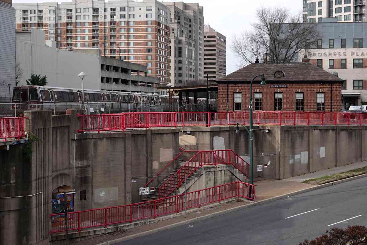
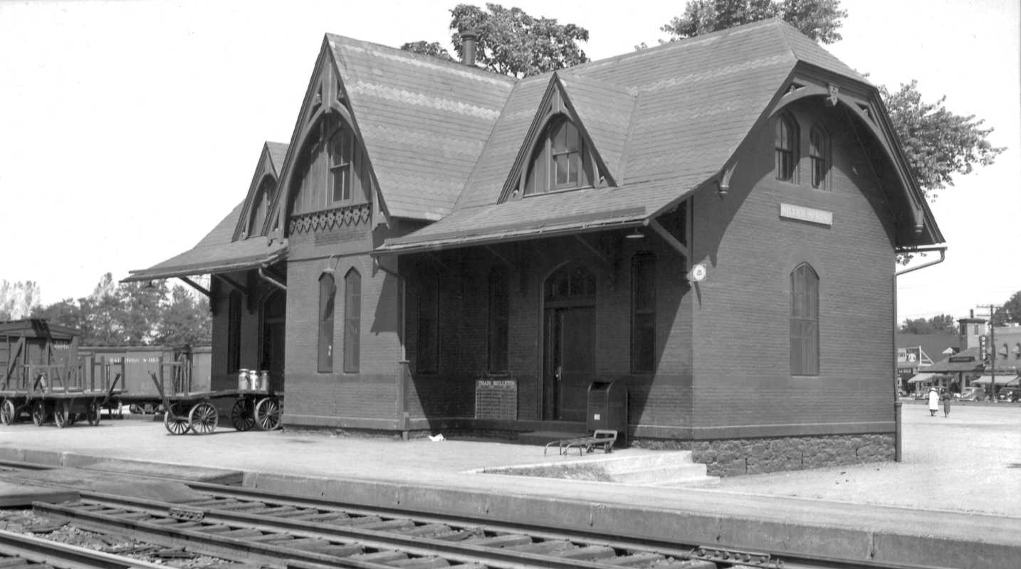
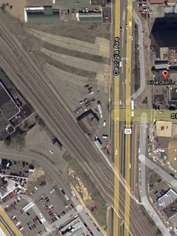
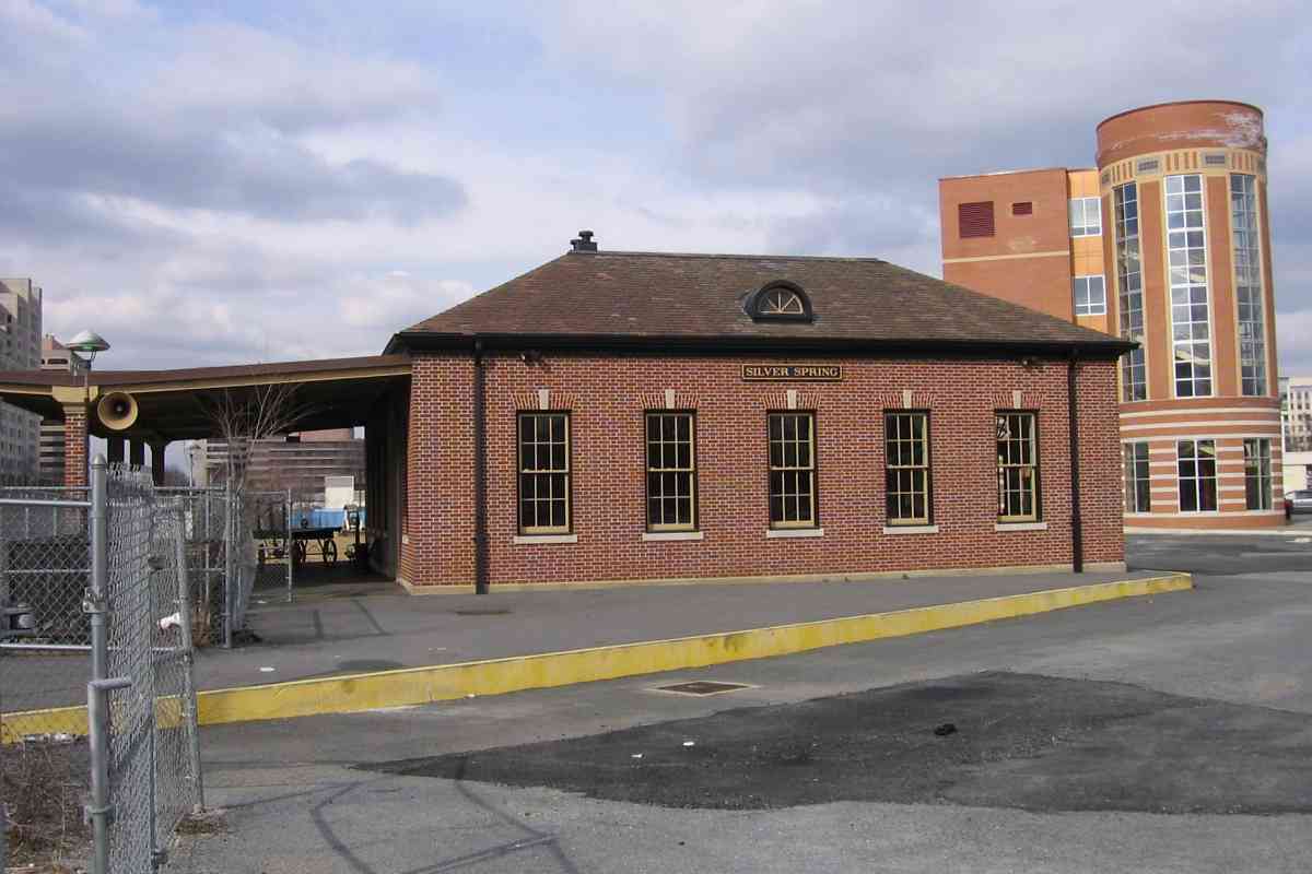
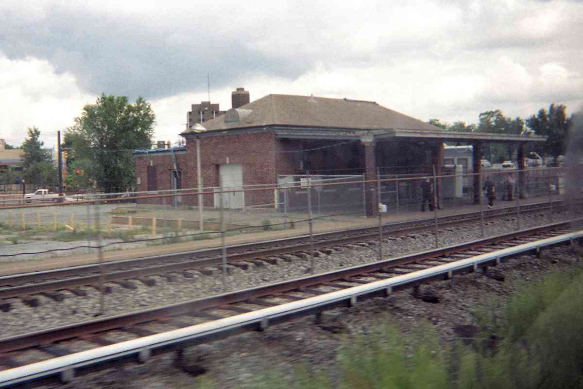
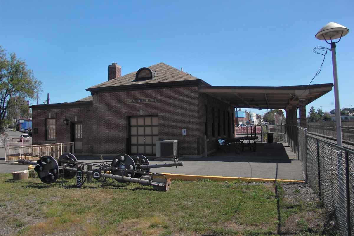
B&O's first station here was this Ephraim Baldwin-design described in a NRHP Registration Form as follows:

"The Baltimore & Ohio Railroad has been a longstanding landmark in Silver Spring, beginning with the laying of the tracks of the Metropolitan Branch in 1873 and the construction of the first B&O depot in I878. The depot was named 'Silver Spring' after the nearby country estate of Francis Preston Blair, former editor of the Washington Globe. Blair, whose town home, Blair House, is across from the White House, had influenced the B&O Railroad to rechart the Metropolitan Branch through his property instead of along its originally planned course farther to the west. Stretching from Washington, D.C. to Point of Rocks, Maryland, the Metropolitan Branch stimulated commercial and residential development all along its path through Montgomery County.

cart entrance shops

"In 1883, the new Civil Service Act expanded the federal government's workforce, creating additional demand for housing adjacent to the B&O Railroad, and fostering early commuter suburbs, such as Woodside. By 1889 the Silver Spring area was known as a major distribution point for farmers because of the B&O station, and as a country retreat for wealthy Washingtonians who commuted into Washington on the railroad. In 1897 an alternative means of transportation into the District was established for area residents with the completion of the Washington, Woodside & Forest Glen Trolley, which met Washington's 'Brightwood Line' at the Maryland state line and ran through Silver Spring to Forest Glen. Despite the new trolley service, the B&O passenger service, though more expensive, was heavily used by Silver Spring commuters because it provided a quicker trip to downtown Washington."

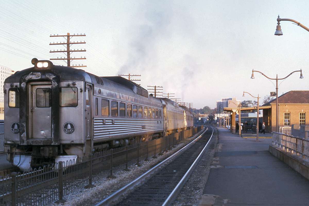
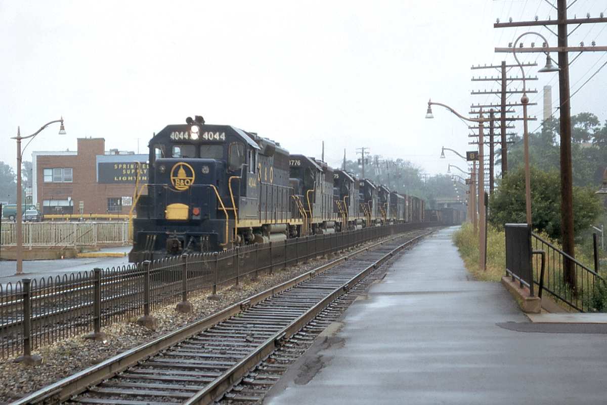
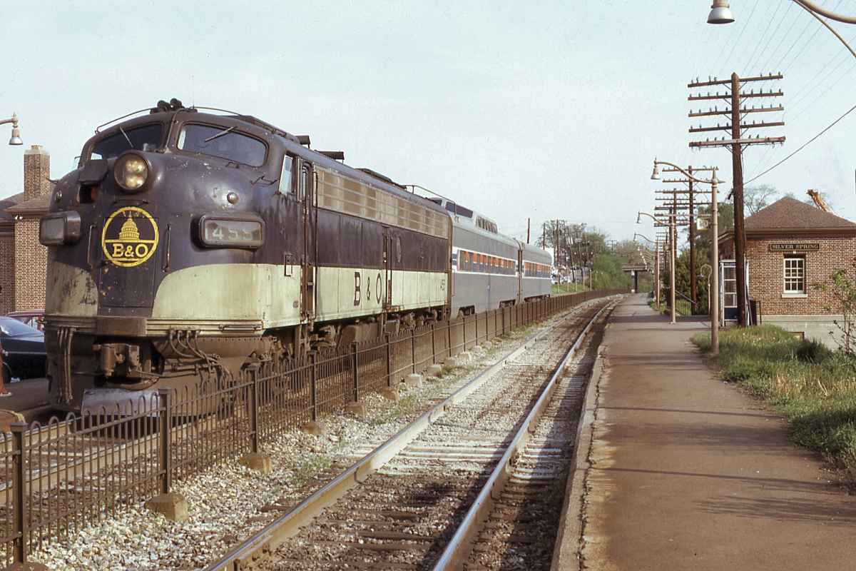
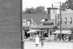
You can find a near duplicate of this station still stading in Rockville, which this tour 
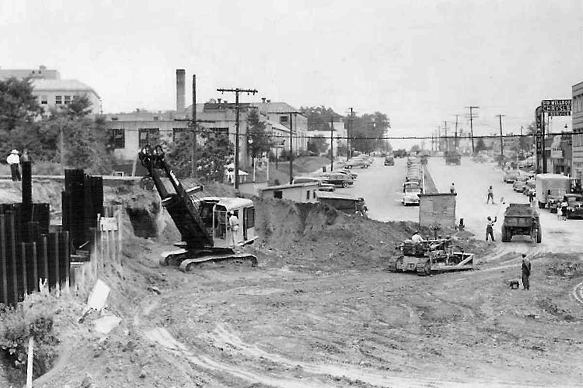
will reach later. The rightmost of the three detail photos shows "LaSalle" in the distance, as recalled by All in the Family lyrics, "Gee, our old LaSalle ran great." That was a General Motors short-lived car brand (1927 to 1940).

Link: LaSalle cars


Aerial 2002
Photo courtesy Google
NEW! mid-Feb 2024

Aerial 2002
Mile: 7.4 Date: 2002
Ease: A- View: N (up)
Area: B- IC2:
Map: Mo 37 A 10 Topographic Maps

Silver Spring deemed its 1878 station version too archaic for the town's post-WWII hip suburban image, so the structure made way in 1945 for a new one built on the same foundation. It appears at the center of this aerial. A matching brick waiting room for Washington-bound commuters stands across the tracks.

The three concrete strips north of the station represent a small rail yard that was used into the 1990s. The strips date to 1919; they were removed during the first decade of the 2000s. In the past, a spur emerged from the yard and crossed Georgia Avenue to serve the Griffith and Perry grain storage facility.


Redesigned Station

Redesigned Station
Mile: 7.4 Date: Feb 2006
Ease: A View: N
Area: B- IC2:
Map: Mo 37 A 10 Topographic Maps

Silver Spring's 1945 version exhibits the Colonial Revival architectural style.

Saved from demolition after a wayward automobile had damaged the structure during the 2000s, Montgomery Preservation restored the station into a combination museum and community center. This is the only building in downtown Silver Spring to be listed within the National Register of Historic Places.

Link: assorted pictures


Interior
Photo courtesy Dave Hiteshew

Interior
Mile: 7.4 Date: Sep 2008
Ease: B View: NE
Area: B- IC2:
Map: Mo 37 A 10 Topographic Maps

The interior has been restored to its appearance in B&O days, plus a Brio train set.


B&O 4044
Photo courtesy B&O History Collection
NEW! mid-Feb 2024

B&O 4044
Mile: 7.4 Date: Jun 1972
Ease: A- View: SE
Area: B- IC2:
Map: Mo 37 A 10 Topographic Maps

B&O 4044 is the first of six westbound locomotives riding continously-welded rail. At photo time, affliated B&O and C&O shared a yellow-lettering-on-blue-background paint scheme that could be found within the same consist. The near track employs rail joints, possibly because B&O knew construction of Metro's Red Line would soon remove the near track in preparation for the opening of Silver Spring's Metro station in 1978.

Links: 1971 view southeast to Burlington Ave?, Metro opens 1978


B&O 1455
Photo credit Walter Schopp
B&O History Collection
NEW! mid-Feb 2024

B&O 1455
Mile: 7.4 Date: May 1973
Ease: A- View: SE
Area: B- IC2:
Map: Mo 37 A 10 Topographic Maps

It took years for Amtrak to assemble a fleet of its own. In 1973, the still-newish Amtrak resorted to cobbling together this train from former B&O and Northern Pacific equipment. The engine is an E9A model. It took over for the failed Turbotrain to operate between Washington and Parkersburg, West Virginia. If Amtrak was not leasing the locomotive, perhaps it can be considered AMTK 1455.

Links: 1969, AMTK 1456 in another mashup 1972


end

End
Mile: 7.4 Date: 2000
Ease: B View: E
Area: B- IC2:
Map: Mo 37 A 10 Topographic Maps

The station site was looking a bit worn in its final days as a commuter stop in year 2000.


CPLs
Photo courtesy Dave Hiteshew

CPLs
Mile: 7.4 Date: Sep 2008
Ease: B View: SE
Area: B- IC2:
Map: Mo 37 A 10 Topographic Maps

In what's left of the rail yard, a pair of B&O color position light signals rest awaiting restorative installation as museum pieces. I'm told CSX donated these after they were replaced at Kensington, but their milepost signage indicates Rockville was the source.

Plans put the Metropolitan Branch Trail through this area, but funding and other issues have been problematic.


Waiting Room
Updated mid-Feb 2024

Waiting Room
Mile: 7.4 Date: Feb 2006
Ease: A View: N
Area: B- IC2:
Map: Mo 37 A 10 Topographic Maps

Across the tracks from the main station (roof in view) B&O erected a waiting room for eastbound passengers. Expansion for Metro in the mid-1970s walkway pushed the building away from its sibling across the tracks. Soon after this photo the structure was demolished to make room for more office buildings and parking decks. A connecting passenger walkway under the tracks was fenced off (right) at photo time. Its other end rises near the station's southernmost corner.

Decades ago in what now seems like another life, the top floor of the distant building at left was home to my offices. Though I had a great view of train activity, I snapped no photos because back then I had not yet taken up studying B&O history.


Green
Photo courtesy anonymous NOAA employee

Green
Mile: 7.4 Date: 2006
Ease: B View: N
Area: B- IC2:
Map: Mo 37 A 10 Topographic Maps

The waiting room's interior provides an example of the pale green that was popular during the mid-20th century.


MARC 62

MARC 62
Mile: 7.4 Date: Feb 2006
Ease: B View: SE
Area: B- IC2:
Map: Mo 37 A 10 Topographic Maps

Outside the waiting room, MARC 62 is about to transport commuters over the old passenger walkway. MARC 62 is an Electro-Motive Diesel (EMD) model GP40WH-2; EMD became a subsidiary of Caterpillar, Inc.


Canada Dry
Photo credit H Buckley
B&O History Collection
NEW! mid-Feb 2024

Canada Dry
Mile: 7.4 Date: May 1971
Ease: A- View: W
Area: B- IC2:
Map: Mo 37 A 10 Topographic Maps

Not far from the waiting room, B&O 3819 takes a ginger ale break while on the daily run from Eckington Yard. Wooden crates and glass bottles were the norm at the time. The crates were popular with kids who built go-karts. This Canada Dry location closed in 1995.

Across East-West Highway from Canada Dry is tiny Acorn Park, site of the spring that gave this area its name.

Links: Canada Dry, LoC entry, history


<< Previous (east) | THIS PAGE: Silver Spring | Next (west) >>

Or, return to main page for other tours.

Copyright Notice