TrainWeb.org Facebook Page
Northern Central Railway Photo Tour


Northern Central Railway
Modern day photo tour

Accompanying each photo below are:

Click a photo to see a larger view. Please send your comments and corrections to Steve.


<< Previous (index) | THIS PAGE: Downtown Baltimore | Next (north) >>

Brief Historical Background: Northern Central Railway

Tour Plan
Photo courtesy Google

Tour Plan
Mile: 0 to 16 Date: Oct 2018
Ease: View: N (up)
Area: T6:
Map: Ba Topographic Maps

This planned virtual tour of the Northern Central Railway begins in downtown Baltimore, Maryland, and follows the red tracing about 16 track miles generally north to Cockeysville, Maryland where at present the old rail line has been converted into a trail. The abandoned Greenspring Valley Branch will also be toured west to Owings Mills. This first of several tour pages covers roughly the first mile of NC track from downtown Baltimore.


Calvert Station
Photo courtesy HH Harwood collection

Calvert Station
Mile: 0.0 Date: ~1930
Ease: A View: NE
Area: B- T6: 231
Map: Ba 35 B 12 Topographic Maps

warehouse The 
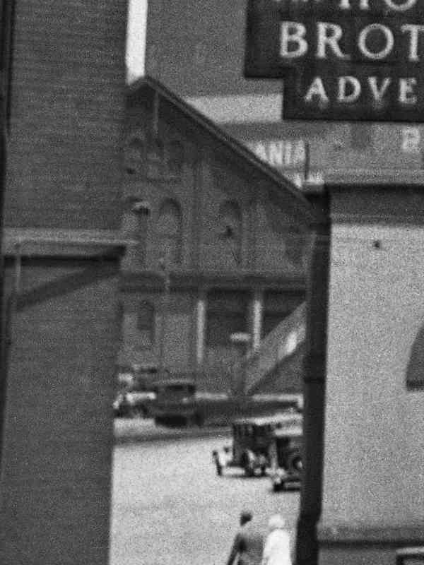
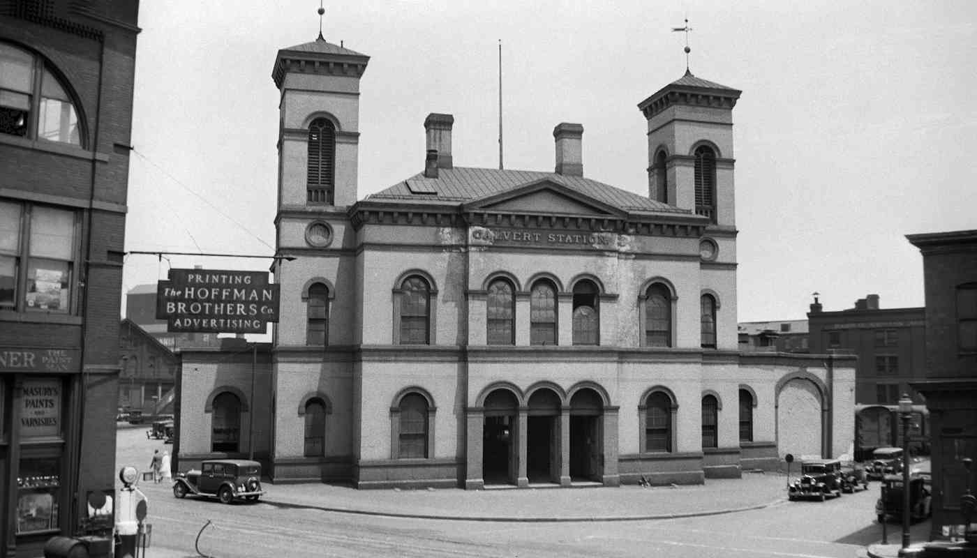
B&S built the Italianate-style Calvert Station at Calvert and Franklin Streets during 1849-1850, not far from the modern location of Mercy Hospital. The building, like many railroad structures in the vicinity, was constructed at an angle to Baltimore's street grid. This makes them easier to spot in old aerial photos.

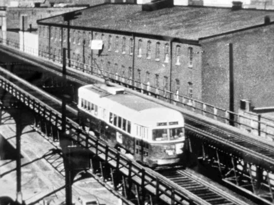
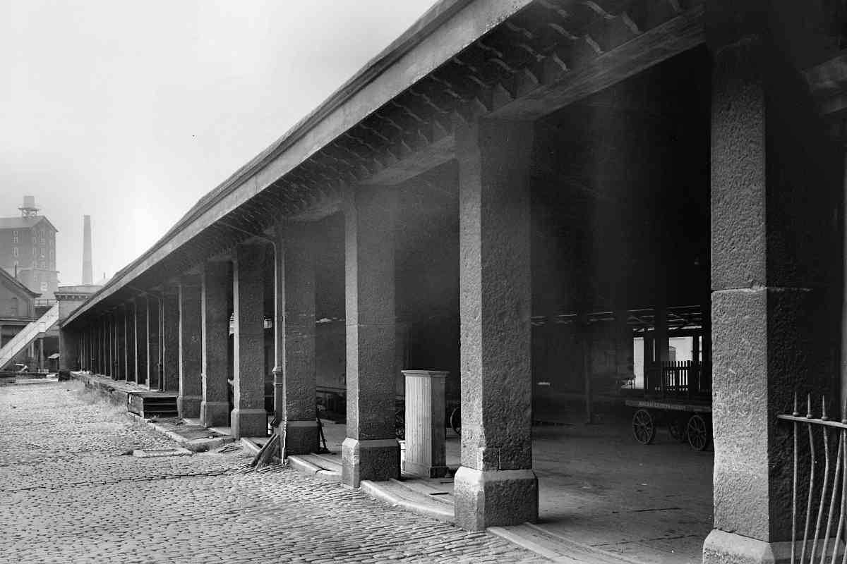
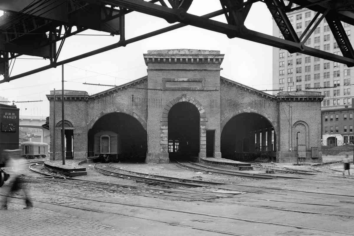
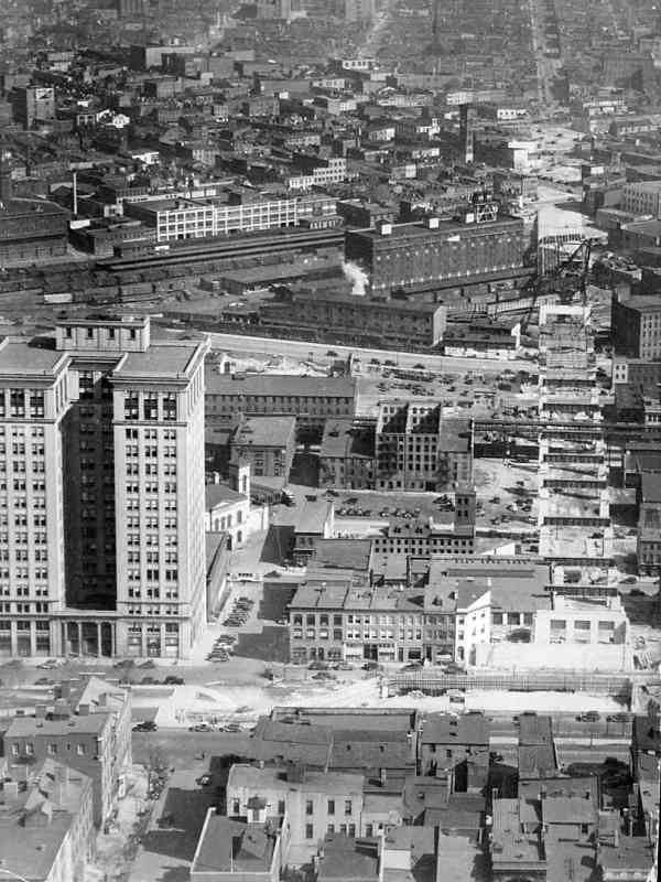
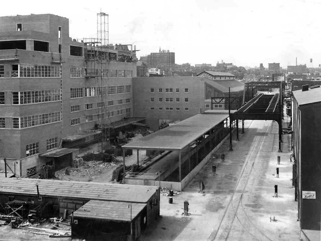
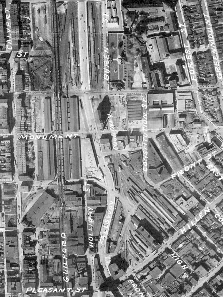
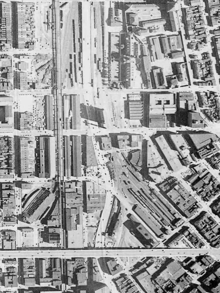
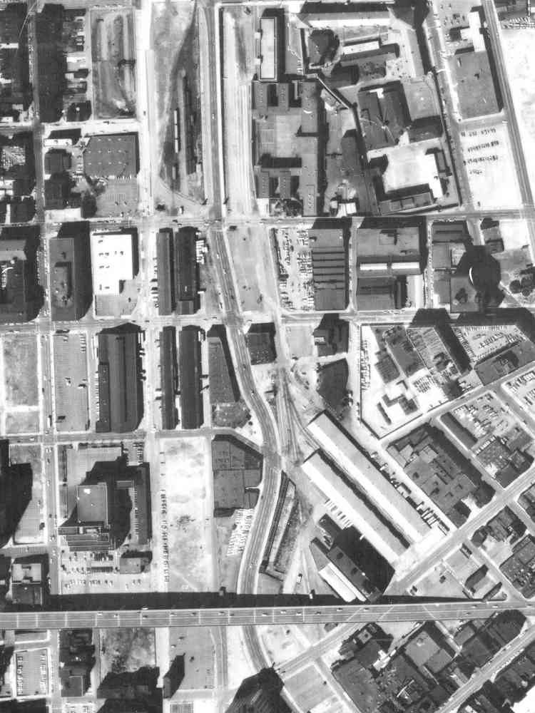
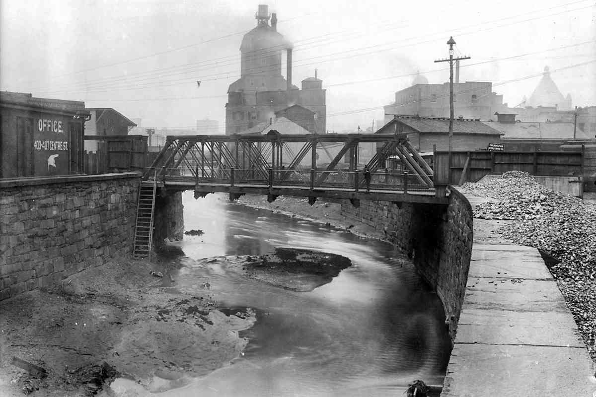
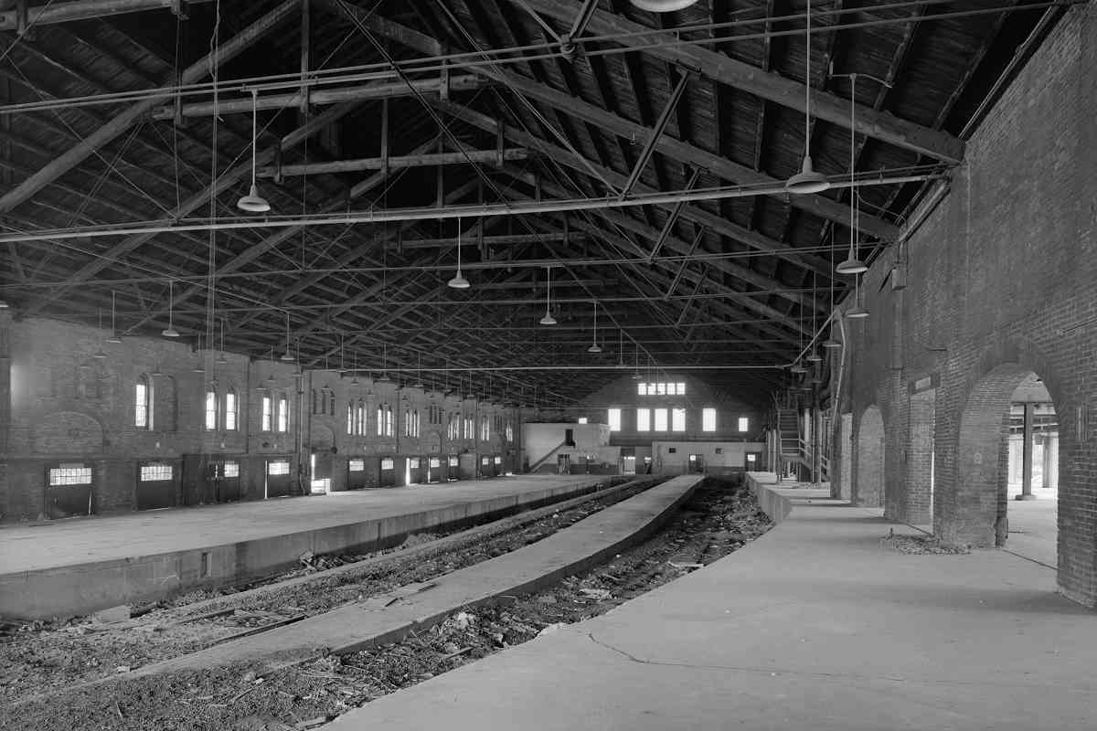
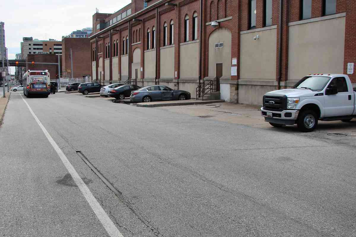
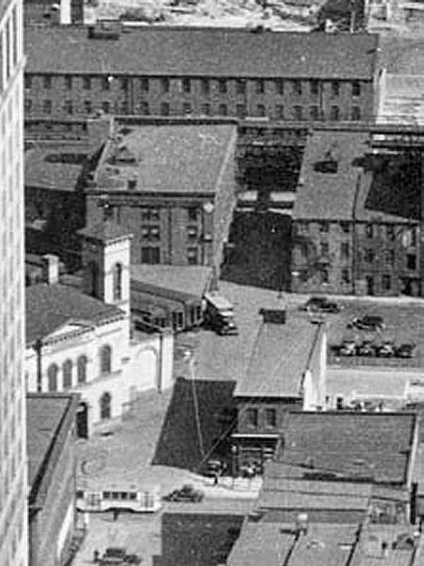
Numerous train sheds and freight warehouses dotted the area around the station. In general, NC facilities occupied the west bank of the Jones Falls, while those of the Western Maryland Railway (WM) were found on the east bank.
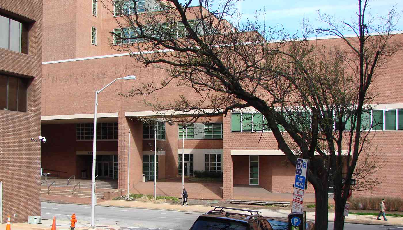
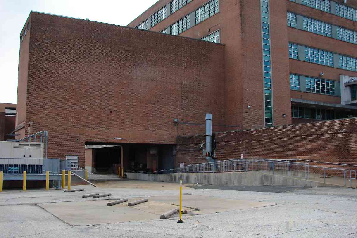
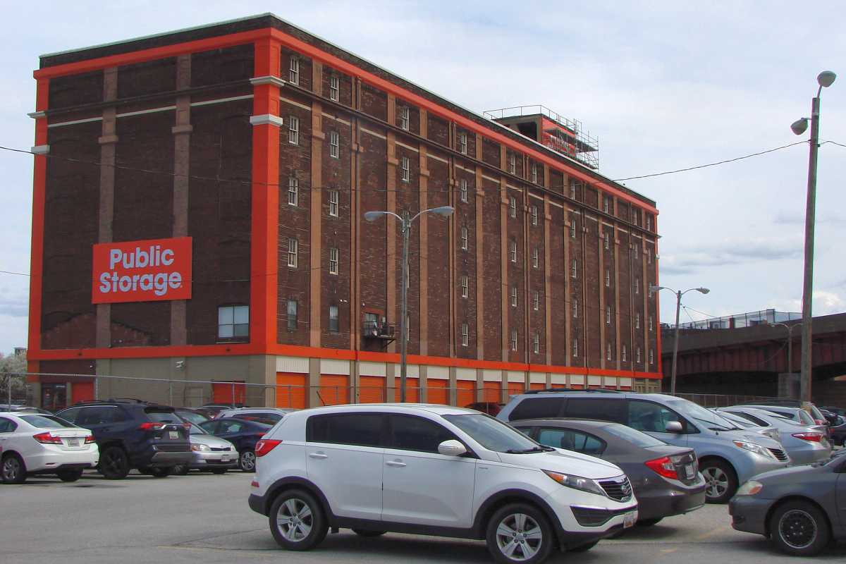
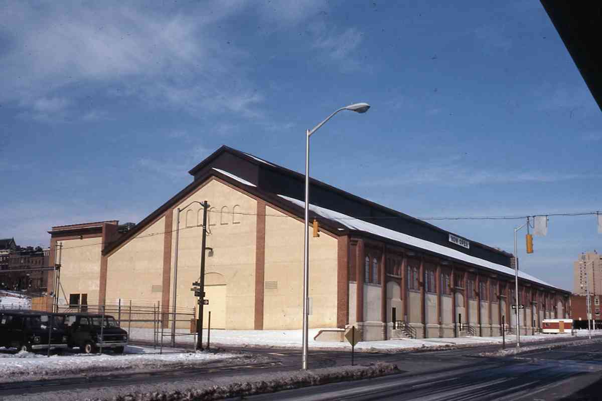
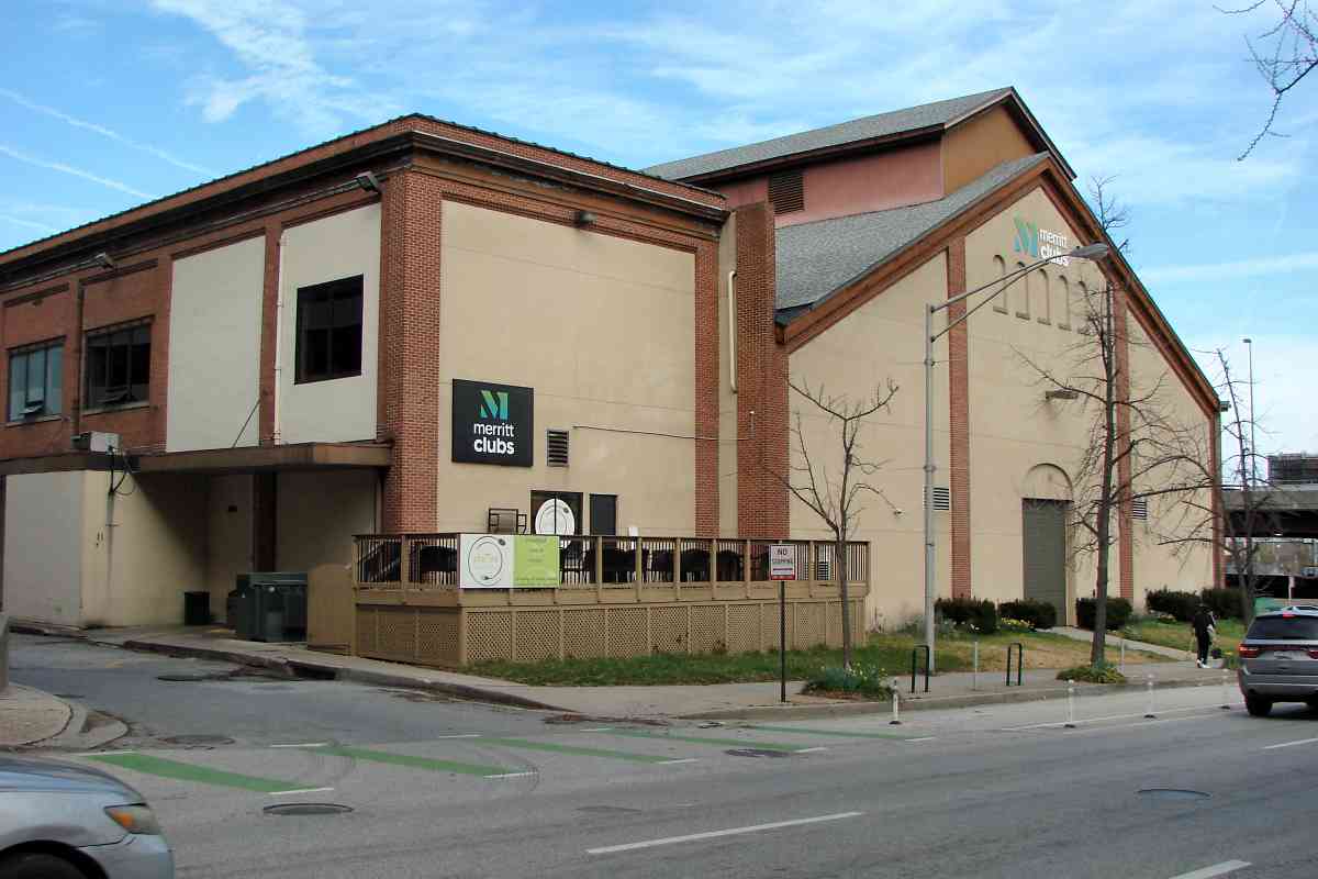
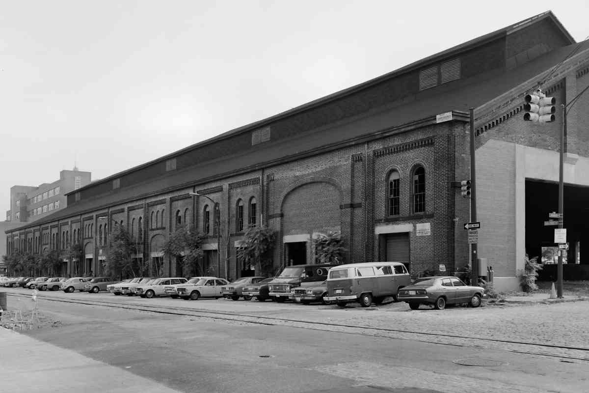
One of NC's few Baltimore's buildings to survive into the 21st century is the freight warehouse seen behind the station at distant left. Beyond it, emblazoned with Pennsylvania Railroad Company lettering, was NC's Grain Elevator #2.


Station Site 2020

Station Site 2020
Mile: 0.0 Date: Mar 2020
Ease: A View: NE
Area: B- T6:
Map: Ba 35 B 12 Topographic Maps

This is much the same view almost a century later, however nothing but Calvert Steert remains at the station's site to anchor a then-now photo comparison. The station was torn down as it neared its 100th birthday to make room in 1949 for headquarters of The Baltimore Sun newspaper. The Sun remodeled the facility during 1981, then departed it for smaller quarters at Port Covington during the 2010s.

That is Calvert Street in the foreground. If the photographers for both the 1930 and 2020 photo seem to be standing on higher ground, that's because they are. Land rises sharply both north and particularly west of this location.


Station Demolition
Photo courtesy HH Harwood collection

Station Demolition
Mile: 0.0 Date: 1948
Ease: A View: NE
Area: B- T6:
Map: Ba 35 B 12 Topographic Maps

Elevated trackage over Guilford Avenue can be glimpsed beyond the gutted remains of the station. Calvert Street was one-way southbound at photo time, but automobile traffic now rolls the opposite direction.


Guilford Avenue El
Photo courtesy Maryland Transit Admin

Guilford Avenue El
Mile: Date: ~1935
Ease: B? View: NE
Area: C+ T6:
Map: Ba 35 B 12 Topographic Maps

That elevated trackage began in 1893 as part of the Lake Roland Elevated Railway, the country's first electrified elevated train line. The elevated portion, necessitated by the NC's tangle of tracks below, was only eight city blocks long. The line followed Roland Avenue, among other streets, on its way to Lake Roland. Though it began as an independent rail company, it eventually became part of Baltimore's streetcar system.

Links: Lake Roland Elevated, 1936, riding the El, a first


Behind Station
Photo courtesy Library of Congress

Behind Station
Mile: 0.0 Date: Jul 1936
Ease: A View: NE
Area: C+ T6:
Map: Ba 35 B 12 Topographic Maps

Passengers boarded trains at this shed immediately behind Calvert Station.

A small number of Catonsville Short Line trains ventured this far east.

Change for: this site's Catonsville Short Line tour


Train Shed
Photo courtesy Library of Congress

Train Shed
Mile: 0.1 Date: Jul 1936
Ease: A View: SW
Area: C+ T6: 231
Map: Ba 35 B 12 Topographic Maps

This is a reverse view of the shed as seen from under the elevated streetcar line.


Train Shed Site

Train Shed Site
Mile: 0.1 Date: Mar 2020
Ease: A View: SW
Area: C+ T6:
Map: Ba 35 B 12 Topographic Maps

Though this is roughly the same view as the prior photo, nothing of the station or shed survives. A few concrete automobile parking blocks happen to echo the alignment of tracks inside the shed.


Aerial 1935
Photo courtesy Baltimore Sun

Aerial 1935
Mile: Date: 1935
Ease: View: E
Area: T6:
Map: Ba 35 B 12 Topographic Maps

station zoom By chance one day during 1935, the Baltimore Sun captured the site of its then-future headquarters in this photo that looks east. All the buildings not aligned with the street grid belong to various railroads. Calvert Station's bright exterior is partially visible at left as a streetcar passes in front. Western Maryland structures stand in the distance.

At right about a dozen bridge supports extend into the distance. That's the Orleans Street Viaduct, which now carries US 40, under construction to better connect east and west Baltimore. Streetcars riding the elevated line would manage to squeeze under.

Links: source photo, then-now 1955-2019, ~1940


Up and Down
Photo courtesy Baltimore Sun

Up and Down
Mile: 0.0 Date: 1949
Ease: B View: N
Area: C+ T6:
Map: Ba 35 C 12 Topographic Maps

As The Sunpaper's brick building went up in 1949, the elevated railway came down. This view looks north along Guilford Avenue during 1949 or 1950.

The newspaper chose this location in part because rail service simplified the delivery of mass quantities of paper from Canada and New England. The Sun did not print a December 25, 1950 edition because that was the day they moved here from Sun Square (Charles and Baltimore Streets). Note that high-resolution versions of many Sun photos can be purchased via their web site.

Link: source photo


Map 1876
Image courtesy Johns Hopkins University

Map 1876
Mile: Date: 1876
Ease: View: N (up)
Area: T6:
Map: Ba 35 C 12 Topographic Maps

This GM Hopkins map captures the area around and north of Calvert Station immediately before the WM arrived on the scene. The Jones Falls flows north to south through the middle, with the NC mostly on its west bank (left).

At map time, NC branch trackage followed Monument Street east then Central Avenue (off map) south to reach Jackson's Wharf at Baltimore's harbor. Later aerial photos do not make clear when service ended on the branch, but that might have been around 1960.


Survey 1894
Image courtesy Johns Hopkins University

Survey 1894
Mile: Date: 1894
Ease: View: N (up)
Area: T6:
Map: Ba 35 C 12 Topographic Maps

This 1894 map includes the WM's trackage, mostly on the Jones Falls east bank (right). On the west side, XXX crosshatching indicates elevated tracks.

After electricity reduced the usefulness of water power, many streams like the Falls became considered a nuisance, suitable only for wastewater.


Aerial 1927
Photo courtesy Johns Hopkins University

Aerial 1927
Mile: Date: 1926/1927
Ease: View: N (up)
Area: T6:
Map: Ba 35 C 12 Topographic Maps

This photographic view covers the same area as the two maps above. It dates to after The Fallsway covered over the Jones Falls. Several decades later I-83, the Jones Falls Expressway, aka JFX, would be squeezed through as well.


Aerial 1938
Photo courtesy Johns Hopkins University

Aerial 1938
Mile: Date: Apr 1938
Ease: View: N (up)
Area: T6:
Map: Ba 35 C 12 Topographic Maps

The same view about a decade later shows the Orleans Street Viaduct in place, and the NC Train Shed getting a new roof.


Aerial 1972
Photo courtesy Johns Hopkins University

Aerial 1972
Mile: Date: Mar 1972
Ease: View: N (up)
Area: T6:
Map: Ba 35 C 12 Topographic Maps

By 1972, I-83's southward progression reached Eager Street, just off the top edge of this photo. The NC's warehouses and yards did not need to make way for I-83's reach to Fayette and President Streets until around 1980.


WM Warehouse

WM Warehouse
Mile: Date: Mar 2020
Ease: A View: SE
Area: C T6:
Map: Ba 35 C 12 Topographic Maps

This, the tallest of the surviving railroad structures in the vicinity, is easily seen from the Orleans Street Viaduct. Its location east of I-83 is a hint this is not of NC heritage but rather WM. The WM's Hillen Station complex, which included WM headquarters, had occupied this area.

Link: Hillen Station 1950


Falls at Center Street
Photo courtesy Baltimore Sun
NEW! mid-Aug 2020

Falls at Center Street
Mile: 0.1 Date: ~1900
Ease: A View: N
Area: C+ T6:
Map: Ba 35 C 12 Topographic Maps

Circa 1900, the most direct walking route west from the WM's Hillen Station to the NC's Calvert Street Station included the Center Street bridge. Few photos exist of the Jones Falls in this vicinity prior to The Fallsway being built over it. This one looks north from where High Street now meets The Fallsway. Towering in the distance is the aforementioned NC/PRR Grain Elevator #2.

Link: photo source


NC Warehouse
Photo credit HH Harwood

NC Warehouse
Mile: 0.1 Date: ~2000
Ease: A View: NW
Area: C+ T6:
Map: Ba 35 C 12 Topographic Maps

Freight Warehouse A, on the west side of the Falls and I-83, is the largest of NC's surviving structures. Before Calvert Station was demolished around 1948, the adjacent Freight Office began double duty as a passenger depot. The building was shortened to make room for the widening of Centre Street. That explains why the masonry of the building's south end does not quite match that glimpsed in the older photo above.


Health Club

Health Club
Mile: 0.1 Date: Mar 2020
Ease: A View: NE
Area: C+ T6: 232
Map: Ba 35 B 12 Topographic Maps

As seen from Centre Street, the former warehouse is in use as a health club. The Freight Office, the flat-roofed building on left, was modified during 1946 for passenger use.


Reverse View
Photo courtesy Library of Congress

Reverse View
Mile: 0.1 Date: ~1974
Ease: A View: SW
Area: C+ T6:
Map: Ba 35 C 12 Topographic Maps

The 1860-built warehouse is one of few surviving examples of composite timber and iron roof construction of the mid 19th century. The roof structure is comprised of a GE traffic signal series of tricomposite trusses with timber top chords, wrought iron tension rods and cast iron compression members.

General Electric Streamline model traffic signals, like this one at Guilford Aveune and Monument Street, had been common in Baltimore. They date to the mid-1950s, following the May 1951 removal of the last of the elevated streetcar structure. The few Streamline signals that endured into the 2000s have been swapped out for LED-type signals.

Note the street-level tracks. They still exist, paved over for the most part.

Link: GE Streamline signals


Interior
Photo courtesy Library of Congress

Interior
Mile: 0.1 Date: 1946
Ease: B View: S
Area: C+ T6:
Map: Ba 35 B 12 Topographic Maps

This interior view was captured while the building was being modified to support passenger service.


Rails

Rails
Mile: 0.1 Date: Mar 2020
Ease: A View: SW
Area: C+ T6:
Map: Ba 35 C 12 Topographic Maps

Tracks at street level are NC remnants that re-emerge wherever pavement thins. NC trackage had continued a few blocks south of Calvert Station to a flour warehouse at Pleasant Street that as of 2020 is a self-storage facility.


Ex-RoW

Ex-RoW
Mile: 0.1 Date: Mar 2020
Ease: A View: N
Area: C+ T6:
Map: Ba 35 C 12 Topographic Maps

This photo was snapped from the same Guilford Aveune and Monument Street area as the prior.

B+O 4500 Mikado From Mikes to bikes. Mike is shorthand for the 2-8-2 steam engine type known as a Mikado (public domain photo of a B&O Mikado at right).

Links: 1900, 1900, Fallsway construction 1914


Uncer I-83

Under I-83
Mile: 0.3 Date: Mar 2020
Ease: A View: N
Area: B- T6:
Map: Ba 35 C 11 Topographic Maps

Prior to becoming a parking lot for adjacent Maryland State Government offices, WM trains ran here, while NC's did so on the left through what it called Madison Yard.

Many scenes for season 5 episodes of The Wire were filmed in this vicinity; this is the only place in Baltimore that octagonally-shaped support poles for an elevated highway can be found, so when you see them in The Wire you know where McNulty is doing his thing.

Links: looking east 1914, Fallsway construction 1914


Crossties

Crossties
Mile: 0.3 Date: Mar 2020
Ease: A- View: SW
Area: B- T6:
Map: Ba 35 C 11 Topographic Maps

Rails remained in use here into the 1990s, and are visible in scenes of The Wire filmed during 2007. Some of the last deliveries were of newsprint to the Baltimore Sun. As of 2020, only crossties remain at this spot north of Madison Street.


From Chase Street

From Chase Street
Mile: 0.5 Date: Mar 2020
Ease: A- View: S
Area: C T6:
Map: Ba 35 C 11 Topographic Maps

In this reverse view, The Fallsway is on the left, and I-83 on the right. Where sun amd rain have reached the disused right of way for the past 20 years, brush has overtaken.


Under Chase Street

Under Chase Street
Mile: 0.5 Date: Mar 2020
Ease: A- View: SW
Area: C T6:
Map: Ba 35 C 11 Topographic Maps

However, where sun and rain have not reached, rail ties are visible.

Link: Chase Street bridge 1914


Map 1855
Image courtesy Wikipedia

Map 1855
Mile: Date: 1855
Ease: View: N (up)
Area: T6:
Map: Ba 35 C 11 Topographic Maps

Prior to 1871, the Union Railroad had not yet connected Canton with what is now Penn Station. Consequently, B&S and NC trains made their way to Calvert Station from the Bolton Hill area by heading east and southeast to Chase Street where they turned south to follow Guilford Avenue. What is labeled "W. John" on this map is now Preston Street. B&S street trackage also followed Howard Street south to the B&O's then-planned Camden Station.

The facilities at Bolton, the B&S's first Baltimore terminal, will be covered by the next tour page. On this 1855 Colton map they are labeled "Susquehanna Railroad Depot". Present-day Penn Station sits on the west side of the "Water Cos. Reservoir". It is important to note that this is more plan than map: many of the indicated streets existed only on paper during 1855.

Link: source


Some Rails

Some Rails
Mile: 0.5 Date: Mar 2020
Ease: A- View: E
Area: C T6:
Map: Ba 35 C 11 Topographic Maps

Some rails can be found north of Chase Street, along with discarded shelving. Both are being enveloped by vines and soon won't be visible even during winter.

Relative to other railroads in Maryland, except for its stations, the Northern Central is sparsely documented. The NC lacks the B&O's home-grown flavor, the PRR's world-domination quest, and the Ma & Pa's charm. Additionally, whatever unique personality the NC had was lost upon its assimilation into the PRR collective. Old pictures of the NC's Jones Falls route are few and far between online. This tour hopes to address some of that short shrift.


Five Bridges
Image courtesy Johns Hopkins University

Five Bridges
Mile: Date: 1894
Ease: View: N (up)
Area: T6:
Map: Ba 35 C 10 Topographic Maps

The prior photo was snapped near the bottom of this topographic survey where WM-NC shared tracks diverge. The NC had bridged the Jones Falls five times within a mile.

WM-NC coziness dates to the 1850s when the NC transferred the Green Spring Branch (north of Baltimore City) to WM so it could access the city. This deal happened prior to the Pennsylvania RR's control of the NC, and continued until 1874 when the WM transferred the branch back.

The Union Railroad shown on the map began as a project of the Canton Company to build track to connect the Canton area of Baltimore with the Jones Falls area. That work included the Union Tunnel east of what is now Penn Station. When completed, the NC leased the route, then during 1882 purchased the Union Railroad. That track section and tunnel are now part of Amtrak's Northeast Corridor.

Prior to this topo map, Belvidere Street crossed the tracks at grade and connected to and beyond Preston Street.

Link: Belvidere Street bridge (once there, scroll to bottom)


Under Biddle Street

Under Biddle Street
Mile: 0.6 Date: Mar 2020
Ease: B View: SW
Area: F T6:
Map: Ba 35 C 11 Topographic Maps

One of NC's aforementioned five Jones-Falls-spanning bridges existed here under Biddle Street where now only a few old ties (and homeless people) are to be found. When The Fallsway came through during the 1910s, the water here was covered over, all but two of the rail bridges eliminated, and the tracks relaid. However, old aerial photos lack the resolution to confirm the Falls was completely enclosed here.

Two surviving NC bridges of the five are upstream, west of Penn Station. Could there be bridge artifacts to be found here, east of Penn Station? What about the barely-covered manhole off photo right?


Jones Falls

Jones Falls
Mile: 0.6 Date: Mar 2020
Ease: B View: NW (up)
Area: F T6:
Map: Ba 35 C 11 Topographic Maps

A stone arched structure is about twenty feet down the manhole. Could that be a bridge remnant?

1876 GM Hopkins map Possibly, but more likely it is something else. An 1876 GM Hopkins map (right) places this then-future manhole between the west bank of the Jones Falls and the mill race of the Baltimore Pearl Hominy Company. The street labeled North on the map is now Guilford Avenue. The mill race was spanned by what could be counted as the NC's sixth bridge in this area.

channel The highly-detailed 1894 city topo map concurs the NC had passed over this spot. Even so, location uncertainty means the arched structure could be related to the mill, the railroad, or the Falls. Despite the brown water, there was no sewage odor. What looks to be a narrow water path at the bottom might even be a channeled creek that feeds into the Falls.

Before you rush to see this yourself, take note this is a dangerous area for multiple reasons. At last check, this manhole was covered at ground level by a thin sheet of old plywood that might no longer support the weight of a person. If you step on it, you could fall through, and get injured or drown with little hope of anyone noticing your need for help. I urge you to avoid this area.

Links: Baltimore Pearl Hominy Company 1876 pamphlet, Fallsway construction 1914, Fallsway construction 1914


Box and Tank

Box and Tank
Mile: 0.6 Date: Mar 2020
Ease: B View: N
Area: D T6:
Map: Ba 35 C 10 Topographic Maps

FRA tag South of Preston Street's overpass a rusty trackside box (left) and a track switch's air tank (right) survive. The Federal Railroad Administration tag probably means this box dates to the 1970s era of Conrail. I-83 is adjacent on the left.


Wye

Wye
Mile: 0.7 Date: Mar 2020
Ease: B+ View: N
Area: C T6:
Map: Ba 35 C 10 Topographic Maps

Just north of Preston Street a wye permitted departing trains to bend west or east. The southeast leg of the wye (right) was added when I-83 forced the NC's trackage (left) to shift east a bit. Through the brush on the right you can spot a few ex-PRR boxcars; they will be seen better in photos below.


Turntable
Photo courtesy Johns Hopkins University

Turntable
Mile: Date: 1926/1927
Ease: View: N (up)
Area: T6:
Map: Ba 35 C 10 Topographic Maps

This view matches that of the "Five Bridges" topo map above. Preston Street cuts left-right through the middle. What was an NC Engine House on the 1894 topo map had been reduced to a turntable by the time of this 1927 view. That turntable is the round structure that resembles a screw head above and left of photo center

As revealed by its shadow, an interlocking tower had existed between Chase and Biddle Streets, the southernmost of the two east-west streets in this view. This is where southbound trains switched west (left) for NC facilities, or east (right) for WM. This tower does not appear in 1937 aerial photos.


I-83 Arrival
Photo courtesy Johns Hopkins University

I-83 Arrival
Mile: Date: Apr 1964
Ease: View: N (up)
Area: T6:
Map: Ba 35 C 10 Topographic Maps

I-83's then-fresh concrete road surface gleams brightly in this 1964 aerial, then curls south as far as Biddle Street. The trackage wye seen here is not present in a 1952 aerial.

The large diagonal building below and right of photo center occupies air space over the Jones Falls.

The tracks running left-right along the top of this photo are ex-Union Railroad, and are now part of Amtrak's Northeast Corridor. Baltimore's Penn Station is just beyond the top-left corner.


Boxcars

Boxcars
Mile: 0.7 Date: Mar 2020
Ease: A- View: NW
Area: C T6: 314
Map: Ba 35 C 10 Topographic Maps

Here's the promised better view of the boxcars that since the 1990s have sat inside what had been the trackage wye. NC's engine house had existed just beyond the left edge of the leftmost boxcar.

On the next tour page, we'll proceed to and beyond Penn Station where one NC steel bridge and one masonry bridge across the Jones Falls remain extant.

Link: aerial photos


<< Previous (index) | THIS PAGE: Downtown Baltimore | Next (north) >>

Or, return to main page

Copyright Notice