TrainWeb.org Facebook Page
Old Main Line Photo Tour


B&O Old Main Line
Modern day photo tour

Accompanying each photo below are:

Click a photo to see a larger view. Please send your comments and corrections to Steve.


<< Previous (east) | THIS PAGE: Hartman to Monocacy River | Next (branch) >>

Hartman Tunnel, East

Hartman Tunnel, East
Mile: 50.8 Date: May 2001
Ease: B View: W
Area: A IC2:
Map: Fr 39 F 2 Topographic Maps

At 215 feet, Hartman Tunnel is the shortest along the OML. Like most of the route's other tunnels, it was built around 1902 to straighten what had been an excessive curve around a hill. The 6 degree curve that remains is exceeded only by the 7 degree curve of the Union Dam Tunnel.


Hartman Tunnel, West

Hartman Tunnel, West
Mile: 50.9 Date: May 2001
Ease: C+ View: E
Area: A IC2:
Map: Fr 39 F 2 Topographic Maps

The limestone of Hartman Tunnel's west portal shines brightly in the May sun.

The origin of the name Hartman appears to be with a landowner in the vicinity. The only Hartman mentioned on the Frederick County ADC maps is located east of I-70 exit 59.


Abandoned Bridge

Abandoned Bridge
Mile: 50.9 Date: May 2001
Ease: C View: W
Area: A IC2:
Map: Fr 39 F 2 Topographic Maps

Hiding in the woods on the south side of the current ROW are stone piers from the Bush Creek bridge abandoned when Hartman Tunnel forged the new route. Note the lack of mortar, indication of original circa 1830 construction.

Part of the current bridge (33C) can be glimpsed in the distance downstream at center right.


CSX 712

CSX 712
Mile: 50.9 Date: Mar 2005
Ease: C+ View: W
Area: A IC2:
Map: Fr 39 F 2 Topographic Maps

At bridge 33C, CSX 712 leads an eastbound coal drag uphill to surmount Parrs Ridge at Mt. Airy.


Can You Hear Me Now?

Can You Hear Me Now?
Mile: 51.2 Date: Mar 2005
Ease: C View: S
Area: A IC2:
Map: Fr 39 E 2 Topographic Maps

In the foreground is bridge 34 with a plaque that reads "American Bridge Company. U.S.A. 1927". Within a mile long stretch in this area, the OML spans Bush Creek a total of 4 times. During the 1800s, the tracks followed a very different alignment (green line) that can also be toured.


East Reel
NEW! mid-Jan 2023

East Reel
Mile: 51.4 Date: Mar 2005
Ease: C View: N
Area: A IC2:
Map: Fr 39 E 3 Topographic Maps

Communications engineers check the status of a new transmitter at East Reel, one endpoint of a roughly 12,000 foot siding, the OML's longest. Because the dish is oriented SW, I'm guessing it points to a geostationary satellite.


Bridge 34 1/2
NEW! mid-Jan 2023

Bridge 34 1/2
Mile: 51.8 Date: Apr 2005
Ease: B- View: SW
Area: A IC2:
Map: Fr 39 D 4 Topographic Maps

This Bush Creek bridge dates to 1927, but the concrete portions certainly appear newer, perhaps part of flood repairs.


Reels Mill

Reels Mill
Mile: 52.7 Date: May 2001
Ease: A View: NW
Area: A IC2:
Map: Fr 39 B 3 Topographic Maps

Some days on the OML it's more likely you'll see inspection and maintenance vehicles than trains. This one has just passed the Reels Mill Road grade crossing.

At this spot eastbound trains begin their ascent over Parrs Ridge at Mt. Airy.


Main-SG
NEW! mid-Jan 2023

Main-SG
Mile: 52.7 Date: Oct 2022
Ease: A View: SE
Area: A IC2:
Map: Fr 39 B 3 Topographic Maps

During 2022 CSX painted track identifiers like this at the region's grade crossings. I believe Main-SG means this is the single (one) main line track here. The track on the left was stenciled "CSX Siding".


Reels Mill Yard

Reels Mill Yard
Mile: 52.9 Date: Apr 2005
Ease: B+ View: NW
Area: A IC2:
Map: Fr 39 B 2 Topographic Maps

The increase in spacing between the main (left) and its siding (right) marks the location ofReels Mill Yard. Around 1903, B&O constructed a helper station here, with coaling trestle, interlocking tower and water tank -- but the helper engines were actually based at Brunswick, some distance west, and there were no turning capabilities at Reels Mill. The incompleteness of the facilities led to their closure in 1925.


Sign Sign Everywhere a Sign

Sign Sign Everywhere a Sign
Mile: 53.1 Date: Apr 2005
Ease: B View: SE
Area: A IC2: 207
Map: Fr 39 B 2 Topographic Maps

Before the band Tesla covered the song, the Five Man Electrical Band sang those lyrics. Before electricity powered locomotives, coal did. The soil at the bottom left is black with detritus from the coal tower that once stood at this location.

In addition to the W whistle post for the grade crossing ahead, three generations of mile 53 sign posts are blockin' out the scenery. Between the tallest and newest 53 and the utlity pole, note the milepost on a rail, the oldest marker of the bunch.


Descent

Descent
Mile: 53.2 Date: Apr 2005
Ease: B View: W
Area: A IC2:
Map: Fr 39 A 2 Topographic Maps

If the tracks appears to be descending as they leave Reels Mill Yard, it's because they are, slightly, down through the Monocacy National Battlefield to the Monocacy River.


Iron Pipe
NEW! mid-Jan 2023

Iron Pipe
Mile: 53.3 Date: Oct 2022
Ease: B- View: N
Area: A IC2:
Map: Fr 39 A 2 Topographic Maps

Within about a one-mile stretch are at least three iron pipe culverts, all of which likely date to the early 20th century construction of Reels Mill Yard.


West End
NEW! mid-Jan 2023

West End
Mile: 53.7 Date: Oct 2022
Ease: B- View: NW
Area: A IC2:
Map: Fr 38 K 1 Topographic Maps

Approach-activated signals guard the west end of the siding.

Link: CPLs 2003


Colorful
NEW! mid-Jan 2023

Colorful
Mile: 53.9 Date: Oct 2022
Ease: B- View: W
Area: A IC2:
Map: Fr 38 K 1 Topographic Maps

Colorful foliage hides the fact a river crossing is immediately beyond milepost 54.


Monocacy River

Monocacy River
Mile: 54.0 Date: May 2001
Ease: B View: N
Area: A IC2: 207, 71
Map: Fr 38 J 1 Topographic Maps

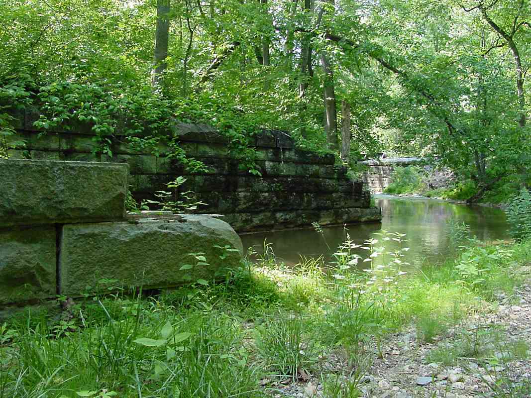
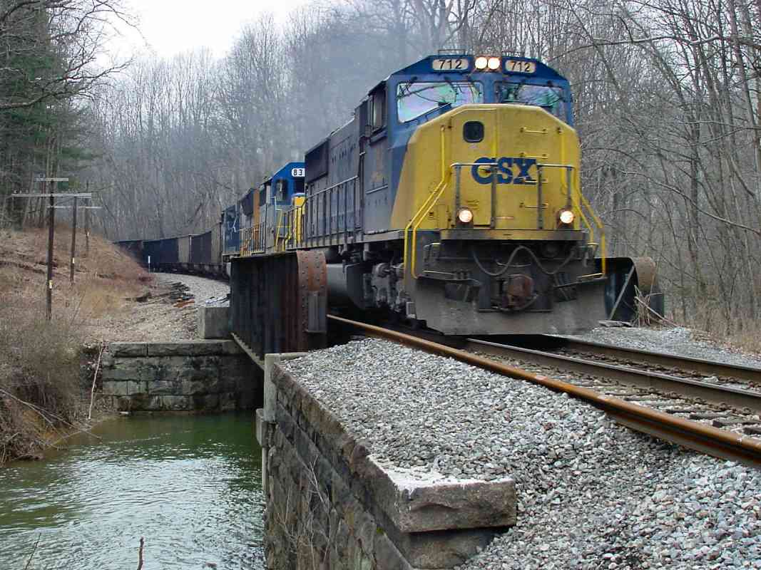
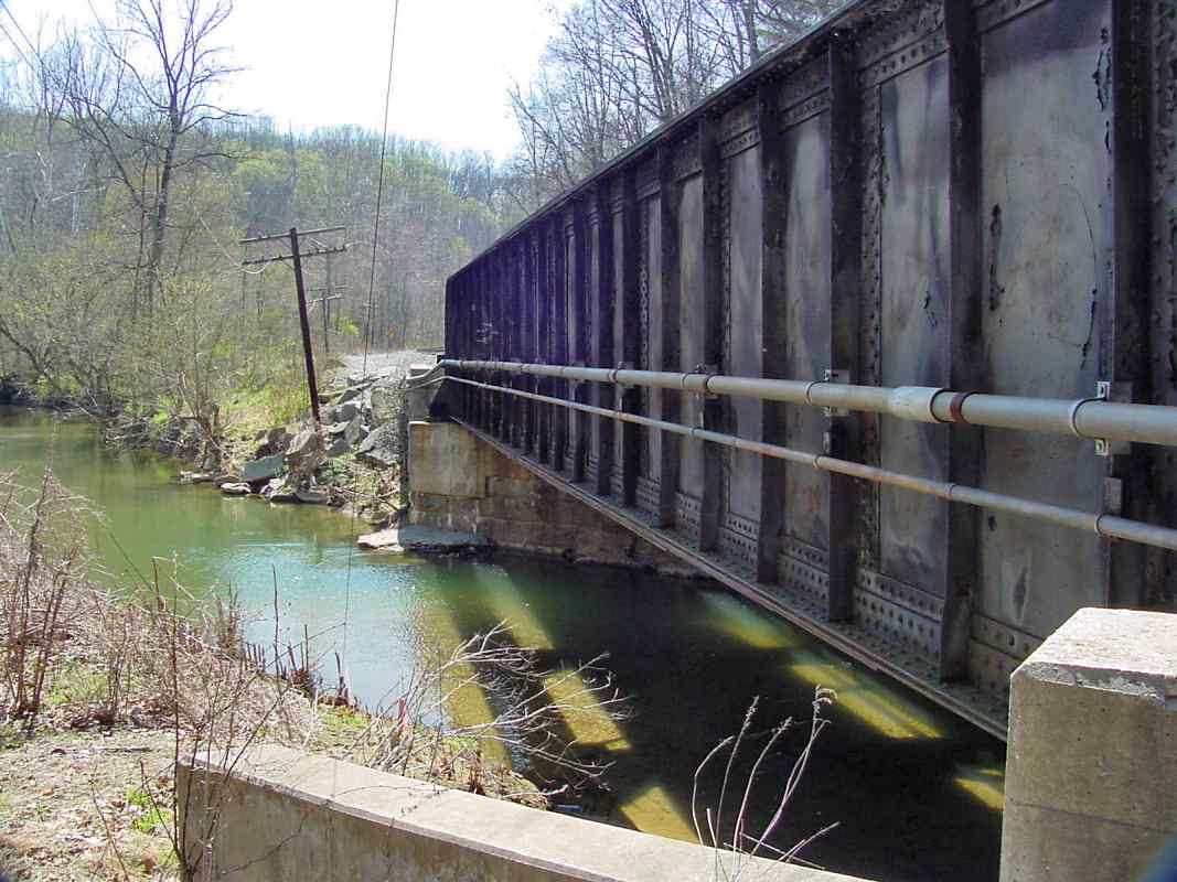
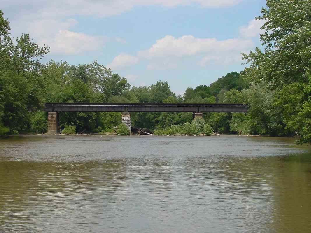
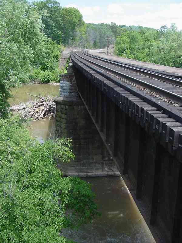
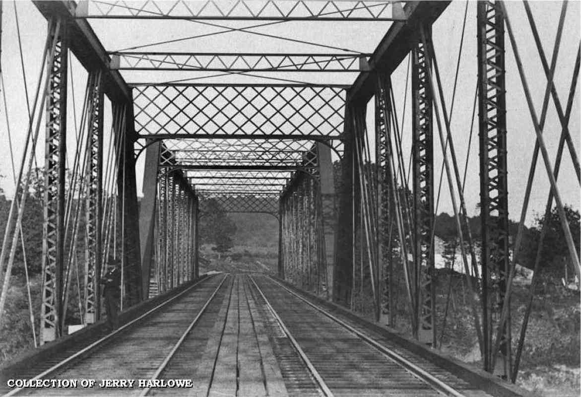
The Monocacy River might be the OML's most substantial water crossing. This bridge was a favorite target during the Civil War, and B&O had to rebuild it many times. The original bridge was a covered wood 
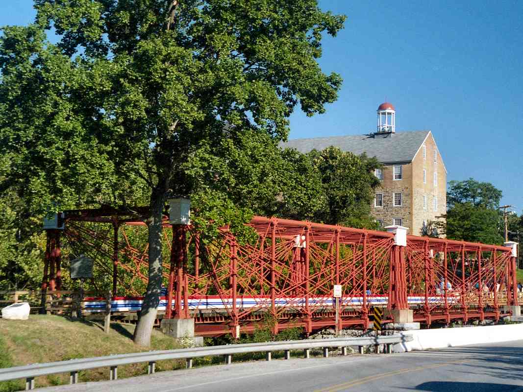
variety, but wooden bridges were easily set afire, so B&O tried iron Bollman bridges, but even they were not permanent.

Here are some entries from B&O's annual reports of that turbulent period:

September 8, 1862: The splendid iron suspension bridge at Monocacy blown up by the enemy. The water station at Monocacy, including pump house and engine, also burned.

September 15, 1862: Commenced removing debris of Monocacy bridge. This vicinity was the camping ground of the Confederate army, and before operations could be commenced at the bridge, dead men, horses and cattle had to be buried.

September 17, 1862: Monocacy trestling commenced; crossed trains over at 11 AM September 21.

September 25, 1862: The water station at Monocacy was rebuilt during the month.

April 24, 1863: Monocacy River higher than for many years.

June 3, 1863: Rumors of an advance of the enemy; no freight trains ran west of Monocacy until night.

June 18, 1863: All the engines and cars sent from Frederick to Baltimore. Frederick train went into Frederick and returned to Plane No. 1 for safety, and went again to Frederick on morning of the 19th for passengers.

June 20, 1863: Frederick train went only to Mt. Airy; the enemy in Frederick.

June 21, 1863: The enemy at Mt. Airy. Track torn up at Mt. Airy and telegraph wires cut at midnight and repaired next morning.

July 2, 1863: Trains running to Frederick. (Further north, the Battle of Gettysburg was in full swing.)

January 21, 1864: Commenced the erection of the east span of the Monocacy iron bridge and completed it on the 25th.

Link: Battle of Monocacy Junction


Monocacy River
Photo courtesy Jerry Harlowe

Monocacy River
Mile: 54.0 Date: ca. 1900
Ease: B View: N
Area: A IC2: 207, 71
Map: Fr 38 J 1 Topographic Maps

Civil War book author Jerry Harlowe kindly submitted this photo of a heretofore unknown bridge design that spanned the Monocacy. This view upstream is very similar to that of the prior photo.

Note the disused shorter stone bridge supports; those had been used by standard Bollman-style bridges. Until discovery of this photo in 2003, it had been thought the Bollman bridge had survived until replaced (around 1920?) by the bridge that still graces this location today.

Instead, the bridge seen here chronologically follows the Bollman design and precedes the current. If you compare this photo with the modern one, you'll note the modern one shows more stone supports have been added, ostensibly to support heavier loads.

Jerry reports finding the old bridge photos in an antique store in Frederick.

Change for: Metropolitan Subdivision at Monocacy River


Monocacy Bridge

Monocacy Bridge
Mile: 54.1 Date: May 2001
Ease: B+ View: E
Area: A IC2: 280
Map: Fr 38 J 1 Topographic Maps

Here's a view from trackside of the 350-foot long deck girder bridge. Like most (all?) OML bridges, the Monocacy Bridge had been double tracked through the 1950s.


Monocacy Bridge
Photo courtesy Jerry Harlowe

Monocacy Bridge
Mile: 54.1 Date: ca. 1900
Ease: B+ View: E
Area: A IC2: 280
Map: Fr 38 J 1 Topographic Maps

This photo, another Jerry Harlowe discovery, roughly duplicates the view of the modern photo above. Note the person standing on the left, as well as the light weight of the rails and bridge structure.

The crossbars on the sides of this bridge are reminiscent of those used in greater quantity on standard Bollman-style bridges. I wonder if this bridge might also be of Bollman-company origin, simply a later version of the original design.

Thanks for the contributions, Jerry!


Drake and Stratton
Photo courtesy Dave Hiteshew

Drake and Stratton
Mile: 54.0 Date: May 2007
Ease: B View: E
Area: A IC2:
Map: Fr 38 J 1 Topographic Maps

The Monocacy River bridge has been rebuilt and updated more times than any other OML bridge. One update was performed less than 50 years after the Civil War, as evidenced by this date stone. It reads The Drake and Stratton Co. 1908 AD Contractors.

Drake and Stratton was an engineering company with offices in New York and Philadelphia that assisted many Northeast and Midwest railroads with bridge building tasks.


Frederick Junction

Frederick Junction
Mile: 54.1 Date: May 2001
Ease: A View: NW
Area: A IC2: 134, 208
Map: Fr 38 J 1 Topographic Maps

Time has erased much of what was Frederick Junction where the OML meets the 3.5-mile branch that leads into Frederick.

This photo looks across the Y made between the OML and spur. The Frederick Junction Station sat within the Y near the lonely utility pole at photo center.


<< Previous (east) | THIS PAGE: Hartman to Monocacy River | Next (branch) >>

Or, return to main page

Copyright Notice