Visit the TrainWeb.org Fan Page on Facebook!
Your Ad Here
Old Main Line Photo Tour

B&O Old Main Line
Modern day photo tour

Accompanying each photo below are:

Click a photo to see a larger view. Please send your comments and corrections to Steve.


Union Dam Tunnel

Union Dam Tunnel
Mile: 15.3 Date: Jan 2000
Ease: C View: S
Area: A IC2:
Map: Ho 12 J 4 Topographic Maps

White snow and black tunnel contrast on this wintery day while mineral deposits mimic icicles on the tunnel's north (west) stone portal.


Agnes Damage
Photo courtesy Mike Cather

Agnes Damage
Mile: 15.5 Date: Jul 1972
Ease: C View: NW
Area: A IC2:
Map: Ho 12 H 4 Topographic Maps

Tracks hang in midair where floods from Tropical Storm Agnes washed away the bank. The Patapsco River is still muddied in this picture, likely taken a week or two after the tragic event. Scenes like this were to be found up and down the Old Main Line, and the B&O pondered abandoning the route. Almost two years would elapse before trains again operated here.

Links to other Agnes pictures: Gun Road, Orange Grove, Ilchester, Ellicott City, Ellicott City, Ellicott City, Ellicott City, Daniels


Under I-70

Under I-70
Mile: 16.0 Date: Jan 2000
Ease: B View: NW
Area: A IC2:
Map: Ho 12 G 3 Topographic Maps

CSX 736 negotiates its way under Interstate 70 in this wintry scene. The coal drag is dwarfed by the highway overpass, which is much taller than the similar overpass of I-95 back at mile 7.5.


CSX 736

CSX 736
Mile: 16.0 Date: Jan 2000
Ease: B View: NW
Area: A IC2:
Map: Ho 12 G 3 Topographic Maps

Four engines can make their own heat on a cold day.


Under I-70

Under I-70
Mile: 16.2 Date: Jan 2000
Ease: B View: S
Area: A IC2:
Map: Ho 12 G 3 Topographic Maps

Hey, you forgot the caboose!

According to a 1917 B&O Form 6 (Station List), HS tower had been situated a short distance west of this spot. The tower was destroyed in a fire on December 18, 1923 that claimed the life of the telegraph operator on duty. I have yet to locate any tower artifacts, such as the concrete of a foundation.


Oldest Grade Crossing

Oldest Grade Crossing
Mile: 16.6 Date: May 1999
Ease: A View: E
Area: A IC2:
Map: Ho 12 G 2 Topographic Maps

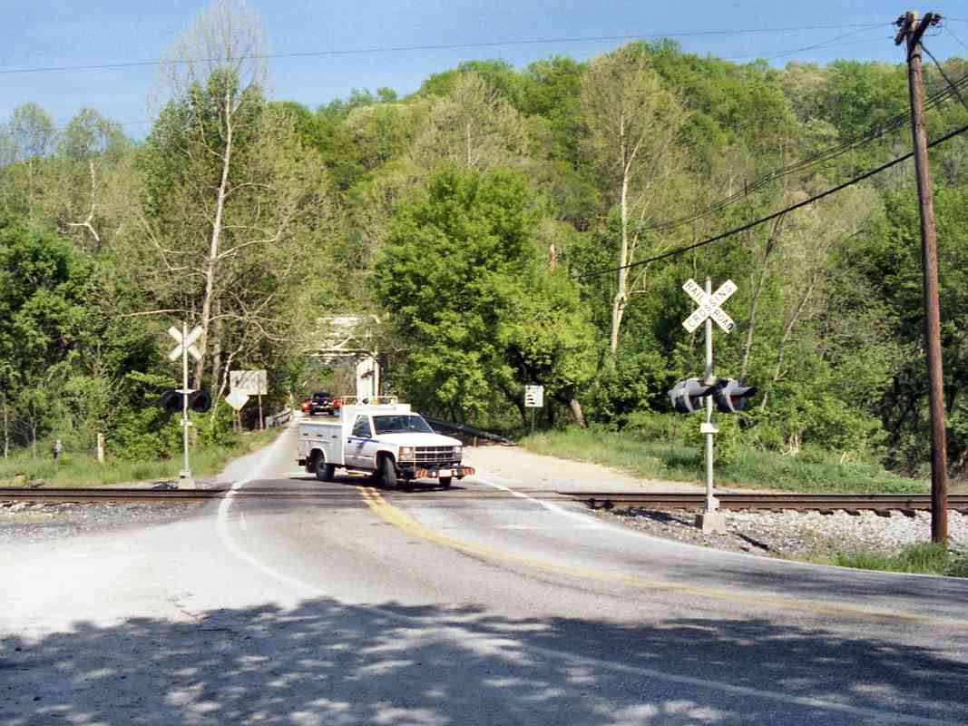
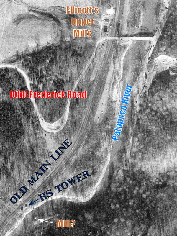
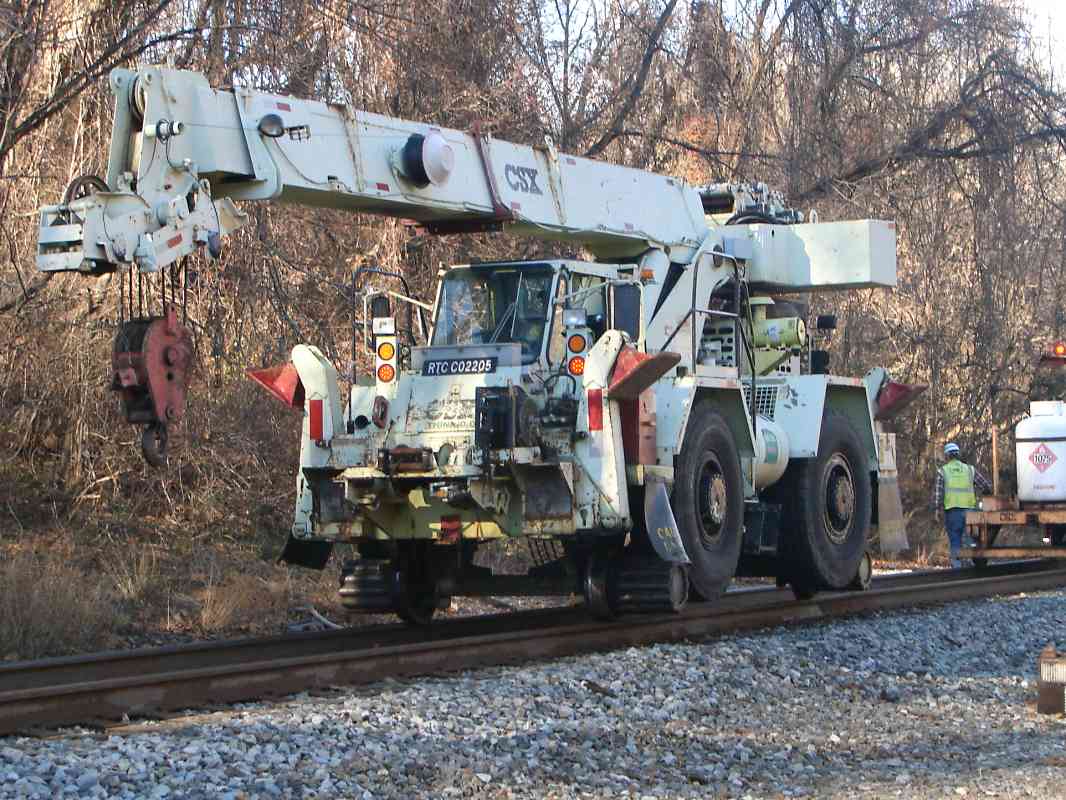
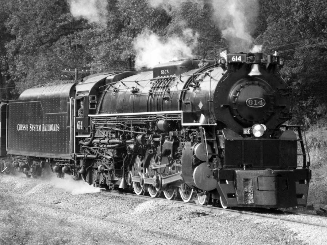
A CSX track inspection car turns off the rails onto pavement at the Old Frederick Road grade crossing. This is the only still-active grade crossing within the easternmost 20 miles of the OML.

But of greater significance in the continuing quest for B&O superlatives: this is the oldest surviving railroad grade crossing in the world. The road here likely dates back to 1775 when Ellicott's Upper Mills stood near this location, and then the railroad arrived around 1830.

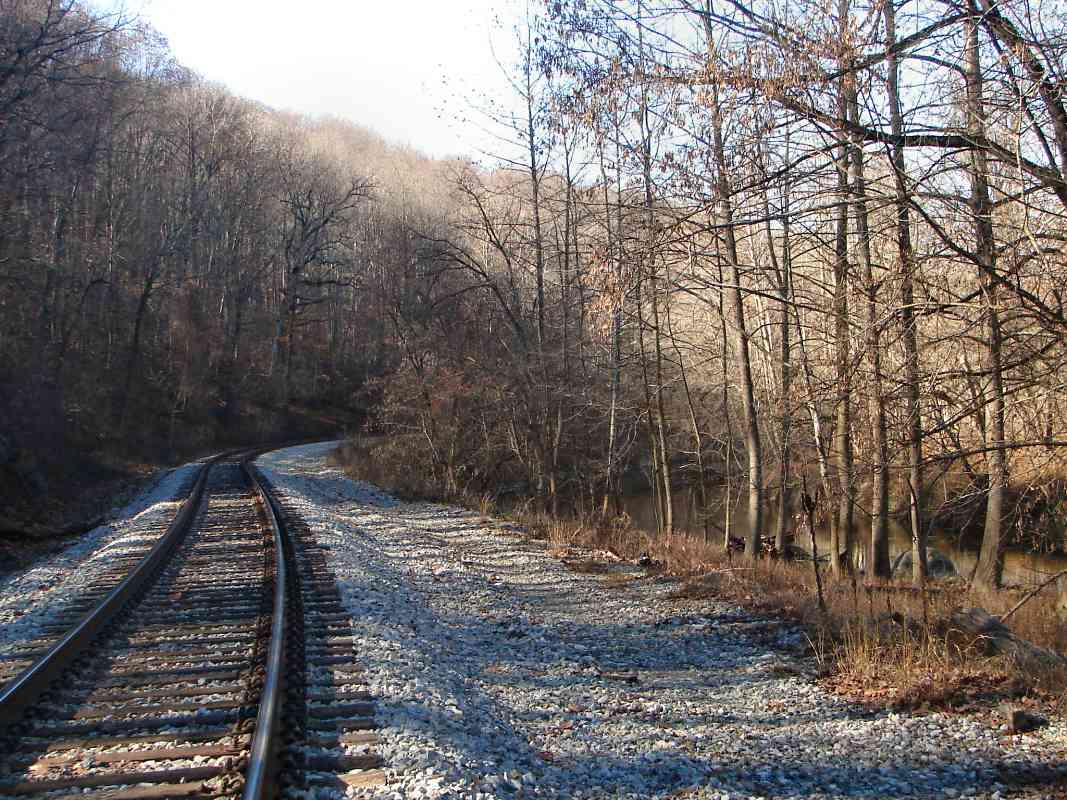
The oldest roads of an area generally follow the highest ground because that means fewer muddy spots and fewer bridges. In Howard County, Old Frederick Road traces a ridge that marks a watershed boundary: north of the road, streams feed the Patapsco River, while south of the road they lead to the Patuxent River.

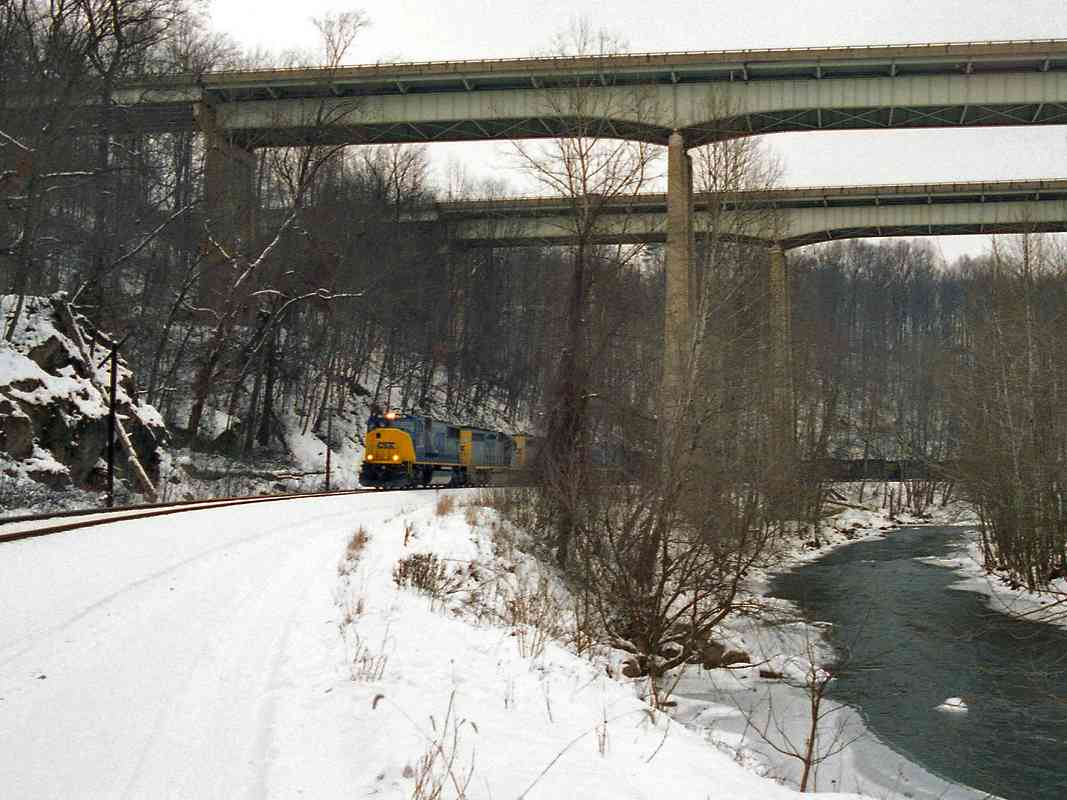
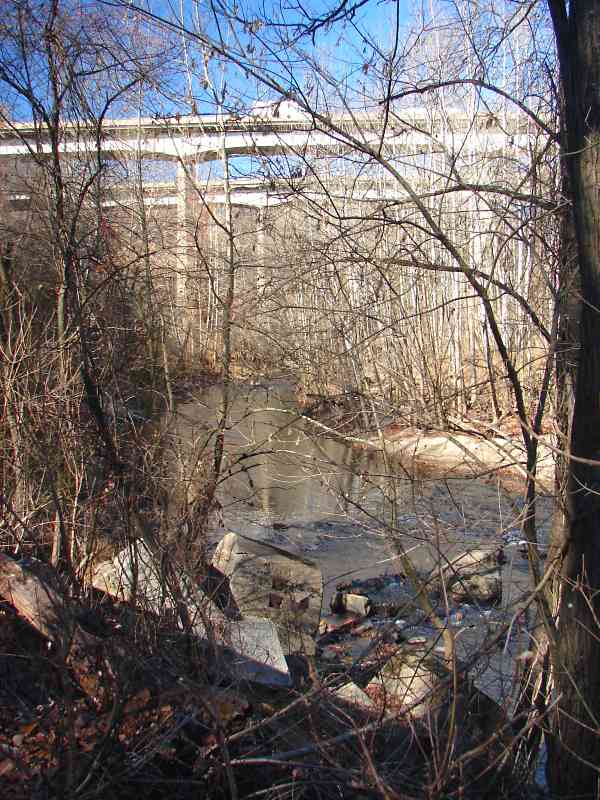
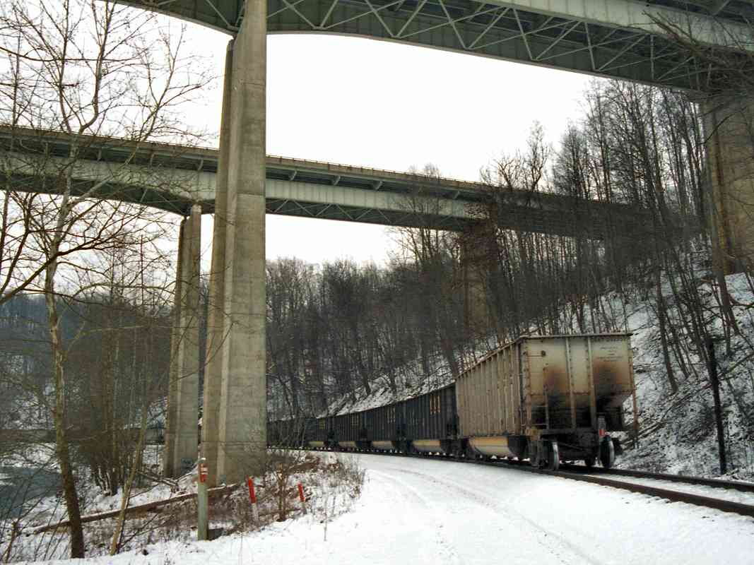
Also of note is the highway bridge that crosses the Patapsco just beyond the tracks. It was built in 1934 making it the oldest automobile bridge still in use in this area, as well as a survivor of the floods of Tropical Storm Agnes. It was renovated in 2005/2006. Its restored plaque reads "Patapsco River Bridge - Built 1934 - State Roads Commission - E. Clinton Uhl, Chairman. - E. Brooke Lee. Robert Lacy. - H.D. Williar Jr. Chief Engineer. - W.C. Hopkins Bridge Engineer".

Link: Real-time USGS stream flow data near this location


CSX 321

CSX 321
Mile: 17.0 Date: Aug 2005
Ease: B View: E
Area: A IC2:
Map: Ho 12 F 1 Topographic Maps

Westbound coal empties swing past milepost 17 with CSX 321 in the lead.


Tied Culvert

Tied Culvert
Mile: 17.1 Date: Nov 2000
Ease: C View: N
Area: A IC2:
Map: Ho 12 F 1 Topographic Maps

A stack of recycled railroad ties shores up this culvert. I've not seen so many ties used for such a purpose anywhere else on the OML.


New Signals
NEW! Nov 2006

New Signals
Mile: 17.8 Date: Aug 2005
Ease: B View: N
Area: A IC2:
Map: Ho 12 D 1 Topographic Maps

In 2005, CSX completed replacing the OML's B&O color-position signals with ones like those seen here. Just beyond the bend is the old mill town now named Daniels.


Daniels
NEW! Nov 2006

Daniels
Mile: 17.9 Date: Aug 2005
Ease: B View: N
Area: B+ IC2: 87
Map: Ho 12 D 1 Topographic Maps

Over the centuries, the hidden industrial town of Daniels has witnessed many changes. First named Elysville, then Alberton, what remains is named Daniels, after the company most recently to have owned and operated it. The town began pre-railroad with a flour mill, which evolved into a substantial cotton mill, and sprouted churches plus 118 employee houses.

The building at center is the former St. Albans church. The grounds are now used by The Mulch Factory, which suprisingly receives bulk quantities of wood chips via truck rather than train.

Links: ~1880, 1968, 1984


From Above
NEW! Nov 2006

From Above
Mile: 17.9 Date: Mar 2000
Ease: B View: NW
Area: B+ IC2:
Map: Ho 12 D 1 Topographic Maps

The mill town was located at the head of a particularly winding stretch of the Patapsco River that caused the B&O headaches for many years. The earliest alignment (green) had trains screeching around an 18-degree curve on tracks that hugged the south bank of the river to avoid the surrounding hills.

The B&O waited until 1906 to build a 2-mile long straighter alignment that includes the bridge across the Patapsco River seen at left.


Daniels Bridge

Daniels Bridge
Mile: 18.0 Date: Apr 2001
Ease: B View: W
Area: A IC2:
Map: Ho 12 D 1 Topographic Maps

The longest railroad bridge across the Patapsco now carries just one CSX track. Originally, there were two tracks, but sometime after 1950 the OML was converted into single track. In this view from the east, only the mounting plate remains from the second track. Apparently the B&O decided that the stone structures could handle the imbalance, and never centered the remaining, active track.


Gary Memorial Methodist

Gary Memorial Methodist
Mile: 18.0 Date: Apr 2001
Ease: B View: S
Area: A IC2:
Map: Ho 12 D 1 Topographic Maps

Seen through the single-lane road under the Daniels Bridge is Gary Memorial United Methodist Church. The church, which was built in the 1879 to serve the mill town, remains active to the present day.

In spring 2001, the church hosted a portion of the Walt Disney Pictures production of "Tuck Everlasting." In fact, Disney used this Web site to help select this and other locations within Patapsco State Park for filming of their movie.

Link to older picture: 1980s


Follow along the disused original routes west

Continue to the next page in this tour

Or, return to main page


Copyright Notice
Visit the TrainWeb.org Fan Page on Facebook!
Create your own free Rail Blog or Website!

Advertise | About Us | Contact Us | Sign up for our Newsletter | TrainWeb.com

Your Ad Here
Your Ad Here