TrainWeb.org Facebook Page
Old Main Line Photo Tour


B&O Old Main Line
Modern day photo tour

Accompanying each photo below are:

Click a photo to see a larger view. Please send your comments and corrections to Steve.


<< Previous (east) | THIS PAGE: Marriottsville to Henryton | Next (west) >>

Diverted

Diverted
Mile: 23.7 Date: Nov 2014
Ease: B View: NW
Area: A IC2:
Map: Ho 6 C 7 Topographic Maps

If you took the detour, you learned B&O's original alignment bent to follow a Patapsco River kink. To straighten the tracks before the railroad's first 10 years had elapsed, B&O diverted the river into a cut on the right, thereby creating McKeldin Falls. Fill was heaped over the river's kink. Unseen on the left behind trees is the 1830 original alignment. This is the only location at which B&O rerouted the Patapsco River.


Whistle Post
NEW! early-Oct 2025

Whistle Post
Mile: 24.1 Date: Jun 2000
Ease: B View: W
Area: A IC2:
Map: Ho 6 C 7 Topographic Maps

B&O whistle posts were made of concrete and embossed with a W painted black. My guess is this design dates to between 1910 and 1940. This one warned that the Marriottsville Road grade crossing is ahead. CSX replaced it with a metal W by 2014. They also replaced the CPL signals and moved the track greaser west.


Wide

Wide
Mile: 24.2 Date: May 2005
Ease: B View: W
Area: A IC2:
Map: Ho 6 C 7 Topographic Maps

Marriottsville Aug 1952 As we approach Marriottsville (and its former post office, the white building at the grade crossing in the distance) the width of the clearing reveals the past existence of one or more sidings. Marriottsville was a stop for water; that might be a tank trackside near the center of the August 1952 aerial at right. These days CSX often temporarily holds supplies or scrap here.


CSX 835

CSX 835
Mile: 24.3 Date: Nov 2014
Ease: A- View: W
Area: A IC2:
Map: Ho 6 B 7 Topographic Maps

CSX 835 and CSX 3137 drag coal through the Marriottsville Road grade crossing to the port of Baltimore.


On-Track

On-Track
Mile: 24.4 Date: Jun 2000
Ease: A- View: N
Area: A IC2:
Map: Ho 6 B 7 Topographic Maps

Just east of the grade crossing was an installation of CSX's On-Track system. It is no longer extant.

Reader Tom Rogers wrote and said:

    "I've been told by a CSX engineer as well as another railfan that the detector at Marriottsville is a photo detector. The device has lights so that its photo cells get decent amounts of light no matter what the ambient light. Evidently it transmit it's photos ahead to the yards along the line yielding a photo book of the cars in the consist. The photos are evidently good enough to make out numbers and bar codes. My friend has evidently seen the pile of photos it transmits. I've witnessed numerous trains at Marriottsville and never picked up and audible detector announcement on my scanner."

Reader Craig Hinners wrote to add:

    "I used to work for CSX and know about the 'On Track' system at Marriottsville. If a car's AEI tag cannot be read, a photo of the side of the car is taken and transmitted to Jacksonville, where an operator sits at a PC and manually enters the number. Some of the train crews actually duck below their engine's windows when they pass this camera, convinced that 'spies' in Jacksonville are taking photos to ensure compliance with safety regulations."

Reader Henry Snyder from Jacksonville, FL added:

    "Just thought you might to have a little more information. What you photographed is a 'video reader' as CSX calls them. They take a video of trains passing in either direction. This video is them sent to Jacksonville where the work orders are completed on each individual train before it starts it next move. With these videos the clerk's here in Jacksonville can see if there were any 'add cars' that the train might have picked up while it was enroute. One problem with these readers is that sometimes they tend to malfunction, because of weather or vandalism. One image that was captured in the Narrows in Cumberland was some deer crossing the tracks within range of the motion detector which starts the video and lights coming on. The lights at time would come on for no apparent reason therefore needing bulbs to be replaced. Now the locomotive passes a predetermined location with sensor to trigger the lights. When locomotive and consist is within a predetermined range of the motion detector then the video starts rolling."

Reader Tim Quinn said during October 2004:

    "The Automatic Equipment Identification & Video in your photo at Marriottsville is now out of service and will be removed. A new Automatic Equipment Identification (AEI) building and antenna system has been installed at the same location. The equipment reads the information on the tags that are located on the locomotives, cars and on the EOT device. It also records the speed, axle count and the direction of the train. There is no audio announcing the train moves."

The Marriottsville Road highway bridge is the concrete structure in the background.


Transcore

Transcore
Mile: 24.4 Date: May 2005
Ease: A- View: W
Area: A IC2:
Map: Ho 6 B 7 Topographic Maps

Five years after the prior picture, the On-Track equipment is still present, but has been superceded by the Transcore system seen in the trackside "planter" at left center. Transcore watches for on-car radio-frequency identification tags. The Marriottsville grade crossing is in the distance.


One-Lane Bridge
Photo by William Schuler, courtesy Steve Schuler

One-Lane Bridge
Mile: 24.4 Date: Dec 1975
Ease: A View: N
Area: A IC2:
Map: Ho 6 A 7 Topographic Maps

Previously, this one-lane bridge had sufficed to carry Marriottsville Road between Howard and Carroll Counties.


Survivor
Photo courtesy Baltimore Sun
NEW! early-Oct 2025

Survivor
Mile: 24.4 Date: 1970s
Ease: A View: NE?
Area: A IC2:
Map: Ho 6 A 7 <Topographic Maps

To my knowledge, this and Old Frederick Road (mp 16.6) were the only two road bridges across the Patapsco River between Elkridge and Mt. Airy to survive the floods of 1972's Tropical Storm Agnes. They also survived 1975's Eloise. Sturdier versions of this bridge style were installed by railroads circa 1900. I've been told this example was replaced around 1983.

The previous Patapsco River bridge downstream at Woodstock looked quite similar to this one but was about twice as long.


Marriottsville

Marriottsville
Mile: 24.4 Date: Nov 2014
Ease: A View: W
Area: A IC2:
Map: Ho 6 A 7 Topographic Maps

The width of the clearing, and a railroad bridge beyond, suggest one or more sidings had also existed west of Marriottsville's grade crossing. A brief scene with Clint Eastwood was filmed here for the 1997 movie Absolute Power; these grade crossing signals are visible, but no trains.

Reader Joe Simmons contributed some historical background:

    "When I was a pre-schooler, we lived on the Ivy Hill Farm on Driver Rd. above Marriottsville. One of my very early memories is of a train wreck at Marriottsville. I can remember seeing the steam engine where it crashed through the back wall of Mrs. Gates' store. This must have been some time in late 1943 or 1944. My parents always said that the derailment was thought to have been sabotage. Another item about the B&O and Marriottsville concerns several widows living there during this period. My mother told me that the B&O furnished coal to these ladies by way of the firemen on passing trains. The children in the community would gather the coal from along the tracks for these ladies. I have enjoyed looking over your website."


Creek
NEW! early-Oct 2025

Creek
Mile: 24.4 Date: Nov 2014
Ease: B View: SW
Area: A IC2:
Map: Ho 6 A 7 Topographic Maps

Bridge 24 has been modified over the years. The stonework at the far/inlet end might be original 1830 construction. A concrete addition widened the bridge, perhaps to support sidings. Now, the single track that remains rides the concrete portion.

Few OML bridges have started with stone and been widened via concrete. This and bridge 30B near Mt. Airy Plane 4 are the only two I can think of between Relay and Harper's Ferry. The style suggests the addition was made circa 1930.


CSX 39

CSX 39
Mile: 24.6 Date: Dec 1999
Ease: B+ View: SE
Area: A IC2: 279
Map: Ho 6 A 7 Topographic Maps

A series of westbound tanker cars, headed by CSX 39, continues past Marriottsville.

The flat area of the left is a remnant of a siding that served a mine on the other (Baltimore County) side of the river (left). Limestone was quarried in this vicinity.


Whistle Post

Whistle Post
Mile: 24.7 Date: Dec 1999
Ease: B+ View: E
Area: A IC2:
Map: Ho 6 A 7 Topographic Maps

This concrete whistle post is one of only a few such survivors of its vintage along the OML. It likely dates to around 1910 and warns of the Marriottsville Road grade crossing just around the bend. Since the time of this photo, it has been removed.


Henryton Bridge

Henryton Bridge
Mile: 25.1 Date: Sep 2005
Ease: B View: W
Area: A IC2:
Map: Ho 5 K 7, Ca 35 K 6 Topographic Maps

A bridge was first constructed at this site around 1850 to accommodate the OML's re-routing through the Henryton (then Marriottsville) Tunnel hiding in the distance at left. I've read that a Bollman bridge once spanned the Patapsco here and was washed away in 1868, but there is no evidence of that today. The style of the current bridge indicates a construction date early in the 1900s, probably around the time the nearby tunnel was improved, followed by updating later in the 20th century, possibly after the floods of Tropical Storm Agnes.


Henryton Tunnel, East

Henryton Tunnel, East
Mile: 25.1 Date: Dec 1999
Ease: C+ View: W
Area: A IC2: 70
Map: Ca 35 K 6, Ho 5 K 7 Topographic Maps

Henryton Tunnel is the third-oldest tunnel in the world that remains in active railroad use. Opened around 1850, it was the first tunnel constructed on the OML. The tunnel was widened for double track shortly after the Civil War then rebuilt into the form seen here in 1903. B&O reduced this section back to single track around 1960.

The award for "oldest tunnel still in railroad use" goes to Taft Tunnel (aka Bundy Hill Tunnel) in Lisbon, CT built by the Norwich-Worcester Railroad in 1837. Also dating to 1837 is Mount Prospect Tunnel that is employed by Metro North commuter trains in New York City. The Howard Tunnel in York County, PA opened in 1840 but during the 21st century has seen only an occasional tourist train.


Henryton Tunnel, West

Henryton Tunnel, West
Mile: 25.2 Date: Dec 1999
Ease: C View: E
Area: B IC2:
Map: Ca 35 J 6, Ho 5 K 7 Topographic Maps

Another view of the tunnel, this time of the west portal. Note that this tunnel is not marked on most editions of the ADC street maps. Henryton is named after former landowner Henry Devries.

Link: 1985


Henryton Plaque

Henryton Plaque
Mile: 25.2 Date: Dec 1999
Ease: C View: N
Area: B IC2:
Map: Ca 35 J 6, Ho 5 K 7 Topographic Maps

This plaque, which can be found near the west portal of the Henryton Tunnel, documents the date of reconstruction. A similar plaque can be found in Sykesville Tunnel.


Henryton Hospital

Henryton Hospital
Mile: 25.3 Date: Dec 1999
Ease: C View: N
Area: B IC2:
Map: Ca 35 J 6, Ho 5 J 7 Topographic Maps

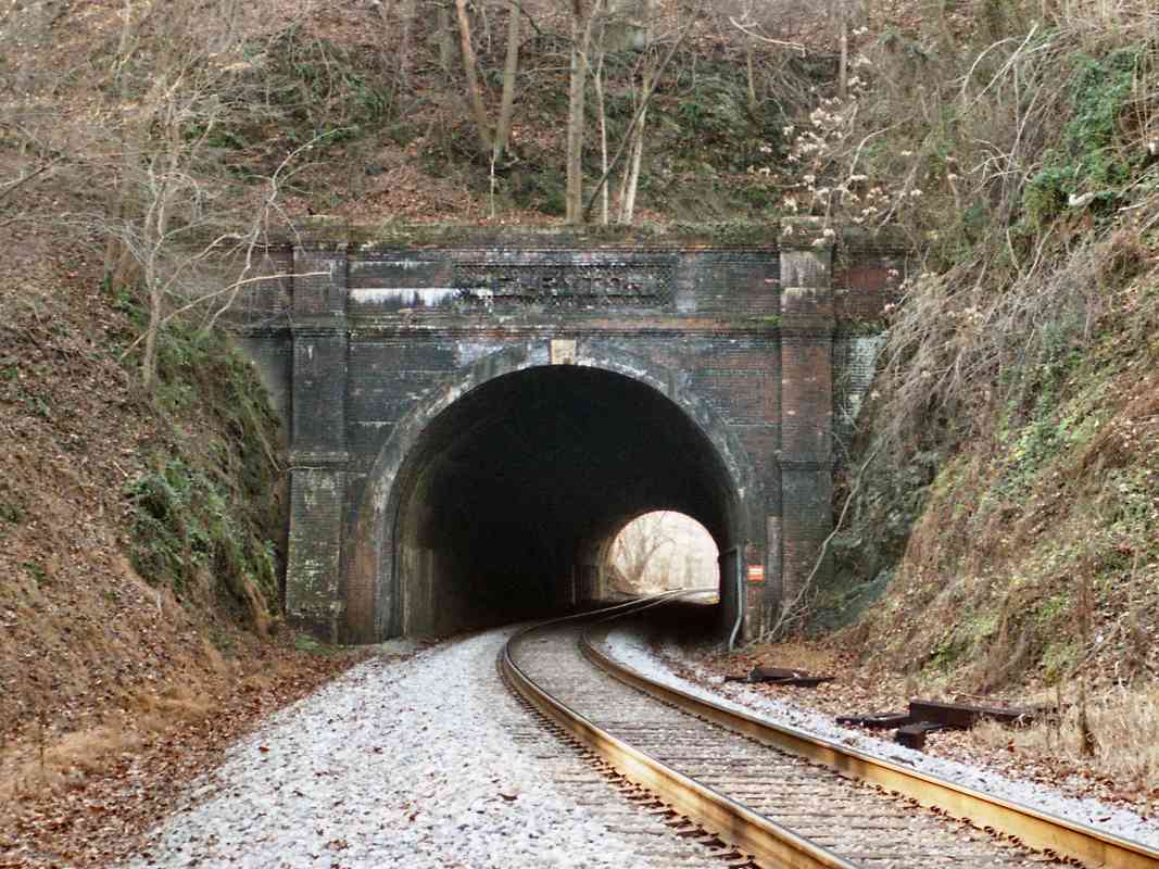
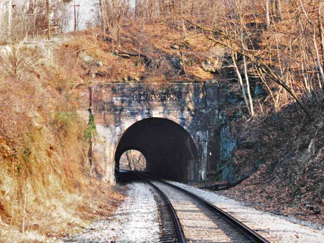
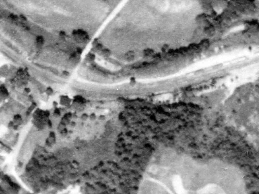
Just west of the tunnel is where Henryton State Hospital had stood. Repeated vandalism led to most of the structures being demolished by government authorities during 2013.

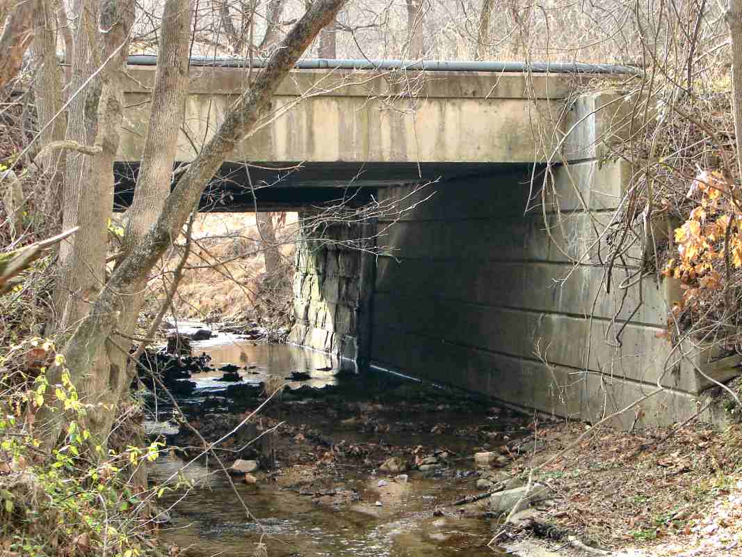
The facility was smack dab in one of the most isolated sections of 
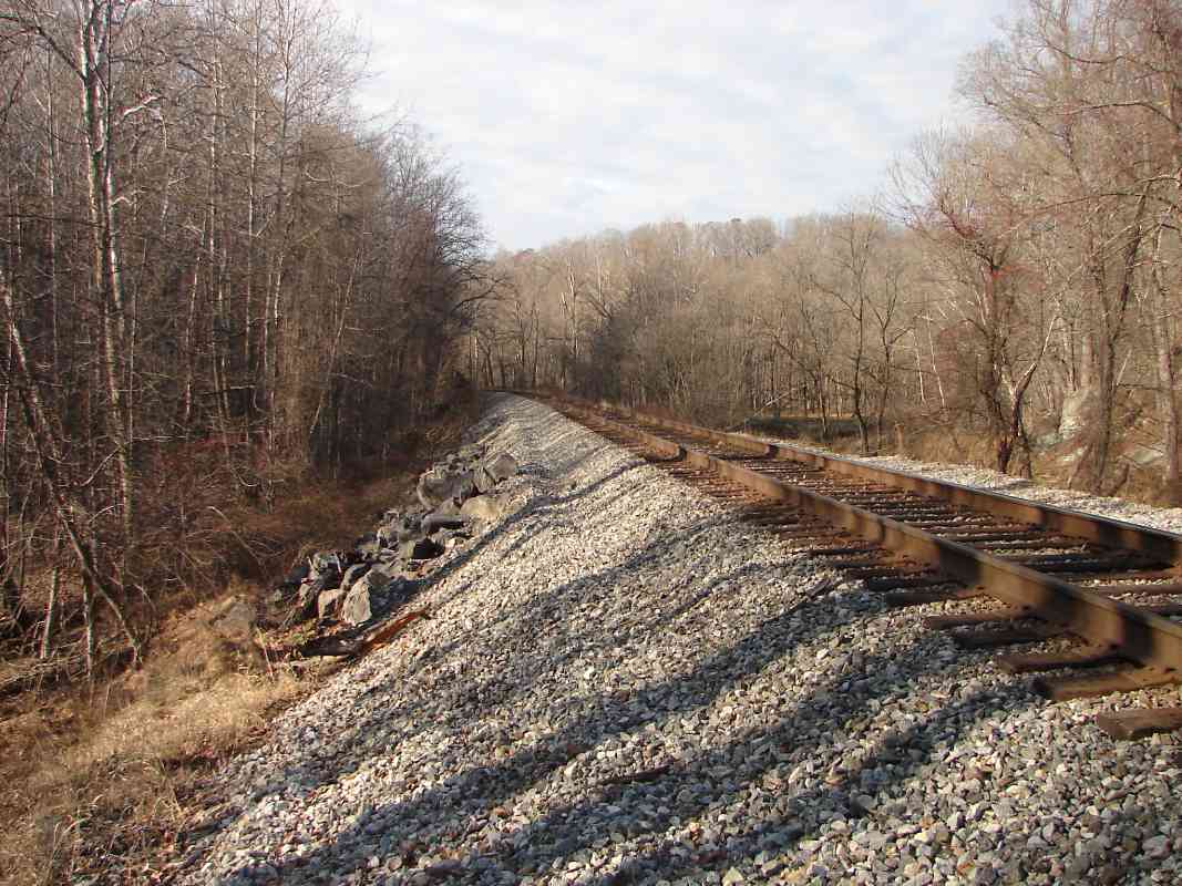
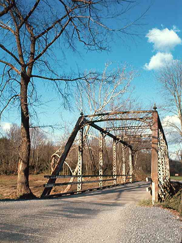
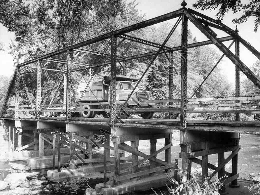
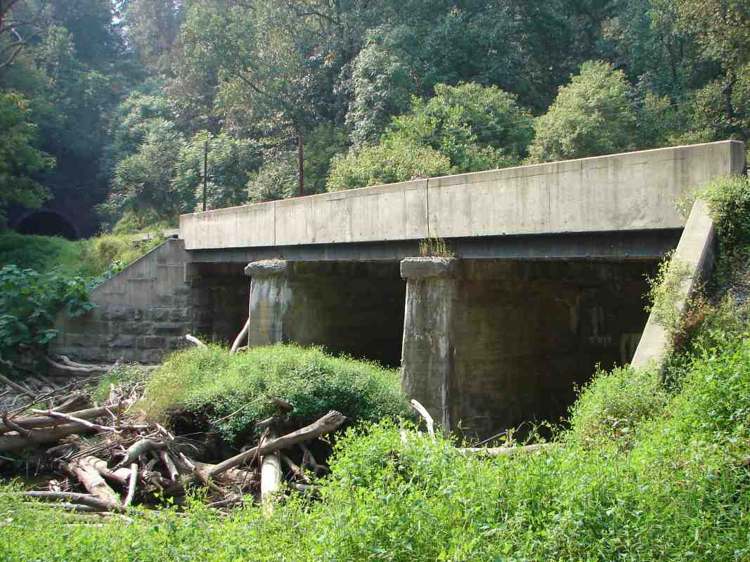
Patapsco Valley State Park. Henryton Road used to cross the river and railroad here, but the bridge was washed out by 1972's Tropical Storm Agnes and was never rebuilt.

Reader Charley Wingate contributed the following:

    "I think I can shed some light on the Henry Hospital Center mystery. It was established in 1922 as a tuberculosis sanitorium and was converted to a center for the mentally retarded in 1963, finally closing in 1985.

    "However, either at the same location or in the same area, there is now operating the Thomas O'Farrell Youth Center, targeted at male adolescent 'Substance Abusers, Drug Dealers, Weapon Carriers, [and] Property Offenders'. The address is given as being on Henryton Road proper, which according to the current ADC maps is not the road that runs down to the river, but the one that runs parallel to it. If you look at the ADC map, the are two holes cut out of the state park area. The larger is clearly the old hospital; the smaller one, on the north side of the road, would appear to be this treatment center. Obviously this is the sort of place that is going to make the police jittery."

Reader Glen Stegmiller sent the following historical information:

    "Let me answer some of your questions -

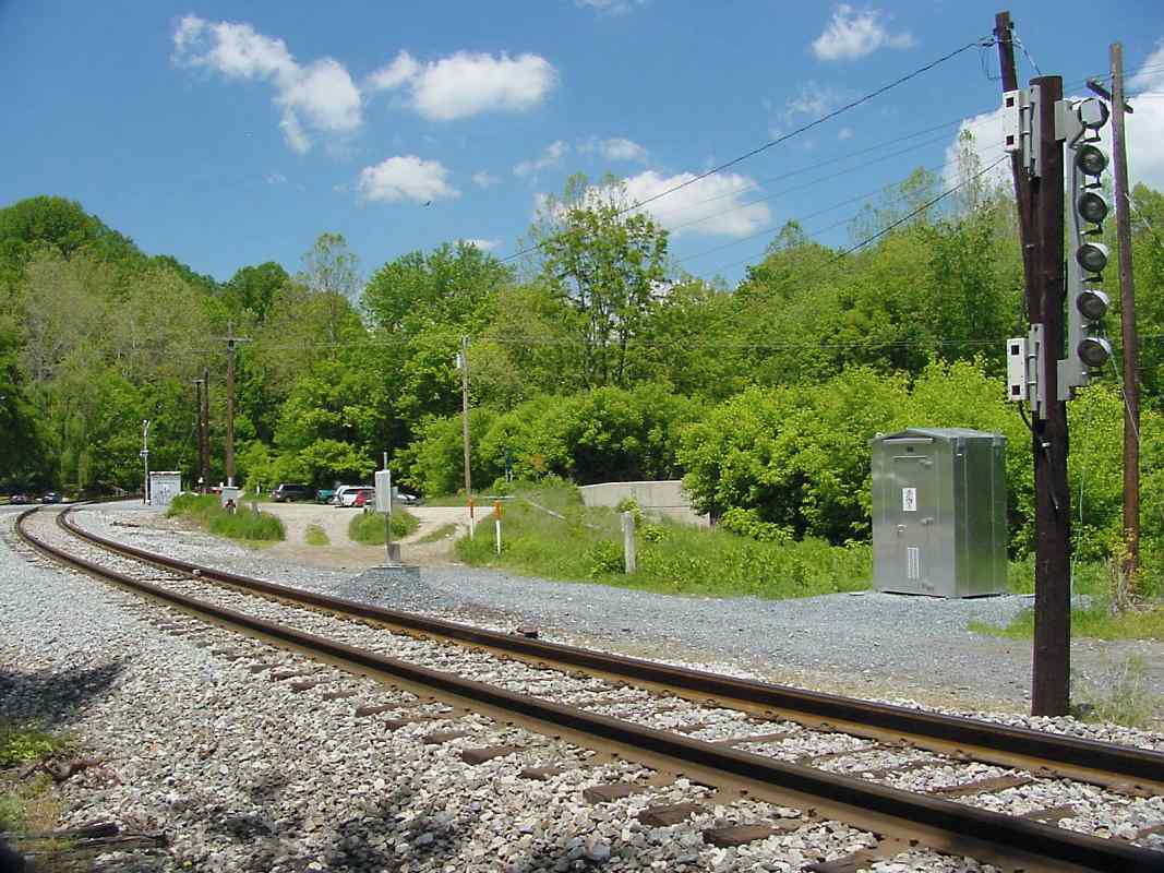
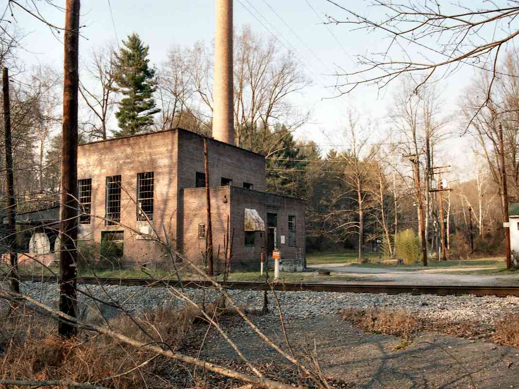
    "The boiler house is the building next to the tracks. You can still See the old pipes that went up to the hospital. Next to the boiler house used to be green houses.

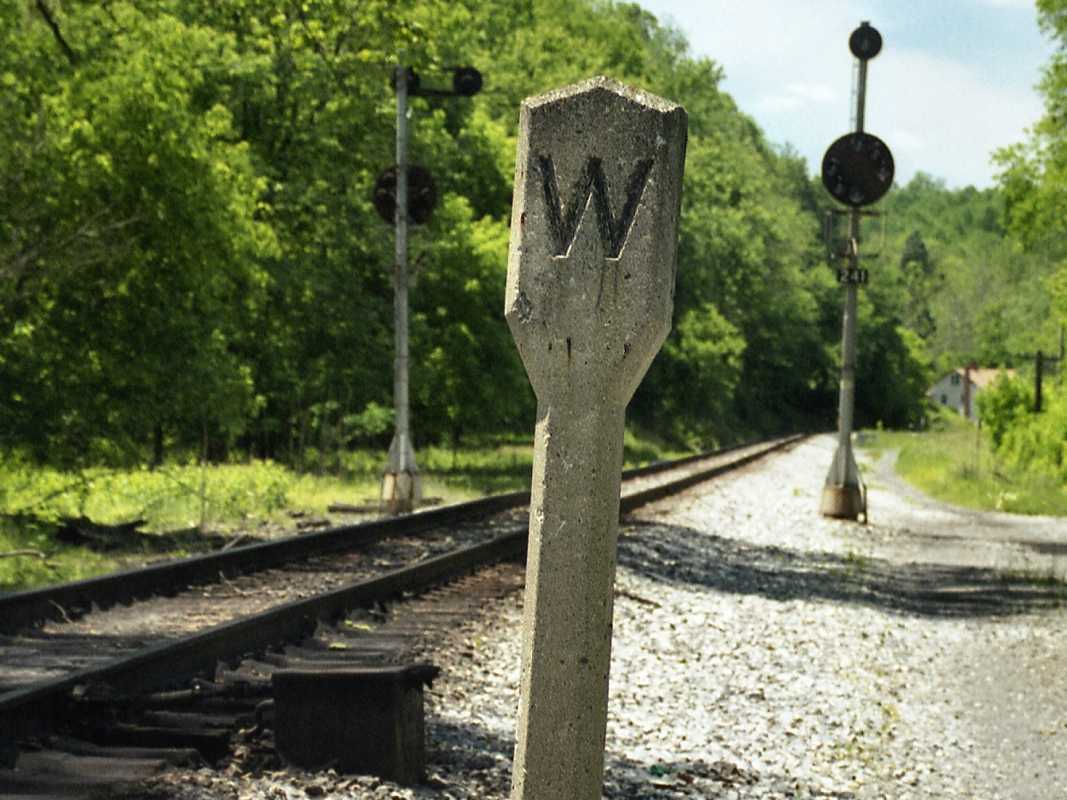
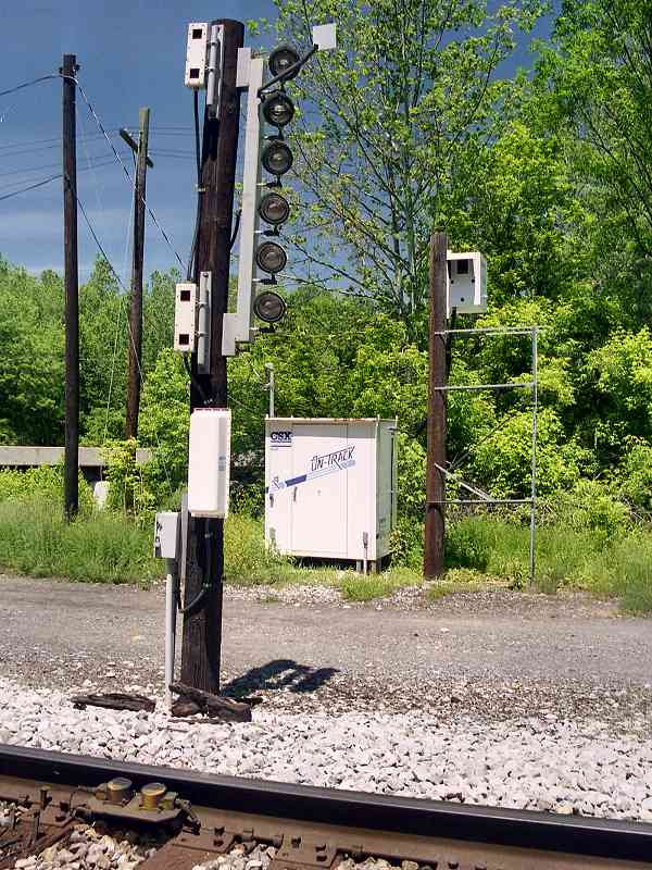
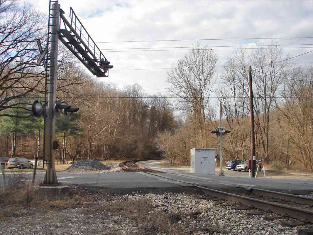
    "The old road crossing signals remained way after Henryton Road was closed after (Tropical Storm) Agnes, they did close the road. The bridge remained until about four or five years ago (1995). [Note from Steve: the remaining pavement looks to me like it was disused many years before 1995.] It was in bad shape - the same kind of bridge was also used on Marriottsville Road until about 83-84? I did take pictures of that bridge defore it was taken down. What traffic jams when the train came and the everybody needed to cross the old one lane bridge! I understand the old Genstar Rock Co. used to pay for repairs to keep the bridge up to par, because of the dump trucks that used it.

    "Did you know about the old siding in Marriottsville? It was near the RR signals and used to store MoW equipment. Before welded rail was installed, I saw a derailment caused by the switch track and rocking cars.

    "Agnes did a number on the OML. Did you know the state wanted to buy the line after Agnes and turn it into a trail for walking and biking?"


<< Previous (east) | THIS PAGE: Marriottsville to Henryton | Next (west) >>

Or, return to main page

Copyright Notice