TrainWeb.org Facebook Page
Old Main Line Photo Tour


B&O Old Main Line
Modern day photo tour

Accompanying each photo below are:

Click a photo to see a larger view. Please send your comments and corrections to Steve.


<< Previous (east) | THIS PAGE: Woodbine to Watersville Junction | Next (west) >>

Woodbine Tunnel, East

Woodbine Tunnel, East
Mile: 33.6 Date: Mar 2005
Ease: B View: W
Area: A IC2:
Map: Ca 33 J 4, Ho 3 J 5 Topographic Maps

Woodbine Tunnel was built in 1902 as part of the project to straighten the OML. At 385 feet long, it's one of the OML's shorter tunnels. The limestone used came from Marriottsville.


Woodbine Tunnel, West

Woodbine Tunnel, West
Mile: 33.7 Date: Mar 2005
Ease: B View: E
Area: A IC2:
Map: Ca 33 H 4, Ho 3 H 5 Topographic Maps

And, for the sake of completion, here's the West portal.


Steam Scar

Steam Scar
Mile: 33.7 Date: Aug 2014
Ease: B View: E
Area: A IC2:
Map: Ca 33 H 4, Ho 3 H 5 Topographic Maps

Countless engines have left their mark on the tunnel's roof. The scar is centered over where the westbound track had been during the steam era. There is not a similar scar over what had been the eastbound track since that's primarily the "downhill" side where engines expend far less energy.


Woodbine

Woodbine
Mile: 34.1 Date: Oct 2004
Ease: A View: N
Area: A IC2:
Map: Ca 33 G 4, Ho 3 G 5 Topographic Maps

Downtown Woodbine, as seen here, may be sleepy but its main road is busy, so I'm surprised the grade crossing does not rate gates.


Woodbine Station
Photo credit E.L. Thompson

Woodbine Station
Mile: 34.1 Date: 1943
Ease: A View: W
Area: A IC2: 260
Map: Ca 33 G 4, Ho 3 G 5 Topographic Maps

A semaphore signal was still on duty adjacent to Woodbine Station during the 1940s. I am not sure if the photographer is standing at the Woodbine Road grade crossing, or if that crossing is beyond the station.


Inspector

Inspector
Mile: 34.2 Date: Oct 2004
Ease: A- View: E
Area: A IC2:
Map: Ca 33 G 4, Ho 3 G 5 Topographic Maps

In this view back to the crossing, a CSX track inspector drives east. Those specially equipped vehicles would certainly make viewing the OML much easier. I want one!

Woodbine Station had been on the right, but was demolished quite some time ago.


Straighten

Straighten
Mile: 34.2 Date: Oct 2004
Ease: A- View: W
Area: A IC2:
Map: Ca 33 G 4, Ho 3 G 5 Topographic Maps

A tiny stub survives to provide a glimpse of the Old Main Line in its double track days. The original alignment had curved off to the right in the process of crossing Gillis Falls. Many such small kinks were straightened contemporaneously with the construction of most of the OML's tunnels, that is, between 1901 and 1906.

Only with hindsight can we say it may have initially been a financial mistake to invest so heavily into rebuilding the route at the dawn of the automobile. The Model T Ford debuted in 1908 and changed the transportation landscape. However, without that investment it is unlikely the OML would have survived as a railroad into the 21st century. As the population of this area continues to grow, the value of its transportation corridors increases, and the OML is once again an important link in the CSX network.


Gillis Falls

Gillis Falls
Mile: 34.2 Date: Apr 2001
Ease: A View: NW
Area: A IC2:
Map: Ca 33 G 4, Ho 3 G 5 Topographic Maps

A short distance west of Woodbine is where you'll find this bridge spanning Gillis Falls. Previously, a Bollman type bridge graced this spot.

Links: July 1923 flood report, 1985, 2011 pic


Nortrak

Nortrak
Mile: 34.6 Date: Mar 2005
Ease: B- View: S
Area: A IC2:
Map: Ca 33 F 4, Ho 3 F 5 Topographic Maps

From the company's web site, "Nortrak is the North American market leader in turnout technology for railways, metros and tramways." Their tag on rail awaiting installation reads:

    26'-8" 141RE
    132 RE 1/1 WORN 01/05
    S/N BO550129
    1190 LBS.
My guess is this means:
    the replacement segment is 26 feet, 8 inches long, rated 141 rail weight
    whereas the existing rail has been worn down to 132 as measured January 2005
    route serial number B&O 550129
    segment weight 1190 pounds
but I probably have at least some of that wrong. Anyone know better?


Erosion
NEW! mid-Dec 2017

Erosion
Mile: 35.3 Date: Aug 2017
Ease: C+ View: NW
Area: A IC2:
Map: Ca 33 D 3, Ho 3 D 4 Topographic Maps

The Patapsco River has long been the OML's nemesis, nibbling on the bank, threatening to undermine the tracks upon the next rainstorm. Farther ahead CSX had recently battled back by spilling carloads of stone, with some needed here soon.


Rosetta Pole

Rosetta Pole
Mile: 35.4 Date: Mar 2005
Ease: C+ View: SW
Area: A IC2:
Map: Ca 33 D 3, Ho 3 D 4 Topographic Maps

As B&O improved the route west from Baltimore, straightening curves, etc. the mileage along the line changed. This utility pole reflects an updated milepost measurement, and acts as a sort of Rosetta Stone to help us translate between the current mileage (35 and 20/40) and the previous (38 and 5/6ths).

I'm told B&O placed OML utility poles at 40 per mile and numbered them consecutively. Thus 35-20 is mile 35 post 20 (of 40), which translates to milepost 35.5. A CSX grade crossing signpost about 0.1 miles west of here lists milepost 35.50, which means by current reckoning this pole is near 35.4.

That 35.4 value is about 3.4 miles less than the 38 and 5/6ths distance indicated by the old nailed-on digits. The bulk of the difference is likely due to the construction in the 1860s of the Camden Cutoff, which saved about 2 miles. I don't think this utility pole dates from the 1860s. Instead it's more likely B&O retained the old mileposts, perhaps for decades, until finally recalculating them, maybe at the time the OML saw its substantial upgrades in the early 1900s. Since the time of this photo CSX removed the poles.

Detour: Camden Cutoff tour


Private Crossing

Private Crossing
Mile: 35.5 Date: Mar 2005
Ease: C View: NE
Area: A IC2:
Map: Ho 3 D 4, Ca 33 C 3 Topographic Maps

The tiniest Patapsco River bridge I've ever seen leads up to the equally tiny (yet paved) Zepp's grade crossing. It appears the farm is in Howard County, and the farm house is in Carroll County, no doubt making for special fun come tax time.

In addition to RR photos, I snap photos of one-lane bridges in Howard County, so this find was an extra treat. Since the time of this photo a flood has collapsed this bridge into the river.

The CPL signals which had lived just west of here are no longer.


Mt. Airy Cutoff

Mt. Airy Cutoff
Mile: 36.0 Date: Mar 2005
Ease: C View: W
Area: A IC2:
Map: Ca 33 B 3, Ho 3 C 4 Topographic Maps

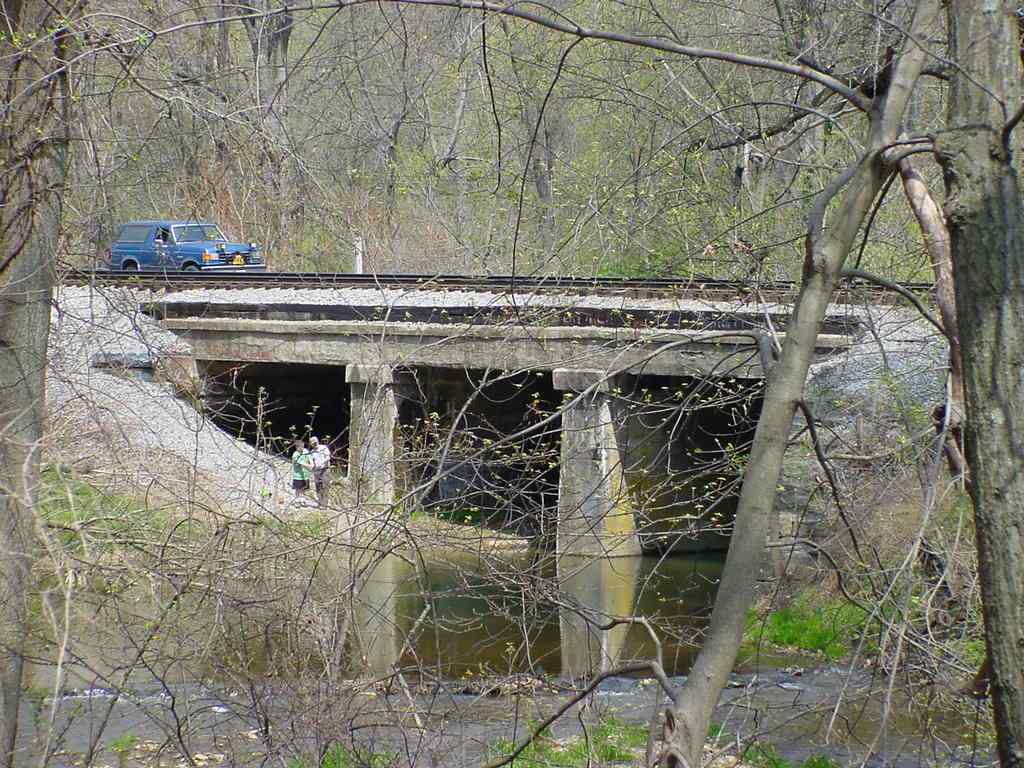
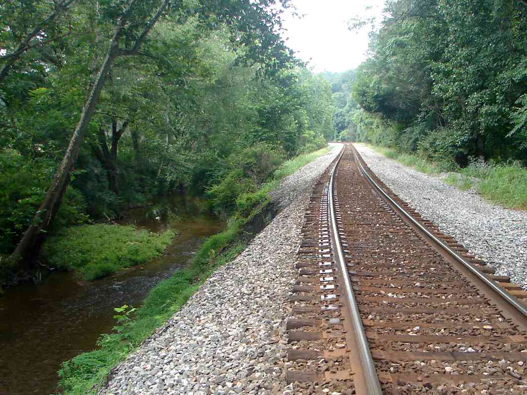
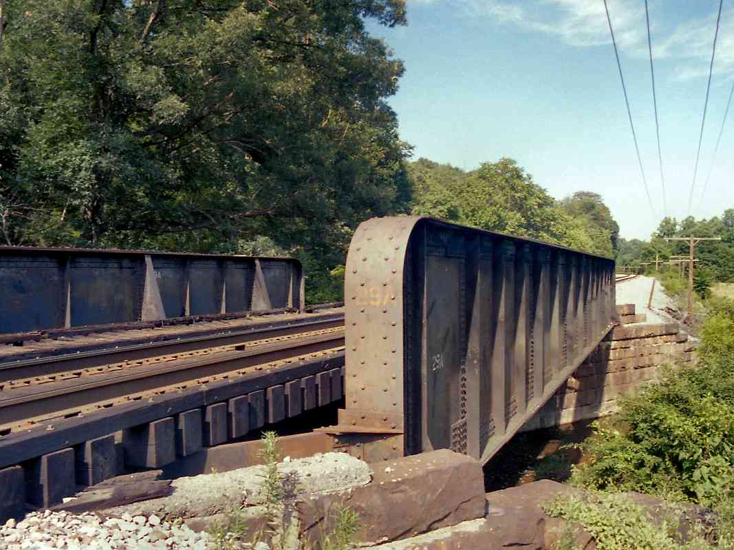
Like the farmer, the railroad also crosses the Patapsco River back into Howard County, 
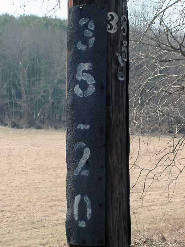
but does so via a slightly more substantial bridge. Note modern mile marker 36 at center, juxtaposed with a whitewashed old "mile-marker-on-a-rail" on the left side of the tracks.

The tracks have been shouldered by the Patapsco ever since Relay, some 30 miles ago. But in reality the river is hardly more than a stream here; its source is Parrs Spring, about 4 miles ahead, so the easy river bank mileage is running out. Parrs Spring sits astride Parrs Ridge, a serious vertical challenge for the fledgling B&O.

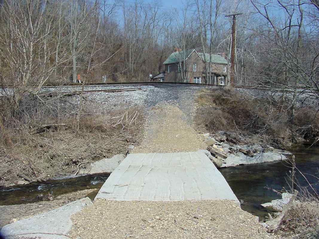
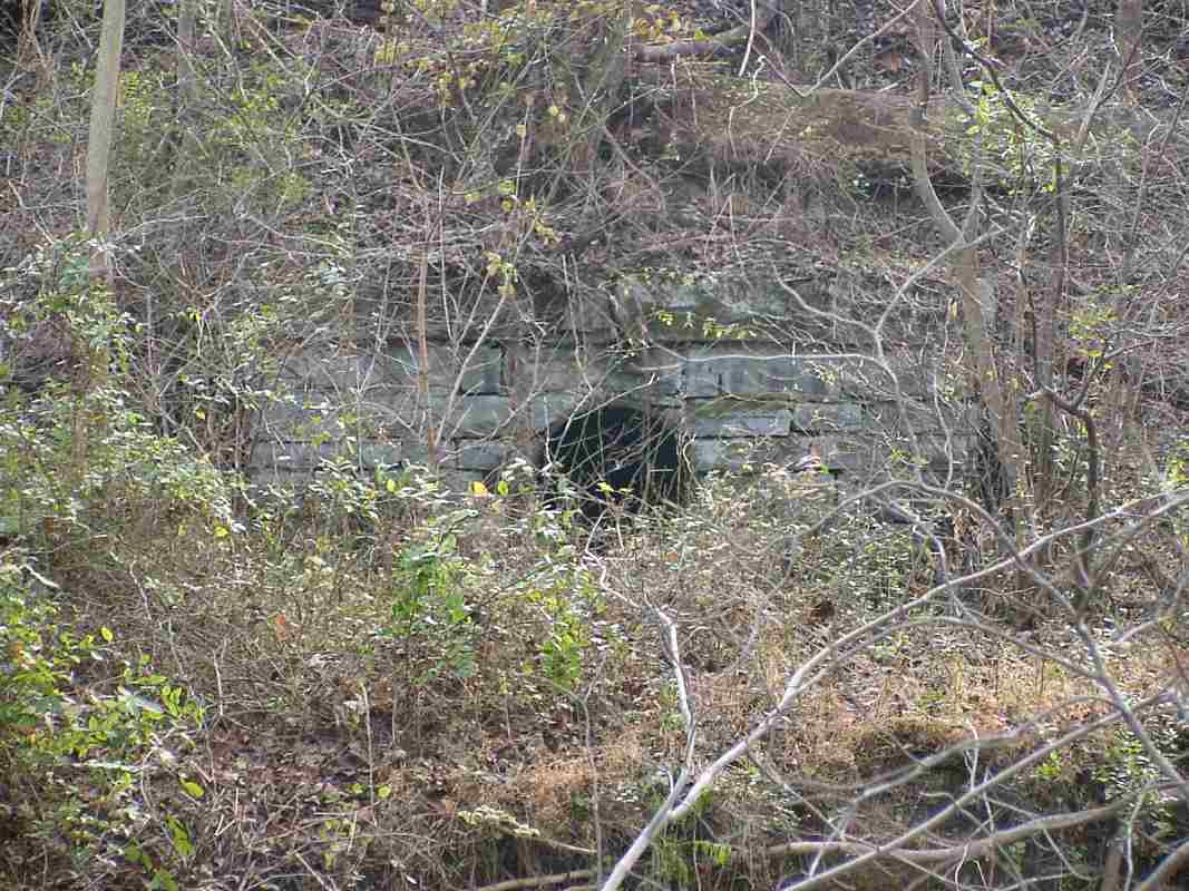
B&O's 1831 answer to the challenge was a series of inclined planes. 
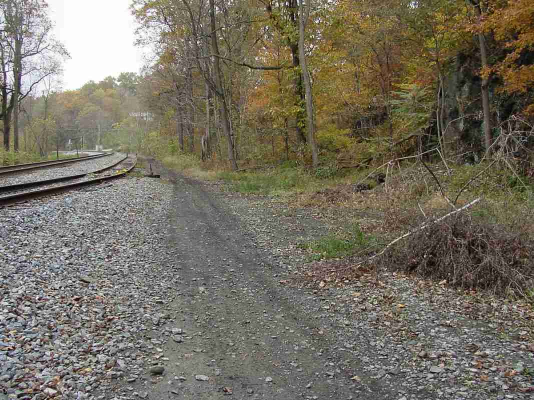
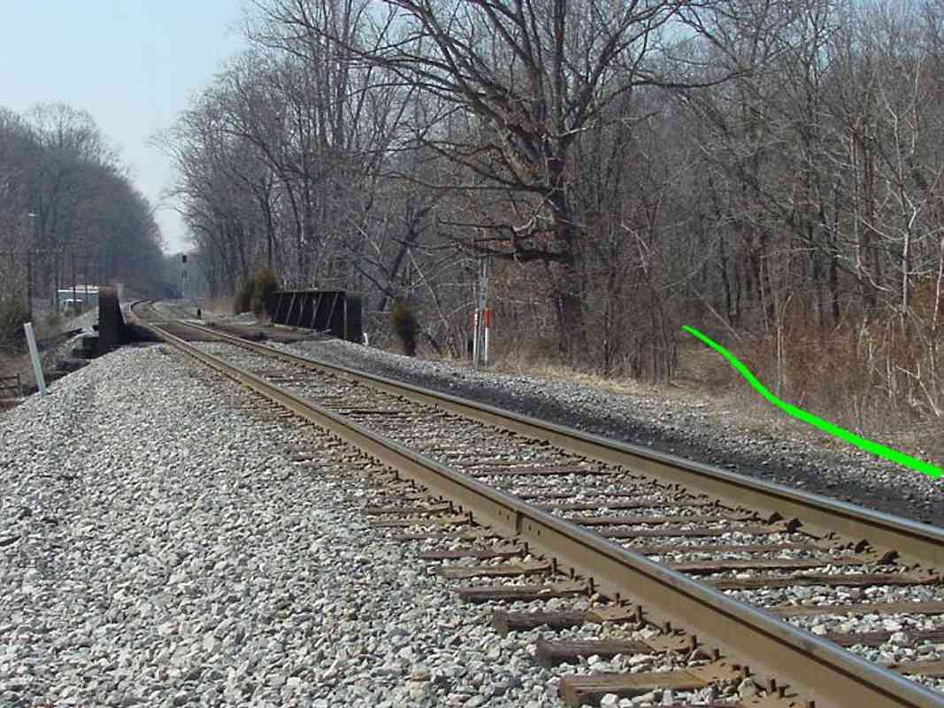
That route traversed slightly north of but roughly parallel to the present-day trackage. In fact, in this photo, the gap in the trees on the right is a vestige of that alignment (green line). Sections of that original remained in use into the early 1900s until replaced by 10 new miles of track (and tunnel) known as the Mt. Airy Cutoff.

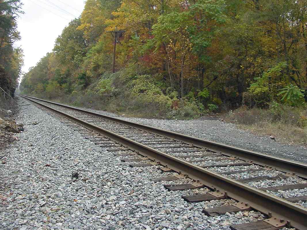
The Mt. Airy Cutoff remains the active alignment today. The bridge in the distance and track west date to about 1901. This tour continues westward along the Cutoff, however, the original Mt. Airy Plane route is also available as a virtual tour.

Change for: Mt. Airy Planes alignment tour at this site


Patapsco Bridge

Patapsco Bridge
Mile: 36.0 Date: Jul 2000
Ease: B View: E
Area: A IC2:
Map: Ho 3 B 4, Ca 33 B 3 Topographic Maps

Here's a better view of bridge 29A, this time looking back from west to east.

This is the original bridge at this location. Prior to the building of Mt. Airy Cutoff and Tunnel, the ROW kept on the north bank of the river (the left side, in this photo).


NS 1000

NS 1000
Mile: 36.6 Date: Nov 2013
Ease: A View: E
Area: A IC2:
Map: Ho 3 A 4, Ca 33 A 3 Topographic Maps

Only infrequently will you find CSX-competitor Norfolk Southern galloping along the OML.


Grade Crossing

Grade Crossing
Mile: 36.6 Date: Oct 2004
Ease: A View: SE
Area: A IC2:
Map: Ho 3 A 4, Ca 33 A 3 Topographic Maps

Watersville Road is the last grade crossing before we reach Mt. Airy.


Culvert

Culvert
Mile: 37.2 Date: Nov 2004
Ease: C View: S
Area: A IC2:
Map: Ca 32 J 3, Ho 2 J 4 Topographic Maps

Viewed from the north bank of the river, this circa 1900 culvert appears to use non-mortared stonework, a surprise since all others from that era rely on the "cement glue" to help hold them together. The iron pipe is a giveaway this is not 1830 construction. A closer inspection reveals the mortar is deteriorating and falling out.


Watersville Junction

Watersville Junction
Mile: 37.7 Date: Oct 2004
Ease: C View: W
Area: A IC2:
Map: Ho 2 H 5, Ca 32 H 4 Topographic Maps

Via a tunnel about 2 miles west, the Cutoff will soon bypass the town of Mt. Airy. When the Cutoff was built in 1901, B&O still had customers in the town, and therefore built an extension from the Cutoff to its Mt. Airy Loop trackage. Photo evidence suggests the Cutoff's double track divided here at Watersville Junction, with one becoming the extension and proceeding through the gap in the trees, while the other continued west on its own. This could mean the Cutoff has never been double tracked through Mt. Airy Tunnel.

All this can be seen more clearly on the maps that accompany the tour of the Mt. Airy Loop.

Change for: Mt. Airy Loop alignment tour at this site


<< Previous (east) | THIS PAGE: Woodbine to Watersville Junction | Next (west) >>

Or, return to main page

Copyright Notice