TrainWeb.org Facebook Page
Old Main Line Photo Tour


B&O Old Main Line
Modern day photo tour

Accompanying each photo below are:

Click a photo to see a larger view. Please send your comments and corrections to Steve.


<< Previous (east) | THIS PAGE: disused at Ilchester | Next (west) >>

Ilchester - Brief Historical Background:

Map

Map
Mile: Date: Jul 2006
Ease: View:
Area: IC2:
Map: Ba 41 A 7, Ho 13 B 13 Topographic Maps

This map depicts the area around Ilchester Tunnel (black) and the now disused original Old Main Line alignment (green) it bypassed. Ellicott City is off the map to the left and Relay to the right. The Patapsco River winds through the valley, with Howard County on the south and Baltimore County on the north.

The dashed red line represents River Road before the floods of Tropical Storm Agnes washed it away in 1972. The road has not been rebuilt. The gray line is a hiking path from South Hilltop Road (where the power lines cross overhead) to the rocks above Ilchester Tunnel, down to Bloede Dam.


Ilchester Tunnel

Ilchester Tunnel
Mile: 10.3 Date: Oct 2001
Ease: C View: W
Area: A IC2: 204
Map: Ba 41 A 8, Ho 13 C 13 Topographic Maps

Instead of going through this hill as does the Ilchester Tunnel seen in the distance, the original alignment curved around it, roughly as marked by the green line.


Stone Stringers

Stone Stringers
Mile: 10.4 Date: Nov 1999
Ease: C View: W
Area: A IC2: 202
Map: Ba 41 A 8, Ho 13 B 13 Topographic Maps

Despite the passage of over 100 years, the ballast left behind has prevented new tree growth along the old right of way. And, in at least one spot, you can see one of the most curious railroading artifacts anywhere in the world: B&O's original stone stringers.

For some of its earliest tracks, the railroad employed stone with parallel thin rails affixed to it instead of wood cross ties because stone was deemed more durable and long lasting. Indeed, this photo is evidence of that, but B&O quickly discovered that the stiff granite was also less forgiving on the rolling stock.

All but one contractor employed by B&O to build the OML was bankrupted by the unexpectedly high cost of building the stone track. Work progressed too slowly as well, and eventually the company relented, and allowed the second track along this route to be constructed with wood ties, similar to those used today. They learned the wood-style track construction could be completed 10 times faster, and that sealed the fate of the stone.


Stringer Switch
Photo courtesy Dave Hiteshew

Stringer Switch
Mile: 10.4 Date: Mar 2008
Ease: C View: NW
Area: A IC2:
Map: Ba 41 A 8, Ho 13 B 13 Topographic Maps

The holes indicate where iron strap rail (B&O called it plate rail) was affixed. This stringer exhibits two rows of holes, leading to the belief it had been part of a switch. You can still see the grooves left behind by the iron strips.

strap rail with nail Strap rail was employed because it used less iron than other designs; iron was in short supply and had to be imported from mother England. The strap rail had the frightening reputation of peeling off the granite, then curling up and piercing the cars that rolled above; these were called "snakeheads". Still, B&O stuck with strap rail for about 20 years, then frugually reused it on sidings and in yards into the 1860s. (B&O strap rail with nail picture at right courtesy Dave Hiteshew.)


Bypassed Culvert

Bypassed Culvert
Mile: 10.4 Date: Nov 1999
Ease: C View: SW
Area: A IC2:
Map: Ba 40 K 8, Ho 13 B 13 Topographic Maps

This culvert is good for comparisons to others. This one is located along the abandoned right of way, not far from the stone stringers above. This hasn't seen any maintenance for about 100 years, but, except for plant overgrowth, appears in good shape.

Sadly, this original culvert was torn out and not restored by the Patapsco Relocator project that removed Bloede Dam.


Path

Path
Mile: 10.5 Date: Jul 2004
Ease: C View: E
Area: A IC2:
Map: Ba 40 K 8, Ho 13 B 13 Topographic Maps

Looking backward, the Grist Mill Trail Extension constructed in 2003 climbs to join the original right-of-way. The present-day trackage is inside Ilchester Tunnel bored through the hill on the left.

At the path intersection, the stringers were torn out and now serve as a curb of sorts. Behind us, on the way to the Patterson Viaduct, the stringers were simply paved over, preserving them for future archeologists who will someday marvel over our "stone age" of railroading.

Except, while removing Bloede Dam, the Maryland Dept. Of Natural Resources rerouted sewer lines in the vicinity from their current location to underneath Grist Mill Trail, and tore out the paved-over stringers. This has been one of few locations that preserved the original history of such track construction techniques. Fortunately a stretch closer to Ilchester Tunnel remains undisturbed.


Bloede Dam

Bloede Dam
Mile: 10.5 Date: Nov 1999
Ease: C View: W
Area: A IC2:
Map: Ba 40 K 8, Ho 13 B 13 Topographic Maps

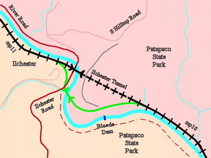
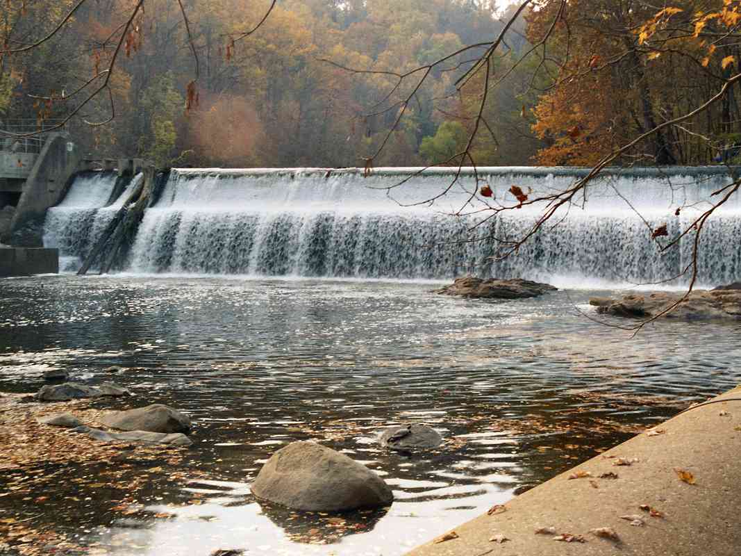
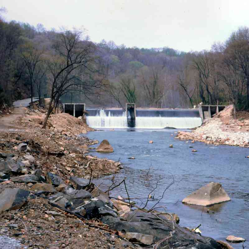
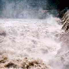
Easily heard from the path was the crash of water over Bloede Dam. Bloede is pronounced "Bler-dah" according to a friend of the family of Victor Bloede, founder of Patapsco water and power companies. The dam officially opened November 28, 1907, the date upon which its internal generators began cranking out electricity for the area, enough that during 1913 the Baltimore Gas & Electric (BGE) Co. acquired it. 
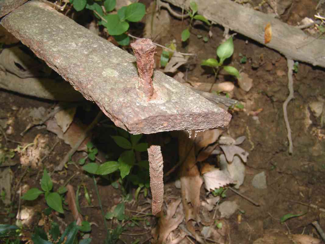
According to BGE, the dam's construction was unique in that it was hollow with the water wheels and generators housed inside. The dam was upgraded in the 1990s to add fish ramps; I am not sure when it stopped generating power. The concrete pipe on the right is a storm or sanitary sewer. Bonus points if you spotted the turtle lounging on the rock.

This dam was removed during 2018, see: Bloede Dam removal. With the push to "go green" that effort might have been better spent restoring the dam's capability to generate hydroelectric power. With Daniels Dam and McKeldin Falls unlikely to be removed, removing Bloede's accomplished little.

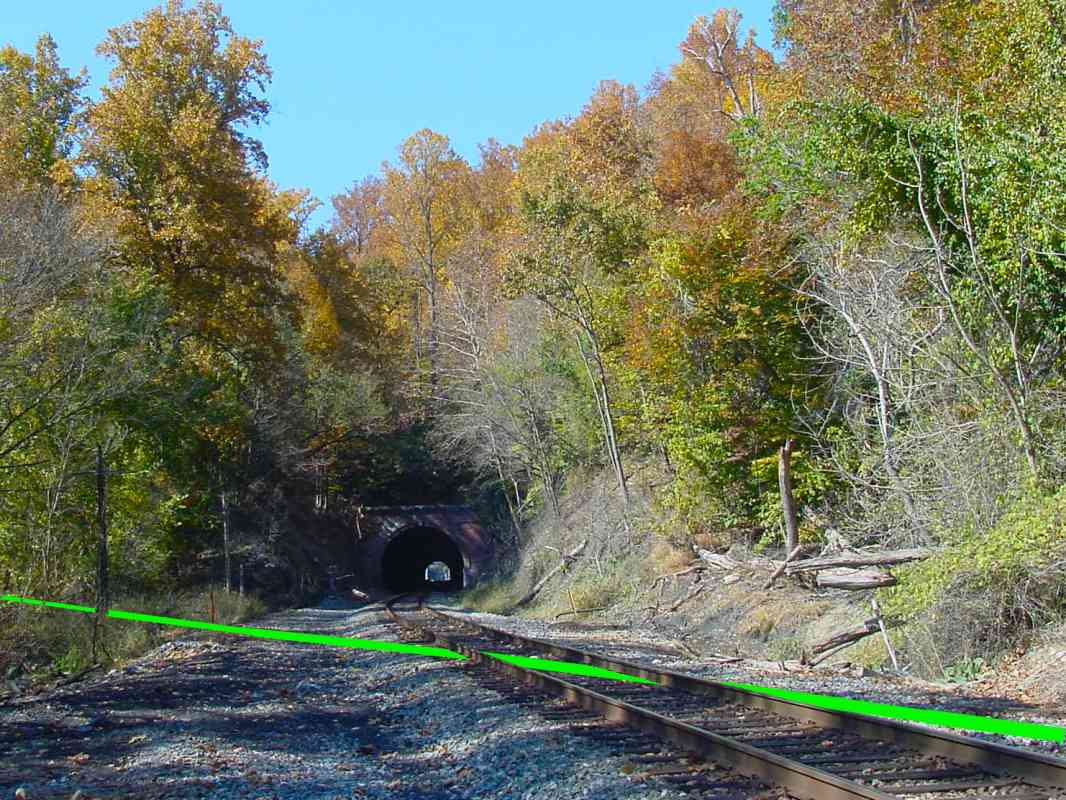
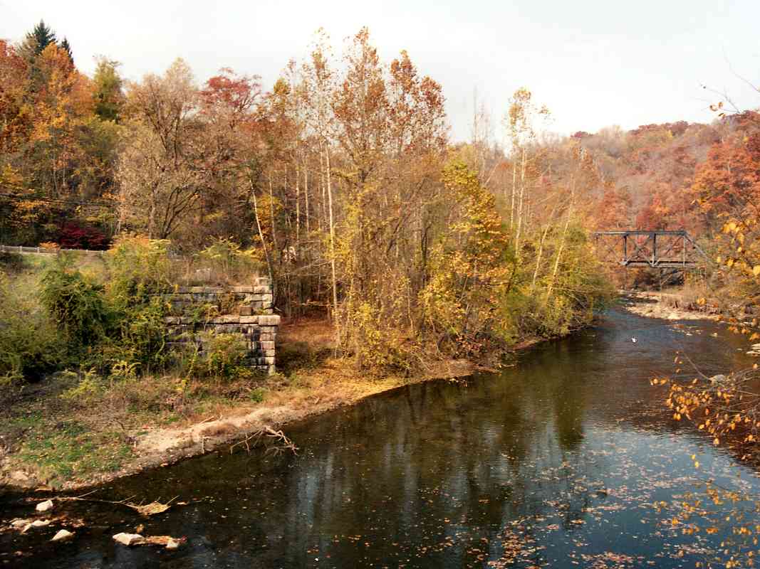
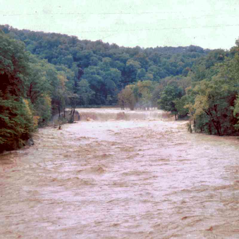
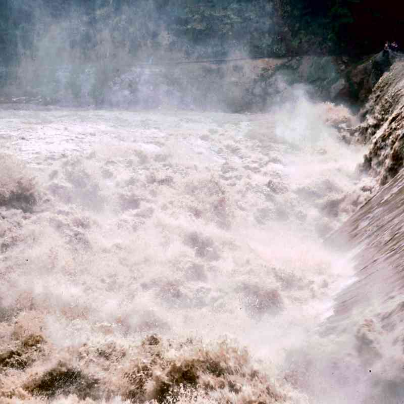
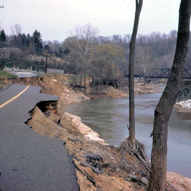
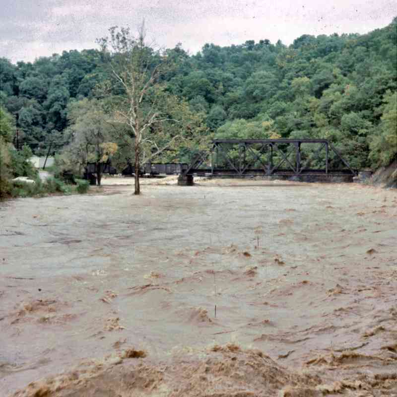
Courtesy JD Hiteshew below are other views dating from 1973 
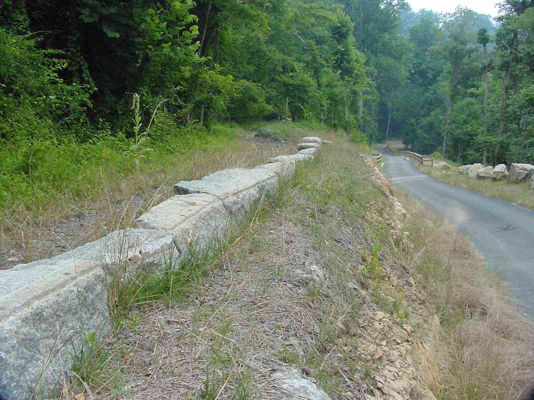
(the spring after Agnes floods, note the scoured valley and remains of River Road on left), plus two from 1975 (more flooding, probably due to the remains of Hurricane Eloise in late September that year):
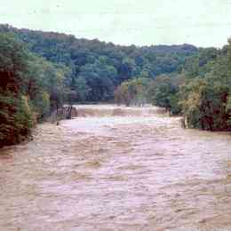
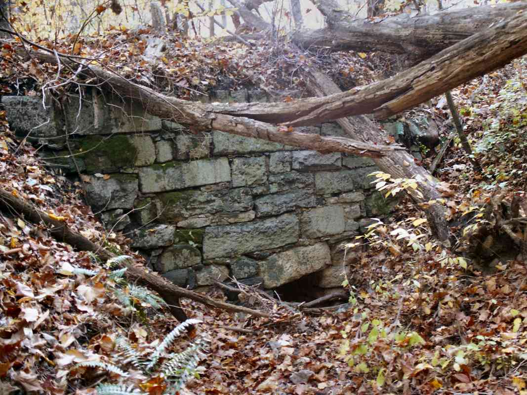
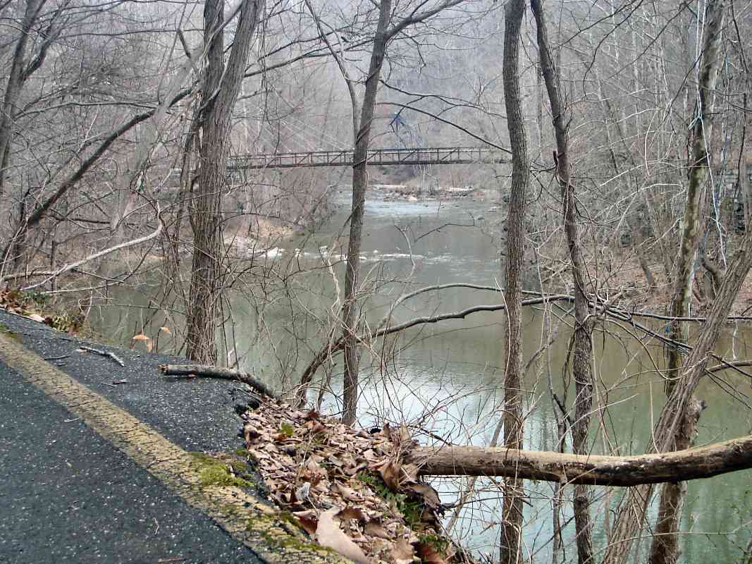
Bloede Dam 1973 Bloede Dam 1975 Bloede Dam 1975

Links to older pictures: 1907, 1912, 1930s, ~1940


Patterson Viaduct

Patterson Viaduct
Mile: 10.7 Date: Nov 1999
Ease: C View: NW
Area: A IC2: 115, 390
Map: Ba 40 K 7, Ho 13 A 13 Topographic Maps

This photo is one of my favorites. It was snapped from the east bridge abutment of the remains of the Patterson Viaduct at Ilchester. Some reports say the Patterson Viaduct was the first railroad bridge in the world, with its cornerstone laid May 6, 1829 and first crossing later that year on December 4th, with completion a few months before B&O's Carrollton Viaduct. Across the Patapsco River on the Howard County side is the west bridge abutment. Flood 1975

The bridge had consisted of four granite arches, with the ones at both shores spanning roads. A flood in 1866 or 1868 (sources vary) managed to remove all but one of the arches. The Patterson is the only early B&O multi-arched stone viaduct to suffer such a fate. Now the railroad spans the river by means of the bridge seen upstream on the right.

The picture at right courtesy JD Hiteshew illustrates another flooding event in 1975 as seen from the same spot.


Footbridge
Photo courtesy Patrick O'Donnell

Footbridge
Mile: 10.7 Date: Oct 2006
Ease: B View: NW
Area: A IC2:
Map: Ba 40 K 7, Ho 13 A 13 Topographic Maps

For the first time in about a century, the Patterson Viaduct is once again carrying traffic. The footbridge seen here nearing completion opened on October 18, 2006.

Patrick O'Donnell kindly contributed this photo, and wrote:

    "I had the opportunity to work on that new footbridge and have found the history of the area fascinating - thanks to your website. The plans of the new cable-stayed footbridge show that there's (less than an inch) variance between the elevations of the opposing abutments. Quite remarkable for abutments built in the late 1820s, 164 feet apart from each other, and their excellent condition as well. No modification was needed to accompany the new bridge - other than placing additional tower pedestals atop each abutment.

    "I was contacted by the company putting in the footbridge for pictures of the existing suspension footbridge about a mile down river. The plan was to do something like the suspension bridge. When the owner found out that a Bollman Truss once existed at the Patterson Viaduct it became clear that only a cable-stayed bridge with a stiffening truss will do. The diagonal cable stays are to emulate the diagonal members of the Bollman Truss. The beauty of cable bridges in general is that they appear light and airy and unobtrusive."

That the design recalls that of a Bollman bridge is a nice touch. The small height variance of the abutments relative to each other seems remarkable, but we do not know what the original design called for. To maintain the OML's upstream/uphill grade in this area, the western abutment should be about 5 inches higher than the eastern.

Link to other pictures: lots more photos of this by Patrick


River Road

River Road
Mile: 10.7 Date: Feb 2008
Ease: C View: N
Area: A IC2: 390
Map: Ho 13 A 13, Ba 40 K 7 Topographic Maps

The yellow stripe at bottom left designates the middle of River Road, or rather what remained of it more than 35 years after Tropical Storm Agnes had her way with the Patapsco Valley. The disused B&O RoW we're following rides the opposite bank of the river (right), and through the trees you can spy the Patterson Viaduct footbridge and further upstream the active steel railroad bridge. The River Road dregs here were removed during the 2010s. River Road 1973

Frequent contributor Dave Hiteshew shares with us the photo at right captured from roughly the same location in April 1973. It illustrates the ferocity with which during the prior June Agnes tore asunder what both nature and man had assembled. This section of River Road has not been rebuilt. In the distance at center left appears to be the remaining stone walls of George Ellicott's Ilchester tavern. A note about the road striping: prior to the early-1970s, a single yellow line, rather than double, had been the USA standard to separate lanes of opposing traffic.

~1868 by WM Chase, courtesy MdHS The circa 1868 picture at right by WM Chase, courtesy Maryland Historical Society, is particularly interesting because it was also snapped from roughly the same location and appears to show the viaduct with an iron Bollman bridge under construction shortly after most of the Patterson's stonework had been washed away. At the far end of the bridge are posts matching the Bollman design, while the center appears to be a temporary wooden structure. Compare this image to the engraving shown on page 390 of Impossible Challenge II.

At right, only rubble remains of what likely was a stone retaining wall. As we'll see below, it was rebuilt around 1874.


Retaining Wall
NEW! late-Jan 2020

Retaining Wall
Mile: 10.7 Date: May 2018
Ease: B View: E
Area: A IC2:
Map: Ho 13 A 13, Ba 40 K 7 Topographic Maps

stones During 2018 the retaining wall was removed again, this time not by nature, but by the "Patapsco Interceptor Relocation" project, the rerouting of a sewer line as seen on the Bloede Dam removal page.

The original stones were set aside, as seen in these photos, then reinstalled. One of the stones was found to be dated 1874, as shown below.


CHM 1874
Photo courtesy Maryland DNR
NEW! late-Jan 2020

CHM 1874
Mile: (10.7) Date: Jan 2020
Ease: View:
Area: IC2:
Map: (Ba 40 K 7, Ho 13 A 13) Topographic Maps

This engraved stone was found in or near the retaining wall. Limestone like this block erodes faster than granite, so the sharpness of the inscription suggests it was either not facing outward, or had fallen face down where it sat undisturbed until discovered sometime around 2018.

A stone of a B&O bridge upstream, west of Daniels, also has the initials CHM, along with the year 1873. It seems likely CHM are the intials of one of the crew that built the bridges and/or retaining walls, perhaps a B&O employee, or a contractor.

Link: other CHM


Ilchester Bollman
Photo courtesy Jeremy "Kipp" Clark

Ilchester Bollman
Mile: 10.7 Date: 1880s
Ease: View: NW
Area: A IC2: 115, 390
Map: Ba 40 K 7, Ho 13 A 13 Topographic Maps

B&O replaced its collapsed Patterson Viaduct first with a temporary wooden structure, and then an iron Bollman bridge, as seen here. My eye reads the date on the bridge as 1869. This view is almost the same as that of the year 1999 picture further above, yet this one appears crowded with buildings.

Immediately to the left of the bridge is the side of the first B&O Ilchester station. To the left of that is George Ellicott's house and tavern. Further above are buildings of St. Mary's College. Most of these structures are now completely gone, or survived by little more than crumbling walls and foundations.

Special thanks to Jeremy "Kipp" Clark for sharing this historic photo and the one below. You can visit his Ellicott City web site.


Ilchester Station
Photo courtesy Jeremy "Kipp" Clark

Ilchester Station
Mile: 10.7 Date: 1890s
Ease: View: SW
Area: A IC2: 115, 390
Map: Ba 40 K 7, Ho 13 B 12 Topographic Maps

When viewed from the side and above, the area appears less congested. This photo from the hillside above Ilchester Tunnel shows the original Ilchester Station, plus the riverside road that passed under the Patterson Viaduct's surviving stone arch, and George Ellicott's tavern on the right. The road was later moved higher up the embankment and today crosses where the station had been.

Also note at the shadowy extreme left edge of the photo that a steel girder bridge has supplanted the Bollman design. Such an upgrade has also been found at the OML's Monocacy River crossing near Frederick, suggesting the Bollman design proved unacceptable for heavy use. Its iron bars had a reputation for loosening and requiring frequent readjustment.


Sign

Sign
Mile: 10.7 Date: ~1870 (Feb 2008)
Ease: B+ View: S (N)
Area: A IC2: 115
Map: Ba 40 K 7, Ho 13 B 13 Topographic Maps

Installed at the east end of the Patterson Viaduct is a sign describing the importance of the B&O to Baltimore. It includes a circa 1870 picture that looks downstream to the then new Bollman bridge, and the stone arch that survived the floods of the 1860s. That arch remains extant per the next photo.


Patterson Arch

Patterson Arch
Mile: 10.7 Date: Jul 1999
Ease: B View: SE
Area: B+ IC2: 38
Map: Ho 13 A 13 Topographic Maps

The surviving arch, pre-footbridge, was looking a bit weary by 1999.

It is here the railroad leaves Baltimore County for the first time and enters Howard County. It does so in order to switch to the opposite bank of the Patapsco. The next few miles of the river were (and still are) lined with various mills originally sited to take advantage of free water power.

Prior to the construction of the railroad, all the mills were on the Baltimore County side of the river. They were situated so as to facilitate the transportation of their products to the port of Baltimore: by being on the Baltimore side to begin with, they would not have to haul the finished goods across the river.

Since the mill buildings occupied the Baltimore bank of the Patapsco, B&O decided to cross the river and build on the opposite bank. One consequence was that to connect a mill to the railroad, a bridge would need to be built across the river.

The Ellicott brothers immediately recognized the importance of the railroad, and in exchange for land, convinced the B&O to build a bridge to their mill first. Records indicate the bridge was in place when the railroad began service in May 1830. A bridge (of newer construction) still exists at the site, and is pictured later in this tour.


Reopened
NEW! late-Jan 2020

Reopened
Mile: 10.7 Date: Jul 2019
Ease: A- View: E
Area: B+ IC2: 38
Map: Ho 13 A 13 Topographic Maps

1976 After the sewer line was relocated, the area was restored, and the popular Grist Mill Trail reopened during 2019. Vines continue to overtake the Patterson's surviving arch at left. The photographer is standing at the site of B&O's first Ilchester Station as shown in a photo above. 1976 view at left of same side of the arch courtesy JD Hiteshew.

Links to older pictures: 1936, ~1970


More Stringers

More Stringers
Mile: 10.7 Date: Sep 2003
Ease: A View: N
Area: B IC2:
Map: Ho 13 A 13 Topographic Maps

I brushed away leaves damp from Hurricane Isabel to reveal one of several more stone stringers in this area. Note how the original trackbed is parallel to Ilchester Road and almost perpendicular to the religned right of way (the bridge over the road in the distance).

Ilchester Station had originally been positioned a short distance behind me, and St. Mary's College up on the hill at left.


St. Mary's College
Updated late-Jan 2020

St. Mary's College
Mile: 10.8 Date: Mar 2004
Ease: B View: SW
Area: B IC2:
Map: Ho 13 A 12 Topographic Maps

St. Mary's These precarious walls were some of the remains of St. Mary's College in 2004. This structure was built in the 1860s, served for decades as a seminary before being disused in the 1970s, sold to a foreigner in the 1980s who left it vacant, torched by vandals in 1997, and finally leveled in 2006. After being disused, it became a favored place for local teenagers looking for haunted-house type adventures.

Before St. Mary's, George Ellicott sold the property for St. Clement's College after he failed to convince B&O to make Ilchester (and the tavern he had constructed) a significant stop on the railroad.

Link: Atlas Obscura


Cross River

Cross River
Mile: 10.7 Date: Dec 1999
Ease: C View: W
Area: A IC2: 203
Map: Ba 40 K 7, Ho 13 B 13 Topographic Maps

Looking from the top of Ilchester Tunnel, across the Patapsco River into Howard County, the 1902 bridge is in the foreground. The green line marks the path of the original alignment. In the center-right distance, steam from Thistle Mill rises.


Ilchester Bridge
Photo courtesy Herb Harwood collection

Ilchester Bridge
Mile: 10.7 Date: 1941
Ease: View: W
Area: A IC2:
Map: Ba 40 K 7, Ho 13 B 13 Topographic Maps

This is a similar view in 1941, when Ilchester Station in its second incarnation was still standing. Upon the hill on the left, the maintained lawn of St. Mary's College can be seen, and at the left edge of the photo the base of the steps leading up to it from the station.

Link: 1870s


rejoining

Rejoining
Mile: 10.7 Date: Sep 2003
Ease: B+ View: W
Area: B IC2:
Map: Ho 13 B 12, Ba 40 K 7 Topographic Maps

Ilchester Station's concrete slab foundation is hidden within the brush on the left. The green line illustrates how the OML's original alignment had curved and where the current alignment rejoins.


<< Previous (east) | THIS PAGE: disused at Ilchester | Next (west) >>

Or, return to main page

Copyright Notice