TrainWeb.org Facebook Page
Old Main Line Photo Tour


B&O Old Main Line
Modern day photo tour

Accompanying each photo below are:

Click a photo to see a larger view. Please send your comments and corrections to Steve.


<< Previous (east) | THIS PAGE: disused at Hartman, part 1 of 2 | Next (west) >>

Hartman Tunnel - Brief Historical Background:

Map

Map
Mile: 50 to 53 Date: Nov 2008
Ease: View:
Area: IC2:
Map: Fr 39 E 2 Topographic Maps

The map is centered on Hartman Tunnel and stretches from Ijamsville, Maryland west to Reels Mill; OML milepost 50 to 53. Click on the map to see a larger version.

The green line marks the original alignment, the magenta represents an early realignment, and the black the current railroad.


Reichs Ford Road

Reichs Ford Road
Mile: 50.2 Date: Oct 2008
Ease: A View: W
Area: A IC2:
Map: Fr 39 G 2 Topographic Maps

The current right of way veers left from the original (green line) at the Reichs Ford Road grade crossing. The road was named for a Ford Motor dealership near Frederick.

The current alignment dates to the opening of Hartman Tunnel in 1902. The tunnel is about a half mile west.


culvert

Culvert
Mile: 50.2 Date: Oct 2008
Ease: A View: SW
Area: A IC2:
Map: Fr 39 G 2 Topographic Maps

This small piped culvert with stone facing is not the style used by B&O so was instead built for Reichs Ford Road. I did not find any evidence of an older, railroad culvert at this spot.

In the distance you can glimpse the east end of railroad bridge 33A.


ballast

Ballast
Mile: 50.3 Date: Mar 2005
Ease: A View: W
Area: A IC2:
Map: Fr 39 G 2 Topographic Maps

The stones at the side of Reichs Ford Road are not railroad ballast but they serve as a convenient reminder that B&O once paralleled on the left here.

B&O was using real horses in 1831, not iron ones, to pull trains. According to the B&O Museum, there was a horse change location at a spot named Littlejohn's. My measurements put Littlejohn's somewhere in this vicinity or nearer Ijamsville... does anyone know?


concrete pipe

Concrete Pipe
Mile: 50.3 Date: Mar 2005
Ease: B View: S
Area: A IC2:
Map: Fr 39 G 2 Topographic Maps

This is neither the style nor capacity of a circa 1830 B&O culvert, but it is along the original right of way where it crosses a tiny tributary of Bush Creek. Once disused for railroad purposes, many of B&O's routes gained second lives as small roads or farm access ways. Perhaps B&O's original culvert here washed out, but later users saw fit to restore the tributary crossing. The overgrowth of vines suggests even the second life has expired.

Yes, that's the active railroad in the distance, parallel to Bush Creek which is unseen in this view.


stone wall

Stone Wall
Mile: 50.3 Date: Oct 2008
Ease: B View: N
Area: A IC2:
Map: Fr 39 G 2 Topographic Maps

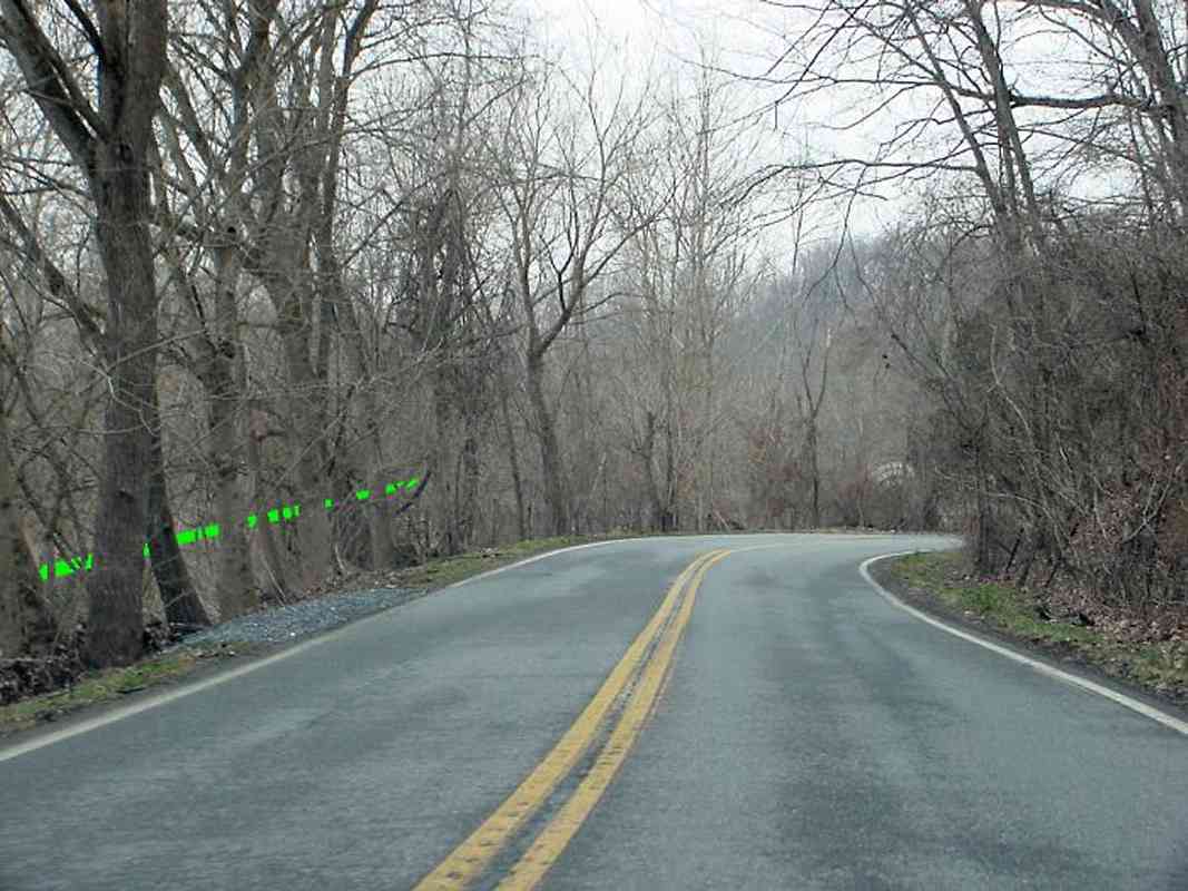
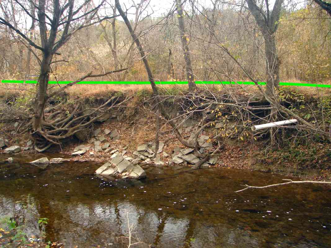
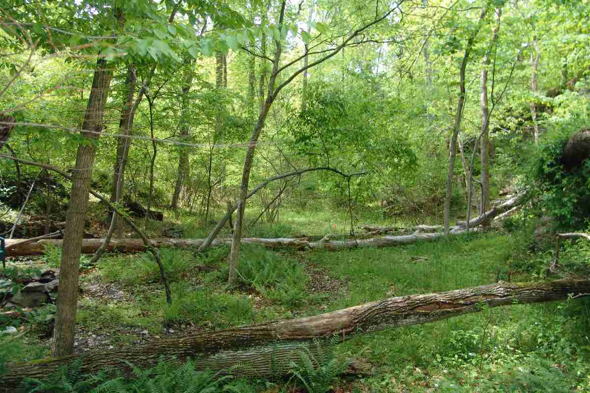
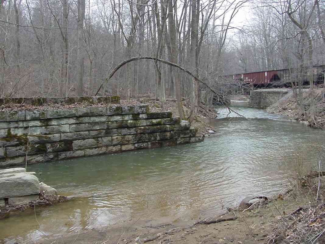
The dry summer and autumn of 2008 belie Bush Creek's erosive capability when filled by tropical storm downpours. The tenacious tree on left and white drainage pipe on right indicate the river bank once had a very different profile.

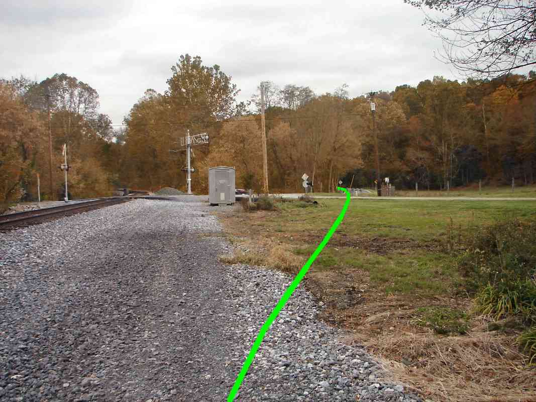
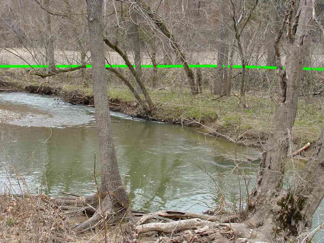
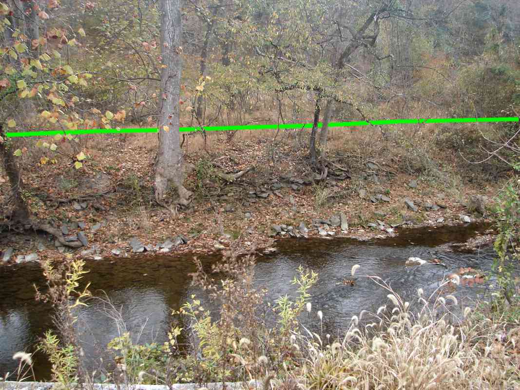
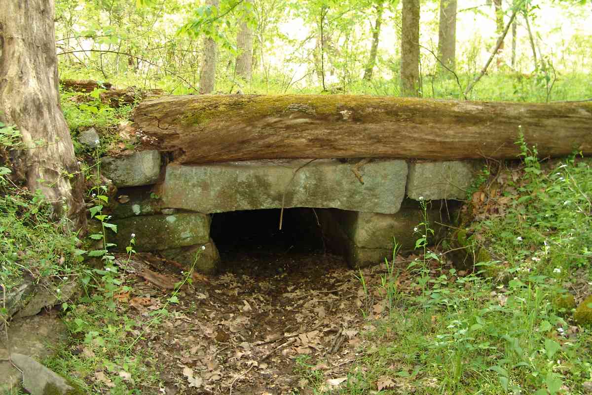
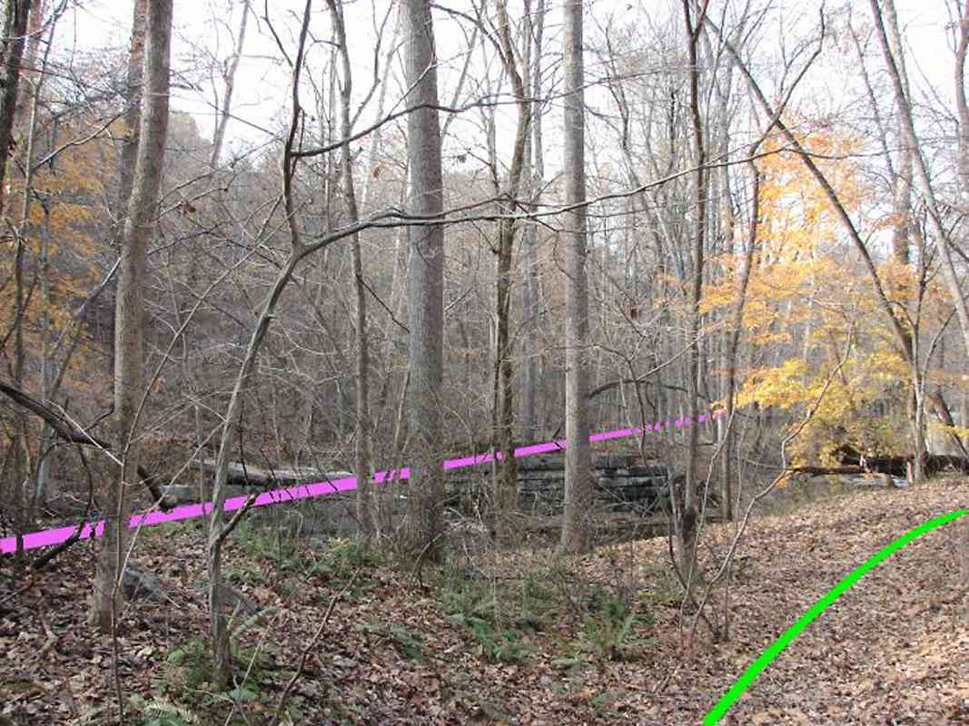
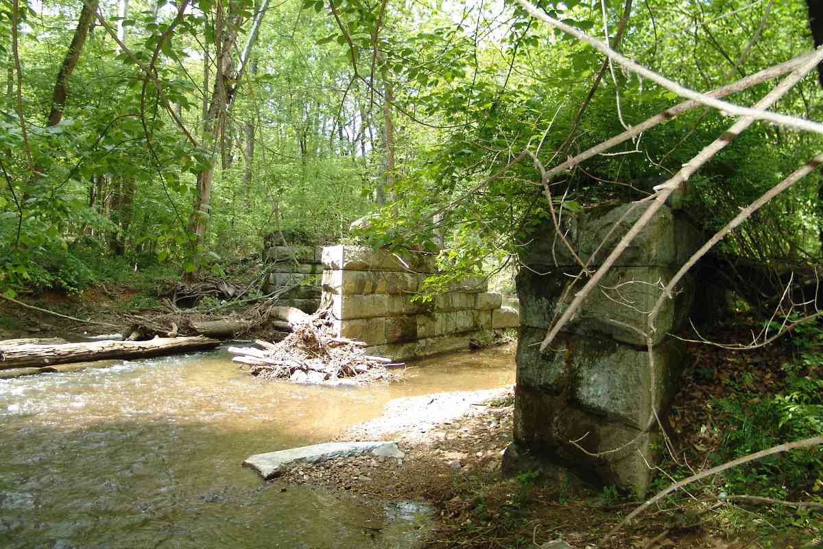
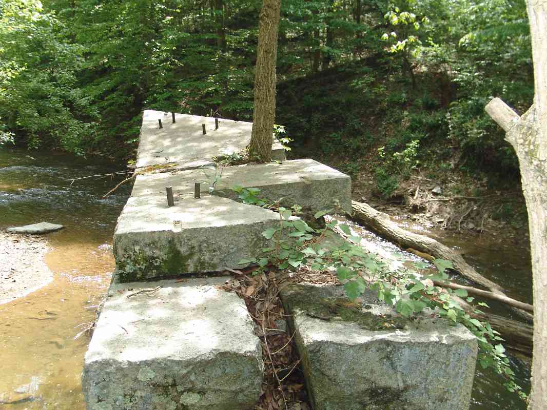
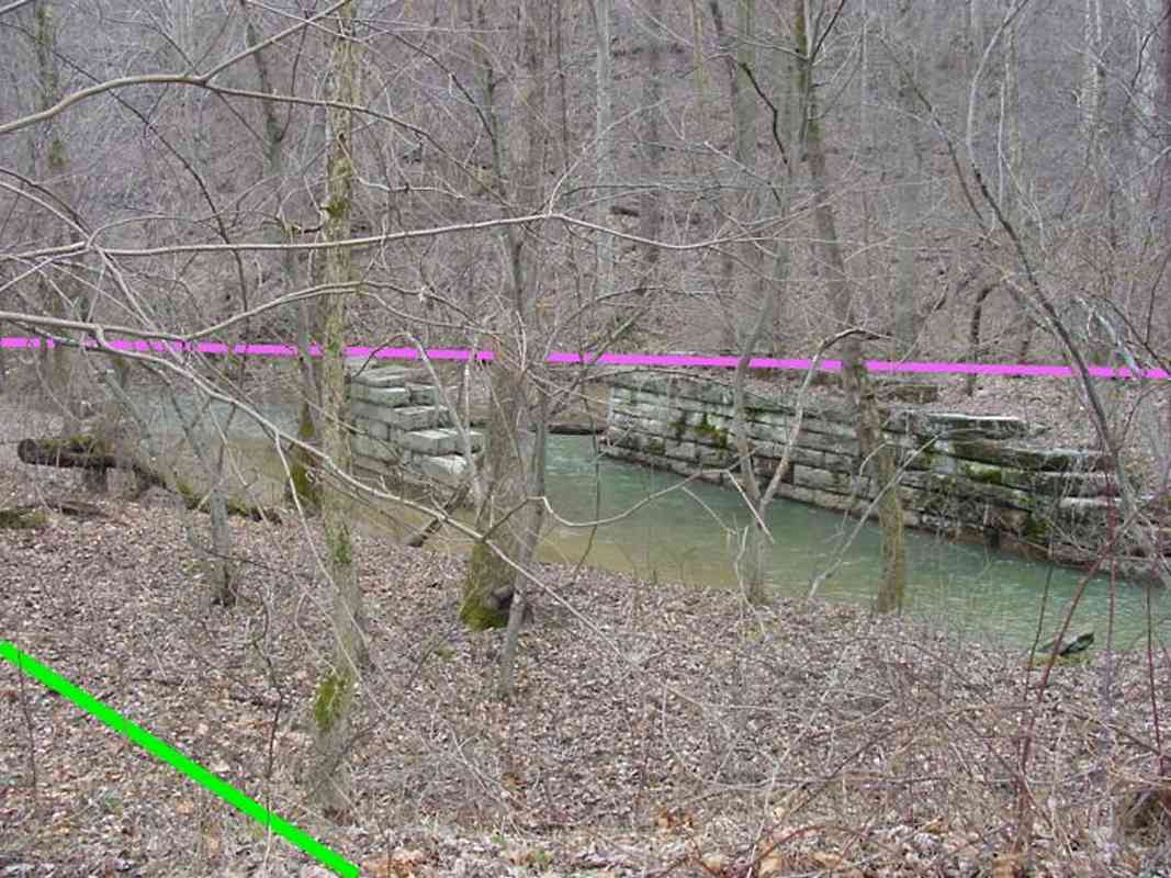
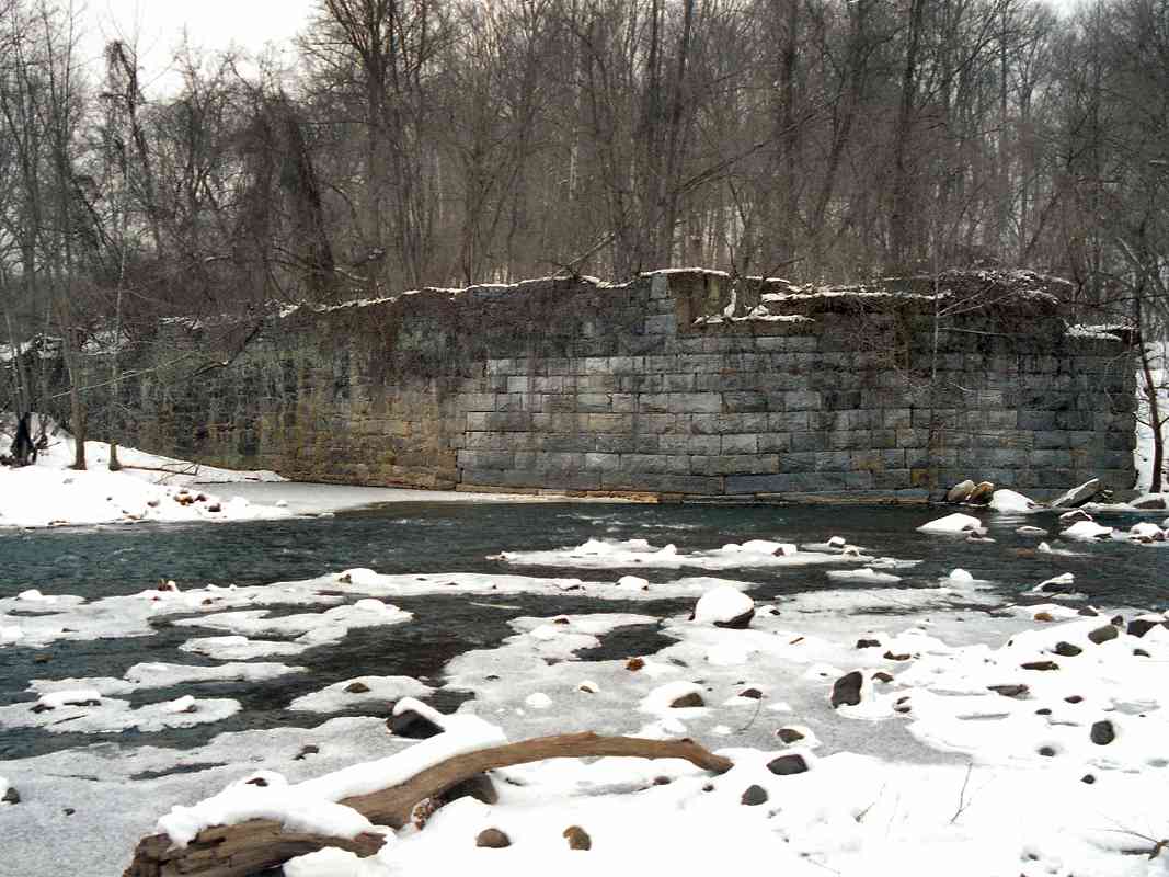
This spot, just downstream from the tributary, looks to have given B&O trouble. Squared stones suggest a retaining wall had previously held back the river from undermining the railroad on the bank above. Farmers don't build walls of such stone, railroads do, so I take this as more evidence B&O had been here.

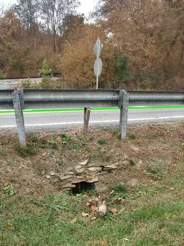
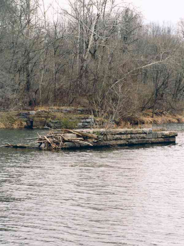
The flat stones may be slate. The Ijamsville slate quarry, about a mile upstream (right, in this photo) predated the railroad and would have been a convenient source of stone.


rail

Rail
Mile: 50.3 Date: Oct 2008
Ease: B View: NE
Area: A IC2:
Map: Fr 39 G 2 Topographic Maps

For mile markers and fence posts, B&O hammered rails vertically into the ground. One is visible on the right side of this photo.

Early 20th century maps show that after the new alignment with Hartman Tunnel opened, B&O retained the original as a siding. The siding may have extended eastward from the left to this fence.


mound

Mound
Mile: 50.4 Date: Mar 2005
Ease: B View: N
Area: A IC2:
Map: Fr 39 G 2 Topographic Maps

If you've been reading through these tour pages, you know that a mound parallel to a stream doesn't happen by accident.


more wall

More Wall
Mile: 50.5 Date: Oct 2008
Ease: B View: N
Area: A IC2:
Map: Fr 39 F 2 Topographic Maps

The mound continues further west, and the retaining wall is in better shape here.


bridge 33b

Bridge 33B
Mile: 50.6 Date: Oct 2008
Ease: B View: W
Area: A IC2:
Map: Fr 39 F 2 Topographic Maps

Thanks to the twists and turns of Bush Creek, the current alignment meets the original at bridge 33B. That's Hartman Tunnel in the distance. The original alignment continues left, around the hill.


curve

Curve
Mile: 50.6 Date: Oct 2008
Ease: B View: NE
Area: A IC2:
Map: Fr 39 F 2 Topographic Maps

This reverse view better illustrates how the original alignment curved to follow the creek. The black line represents the 1902 connection that converted the original alignment into a siding.

Hidden by the brush is a dry gully that both the green and black alignments cross, but for which I could find no surviving evidence of a bridge.


siding

Siding
Mile: 50.7 Date: Oct 2008
Ease: B View: NE
Area: A IC2:
Map: Fr 39 F 2 Topographic Maps

The siding progressed through the break in the trees, while in the distance the original alignment continues along Bush Creek to swerve around the hill now pierced by Hartman Tunnel. The tunnel is a short distance behind the photographer.


csx 8633

CSX 8633
Mile: 50.6 Date: Oct 2008
Ease: B View: W
Area: A IC2:
Map: Fr 39 F 2 Topographic Maps

There's Hartman Tunnel as CSX 8633 approaches. This is the shortest train I've seen operating on the OML.


overgrowth

Overgrowth
Mile: 50.6 Date: Oct 2008
Ease: B View: SW
Area: A IC2:
Map: Fr 39 F 2 Topographic Maps

After a century of overgrowth, it's no longer obvious the original alignment proceeded into the distance to curve around the hill, but there were some artifacts to be found ahead...


Sewer Line
NEW! late-Feb 2019

Sewer Line
Mile: 50.6 Date: Jun 2018
Ease: B View: SW
Area: A IC2:
Map: Fr 39 F 2 Topographic Maps

... unfortunately those artifacts were likely removed during 2013 when Frederick County buried a sewer line along the route. I felt too discouraged to check if the items shown below survived.


small cut
Photo courtesy Dave Hiteshew

Small Cut
Mile: 50.7 Date: May 2007
Ease: B View: NE
Area: A IC2:
Map: Fr 39 F 2 Topographic Maps

This small hillside cut and some ballast (lower left) were clues B&O had been here before the sewer line.


culvert
Photo courtesy Dave Hiteshew

Culvert
Mile: 50.7 Date: May 2007
Ease: B View: W
Area: A IC2:
Map: Fr 39 F 2 Topographic Maps

The crude construction of this culvert suggests that by the time the B&O built west to here, they were no longer worrying about niceties such as perfectly dressed stone, but rather hurrying along so as to reach Frederick before the end of 1831. Another culvert of somewhat better construction is nearby.

A desire to earn enough to buy food (and booze) fueled work crews to cut fifty miles of "rail road" in just two years... that pace of construction (without machinery!) will always astound me.


realignment
Photo courtesy Dave Hiteshew

Realignment
Mile: 50.8 Date: Nov 2007
Ease: C+ View: W
Area: A IC2:
Map: Fr 39 F 2 Topographic Maps

The main surprise waiting around the bend are the remnants of a significant bridge spanning Bush Creek. This bridge represents the second alignment (magenta line), one to bypass a significant bend in the creek followed by the original right of way.

Just discernable in the distance, beyond the colorful tree on the right, is the south side of CSX bridge 33C, seen with coal hoppers traversing in this picture.


piers
Photo courtesy Dave Hiteshew

Piers
Mile: 50.9 Date: May 2007
Ease: C View: W
Area: A IC2:
Map: Fr 39 F 2 Topographic Maps

Four substantial stone piers make this the OML's third-longest non-arch disused bridge; the Upper and Lower Elysville bridges are longer.

Based on the resemblance of the stone cutting here to that of the Elysville bridges, I figure this bridge to be their contemporary, which puts the date of construction around 1838. Note also the lack of mortar, another sign of a pre-Civil War B&O bridge.

The creek is flowing left to right, as you may have guessed by the log and debris wedged against the piers.


bridge top
Photo courtesy Dave Hiteshew

Bridge Top
Mile: 50.9 Date: May 2007
Ease: C View: S
Area: A IC2:
Map: Fr 39 F 2 Topographic Maps

One of the consequences of mortarless construction is the build up of dirt, which lets small plants and then even trees take root and push apart the stones. I'm surprised by the iron rods, but those may have been added later to tie a bridge structure to the piers.


looking south

Looking South
Mile: 50.9 Date: Mar 2005
Ease: C+ View: S
Area: A IC2:
Map: Fr 39 E 2 Topographic Maps

One last view of the disused bridge.

"Look Ahead - Look South" was a slogan of the Southern Railway, now part of CSX's competitor Norfolk Southern.


meet again

Meet Again
Mile: 50.9 Date: Mar 2005
Ease: C+ View: W
Area: A IC2:
Map: Fr 39 E 2 Topographic Maps

Near bridge 33C the original and current alignments meet at an almost right angle, while on the left the second alignment from 1838 breaks through the hill via what on B&O roadway maps is named Penitentiary Cut.

This cut is the most substantial on the Old Main Line west of Relay. Its name suggests prison labor was employed, but I have not found solid documentation of that. At first I suspected the 1838 alignment curved around the hill, following the south bank of Bush Creek, but there is no supporting evidence. Hence, I somewhat reluctantly believe the cut dates to 1838, and was widened later, probably as part of the Hartman Tunnel project.


Revisit
NEW! late-Feb 2019

Revisit
Mile: 50.9 Date: Jun 2018
Ease: C+ View: W
Area: A IC2:
Map: Fr 39 E 2 Topographic Maps

More than a decade later finds Frederick County's sewer line following the old B&O route (photo right) here as well. Where in the distance the trees darken the path the sewer line crosses to the other side of the river (left). Beyond that, and the shooting range shown on the next tour page, I believe the ex-B&O alignment survives unscathed - for now.


<< Previous (east) | THIS PAGE: disused at Hartman, part 1 of 2 | Next (west) >>

Or, return to main page

Copyright Notice