Search Railroad Sites For:
Old Main Line Photo Tour

B&O Old Main Line
Modern day photo tour

Accompanying each photo below are:

Click a photo to see a larger view. Please send your comments and corrections to Steve.


Map - Western Approach

Map - Western Approach
Mile: Date: Jul 2006
Ease: View:
Area: IC2: 352
Map: Topographic Map

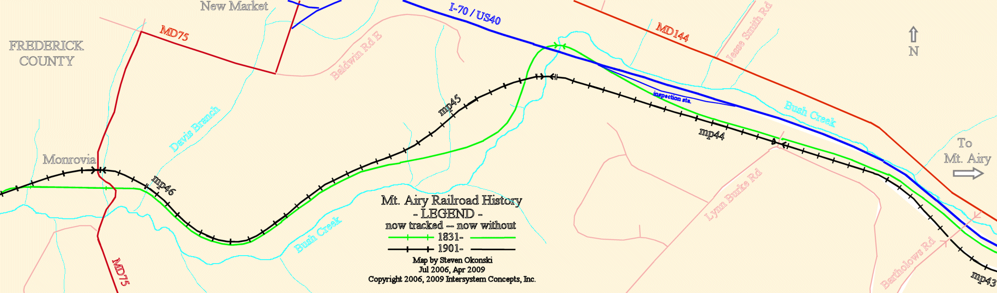
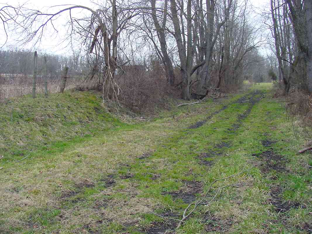
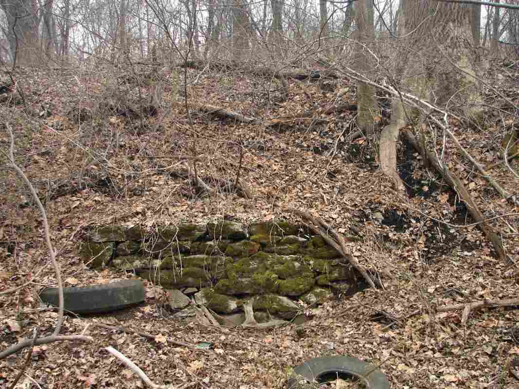
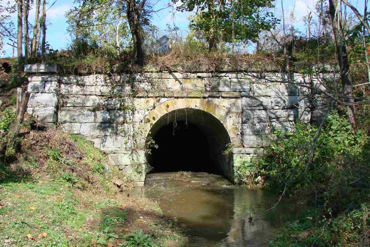
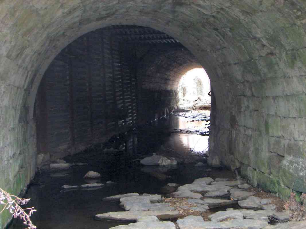
For reference, here's a map of the area from west of Mt. Airy to Monrovia, Maryland.

This map represents data from Harwood (1979), USGS maps (1945 and 1980), and aerial photos (1980) combined with research from my hiking and photographing the area many times over the course of several years.

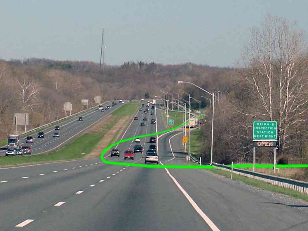
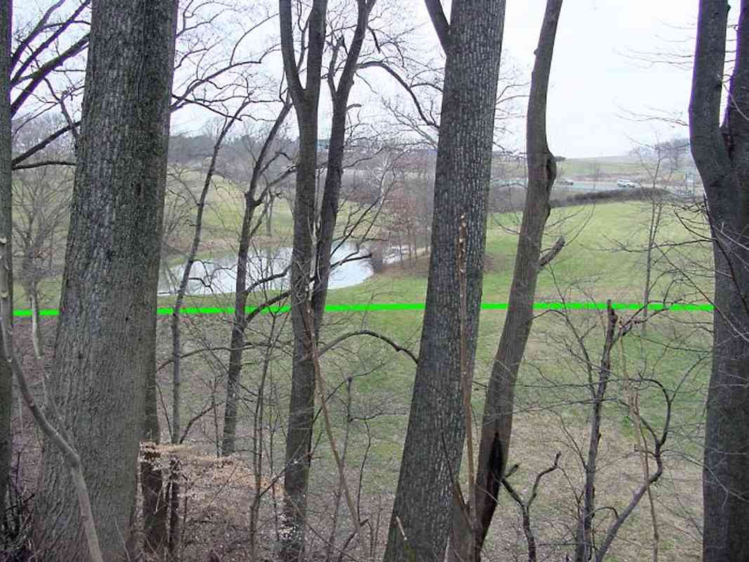
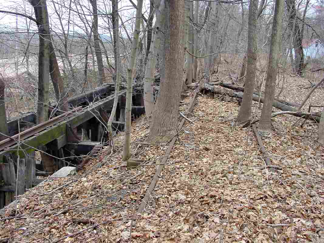
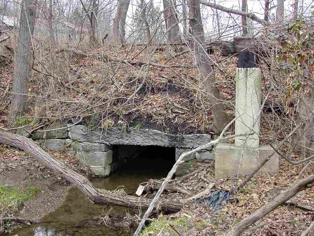
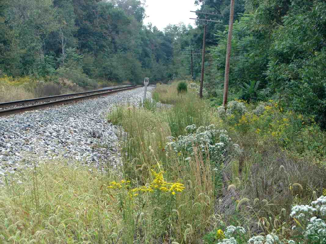
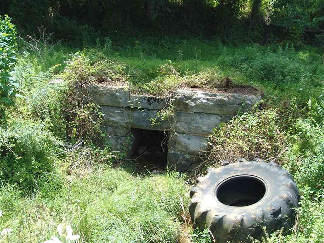
The alignments are depicted on the map by colors that indicate the date of opening. The same colors are overlaid on some of the photos below to assist visualizing the route.

Even though this map is called "Western Approach", this tour page continues the east to west progress of the tour's preceding pages.


Bartolows Road

Bartolows Road
Mile: 43.2 Date: Jan 2005
Ease: A View: W
Area: A IC2:
Map: Fr 41 D 1, Ho 1 C 4 Topographic Map

When heading west from Mt. Airy on I-70, the first overpass is that of Bartolows Road. Marked by the green line is the hint of a shelf of land that I speculate marks the Old Main Line's original, circa-1830 alignment.

Higher on the hillside, the snow helps to show where the current alignment can be found.


WE Plane

WE Plane
Mile: 43.2 Date: Jan 2005
Ease: A View: NW
Area: A IC2:
Map: Fr 41 D 1, Ho 1 C 4 Topographic Map

Even for CSX, the planes live on. As viewed from the Bartholows Road overpass BNSF pumpkin number 4752 glides autoracks past the endpoint of the Mt. Airy Loop siding. Notice the shiney new CSX power/comm booth; it's stenciled "WE Plane" (West End Plane).

The Loop may end here, but the Mt. Airy Cutoff track that in 1901 supplanted the original alignment continues west several more miles. The original alignment is within the trees on the right.

Link: Railroad Routes in the Alleghenies - the Pennsy's plans for planes


Original Culvert?

Original Culvert?
Mile: 43.7 Date: Nov 2004
Ease: B+ View: N
Area: A IC2:
Map: Fr 32 B 13, Ho 1 B 3 Topographic Map

For several miles, the original alignment remains sandwiched between the current alignment and Interstate 70. At Lynn Burke Road, I found this culvert hiding in the brush at the edge of someone's lawn.

The raised mound and the rusty rail at the side that suggests this culvert had a former life as part of the B&O. Behind the photographer the current alignment towers overhead, in the distance is I-70.


Bush Creek

Bush Creek
Mile: Date: Apr 2005
Ease: A View: E
Area: A IC2:
Map: Fr 31 K 12 Topographic Map

Somewhere in this vicinity, the OML's original alignment had crossed from Bush Creek's south bank over to its north bank (foreground). Unfortunately the precise spot has been lost to time because I-70's girth has erased the artifacts of that crossing.

Based on data from old maps, my best estimate puts the OML's path roughly as marked by the green line here. (On the map at the top of this page, the OML appears to fully cross I-70 because in reality I-70 is wider than depicted by the blue line on that map.)


1909 Map

1909 Map
Mile: Date: 1909
Ease: View:
Area: IC2:
Map: Fr 32 A 13 Topographic Map

This snippet from a 1909 map shows the then new Cutoff tracks, but also shows remants of the original alignment. Look closely left of the large letter O and just above the blue line (I-70) and you'll see curved topographical lines that span Bush Creek. This is where the B&O's bridge had been.

Link: Old USGS maps online


Berm

Berm
Mile: 44.5 Date: Jan 2005
Ease: C+ View: NW
Area: A IC2:
Map: Fr 31 K 13 Topographic Map

Shortly after we get away from I-70's regrading, the mound marking the original alignment re-emerges to now act as a pond's berm.


High Road, Low Road

High Road, Low Road
Mile: 44.6 Date: Jan 2005
Ease: C View: N
Area: A IC2:
Map: Fr 31 K 13 Topographic Map

The shelf of the original alignment (foreground) sits much lower than the current (Cutoff) tracks at top. In order to make the grade east up to Mt. Airy more gradual, the B&O spread it out over 5 miles, and thus at locations in the middle like this one there is a large difference in height.

Also, the two alignments cross almost perpendicularly here. I would guess the B&O kept the original OML operational as long as possible while the Cutoff was under construction. If that was the case, this spot where the alignments cross would have been one of the last to have been built.


Cow Path

Cow Path
Mile: 45.2 Date: Jan 2005
Ease: C View: NE
Area: A IC2:
Map: Fr 40 J 1 Topographic Map

Smells like railroad! And cow pies too. The original alignment crosses a farm field well south of its replacement.

An original B&O stone culvert can be found a short distance east of here, but was too covered by brush to be worth picturing.


Shelf

Shelf
Mile: 45.5 Date: Jan 2005
Ease: C+ View: W
Area: A IC2:
Map: Fr 31 J 13 Topographic Map

There's the shelf again. From here to Monrovia, the two alignments run mostly side by side.


Davis Branch

Davis Branch
Mile: 46.0 Date: May 2004
Ease: B View: W
Area: A IC2:
Map: Fr 40 G 1 Topographic Map

Approaching Monrovia near milepost 46, maps say both alignments cross Davis Branch, but the growth is so thick, I've never found exactly where that happens! There should be a bridge for the current alignment and remains of one for the original. If anyone knows where these structures are hiding, please share the secret.


Monrovia

Monrovia
Mile: 46.2 Date: Jan 2005
Ease: A View: E
Area: A IC2:
Map: Fr 40 F 1 Topographic Map

At Monrovia, looking back to the MD 75 crossing, the original alignment's right of way is now a driveway shared by some homes and businesses. Cracks in the pavement indicate the rails have been buried underneath.


Rusty

Rusty
Mile: 46.2 Date: Jan 2005
Ease: A View: W
Area: A IC2:
Map: Fr 40 F 1 Topographic Map

Turning around and looking west from the same spot shows rails disused long enough for substantial trees to have grown. The tracks on the right represent the original alignment, those on the left an elevated siding. After the Mt. Airy Cutoff opened, both were relegated to siding duty.


Culvert

Culvert
Mile: 46.2 Date: Jan 2005
Ease: B View: N
Area: A IC2:
Map: Fr 40 F 1 Topographic Map

Underneath the same spot is a circa-1830 culvert. The column on the right supports what remains of the elevated siding.


Driveway

Driveway
Mile: 46.3 Date: Sep 2005
Ease: B View: W
Area: B+ IC2:
Map: Fr 40 F 1 Topographic Map

Continuing west, the old right of way is now a shared driveway and utility access road. Rusting rails can be found in many spots along the edge.


Mt. Airy Cutoff

Mt. Airy Cutoff
Mile: 46.5 Date: Sep 2005
Ease: B View: E
Area: A IC2:
Map: Fr 40 F 1 Topographic Map

Just west of Monrovia, the rusty rails in the grass mark where the original alignment meets the western endpoint of the Mt. Airy Cutoff.

The 10+ miles of Cutoff track that opened in 1901 successfully reduced the B&O's maximum grade over Parrs Ridge at Mt. Airy. The heaviest trains such as mile-long coal drags still require helper engines to climb the ridge, but the ridge is not the same operational bottleneck it was back in the 19th century. The improvement provided by the Cutoff helped keep the Old Main Line useful and active into the present.


Thanks for riding along! This ends the Mt. Airy Planes tour; back to its first page.

Or, return to main page


Copyright Notice


  Free Web Hosting Since 1996. Join & Become Part of the TrainWeb's Railroad Community.