TrainWeb.org Facebook Page
PRR / Amtrak Photo Tour


PRR / Amtrak in Maryland
Modern day photo tour

Accompanying each photo below are:

Click a photo to see a larger view. Please send your comments and corrections to Steve.


Special Note: >>> The places described on this page host quiet, high-speed trains. Stay well clear! <<<

<< Previous (branch) | THIS PAGE: Orangeville to Penn Station | Next (southwest) >>

1927 Aerial
Photo courtesy Johns Hopkins University

1927 Aerial
Mile: 92.0 to 93.0 Date: 1927
Ease: View: N (up)
Area: T6: 296
Map: Topographic Maps

The tour continues from where we left off the main line at Bay Tower, found at the right side of this aerial, and proceeds west (left). roundhouse 2017 courtesy Google

In this vicinity, note the Orangeville Engine House, the PRR's primary locomotive repair facility in Baltimore. Some rusty rails and an arc of the roundhouse's concrete pads survived into the 21st century, but were torn our during 2019. Easiest views come from above, such as that at right courtesy Google. Orangeville was named for the nearby Orange Farm which, despite its name, did not grow citrus fruit.

West of Orangeville the main line tracks enter the first of two S curves in order to line up for Union Tunnel.

Links: 1974, 1975, 1975, 1977, 2013


S Curve

S Curve
Mile: 92.5 Date: Aug 2018
Ease: B+ View: W
Area: C T6:
Map: Ba 35 K 12 Topographic Maps

Within a quarter mile after the curve, trains cross four grade separation bridges: closest in photo is Pulaski Highway (US 40), then Kresson Street, Monument Street, and Haven Street. Prior to grade separation, Herring Run Railway had followed Philadelphia Road, later Pulaski Highway.

The leftmost pole holds the skeletal remains of a PRR signal. To my knowledge Amtrak no longer mounts signals on NE Corridor catenary poles, but sometimes leaves behind PRR-era relics of such.

Link: GG1 CR 4800 with caboose in 1978


Monument Street

Monument Street
Mile: 92.6 Date: Aug 2016
Ease: A View: W
Area: C+ T6:
Map: Ba 35 K 11 Topographic Maps

Monument Street sees two railroad bridges because the closest is for what became the PRR main line while the disused one beyond was an 1871 Union Railroad line built to connect the Northern Central RR south to the Canton waterfront port. This bridge was lengthened during 1956 when Monument Street was twinned (widened on its north side). This is why the southern bridge abutment is made of stone while the northern relatively newer concrete. Originally, the tracks crossed Monument Street at grade, on this side (east) of the bridges.

Links: 1947, 1960


Haven Street

Haven Street
Mile: 92.7 Date: Aug 2018
Ease: A View: SE
Area: C+ T6:
Map: Ba 35 K 11 Topographic Maps

The same two bridges are visible from Haven Street. Originally these lines met Haven and Monument Streets at grade. Note the ledge in the stonework for the spur to Canton (right) permits double tracking of that line. The spur last saw a train during the 1970s.

Link: Haven Street revival


Amtrak 603

Amtrak 603
Mile: 92.7 Date: Aug 2018
Ease: B+ View: SE
Area: C+ T6:
Map: Ba 35 K 11 Topographic Maps

signal skeleton AMTK 603 leads a southbound over Monument Street, bridge number 61 as seen in the zoom. Few of the PRR's painted-on bridge numbers have survived this long. Note the stack of metal plates attached to the top of the bridge; that may have been a later addition to reduce the bridge's flexing under heavy loads.

In the zoom, the signal skeleton has been highlighted on the pole in the distance. At the time of the photo I had not noticed that relic otherwise I would have sought a better view.


Amtrak 656

Amtrak 656
Mile: 92.7 Date: Aug 2018
Ease: B+ View: W
Area: C+ T6:
Map: Ba 35 K 11 Topographic Maps

In what was likely an equipment move, three engines pull one car over Haven Street.


Original Alignment

Original Alignment
Mile: 93.1 Date: Aug 2016
Ease: B View: SE
Area: C+ T6:
Map: Ba 35 J 11 Topographic Maps

The photographer is standing on what apparently had been the PW&B's original alignment in the area between Monument Street and Edison Highway. It was bypassed presumably around the same time the grade separation bridges seen above were built, which would have been 1893.

The old alignment was retained to serve the Southern Can Company (later Continental Can Company). B&O also had rails to the can manufacturing site, in fact the ex-PRR and ex-B&O tracks connected within the boundaries, a connection that was not dismantled until the early 2000s.

That's milepost 93 visually below and right of the distant Amtrak Acela unit 2019.

Link: site cleanup info


Amtrak 2014

Amtrak 2014
Mile: 93.1 Date: Aug 2016
Ease: B View: W
Area: C+ T6:
Map: Ba 35 J 11 Topographic Maps

From the same spot, looking west finds AMTK 2014 traversing the middle section of the broad S curve, about to pass under Edison Highway. It was here during the 1870s the PW&B initially connected with the Union Railroad, an operation founded by the Canton Company to bring more rail service to their port.

Links: LoC 1970s aerial, bridge status


S Curve 2
Photos courtesy Johns Hopkins University

S Curve 2
Mile: 93.7 to 94.7 Date: 1927
Ease: View: N (up)
Area: T6:
Map: Topographic Maps

West of the first S curve lies another, sharper one within a Baltimore neighborhood called Middle East.

1937 aerial The 1937 aerial at right zooms into three sidings in this vicinity. The rightmost one, known as Patterson Park Yard, was at grade, the middle was elevated with bins below for coal, and the leftmost was covered.

The narrowest rowhouses seen here were 12 feet wide. Most south of the railroad have been torn down. As of this writing, many north of the railroad are abandoned; this was/is the roughest neighborhood on Baltimore's east side, though unlike the west side, here I have never been greeted by gunfire.

Aerial photos suggest the three sidings faded from use beginning during the 1950s, with the middle one still in use into the 1980s. Though none remain in service some artifacts can be found...


Collington Avenue

Collington Avenue
Mile: 94.0 Date: Jun 2018
Ease: A- View: NE
Area: C T6:
Map: Ba 35 F 11 Topographic Maps

The bridge for the middle of the three sidings, the one with the drop bins, survives in a disused state to span Collington Avenue.

A Maryland Department of the Environment report tells the history:

    "The site was initially developed as a coal yard (Wilcox Ziegler Coal Storage Yard) in the 1800s and portions of the property continued this use until the 1980s. In 1928, the property was listed as Gross Coal Company. In 1956, the property was listed as the Potomac Coal Storage Yard. In 1964, the property was listed as Anderson Auto Sales. In 1969, portions of the property that were not utilized as a coal yard were used as an automotive sales and junk facility. In the 1960s and 1970s, Wise Fuel Oil operated on a portion of the property. In 1981, the property was purchased by James Kane from Penn Central Corp."

Link: 1965


Chase Street

Chase Street
Mile: 94.1 Date: Jun 2018
Ease: A View: NE
Area: C- T6:
Map: Ba 35 F 11 Topographic Maps

The leftmost siding still hangs on at the edge of the bridge at Chase Street near Castle Street. The in-service section of the rust bridge looks to have been rehabbed by Amtrak, but the siding has been left as is, which is lucky for us because it displays the only surviving, if faded, "The Pennsylvania Railroad" paint I've found in the Baltimore area. The siding had served the A. Lang Brothers Coal Yard on the south side of Chase Street.

The masonry of the bridges in this area is a combination of stone and concrete because the PRR widened all of them from 2 to 4 tracks during the 1930s. In places the pervasive menace known as rust washes down from the catenary poles to stain the masonry to almost a PRR red.

Anyone who has been trackside in a storm knows shiny rails begin showing rust within seconds of being pelted by rain drops.


Traffic Signals

Traffic Signals
Mile: 94.2 Date: Jun 2018
Ease: A View: W
Area: D T6: 309
Map: Ba 35 F 10 Topographic Maps

The elevated RR shadows intersections of Biddle Street at Washington Street, where the PB&W had maintained a station, as well as here where Preston meets Wolfe. Traffic signals on unique mounting poles sprout from the supports. Immediately northwest of here was a siding for the Hall Brothers and Company Coal Yard.

Links: Biddle Street Station, 1945 trackside details, ordered west to east


Broadway

Broadway
Mile: 94.6 Date: Jun 2018
Ease: A- View: E
Area: D T6:
Map: Ba 35 E 10 Topographic Maps

Ths S curves end at Broadway, the widest of the crossings. The south side abutment seen here is a concrete addition from the 1930s, while the north side is original stone masonry.

If this view looks familiar, you have seen it in a few Season 4 episodes of The Wire where Marlo and his henchmen discuss plans as Amtrak trains roll by, similar to the southbound led by AMTK 621 in this photo. Johns Hopkins Hospital is about a half mile south of here.


From Bond Street

From Bond Street
Mile: 94.6 Date: Jun 2018
Ease: A- View: E
Area: D T6: 324
Map: Ba 35 E 10 Topographic Maps

Southbound AMTK 2003 is about to cross Broadway then enter Union Tunnel. This is the obstructed view from Bond Street above the tunnel's north (east) portal.

Broadway Tower had controlled switching at this end of the tunnel until its functions were transferred during the 1920s to Union Junction Tower at the other end of the tunnel. One source says Broadway Tower was demolished September 1924 but what looks to be the tower appears in the northwest quadrant in a 1927 aerial.


Union Tunnel

Union Tunnel
Mile: 94.6 Date: Jun 2018
Ease: B+ View: W
Area: D T6: 230, 326
Map: Ba 35 E 10 Topographic Maps

URR 1871 As Baltimore grew, the streets became too crowded to be shared by trains, so during 1871 the Canton Company's Union Railroad (URR) began drilling under Hoffman Street in order to reach the Jones Falls Valley where the Northern Central operated. The tunnel on the right opened in 1873, and in 1935 the PRR added the adjacent, wider tunnel on the left. Both tunnels make a straight run of about 2/3rds of a mile; one can see light from the opposite end of the original tunnel.

After decades of decline, during the 2010s the surrounding neighborhood started to gentrify, being propped up by nearby Johns Hopkins Hospital that has been buying abandoned houses, rehabbing some, and selling them to employees at deep discount.

The two gray color boxes above AMTK 634 appear to be communications related.

Links: 1870s engraving, 1977, 1977, 2011, JHH Eager Park


Power

Power
Mile: 94.6 Date: Jun 2018
Ease: B+ View: NW
Area: D T6:
Map: Ba 35 E 10 Topographic Maps

The original Union Tunnel did not anticipate electric trains so did not have sufficient clearance for two tracks with catenary. After the tunnel's floor was lowered, one centered powered track was installed.

undervoltage relays Electrification of the tunnel had been discussed for decades as a way to reduce smoke from trains. The Baltimore Sun of May 11, 1909 describes discussions of a new city ordinance to require electrification, with the PRR reporting it would be too expensive.

Adjacent the tunnel is this disused, and mostly pillaged, utility box, with a few bits of remaining equipment like these General Electric undervoltage relays that appear to date from the 1930s. Amtrak removed these relics after photo time.

From here to Washington the PRR employed Oilostatic Okonite Cable for its 132 kV transmission lines, that choice driven by the special needs of running power lines through the Union and B&P Tunnels. Between 2004 and 2009 these original cables were replaced since they had outlived their expected service life.

Link: replacement project report (PDF)


South Portal
Photos courtesy Amtrak

South Portal
Mile: 95.3 Date: 2013
Ease: B View: E
Area: C+ T6: 229
Map: Ba 35 C 10 Topographic Maps

AMTK 2002 emerges from the original tunnel's south (west) portal on a snowy day. The newer, double-track tunnel is adjacent off photo-edge right.

Link: 2013


Hill

Hill
Mile: 95.5 Date: Jun 2018
Ease: C View: E
Area: B- T6: 230, 325
Map: Ba 35 B 10 Topographic Maps

overhead view Both tunnels are visible as AMTK 634 peeks out from the south portal. These views illustrate the hill through which the tunnels bore. During the 1930s, houses on the south side of Hoffman Street were demolished, presumably to acquire rights to put the second tunnel under their land.

The treed area on the left is part of Green Mount Cemetery.

Links: 1946, 1947, 1978


Turntable
Photo courtesy Johns Hopkins University

Turntable
Mile: 95.4 Date: 1927
Ease: A View: N (up)
Area: B- T6: 230, 314
Map: Ba 35 C 10 Topographic Maps

CS Tower stood at the south portal, revealed by its trackside shadow below the L in Belvidere. By 1927 the only remnant of the Northern Central's Guilford Avenue Engine Terminal, a repair facility, was its turntable used to spin locomotives to face the desired direction (circle left of photo center).

That turntable endured into the 1950s before 1) the JFX (I-83) was built over boxcars 2018 and adhacent the Jones Falls, and 2) wye trackage was added as a substitute. The wye also supported trains heading south to customers such as the Baltimore Sun newspaper at its former location within Calvert Street Station (Calvert at Franklin). Calvert Street Station was built by the Baltimore & Susquehanna Railroad, which was later incorporated into the Northern Central Railway.

In the 2018 view (left), the turntable had been at photo center, just beyond the red PRR boxcars stranded here for decades as storage. The Jones Falls is sequestered below where the photographer is standing.

Link: pics 1940s - 1960s


Amtrak 2035

Amtrak 2035
Mile: 95.5 Date: Nov 2018
Ease: B View: E
Area: B- T6: 319
Map: Ba 35 B 10 Topographic Maps

signals 
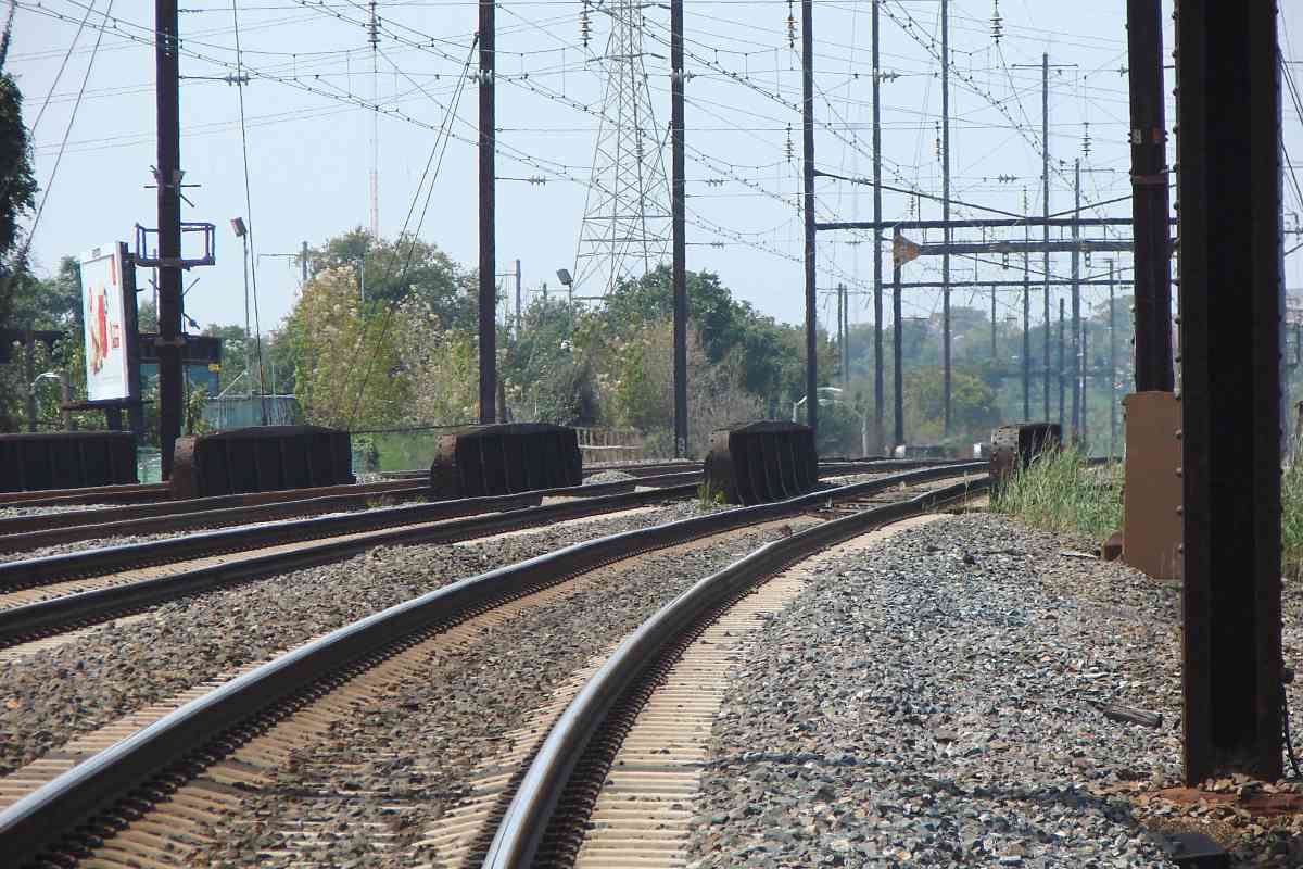
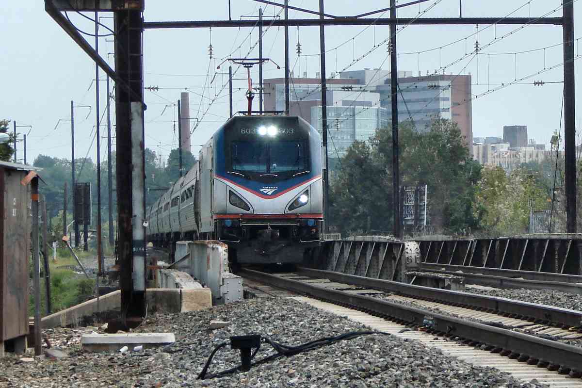
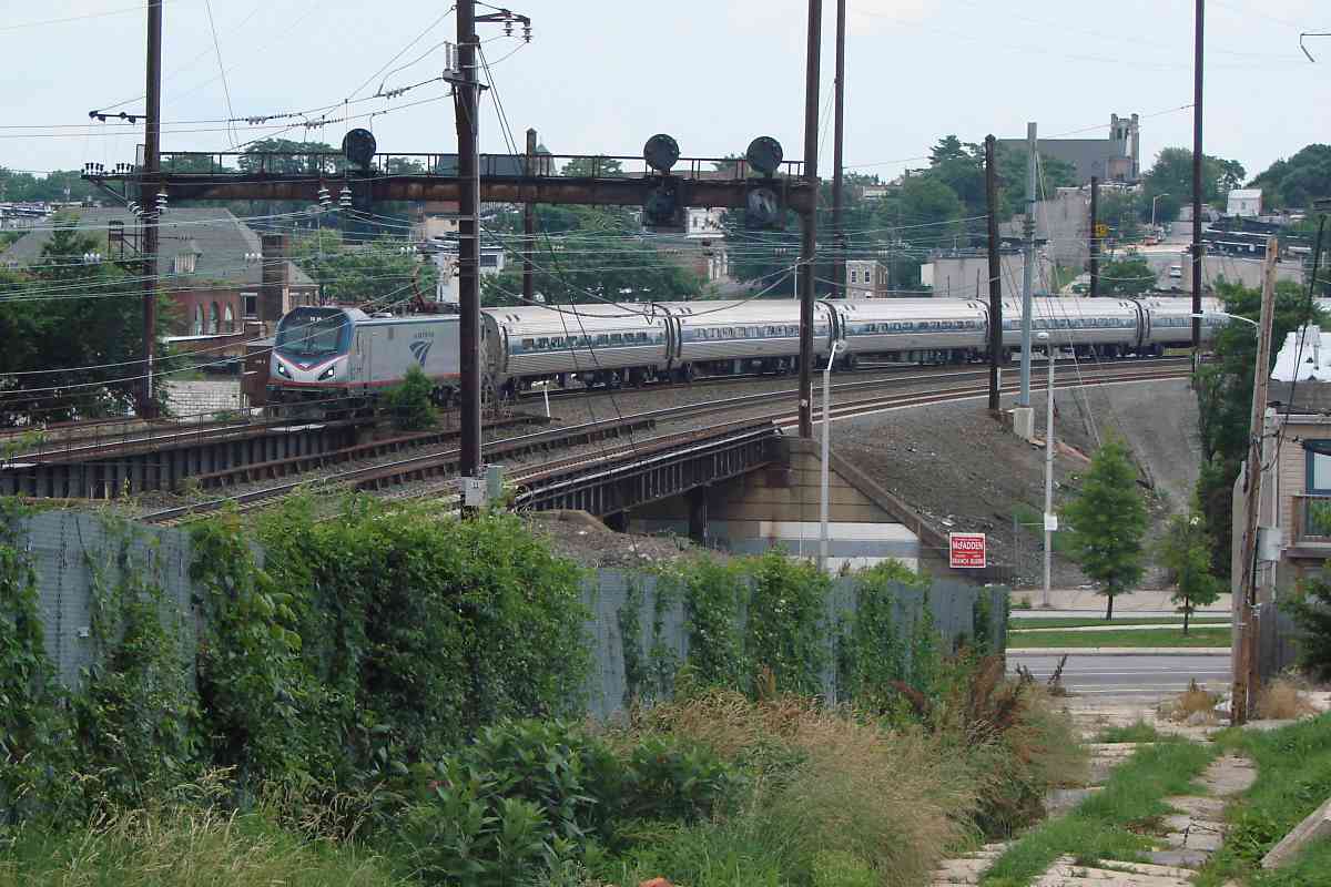
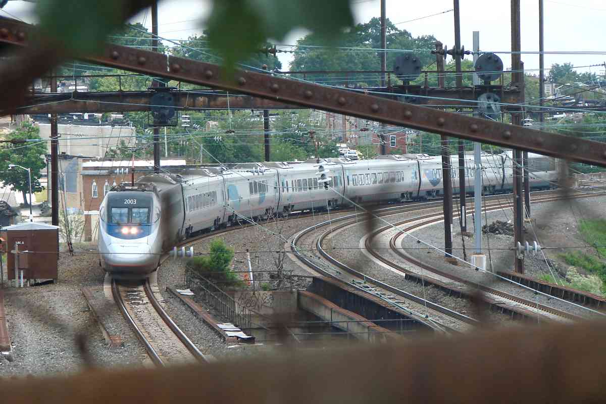
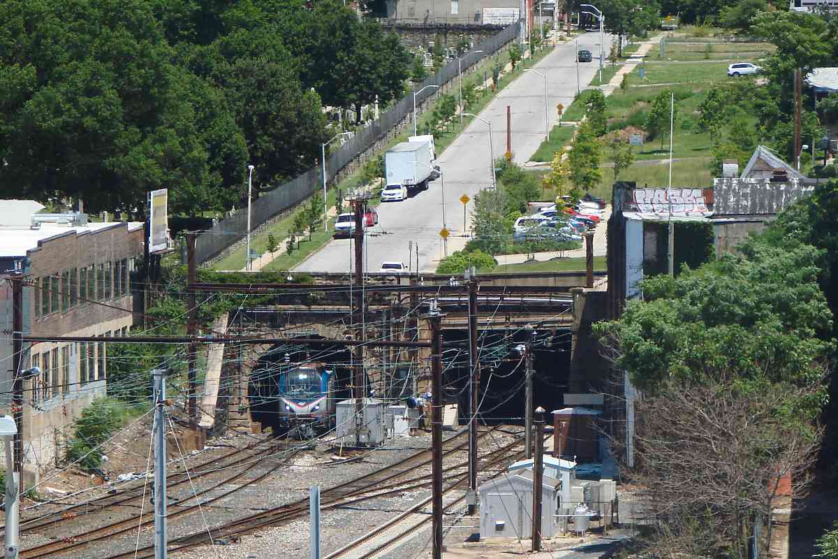
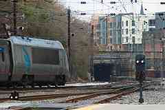
After emerging from Union Tunnel, as seen from track level this southbound is rolling under Guilford Avenue, and slowing to stop at Penn Station.

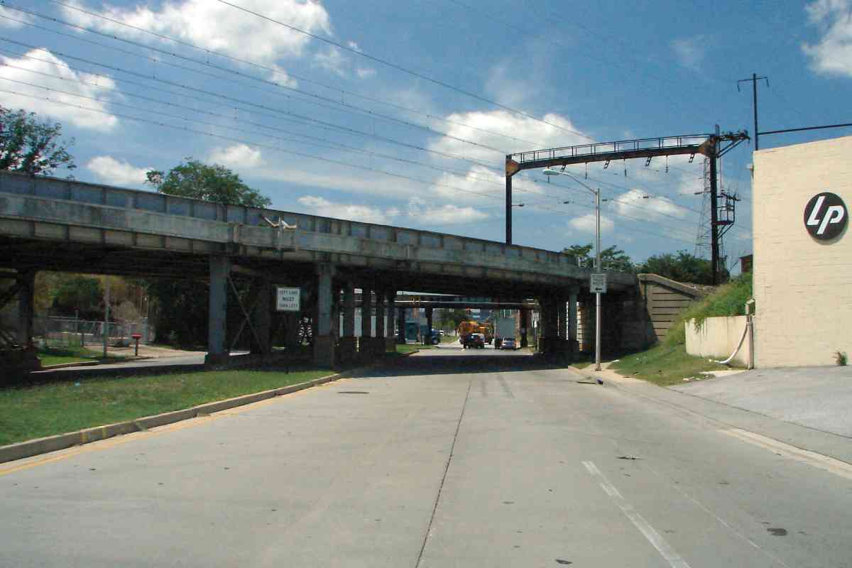
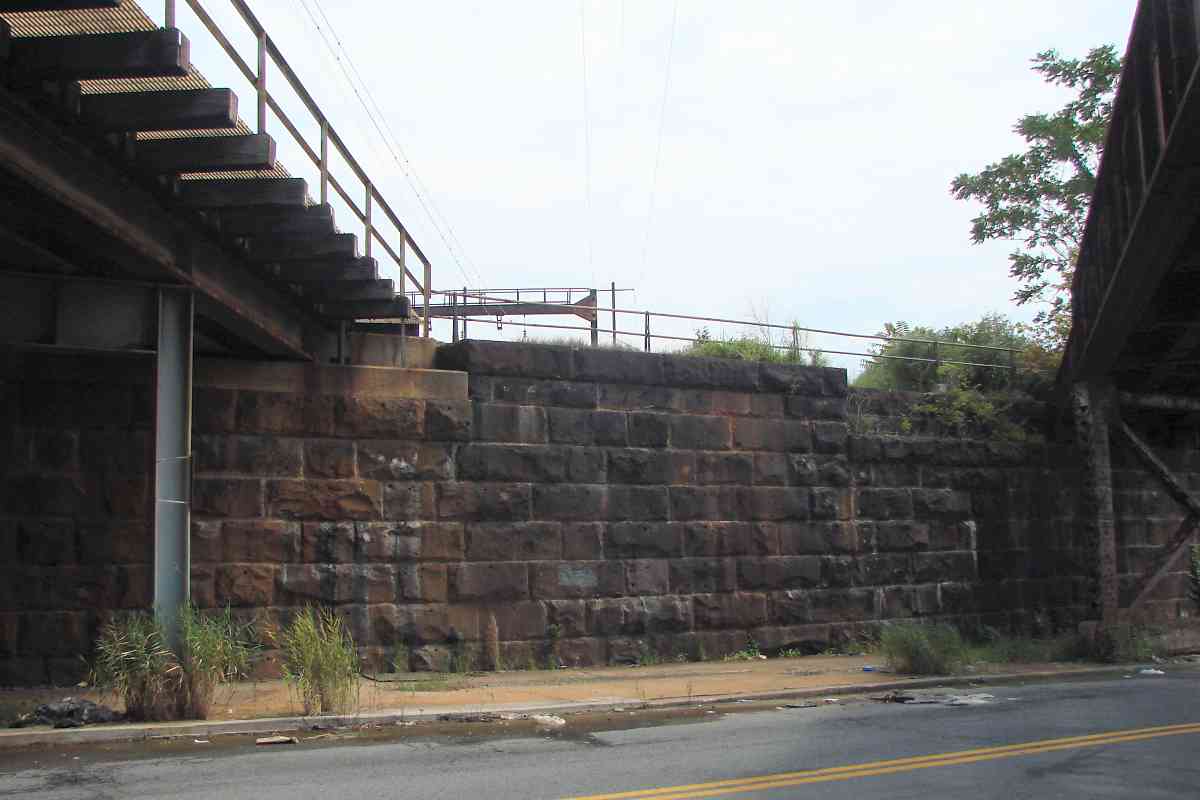
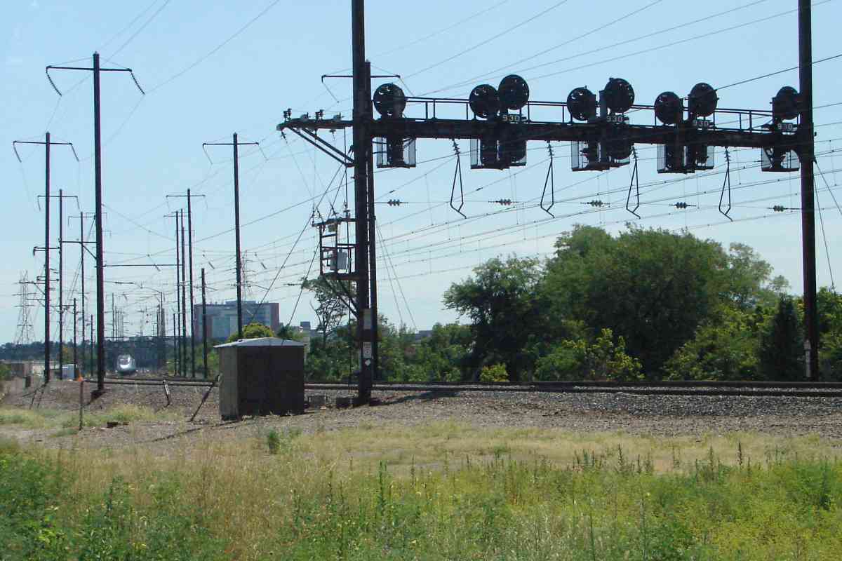
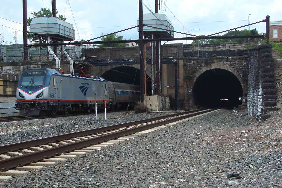
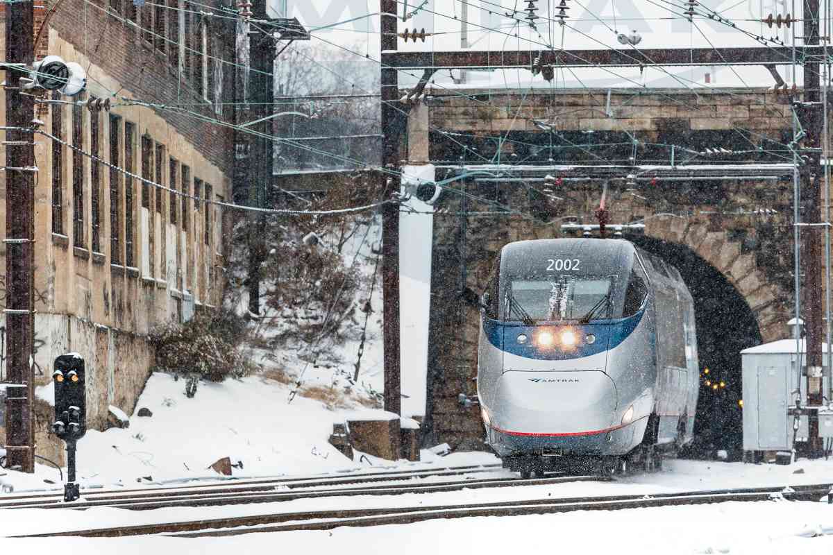
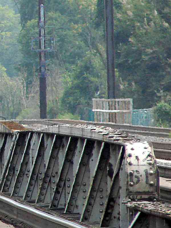
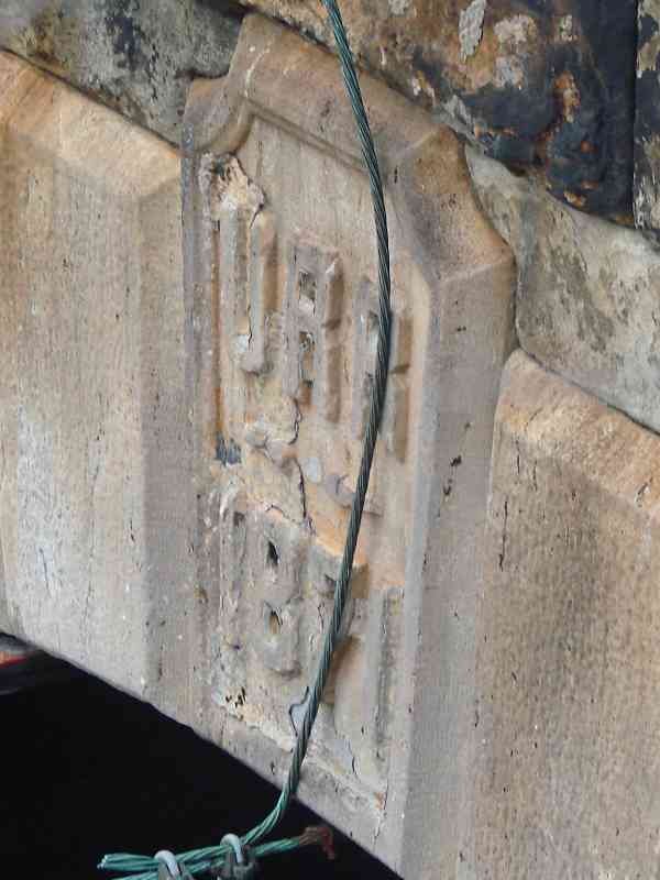
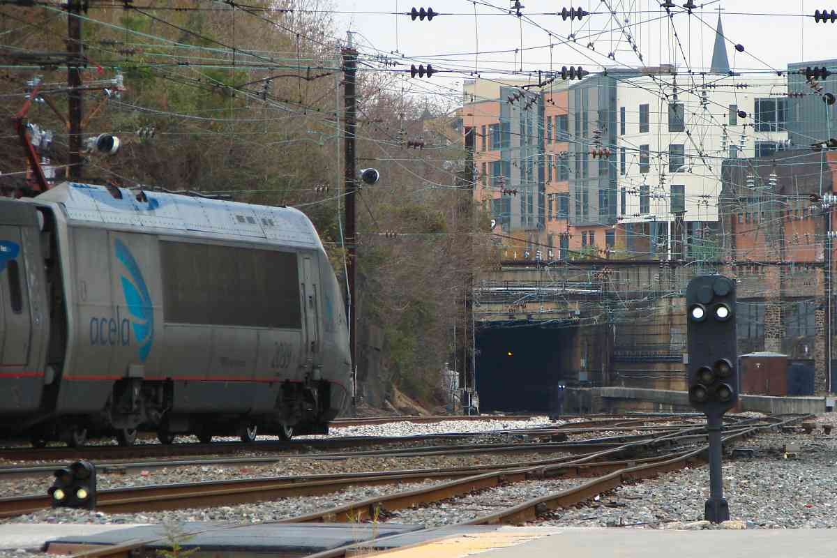
As the train clears, the second tunnel's south portal becomes visible in the distance; "1934" is embossed above the portal. Unlike the north portal, for reasons unknown, this opening is rectangular. In the foreground are two types of PRR signals, a dwarf and a pedestal, both still in service.

Links: 1912, ~1920, 1959, 1978, 1980, 1983, MARC 7853 in 2012, 2013, 2017


<< Previous (branch) | THIS PAGE: Orangeville to Penn Station | Next (southwest) >>

Or, return to main page

Copyright Notice