TrainWeb.org Facebook Page
B&O Washington Branch Photo Tour


B&O Washington Branch
Modern day photo tour

Accompanying each photo below are:

Click a photo to see a larger view. Please send your comments and corrections to Steve.


<< Previous (east) | THIS PAGE: Laurel to Muirkirk | Next (west) >>

MARC 22

MARC 22
Mile: 21.7 Date: Sep 2021
Ease: B View: SW
Area: B IC2:
Map: PG 4 H 4 Topographic Maps

Around the autumn equinox, shadows quickly grow longer across trains like westbound MARC 22.


Bowie Road

Bowie Road
Mile: 21.8 Date: Sep 2000
Ease: A View: NW
Area: B IC2:
Map: PG 4 H 4 Topographic Maps

GCFX 3055 and 3062 do their job over Bowie Road. This is about as narrow as a 2-lane road underpass can get. The stone construction style of this structure would indicate it has been here for some time. This was a major road into Laurel before MD 198 was built.

Around 2013 this was converted into a single-lane underpass, with access regulated by traffic signal.

Links: 1922 wreck, 1922 wreck


Crow Branch

Crow Branch
Mile: 21.9 Date: Jan 2003
Ease: A View: SE
Area: B IC2:
Map: PG 4 H 4 Topographic Maps

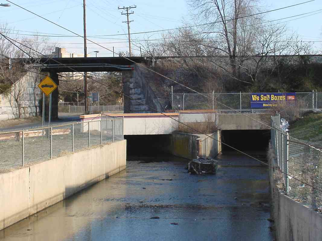
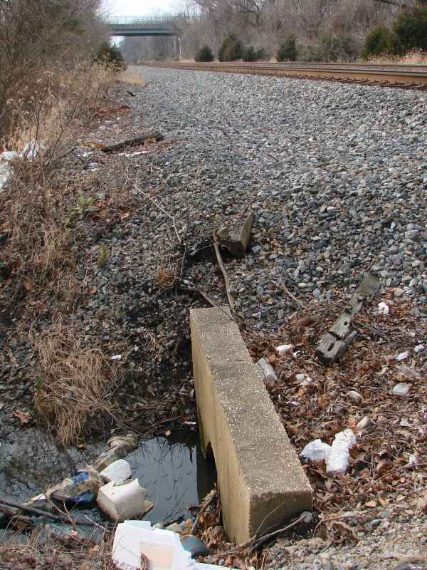
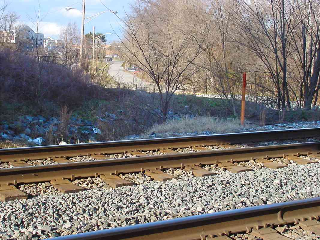
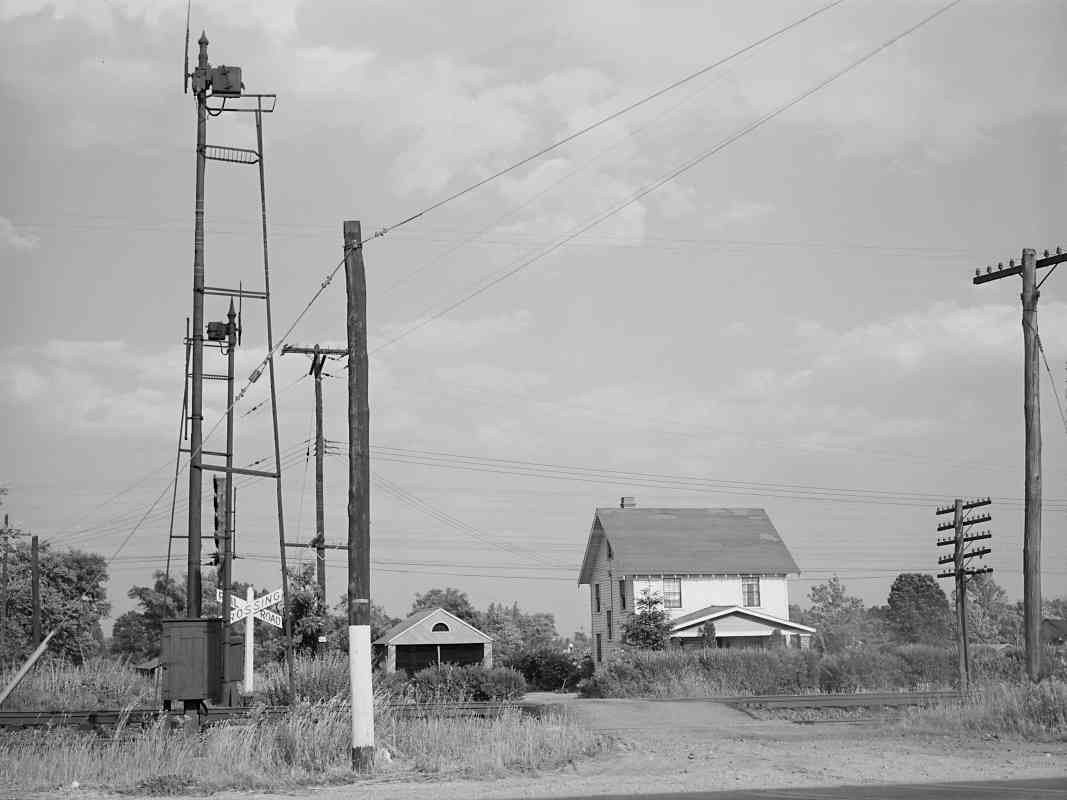
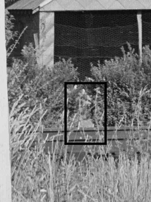
In a practice that makes me think of southern California, Prince George's County is fond of controlling its streams via concrete channels like this one.

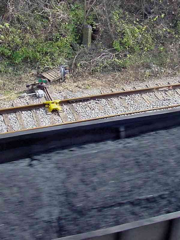
This photo looks downstream as the Crow and Bear Branches combine ahead, only to be oddly split into two, 
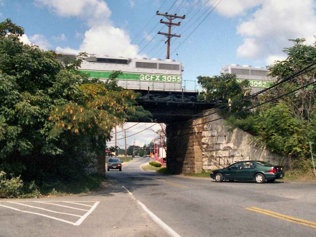
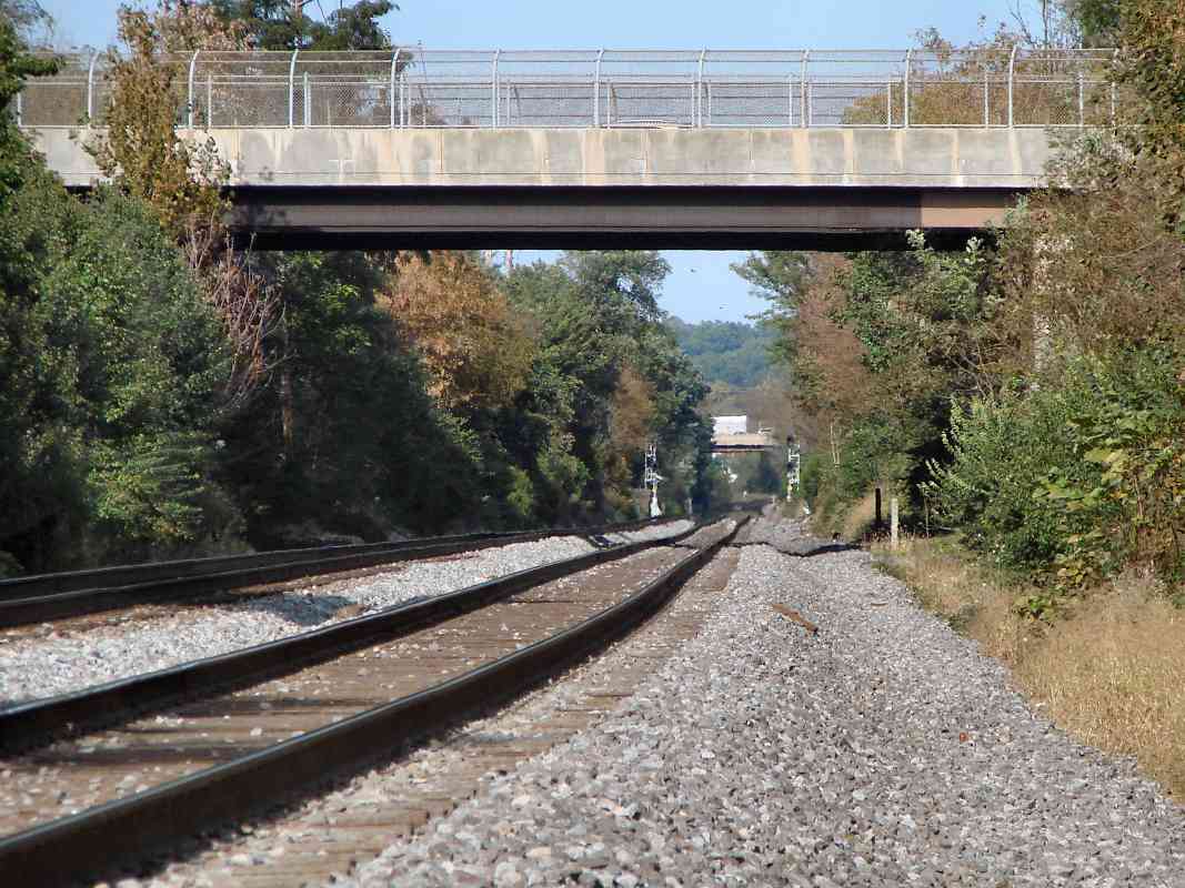
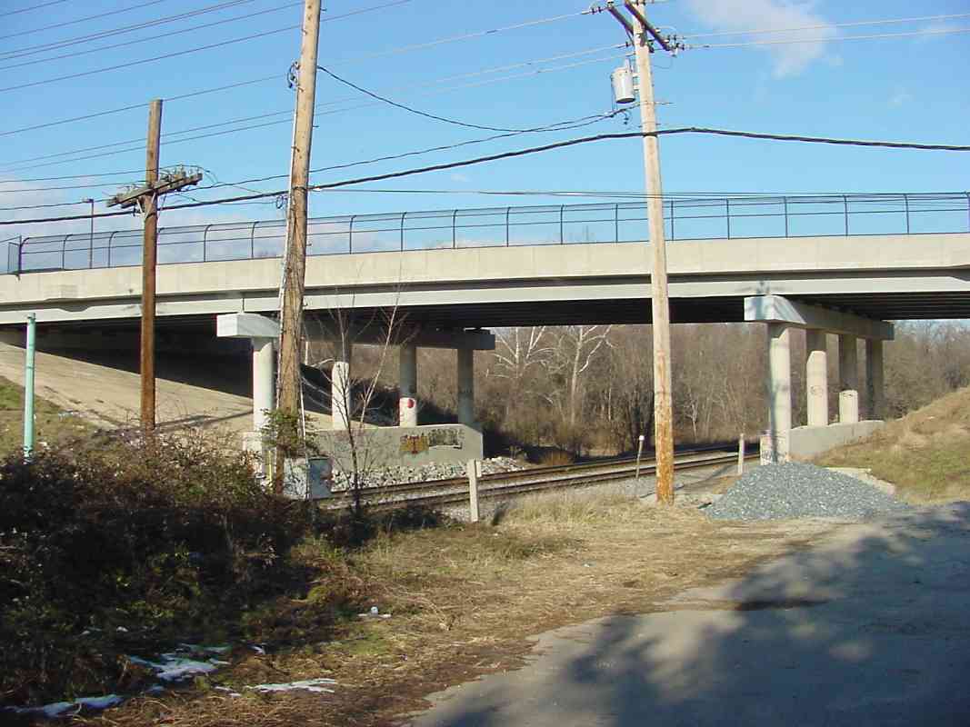
with the left side apparently flowing under the road, under the Bowie Road RR bridge. It is not obvious where these channels emerge on the other side.

I originally listed the stream in the foreground as the Bear Branch, but reader Karl Ginter kindly provided clarifications:

    "The channel emerges on the left hand side of the road beyond the bridge, runs thru the apartment complexes (splitting the two complexes) and continues on across the rerouted (new in 1958) Md 197 to the swamp and the Pax river channel.

    "A lot changed in this area between 1950 to 1980. They rebuilt this area and put in the flood control in the 1970's or early 1980's. This was just after Hurricane Agnes where the city was severely flooded, so there was a lot of flood control projects in the city then. Before then, it was bare stream beds, full of trash. The culvert is actually an improvement! This work was done in the late 1970's as my best guess. County records call this bridge structure 200000P-016102, and indicate it was built in 1972.

    "I don't believe that you're looking at the Bear Branch, but the Crows Branch which runs up Marshall Ave, and then over behind Laurel High School.

    "If I recall correctly, the Bear Branch runs underground from US 1 @ Cherry Lane to this point. It's been a long time... and it was above ground at some point back then, although I can't remember precisely when everything got covered over. To the right of the picture is the bowling alley, and what used to be the Roadway depot and the old Laurel Drive In Theater. The Bear Branch ran long the edge of what used to be the Avondale School property, along the freight depot, behind the old 7-11, and merged in at the bridge where the funky split in the culvert is."


D&F Furniture

D&F Furniture
Mile: 22.1 Date: Aug 2018
Ease: A View: NE
Area: B IC2:
Map: PG 4 H 5 Topographic Maps

bay doors During the 1970s, these gates opened to about 100 warehouse bay doors that did the hustle with boxcars. Aerial photos suggest the last dance with trains here came during the 1990s. All but a few segments of the siding's double track have been pulled up.

This remains a busy location, but now the bump and grind is done by trucks. A B&O list from 1889 puts Buxton Station at milepost 22.3.


Overpasses

Overpasses
Mile: 22.7 Date: Oct 2018
Ease: B View: N
Area: B IC2:
Map: PG 4 G 6 Topographic Maps

The run from the MD 198 (distant) to Cherry Lane (foreground) overpasses is a straight one. Into the 1980s, Cherry Lane had crossed at grade on the near side of its subsequent overpass. With a location name that has since faded, B&O's Mistletoe Springs Station had stood at this grade crossing, possibly in the southeast quadrant where what is now Bramble Lane had met the tracks. An 1878 GM Hopkins map calls it Shipley Station. Before 1964, people could follow Cherry Lane west to Laurel Sanitarium.

Links: 2015, 1950s


Marker 23

Marker 23
Mile: 23.0 Date: Dec 2003
Ease: B View: E
Area: B- IC2:
Map: PG 4 G 7 Topographic Maps

Both modern (left) and stone (right) markers grace this mile location which is sandwiched between housing developments found across US 1 from Laurel Lakes Shopping Center. Spruce Hill Drive is the nearest street.

Dating back to the 19th century, there had been a significant hotel near here, worthy of its own B&O stop. Various sources have named it as the Oak Rest Hotel, or Oak Crest Hotel, or Red Oak Inn. Oak Crest seems the most likely given the station photo below.

The hotel stood near the present-day intersection of Cypress Street and Waggaman Avenue.


Oak Crest Station
Photo courtesy Laurel Historical Society
NEW! early-Apr 2024

Oak Crest Station
Mile: 23.0 Date: 1926
Ease: B View: E
Area: B- IC2:
Map: PG 4 G 7 Topographic Maps

B&O's Oak Crest Station was found where Cypress Street now dead-ends at the railroad. The kerosene lamp hanging at upper right reveals electricity had not yet reached the station. Sparse documentation of the station suggests it may have closed within the following ten years.

Link: source photo


Concrete Culvert

Concrete Culvert
Mile: 23.4 Date: Jan 2021
Ease: B View: SW
Area: B IC2:
Map: PG 4 E 7 Topographic Maps

Not every search turns up an interesting artifact. Hopes for an undocumented 1830s stone culvert were dashed by this prosaic 20th century concrete-around-steel-pipe job. Contee Road bridges in the distance.


Contee Place

Contee Place
Mile: 23.6 Date: Jan 2003
Ease: B View: N
Area: B+ IC2:
Map: PG 4 E 8 Topographic Maps

From Elkridge south to DC, US 1 now remains on the west side of the Washington Branch tracks. However, that was not true before about 1920. Here at Contee, US 1 had crossed to the east side of the tracks (i.e. toward then behind the photographer) where it remained until crossing back at Beltsville.

The road in the distance, which is now named Contee Place, had been part of that Baltimore Washington Turnpike. It had crossed the tracks at the location of this photo. Even after US 1 was realigned, this remained a grade crossing into the 1990s.


CSX 3243

CSX 3243
Mile: 23.6 Date: Jan 2021
Ease: B+ View: NE
Area: B+ IC2:
Map: PG 4 E 8 Topographic Maps

CSX 3243 and CSX 3070 are westbound with autoracks under Contee Road.


Contee Station

Contee Station
Mile: 23.6 Date: 1952
Ease: A View: N (up)
Area: B IC2:
Map: PG 4 E 8 Topographic Maps

An 1878 GM Hopkins map indicates B&O's Contees Station is the large Contee Station, Apr 2004 structure in the northeast quadrant of the combined grade crossing of Contee Road and Old Washington Boulevard at photo center. A tree-lined entranceway extends east (right) from the crossing to the Oaklands estate that predates the railroad.

B&O's Contee Station survives in name only, applied to a business complex in the southeast quadrant of Contee Road at US 1, as seen adorned with locomotive art at left.

Link: Oaklands at LoC


Contee Road

Contee Road
Mile: 23.7 Date: Jan 2003
Ease: A- View: NE
Area: B+ IC2:
Map: PG 4 E 8 Topographic Maps

The Contee Road bridge is one of the newer overpasses to be constructed along the Washington Branch. In 1997 it eliminated the grade crossing that had been along its southwest side.

The pavement in the foreground is the crumbling remains of the Baltimore Washington Turnpike's original alignment. Parts of that alignment survive today and remain in use as Old Baltimore Pike.


Dinosaur Park

Dinosaur Park
Mile: 24.0 Date: Jan 2021
Ease: A View: W
Area: B IC2:
Map: PG 4 E 9 Topographic Maps

B&O was not the first to lay big tracks here: dinosaurs had them beat by millions of years. Some dinos grew to more than twice as long as a modern locomotive.

Less than 1000 feet from the railroad, Dinosaur Park marks where numerous fossilized dinosaur bones began to be uncovered during 19th century iron mining. Visitors had more to do at Dino Park back when the park permitted found fossils to be kept, but this remains an interesting stop simply because there are few sites like it in the region. You'll see a fenced-in dig site, interpretative signage, and basic dino info. It's so close to the trains, it's worth a visit if you are in the area to railfan.

Link: Dinosaur Park


Ordinary

Ordinary
Mile: 24.2 Date: Sep 2021
Ease: B View: SW
Area: B+ IC2:
Map: PG 4 D 9 Topographic Maps

Other than dinosaurs, there's nothing particularly interesting along the all clear mile between Contee and Muirkirk.


CSX 3318
NEW! early-Apr 2024

CSX 3318
Mile: 24.9 Date: Aug 2022
Ease: A View: NE
Area: B+ IC2:
Map: PG 4 B 10 Topographic Maps

CSX 3318 leads an intermodal train west through Muirkirk Station.


CSX 5853

CSX 5853
Mile: 24.9 Date: Jan 2003
Ease: A View: NE
Area: B+ IC2:
Map: PG 4 B 10 Topographic Maps

CSX 5853, an ex-SBD model B36-7, is killing time as it lazily rolls some work equipment westbound through Muirkirk Station on Track 1. The hopper on the end still carries a C&O reporting mark (might have been CO 918329). Even into the 2020s, the C&O mark could still be found on maintenance of way flatcars.

Link: CSX 5853 pics


Muirkirk Station

Muirkirk Station
Mile: 24.9 Date: Jan 2021
Ease: A View: SW
Area: B+ IC2:
Map: PG 4 B 10 Topographic Maps

A normally-busy Muirkirk Station parking lot was all but empty during a bleak midwinter of COVID.

An 1878 GM Hopkins map places B&O's Muirkirk Station on the left, right about where the Muirkirk sign is. MARC's version opened in 1994.

Link: 1996


From Muirkirk Road

From Muirkirk Road
Mile: 25.0 Date: Feb 2000
Ease: A View: NE
Area: B+ IC2: 155
Map: PG 4 B 10 Topographic Maps

This is the view north from the 1970-dated Muirkirk Road overpass. On the right is the Muirkirk MARC commuter station, site of the photo above, and on the left is US 1. There is a very similar photo (circa 1920) on page 155 in Impossible Challenge II that's fun to compare.

The Intercounty Connector, MD 200, now connects to US 1 on the left. About 2 miles west the ICC connects through the Konterra development, which is being promoted by none other than descendants of 19th century railroad baron Jay Gould.


Not in a Hurry

Not in a Hurry
Mile: 25.0 Date: Jan 2003
Ease: A View: SW
Area: B+ IC2: 95
Map: PG 4 B 10 Topographic Maps

Almost two minutes later, the sluggish work train has not only passed the entire station but also the siding off Track 2 for the Muirkirk Industrial Park. Eventually, the train may even reach signals at Dale, about a half mile distant. delivery

That's US 1 on the right. The siding on the left to Capitol Building Supply was still active, per the 2018 photo at left. And, yes, in the distance that's an automobile parked on the active siding.

The snowy circa 1948 photo linked below shows heavily-wired poles to be located between the railroad and what presumably is US 1. All other period photos I have seen from this area show the wires on the other side of the railroad. Consequently, I'm uncertain as to the precise location of the ~1948 photo.

Link: near here? ~1948


CEFX 3144

CEFX 3144
Mile: 25.0 Date: Dec 2003
Ease: A View: SW
Area: B+ IC2:
Map: PG 4 B 10 Topographic Maps

Here's the view from above as two leased units lug an almost mile long mixed freight; milestone 25 CEFX 3144 is in the lead wearing a "Bluebird" paint scheme. As of 2021, it is OMLX 3144.

At least one of the sidings on the left remains active as of 2022. From here the line generally follows Indian Creek south to Hyattsville.

From this vantage spot on the Muirkirk Road overpass, you can look down and to the left to find original B&O stone milepost number 25, which is at the top of the photo at left.


Muirkirk 1940
Photo courtesy Library of Congress

Muirkirk 1940
Mile: 25.0? Date: 1940
Ease: A View: SE?
Area: B+ IC2:
Map: PG 4 B 10? Topographic Maps

This Library of Congress photo is labeled "Muirkirk" so this might be Muirkirk Road's milestone 25? grade crossing shortly before it was eliminated by a single-lane bridge. Milestone 25 can be found near Muirkirk Road, and as boxed in the zoom view at left, that may be it on the other side of the tracks, partially obscured by plants.

Note that wires are crossing over the tracks; once established such crossings tend to persist. As seen at top of the 2003 photo above, wires cross the tracks adjacent to the Murikirk Road bridge. Pole

Plenty of wires ran parallel to the tracks as well, including one that carried the first telegraph message during 1844. If, a century later, you sent a telegram between Washington and New York it was likely carried by one of the wires shown at right. By 1942, the Bell System would urge customers to minimize calling Washington so as to leave these lines open for use of official war-effort communications. Also depicted are various types of glass insulators typically employed by B&O at that time.

A casualty of war later, photos suggest B&O gradually swapped out semaphore signals like the ones in the main photo for CPLs during a period centered around 1950.

Links: LoC source photo, 1844 Morse telegraph


CSX 3223

CSX 3223
Mile: 25.1 Date: Aug 2022
Ease: A View: N
Area: B IC2:
Map: PG 4 B 11 Topographic Maps

Though it lacked a marker, typically a flashing rear end device (FRED), CSX 3223 was serving as the caboose on this eastbound, my first sighting of such along the main line. The lack of a FRED was perfectly fine, per the General Code of Operating Rules (GCOR) section 5.10.1, which says, "When an engine is operating without cars or is at the rear of the train, the trailing headlight illuminated on dim may be used as a marker."

The heat distortion above the engine suggests it was actively pushing. The green sign behind it is visible in the photo below.

Link: GCOR


CSX 95188

CSX 95188
Mile: 25.2 Date: Aug 2022
Ease: A View: N
Area: B IC2:
Map: PG 4 B 11 Topographic Maps

That big green sign shows E-Z Pass tolls for Maryland 200, the Intercounty Connector, whose eastern limit is at US 1 at left. Among the few who can ride the rails without passes are CSX MoW units.


CSX 7263

CSX 7263
Mile: 25.2 Date: Aug 2022
Ease: A View: SW
Area: B IC2:
Map: PG 4 B 11 Topographic Maps

The hide of brush masks a disused siding for the Muirkirk Industrial Park.


<< Previous (east) | THIS PAGE: Laurel to Muirkirk | Next (west) >>

Or, return to main page

Copyright Notice