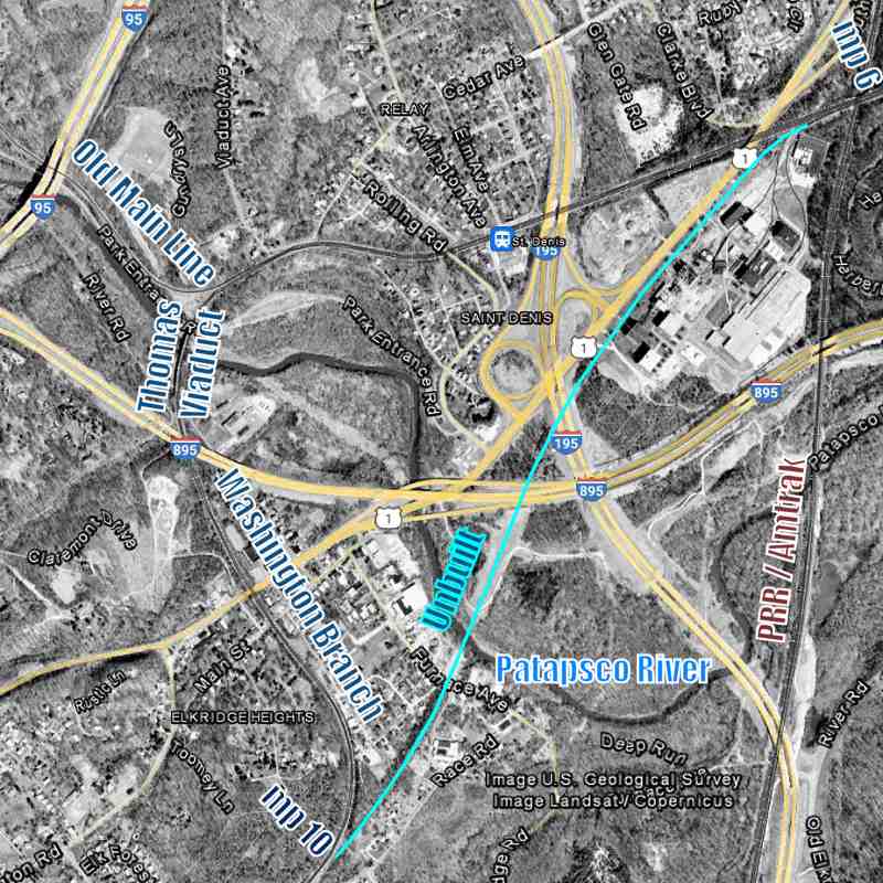
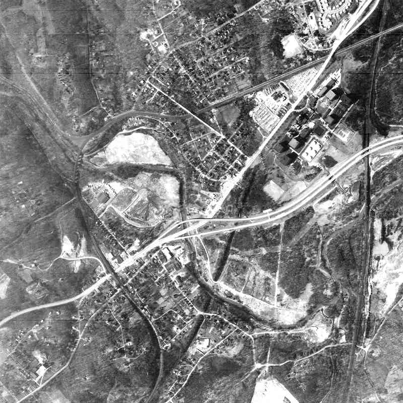
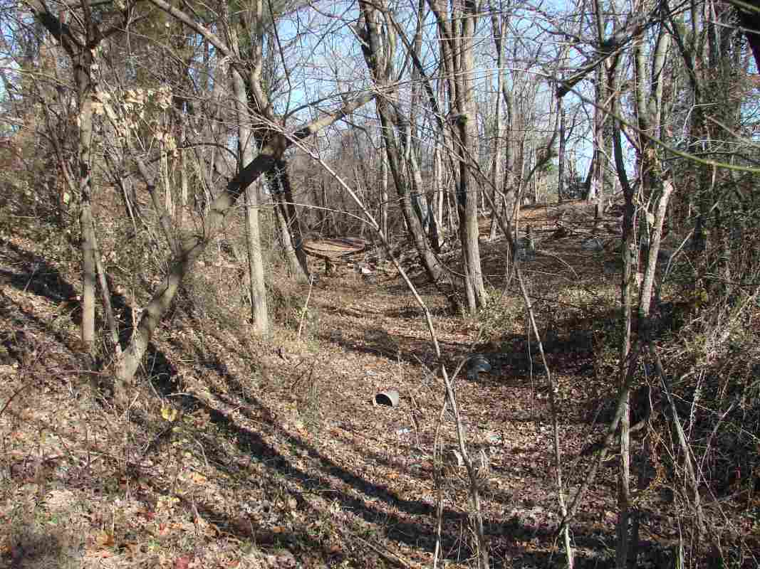
TrainWeb.org Facebook Page
B&O Washington Branch Photo Tour


B&O Washington Branch
Modern day photo tour

Accompanying each photo below are:

Click a photo to see a larger view. Please send your comments and corrections to Steve.


<< Previous (index) | THIS PAGE: Thomas Vidauct Bypass | Next (west) >>

Brief Historical Background: Thomas Viaduct Bypass

Thomas Viaduct
Photo courtesy Library of Congress

Thomas Viaduct
Mile: 9.2 (Cap) Date: 1936
Ease: B View: N
Area: B IC2:
Map: Ho 17 J 5, Ba 41 H 13 Topographic Maps

The viaduct, seen here upon its 100th birthday, is named for Philip E. Thomas, B&O's first president. The company's Viaduct Hotel stood at the north (far) end until removed in 1950.


B&O 50
Photo courtesy William Thurston Collection

B&O 50
Mile: 9.0 Date: ~1939
Ease: B View: NE
Area: B IC2:
Map: Ba 41 H 12, Ho 17 J 5 Topographic Maps

In part due to the viaduct's curvature, there has been insufficient room for trains to bend west (left) to follow the Old Main Line. Consequently, B&O built the Viaduct Hotel so passengers could change trains at the northern end. The E. Francis Baldwin creation opened in 1873 around the same time as did B&O's Metropolitan Branch west from Washington, DC. That new route west reduced the need for a hotel here.

The V of rails within those at photo bottom are the start/end of guard rails installed to reduce the risk of derailed equipment straying far from the tracks, or in the case of a bridge, toppling over its edge.

Change for: Old Main Line tour at this site
Detour: Metropolitan Branch tour at this site


walkway
Photo courtesy William Thurston Collection

Walkway
Mile: 9.1 Date: 1939
Ease: View: NE
Area: IC2:
Map: Ba 41 H 12 Topographic Maps

An illuminated walkway had graced the upstream side of the viaduct. This photo makes the track curve evident. The walkway fell into disrepair after the hotel was demolished and was closed during the 1970s.

Links: 1972, 1984


Map 1898
Image courtesy Johns Hopkins University

Map 1898
Mile: Date: 1898
Ease: View: N (up)
Area: IC2: 49
Map: Ba 41 J 12 Topographic Maps

The viaduct and hotel are found at the left edge of this map. The bypass plan (light blue arrows) shows up on maps from the late 1800s, though is unlabled on this one. At that time, B&O owned almost all the land between its tracks and the Patapsco River from Monumental at milepost 5 to St. Denis near milepost 7.

B&O chief engineer Jonathan Knight had circa 1830 also surveyed the straighter route later used by B&P, but for the Washington Branch instead logically chose the higher elevation route closer to the fall line where mills were found. Land acquistion difficulties at Elkridge (then Elk Ridge) caused Knight to push west the Washington Branch's separation from the main line.


Aerial 1993
Photo courtesy Johns Hopkins University

Aerial 1993
Mile: Date: 1993
Ease: View: N (up)
Area: IC2:
Map: Ba 41 J 13 Topographic Maps

The straighter bypass would have started west of Halethorpe, Maryland near Old Main Line milepost 6 (upper right). That is west of the bridge over the B&P/PRR/Amtrak line, near the spur into Seagram that now belongs to Guinness Brewery.

The light blue line traces the path of the bypass. It would have been about a half mile shorter than the route over the Thomas Viaduct. The bypass would have rejoined the main line near milepost 10. The distance between mileposts 6 and 10 ordinarily would be 4 miles, but in reality is closer to 2 miles because the two mileposts measure along different routes within Baltimore city.


Aerial 1964
Photo courtesy Johns Hopkins University

Aerial 1964
Mile: Date: 1964
Ease: View: N (up)
Area: IC2:
Map: Ba 41 J 13 Topographic Maps

The / diagonal line of dark foliage at center traces the unbuilt bypass in 1964. Northeast of there, it would have run between US 1 and Seagram (formerly Calvert, now Guinness).

I-895, the pair of bright lines that reach to the right edge, was extended west beyond US 1 after I-95 opened during the early 1970s.

Link: I-895 under construction 1972


CSX 8528

CSX 8528
Mile: 6.3 Date: Oct 2000
Ease: B- View: E
Area: B IC2:
Map: Ba 41 K 11 Topographic Maps

Approaching CSX 8528 nears the bridge over Amtrak that is marked by a rusty guardrail. HX Tower stands at distant left beyond old CPL signals. The spur to Seagram/Guinness peels to the right.

Links: 1987, 2006


Guinness Brewery

Guinness Brewery
Mile: 6.2 Date: Apr 2023
Ease: B+ View: W
Area: B IC2:
Map: Ba 41 K 11 Topographic Maps

The bypass would have split off beyond the switch for Seagram/Guinness, closer to the signals that have taken over for the ones in the prior photo.


Halethorpe Junction

Halethorpe Junction
Mile: 6.3 Date: Apr 2023
Ease: B+ View: SW
Area: B IC2:
Map: Ba 41 K 11 Topographic Maps

From what would probably have been named Halethorpe Junction, the bypass would have continued southwest between Guinness (left) and US 1 (right).


Aerial 1960

Aerial 1960
Mile: 6.5 Date: ~1960 (Aug 2018)
Ease: View: S
Area: IC2:
Map: Ba 41 K 11 Topographic Maps

From this angle, the tour is proceeding from bottom left to upper right. Had the bypass been built along the light blue line, access to the brewery from US 1 would have involved crossing at grade.

Note the trees along the bypass at upper right. They are not taller than the surrounding trees, but instead are growing on the mound graded by B&O to keep the bypass elevation fairly level. A cross section of that mound is visible where the Harbor Tunnel Thruway (later I-895) cut through at upper right.


I-895

I-895
Mile: 6.7 Date: Jun 2011
Ease: A- View: W
Area: B IC2:
Map: Ba 41 J 13 Topographic Maps

The bypass would have bridged where the guardrail begins beyond the sign for I-895's Exit 1, which, coincidentally, is the exit for US 1. Had the bypass been built before I-895, it may have forced I-895 to a lower elevation.

The near bridge carries I-195, creating the rare example of two interstate highways that meet but have no interchange ramps. There are fewer than ten such examples in the country, with this the only one in Maryland.

Link: List of Interstate gaps


Utilities

Utilities
Mile: 6.8 OML / 10.0 Cap Date: Nov 2002
Ease: B- View: E
Area: B IC2:
Map: Ba 41 K 13 Topographic Maps

South of I-895 the bypass would have progressed through surroundings that became part of Patapsco State Park. The area between the interstates and the Patapsco River is a limited-access, swampy lowland traversed by highways, utility lines, and crude maintenance roads.

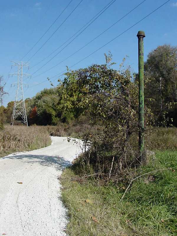
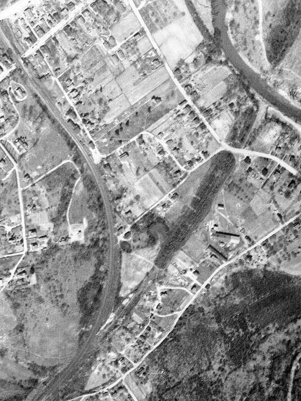
To boost the tracks over the swamp, B&O used dirt it had excavated for the Howard Street Tunnel as fill. The railroad later removed most that soil for use elsewhere which is why you now find ponds along the bypass route north of the Patapsco River.

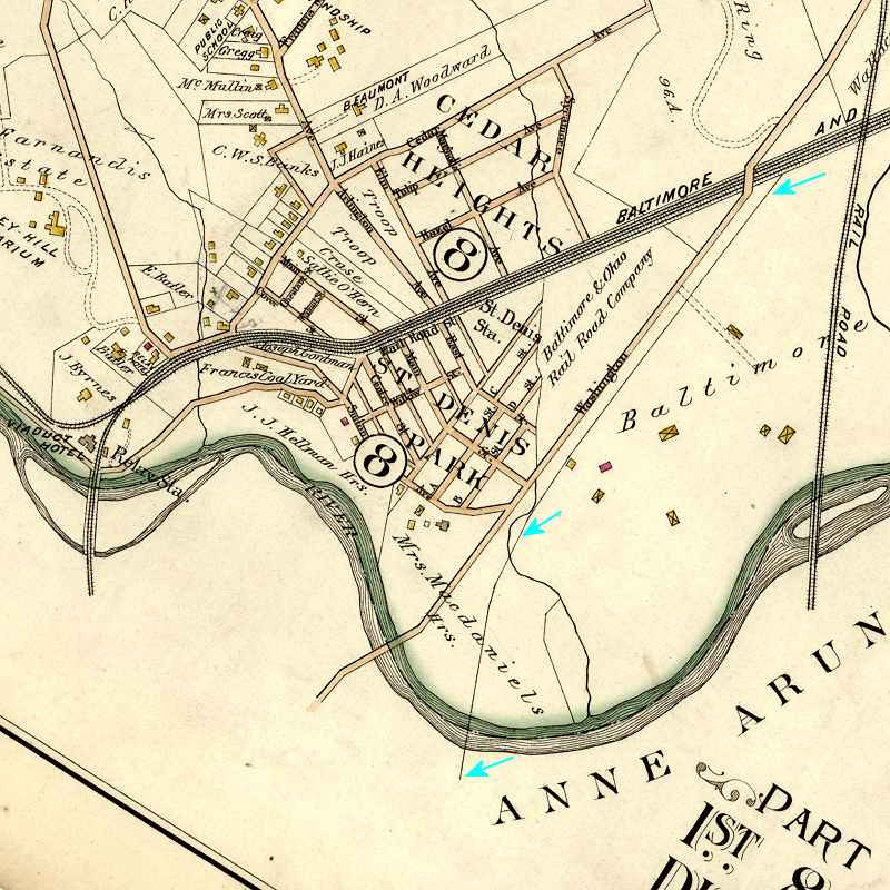
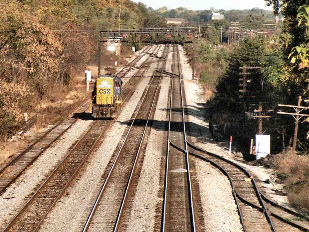
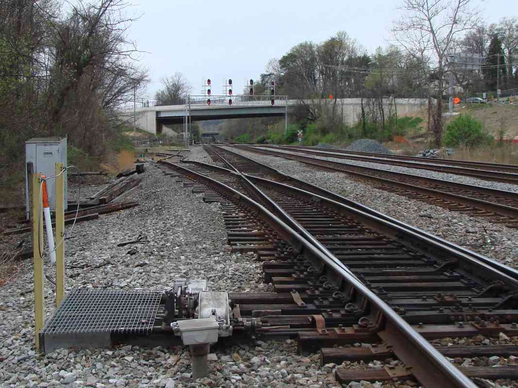
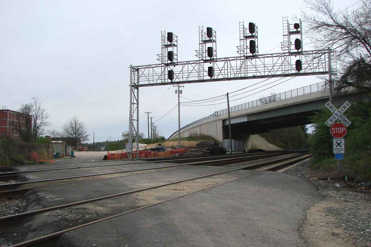
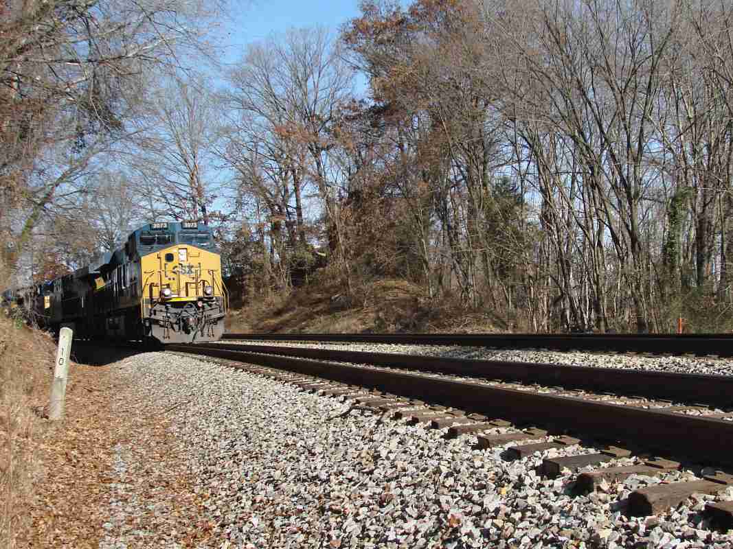
Note milepost values near the Viaduct have been distorted by modifications to the preferred route from/to Baltimore. What is marked trackside as Old Main Line milepost 7 is closer to 7.2, which is also where Washington Branch (CSX Capital Subdivision) milepost 9 can be found. When B&O opened the Camden Cutoff, roughly two miles were shaved from the distance, but Washington Branch mileposts were never updated.

Detour: Camden Cutoff tour at this site


Aerial 1938

Aerial 1938
Mile: 9.1 (center) Date: Apr 1938
Ease: View: N (up)
Area: IC2:
Map: Ho 17 K 6 Topographic Maps

The dark / diagonal represents the southern part of the bypass, starting from upper right where a bridge over the Patapsco River would have been required. The bridge would have been located about 4400 feet downstream of the Thomas Viaduct. B&O never began building that bridge, so there is nothing of it to be found along the riverbanks.

The bright line crossing the trees is Furnace Avenue. Photo resolution is insufficient to determine if a short siding had existed at the southernmost part of the bypass where there was no tree cover.


Furnace Avenue

Furnace Avenue
Mile: 9.5 Date: Dec 2017
Ease: A View: NE
Area: B IC2:
Map: Ho 17 K 6 Topographic Maps

South of the river the bypass comes ashore in Howard County adjacent some relatively new homes along Furnace Avenue. The road gets its name from the former iron forge known as Elkridge Furnace. The tracks likely would have bridged over Furnace Avenue here.


Mounded

Mounded
Mile: 9.6 Date: Dec 2017
Ease: A View: SE
Area: B IC2:
Map: Ho 17 K 6 Topographic Maps

South of Furnace Aveue, and southeast of Railroad and Paradise Aveues, the bypass mound has not been removed. Behind these homes, it towers about 20 feet higher than the surroundings, and would have needed to be almost 10 feet taller to keep the grade from here south to the Washington Branch reasonable.


Fence

Fence
Mile: 9.8 Date: Dec 2017
Ease: A View: W
Area: B IC2:
Map: Ho 17 K 6 Topographic Maps

The mound, shrouded by foliage even in late autumn, runs parallel to the fence.


Tree Gap

Tree Gap
Mile: 10.0 Date: Dec 2017
Ease: B View: NE
Area: B IC2:
Map: Ho 17 K 7 Topographic Maps

A path or perhaps a siding followed some of the mound.


Elkridge Junction

Elkridge Junction
Mile: 10.0 Date: Dec 2017
Ease: B View: NE
Area: B IC2:
Map: Ho 17 K 7 Topographic Maps

CSX 3073 follows the Washington Branch, now CSX Capital Subdivision. The bypass would have emerged from the trees on the right to make this spot Elkridge Junction.

B&O's bypass plan called for the Thomas Viaduct to be kept active to serve customers along the original alignment in Elkridge. After those customers closed shop during the 20th century, the grand Thomas Viaduct would have been at risk of disuse.

Had the bypass been constructed, the viaduct could have then been kept productive by modifying its north/east end to permit Washington Branch eastbound trains to turn west along the Old Main Line. Had there originally been room for such a connection, B&O might never have built its Metropolitan Branch.


Future

Future
Mile: 6.5 Date: ~1960 (Aug 2018)
Ease: View: S
Area: A IC2:
Map: Ba 41 K 12 Topographic Maps

delivery Aug 2018 Sadly, I suspect CSX or a successor railroad will someday turn the Thomas Viaduct into a stone age relic by bypassing it via the straighter alignment. Given how Calvert/Seagram/Guinness have avoided building on the land close to US 1, CSX may still have an easement along that strip.

With the 2018 opening of the first Guinness brewery in the USA, again deliveries are arriving there via train.

Link: Yelp reviews of Guinness Open Gate Brewery and Barrel House


From here you can continue west along the Capital Subdivision at mp 10.

<< Previous (index) | THIS PAGE: Thomas Vidauct Bypass | Next (west) >>

Or, return to main page

Copyright Notice