



.
INDUSTRIAL
& TERMINAL RAILROADS
&
RAIL-MARINE OPERATIONS OF BROOKLYN, QUEENS,
STATEN
ISLAND, BRONX &
MANHATTAN:
South Brooklyn Railway So Bk Rwy SoB SBRR Railroad SBK
 |
|
SUNSET PARK, BOROUGH PARK, GREENWOOD, KENSINGTON, PARKVILLE, GRAVESEND, CONEY ISLAND, BEDFORD and BATH BEACH; BROOKLYN
South Brooklyn Railway New York Municipal Railroad Prospect Park Coney Island Long Island Nassau Street Rapid Transit Manhattan Heights
 .
.
|
updated: |
||
|
|
||
|
update summary: |
date: | chapter: |
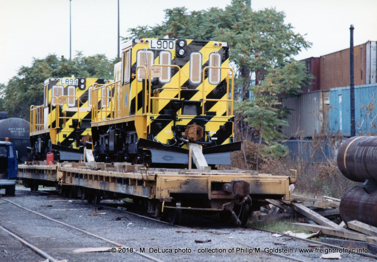
| chapter expanded | 01 October 2026 | Transition Cars, Dual Couplers & Compromise Couplers for hauling subway cars |
| major additions to location list and maps, 1950 and 1968 track maps added, chapters expanded |
28 September 2026 | |
| Dave Klepper images ca. 1930 - 1948 added | 22 September 2026 | multiple locations, multiple locomotives |
| NYTM
archives images added: street survey, 37th Street right of way, Robers
Foods, Tenth Avenue Yard; McDonald Avenue & Avenue P, Avenue S,
Avenue X, Avenue Y, Avenue Z; Culver Yard, Team Tracks & freight house |
21 September 2026 | Location List |
| 1978 - Beginning of the End of the Old Era chapter added, documents added |
17 September 2026 |
1978: The beginning of the end for the old era of operations |
| 1968 / 1976 / 1981 / 1994 South Brooklyn Railway Operations Manual added |
11 September 2026 | Crew & Train Operation & Operations Manual |
| New diagrams, redrawn maps and expanded chapter on car clearances and tags |
09 September 2026 | Car Clearances |
| October 1946 B. Hirsch photo of #9006 in use |
27 August 2026 | Locomotive & Equipment Photos |
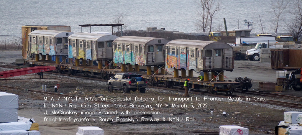
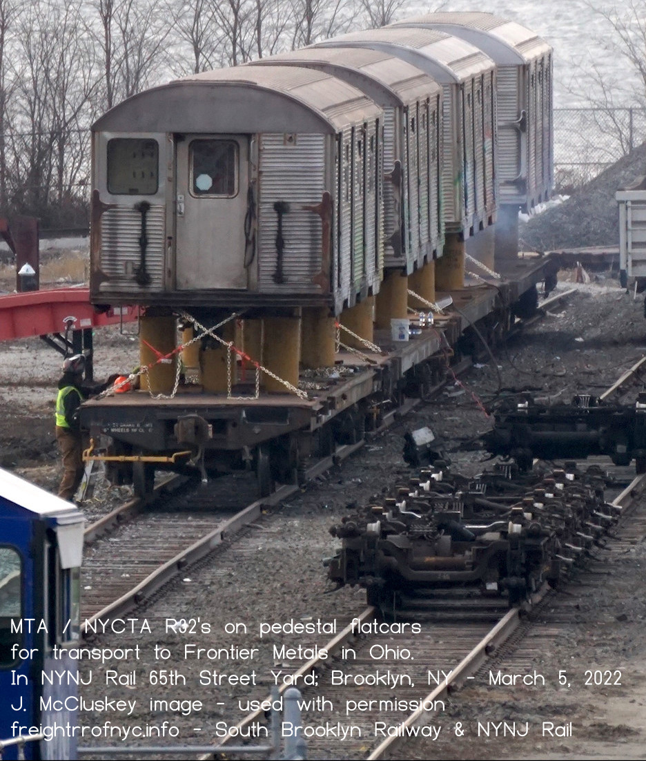
| J. McCluskey R32's on pedestal cars images added |
02 August 2026 | Update 2026: outbound R32's, R44's and R46's |
| Great oblique aerial images of First, Second & Third Avenue Yards! |
25 July 2026 | 39th Street & First / Second Avenue Yard |
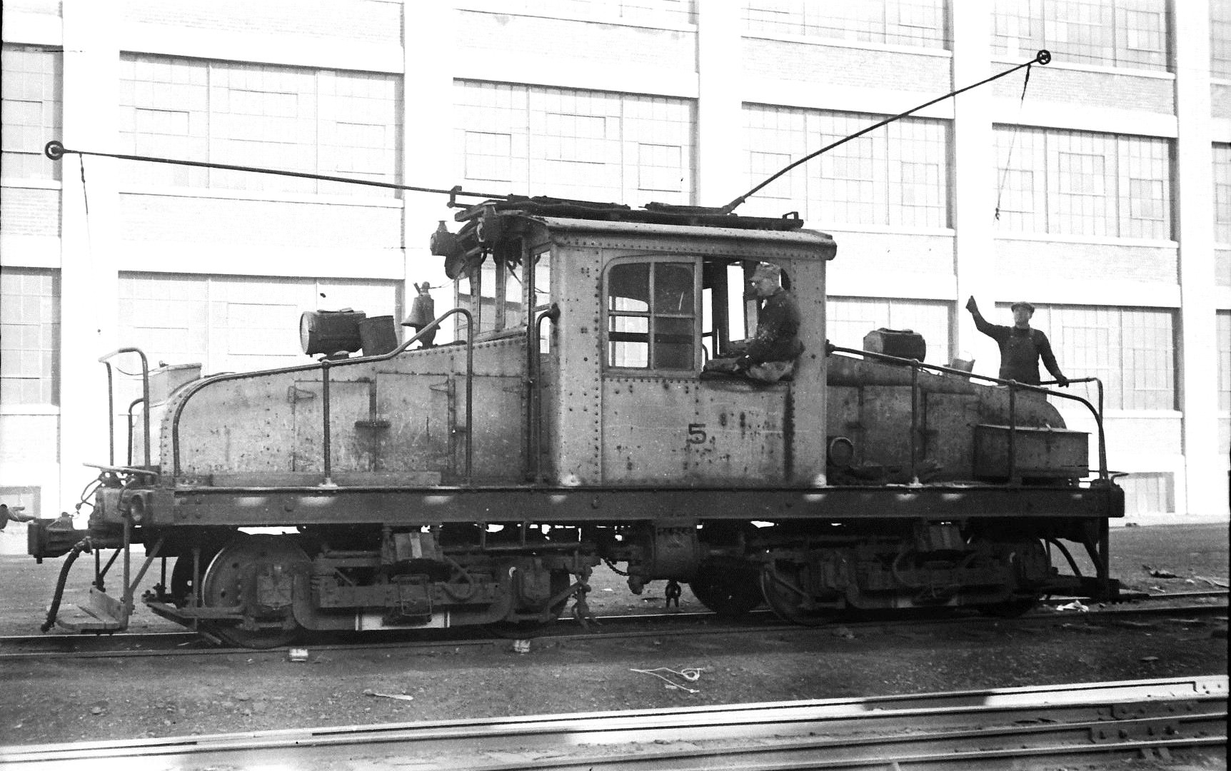
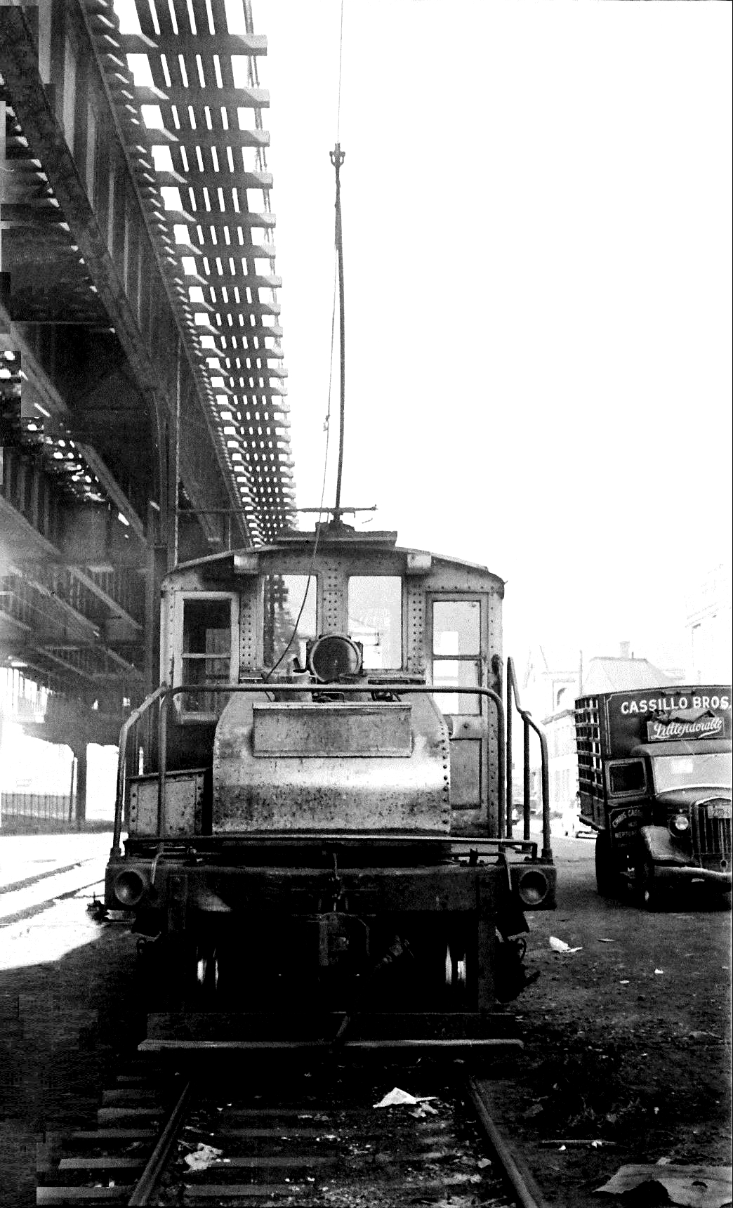
| Update 2026: new incoming equipment, Railcar Acceptance Facility, et al; #5 at 37th Street Team Track images added #8 and #9 (first) images added |
09 July 2026 | Update 2026 9) Greenwood Ind'l Sidings & 37th Street and 13th Avenue Freight Sta. Locomotive Photos |
.
..
.
.


|
As this particular webpage deals with an active
railroad and company,
or any of their subsidiaries, holding companies
or parent organizations, employees or otherwise;
This website and the information contained
within has been compiled for the use of reference only, and any inaccuracies
are purely accidental. Also, this website does not condone or authorize anyone not employed or affiliated with the above companies or agencies |
.
.
Overview
.
The South Brooklyn Railway, was but a fifth independent common carrier railroad located in Brooklyn; and it is most often overlooked as it did not have a freight terminal, float bridges or rail-marine capacity of its own, as did Bush Terminal, Brooklyn Eastern District Terminal, Jay Street Terminal and New York Dock.
Having first been operational since 1892; the South Brooklyn Railway predates that of all the other terminal railroads, except for the Brooklyn Eastern District Terminal, having started as Palmer's Docks in 1870, and was different in many ways; from the typical freight terminal operations.
For the South Brooklyn Railway or the "SBK"; almost all freight traffic inbound from or outbound to the continental United States, came in or out of the 51st Street float bridges of Bush Terminal Railroad with whom it had a freight agreement with. This agreement was transfered to later operators: New York Dock Railway (1972 - 1983) and New York Cross Harbor RR (1983 - 2006), and now New York New Jersey Rail (2006 to present). On occasion, freight came in via carfloat by the LIRR / NYNH&H 65th Street transfer bridges located at 65th Street (1916 - 1968); but most SBK freight came in and out of Bush Terminal.
The South Brooklyn Railway did have its own freight station (actually several) along its fixed route - the largest being their main station located between Second and Third Avenues, between 37th and 39th Streets.
But the history of the South Brooklyn Railway is richer than that, and it rightfully deserves it own place in the annals of Brooklyn railroading history; as prior to their fixed route operation; they delivered freight via the vast Brooklyn trolley network.
Anywhere a trolley went, a freight box motor (basically an electrically powered boxcar) could go. These freight box motors were self powered (through the trolley wire) and compact. They only needed one person to operate: a motor man; and they were so simple to operate, that some businesses were allowed to have their employees operated the car between internal sidings (with brief training of course.) Freight box motors were nimble, and a siding could be installed in most small driveways and alleys and even unimproved lots and yards.
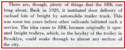
Another notable fact about the South Brooklyn Railway: they were the first to offer freight car door to customers door trucking service "door to store" via their Paramount Station at Third Avenue. All the other terminal railroads were conventional in where "you come and get it" or you hired someone to come and get it for you. The South Brooklyn Railway delivered it to you, which was a very novel approach before wide spread teamsters and motor trucking outfits became prolific.
Another fact that made the South Brooklyn Railway unique among the other four Brooklyn freight railroads: it would come to be owned by a quasi-governmental agency of the City of New York. First, is was acquired by the City of New York Board of Transportation, when the Brooklyn Manhattan Transit "BMT" was absorbed in 1940; and then the Board of Transportation's successor: the New York City Transit Authority in 1953; whereas the other four Brooklyn freight railroads remained held by private corporations.
.
.
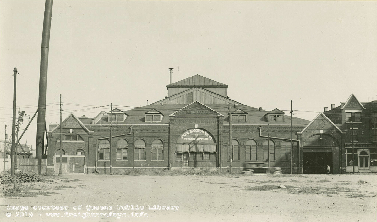
South Brooklyn Railroad & Terminal Co. Freight
House - September 7, 1938
William J. Rugen photo
Looking east: Automobile is on Second Avenue, between 38th
Street (left) and 39th Street (right).
This structure would be razed unknown year, and the location subsequently
occupied by a brick yard, Davidson Pipe, and now CostCo Wholesale club.
original image courtesy of Queens Public Library Digital Archives
via P. Matus
added 13 July 2010
.
.Private Ownership: 1887-1940
A great deal of the information for this chapter comes from "The Elevated Railways of Brooklyn and the BMT Subway" by Eric Oszustowicz, and he has graciously allowed the use of this information here. I don't believe a more comprehensive early history of the South Brooklyn Railway has been assembled, and I for one am grateful for his work and to be able to reuse it here.
| The South Brooklyn Railway or "SBK" (as
it is known within New York area railfanning groups) as organized, was unique
in the fact that it at one time; handled both freight and passenger service.
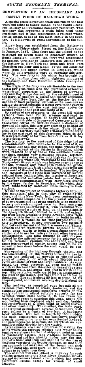
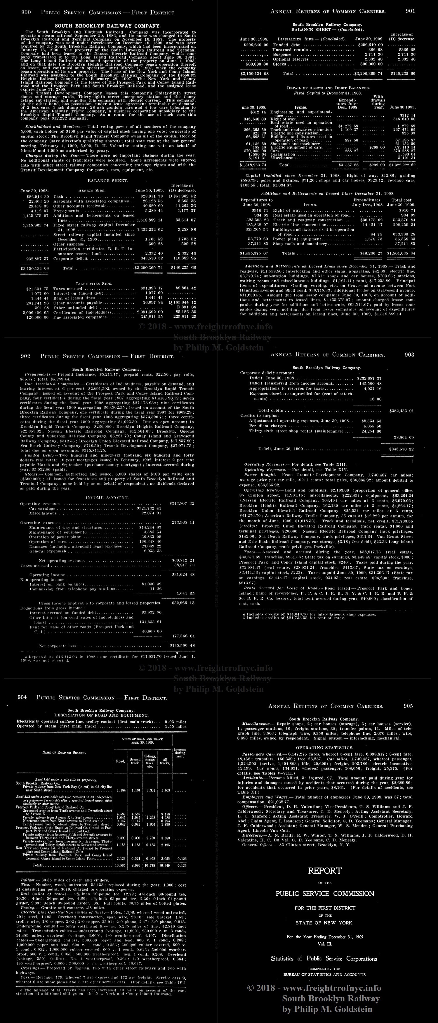
This webpage will focus itself upon the freight aspects of their operations, with intermittent mention of passenger operations where relevant. According to the New York Times article dated July 16th, 1892 (seen at right); the South Brooklyn Railroad & Terminal Company was organized in 1887, but its history really predates this by one year. On September 29, 1886, the South Brooklyn and Flatbush Railroad Company was incorporated to operate a steam railroad. Historical recordings reflect that this company never started construction and on November 10, 1887; the name was changed to South Brooklyn Railroad & Terminal Company. Even at this time, it was not an operating railroad in that it owned no locomotives or rolling stock, but had been merely organized as a property holder no longer than a few city blocks. It was organized with the intent for that property to be leased to another operating railroad that wished to the connect to the Ferry Terminal at the foot of 39th Street. Unfortunately, no other railroads showed interest, and the land remained unused.
In 1892, the South Brooklyn Railway &
Terminal Company spent a great deal of money to purchase that land and extend
the route to the new ferry terminus at the foot of 39th Street and the shoreline
of New York Harbor. A Terminal Station and freight house was built at Third
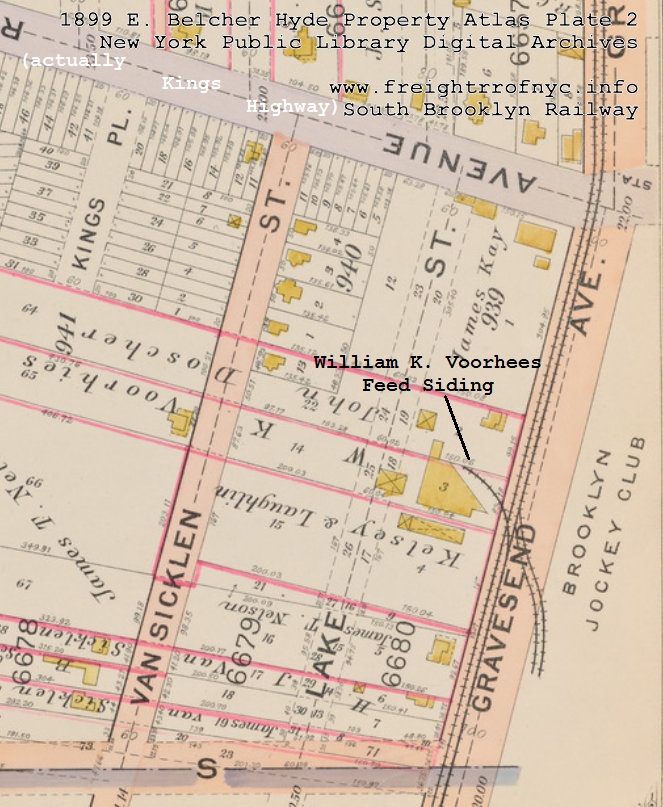
Avenue & 37th through 39th Streets. On June 30, 1897; the Nassau Electric RR turned over its lease on the South Brooklyn Railroad & Terminal to the Long Island Railroad (which had been operating passenger trains from their own ferry terminal at 65th Street via the Bay Ridge Branch and connecting with the Prospect Park & Coney Island RR at Parkville Junction), and as a result, LIRR eliminated their Bay Ridge Branch to Parkville Junction passenger train). Quick side bar here: in 1893, Andrew Culver sold his Prospect Park & Coney Island RR (which ran along Gravesend Avenue) to the Long Island Rail Road. The Long Island Rail Road operated the South Brooklyn Railway & Terminal Company using steam powered locomotives (former elevated locomotives of 0-4-2T and 0-4-4T wheel arrangements) from June 1897 and until June 1903. Unfortunately, these locomotives were not adequate for freight operations, and the line was electrified in 1899. In spite of this, the LIRR continued to run irregular steam powered "Racetrack Specials" to the Brooklyn Jockey Club / Gravesend Racetrack located between Kings Highway and Avenue U, between McDonald Avenue and Ocean Parkway., with passenger railroad service via sidings on McDonald Avenue. . The Aught's . On December 19, 1899, the South Brooklyn Railroad & Terminal Company would go into foreclosure, but would continue operation by the Long Island RR., and on January 13, 1900, the SBRR&T Co was reorganized as the South Brooklyn Railway by the new owners, Brooklyn Rapid Transit. Even under this new Brooklyn Rapid Transit ownership, the Long Island Rail Road would continue to operate the trains.
In 1900, Irving T. Bush of the "Independent Stores" (soon
to become Bush Terminal) advised the Brooklyn Heights Railroad (a BRT
subsidiary) that their trolley cars should handle freight as well, and
by installing private sidings for the service of such. Following this,
the BHRR formed a freight department. In June 1903 (some references cite 1905), the Long Island Rail Road ceased operating the trains on the South Brooklyn Railway and Brooklyn Rapid Transit would assume passenger service. It should be recognized that in these early days of operation, being a subsidiary of the Brooklyn Rapid Transit; the freight was operating over several dozen of the already established streetcar routes, that by this time had been absorbed under the parentage of Brooklyn Rapid Transit. Walter S. Wells, former manager of South Brooklyn Railway freight traffic recalled the method of interchange between South Brooklyn Railway and Bush. In 1905, South Brooklyn Railway 's freight was sorted by Bush Terminal into trolley hauled freight and steam hauled freight, and both of these were placed in the Bush Terminal Yard at Second Avenue between 40th and 41st Street. South Brooklyn Railway trolley motors would venture of to the Bush Terminal Yard and carload freight would be transferred directly from freight car to trolley motor, and Less Than Car Load (LCL) freight would be transferred from the Bush Terminal freight house to other trolley motors. Carloads like tank cars, gondolas of stone, etc; were also brought in by Bush Terminal locomotives, but these went to the 38th Street and Second Avenue Yard, where South Brooklyn Railway locomotives would take the car throughout their route. Under the contract that existed with the Brooklyn Height Railroad (the parent organization of the South Brooklyn Railway) at this time, the Bush Terminal RR supplied the interchange yard, provided the freight car transfers, and the office space for the Brooklyn Heights freight representative. As such, some of the very early images show the equipment marked as BRT Freight Department. With the development and growth of Bush Terminal, and increasing amount of freight traffic destined for the South Brooklyn Railway, the yard at 40th ans 41 st Streets was growing inadequate. Bush Terminal constructed a new freight yard located between 47th and 48th Streets and First and Second Avenues,where a freight agent of the South Brooklyn Railway had an office. |
 |
During this period, the South Brooklyn Railway ran on Bush Terminal tracks from Second Avenue, down 41st Street, and along First Avenue to 48th Street. When the BRT second Avenue tracks were completed, South Brooklyn Railway would use the Second Avenue routing exclusively.
When Brooklyn Rapid Transit assumed control of the South Brooklyn Railway in 1903 (nineteen aught three), it was able to operate passenger service, but not the freight service aspect; therefore the Long Island Rail Road handled the freight service. But, it soon became apparent that this joint operation was both cumbersome and of added expense and likewise not practical from a profitability standpoint. Therefore, on April 10, 1905, the South Brooklyn Railroad began hauling its own freight on the Culver Line.
At this time, any freight cars from Class 1 trunk line railroads coming through the Long Island Rail Road for the South Brooklyn Railway would be interchanged at Parkville Interchange at Gravesend Avenue (to become McDonald Avenue in 1931) and Avenue I . However, due to the unfavorable division of the freight tariffs, the management of South Brooklyn Railway now directed most of their freight traffic through Bush Terminal; because at this time, Bush Terminal was able to directly receive freight cars from out of state trunk lines via their float bridges, whereas the Long Island Rail Road did not have a car float facility in Brooklyn at this early stage.
Long Island Rail Road hauled freight would have to either become generated on the LIRR network (Brooklyn, Queens, Nassau & Suffolk Counties, or arrive via their Long Island City freight terminal which did have float bridges); where they would then have to haul the freight cars east to Fresh Pond Yard in Glendale, Queens and then onto the Bay Ridge Branch to head south to Parkville Interchange or 63rd Street and First Avenue, which obviously added extra handling and mileage.
This choice in reducing traffic to and from the Long Island Rail Road, appears to have contributed to the dispute of rental charges of the Coney Island freight house; where the Long Island Rail Road was the owner and the South Brooklyn Railway the lessee. As the South Brooklyn Railway needed the freight house for Less Than Carload freight delivery in the Coney Island area, but under the original arrangement of $1000 per year rental, if the profits from the South Brooklyn Railway freight service to/from this location did not exceed the $1,000 per annum rental fee; the South Brooklyn Railway was operating this location at a loss. Therefore it wanted more favorable terms. Also, the freight house was old and dilapidated.
It is obvious that if prevailing freight charges were right around the same amount or more than, the rent, there would be no issue. But apparently the South Brooklyn Railway was operating this location on that very fine line between profit or deficit. Ultimately, the parties involved agreed to a temporary month-to-month lease of $83.33 per month (which comes to $999.96 for the year.)
Following amendments made to the regulations of the Interstate Commerce Commission Act of 1907, this resulted in a reorganization of freight haulage by the South Brooklyn Railway and other subsidiaries of Brooklyn Rapid Transit. The conclusion was that all freight handling was now assigned solely to the South Brooklyn Railway.
As such, the South Brooklyn Railway entered into multiple trackage agreements throughout the following year with the Brooklyn, Queens County and Suburban RR; the Brooklyn Union Elevated; the Sea Beach Railway; and Nassau Electric Railroad among several others subsidiaries of BRT.
An agreement with the Long Island Rail Road was signed to allow the LIRR to haul special trains to the Brooklyn Jockey Club located at Avenue U and Gravesend Avenue (this agreement augmented a prior agreement between the LIRR and the Brooklyn Heights Railroad for the same service and considerations.)
In 1908, the South Brooklyn Railway entered into agreement with many of the BRT's subsidiary operating companies to provide express and US mail delivery operations over their trolley lines.
.
The Teens
.
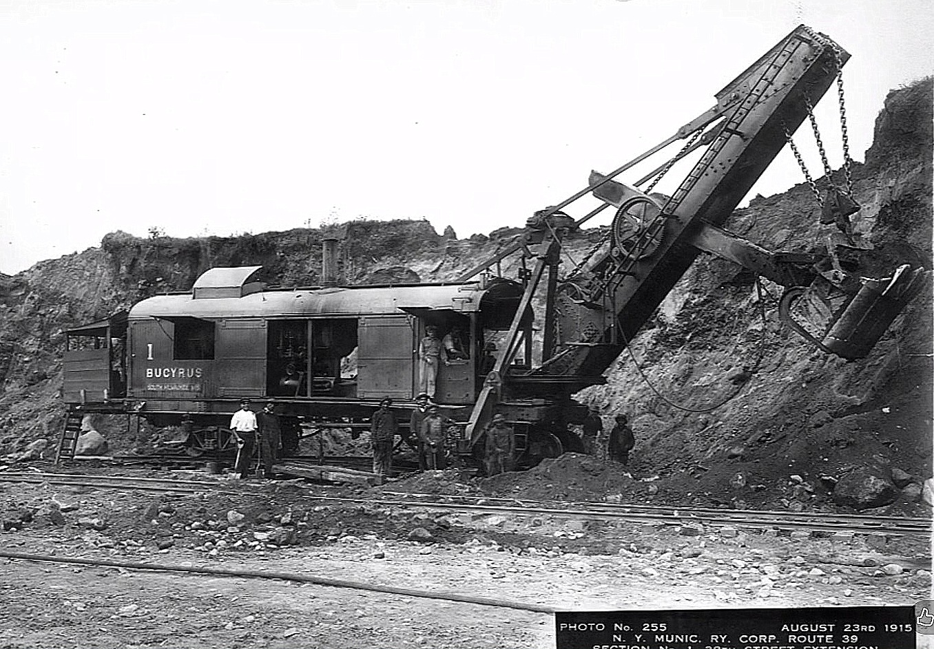
A significant date in South Brooklyn Railway history took place on March 13, 1913 and after the "Dual Contracts" were signed. The South Brooklyn Railway's subgrade cut along 38th Street between Fourth and Tenth Avenues became instrumental to the construction of the West End Line and the Fourth Avenue Subway. Therefore the South Brooklyn Railway conveyed to the City of New York, a permanent right of way and in return, the City leased trackage rights to the South Brooklyn Railway. And when construction began, the South Brooklyn Railway hauled the excavated materials from the tunnel boring and the Sea Beach line's excavation; and not an "outside" contractor.
With this increase in haulage by 1914, the South Brooklyn Railway purchased 26 air dump cars and (numbered 3052-3059 and 3062-3079) but most importantly, it ordered two more locomotives from General Electric: #6 (first) and #7 (first), which were 55 tons, 800 horsepower, trolley wire and third rail capable.
| Please note: these are NOT the same #6 and #7 locomotives that we are familiar with today, that are / were in the Museum fleet. The two locomotives purchased on this date in 1914 were the first pair of locomotives to carry road numbers 6 and 7. The South Brooklyn Railway sold these two locomotives when the subway excavations were completed: #6 was sold to West Side Railway in Charleroi, PA in December 1917; and #7 was sold October 1917 to Interurban Railway, Iowa #806. When rail traffic increased again following World War I, the current #6 (second) and #7 (second) were purchased in 1921. |
When the Fourth Avenue Subway was under construction, a temporary trolley wire was installed to allow the South Brooklyn Railway to bring trolley flats and trolley gondolas to the site, then once loaded, remove them and bring them to dump sites in vacant lots around 86th Street. Steam shovels were filling one trolley gondola every three minutes.
Also necessary to the construction of the subway and the elevateds, steel girders and support columns of every size and length were manufactured out of Brooklyn, car floated from New Jersey to Brooklyn by the Bush Terminal Railroad, then interchanged with South Brooklyn Railway. The South Brooklyn Railway then brought them directly to the site of construction; where hoists would unload the girders direct from the railroad car. Rails and ties and other materials necessary to the construction, also arrived the same method.
In 1914, with the influx of new subway cars for the New York Municipal Railroad (another subsidiary of Brooklyn Rapid Transit) they needed storage space. So, the NYMRR leased the South Brooklyn Railway's 39th Street Shops (the freight house) as well as their 38th Street Yard for a term of five years. This led to NYMRR to build a huge yard west of Second Avenue on South Brooklyn Railway owned property for the storage of rails, ties, and ballast; but the South Brooklyn Railway retained trackage rights in this yard.
Because the Bush Terminal Railroad was the primary source of incoming freight cars, (and because Irving T. Bush was a very astute freight terminal operator and businessman) the South Brooklyn Railway entered into an agreement for a track connection from this yard, to the Bush Terminal tracks on First Avenue. Under this agreement, South Brooklyn Railway paid Bush Terminal RR $1.90 per car and locomotive (no "light" locomotives - those not hauling cars) between the interchange track at 41st Street and the Long Island RR at 63rd Street.
In 1914, 20 more dump cars were purchased (3080-3099) as well as four rail cars: 9978, 9979, 9987 and 9988 built by the Transit Development Co., yet another BRT subsidiary. At this time, #9980 was converted to an ash dump car. Ironically, this car would be the only one to survive through to the modern era of operations and saw use right up through the 1960's.
A Whiting crane was installed on #9004 and a new under frame installed on #9133. (dupe on equipment page.)
In compliance with a Public Service Commission order, geared hand brakes were installed on 37 South Brooklyn Railway cars; and the 3000 series equipment was renumbered into the 9000 series to fit in with the existing numbering scheme on BRT equipment.
All was going well for the South Brooklyn Railway, freight traffic was booming, the subways and elevateds getting built. But the first half of 1917 changed its prospects.
From a Brooklyn Rapid Transit Annual Report, June 30, 1917, (via Eric's book):
During the latter part of the fiscal year the US Government requisitioned for war purposes, the valuable waterfront property on New York Bay at 63rd Street and the connecting rights-of-way and tracks between 2nd and 4th Avenues, all belonging to New York Consolidated Railroad Company.
The taking of this property not only deprives the system of valuable waterfront and storage yard facilities (now almost impossible to get) but takes away direct railroad connection with the waterfront, upon which not only do the companies of our system depend on getting their materials but upon which a large part of Brooklyn is more or less dependent for freight shipments. No adequate substitution can be provided therefore.
We offered the government the joint use of this property during the period of the war but this would not suit the Government's purpose and permanent possession thereof has been taken.
It is to be presumed that ample compensation will be paid. In the meantime the Government has undertaken on lands elsewhere provided by the system to furnish some substitute facilities for storage purposes."
This was a major set back for the South Brooklyn Railway; as well as motor trucks were making inroads (pun intended) for freight delivery and started whittling into the South Brooklyn Railway's business.
Back in 2009, I acquired a copy of the "Brooklyn Rapid Transit - Track Mileage Book" originally dated January 1, 1910; which reflects that the South Brooklyn Railway (freight) would have operated over the following passenger "routes".
Reference to these several different "routes" led me to understand these routes were originally operated by several different "owners", which was quite confusing.
While I hope the following compilation is accurate there is a small possibility of error. Please note the locations given are passenger stops / stations. Corrections are welcome.
| owner | route | from | to | distance from 39th Street Ferry Terminal |
| Property of the City of NY | . | Ferry Terminal | connection of South Brooklyn Railway | 0.094 |
| South Brooklyn Railway Co. | (Private Right of Way) | connection of South Brooklyn Railway | Second Ave & 39th Street | 0.264 |
| Brooklyn City RR | 39th St Ferry - Coney Island | Second Avenue & 39th Street | Third Avenue & 39th Street | 0.302 |
| Brooklyn City RR | 39th St Ferry - Coney Island | Third Avenue & 39th Street | Fifth Avenue & 39th Street | 0.746 |
| Nassau City Electric RR | Culver | Fifth Avenue & 39th Street | old city line | 1.184 |
| Sea Beach Railway Co. | Culver | old city line | Ninth Ave connection to Culver Line | 1.370 |
| Prospect Park & Coney Island Railroad | Culver | Ninth Avenue connection to Culver Line | Fort Hamilton Parkway | 1.640 |
| " " " " " " " " " " | " " | Fort Hamilton Parkway | Thirteenth Avenue | 1.908 |
| " " " " " " " " " " | " " | Thirteenth Avenue | Kensington Junction | 2.472 |
| " " " " " " " " " " | " " | Kensington Junction | Eighteenth Avenue | 2.840 |
| " " " " " " " " " " | " " | Eighteenth Avenue | Parkville | 3.085 |
| " " " " " " " " " " | " " | Parkville | Twenty-Second Ave | 3.517 |
| " " " " " " " " " " | " " | Twenty-Second Avenue | Woodlawn (Avenue N) | 4.005 |
| " " " " " " " " " " | " " | Woodlawn (Avenue N) | Avenue P | 4.357 |
| " " " " " " " " " " | " " | Avenue P | Kings Highway | 4.683 |
| " " " " " " " " " " | " " | Kings Highway | Gravesend Race Track* | 4.965 |
| " " " " " " " " " " | " " | Gravesend Race Track* | Gravesend (Avenue U?) | 5.308 |
| " " " " " " " " " " | " " | Gravesend | Avenue W | 5.490 |
| " " " " " " " " " " | " " | Avenue W | Van Sicklen | 6.295 |
| " " " " " " " " " " | " " | Van Sicklen | Culver Terminal | 6.723 |
* = also known as the Brooklyn Jockey Club
.The not so roaring Twenties
.
By 1920, a lot of the subway projects were completed or nearing completion in Brooklyn, and this too was a down turn for the South Brooklyn Railway.
The Culver Line, which had been constructed over the South Brooklyn Railway's right-of-way on 37th Street, descended into the the tunnel at the east end of the Ninth Avenue Station, thereby blocking the main line of the South Brooklyn Railway, forcing it to realign the main line adjacent to the Culver tracks . This required the purchase of land, yet another expense.
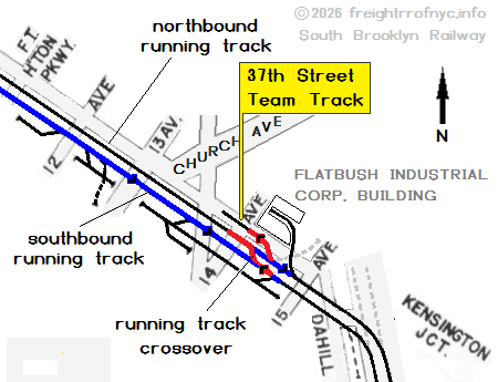
Despite this fall off in business, the South Brooklyn Railway carloading was down, but not out; and was still profitable according to their September - October 1919 report; which showed an average of 60-75 carloads over the line daily. In 1920, the Flatbush Industrial Building was built, and the siding connecting to the South Brooklyn Railway tracks on their 37th Street right-of-way.
In 1921, an agreement was entered with the New York Consolidated RR<permitted the running of freight through the Fourth Avenue, Sea Beach and West End Lines and in reciprocation, the NYCRR could use South Brooklyn Railway locomotives when required.
But it was beginning at this times, that freight sidings along the trolley lines were decreasing with the industries opting to build or relocate on the main freight line.
In 1922, the Prospect Park & Coney Island RR< the New York and Coney Island RR and the Prospect Park and South Brooklyn RR were merged into the South Brooklyn Railway, when South Brooklyn Railway purchased the majority of the stock for those companies.
The players may change but the game remains the same.
.
1923 saw Brooklyn Rapid Transit file for bankruptcy; and it would be reorganized into the Brooklyn Manhattan Transit Corporation (BMT), which in effect became parent organization to the South Brooklyn Railway, as the BRT had been; and all Interstate Commerce Commission regulations remained as before.
In 1926 the New York Rapid Transit Corp. (a subsidiary of Brooklyn Manhattan Transit) wanted the South Brooklyn Railway to cease operating in the Fourth Avenue Subway and on the Sea Beach Line. The South Brooklyn Railway only had four customers remaining on the Sea Beach: J. M. Huber, at Sixth Avenue; Rubel Coal & Ice and Granitface at Seventeenth Avenue; and the Brooklyn Boro Gas Company adjacent to the Coney Island Yard (with their well recognized and remembered "Gas Heats Best" gas holder.) The NYRT was not successful in this endeavor; however, but the die was cast as the trolley (and now rapid transit line) freight delivery network was coming to and end.
1927 saw the South Brooklyn Railway construct a new freight house at Sheepshead Bay Road (where!?!!)
On September 27, 1929, a twist of fate occurred that was beneficial to the South Brooklyn Railway: New York Rapid Transit (which had attempted to evict the South Brooklyn Railway from operating on their Sea Beach and Fourth Avenue subway lines three years prior); now needed space to lease for a bus storage yard for their Brooklyn Bus Corp. (yet another BMT subsidiary.) The South Brooklyn Railway property at 38th Street Yard (between Second and Third Avenues) was the site chosen. Two miles of yard track and sidings were removed and the site macadamized for vehicles. This location would be used for buses until 1952; when the land was once again repurposed for industry, and in 1959 Davidson Pipe would take up residence here.)
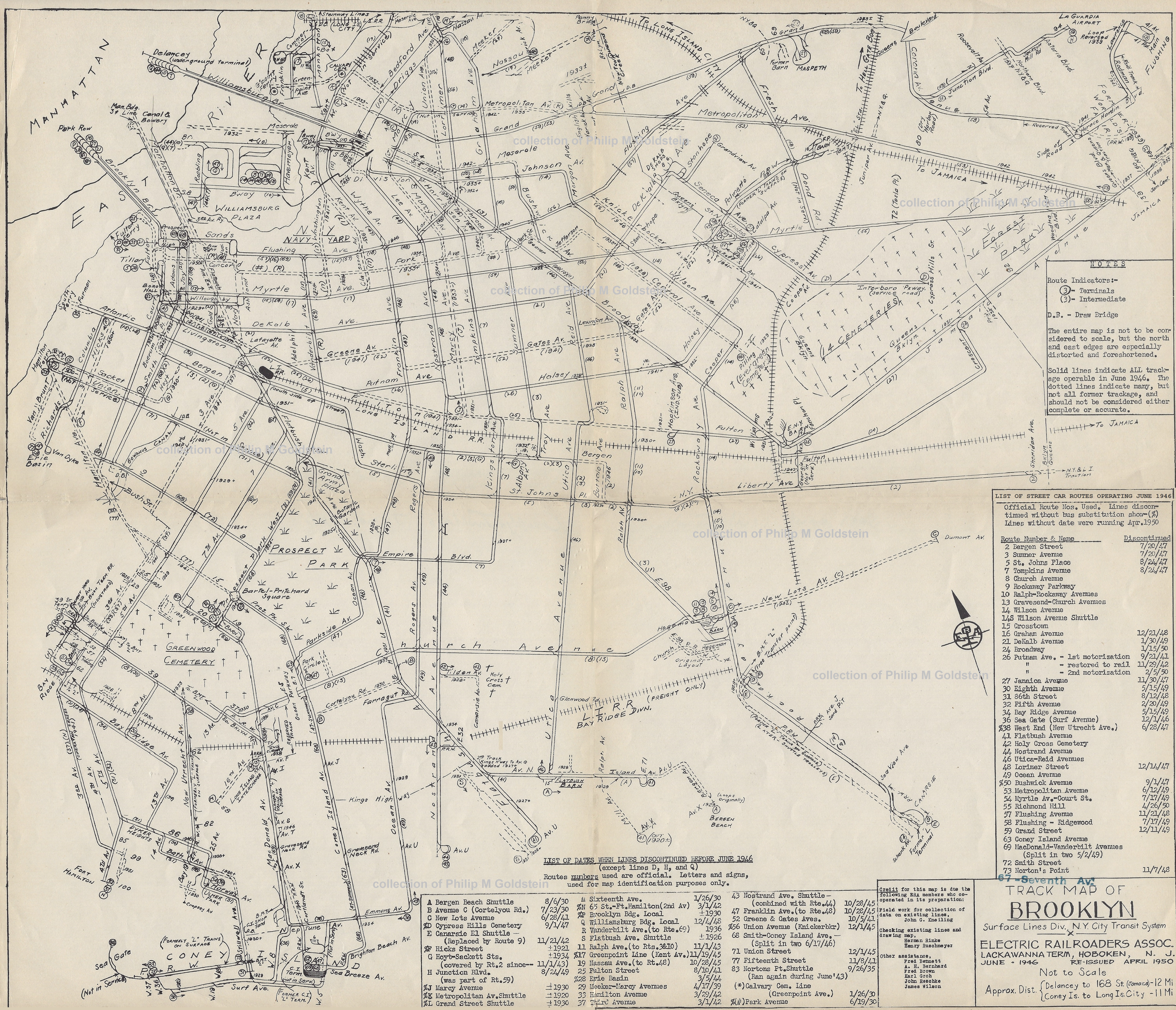
To give the reader a better (and visual) understanding of the vast network the trolley network that existed in Brooklyn (like in other boroughs); this map by the Electric Railroaders Association should help. The BHRR freight department and the South Brooklyn Railway could send a freight box motor or trolley flat car over all of the tracks shown (as long as it was in service!)
|
City of New York Ownership - 1940 . All the private transit operators were now operating in the red - by a little or a lot; it made no difference. The City of New York had formed their own transit entity in 1932 - "the IND". The IND was intended to be fully owned and operated by the municipal government, in contrast to the privately operated or jointly funded Interborough Rapid Transit Company "the IRT" and Brooklyn–Manhattan Transit Corporation "the BMT" companies. And so, in May 1940, the South Brooklyn Railway became part of the City of New York Board of Transportation "BoT", which consolidated( also known as "the First Unification") all the individual privately owned transit companies (the IRT & BMT) and street car lines in the New York City proper under one municipal government organization: the Board of Transportation. In practice, these three operations remained somewhat independent of one another, whether due to equipment size, signaling, et al. But, the BoT entered into contract with the South Brooklyn Railway to provide labor, supplies and ultimately, equipment for freight delivery. Railroad freight traffic, which had been tapering off with the advent and proliferation of motor trucks, figuratively exploded with the entrance of the United States in World War II. Wartime restrictions and rationing of gasoline and other petroleum products curtailed motor truck usage and the South Brooklyn Railway (which was electric powered) now found itself with plenty business. In 1946, World War II was over and the South Brooklyn Railway would purchase two surplussed ex-U.S. Army Whitcomb 65 ton Diesel-electric locomotives, #8 & #9 (first). In June 1953, the New York City Board of Transportation was reorganized and renamed the New York City Transit Authority (NYCTA). The purpose of this was to remove transit policy, and especially the setting of the transit fare, from City politics. On October 31, 1956; passenger service by streetcar along McDonald Avenue was discontinued, leaving that route to the exclusive use of the South Brooklyn Railway for freight movements (although it would have to share that thoroughfare with automobiles.) In 1960, two more Diesel electric locomotives were purchased (#12 & 13) and a sad milestone in South Brooklyn Railway history occurred in December 27, 1961, when the overhead trolley wire was de-energized, effectively ending electric locomotive operations along the South Brooklyn Railway. |
 |
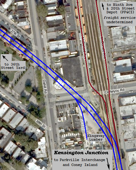
The switches at Kensington Junction were locked into the 37th Street position (some references state they were removed altogether) thereby isolating the branch up to the Ninth Avenue & 20th Street Depot & Car barn, which was no longer needed with the cessation of passenger streetcar operations.
Freight would continue to be transported along the South Brooklyn Railway to several merchants, but like the rest of the terminal railroads located in Brooklyn; freight traffic was dwindling due to the ever increasing use of the motor truck.
In 1978 the street trackage east of Fort Hamilton Parkway, as well as that upon McDonald Avenue trackage was embargoed (placed out of service, but not sold or abandoned.) Abandonment would take place two years later. By 1980, there were only two non-Transit Authority customers: Davidson Pipe at Third Avenue, and Roberts Foods at 37th Street and Tenth Avenue.
Portions of the McDonald Avenue line were paved over around 1991. The 37th Street right of way was parceled out and rezoned residential - with many two or three storey townhouses constructed upon it.
In 1994, the last non-NYCTA customer, Davidson Pipe closed their yard bound by Second and Third Avenues and 39th and 37th Streets. The South Brooklyn Railway would continue to partake somewhat of the Bush Terminal Interchange to intermittently utilize the Long Island Rail Road's Bay Ridge Division.
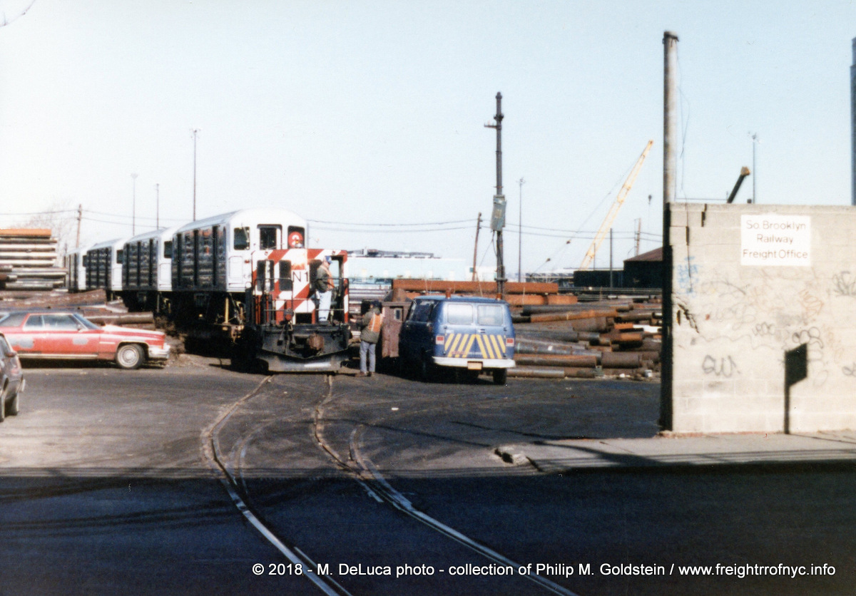
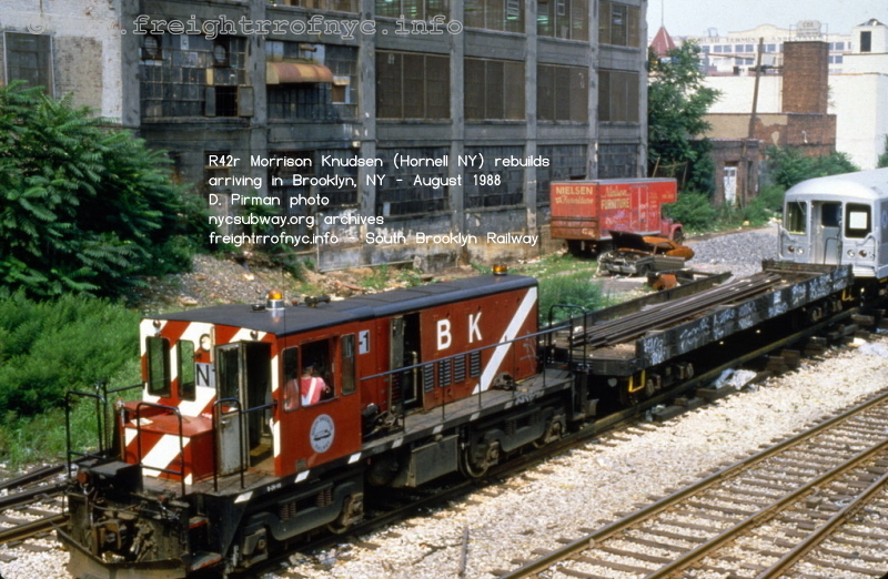
During this period was the South Brooklyn Railway's slowest. It had not hauled new or rebuilt inbound subway cars since 1992 with the delivery of rebuilt R44's; or outbound obsolete subway cars for scrapping or rebuilding since circa 2004.
It did however place obsolete subway cars in the Second Avenue and 39th Street Yard for asbestos removal as late as 2007. But these cars were not interchanged with New York Cross Harbor / New York New Jersey Rail or shuttled to & from the float bridge at Bush Terminal or LIRR Bay Ridge Branch.
Its resurgence, if it can be called that; began in May and throughout June 2012, where the South Brooklyn Railway saw haulage of new equipment for the NYCTA: the delivery of twenty-eight R156 Diesel-electric work locomotives. Delivery took place upon the completion of the reconstruction of street trackage along First Avenue to the new South Brooklyn Marine Terminal at 39th Street, which included a new interchange with New York New Jersey Rail, the successor to Bush Terminal railroad, New York Dock Railway, and the New York Cross Harbor Railroad. At this point, in was only the South Brooklyn Railway right of way that was seeing action - the two locomotives in South Brooklyn Railway livery were assigned to other parts of the subway system.
In June 2019, new R252 contract flatcars began arriving via tractor trailer, and offloaded at the SBK / NYNJ Rail interchange.
During 2025 through 2026, the MTA Railcar Testing and Acceptance Facility was built and completed upon the former SBK 38th Street "Unloading Yard" (between Third and Fourth Avenues) and where the subway new and rebuilt subway cars were unloaded from their flatcars.
The South Brooklyn Railway Corporation remains in operation as a freight subsidiary to the New York City Transit Authority and a property holder, but it no longer rosters any equipment.
Any updates regarding this will appear in the Current & Future Operations chapter below.
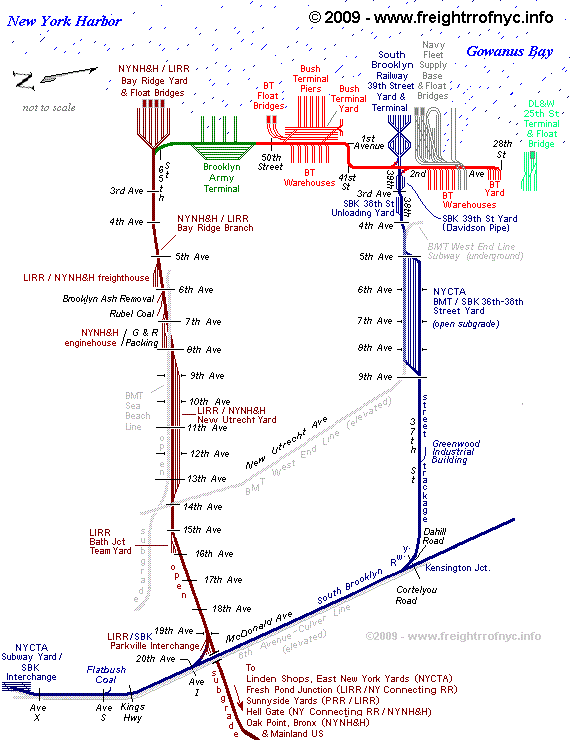
The schematic seen above shows the original route of the South Brooklyn Railway (in blue) and the connections and interchanges to the BMT Subway (light gray), Bush Terminal (red); Fleet Supply Base of the US Navy (dark gray), Brooklyn Army Terminal (in green) and the NYNH&H / LIRR Bay Ridge Division (shown in brown).
Please keep in mind, is it not to scale and is a composite of the various railroads and industries that operated throughout the Twentieth Century, even though some of the businesses may not have existed all at the same time.
.
.
.
An In Depth Look into South Brooklyn Railway Delivery Network
.
 |
 |
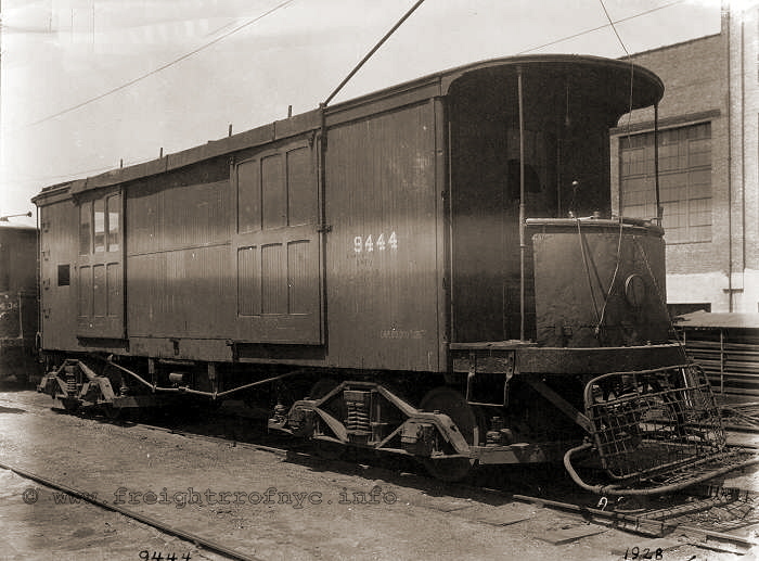
| #9444 - "freight box motor" - 1928 |
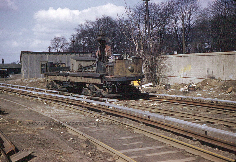
#9137 - "trolley derrick gondola" - Tenth Ave Yard - 1959 |
Freight business under the auspices of the South Brooklyn Railway began in April 1896 when the South Brooklyn entered into contract with the National Express Company to carry freight in seven express trolley cars. In May, National Express Co. leased a store at the corner of Jamaica Union Hall Street (approximately near the present 160th Street) and utilized it as a baggage office. Actual service commenced on June 10, with four round trips daily.
One more express trolley would enter service four months later. Sidings were installed at six locations:
- 8 - 10 Fulton Street (Main Depot)
- Jamaica Avenue & Union Hall Street (160th Street)
- Third Avenue and 23rd Street
- Bay 19th Street and Bath Avenue
- Gravesend Avenue and 16th Avenue
- Stillwell Avenue and Railroad Avenue (1/2 block north of Surf Avenue)
This service would continue for almost three decades, ending December 31, 1928.
Because of the complexity of passenger service and the proposed freight service, the Brooklyn Rapid Transit decided to form a freight department. Wisely, the company proceeded along these lines methodically and slowly. Furthermore, the haulage of the construction material for both their own lines and the new ones being constructed saw a rapid increase in freight traffic. At the beginning, the BRT forces performed their own work, but as the scope of the construction and reconstruction became obvious, the BRT hired private contractors to assist.
Meanwhile word got out and the demand for freight service kept increasing. Elaborate plans for handling freight cars were set on paper by ex-Governor Flower, Richard Croker and John F. Carroll who conceived the idea of hauling the ashes on the surface lines.
Prominent Realtors McNulty & Fitzgerald were expecting to reclaim much of the marsh land in Coney Island Creek area and sell for suitable residential building lots
In 1897, the Long Island Railroad, (which had been operating passenger trains from their own ferry terminal at 65th Street via the Bay Ridge Branch and connecting with the Prospect Park & Coney Island RR at Parkville Junction), now leased the South Brooklyn Railway & Terminal Company, (and LIRR eliminated their Bay Ridge Branch to Parkville Junction passenger train).
Quick side bar here: in 1893, Andrew Culver sold his Prospect Park & Coney Island RR (which ran along Gravesend Avenue) to the Long Island Rail Road.
.
|
. It is most important to remember that the South Brooklyn Railway, unlike any other of the freight terminal railroads throughout Brooklyn, that its delivery system was based upon the vast network of passenger streetcar trackage laced throughout the borough. It did not haul freight along a fixed route from Point A to Point B until much later in its existence. When the South Brooklyn Railway was first created it handled the freight delivery for most of, if not all the passenger carrying streetcar lines throughout Brooklyn. There were untold customers and countless sidings and spurs off the streetcar routes that snaked their way through Brooklyn. This early history must not be forgotten despite it being slowly erased from our collective memories. When presently discussed all that seems to be remembered about the South Brooklyn Railway is that it hauled subway cars for the NYCTA from Bush Interchange to the Coney Island Shops. It has become too easy to think in simplistic terms of the fixed route service discussed at length below and I, more than anyone; am guilty of this. The South Brooklyn Railway was so much more than that. Hence the creation of this chapter. For both Carload and Less-Than-Carload It also must be understood, that there were two varieties of freight being handled by the South Brooklyn Railway: carload and less-than-carload. Carload freight is comprised of an entire railroad freight car being loaded for a single customer. It could be a box car of metal castings for an assembly firm, sacks of hops or barley for a brewery, flatcars of granite to be cut for curbstones or to be carved into headstones, gondolas of steel pipe or hoppers of coal for a coal dealer to resell or to heat or power a electrical generating station for a large industry. On the South Brooklyn Railway, a good deal of the carload freight at this time was for contractors that were helping expanding the city: Cranford Asphalt, owned their own fleet of cars and transported sand from the sand pit at Avenue R on the Brighton Line to their storage yard which was located between Park Place and St. Marks Avenue on the present day Franklin Avenue shuttle line. Granite for curbstones, as well as headstones for the cemeteries. Originating at locations throughout Brooklyn would be the trolley gondolas carrying ash from coal stoves used in home and business heating as well as the manufactured good originating in Brooklyn for outbound transfer. |
|
In most cases, this would be a boxcar loaded with many different items or materials from different consignors for different customers. Almost always, Less than Carload meant a box car, but it could also mean different loads in a gondola (one batch of pipe to here, another to the there); or on a flat car (one piece of machinery to one destination, another to another.) Later in the era of multiple bay covered hoppers used in dry bulk shipping, less than carload could be applied here as well.
Very rarely was less than carload in a tank car or an open hopper where it was difficult to measure out the commodity being removed from the "whole" load.
By itself, in less than carload shipping; that partial load would have been a waste of space in assigning an entire boxcar to deliver just a single customers few crates and would have been cost prohibitive. When many small loads shared one boxcar and thereby sharing the expense of shipping, it cut the cost of shipping. But, these less than carload shipments were the most labor intensive. It is with these types of deliveries, that the final delivery agent (in this case the South Brooklyn Railway) needed a large roster of freight cars for its network of customers.
It was the less-than-carloads that usually were transferred to the "freight box motor" or similar equipment. Freight box motors were really nothing more than a powered boxcar with a platform on both ends (sometimes one) for the motorman to operate from. Basically it was the next step in the evolution from horse-drawn wagon delivery in urban environments with a network of trolley tracks. Whether small towns or large cities, most trolley companies had at least one trolley motor for small deliveries.
Beginning in 1904, following Irving T. Bush's business advice, the Brooklyn Heights Railroad began installing freight sidings upon request. The first of these sidings was to the Iron Clad Manufacturing Co (manufacturer of steel kegs and drums) located at Flushing Avenue and Cook Street, in the Bushwick neighborhood.
It is also at this juncture in time, that the small steam locomotives the South Brooklyn Railway had acquired and were operating were turning out not to be powerful enough to handle this increase in freight traffic. These locomotives were surplussed from elevated passenger lines that had been converted to electricity as a source of power and propulsion.
Therefore, the Brooklyn Rapid Transit designed and constructed their own electric box cab locomotive in their 39th Street shops; which was delivered in 1907 and given the number 4. 600 horsepower through 8 wheels (B-B wheel arrangement) on 57 tons, with smooth efficient electric propulsion; it was the largest electric locomotive built by a municipal railroad at that time. This would also be the very locomotive actually lettered "South Brooklyn Railway." (and it survives to this day at the Shore Line trolley museum in East Haven, CT)
A good deal of the carload freight at this time was for contractors that were helping expanding the city: Cranford Asphalt, owned their own fleet of cars and transported sand from the sand pit at Avenue R on the Brighton Line to their storage yard which was located between Park Place and St. Marks Avenue on the present day Franklin Avenue shuttle line.
Granite for curbstones, as well as headstones for the cemeterys.
Beginning in 1904, following Irving T. Bush's business advice, the Brooklyn Heights Railroad began installing freight sidings upon request. The first of these sidings was to the Iron Clad Manufacturing Co (manufacturer of steel kegs and drums) located at Flushing Avenue and Cook Street, in the Bushwick neighborhood.
As such, the South Brooklyn Railway had dozens of these trolley box motors and trolley gondolas to serve the needs of its customers. They would pretty much fan out throughout Brooklyn on a daily basis to hundreds of different customers and return to the freight stations for more deliveries arriving throughout the day. The best I can compare it to in modern times, is think of it as a primitive UPS distribution system, but instead of brown trucks, it was brown (or dark red or olive green) trolleys!
Another factor to be considered was that the standard size freight cars in use by the transcontinental railroads at that time were too large in dimension for easy transport through narrow city streets (yet tiny in comparison to the freight cars of today!) So the less-than-carloads were transferred to smaller trolley sized equipment such as those shown below.
And of course, the South Brooklyn Railway worked for the growing rapid transit system - the subways and elevateds; by hauling tunnel excavation debris and delivering the various materials needed for the building of tunnels, stations and the elevateds.
It should be remembered that the subways and elevateds were considered "rapid transit" because the train could go blocks without stopping, covering more distance in less time than opposed to the "surface transit" of which the trolleys and streetcars pretty much stopped on every street corner much like the present bus routes. The rapid transit and surface transit systems thought of as separate operations in those days.
On August 31, 1902, the Brooklyn Rapid Transit Company acquired full control of the South Brooklyn Railway for $500,000 by buying in all stock except for directors shares; and the South Brooklyn became another subsidiary of the Brooklyn Heights Railroad.
Things really got going with when contracts were let for the construction of 52 freight car bodies as the cost of $31,886. This shall include:
12 additional flat cars for freight service were built in the company shops at approximately $6,000, and a portion of this equipment would reuse motors and trucks and electrical systems from obsolete passenger equipment.
On July 30, 1903, the American Railway Traffic Company was incorporated in Jersey City, NJ. This company was created with the purpose of hauling the ash, rubbish and street sweepings (read: horse droppings) collected in the Borough of Brooklyn. This operation was small in scale due to the fact that ARTCo was not incorporated in the state of New York and had not yet acquired the rail cars for widespread service. This would be remedied in 1904, and twenty-eight gondolas were ordered.
Also taking place in 1903, was the construction of a railyard (equipped with overhead trolley wire), which was located adjacent to the 39th Street Ferry Terminal.
This yard was so situated that it allowed the transfer of freight from the Bush Terminal Railroad. In 1905, the South Brooklyn Railway purchased three locomotives along with 40 additional freight cars to handle the increase in freight traffic.
This freight traffic arriving at Bush Terminal for interchange with South Brooklyn, was divided into two groups: "trolley freight" and "steam freight". While not specifically stated in the Linder / Eppler article, it can be assumed that steam freight referred to carload and trolley freight was less than carload. This assumption is reached as trolley freight would have had to have been transferred from a standard "steam" railroad car to the SBK / BHRR trolley car for final delivery, and as it would not make any sense to transfer freight from one steam railroad car to yet another when that first steam railroad car could simply be interchanged and hauled to destination in the first place.
Steam freight was interchanged at the yard west of Second Avenue between 40th and 41st Streets operated by Bush Terminal which accessed the yard from the west under a large coal trestle. At that time there were no tracks on 41st Street. These cars would be hauled along Second Avenue to the 38th Street Yard west of Second Avenue where they would be coupled to South Brooklyn Railway locomotives. The Bush Terminal Railroad performed this service under contract from the Brooklyn Heights Railroad as well as maintained the yard and provided office space for the BHRR representative.
Trolley freight was interchanged from Second Avenue. Freight was transferred from steam railroad cars and less than carload freight was transferred from the freight house to South Brooklyn Railway cars.
This transfer and interchange service all changed around 1906, when Bush Terminal began a massive expansion and construction of its lofts and warehouses. The 40th Street freight yard was demolished and a new South Brooklyn Railway / Bush Terminal Railroad interchange yard and freight house was built at 48th Street and Second Avenue.
The South Brooklyn Railway and Long Island Rail Road were unable to to agree on rent for the LIRR Coney Island Freight House. South Brooklyn Railway needed the use of the freight house for less than carload traffic but the profit would have been less than the $1000 annual rent LIRR was demanding. This led to the BHRR constructing it's own freight house located on West 8th Street, near the Police Station.
South Brooklyn Railway began hauling the freight with several small locomotives no longer needed after the electrification of the elevated lines. These locomotives soon proved not to be powerful enough, and BRT designed locomotive #4 and built it.
Also during this period freight traffic steadily increased. Throughout the next few years, the South Brooklyn Railway entered into many agreements to haul the freight for the occupying passenger hauling company lines throughout Brooklyn, i.e.: Transit Development, Brooklyn, Queens County & Suburban, Nassau Electric, Brooklyn Union Elevated, Prospect Park & Coney Island, Sea Beach Railway, New York & Coney Island Railway, Coney Island & Brooklyn Railroad, among others.
As freight traffic materialized, more sidings would be added. Circa 1907, a siding was installed at Unionville (Ulmer Park) on the old Brooklyn, Bath & West End RR; for the Cropsey & Mitchel Lumberyard and several coal yards. These two businesses had been receiving their freight from boats tied up to the piers in the neighborhood, but they had to unload and pick it up for themselves.. The South Brooklyn Railway offered "to-their-door" delivery.
By 1910, a second public delivery point was established in the area, this one located at Bay 19th and Bath Avenue, which had been the Bath Beach Depot of the American Express Company.
Also in 1910, not three years after taking delivery of box cab locomotive #4; steeple cab locomotive #5 had been ordered from and built by General Electric Company located Schenectady, New York; and delivered to South Brooklyn Railway. This locomotive was designed with slightly different gearing than the box cab so as to ascend the steep grade near the waterfront as well as operate at high speeds on lengthy runs.
The South Brooklyn Railway instituted regular local freight service for the transport of sand, cement, crushed stone, paving blocks (setts not cobblestones) and other commodities of the building and construction trades from their docks at 63rd Street and from their dock at the foot of Stagg Street on the English Kills branch of the Newtown Creek.
Material and spoils excavated from the Crown Heights section was brought to the marshlands between Coney Island and Brighton Beach. When the Interborough Rapid Transit began excavating their tunnels at Joralemon Street, tunnel spoils were brought to the surface through elevator shafts (like those found at mines), dumped into gondola trolleys, and brought to the same dump sites in Brighton Beach and Coney Island, as well as Dyker Heights which was now being developed as well. Basically, in the development of Brooklyn which was not as flat as it is now, this was the era of digging dirt from hills and transporting it to fill valleys and tidal lands; all in the pursuit of making Brooklyn the finest city!
Even ashes and cinders from the coal fired electrical generating stations of the Brooklyn Rapid Transit were hauled over the South Brooklyn Railway.
In 1915, with the beginning of construction of the Brooklyn Rapid Transit's Culver Line which was being constructed either directly next to or over South Brooklyn Railways right of way adjacent to 37th Street, required a a tunnel east of Ninth Street Station. This effectively blocked the South Brooklyn Railway's main line. So, the South Brooklyn Railway commenced in purchasing land on the north side of ongoing construction and rerouted their right of way.
In 1916, the Transit Development Company (another BRT subsidiary) built four rail cars: 9978-9979 and 9987-9988 for the South Brooklyn Railway. At about the same time, a motor was installed on ash car 9980, which allowed the ash bins to be dumped mechanically. Other improvements to rolling stock this year were a Whiting crane was installed on Derrick Car 9004 and a new under frame built for 9133. In compliance with Public Service Commission orders, geared hand brakes were installed on 37 other cars on the roster.
While not related to freight operation, it is worth noting that in 1918, all elevated cars were fitted with trolley poles in addition to third rail contact shoes when the United States Army announced their intention to use the dock at Norton's Point, located at the west end of SBK's Norton Point Line. The BRT substituted Brooklyn Heights Railroad "El" cars for trolley cars on May 25, 1918. The dock was never used, and the US Army altered their plans, and passenger traffic did not increase. Therefore, trolley cars returned October 1919. In fact, passenger traffic became so light, that South Brooklyn Railway purchased six single truck "Birney" cars from Cincinnati Car Company, numbered 7200 through 7205.
Freight traffic started falling off following the conclusion of World War I, but the routes were still busy. In the internal BRT monthly magazine published September / October 1919; the South Brooklyn Railway was averaging 60 to 75 carloads daily.
In 1918, with the near completion of most of the subway construction projects, the South Brooklyn Railway was becoming burdened with a surplus of equipment. Locomotives #6 (first) and #7 (first) were sold to New York Consolidated Railroad, yet another(!) subsidiary of the Brooklyn Rapid Transit, this one being their rapid transit subsidiary. Numbers 6 and 7 were sold for $34,000 and twenty-six air dump cars: #9940-9959 and 9964-9973 were sold for $22,000; netting a profit of $1,000.
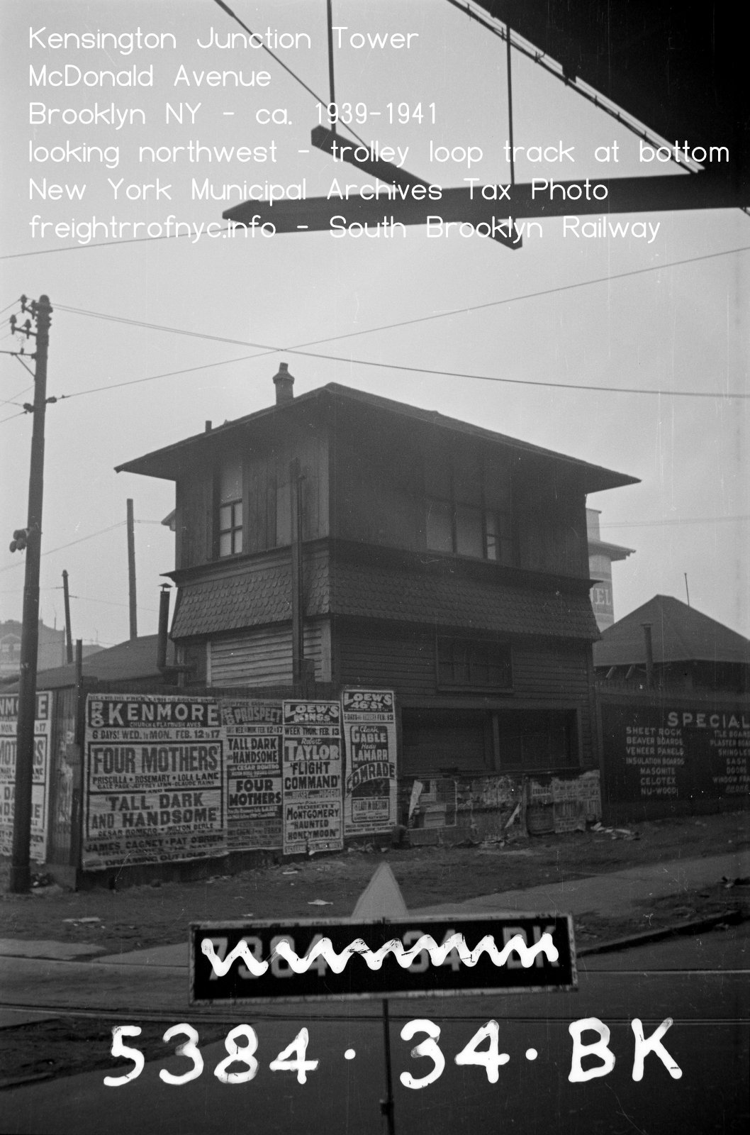
In 1920, plow motors 9802, 9803 and 9805 were sold to the Brooklyn Development Company for $19,319.76 and Locomotive #3 sold to New York Consolidated for $6065.85. Fifteen dump cars were scrapped. Also in 1920, Kensington Tower and the Parkville Passenger Station (built 1885) were removed.
Freight was also allowed to be transported through the new subway tunnels of Fourth Avenue Line, between the hours of 1:00 am and 5:00 am; and also from the Culver Line to the Sea Beach Line. On January 18, 1921, and agreement was made with the New York Consolidated RR permitting operation of of freight cars on portions of the Fourth Avenue, Sea Beach & West End Lines. A reciprocal agreement was made concerning their use of the electric cars and freight locomotives. All this freight was usually carried at night, and without interference to the commuter.
Despite being a Sunday, that day of the week saw significant freight traffic. Ten cars were required for the Sunday issues of the areas newspapers, three alone for the Brooklyn Daily Eagle.
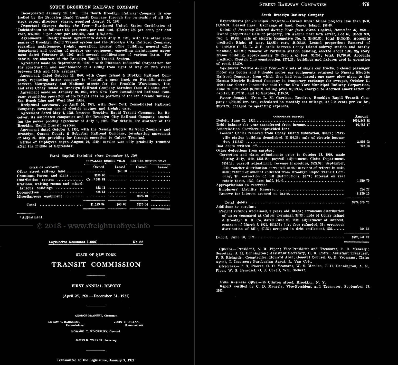
Transit Commission Annual Report - 1921
In 1926, the New York Rapid Transit Corporation, the Brooklyn Manhattan Transit subsidiary requested that South Brooklyn Railway cease operating freight trains in the Fourth Avenue Subway and on the Sea Beach Line. Even though the South Brooklyn Railway only had four customers remaining on the Sea Beach Line (J. M. Huber, Rubel Coal & Ice, Granitface and Brooklyn Borough Gas); the NYRT was not successful in their action and freight service along that route continued for several more years.
Commencing in 1929, and following the merger of the various BMT trolley subsidiaries into the formation of the Brooklyn & Queens Transit Corporation; the South Brooklyn agreed to pay the B&QT ten cents per mile for freight cars operated on its streetcar lines.
By 1930, South Brooklyn Railway instituted their motor truck store-door delivery service from "Paramount Station"..
In 1935, South Brooklyn Railway agreed to pay New York Rapid Transit Corporation 30 cent per mile for freight cars operating on their tracks.
On June 1, 1940, the City of New York assumed operation of all surface and rapid transit lines throughout the Boroughs of Brooklyn and Queens. The previous day, the South Brooklyn Railway entered into contract with the newly formed Board of Transportation of the City of New York, whereas the BoT agreed to control and operate the South Brooklyn Railway and furnish the labor, employees, material, and supplies required for maintenance and operation. This contract allowed the South Brooklyn Railway to share the use of the various BoT clerical and operating departments and provided that employees required by the South Brooklyn operation be assigned by the BoT.
A survey held in 1953 revealed the Granitface siding at 17th Avenue was no longer used and the Huber siding was unused since June 1949. Following this, the trackage rights as agreed to in 1934 of the South Brooklyn Railway on the Sea Beach Line were amended. It was now amended to only include the portion between the north end of the 86th Street Station and the old junction junction of the Sea Beach Line at Avenue Y.
On August 26, 1954 the overhead wire on the property of the Brooklyn Borough Gas Company siding was removed.
.
1) Savings due to the substitution of electric motor power for the two present diesel locomotives.
2) Lowering the tracks in the Fourth to Ninth Avenue rapid transit tunnel sufficiently to accommodate the standard AAR 40 foot 6 inch box cars.
3) Discontinuance of the J. M. Huber Inc private sidetrack at Sixth Avenue and 63rd Street.
.
.
.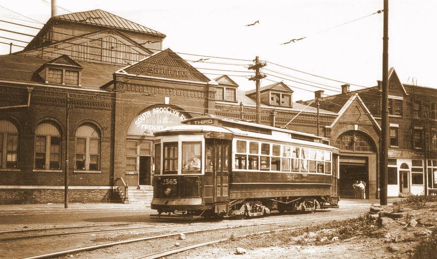
South Brooklyn Railway Main Freight House - Second Avenue between 38th and 39th Streets - ca. 1899
Looking east-southeast, Third Avenue Line trolley is entering upon
trackage and private right of way to the 39th Street Ferry House two
blocks behind photographer.
|
Up until 1904, the Long Island Rail Road, Brooklyn Heights Railroad and several other subsidiaries (the South Brooklyn Railway being one of many) of Brooklyn Rapid Transit (the main holding company) handled the freight traffic throughout Brooklyn. On April 16, 1905, South Brooklyn Railway took over freight handling from Long Island Rail Road. Also, this year is doubly significant for it is the year the South Brooklyn Railway entered into direct agreement with Bush Terminal Railroad to forward freight from the Class 1 mainland railroads yards in New Jersey through Bush Terminal via carfloats. Without this agreement, the South Brooklyn Railway most certainly would not have enjoyed the cost savings and convenience of someone else doing the carfloating, and doubtfully would have been so successful. In 1907, newly enacted legislation by the Interstate Commerce Commission resulted in the South Brooklyn Railway being split off from the Brooklyn Rapid Transit Company, and of which would now operate the South Brooklyn Railway under its own name as a completely separate company. This required a slew of trackage rights and terminal agreements being canceled by the original subsidiaries and new contracts issued by the South Brooklyn Railway. Had this not been done, the entire Brooklyn Rapid Transit system (almost entirely a passenger hauling company) would been made subject to Interstate Commerce Commission regulations. Upon the formation of the South Brooklyn Railway (as will be discussed in The Old Era chapter above), there were dozens if not hundreds of small customers that received freight via the streetcar delivery network. Unfortunately, quite a few of those names have been lost to history until a receipt or a document makes itself available, at which time it will be added to the list below. At right: advertisement from the Official Railway Guide - June 1911 |
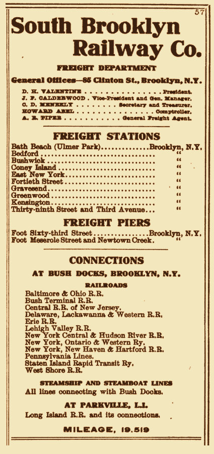 |
The South Brooklyn Railway had several yards throughout its fixed route:
.
What I do know is that the South Brooklyn Railway had published freight stations at the following locations (some of which have been discussed at length, others very little is known). The August 27, 1915 - Volume 9, No. 9 issue of Railway Age Gazette (a railroad trade journal) lists the following locations as freight stations for the South Brooklyn Railway:
.
While researching various other documents (i.e.: Documents of the Senate of the State of New York - 1917, the Joint Report with Comprehensive Plan and Recommendations, Volume 1, Part 4 -1920 as well as numerous others), I have come to learn that the following locations also came to be freight or delivery stations for the South Brooklyn Railway.
.
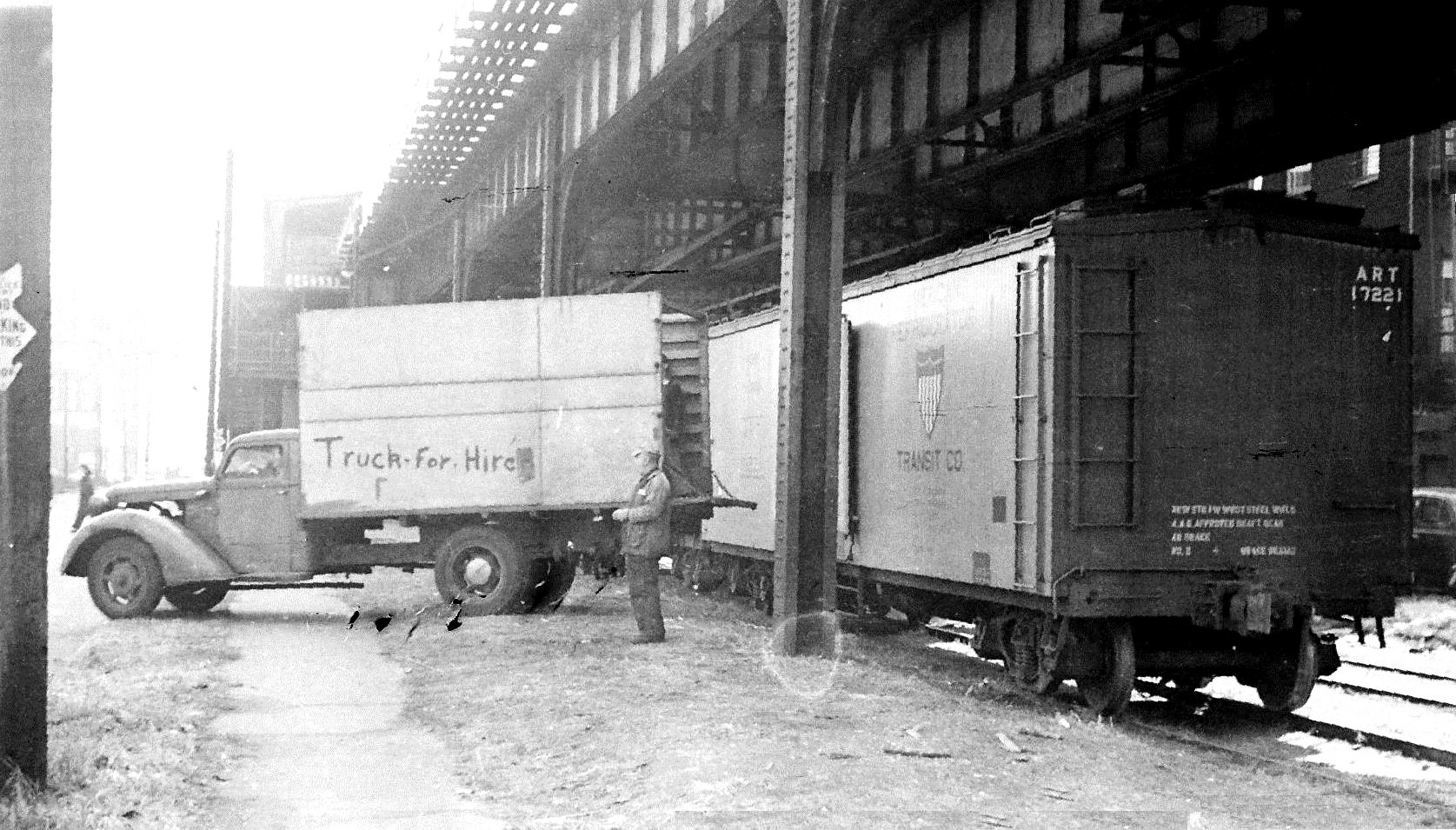
It should also be recognized, that images exist of direct freight car to truck transloading taking place on several sidings along the route.
Some of the information for actual customers comes from the ten part Bernard Linder / Paul Eppler series of articles on the South Brooklyn Railway as published in the Electric Railroaders Association bi-monthly magazine: "Bulletin". Benjamin W. Schaeffer fortunately has the complete set in his personal library. Furthermore, with the kind generosity and courtesy of Jeff Erlitz, present editor in chief of the ERA Bulletin, I have secured permission to republish the articles on this website.
From this series and from official filings, lawsuits, announcements, magazine articles, property map notations as well as recollections and information from the various transit buffs of the South Brooklyn Railway for both old and new era of operations, I have been able to compile the list below. As I learn more, they too will be added to the list below.
|
In the chapter discussing the South Brooklyn Railway, it is mentioned on page 75 of "Railroads of New York" by G. W. O'Connor (Simmons Boardman Publishing, 1949): "It also operates a fleet of trucks." By referencing a particular paragraph in the article below, an unusual facet of South Brooklyn Railway's operation comes to light:
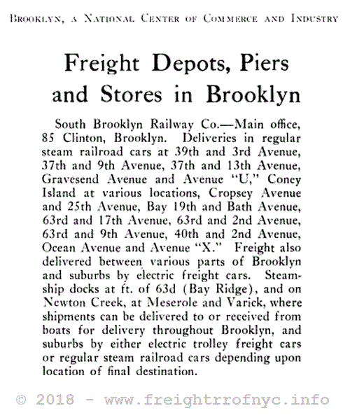
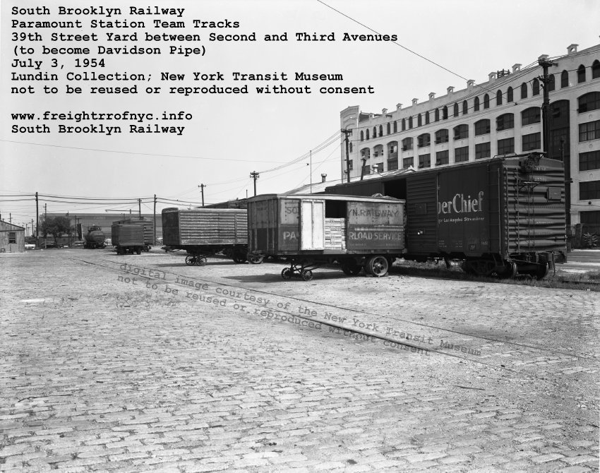
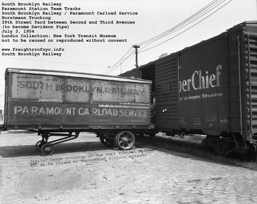
We know now that the South Brooklyn Railway contracted with Horstmann trucking, and operated their "Paramount Station" which offered truck delivery from the main freight yard between Second and Third Avenues, to the customers door, via motor truck. They advertised it as their "Store to Door" delivery trucking. This was unusual arrangement that the South Brooklyn Railway engaged in, when most terminal railroads were of the mind set "you want it? Come in get it." Not for any other reason other than the burden of cost of such a service; and quite a while before any other common carrier railroad began to offer such service., The South Brooklyn Railway entered into contract with Horstmann Trucking to furnish the trucks and drivers. If a consignee specified "Paramount Station" on their waybill, that freight was delivered to the main freight house at Third Avenue & 39th Street. Here the South Brooklyn Railway unloaded the freight from the Class 1 railroad freight car (brought in by Bush Terminal via carfloat) and placed it upon a motor truck for haulage to the final delivery location. The reverse held true for outgoing shipments. |
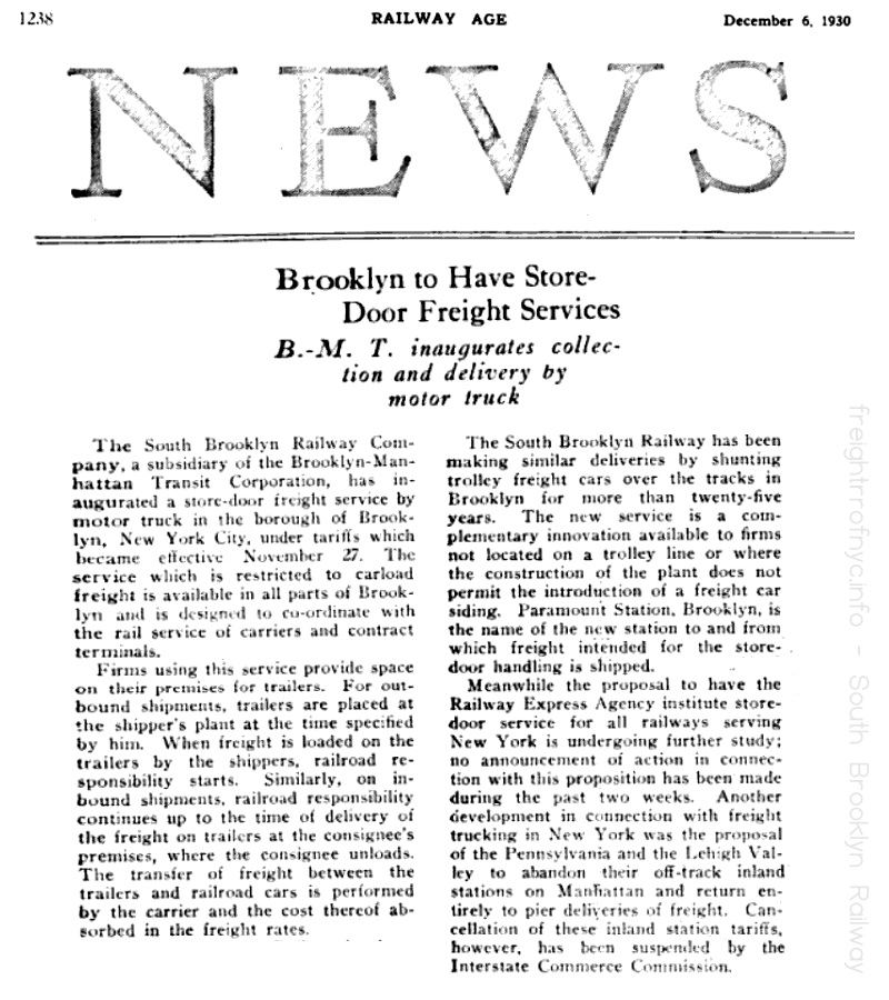 |
|
|
|
| Paramount Station Team Tracks / Horstmann Trucking 39th Street between First and Second and Third Avenues (to become Davidson pipe) images courtesy of the New York Transit Museum (not to be reused or reproduced without consent) added 03 June 2021 |
|
.
Customer List / Siding Location List
The years served column is only an estimated time frame. Dates given are usually the date of the reference article, and actual dates of service could extend before or after the given date. This is by no means a complete list, but is quite comprehensive:| customer | commodity | location | years served |
Direct Freight Car Service (via steam and/or electric locomotive) |
|||
| S. Abato | Shell Road & Cobek Court | 1928 | |
| Ansonia Clock | clock manufacturer | 20th Street & Ninth Avenue | |
| Armour Packaging | distribution plant | 38th Street & Third Avenue | |
| Bay Ridge Coal | coal & ice | 37th Street & Fifteenth Avenue | |
| Berkshire Structural Steel | steel beams | 37th Street & Fort Hamilton Parkway 38th Street & Tenth Avenue |
ca. 1917 to ? |
| Brooklyn Borough Gas | construction materials, valves, pipe manufactured illuminating gas and gas storage |
West 17th Street & Mermaid Avenue Coney Island Creek |
c1913-1960 |
| Burns Brothers coal | coal | Dahill Road & Cortelyou Road (Kensington Junction) | |
| Cirillo Brothers Ice & Coal | ice & coal | 37th Street & Thirteenth Avenue | 1932 |
| Cobco Flooring & Lumber | 38th Street & Twelfth Avenue | 1927 | |
| Cohn Cut Stone | cut stone | 38th Street & Fourteenth Avenue | 1909 |
| Cullen Fuel | Coney Island | 1926 | |
| Culver Lumber | dimensional wood & building supplies | 37th Street & Fifteenth Avenue | c1930 |
| Davidson Pipe | steel pipe | 38th Street & Third Avenue | c1955 - 1994 |
| Desbrock Coal & Company | coal & ice | 14th Avenue & 60th Street; relocated to 16th Avenue & 63rd Street (Sea Beach Line) |
ca. 1913 |
| Five P Holding | 38th Street & Twelfth Avenue | 1927 | |
| Flatbush Coal | coal | Gravesend Avenue (McDonald Avenue) & Avenue S (listed as Gravesend Avenue& Kings Highway) |
1928-1978 |
| Flatbush Industrial Building | machinery (H. W. Cotton), manufacturing lofts | 37th Street & Fourteenth Avenue | 1920-1978? |
| Granitface (?) | cut granite | Seventeenth Avenue | 1926-1953 |
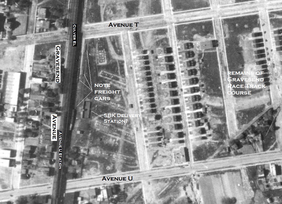
| Gravesend Racetrack & Brooklyn Jockey Club? | hay & feed? | Gravesend Avenue (McDonald Avenue) & Avenue U | 1920's |
| Greenwood Cemetery | cut stone for mausoleums, headstones | 38th Street & Ninth Avenue | |
| Philip Gruber | 37th Street & Fourteen Avenue | 1926 | |
| Harstan Chemical | 38th Street & Twelfth Avenue | 1919 | |
| J. M. Huber | printing inks | 63rd Street & Sixth Avenue (Sea Beach Line) | 1912-1949 |
| C & S Jacobs Plumbing Supply | plumbing heating & steam fitting | 37th Street & Twelfth Avenue | 1927 |
| Kings Highway Lumber (may have become Kingsway Lumber) | dimensional wood & building supplies | Gravesend Avenue & Cortelyou Road (Kensington Junction) | ca. 1930 |
| Knickerbocker Coal Ice & Fuel Oil | heating fuels | 38th Street & Twelfth Avenue | 1927 |
| Samuel Klein / Klein's Lumber | dimensional wood & building supplies | 37th Street & Thirteenth Avenue | 1919 - c1930 |
| Luzerne Coal | coal | 38th Street & Sixteenth Avenue | 1930 |
| Maltine Co. | medical preparations | 20th Street & Ninth Avenue | |
| Massoit Corp | 36th Street & Fourteenth Avenue | 1920 | |
| New York City Transit Authority and predecessors (Brooklyn Rapid Transit) |
subway cars and parts thereof; track components | 36th / 38th Street Yard, Coney Island Shops | 1899 - present |
| Nygaard Flooring | 37th Street & Twelfth Avenue | 1928 | |
| Peter Olson | 37th Street & Fort Hamilton Parkway | 1911 | |
| Phoenix Hermetic | sheet metal, canning / packaging supplies, lithographic plates | 37th Street & Fourteenth Avenue | ca. 1916 |
| S. Pizzutiello & Co | 37th Street & Twelfth Avenue | 1925 | |
| Prospect Coal | coal | 37th Street & Fort Hamilton Parkway 38th Street & Tenth Avenue |
ca. 1917 to ? |
| Daniel M. Rader | 37th Street & Fort Hamilton Parkway | 1924 | |
| Roberts Holdings (Roberts Foods) | pickles, mayonnaise, condiments | 37th Street & Fort Hamilton Parkway 38th Street & Tenth Avenue |
1919-1978 |
| Rubel Ice & Coal | ice | Dahill Road & Cortelyou Road (Kensington Junction) | 1922 |
| Saltser & Weinsier | plumbing supplies | 38th Street between Fourteenth & Fifteenth Avenues | < 1921 to? |
| Serlinsky & Kalish | Neptune Avenue & Coney Island Creek | 1926 | |
| Shell Road Coal | coal | Avenue Y & Shell Road | 1921 |
| Somers & Anderson | coal, tin plate & stamping? | Fort Hamilton Parkway & Culver Line | ca. 1913 |
| W. A. Case & Son | plumbers supplies | 49th Street & Twentieth Avenue (Parkville Junction) | ca. 1907 |
|
Trolley Motor Freight Service
|
|||
| Advex | adhesives, chemicals | Montgomery Street & Franklin Avenue | 1922 to |
| American Ice | ice | 331 Park Avenue near Grand Avenue | |
| American News | newsprint, printing supplies | Park Row (Manhattan end of Brooklyn Bridge | |
| American Steel Barrel (Brooklyn Meurer Steel Barrel) | steel containers, kegs & barrels | Flushing Avenue & Nostrand Avenue | ca. 1913 |
| Amid Duron | tallow, stiffening gums, rosin soaps, soluble oils for textiles |
Nostrand Avenue & Park Avenue | 1912 |
| Arabol Manufacturing | adhesives, synthetic gum arabic | Nostrand Avenue & Park Avenue | 1904 - 1917 |
| Atlantic, Gulf, and Pacific | shipyard | Kemble Avenue, Mill Basin, Brooklyn | 1916, 1921 |
| Barber Asphalt | sand, liquid tar, asphaltum | Varick Avenue & Metropolitan Avenue; Newtown Creek | ca. 1913 |
| Benisch Brothers Monumental Works | cut stone, marble, granite from Maine | 840 Jamaica Avenue & Lincoln Avenue | 1911 |
| Berglass Manufacturing | 10 Fulton Street | ||
| Borough Asphalt | sand, liquid tar, asphaltum | Varick Avenue & Metropolitan Avenue | ca. 1913 |
| Borough of Brooklyn Highway Department | liquid tar, asphaltum | 63rd Street Dock | |
| Brooklyn Daily Eagle | newsprint & materials for same | Adams Street & Johnson Street | ca. 1913 |
| Burton Dixie | mattresses | Franklin Avenue & Montgomery Street | 1921 |
| Cheek-Neal Coffee | coffee roaster | 39th Street & Third Avenue | < 1921 |
| Consumers Park Brewery | malt, cereal for beer brewing | Montgomery Street & Franklin Avenue (Brighton Line) | |
| E. H. Cook Coal | coal | West 8th Street 1600' north of Sheepshead Bay Road | 1905 |
| Central Foundry | Fulton Street & Tompkins Avenue | ca. 1913 | |
| Continental Baking | flour, yeast, grain | public team track at power station 3rd Street & Third Avenue | |
| Cranford Asphalt | sand, liquid tar, asphaltum | Avenue R and Brighton Line (East 16th Street) | |
| Cranford Company | tunnel excavation material sand to Trolley Depots |
9th Street & Gowanus Canal temporary tunnel shafts at: Joralemon Street & Court Street Fulton Street & Dekalb Avenue Fourth Avenue & Atlantic Avenue |
|
| Crimmins Contracting | broken stone, cement for new streets | 63rd Street Dock | |
| Cropsey & Mitchell | lumber | Cropsey Avenue & Bay 35th Street | 1910 |
| Cullen Fuel | coal | West 8th Street & Surf Avenue | |
| Damast, Abraham & Murray | 39th Street & Second Avenue | 1921 | |
| Degnon Contracting | street construction of Atlantic Avenue between Fifth & Flatbush Aves |
temporary siding on Atlantic Avenue | |
| DeHass Simonson Realty | land fill | Broadway & Elmhurst Avenue | |
| Frank Brewery | malt, cereal for beer brewing | Flatbush Avenue & Vernon Avenue (now Tilden Avenue) | |
| Charles Froeb | wine & liquor wholesaler | Tompkins Avenue & Flushing Avenue | 1912 |
| Robert Gair | Front Street & Adams Street | ca. 1913 | |
| Granitface (?) | cut granite | Seventeenth Avenue | 1926-1953 |
| H. J. Heinz 1 | canned goods | Franklin Avenue & Bergen Street (former Nassau Brewery) | < 1921 |
| Hildebrandt Baking (predecessor to Continental Baking) | flour, yeast, grain | Third Avenue & 3rd Street (former ARTCo ash station) | |
| Joshua Horricks | wire fencing | Herkimer Street near Reid Avenue - materials delivered to trolley loop | |
| Otto Huber | beer depot | West 8th Street - beer trucked from brewery to Ridgewood Depot, then South Brooklyn to Coney Island |
|
| Igoe Brothers | iron & steel | Flushing Avenue & Marcy Avenue - public yard | |
| Iron Clad Manufacturing | steel containers, kegs & barrels | Flushing Avenue & Varet Street | 1905 |
| Knickerbocker Ice | ice | Flatbush Avenue & East 32nd Street 37th Street between Fourteenth & Fifteenth Avenues |
1912, 1921 |
| League Storage & Warehouse | warehousing | Third Avenue & (proposed) 2nd Street (exact location unknown) | 1919 |
| Lower Gambrinus Brewery | malt, cereal for beer brewing | trucked from brewery on West 42 Manhattan to Williamsburg Bridge Plaza then via South Brooklyn to Coney Island |
|
| W. F. Mangels | Coney Island | 1921 | |
| Metropolitan Engineering | electrical cabinets & cutout boxes | Nostrand Avenue & Atlantic Avenue | 1918 |
| Michael Brewing | beer & ice | Bergen Street & Third Avenue | |
| Benjamin Myers | Coney Island Yard | 1921 | |
| Nassau Brewing | malt, cereal for beer brewing | Dean Street & Franklin Avenue / Dean Street & Bergen Street (under Brighton el) | ca. 1913 |
| National Lead | lead | Strickland Avenue & Mill Avenue | |
| National Express Company | parcels & freight | 8-10 Fulton Street Broadway & Myrtle Avenue Bay 19th Street & Bath Avenue 16th Avenue & Ditmas Avenue Railroad Avenue between Sea Beach Palace and West End Depot 25th Street & Third Avenue East New York at Howard House Jamaica Avenue & Union Hall Street (160th St) |
|
| North American Brewing | malt, cereal for beer brewing | used dead track in Ridgewood Car Barn | |
| J. W. Oeleriches | food packaging | Sanford Street & Park Avenue | 1912 |
| Pathe Freres Phonograph Co. | materials, goods for manufacturing and coal | Grand Avenue & Park Avenue | 1921 |
| Piel Brothers | malt, cereal for beer brewing | Liberty Avenue & Georgia Avenue | pre-1929 |
| Robison Clay Products | vitrified pipe | Seventeenth Avenue & Sea Beach Line | |
| Joshua Rogers & Son | Pacific Street near Franklin Avenue | ca. 1913 | |
| Thomas Roulston 1 | grocer & dry goods | 9th Street & Second Avenue | |
| Saltser & Weinsier (formerly Iron Clad Mfg) | plumbing supplies | Flushing Avenue & Varet Street Flushing Avenue & Bushwick Avenue |
< 1921 |
| Sholtz & Atkinson Realty | land fill | Thirteenth Avenue between 78th and 79th Streets | |
| South Brooklyn News | Sunday newspaper distribution | Park Row | |
| Sure Seal | Pearl Street & Prospect Street | 1912 | |
| Charles Tisch | stove parts | Rockwell Place between DeKalb Avenue & Fulton Street | |
| Trommer's Evergreen Brewery | malt, cereal for beer brewing | Bushwick Avenue & Conway Street | pre-1929 |
| Uvalde Asphalt Paving | sand, liquid tar, asphaltum for paving Rockaway Boulevard |
Metropolitan Avenue & Grand Street (Newtown Creek) | ca. 1913 |
| unknown | paving stone | Kent Avenue & Division Street | |
| US Government - Department of the Navy - Brooklyn Navy Yard | material and supplies for US Government | Flushing Avenue & Claremont Avenue | 1919 |
| US Government - Post Office Department | mail sorted and transported to outlying stations | Adams Street & Johnson Street | |
| W. W. Vandewater | scrap iron & metal (mostly from BRT shops) | Park Avenue & Classon Avenue Park Avenue & Grand Avenue |
1927 |
| J. H. Williams | heavy machinery & parts | 150 Hamilton Avenue (Richards Street & Bowne Street) | ca. 1913 |
|
Public Delivery Yards as of 6/25/1913 unless otherwise noted |
|||
| lumber yard coal yard |
located at Unionville a/k/a Ulmer Park (former Brooklyn Bath & Coney Island Railroad siding) |
||
| Bath Avenue & Bay 19th Street (former American Express Co Bath Beach Depot) | ca. 1910 | ||
| Flushing Avenue between Marcy & Nostrand Avenues | |||
| St Nicholas Avenue & Gates Avenue | |||
| Third Street and Third Avenue | |||
| Bergen Street & Troy Avenue | |||
| 23rd Street and Sixth Avenue | |||
| 19th Street and Seventh Avenue | |||
| Reid Avenue & Marion Street | |||
| Gillen Place and Jamaica Avenue | |||
| Franklin Avenue & Atlantic Avenue | |||
| Flatbush Avenue & Vernon Avenue | |||
| Avenue J and Rockaway Parkway | |||
| Adams Street and Concord Street | |||
| Halsey Street & Broadway | |||
|
Public Delivery Sidings |
|||
| Commercial & Box Street | |||
| Fulton Street & Sands Street | |||
| Flatbush Avenue & Avenue N | |||
| Broadway & Fulton Street | |||
1 - South Brooklyn Railway permitted trained & qualified
employees of H. J. Heinz and Thomas Raulston companies to operate and
move trolley motors on the sidings.
2 - Saltser & Weinier's employees permitted to shift cars within their premises
3 - permission given to William's employees to shift cars on their siding.
| List of Sidings in Service as 1912 |
| Brighton Beach Hotel |
| Herkimer Street Ash Station |
| Flatbush Avenue near Plaza |
| Liberty Avenue & Snediker Avenue |
| Post Office (Adams Street) |
| West End & Beach Crossing |
| Neptune Avenue and Brighton Line |
| end of Cypress Avenue |
| Ridgewood Yard |
| Willow Street near Wyckoff Avenue |
| East 32nd Street |
| List of Sidings in Service as of July 3, 1917 |
List of Sidings in Service as of July 11, 1921 |
|||
| Station | Siding | Station | Siding | |
| Bath Beach | Ulmer Park | Bath Beach | Cropsey Avenue & 25 Avenue | |
| Bath Beach | Bay 19th & Bath Avenue | Bath Beach | Bay 19th & Bath Avenue | |
| Bath Junction | 63rd Street & Seventeenth Avenue | Bath Beach | 63rd Street & Nineteen Avenue | |
| Bath Junction | 63rd Street & Sixteenth Avenue | Bath Beach | 63rd Street & Seventeenth Avenue | |
| Bedford | 56 Nostrand Avenue near Park Avenue | Bedford | 56 Nostrand Avenue near Park Avenue | |
| Bedford | Park Avenue & Grand Avenue | Bedford | Park Avenue & Grand Avenue | |
| Bedford | Flatbush Avenue & Nostrand Avenue | Bedford | Kent Avenue & Division Avenue | |
| Bedford | Williamsburg Power Station | Bedford | 575 Flushing Avenue | |
| Bergen Beach | Bergen Beach Terminal | Bedford | Atlantic Avenue & Nostrand Avenue | |
| Bergen Beach | Kemble Ave | Bedford | Flushing Avenue & Cook Street | |
| Brighton Beach | Ocean Avenue between Avenue X and Avenue Y | Bedford | Avenue J & Rockaway Parkway | |
| Bushwick | Flushing Avenue & Cook Street | Bedford | Flatbush Depot | |
| Bushwick | St Nicholas Avenue & Gates Avenue | Bedford | Ralph Avenue & Atlantic Avenue | |
| Bushwick | DeKalb Depot | Bedford | Fulton Street & Furman Street | |
| Bushwick | Covert Avenue & Cornelia Street | Bedford | 40 State Street | |
| Canarsie | Canarsie Terminal | Bedford | Varick Avenue & Stagg Street | |
| Canarsie | Avenue J & Rockaway Parkway | Bedford | Halsey Street & Broadway | |
| Coney Island | Brooklyn Borough Gas Company (Coney Island Creek) | Bedford | 150 Hamilton Avenue | |
| Coney Island | Culver Yard | Bedford | 3rd Street & Third Avenue | |
| Coney Island | Sea Beach Yard | Bedford | 9th Street & Second Avenue | |
| Coney Island | West 36th Street & Surf Avenue | Bedford | Jamaica Avenue & Railroad Avenue | |
| Coney Island | West 17th Street & Surf Avenue | Bedford | Bergen Street & Franklin Avenue | |
| Corona | Union Avenue | Bedford | Nostrand Avenue & President Street | |
| Corona | Grand Avenue | Bedford | Tompkins Avenue & Fulton Street | |
| Cypress Hills | Woodhaven Sand Pit - Jamaica Avenue | Bedford | Franklin Avenue & Montgomery Street | |
| Cypress Hills | Liberty Avenue, end of line | Bergen Beach | Bergen Beach Terminal | |
| Cypress Hills | Jamaica Avenue & Crescent Street | Coney Island | 4 sidings | |
| Cypress Hills | New Lots Avenue & Berriman Street | East New York | Gillen Place & Jamaica Avenue | |
| Dean Street & Franklin Avenue | Bergen Street & Franklin Avenue | Gravesend | Gravesend Avenue & Kings Highway | |
| Dean Street & Franklin Avenue | Pacific Street (Transit Development Co) | Gravesend | Gravesend Avenue & Avenue U | |
| Dean Street & Franklin Avenue | Nostrand Avenue & President Street | Greenwood | 3 sidings | |
| Dean Street & Franklin Avenue | Tompkins Avenue & President Street | Kensington | 10 sidings | |
| Dean Street & Franklin Avenue | Franklin Avenue Car Barn | 39th Street & Third Avenue | 38th Street & Second Avenue | |
| East New York | East New York Loop | |||
| Flatbush | Vernon Avenue Yard | 39th Street & Third Avenue | 40th Street & Second Avenue | |
| Flatbush | Cortelyou Road & Coney Island Avenue | 39th Street & Third Avenue | 23rd Street between Fifth & Sixth Avenues | |
| Flatbush | Holy Cross Cemetery | |||
| Flatbush | Flatbush Avenue & Nostrand Avenue | |||
| Flatlands | Flatbush Depot | |||
| Flatlands | Flatbush Avenue & Avenue U | |||
| Flatlands | Coney Island Avenue & Kings Highway | |||
| Flushing | Terminal Loop | |||
| Fort Hamilton | Terminal | |||
| Fort Hamilton | 86th Street & Fifth Avenue | |||
| Fulton Street & Furman Street | 8-10 Fulton Street | |||
| Fulton Street & Furman Street | end of Brooklyn Bridge | |||
| Gravesend | Gravesend Race Track / Brooklyn Jockey Club | |||
| Gravesend | Kings Highway & Gravesend Avenue | |||
| Greenwood | Fort Hamilton Avenue & Culver Line | |||
| Greenpoint | Commercial & Box Street | |||
| Greenpoint | Meeker Avenue & Newtown Creek | |||
| Jamaica | Terminal | |||
| Kensington | 3 customers | |||
| Middle Village | Dry Harbor Road & Metropolitan Avenue | |||
| Middle Village | Fresh Pond Road & Lutheran Line | |||
| Middle Village | Maspeth Depot | |||
| Newtown Dock | 4 customers | |||
| North Beach | Terminal | |||
| Richmond Hill | Schwetzen Park | |||
| Richmond Hill | Myrtle Avenue & Jamaica Avenue | |||
| Reid Avenue & Fulton Street | Halsey Street & Broadway | |||
| Reid Avenue & Fulton Street | Ralph Avenue & Atlantic Avenue | |||
| Reid Avenue & Fulton Street | Reid Avenue & Fulton Street | |||
| Reid Avenue & Fulton Street | Troy Avenue & Bergen Street | |||
| Sheepshead Bay | Sheepshead Bay Yard | |||
| Sheepshead Bay | Sheepshead Bay Racetrack | |||
| 63rd Street Dock | 58th Street & Second Avenue | |||
| 63rd Street Dock | 63rd Street & Second Avenue | |||
| 63rd Street Dock | 63rd Street & Sixth Avenue | |||
| 3rd Street & Third Avenue | 19th Street & Seventh Avenue | |||
| 3rd Street & Third Avenue | 20th Street & Ninth Avenue (Depot & two private sidings) | |||
| 3rd Street & Third Avenue | 9th Street & Second Avenue | |||
| 39th Street & Third Avenue | 52nd Street Dock (Transit Development) | |||
| 39th Street & Third Avenue | 52nd Street Storeroom (Transit Development) | |||
| 39th Street & Third Avenue | 39th Street Yard | |||
| 39th Street & Third Avenue | 23rd Street & Fifth Avenue | |||
| 39th Street & Third Avenue | 36th Street & Fifth Avenue | |||
| 39th Street & Third Avenue | 38th Street & Second Avenue | |||
| 39th Street & Third Avenue | 39th Street & Third Avenue | |||
| 39th Street & Third Avenue | 29th Street & Third Avenue | |||
| location | installed |
| 40 State Street | 1921 |
| location | installed | location | installed | |
| Avenue C & Coney Island Avenue | 1917 | North Beach Terminal | 1912 | |
| Bay 19th Street & Bath Avenue | 1912 | Nostrand Avenue & Atlantic Avenue | 1922 | |
| Canarsie Terminal | 1912 | Pacific Street (TD Co) | 1912 | |
| Covert Street & Cornelia Street | 1917 | Reid Avenue & Fulton Street | 1912 | |
| Coney Island Avenue & Kings Highway | 1917 | Rockaway Avenue & Hegeman Avenue | 1917 | |
| Commercial & Box Street | 1912 | Smith Street - 9th Street | 1922 | |
| DeKalb Depot | 1917 | Troy Avenue & Bergen Street | 1912 | |
| Dry Harbor Road & Metropolitan Avenue | 1912 | Ulmer Park | 1912 | |
| Liberty Avenue - end of line | 1912 | Union Avenue & Grand Avenue (Corona) | 1912 | |
| end of Brooklyn Bridge | 1912 | West 17th Street & Surf Avenue | 1917 | |
| Flatbush Avenue & Avenue V | 1917 | West 36th Street & Surf Avenue | 1917 | |
| Fresh Pond Road and Lutheran Line | 1912 | 19th Street & Seventh Avenue | 1912 | |
| Flushing Avenue Yard (near Nostrand Loop) | 1912 | 20th Street & Ninth Avenue | 1917 | |
| Flushing Terminal Loop | 1912 | 29th Street & Third Avenue | 1917 | |
| 8-10 Furman Street | 1912 | 38th Street & Second Avenue | 1912 | |
| Gravesend Race Track | 1912 | 39th Street Yard | 1912 | |
| Holy Cross Cemetery | 1917 | 52nd Street Dock | 1912 | |
| Jamaica Terminal | 1912 | 52nd Street Storeroom | 1912 | |
| Maspeth Depot | 1917 | 58th Street & Second Avenue | 1917 | |
| Meeker Avenue & Newtown Creek | 1917 | 63rd Street & Sixth Avenue | 1917 | |
| New Lots Avenue & Berriman Street | 1917 |
| Siding List: Last Year Reported: 1926 . |
Siding List: Last Year Reported - 1928 . |
|||||||||||||||||||||||||||
|
|
| Siding List: Last Year Reported - 1929 . |
Siding List: Last Year Reported - 1930 . |
|||||||||||||||||
|
|
| Siding List: Last Year Reported - 1931 . |
Siding List: Last Year Reported - 1932 . |
|||||||||||||||||
|
|
| Siding List: Last Year Reported - 1934 . |
Siding List: Last Year Reported - 1936 . |
|||||||||||||||||
|
|
| Siding List: Last Year Reported - 1937 . |
Siding List: Last Year Reported - 1939
. |
|||||||||||||
|
|
| Siding List: Last Year Reported - 1942 . |
Siding List: Last Year Reported - 1945 . |
|||||||||||||
|
|
The Decline
There was a marked decline in customers following the conclusion of World War I. But this also coincided with the advent of the internal combustion engine and motor trucks. And as a result, the streetcar delivery system (and like railroads elsewhere) traffic began to diminish. It was the second step in the progression from horse drawn wagons.
Little by little, as more trucks were built and entered service there was less need for trolley motors to ply the routes. Now a truck could be sent and returned within hours and without having to shoehorn its way into a trolley schedule or wait until off peak hours (usually late at night), and thereby be sent out again quickly.
Another factor hastened the end of the streetcar system (both freight and passenger) in New York City as well as other cities in the U.S. Namely, the well documented General Motors Streetcar Conspiracy. So much has been written and said on this subject that it is not justifiable to expend the time or effort in reiterating it here. In short, it slowly devastated the streetcar systems in major cities throughout the United States.
By 1940, there were only seven freight stations:
Some of this decline was ameliorated by World War II due to gasoline and rubber rationing, and the South Brooklyn Railway held on. After World War II the "chicken in every pot and a car in every garage" way of life really took off, spelling doom for passenger carrying streetcars everywhere because the privately owned automobile was now in reach of just about everyone.
The South Brooklyn Railway's vast borough-wide delivery network was whittled down as each street car route was converted to internal combustion powered buses; and one by one the dominoes fell until by 1956 only a solitary route through Brooklyn survived.
It is this route that is best remembered in the collective memories of todays transit buffs and railfans that lived in Brooklyn in the latter half of the Twentieth Century.
| station | # of customers 4/25/1946 |
# of customers 12/30/1955 |
| Bath Beach | 1 | 0 |
| Coney Island | 2 | 2 |
| Gravesend | 1 | 1 |
| Kensington | 3 | 2 |
| 39th Street & Third Avenue | 26 | 20 |
As of May 28, 1959, passenger service on the Culver Line was cut back to Ninth Avenue. This allowed the track to be rearranged on June 15th, so that the northbound Culver track "C-2" was connected to middle of track just south of Ninth Avenue. As a result, the middle track in the Ninth Avenue Station was no longer needed for passenger service allowing it to be realigned to provide through service to 37th Street right of way for the South Brooklyn Railway.
As a result of this new alignment and installation, the South Brooklyn no longer had to switch operating ends at Ninth Avenue, operate through the 36th Street Yard, then switch ends on the South Brooklyn's main line to Second Avenue. Also, the installation of third rail in 36th Street Yard and the Tenth Avenue Yard on March 25, 1958, made the trolley wire redundant, so it was removed between Fifth Avenue and the coal trestle at the east end of the 36th Street Yard. It was taken out of service at 10 am April 15, 1960.
A letter dated December 27, 1961 ordered the NYCTA electrical department to de-energize the overhead trolley wire.
On November 19, 1965 a contract was entered with Sarnelli Brothers to
remove the poles, overhead wire and other appurtenances between Fort
Hamilton Parkway and Coney Island Freight Yard. The Branford Electric
Railway Association signed an agreement to remove of the overhead wire
between Fourth Avenue and New York Bay.
For 1961, the following freight statistics were recorded: there were 63 loaded cars inbound and 18 cars outbound monthly. The 39th Street Agency, which concerns itself with customers west of the BMT Fourth Avenue Tunnel; the principal commodities were: pipe, brick, and canned goods for two regular and fifteen sporadic customers.
The Greenwood Agency handles everything else from that Tunnel to Coney Island Yard and averaged 70 loaded inbound cars and 2 outbound loaded cars per month for that same year. Here, the principal commodities were rail, ties, track appliances and signal equipment and other related materials for the Transit Authority. Most of the rail and ties are delivered to the 38th Street Yard for the preassembly of track panels for the subway.
During October and November 1961, approximately 60 carloads of grapes was hauled. This amounted to one quarter of the tonnage of the same commodity as hauled during the 1920's.
In 1961, interchange with Long Island Rail Road Bay Ridge Division amounted to approximately 10% of annual freight traffic. The remaining 90% was interchanged via Bush Terminal Railroad.
Also at this time, the south terminal of the South Brooklyn Railway is located in a team yard at Shell Road and Avenue Z, adjacent to the NYCTA Coney Island Shops. There is a small freight house, used by a forwarding firm, as well a track connection to the Coney Island Shops for the movement of subway cars.
In 1976, South Brooklyn Railway sold their yard between Second & Third Avenues to Davidson Pipe, but did retain an easement through the yard as well as occupies an office at the northwest corner of 39th Street and Third Avenue.Unfortunately, as stated in the Transit article below, and like the other contract terminals in the New York City, the South Brooklyn's freight customers were vanishing even along the fixed route. With the closing of Davidson Pipe in 1994 on Third Avenue and 38th Street (and where the South Brooklyn Railway would store their locomotives), the New York City Transit Authority was the only "business" for the South Brooklyn Railway.
And that is the way it remains today.
.
In September 2026, I undertook the initiative to redraw all the (now) crude (and subsequently pixelated maps) I had created when this page was first published in 2005.
Since I now have more resources at my disposal to refer too, such as Peter Doughtery's Tracks of the NYC Subway, and high resolution aerial photos of the facilities (via the New York Municipal Archives and the Brooklyn Public Library); it was also time to accurize the maps as well.
In discussion with Paul Strubeck who was proof-reading the new text, and he sent me a scan of the following official document:
"Information for Employees Engaged In The Operation of Freight Service On The South Brooklyn Railroad -
New York City Transit Authority.
This document was prepared in 1968 by Motorman Instructor Leonard Lacyk and Edward Taylor; and revised in 1976 by Motorman Instructor in charge of B-1 Division, Joseph Rossetti. The document was approved by Superintendent B-1, Alfred V. Broderick.
Upon sharing that document with Peter Dougherty; Peter replied back with another version, which was revised as recent as 1984 (arrival of the R62-A subway cars.) Lord only knows how many times this documents has been mimeo and xerographed!
At the expense of sounding like a priest in a pulpit, I give my utmost thanks to Peter and Paul. Amen.
 |
INFORMATION FOR EMPLOYEES ENGAGED IN THE OPERATION OF FREIGHT SERVICE ON THE SOUTH BROOKLYN RAILROAD NEW YORK CITY TRANSIT AUTHORITY Prepared By:
Motormen Instructor's Leonard Lacyk & Edward Taylor ( 1968 ) Revised By: Motorman Instructor in charge B - 1 Div. Joseph Russetti ( 1976 ) Approved By: |
| . | |
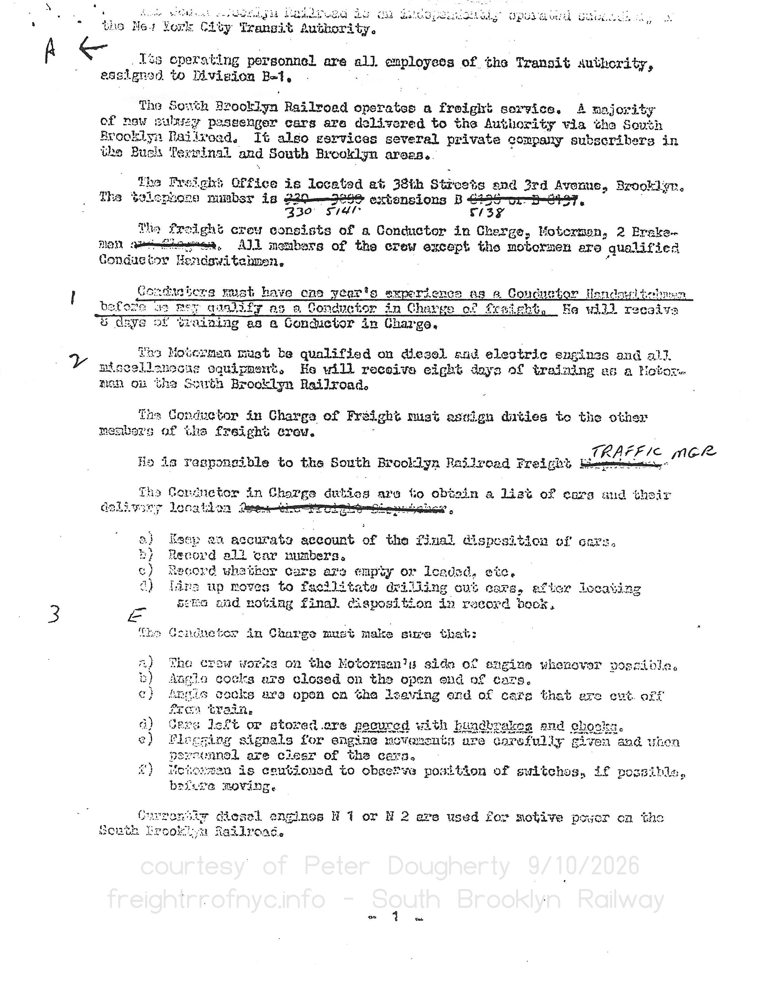 |
The South Brooklyn Railroad is an independently operated subsidiary of |
| . | |
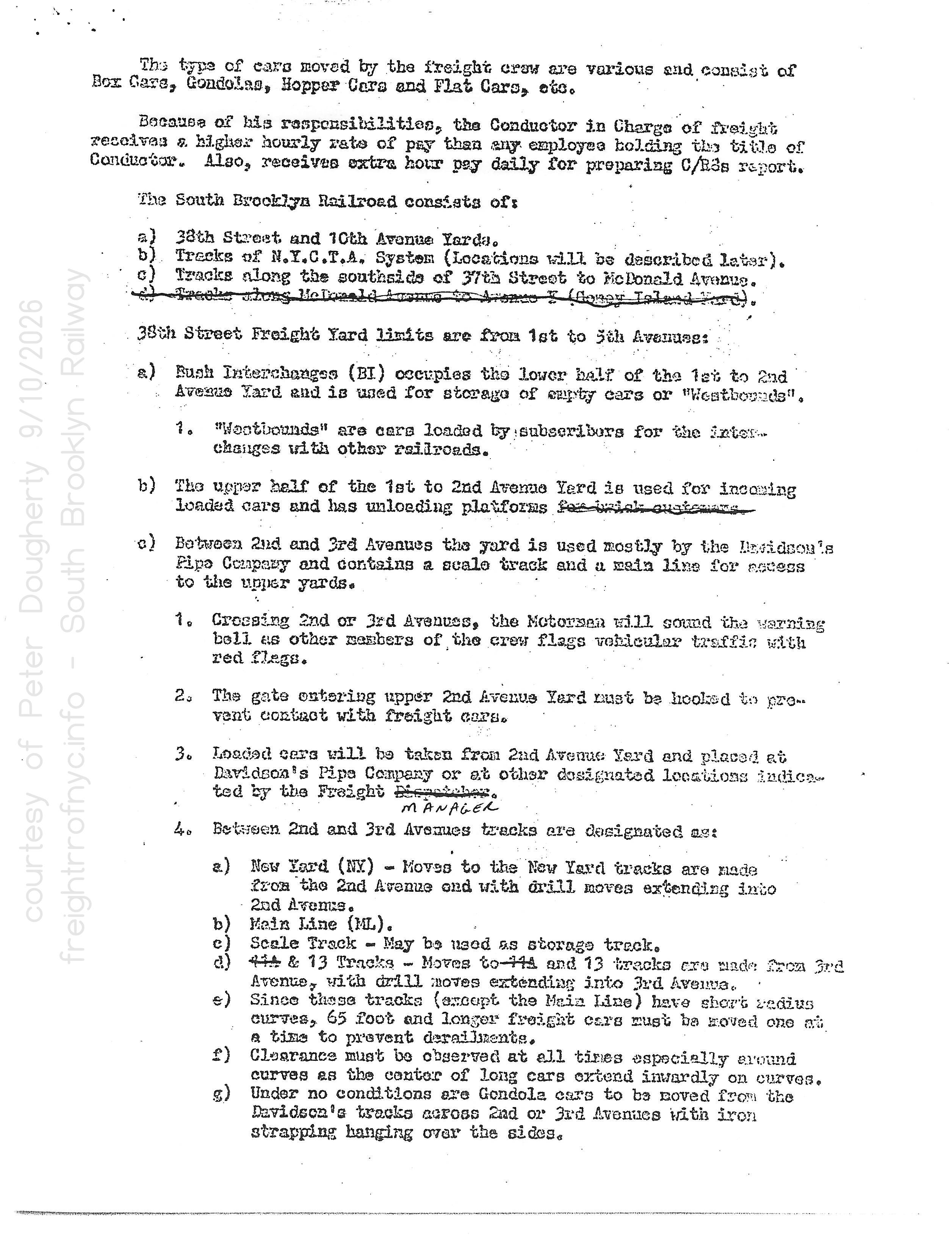 |
The type of cars moved by the freight crew are various and consist of |
| . | |
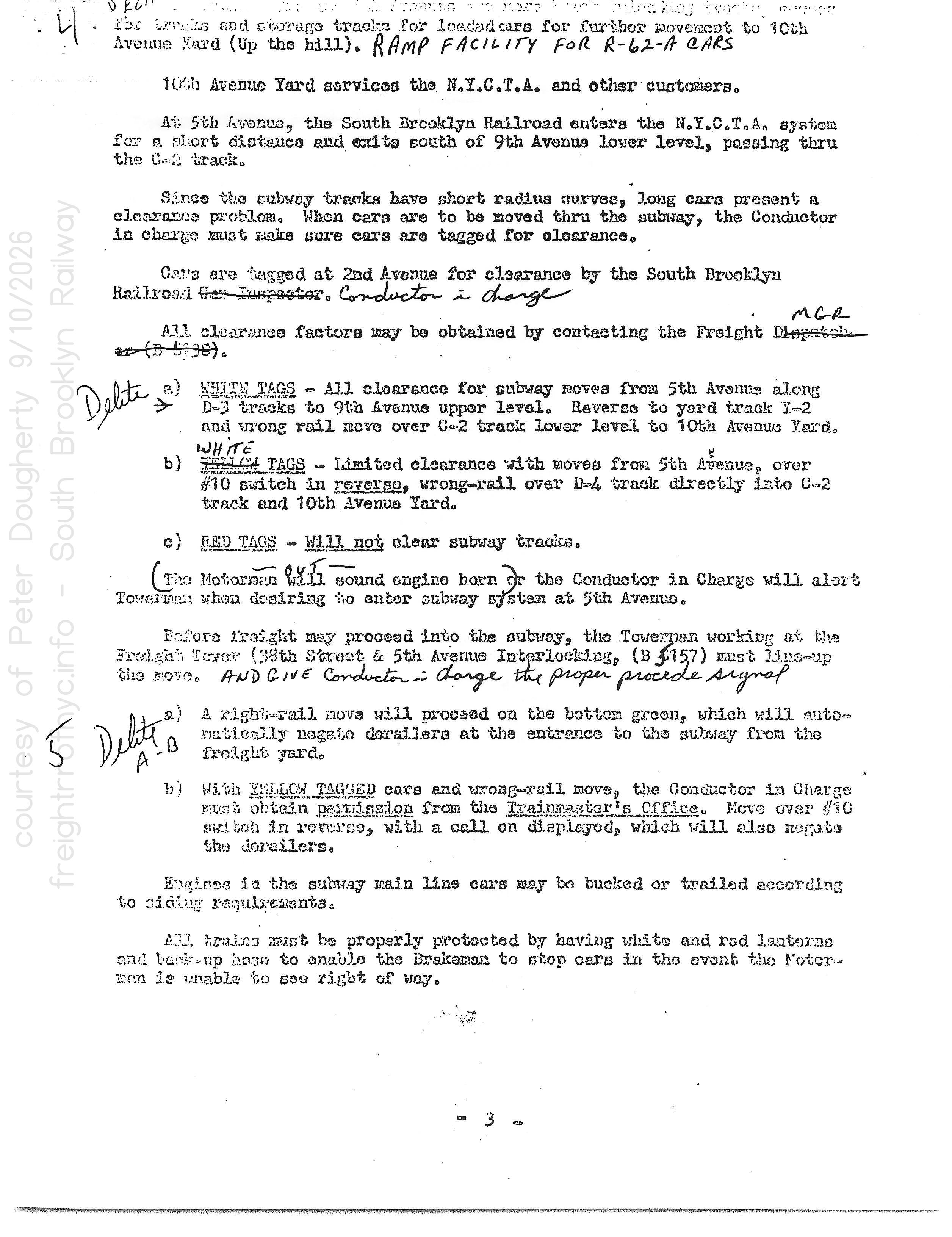 |
h) Between 3rd and 4th Avenues are more brick unloading tracks, access |
| . | |
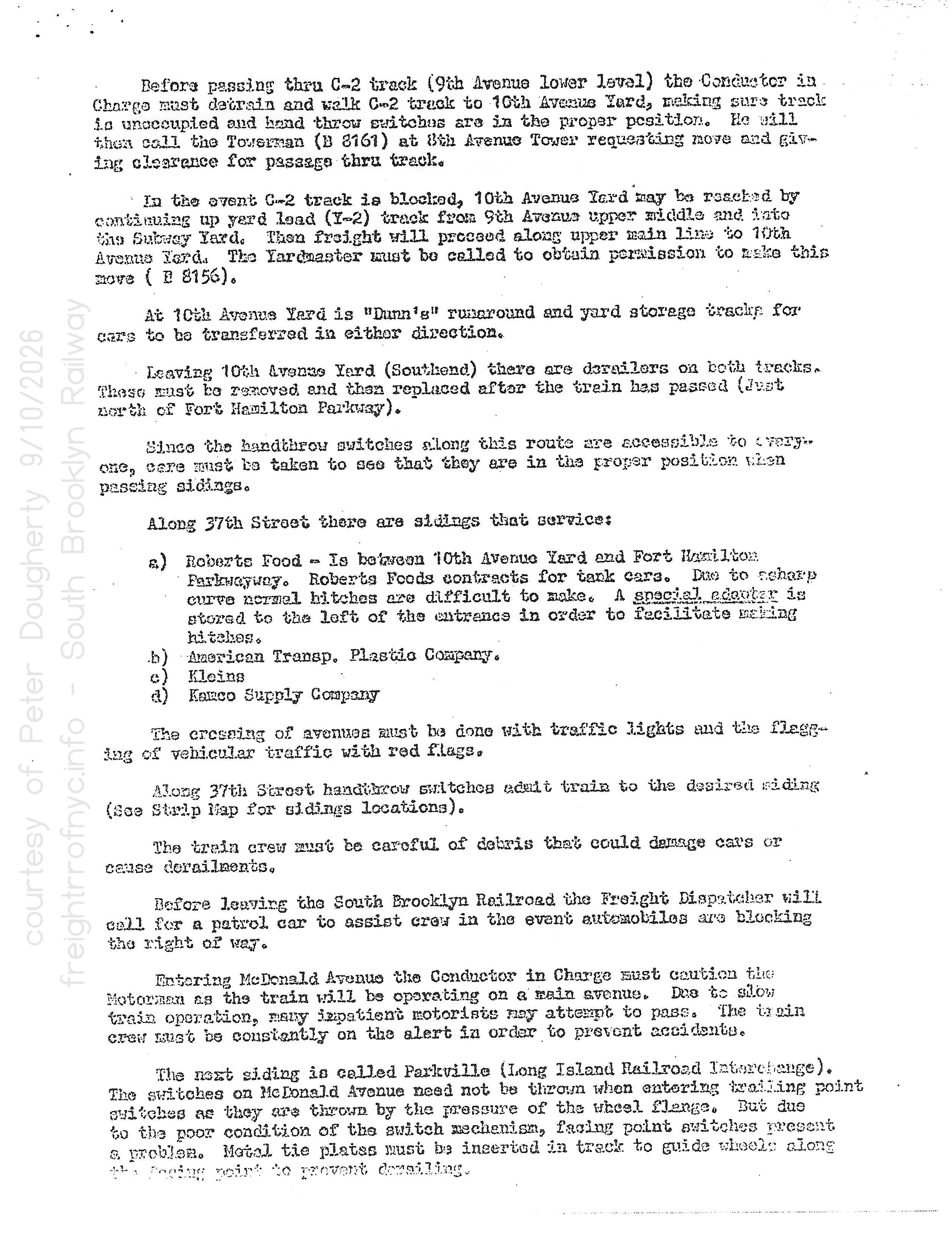 |
Before passing thru C-2 track (9th Avenue lower level) the Conductor in |
| . | |
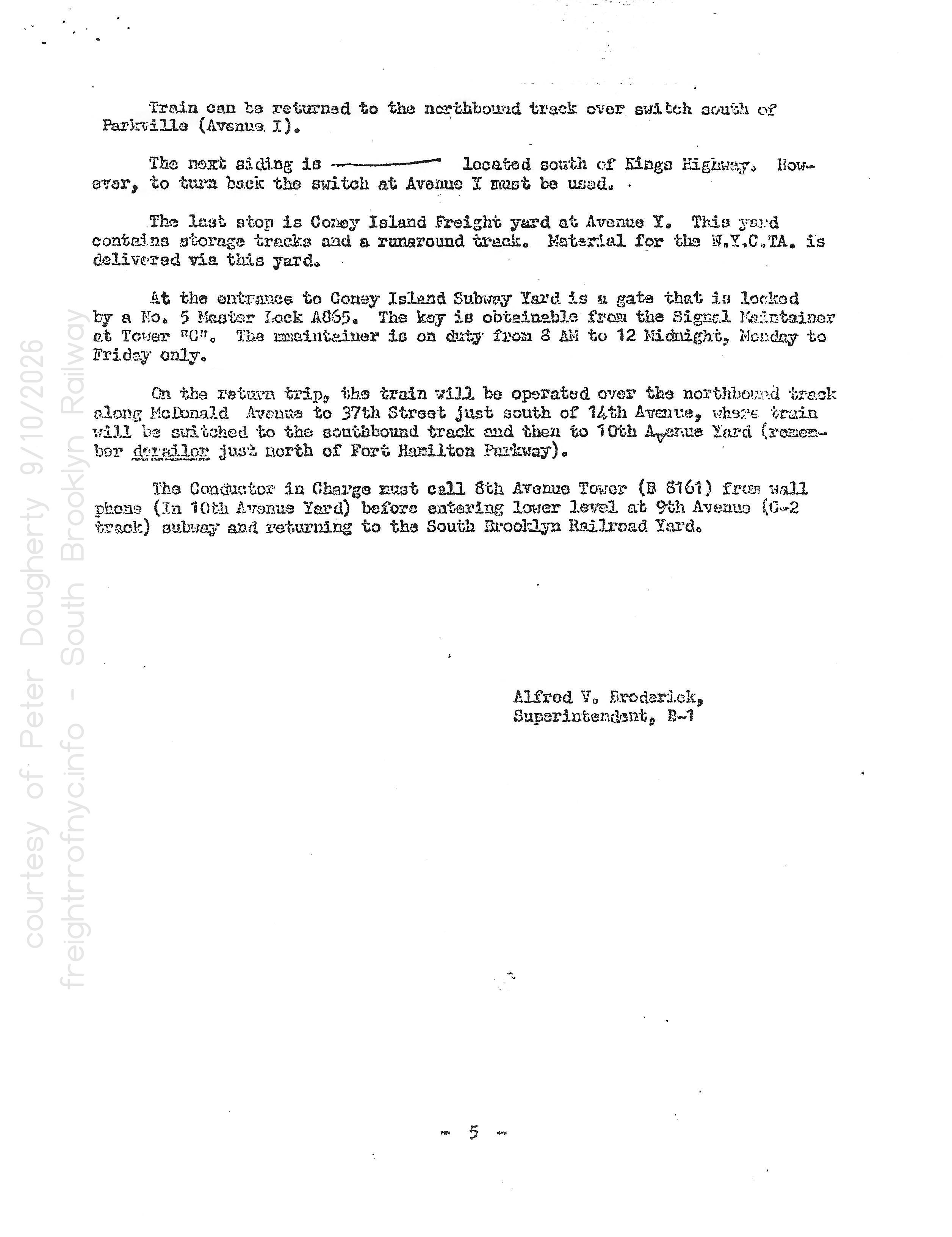 |
Train can be returned to the northbound track oer switch south of |
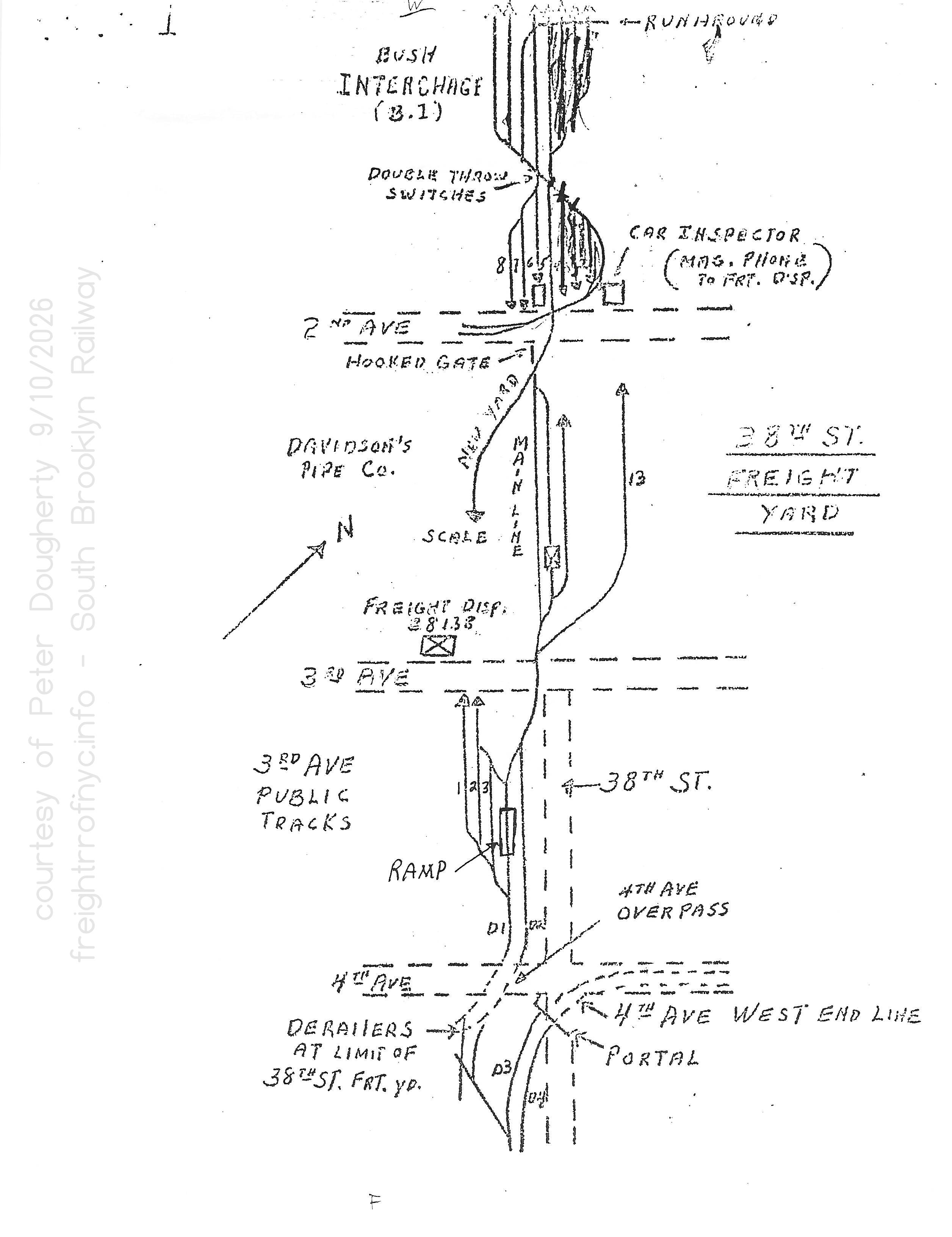 |
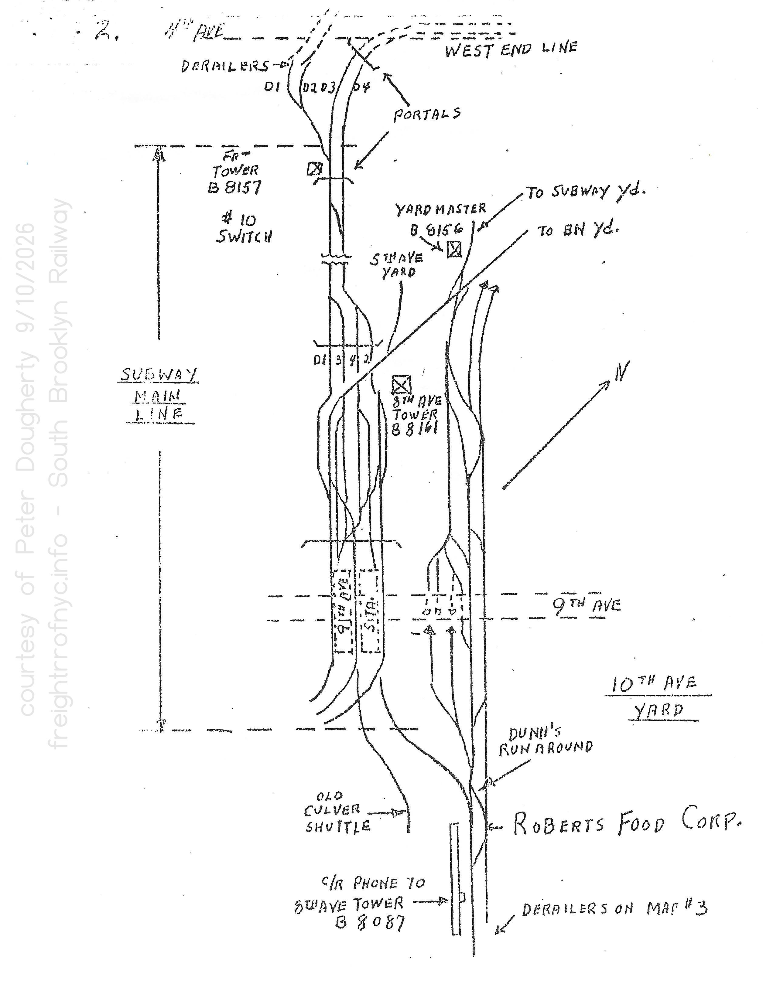 |
| . | |
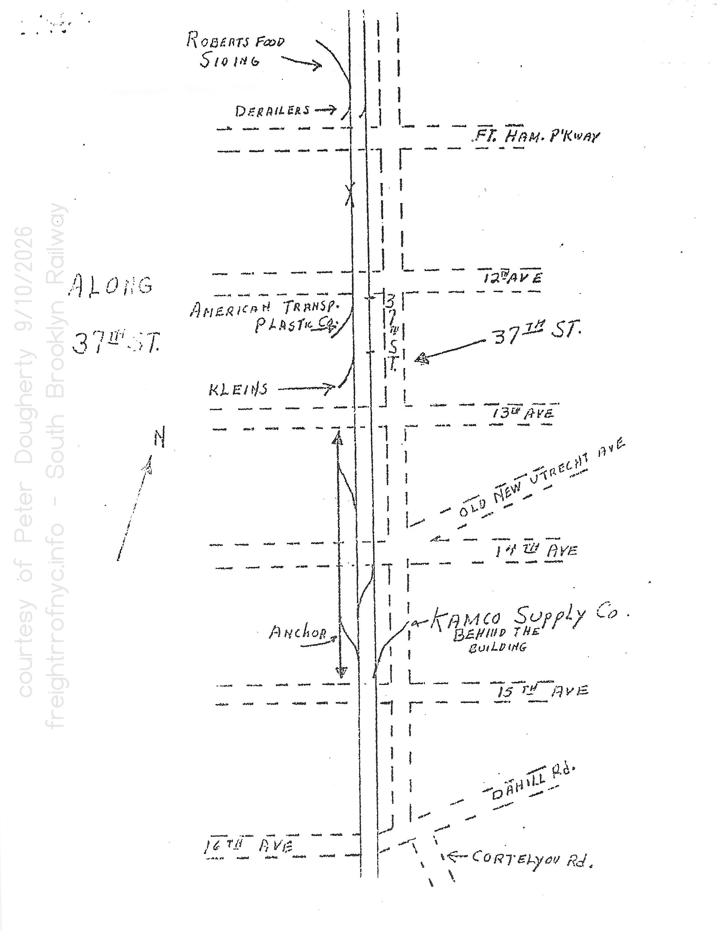 |
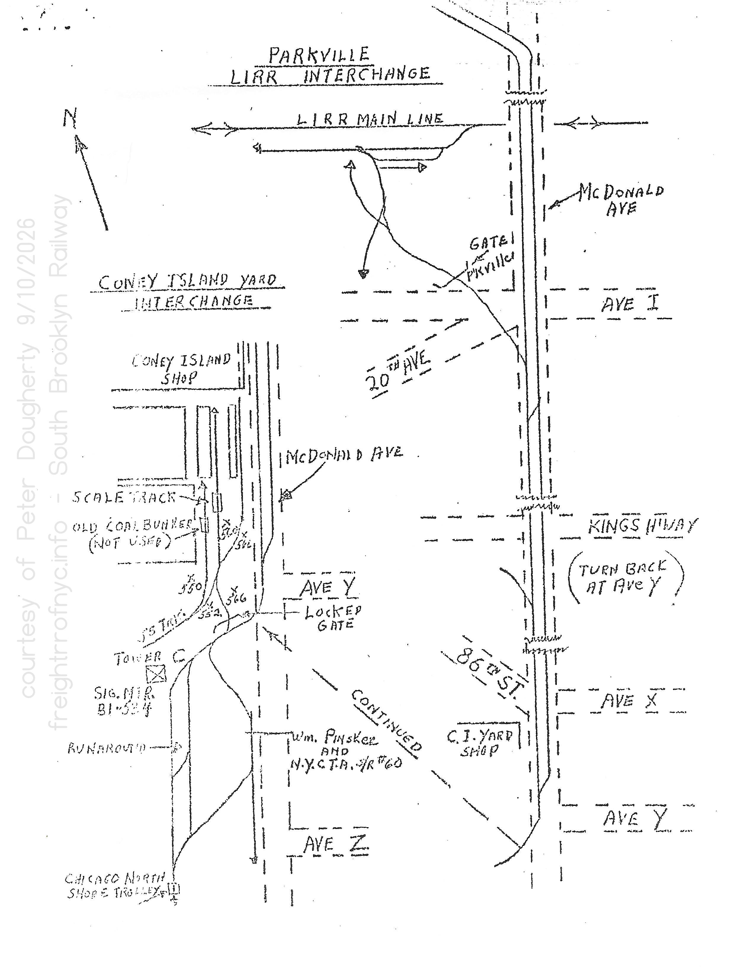 |
| . | |
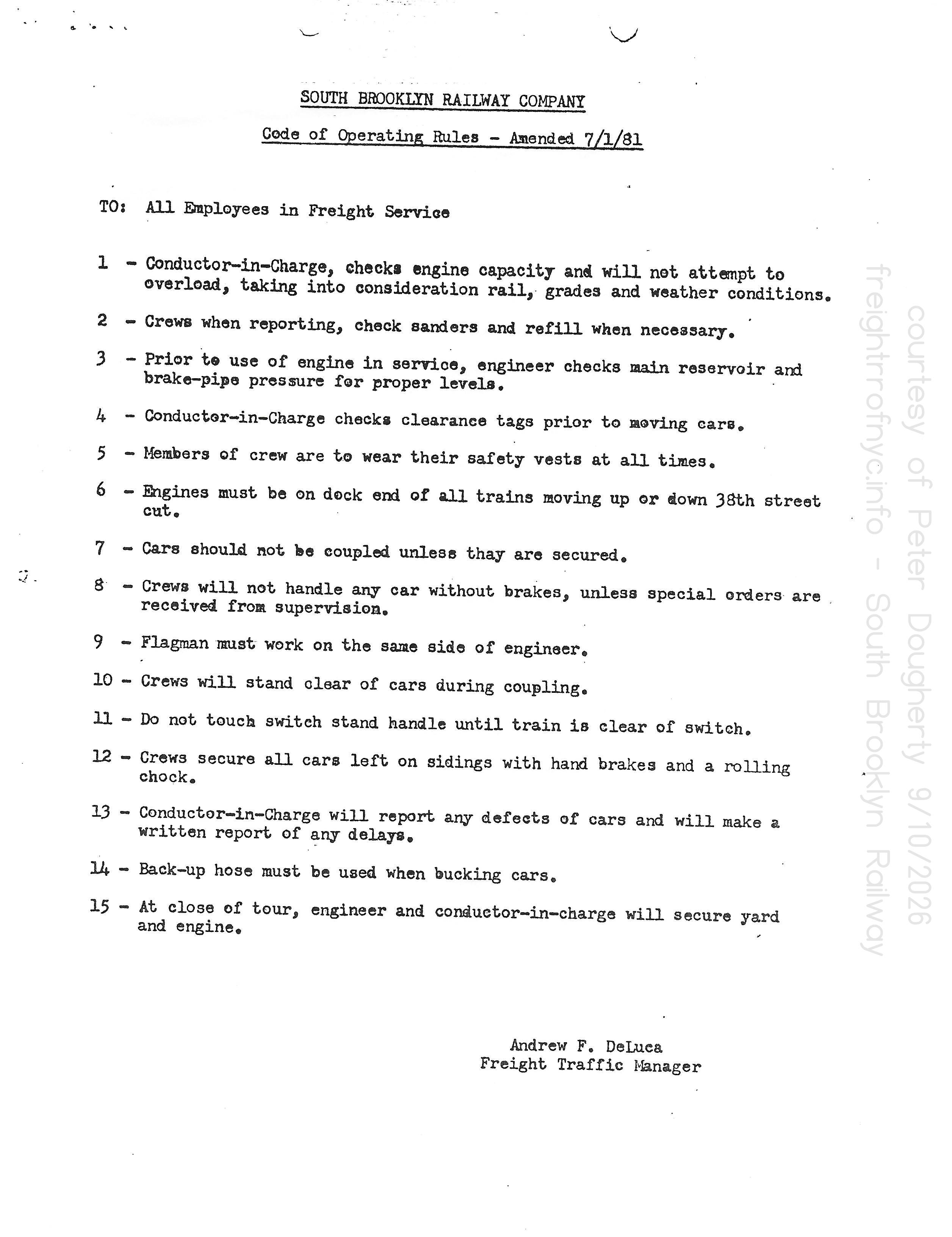 |
SOUTH BROOKLYN RAILWAY COMPANY
Code of Operating Rules - Amended 7/1/1981
|
| . | |
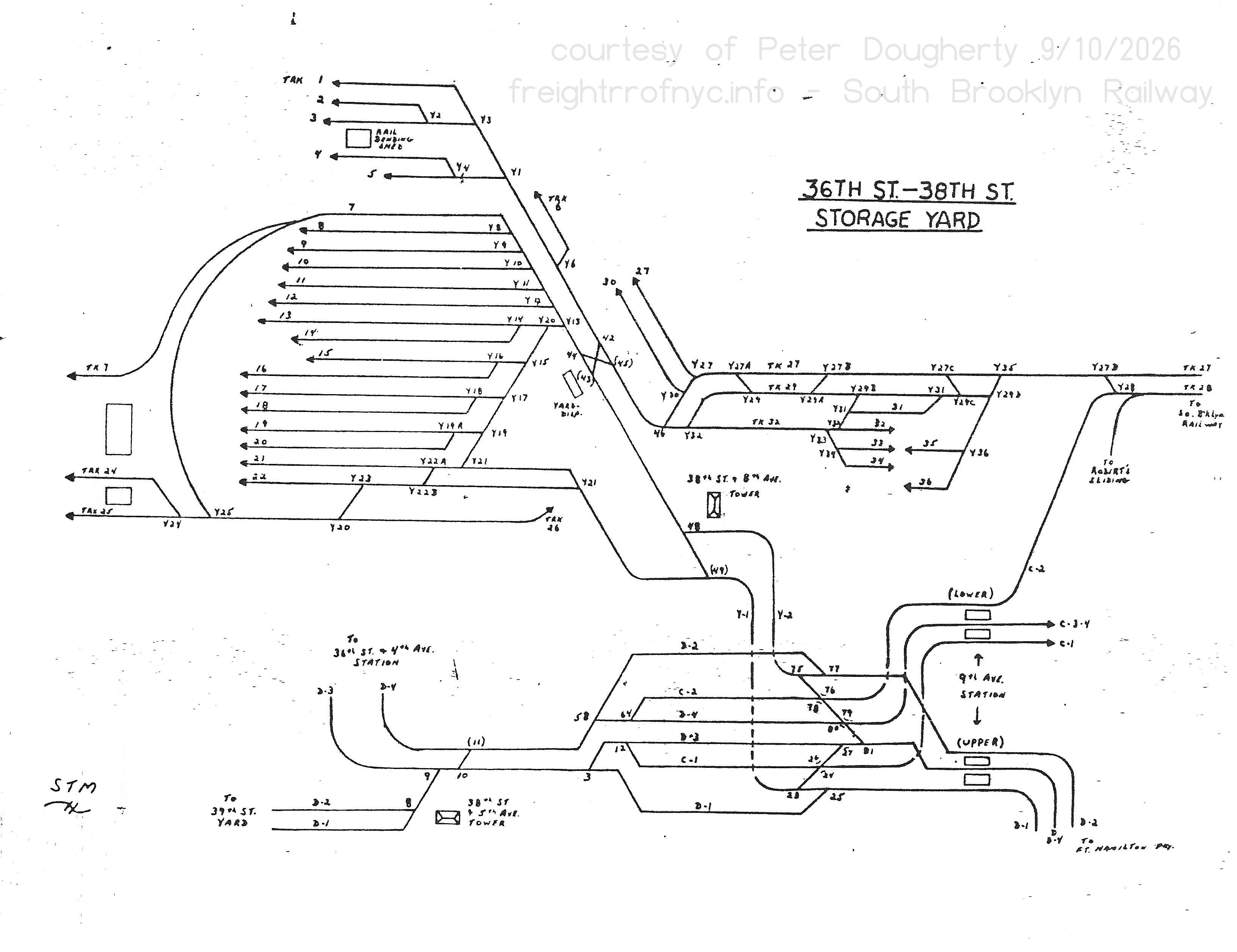 |
|
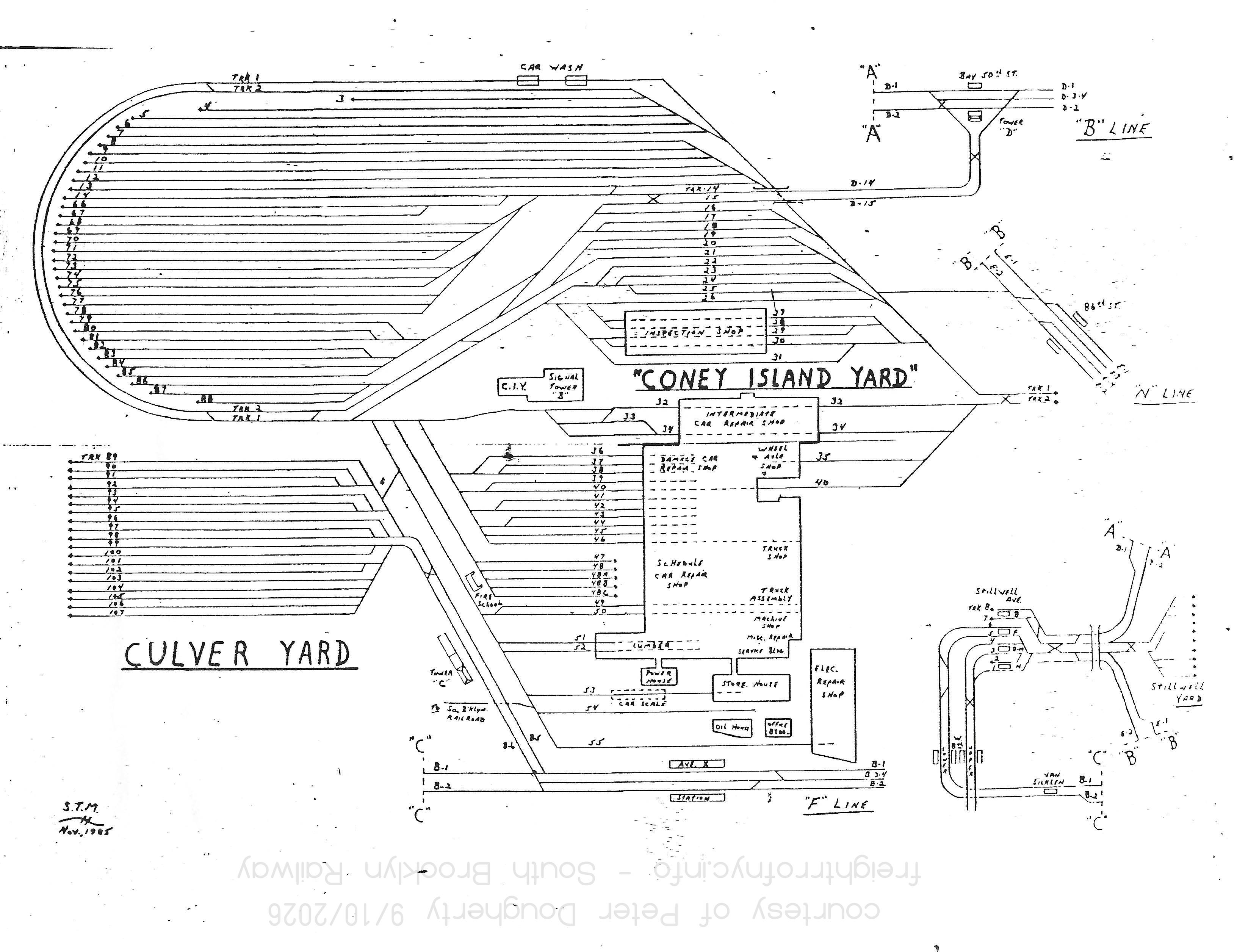 |
|
Additional yard maps from other NYCTA facilities were included in the file, but have been omitted as they are not pertinent to the operation of the South Brooklyn Railway.
As described in the Linder / Eppler article (which apparently took abridged sections of the above manual), the following procedure for operating a train is as follows:
.
The Crew
A typical freight crew for the South Brooklyn Railway consisting of a Conductor in Charge, a Motorman, two brakemen and a flagman.
All members of the crew except the motorman are qualified Conductor / Handswitchmen. The motorman is qualified on Diesel-electric locomotives and straight electric motors and all miscellaneous equipment, and of whom received eight days of training as a South Brooklyn Railway motorman. Conductors must have at least one years experience as a Conductor / Handswitchman, who then must qualify as a Conductor of in Charge of Freight after ten days training.
The Conductor in Charge is responsible to the South Brooklyn
Railway Freight Dispatcher and receives a list of cars and their
destinations from him. Before the cars can move, the Conductor must
record the following information:
When the train arrives at the Ninth Avenue Station on Track C-2 (lower level); the train comes to a stop. It must wait until the conductor detrains and walks on foot (about 600 feet) along track C-2 to the Tenth Avenue Yard, making sure the track is both unoccupied and that the hand throw switch is properly aligned.
If Track C-2 is occupied, the train may call the dispatcher, to align a route west to operate up the incline and onto Yard Lead Y-2 and into the 36th Street Yard, where it can be switched and reversed direction again heading east.
Upon arriving at the Tenth Avenue Yard, the locomotive(s) which were coupled to the rear or west end of the train at Fourth Avenue on eastbound movements; are run around the train, and coupled to the east end (front) of the train. Then the train can resume it eastbound movement in a conventional towed manner.
Upon leaving the Tenth Avenue Yard, the South Brooklyn Railway is now operating on its own right of way under the Culver "El", paralleling 37th Street where most of its customers are located. This is unsignalled (dark) territory and sections of the route have manual derails.
Depending on how far the train is going to travel, the train crew must drop the manual derails at Fort Hamilton Parkway, Thirteenth Avenue and Fourteenth Avenues, and any sidings the train may need to use; as well as raise the derails after the train has passed. These derails were a safety measure in case the hand brakes on a freight car failed or were intentionally released by vandals; and so the derail prevented a runaway car from going more than a city block.
Before crossing avenues or streets that are protected by traffic control devices (traffic lights), crews must be sure that the vehicle traffic light (where mounted) is displaying green. Vehicular traffic must be flagged with red flags on streets and avenues not protected by a traffic control device.
As the train proceeds along 37th Street, it will most likely interrupt an Italian bowling game, bocce; played on a cinder court between the rails. Images can be seen in the Memoirs chapter below.
Trains operate infrequently between Kensington Junction where the South Brooklyn Railway right of way on the surface (and under the elevated Culver Line until 1980) turned south onto McDonald Avenue.
.
Transition Cars, Dual Couplers, and Compromise
Couplers (Coupler Adapters) for hauling Subway Cars
.
Unique to South Brooklyn Railway operations over and above all the other industrial and offline terminal railroad operations covered by this website, is the fact that the South Brooklyn Railway used to transport standard freight cars, as well as various models of subway cars for its parent organizations: the BMT, the Board of Transportation and the NYCTA.
It did not just haul those new subway cars arriving and obsolete models being shipped out; but also hauling the varied equipment comprising of the museum collection throughout all eras of NYC Transit history.
Because subway car couplers differ from standard freight car couplers, to accomplish this special devices and / or methods are required. This chapter covered those devices and methods.
.
How They Arrived
.
One of the more intriguing question was how the various models of subway cars arrived into the New Jersey area (to be carfloated over to Brooklyn) in the first place.
It appears two different methods were utilized. The early subway cars came in on their own wheels, at the expense of pre-revenue service wear and tear. Afterwards, others came in mounted on long flat cars from a freight car leasing corporation: TTX. This change appears to have taken place between the R32 and R44 contracts. No pictures could be found in the nycsubway.org archives to determine the arrival method for R38's (built 1966-1967), R40's (built 1967-1969) or R42's (built 1969-1970).
.
MCB - AAR Type E - alphabet soup
Also encountered and similar in usage is the "transition car". This piece of rolling stock is equipped with a standard MCB / AAR Type E coupler on one end and subway style coupler on the other.
The MCB Association was formed in May of 1867 where attendees suggested the idea to form an association of men responsible for the cars of each railroad. This association called the "Master Car-Builders Association" was established on September 18th, 1867 at Altoona, Pennsylvania, with the goal of finding solutions to deal with the problems created by interchanging freight cars. Here the nations Car-Builder's resolved that: "...a committee be appointed with power to publish an illustrated book, defining the proper terms or names of each and every part used in the construction of railway cars, and a description of the use of the same." This publication would be known as "The Car-Builder's Dictionary."
The MCB was later absorbed under the Amercian Railway Association "ARA" in 1919 which codified the various departments of railroad operation: Car Accounting, Car Builders, Freight Claims & Adjustment, Safety, Structures, Signals, Telegraphy, Track, among others. On October 12, 1934, the ARA ceased to exist, having joined with several other railroad industry trade groups to merge into the Association of American Railroads "AAR".
Hence why the standardized knuckle couplers in use in the United States are known as MCB / AAR couplers.
Relatively speaking, almost any common freight car, passenger car or even subway equipment can be converted into a transition car; where one of the couplers were changed to the type needed. It is not a hard process to accomplish. In "olden days" three or four men and a forklift, or a wheeled hoist was used. Today, one man and a small truck mounted jib crane is used.
Within this page, you can find photos showing many different types of transition cars. Usually, gondolas or flatcars were used for pulling new and rebuilt subway cars off flatcars at the loading ramp at the 38th Street "unloading" yard, as these would be of the lightest types of freight cars in use. NYCTA cut down some older subway cars to the floor, installed an MCB coupler on one end and used that to offload new subway cars off the flat car transporters. This became one of their "internal" (not to venture outside the subway system) transition cars.
As the different subway car manufacturers were located in various parts of the United States, these subway car builders would have had to contract with the trunk line railroad near their construction shops to move the NYCTA subway cars east.
.
Subway car rebuilders were located in:
| R1/9's in transit east. Note gondola transition car. | R32's in transit in New Jersey. Note DL&W gondola transition car before caboose. |
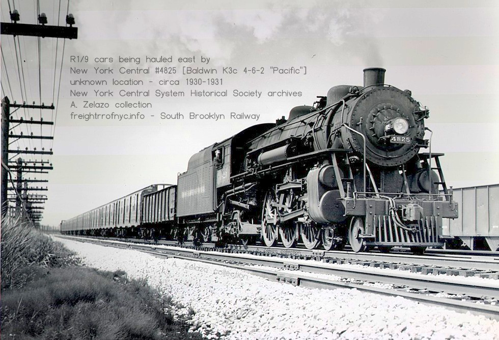 |
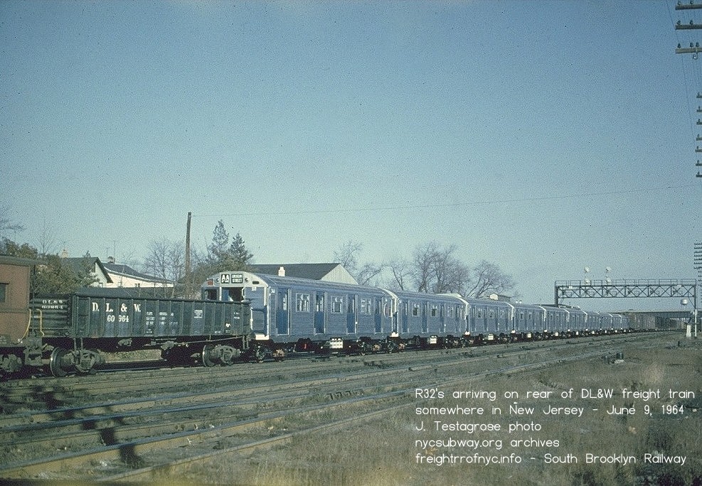 |
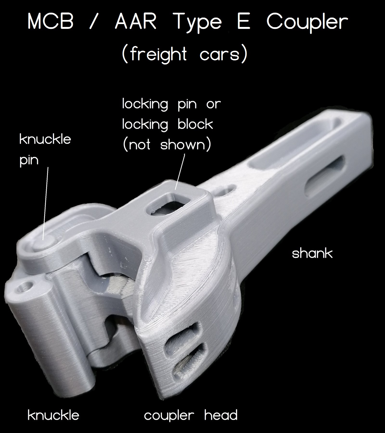 |
At this time, two unloaded gondola cars (I have never seen anything used but gondolas) in regular freight service were leased by the NYCTA, and one gondola was placed near the rear of the train, and the other at the front. Railroad car-men (men assigned to repair railroad cars by their respective freight railroad) would change out the standard MCB / AAR coupler (seen at left) on the ends of the gondola car that were facing the subway cars, to the type coupler that mated to the particular model of subway cars being hauled (not all shown as there were several types - one type seen at right.) The loose MCB / AAR coupler, was placed in the gondola, to keep it and the car together. This particular gondola car had now become a "transition car." It would be coupled to the respective ends of the "cut" of subway cars, allowing the subway cars to be hauled on any railroad line, in any freight train, by any standard freight locomotive (as the "normal" ends of the gondola car were equipped with the standard MCB / AAR couplers.) The subway cars were then loaded onto carfloats in New Jersey, moved across the harbor by tugboat to Bush Terminal, Brooklyn; where they were pulled off the carfloat by the railroad operating at Bush Terminal at that time: - Bush Terminal RR (1906-1971) Once off the carfloat, they would be brought to the Bush Terminal South Brooklyn Railway Interchange Yard at Second Avenue & 38th Street; where the subway cars were transferred to the South Brooklyn Railway. The South Brooklyn Railway would then pick up the cars and bring them to Coney Island Shops for final inspection and testing, then enter service. |
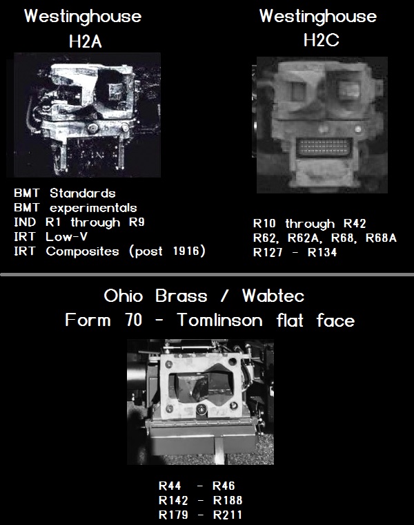 |
The coupler on the transition car (gondola) would be changed back to MCB / AAR coupler by NYCTA car-men; and the gondola car was sent back to Bush Terminal, back across to New Jersey by carfloat, where it was released back into normal freight service.
.
.
Rethink
After the R32 cars were delivered, the shipping procedure was changed. Being as where the subway car builders were located: Pullman-Standard in Chicago, Illinois; the St. Louis Car Company in St. Louis, Missouri or the American Car Foundry in St. Charles, Missouri; it was no longer preferred to haul the subway cars on their own wheels for 700-800 miles, before seeing actual transit service.
This change was for the obvious reasons of wear and tear; not to mention the possibility of incurring damage: a traction motor might have seized; gears broken; a wheel-set locked up; a wheel flange chipped at a bad crossing or broken rail; or any number of types and kinds of damage. Then there is the unfortunate assignation of who is to blame (the builder, the hauling railroad or the railroad doing the carfloating from New Jersey to Brooklyn, et al.)
This of it like this, it's like buying a brand new automobile, and giving it to someone else to drive it around for while before you do. And after you get it back but before you drive it, it already needs an oil change, a wash and wax. A a brake light bulb blown, the cigarette lighter don't work, or chip in the windshield? You gotta fix it before it meets inspection.
Therefore, the revised process for transporting subway cars was to now mount them on long flat cars (also known as trailer flats or "TOFC" - trailer on flat car) which were used to transport two 40 foot truck trailers large distances or cross county. These TOFC cars were 85 feet or 89 feet in length and they fit two 40' truck trailers end to end. Whereas the newer subway cars were 75 feet in length, they fit perfectly.| R44's and R46's came into New Jersey on flatcars, offloaded in New Jersey first. | R46's arriving E-L Croxton Yard, July 5, 1976 |
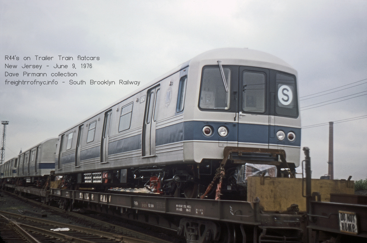 |
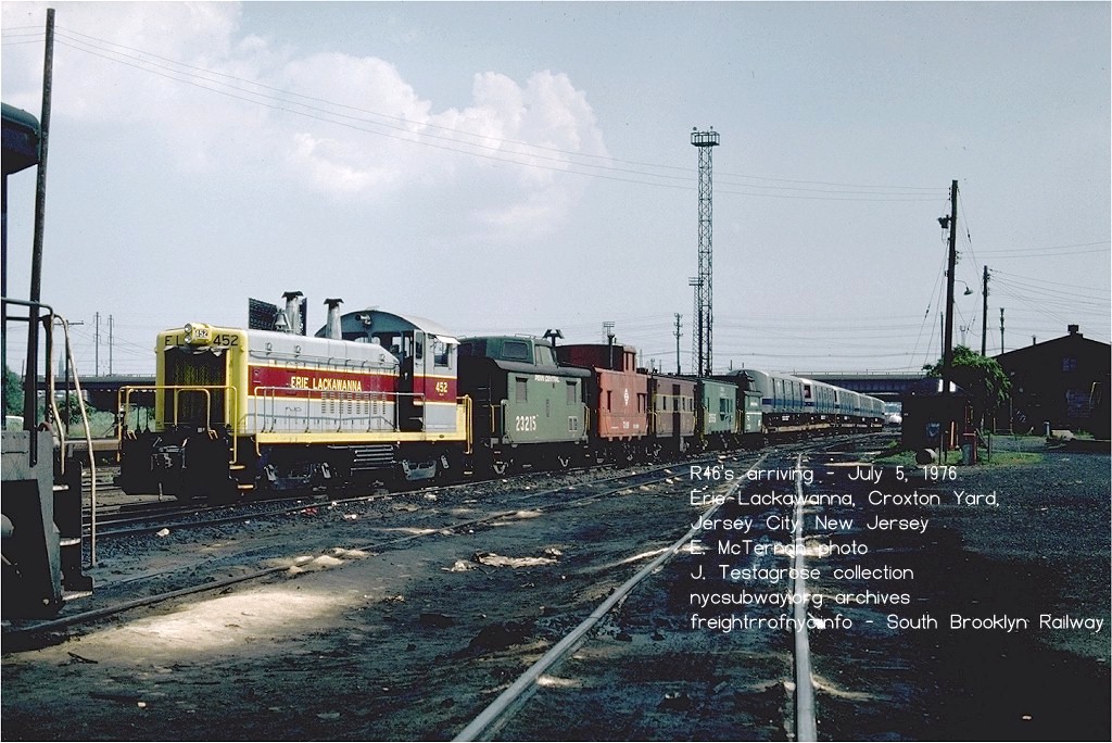 |
However, once that freight train arrived
on the Hudson River shoreline of New Jersey at one of the rail-marine
terminals (the Erie; Lehigh Valley; Delaware Lackawanna & Western;
New York Central; or the Pennsylvania Railroad); the subway cars would
be inspected, then unloaded onto their wheels and inspected again.
Now, a transition car was needed to get them onto a carfloat to get
the subway cars to Brooklyn. So, it was now in New Jersey that two
gondolas had their couplers changed and pressed into service as
transition cars.
|
|
|
| . | |
|
|
|
.
.
Rethinking it again: on the flatcar all the way into Brooklyn.
.
| R62A's arriving on flatcars at Third Avenue & 39th Street Yard (Davidson Pipe), Brooklyn, NY | Morrison Knudsen (Hornell, NY) rebuilt R42's arriving on flatcars at the 38th Street Unloading Yard, Brooklyn, NY. Note the cut down IRT subway car, now repurposed as a transition / reacher car. |
|
|
|
General Electric (Buffalo, NY) rebuilt R38's also arrived from General electric rebuild on flatcars at the 38th Street Unloading Yard, Brooklyn, NY. Note the cut down IRT subway car, now repurposed as a transition / reacher car. |
|
|
|
|
NYCTA Work Motors and Transition Cars
.
Most of the work equipment used by the New York City Transit Authority, (flats cars, tanks cars, gondolas, et al); is equipment that has the standard MCB / AAR coupler mounted (with a few exceptions for specialized or proprietary equipment.)
It is well known, that the Transit System, from the 1930's through the 1980's was always having to beg for funding to purchase new subway cars; therefore it could hardly afford to budget for new workequipment new. Therefore, reusing obsolete cars saved expenses and it made do with what it had. BoT / NYCTA shop forces were very ingenious and very creative.|
|
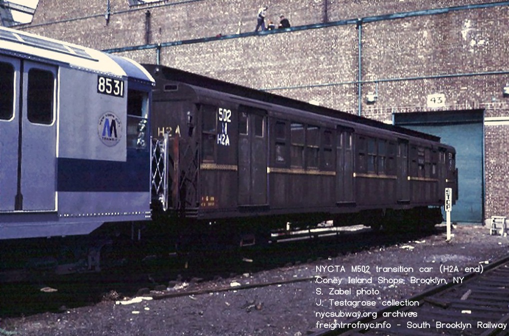 |
|
Transition car M502 (R1) on the south end of R44's going out to LIRR
for speed testing and after having been delivered to LIRR / SBK Parkville Interchange - Brooklyn, NY - February 18, 1972 Note transition car is marked for MCB coupler on this end. Other end of transition car has H2A coupler to mate with subway cars. M501 is on the other end of the subway cars. S. Zabel photo J. Testagrose collection added 19 Dec 2009 |
Transition car M502 (R1) on the at Coney Island Shops - Brooklyn, NY - April 13, 1972 Note transition car is marked for H2A coupler on this end, coupled to R30 #8531 S. Zabel photo J. Testagrose collection added 19 Dec 2009 |
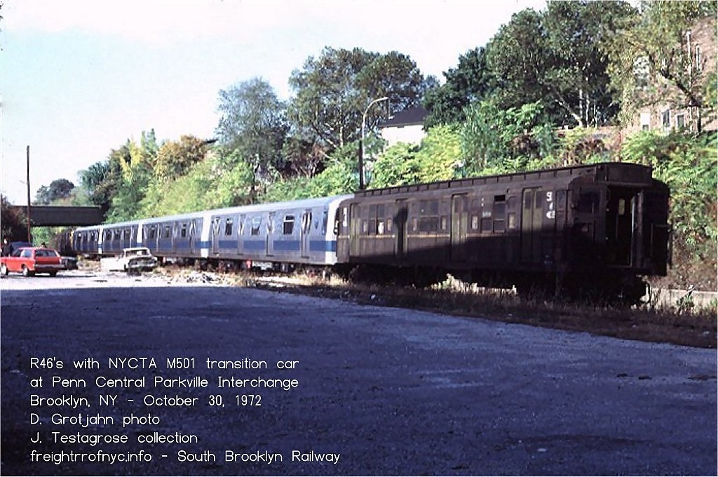 Parkville Interchange - Brooklyn, NY - October 30, 1972 M502 leading, M501 is presumably on the other end. S. Zabel photo J. Testagrose collection added 29 September 2026 |
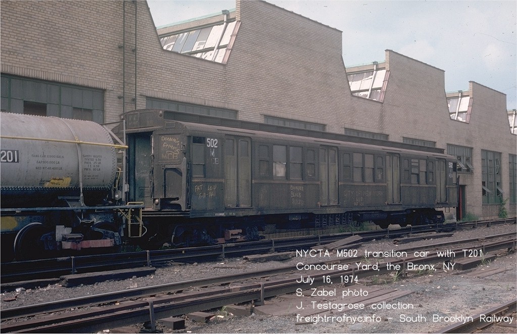 Concourse Yard, the Bronx, NY - October 30, 1972 M502 coupled to NYCTA T201 tank car S. Zabel photo J. Testagrose collection added 29 September 2026 |
|
|
|
| In
February of 2020, I was
involved in a dialog in a Facebook group where another group member
insisted
that the opposite end of the transition car (M502) shown in the image
has MCB couplers on both ends, and a coupler adapter was used to mate
with the R44's. After having spoke with Benjamin Schaeffer and Michael DeLuca; it turns out Mr. DeLuca was present for this move. There was NO coupler adapter between the R1 and the R44. The R1 car was exactly as I have described: MCB coupler on one end (closest to the camera) and H2A coupler on the other end (coupled to R44's).
According to the NYCTA compatibility chart; H2A and Ohio Brass Form 70's will mate. Therefore no compromise coupler / adapter is needed between the H2 and Form 70. An image of the H2A end can be seen here: M502 H2A end image - nycsubway.org I was also told that compromise couplers (a/k/a coupler adapters) did not begin use on the TA until 1975; but transition cars are still used as necessary (such as on the unloading ramp in the photo below, when needed and when weight loading prevents direct coupling with a compromise coupler. Furthermore, this same Facebook group member insisted that M502 is not called a transition car, but a "spacer" car. Again, I inquired of Mr. Schaeffer. As I have been told, a spacer car has MCB coupler on both ends and is used to spread out the weight of the work locomotives which also have MCB couplers front and rear. Furthermore, these "spacer" cars are listed as a Rider Cars (RDxxx) in NYCTA rosters. This is NOT the case in this photo. For the record, Mr. Schaeffer is employed with the NYCTA for over 23 years, and Mr. DeLuca has been employed by several railroads since the 1970's. I believe their tenure quantifies their industry knowledge, over and above the fact that both have been avid transit / Brooklyn railroad buffs even longer than their professional railroad careers. |
.
Compromise Coupler / Coupler Adapter
.
As technology progressed, these couplers changed in function and style; from early and simple Van Dorn couplers (which were similar to link and pin), to the current automatic type couplers self-containing of air and electrical connector lines and being able to be uncoupled by the push of a button in the cab of the subway car. A list of couplers used by subway car models as follows:
| subway car model | coupler model (for #1 end) |
| Van Dorn a | |
| R1 - R9 | WABCo H2A |
| R10 - R22 | WABCo H2C |
| R26 - R28 (pre-GOH) | WABCo H2C on #1 end, H2CAR (semi-permanent for married pair operation) on #2 end |
| R26 (GOH) and R28 (GOH) | WABCo H2C on #1 end only b |
| R29 and R29 (GOH) | WABCo H2C on #1 end only b |
| R30 - R30A | WABCo H2C on #1 end, H2CAR (semi-permanent for married pair operation) on #2 end |
| R32 | WABCo H2C b |
| R33, R36 (all versions) | WABCo H2C b |
| R38 | WABCo H2C b |
| R40S, R40M, R42, and all GOH versions... | WABCo H2C b |
| R44 (pre-GOH) | Ohio Brass Form 70 c (will mate with H2 types) |
| R46 (pre-GOH) | Dresser w/ centering device (Ohio Brass Form 70?) b? c? |
| R46 (GOH) | Hadady Coupler #RTD-107 w/ centering device b |
| R62 - R68A | WABCo H2C b |
| R110A | WABCo N2C b |
| R110B | NYABCo H2C(m) #RTC-201P? b |
| R142, R142A | WABCo automatic (model # unknown) b (Tomlinson style-flat faced, hook type with electrical portions) |
| R143 | WABCo automatic (model # unknown) b |
| R160A, R160B | WABCo automatic (model # unknown) b |
| R179 | WABCo H2C b |
| R188 | Tomlinson (Ohio Brass) automatic couplers b |
| R211 | WABCo automatic (model # unknown) b |
WABCo = Westinghouse Air Brake Company, now Wabtec NYABCo = New York Air Brake Company GOH = after General Overhaul a = Most, but possibly not all, early subway & el cars equipped with Van Dorn couplers were converted to H2A's b = Couplers are listed for #1 (operating cab) end. Post-GOH & modern subway car #2 ends are permanently coupled with linkbars c = will mate with H2A and H2C according to compatibility charts. NOTE: Despite certain models of subway cars have the same model coupler as others, does not mean that those different subway car models are compatible of being coupled & operated together. Compatibility is based upon brake equipment, and other systems. |
|
Before progressing any further, it must be kept in mind that when freight locomotives such as those operated by the South Brooklyn Railway, it is not necessary to have any electrical connections to the subway car(s) being towed, and it is only necessary to have a physical coupler match to that particular subway car, not an electrically operative one.
As such, those compromise couplers sharing physical profiles with one another could be used with various models of subway cars. However, which of those model subway car couplers on the above list that share physical profiles with another is not known at this time. It is presumed but unconfirmed that a compromise coupler suitable for mating to and H2A would be compatible with an H2C. I am trying to ascertain this information for inclusion here.
In any event, even this assortment of coupler models would pose a physical match incompatibility when trying to mate with the standard MCB (Master Car Builders) or AAR (American Association of Railroad) couplers found on typical freight cars and locomotives, hence the need for compromise couplers.
Locomotives #1, #2 and #3 show (by viewing the images in the locomotive photo chapter below) that they were equipped with Van Dorn type couplers. It is not known if these locomotives were ever converted to MCB couplers, and it is not believed so, as images of #1 in storage show it to still be equipped with Van Dorn couplers.
But it is known that there is a Van Dorn / MCB compromise coupler, and was used on 17 November 1998 when Car "G" (which was built in 1878 as New York Elevated RR #41 and subsequently converted to a money collection car by Manhattan Railway in 1898. In 1998, Car "G" was loaned from the Shore Line Trolley Museum located in East Haven, Connecticut; to the New York City Transit Museum collection displayed in former Court Street Station. It had to be trucked from Connecticut to the NYCTA's 207th Street Facility where it was unloaded. It was at this location that Car "G" was coupled to South Brooklyn Railway locomotive N2, utilizing a Van Dorn to MCB compromise coupler, and brought to Court Street Museum.
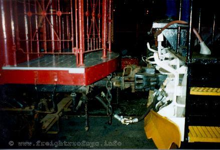
Car "G" on left with Van Dorn to MCB Compromise Coupler
with SBK N2 on right.
November 17, 1998
N. Gerstein photo
.
This image allows us to conclude that despite the advanced age of museum rolling stock and likewise its coupler profile of the series, the South Brooklyn Railway has an assortment of compromise couplers for movement of the museum pieces as well as re-purposed equipment pressed into maintenance of way service.
Locomotives #1, 2 & 3 are seen throughout their history in images equipped with Van Dorn couplers. It does not appear that either of these locomotives were converted to MCB/AAR coupler.
Locomotive #4 shows only an MCB/AAR style coupler, as does locomotive #5.
However, locomotives #6 and #7 were equipped with dual couplers, meaning they had both an MCB and a H2 subway car coupler mounted side by side on a common coupler shank, on both the front and rear of the locomotive. All a brakeman had to do, was move the desired coupler into position:
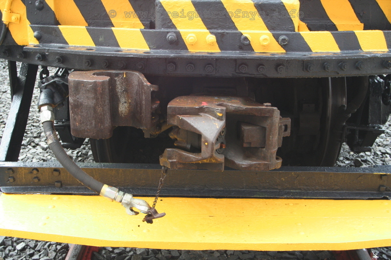
dual couplers on SBK 7 - April 2008
coupler on left: MCB (freight cars)- coupler on right: H2 (subway cars)
Coney Island
Yard, Brooklyn, NY - TA Roadeo
P. F. Strubeck
photo
added 24 Dec 2009
.
After the electric locomotives with dual couplers were retired, the South Brooklyn Railway Diesel-electric locomotives (which were equipped with standard MCB/AAR couplers) would need a compromise coupler or a transition car to pull subway cars.
Some of these unique, essential and all-to-often overlooked pieces of equipment necessary to South Brooklyn Railway operations. Here are just two examples of the many types used:
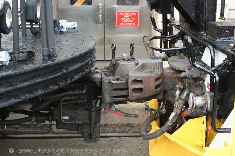
H2 (left) to MCB (right) Compromise Coupler (with knuckle lock pins) - April 2008
Observation / Inspection Car 0F116 on left, SBK N1 on right
Coney Island Yard, Brooklyn, NY - TA Roadeo
P. F. Strubeck
photo
added 24 Dec 2009
.
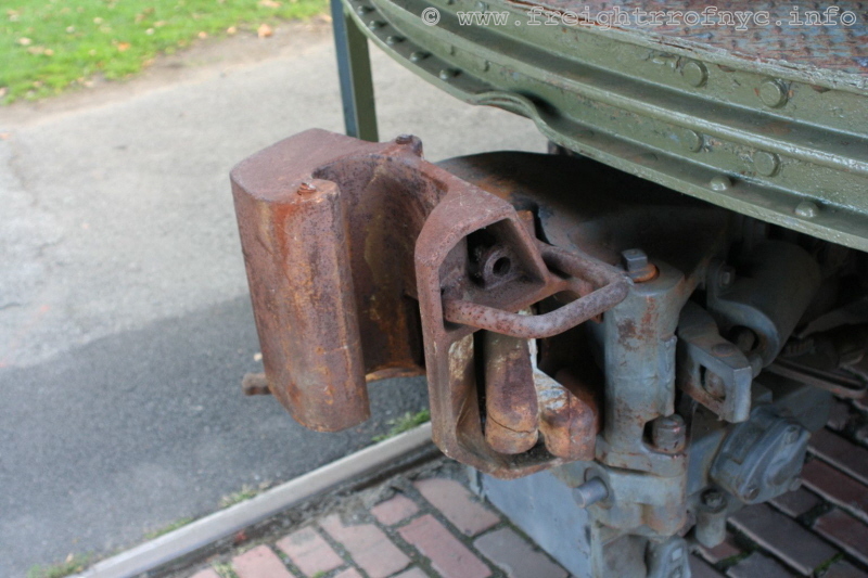
MCB to H2 Compromise Coupler - (MCB face showing) - October 2008
Trolley Museum of New York; Kingston, NY
P. F. Strubeck
photo
added 24 Dec 2009
.
With the utmost thanks to my "source" at the NYCTA; here is a composite photo of the issued poster that circulates with the Authority. The left panel is comprised of photos showing the types of car couplers encountered on subway equipment - both work (non-revenue) cars and revenue (passenger) cars. The right panel are photos of the adapters to be used for those couplers. Please note that the couplers shown for revenue equipment are for equipment in active service (when the poster was issued), and not for retired cars or cars in the Transit Museum.
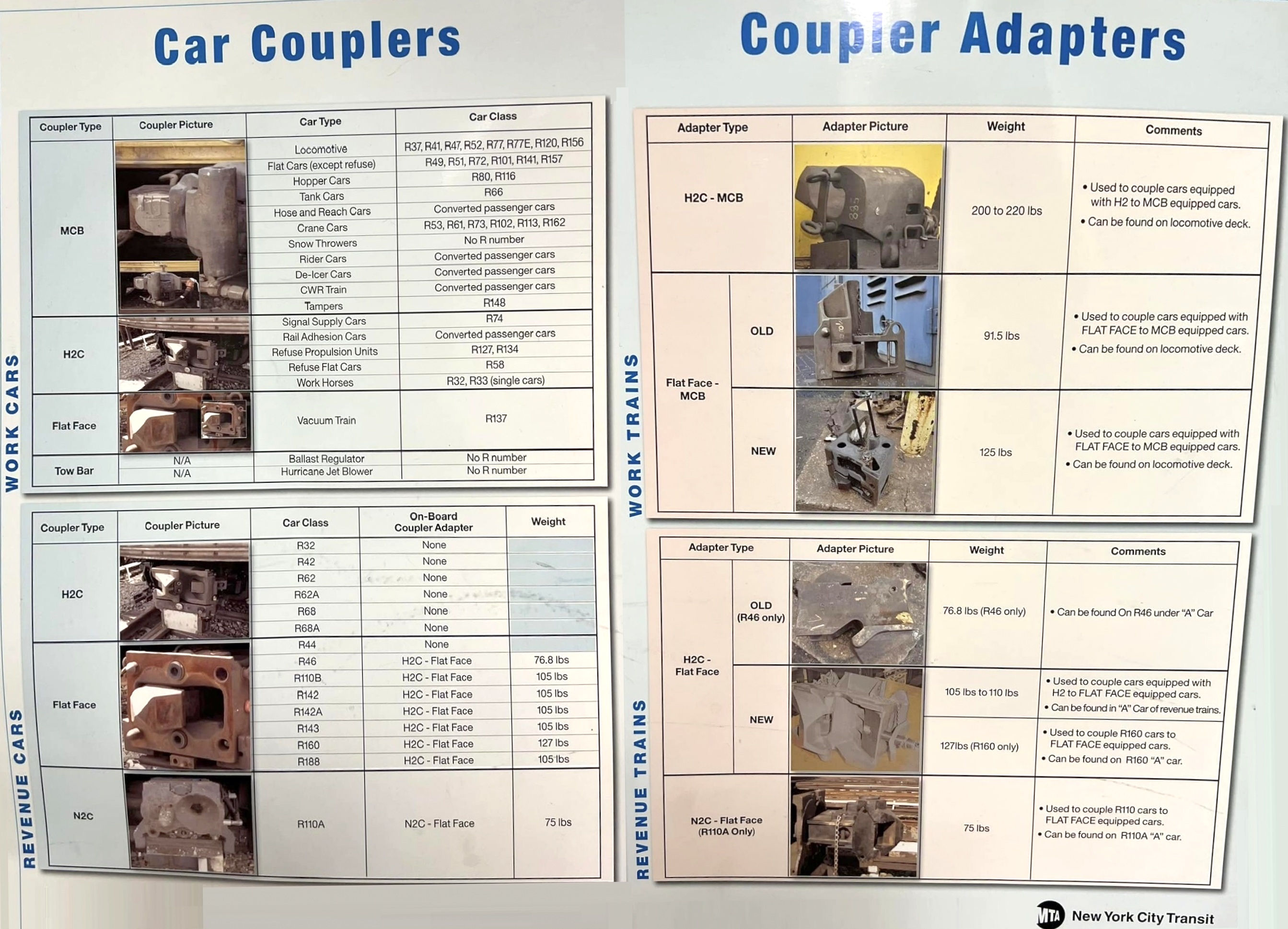
thanks MW!
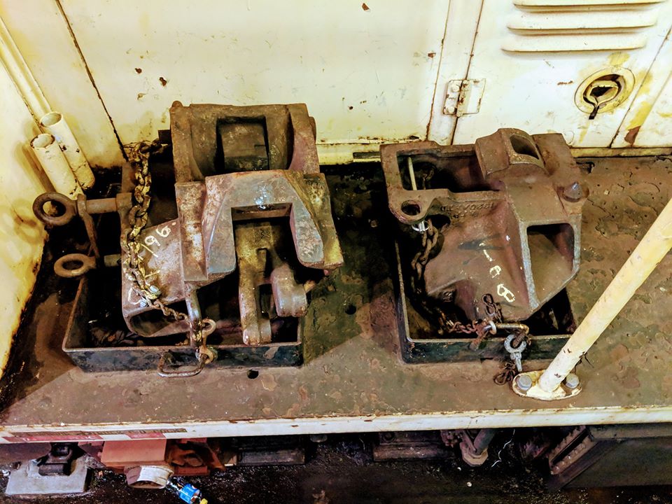
.
.
Synopsis
.
Having gone through all the known images of South Brooklyn Railway hauling subway cars, I have been trying to make heads or tails and determine which method was used at which point in time.
At first, I thought, the work motor / transition cars were only
used only in LIRR / Parkville interchange, but alas, there is a photo
of an LV gondola being used during a Parkville Interchange.
But I cannot seem to come up with firm determination.
This first table is organized by locomotive number.
| SBK loco | transition car (type) or compromise coupler | subway car model | date | notes | |
| 5&4 | transition car - gondola | R10 | 1947 | ||
| 5 | transition car - gondola | R27 | 1961 | ||
| 5 | built in H2 compromise coupler | SI Series 500 | 1954 | ||
| 6 | built in H2 compromise coupler | C types for scrapping | 1956 | ||
| 7 | built in H2 compromise coupler | BMT Standards | post 1940 | CI Yard | |
| 7 | built in H2 compromise coupler | IRT cars from Flushing | 1940's | ||
| 9 | transition car - gondola - DL&W | R12 / R14 | 1948/1949 | ||
| 12 | transition car - NYCTA M501 | R44 | 1972 | via LIRR Parkville Interchange | |
| 12 | transition car - gondola - LV #36000 | R44 | 1972 | via LIRR Parkville Interchange | |
| 12 | two red gondolas with cut platform side ribs & transition car - gondola - PC | R44 | 1971/1973 | via LIRR Parkville Interchange | |
| 13 | transition car - gondola - NYC | R30 | 1961 | ||
| 13 | transition car - gondola - LV #36000 | R32 | 1964 | ||
| 13 | transition car - gondola - DL&W | R32 | 1965 | ||
| N1 | compromise coupler | R46 | 1977 | ||
| N1 | arrived on flat cars, offloaded at Unloading Yard ramp with transition car - flat (ex-subway car) | R62A | 1986 | ||
| N1 | compromise coupler | R42 | 1988 | on West End Elevated | |
| N1 | arrived on flat cars, offloaded at Unloading Yard ramp with transition car - flat (ex-subway car) | R42 | 1988 | ||
| N1 | arrived on flat cars, offloaded at Unloading Yard ramp with transition car - flat (ex-subway car) | R32 rebuilt | 1988 | ||
| N2 | compromise coupler | R46 | 1975 | ||
| N1/N2 | arrived on flat cars, offloaded at Unloading Yard ramp with transition car - flat (ex-subway car) | R32 outbound to MK | 1988 | ||
| N2 | compromise coupler | R30 | 1988 | at Bush Interchange | |
| N2 | arrived on flat cars, offloaded at Unloading Yard ramp with transition car - flat (ex-subway car) | R42 | 1988 | ||
| N2 | arrived on flat cars, offloaded at Unloading Yard ramp with transition car - flat (ex-subway car) | R32 rebuilt | 1989 | ||
| N2 | compromise coupler | R30A #8403 | 1995 |
This second table is organized by date.
| date | SBK loco | transition car (type) or compromise coupler | subway car model | notes | |
| 1930 / 1931 | unknown | R1 | carfloated to 207th Street Yard by Bush Terminal | ||
| post 1940 | 7 | built in H2 compromise coupler | BMT Standards | CI Yard | |
| 1940's | 7 |
built in H2 compromise coupler | IRT cars | from Flushing | |
| 1947 | 5&4 | transition car - gondola | R-10 | ||
| 1948/1949 | 9 | transition car - gondola (DL&W) | R12 / R14 | ||
| 1954 | 5 | transition car - gondola | R27 | ||
| 1956 | 6 |
built in H2 compromise coupler | C types | outbound for scrapping | |
| 1961 | 5 | built in H2 compromise coupler | SI Series 500 | ||
| 1961 | 13 | transition car - gondola (NYC) | R30 | ||
| 1964 | 13 | transition car - gondola - (LV #36000) | R32 | ||
| 1965 | 13 | transition car - gondola - (DL&W) | R32 | ||
| 1972 | 12 | transition car NYCTA M501 | R44 | via LIRR Parkville Interchange | |
| 1972 | 12 | transition car - gondola - (LV #36000) | R44 | via LIRR Parkville Interchange | |
| 1971/1973 | 12 | two red gondolas with cut platform side ribs & transition car - gondola (PC) | R44 | via LIRR Parkville Interchange | |
| 1975 | N2 | compromise coupler | R46 | ||
| 1976 | compromise coupler | R46 | unloaded from flatcars in NJ, on own wheels on carfloat | ||
| 1977 | N1 | compromise coupler | R46 | unloaded from flatcars in NJ, on own wheels on carfloat | |
| 1986 | N1 | arrived on flat cars, offloaded at Unloading Yard ramp with transition car - flat (ex-subway car) | R62A | ||
| 1988 | N1 | compromise coupler | R42 | on West End Elevated | |
| 1988 | N1 | arrived on flat cars, offloaded at Unloading Yard ramp with transition car - flat (ex-subway car) | R42 | ||
| 1988 | N1 | arrived on flat cars, offloaded at Unloading Yard ramp with transition car - flat (ex-subway car) | R32r | inbound rebuilt | |
| 1988 | N1/N2 | arrived on flat cars, offloaded at Unloading Yard ramp with transition car - flat (ex-subway car) | R32 | outbound to MK | |
| 1988 | N2 | compromise coupler | R30 | at Bush Interchange | |
| 1988 | N2 | arrived on flat cars, offloaded at Unloading Yard ramp with transition car - flat (ex-subway car) | R42 | ||
| 1989 | N2 | arrived on flat cars, offloaded at Unloading Yard ramp with transition car - flat (ex-subway car) | R32 rebuilt | ||
| 1995 | N2 | compromise coupler | R30A #8403 | ||
| 2026 | NYNJR | compromise coupler | R46 | on own wheels, outbound for scrap |
. Now a pattern emerges: upon the arrival of locomotives N1 and N2 in 1974, the use of a compromise coupler has replaced transition cars in the hauling of subway cars on their own wheels.
There is another potential factor in play, however remains unconfirmed at this time: in April 1976, Conrail was formed and absorbed all the bankrupt railroads that could have hauled subway cars (Erie, DL&W, LV, NYC, or PRR) into New Jersey. Conrail may not -that's *may not* have permitted the changing of couplers of freight cars, now in their operation. However, I strenuously add this is unconfirmed.
.
.
.
| Main Index |
.
.
.
Another interesting facet of South Brooklyn Railway operations was that prior to the abandonment of those street running parts of the route, train movements would employ the use of a escort vehicle while operating on public thoroughfares.
According to Brooklyn Transit historian Ben Schaeffer, the escort vehicles were mostly used when moving subway cars and not during general freight operations.
There are two known escort vehicles that served the South Brooklyn Railway.
The first vehicle is what appears to be a 1971 Ford "Country Squire"; license plate: NY 7897 BV. It is definitely in police livery, but it is unknown at this time whether it is New York City Police Department or New York City Transit Police.
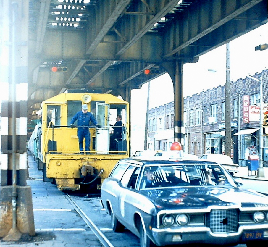
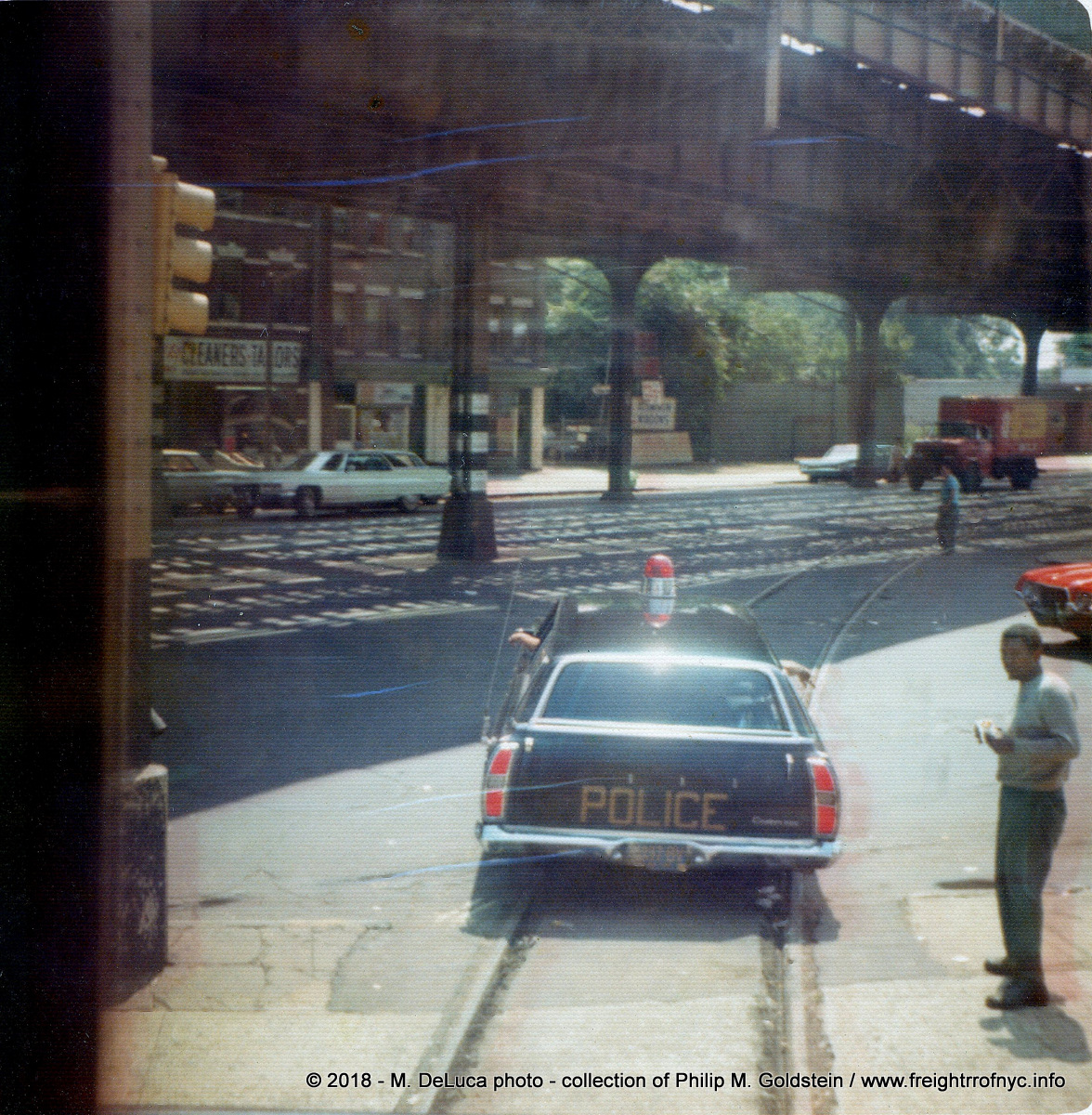
.
.
The second vehicle known to have escorted trains for the South Brooklyn Railway, was a bright red 1973 Plymouth Valiant, license plate: NY 14522-K
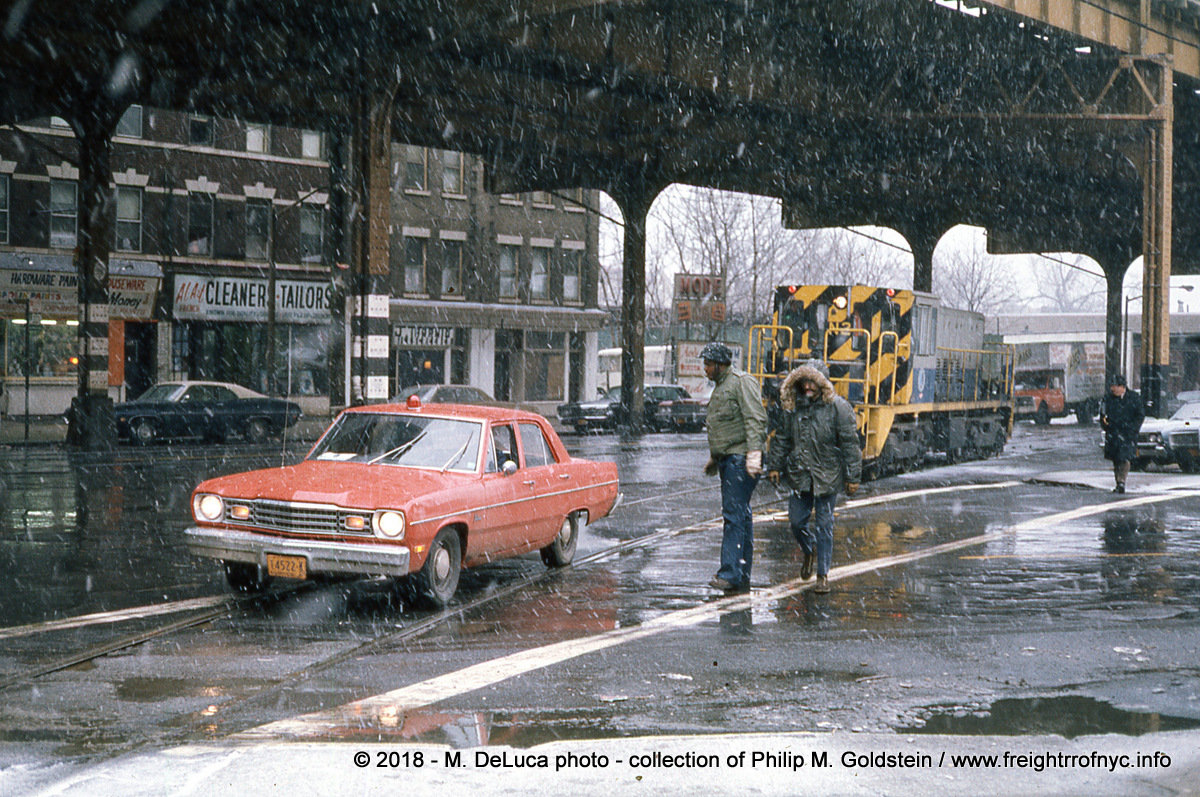
.
.
.
| Main Index |
.
.
Trackage, Right of Way &
Facilities
.
Rapid expansion of the South Brooklyn Railway soon followed the turn of the century and about this time as the Brooklyn Heights Railroad and Brooklyn Rapid Transit began installing freight sidings from established trolley routes into various factories.
The first siding is recorded as being build for the Iron Clad Manufacturing Company, which manufactured steel kegs and drums; and was located at Flushing Avenue & Cook Street.
As such, the South Brooklyn Railway delivery network was vast, as it could take advantage of the huge network of trolley tracks throughout Brooklyn.
By referencing that 1914 article, we can see by the list of delivery stations in Brooklyn as far north as Greenpoint, as far south as Coney Island, as far west as Bay Ridge, and surprisingly, as far east as Jamaica, Queens.
If there was a set of trolley tracks in the street, you can be pretty sure the South Brooklyn Railway had an agreement with the owning railway operator to deliver freight along that route. And there were dozens of streetcar line operators throughout Brooklyn. And since those streetcar operators kept getting consolidated into the larger Brooklyn Rapid Transit and then Brooklyn Manhattan Transit conglomerate, it only made sense to keep the freight traffic "in the family".
The following map, circa 1930, shows the surface streetcar routes (solid red lines) of Brooklyn of that date. It has been annotated by the author as such but as one can plainly see, the streetcar network was vast and with it, the early delivery network of the South Brooklyn Railway. It should be noted that not all freight stations and not all customers existed at the same time.
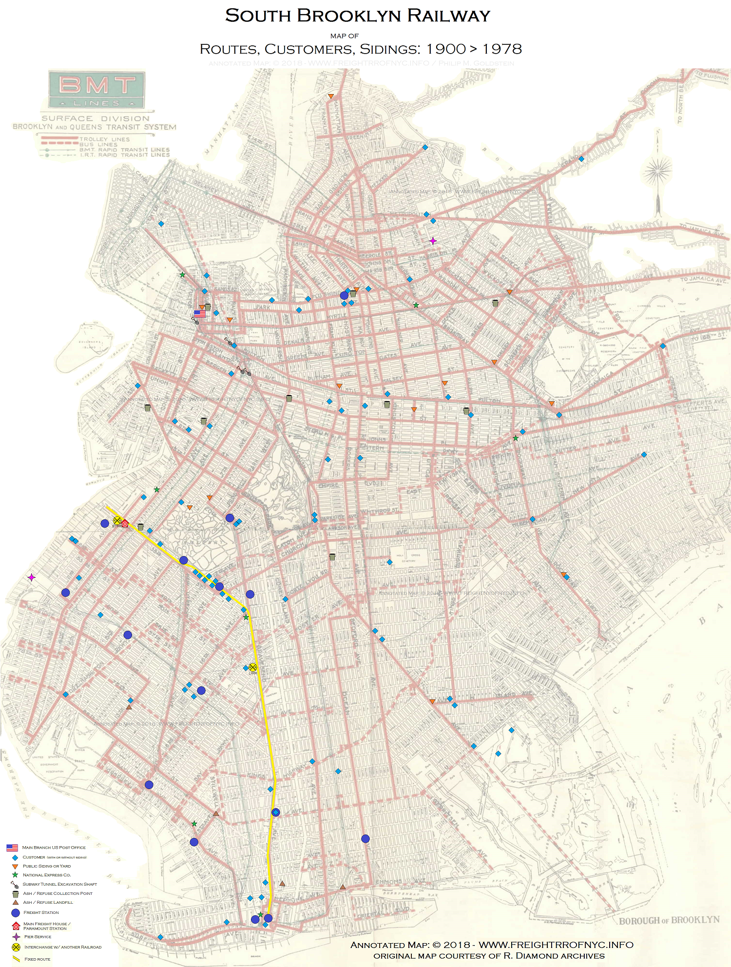
.
.
The actual date on which the SBK trolley network service officially ended, eludes us to this day. I have never seen the date mentioned in any of the historical ERA articles or on contemporary websites. It just seemed to have happened, and the SBK fixed route replaced it.
What is known that the institution of fixed route service greatly preceded the date of final day of trolley operations in Brooklyn (taking place on October 31, 1956.)
As internal combustion powered buses replaced trolleys, the trolley networks of Brooklyn (and other boroughs) shrunk, and quite rapidly. Most of the trolley routes were changed over to bus operation within a 10 year span between 1930 and 1940.
Each of those routes that were converted to bus and the tracks ripped out (or paved over) was a lost route to SBK service, cutting ever deeper into their earning overhead. This was the impetus behind their Paramount Station venture where they contracted with Horstmann Trucking, so that freight could be transferred from railroad freight car to a truck for final mile delivery within Brooklyn, and off the trolley route.
In 1938, the dual service (freight and streetcar) tracks along McDonald Avenue (formerly Gravesend Avenue and so renamed in 1931) were reconstructed. As originally constructed, the horse and automotive lanes to the outside of the trackage were paved, but the two track railroad right of way in the center remained unpaved.
When the overhead elevated line along McDonald Avenue was built in 1920, it had the girder supports between the auto lanes / rail right of way. This sort of kept the two types of traffic segregated, but now by the 1930's with ever increasing automobile and truck traffic, more space was needed for them.
So, the 70 pound (per yard) conventional profile rail  under the elevated structure was replaced with heavier 128 pound grooved girder rail
  , and the space between
the rails and elevated supports graded and paved south of Avenue P, at first, but eventually
the entire McDonald Avenue right of way would see paving between the
tracks from Shell Road all the way to Kensington Junction.
, and the space between
the rails and elevated supports graded and paved south of Avenue P, at first, but eventually
the entire McDonald Avenue right of way would see paving between the
tracks from Shell Road all the way to Kensington Junction.
Only the
portion of the South Brooklyn Railway line adjacent to 37th Street remained conventional
profile rail and unpaved right of way.
Prior to the the construction of the Belt Parkway in 1940, the private South Brooklyn Railway right of way south of Avenue X veered to the east of the Culver Elevated through undeveloped tidal lands of Coney Island Creek, which it crossed on a low trestle.
With the construction of the Belt Parkway, and the development of the surrounding lands to join the Brooklyn street grid; the South Brooklyn Railway right of way was realigned to the public thoroughfare Shell Road, and the freight station and yard in the Culver Terminal by West 6th Street was closed with new replacement facilities located on the east side of the Coney Island Yard. The southbound Shell Road track opened for service April 29, 1940 and the northbound track on May 6.
Following the end of passenger streetcar service in Brooklyn on October 31, 1956 (and probably predating that by a bit) the South Brooklyn Railway now had a solitary "fixed" route through Brooklyn when it hauled general freight for customers. And only customers situated along this route could get freight service from the South Brooklyn Railway.
The line began (or ended - depending on your point of departure) at 38th Street and First Avenue Yard, where incoming freight arrived via interchange with the Bush Terminal Railroad was received. The Bush Terminal Railroad placed the cars in the interchange yard between First and Second Avenues and 39 and 37th Streets.
From here, the South Brooklyn Railway route took it though
the neighborhoods of Sunset Park, Greenwood / Borough
Park, Kensington, Parkville, Midwood, Gravesend and Coney Island.
Joe Korman was gracious enough to allow me to use the following
two images from his website before he passed. These two
images are from a New York City Transit Employees internal magazine,
called (what else?) "Transit".
The article was published in the March 1955 issue, and contains some very interesting information on the South Brooklyn Railway. Most importantly, that by this date; the South Brooklyn Railway is illustrated is that solitary dedicated route.
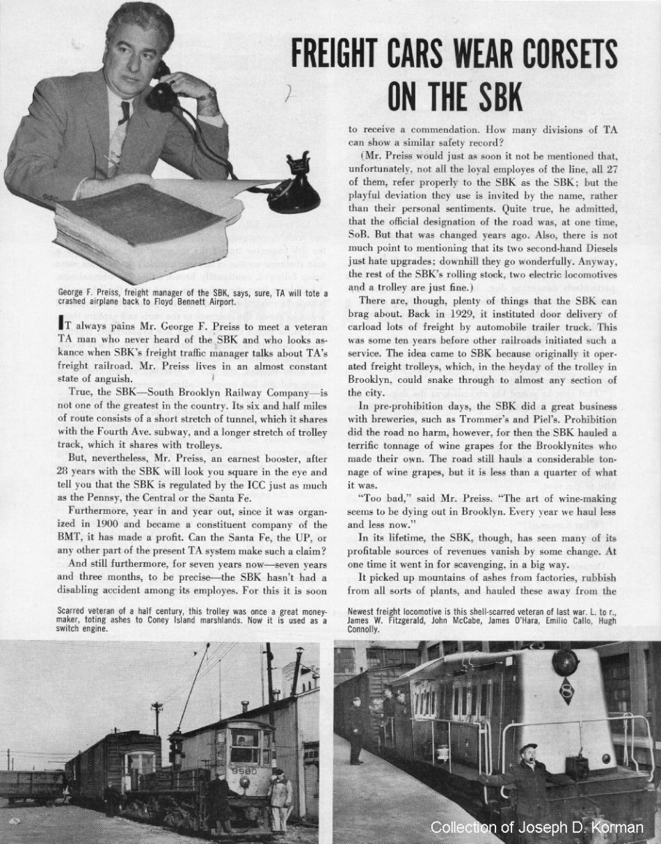
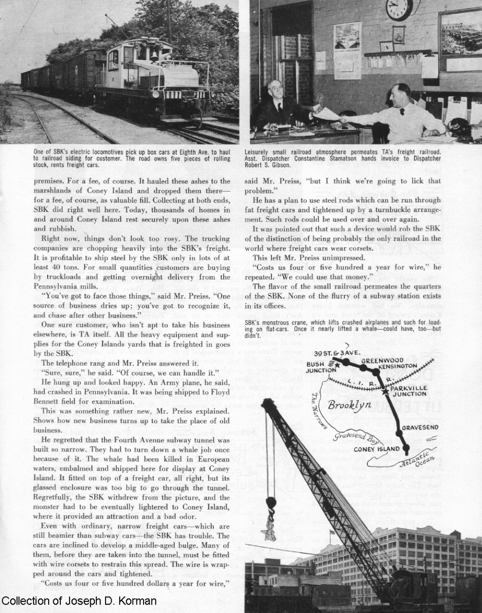
both images above:
March 1955 issue of "Transit Magazine"
collection of Joseph D.
Korman
added 07 Sept 2009
Track Maps
As of September 2026, we now have several historical maps at our disposal showing South Brooklyn Railway trackage. Some are "official", meaning they were issued by the SBK . Others were drawn by H. Raudenbush for his series of articles in ERA Highlights.
Obviously, the SBK issued are to be regarded as official.
1950 - SBK Track Schematic (B. Linder / via E. Oszustowicz)
This is a scan from Eric Oszustowicz's book, and a scan at that.
A first generation scan is forth coming. All I have done with this, is
place tags where the original text was legible.
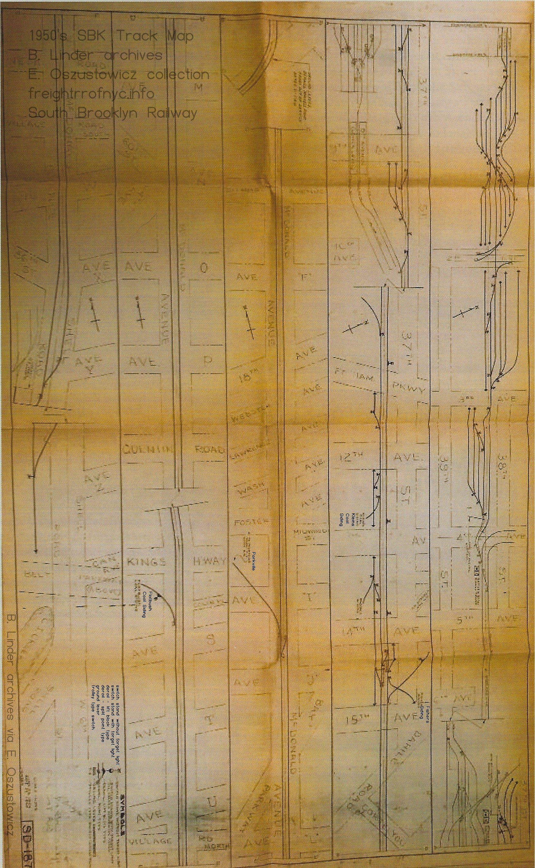
.
Recently re-discovered in an October 1976 issue of the ERA
Bulletin is a track plan which is dated September 29, 1960. While there are not too many differences between
this map and the Raudenbush map of 1961 (they are dated within
one year
of each other), however this 1960 ERA map shows the locations of derails and
bumping posts (end of tracks) and quite as importantly, the names of a
few of the customers served! It is not to scale, and it omits the interlocking complex west of Ninth Avenue Station
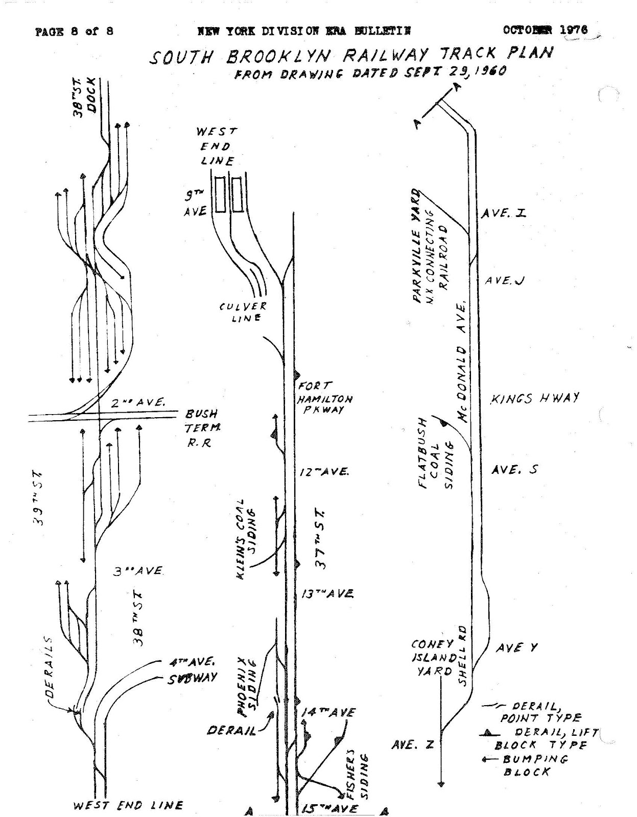
.
.
.
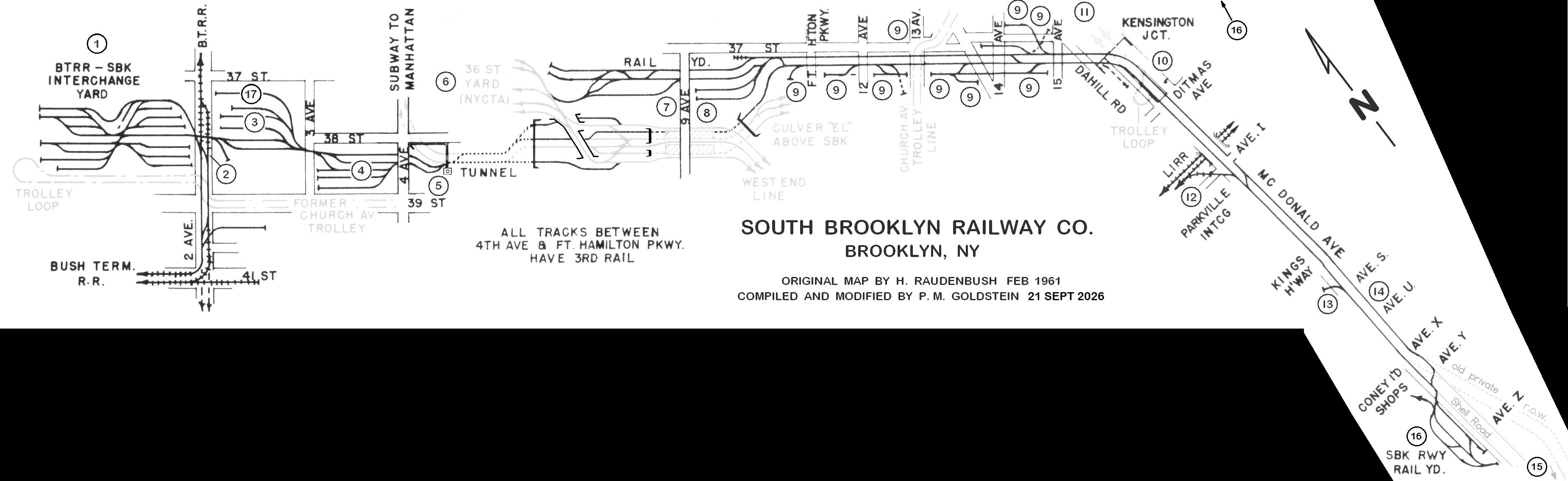
original: H. Raudenbush Map - 1961
modified: P. M. Goldstein - 2026
(numbers correspond to map locations below)
.1968
|
|
|
|
|
|
When first received, I took note of some inaccuracies and omissions in the original Linder / Eppler / ERA issue map as well as the Raudenbush Map) and of which have been confirmed with both aerial imagery and in enthusiast's photographs.
But most importantly, was where the customer were located historically. One edition of a map had one set of customers names, one had another. I procrastinated for 8 years in revising this diagram.
With the arrival of additional maps, and now having a copy of Peter Doughtery's Tracks of the NYC Subway at my disposal, which had track and switch numbers; therefore, it was time. In September 2026, I spent several hours redrawing the plan and re-lettering it.
It isn't to scale, but the following is a compilation of all known sidings and occupants throughout all the series of maps, (but not all sidings or configurations existed at same time), plus track and switch numbers from Tracks of the New York City Subway - 2024 ( P. Dougherty)
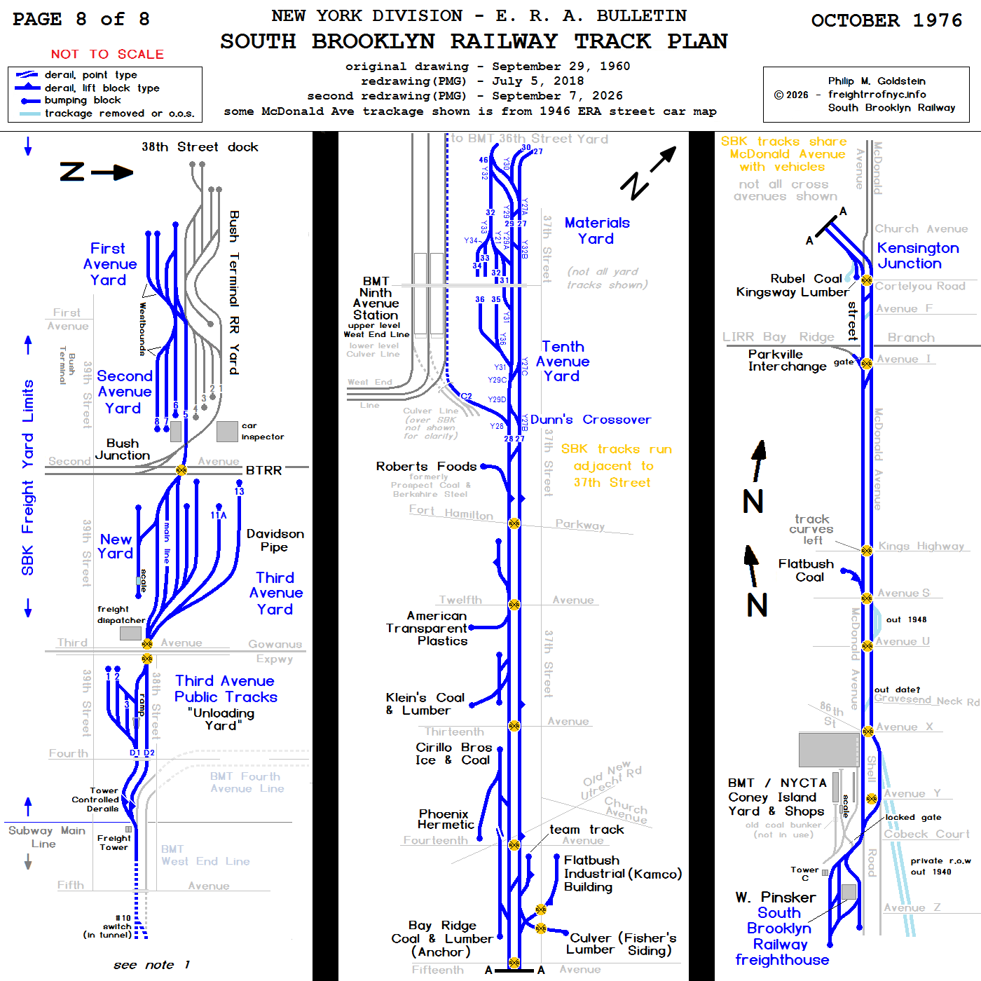
original map courtesy of October 1976 issue Electric Railroaders Association Bulletin
The portion of trackage between Fourth Avenue and Ninth Avenue was not included in the original map and
"Dunn's Runaround" was strangely omitted west of Roberts Foods. It has been added.
Note
1: BMT / NYCTA subway tracks east of Fifth Avenue and west of Ninth Avenue, including the
interlocking is not shown on this map. Refer to the clearance maps below.
map cleaned and modified by author
added 05 July 2018
.
.
Rerouting throughout the
Years: A synopsis
.
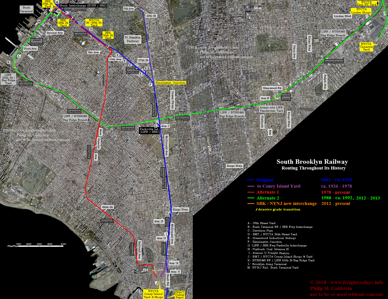
|
Original Route: |
|
Original Route:
39th Street / 37th Street / Kensington Junction / Gravesend-McDonald Avenue to Coney Island Yard & Shops
(1926-1978) |
According to Jay Bendersky's book "Brooklyn's Waterfront Railways"; the South Brooklyn Railway ceased operations on the portion of trackage south of Fort Hamilton Parkway, including the trackage between Dahill Road and Avenue I along McDonald Avenue, on February 1, 1978.
Also, according to an email received on 09 January 2010 from Dan C. he states:
"I lived near McDonald Avenue from 1960 to 1990. McDonald Avenue was reconstructed in 1978. It was at that time that the tracks were removed from the rebuilt LIRR overpass between Foster Avenue and Elmwood Avenue. Tracks were also removed at the intersection with Avenue X / 86th Street. These removals severed the connection. But for some unknown reason the now useless tracks were left in the street on McDonald Avenue while the outer lanes were properly torn up and rebuilt. When I left Brooklyn in 1990 the tracks were still there. If I remember correctly, they were paved over by 1992 and have been subsequently ripped out of the roadbed by the NYCDOT.
Even stranger was that in 1979 the NYCDOT painted Railroad Crossing indicators on the pavement of all the streets crossing McDonald even though by then it was by then impossible for trains to run there. They also put up little Railroad Crossing inventory tags on the pillars of the el. Maybe some of them are still there."
His email caused me to recollect the fresh "R X R" pavement markings, so this may be my source for believing the McDonald Avenue trackage was still in service. But, with that Avenue X / McDonald Avenue trackage removed, it would have been impossible for trains to access the Coney Island Rapid Transit Car Overhaul Shop, (or more simply: "the Coney Island Shops") and Coney Island Yard via McDonald Avenue trackage.
While I originally understood the right of way to have been shut down in two phases (36th Street Yard to Avenue I and Parkville Junction to Coney Island Yard), and after a lengthy telephone conversation with Ben Schaeffer; his information shows my understanding to be faulty, as the entire South Brooklyn Railway right of way from the east exit of the 36th Street Yard to Coney Island Yard being shut down at the same time. (Therefore I now believe that the street markings of R X R are what is causing me to think of a two segment shutdown.)
According to Ben, the last movement of any kind on the southern segment (Parkville Interchange to Coney Island Yard) was Sperry Car #402 being brought from Coney Island Yard to Parkville Junction on Thursday, January 31, 1978. On that same day, Conrail BR-1 (Oak Point Yard, Bronx to Bay Ridge, Brooklyn) dropped several cars for pick up by South Brooklyn Railway at Parkville Interchange.
The next day; on Friday, February 1,
1978; South Brooklyn Railway
removed those few cars from Parkville and brought them points north
along the Kensington Junction to 36-38th Street Yard segment.
After this last movement, all street trackage between
the 36-38th Street Yard and the Coney Island Yard including 37th
Street and McDonald Ave was embargoed. The reason for this embargo was
for the anticipated resurfacing of McDonald Avenue.
In July of 1978, the New York City Department of Transportation sent a crew to apply the "RXR" pavement markings at each intersection as compliant with highway safety regulations. Ironically about the same time, a notice for abandonment was filed with the Interstate Commerce Commission by the South Brooklyn Railway to abandoned its trackage south of Fort Hamilton Parkway.
To the best of Ben's recollection, on or about August 1981 the abandonment was approved. In approximately 1983, the McDonald Avenue overpass over the LIRR Bay Ridge Branch was scheduled for reconstruction. When it was rebuilt, street trackage was not part of the new design. This author distinctly remembers the tracks embedded in McDonald Avenue abruptly ending on both the north and south sides of the new overpass, but no tracks in the newly poured concrete of the overpass itself! This was before I became a historian, and I also recalled saying to myself "what idiot designed this? How will the South Brooklyn Railway use the McDonald Ave trackage!?!?" (Not realizing at that time the SBK street trackage along McDonald Avenue had been abandoned.)
No matter, as no train had or would ever transverse the trackage, since 1978 or would again. Most of the trackage on McDonald Avenue did remain embedded yet visible in the street for many years to come.
Due to the lobbying of Dov Hikind, a local Brooklyn
assemblyman; the trackage along McDonald Avenue was at first simply paved over. The Parkville
Interchange was in his district, and I believe it was stated in his proposal,
that the:
railway wasn't used to it's full potential, (obviously)
that alternative routes existed, (West End Line)
the rails in the pavement both presented asphalt resurfacing problems, (true) and
when wet, the rails were slippery causing vehicular and pedestrian accidents. (true)
At some point during the 1990's, that resurfacing had grown dilapidated and to so effect a proper job, the now buried rails needed to be excavated and new substrate laid. And so McDonald Avenue was completely torn up, the rails removed and the thoroughfare resurfaced.
. However, on an unknown date and sometimes in circa 2010; Track C3-4 would be re-connected to the old SBK running tracks on 37th Street (still in place to Fort Hamilton Parkway (and now used for equipment storage); and Track C2 was severed and abandoned (as well as Track C-1 had been, but that was never used by the SBK.) Again, the exact date this change took place is not certain, so anyone that has a more firm date, corrections or additions; you are invited to contact me.
.
|
Alternate Route 1 (red): |
Following the abandonment of street
trackage south of Fort Hamilton Parkway including McDonald Avenue in
1978; the main route for the transport of subway rolling stock and MOW matériel on flatcars and in gondolas is
along the existing elevated trackage. This route would take South Brooklyn movements
via the BMT "West End Line" elevated (currently the
 train)
along New Utrecht & Stillwell Avenues and into the Coney
Island Rapid Transit Car Overhaul Shop, (or more simply: "the
Coney Island Shops").
train)
along New Utrecht & Stillwell Avenues and into the Coney
Island Rapid Transit Car Overhaul Shop, (or more simply: "the
Coney Island Shops").
The Coney Island Shops are one of only two major overhaul facilities for all the subway equipment in New York City (the other major overhaul shop being 207th Street in Uptown Manhattan). Staten Island Railway equipment is also repaired at the Coney Island Shops, but must be trucked over the Verrazano Bridge.
Returning to the routing, it must also be understood that with
this routing, two factors have to be kept in mind when using the West End Line elevated:
This South Brooklyn Railway routing enters this elevated trackage at the east end of the 36-38th Street Yard (just a couple of tracks south of where they used to enter street running on their former route along 37th Street). It is here that South Brooklyn Railway trains would be switched from yard trackage to the "mainline" of the West End Line, (which circumvents the 36-38th Street Yard for its continuous and unhindered routing under Fourth Avenue).
An inclined transition from the subgrade trackage to the elevated had been constructed in 1916 with the construction of the West End Line elevated.
This route is shown in red in the map above.
|
Alternate Route 2 (green): |
In 1987,
it was discovered that the Williamsburg Bridge was in dire need of
major repairs and required emergency repairs. This required closing the
bridge to both vehicular traffic and transit services. As closing the
bridge
would isolate some of Northern Brooklyn's subway lines,
access would still be needed to get subway equipment in need
of maintenance & repair to and from the NYCTA's Coney
Island Rapid Transit Car Overhaul Shop, more easily called "the
Coney Island Shops". So, on or about October 1987, the South Brooklyn
Railway
entered into an agreement with Long Island Rail Road (both
entities being operated by the Metropolitan Transportation Authority).
This agreement allowed
for the South Brooklyn Railway to operate over Long Island Rail
Roads' Bay Ridge Branch between the
hours of
19:00 and 03:00 (thats 7:00 pm and 3:00 am for those of you who cannot
read 24 hour / military time). This route allows movements from
the LIRR Bay Ridge Yard to the NYCTA Linden Shops or Canarsie Yard,
both located
in
East New York. It would also require the South Brooklyn Railway
to operate on New York Cross Harbor Railroad trackage under a separate
agreement, as well. All told the route was very arduous to say the
least.
A South Brooklyn Railway test train was scheduled, and the route was as follows:
From Coney Island Yard, north up the West End Line (currently the
NYCTA
train),
switch off the West End Line at the SBK switch between 4th and 5th Avenues,
west through the Third Avenue & 38th Street Yard, to Second Avenue and 39th Street.
Here,
the South Brooklyn Railway would switch upon and turn south onto the
New York Cross Harbor Railroad trackage on Second Avenue at "Bush Interchange",
south for two blocks along Second Avenue to 41st Street and curve under the corner
of the warehouse (of which so many photos are taken),
turn west down 41st Street for one block to First Avenue turning south again,
South along First Avenue to 58th Street,
through the Brooklyn Army Terminal to Long Island Rail Road Bay
Ridge Yard and turning east onto the LIRR Bay Ridge Division.
From
here, up to either the Linden Shops (for track & structures)
or to a point just north of the BMT Canarsie Line New Lots Avenue
Subway Station  Train,
A reverse move was necessary to switch onto the Canarsie Line Line and finally
entering into the East New York Yard.
Even after the Williamsburg Bridge was rehabilitated, the South Brooklyn Railway would still see use of the Bay Ridge Branch (see Memoirs), and would still utilize it today if need be.
.|
The new NYNJ Rail - South Brooklyn Railway Interchange: |
|
The original plan, as part of the South Brooklyn Marine Terminal reconstruction had the South Brooklyn Railway's 39th Street Yard between Second and First Avenues being ceded to the South Brooklyn Marine Terminal property. It also had the South Brooklyn Railway now interchanging with New York New Jersey Rail (the successor to New York Cross Harbor Railroad) at South Brooklyn Railway's 38th Street Yard between Third & Fourth Avenue (two blocks east of the original interchange point) but this is not shown in the diagram. Matter of fact, none of South Brooklyn Railways trackage was represented and their 39th Street Yard is shown as "green space". at right: November 28, 2007 presentation by New York City Economic
Development Corp (NYCEDC) |
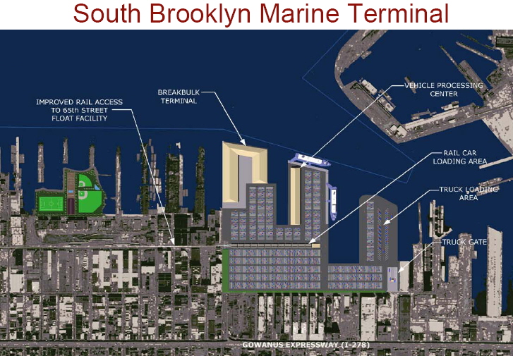 |
As such, it seemed to be that New York New Jersey Rail would have operating rights on the South Brooklyn Marine Terminal trackage, proceeding across Second Avenue, utilize the trackage adjacent to Costco, cross Third Avenue and possibly interchange with South Brooklyn Railway at the South Brooklyn Railway's 38th Street Yard.
It appears by 2012, that plan had changed. Information now handed down to the author now had the South Brooklyn Railway interchanging with the New York New Jersey Rail at First Avenue & 39th Street, one block west of the original interchange point, following a complete restructuring of the track layout.
The graphic below has the yard trackage for the South Brooklyn Marine Terminal still oriented for north / south (and of which the former SBK 39th Street Yard is currently oriented east / west), but with the tracks moved to the eastern boundary of the property instead of running up the center. And with that revised track entrance being located at 39th Street and First Avenue providing access into the yard for New York New Jersey Rail and allowing an interchange with South Brooklyn Railway.
This original graphic below was originally from the "Sunset Park Vision Plan" of 2009 and was modified by the author to reflect all changes prior to May 2012.
As the proposed reconstruction of the South Brooklyn Marine Terminal shows trackage splitting east and west from a First Avenue and 39th Street access point, this arrangement would have effectively dissected the original South Brooklyn Railway 39th Street Yard. Therefore, this South Brooklyn Railway Yard was removed in its entirety to facilitate the new trackage alignment.
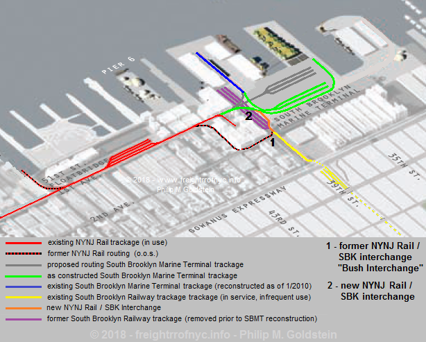
In 2006, the New York Cross Harbor
Railroad became New York
New Jersey Rail, also known as NYNJ Rail. Also about that time, NYNJ Rail welded the turnout point located at First
Avenue and 41st Street for the First Avenue alignment. This weld
prevented New York New Jersey Rail traffic or South Brooklyn Railway
traffic from using 41st
Street to Second Avenue and then to the Bush Interchange where
interchange at Second Avenue & 39th Street could take place.
In
short, the SBK was now isolated at Second Avenue and 39th
Street at their yard. Therefore, the transfer of any freight traffic (if any!) from
NYNJ Rail to South Brooklyn Railway now had to go through the
Brooklyn Army Terminal and to the Long Island Rail Road / New York
&
Atlantic Railway Bay Ridge Yard to NYCTA Linden Shops for transfer
anywhere else in the NYCTA System. Until 2012, it was not an issue as
NYCTA was not receiving any freight traffic or equipment via rail from NYNJ Rail.
This would change in 2012. When the order for the twenty-eight
new R156 work locomotives (MotivePower MP8AC-3) was proposed, a way was needed to transfer
those locomotives to the NYCTA / South Brooklyn Railway. As NYNJ Rail
was already revamping its track structure, and as part of the New York
City
Economic Development Corporations' Sunset Park Improvement Plan, the
South Brooklyn Marine Terminal was being reconstructed. So, the
opportunity presented itself for a new interchange with shallower radius
curves and heavier rail to include conventional two point turnouts, as well as eliminating the sharp
reverse curves encountered previously along the 41st Street routing.
The NYNJ Rail "main" was continued north along First Avenue for
one more block to 39th Street (it previously ended mid-block between
41st and 39th Streets at a large industry), then turning gradually to
the east
to a turnout where the track would split to either a multi-track
siding serving the the South Brooklyn Marine Terminal or connect with
the South Brooklyn Railway. This new interchange was no more than one
city block west of the old "Bush Interchange" but it so
dramatically eased the curvature of the track alignment.
Unfortunately, this new interchange was not ready for use by May
1, 2012 when the first locomotive (0L912) of the new order arrived for
the NYCTA. It would not be until the delivery of the second locomotive, which would
have the
honor of being the first NYNJ Rail / SBK interchange to utilize this
new interchange.
This interchange remains in service. With thanks to a reliable internal source, the delineation line of the South Brooklyn Railroad and New York New Jersey Rail is established at the Second Avenue crossing at 39th Street, in which the legal documents states:
|
"WHEREAS, the 2nd Avenue Grade Crossing at 39th Street is the point of delineation between NYNJR rail territory and operations and SBK Rail territory and operations, and; WHEREAS, the Parties desire to establish an interchange agreement, to formalize and accurately reflect how interchange traffic emanating from both Parties' facilities will be handled, with the primary interchange activity to be NYNJR delivering rail cars to the SBK Connection Track (as hereinafter defined); and WHEREAS, the parties are willing to enter into this Agreement on the terms and conditions provided herein for so long as the Parties tender rail cars to each other..."West of this point is NYNJ Rail property, but SBK does have access rights as far as the switch at First Avenue and 39th Street. |
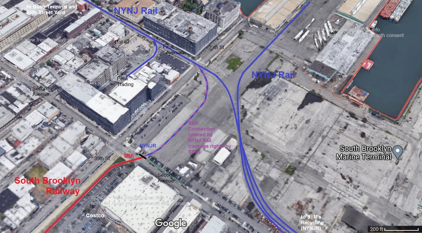
South Brooklyn Railway / New York New Jersey Rail Delineation Point
(North is to the right)
annotated map by author
not to be reused or reproduced without consent.
added 18 April 2021
|
Freight cars with RED tags
must not be operated on subway tracks. Freight cars so Red Tagged, must not go further east than 38th Street Unloading Yard (between Third and Fourth Avenues). YELLOW and WHITE tagged freight cars may move east of Fourth Avenue, provided: Freight cars with a YELLOW tag have limited clearance, and must be moved over #10 switch east of Fifth Avenue in reverse. Trains then run wrong rail over northbound D-4 track directly into C-2 track (lower level) in Ninth Avenue Station after which they proceed to the Tenth Avenue Yard. A WHITE tag indicates that a freight car may be operated in the tunnel on southbound track D-3 to Ninth Avenue upper level (West End Line, center track), where train reverses direction westwards) and briefly enters upon on Yard Lead Y-2. Train then reverses direction again (eastwards) then make a wrong rail move on lower level (Culver) northbound track C-2 to the Tenth Avenue Yard. Without a doubt, it was an unusual part of operations of the South Brooklyn Railway when it hauled freight cars, but a very necessary part. all at right: collection of author
|
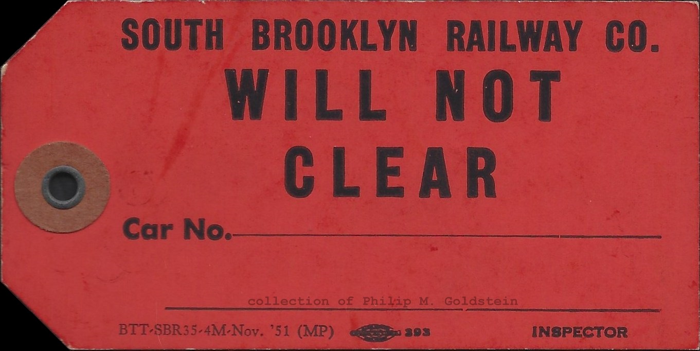 |
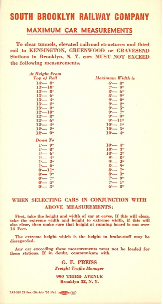 |
|
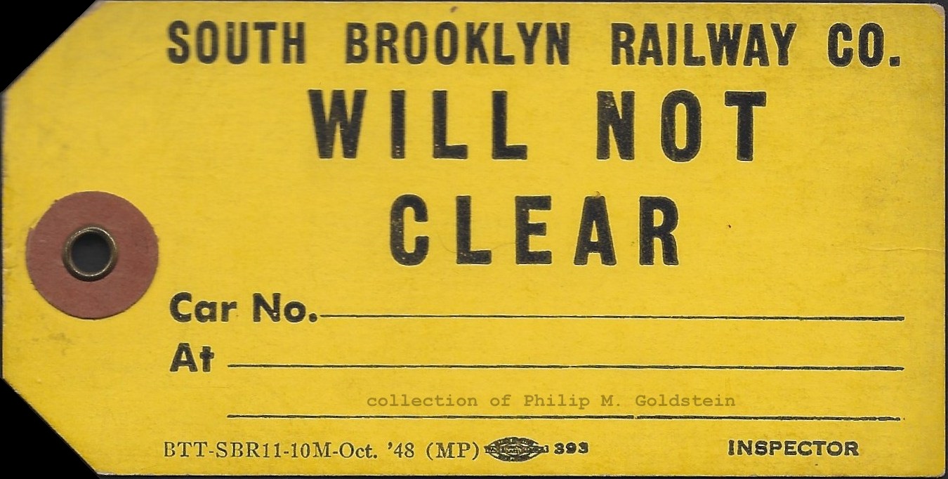 |
|||
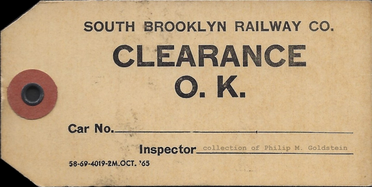 |
Track C2 (the northbound local track) on the lower level of the Ninth Avenue was now connected to the South Brooklyn Railway track south of the station.This is a very interesting revelation, because not only does it make good operating sense, but also this contradicts the content in the images below.
Also during this period, the platform on Track C2 was cut back to accomodate freight cars being transferred by the South Brooklyn Railway.
This allowed freight traffic to bypass 38th Street Yard. Today (2022), the center track (track C3/C4) of the lower level is connected to the South Brooklyn Railway right-of-way so that trains can reach the refuse platforms south of Ninth Avenue. Currently, tracks C1 and C2 end at bumping blocks at the south end of the station.
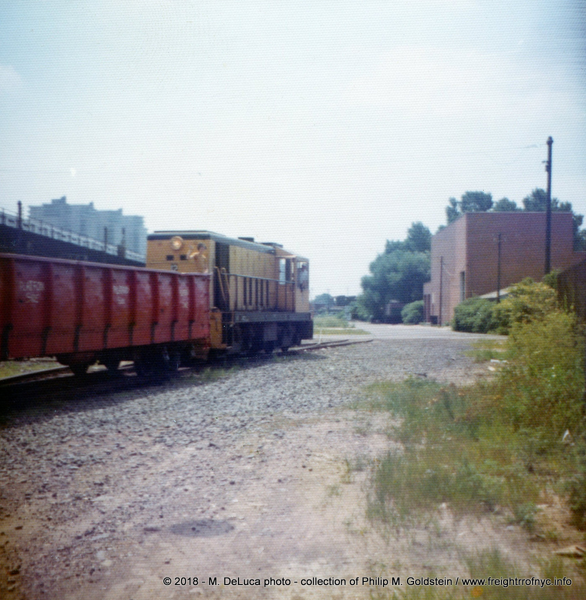 If
one were trace out the trains path via the SBK trackage back to Ninth Avenue, this "platform side" side of
the gondola would fall next to the Track C2 (north / westbound platform side) of the
Ninth Avenue Station.
And, if my conclusions is correct, these gondolas could not be used anywhere else in known SBK routing; i.e. West End Line; (on any track in the subway system), for the following reasons: The uncut ribs would strike any station platform on that side of the car - meaning the red gondolas could not be used on the West End Line as:
|
In
the photo seen at left, we
see SBK #12, with a red gondola which is marked "PLATFORM SIDE" in crude white letters. Note that
the lower portion of reinforcing side ribs are torched off, giving the lower portion of the car greater
clearance to a platform. Like, say; a subway platform? How did I come to this conclusion above? A couple of grainy photos in my collection taken by Mike DeLuca, and taken circa 1971-1972 when the R44's were being delivered. There were actually two gondolas, both of which can now be seen in a companion image of this train and just prior to pulling into the yard, and can be seen below. In the photo below, which shows of the "other" side of the gondola, it is clear the ribs are not off and full length to the bottom of the sill. Obviously, only one side of ribs on the gondola is cut, because if both sides were cut, why would only one side need to be marked? 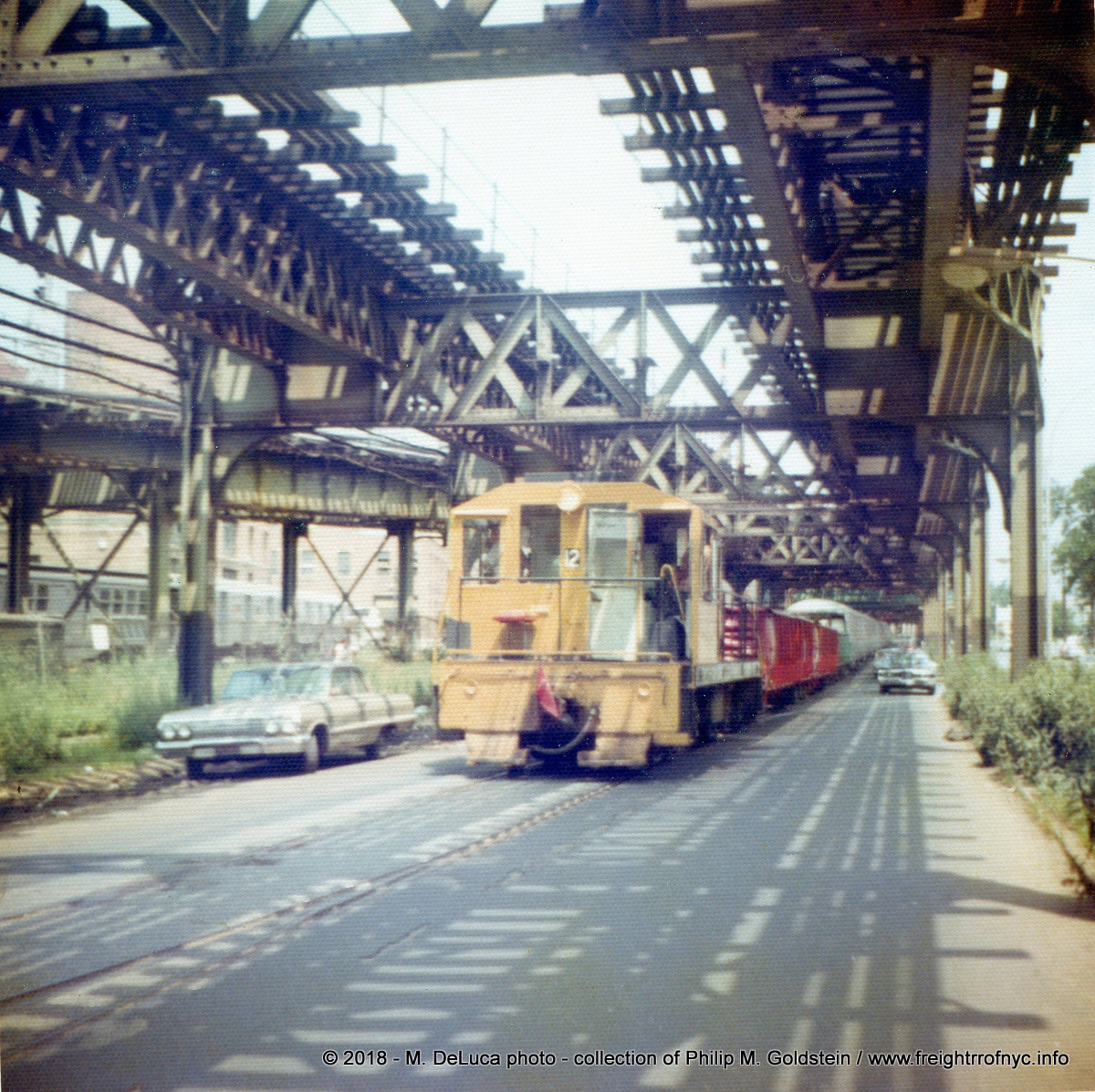 |
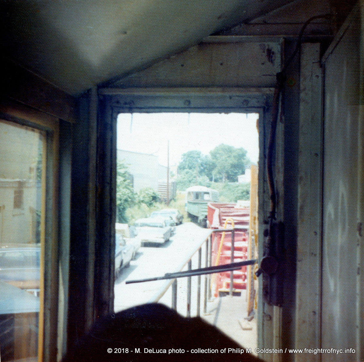 |
Since almost every subway or elevated line in Brooklyn and in the
South Brooklyn Railway operating area was three or four track with
center island platforms, these cars could not be used on any of these lines. Therefore, it appears these red gondolas were only used as spacer cars on the SBK; and had MCB / AAR couplers on both ends, they could possibly be used on the PC / CR / LIRR Bay Ridge Branch as there were no passenger platforms to be concerned with. They also cannot be considered transition cars (which have a MCB / AAR coupler on one end, and Form 70 (or other type of subway coupler) on the other end. These have MCB / AAR couplers on both ends. This is determined by the image seen at left. Clearly seen is a "deepwater green" Penn Central gondola after the red gondolas, but before the R44's. Therefore the PC gondola is serving as a transition car. The PC gondola car (transition car) would have been used to haul the subway cars from the St Louis Car Company manufacturing plant. (Ironically the R44's were to be the last subways cars built by SLCC prior to going out of business.) As the far end of the PC gondola car is mated to the R44 car, that end had a Form 70 coupler. The close end of the PC gondola has MCB / ARR coupler, as do both ends of the red gondolas, and the end of SBK #12. Two questions remain unanswered about the red gondolas: 1) Why the red spacer cars were needed in this mover remains unknown, and these three |
| Returning to the South Brooklyn Railway operation, when the Culver Line was running out of the lower level of
Ninth Avenue Station, it utilized Tracks C3-4 (east & southbound)
and C1 (west & northbound). So, the only track not being used for revenue service was C2, which the South Brooklyn Railway used. When the Culver ramp opened in 1954 and Culver Line service switched to IND Division operation, service was reduced to bi-directional single track operation on the Culver Shuttle elevated out of Ninth Avenue, and so track C3-4 became a spare, but it still was not usable for freight because of the platform clearance! When the Culver Shuttle service was abolished altogether in May 1975, C3-4 and now C-1 were unused. By May 1975, there were only two customers remaining: Davidson Pipe and Roberts Foods; and only one of those was east of Ninth Avenue Station, that being Roberts Foods. The hauling of subway cars to and from Coney Island via the lower level on Ninth Avenue would only last until February 1978 as well. In February 1978, the South Brooklyn Railway embargoed (placed out of service) most of the route along 37th Street east of Fort Hamilton Parkway and onto McDonald Avenue all the yard to the Coney Island Yard entrance at Avenue Y. Service continuing to 37th Street west of Fort Hamilton Parkway, therefore Robert's Foods would retain rail service. The hauling of subway cars (new inbound or those for outbound for rebuilding or scrap) now went via the West End Line. |
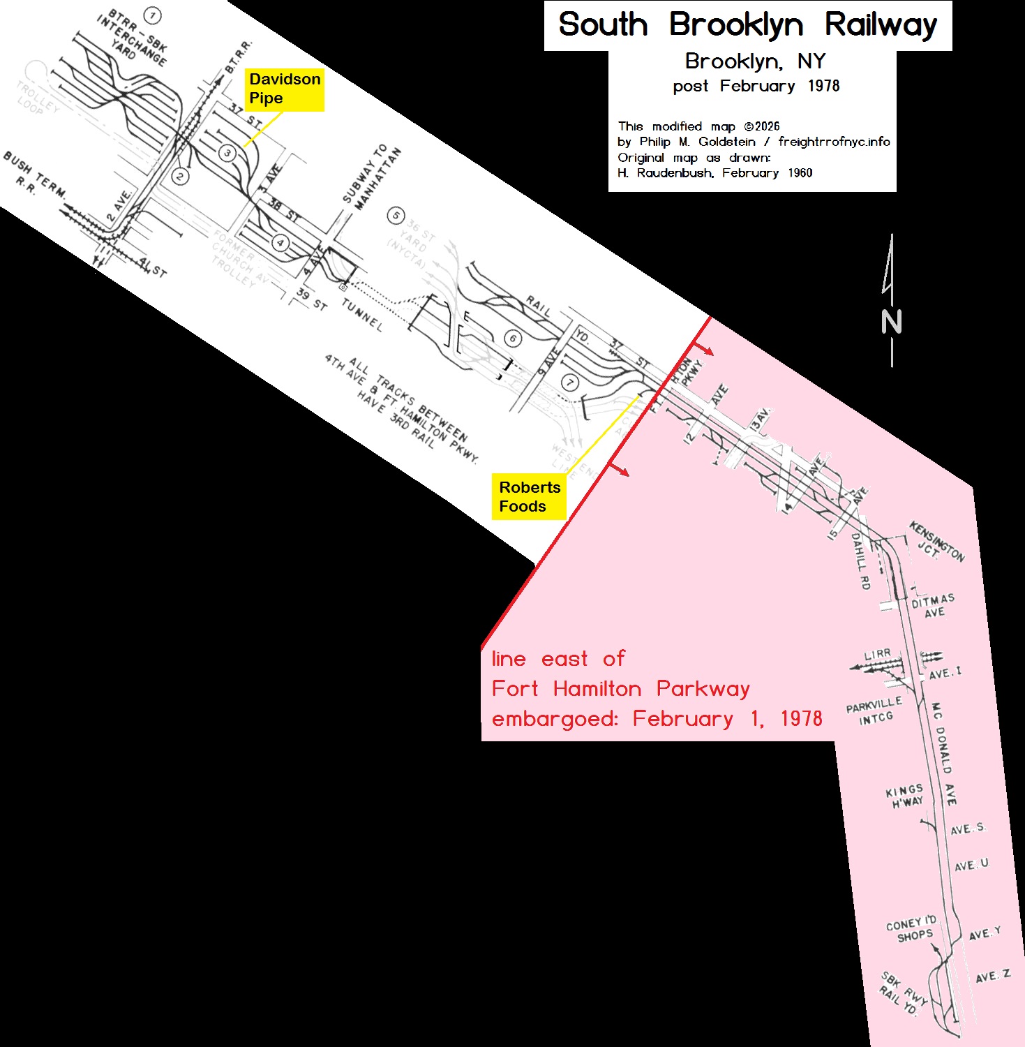 |
Location List
.
Notes:
Numbered links above correspond to map locations below.
9) - Greenwood Industrial Sidings contains multiple links in a sub-map at that chapter below.
Photos of non-station locations are interspersed geographically along the route.
Click on maps below for large scale version.
1) First / Second Avenue Yards - "BI" Bush Interchange
- Sunset Park
.
The northwestern-most point of the trackage was the storage yard located between 39th and 38th Streets between the bulkhead of Gowanus Bay and Second Avenues just to the north of the 39th Street Ferry Terminal.
The trolley line (#8 / #35 Church Avenue Line) running along the south edge of the yard was not part of the South Brooklyn Railway, and the tracks were separated by a tall wood panel fence line.
After reviewing maps, it now appears that most of the trackage between Second Avenue and the bulkhead was "inherited" from the US Navy Fleet Supply Base, after operations of this facility ceased post-World War 1
Randall Auguste was generous enough to allow the use of the following two plates from his 1912 Belcher Hyde Atlas of Brookyn. In it, we can view early track and building arrangements of the Brooklyn Rapid Transit / South Brooklyn Railway facilities in the Sunset Park area.
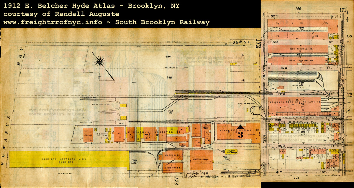 |
| 1912 E. Belcher Hyde Atlas of Brooklyn, NY courtesy of Randall Auguste (two plates scaled and merged by author) added 18 April 2021 |
On 02 January 2010, Joe Roborecky located two maps in the Library of Congress' Historic American Buildings Survey / Historic American Engineering Records; U.S. Navy Fleet Supply Base, Brooklyn, Kings County, NY.
Referencing these two maps, it appears that upon conclusion of World War I, the US Navy began to relinquish a great deal of its property in Sunset Park.
While it had been the authors conclusion that Brooklyn Rapid Transit / South Brooklyn Railway sold a portion of its property to the US Navy, which went on to build its own yard and railroad upon this land, it turns out this was not the case.
The US Navy had leased the unimproved land from the City of New York, and built their structures and installed the trackage throughout the base to connect the various storehouses, as well as interchange with Bush Terminal Railroad.
Shortly after the conclusion of the World War I, the land reverted back to the City of New York, and some of the base yard trackage between 37th Street and 39th Street was connected to the South Brooklyn Railway across Second Avenue, giving the South Brooklyn Railway additional yard space.
The first map is undated but appears to be circa 1913, as the proposed (but never constructed) "South Brooklyn Marginal Railroad" is shown. It appears that the Brooklyn Rapid Transit trackage extended to and occupied a pier north of the Ferry Terminal.
Notice how 38th Street is still shown as a through street. You may click on the map below to bring you to a larger version. Use your back arrow to return you here:

Brooklyn Rapid Transit / South Brooklyn Railway, Brooklyn, Kings County,
NY - circa 1913
Library of Congress - Historic American Buildings Survey
Historic American Engineering
Records
added 02 January
2010
.
.
The second map is dated August 20, 1919 as part of the Navy Fleet Supply Base packet of information; and shows a great deal more trackage and a significant yard belonging to the US Navy abutting the north property line of Brooklyn Rapid Transit Yard (which is the South Brooklyn Railway and unfortunately this trackage is not shown in detail).
Note how the yard has begun to resemble the "hour glass" figure of later eras. Note there is no direct connection shown between the South Brooklyn RR property east of Second Avenue and the tracks west of Second Avenue.
Also, if you take note; the pier north of the ferry terminal is now flanked by a pair of float bridges ("Terminal Bridges"), and according to the legend the trackage is now marked for the US Navy (solid lines = Navy RR, broken lines = other RR).
Also take notice that the 38th Street thoroughfare is no longer shown and the "Property of the South Brooklyn RR" is now a two block parcel. It is this parcel which would become Davidson Pipe Yard in later years.
Again, you may click on the map below to bring you to a larger version. Use your back arrow to return you here.

Brooklyn Rapid Transit / South Brooklyn Railway
(U.S. Navy Fleet Supply Base), Brooklyn, Kings County, NY - August 20,
1919
Dashed lines represent BRT 39th Street trolley. Solid lines represent US Navy Fleet Supply Base trackage.
Library of Congress - Historic American Buildings Survey
Historic American Engineering
Records
added 02 January 2010
.
The Navy would continue to occupy certain parcels of property abutting the South Brooklyn Railway's 39th Street Yard through at least the 1950's, but they eliminated their railroad operation in or around 1920. The north-south trackage parallelling Second Avenue connecting the storehouses was eliminated, but the yard tracks became part of the South Brooklyn Railway Yard.
If by chance you are interested in the Navy operation, I have authored a webpage on that history and of which may be read here: US Navy Fleet Supply Base - South Brooklyn Section
In 1930, in an effort to compete with trucking companies, the South Brooklyn Railway entered into contract with the Horstmann Trucking Corporation to handle interchange freight at this location. In the tariff filings, this location was called "Paramount Station, Brooklyn, NY". This venture was unfortunately short lived, due to the extra expense in having to offload the freight into trucks to deliver the freight off the South Brooklyn Railways' route.
This Fairchild Aerial oblique image of the South Brooklyn - 39th Street area showing redevelopment; dated January 16, 1931; reflects the beginning of the reconstruction of the area. The US Navy Fleet Supply base has been downsized, most of their yard tracks between the buildings and Second Avenue are removed. South Brooklyn Railway has taken over the US Navy trackage to the south of the buildings, for use and interchange with Bush Terminal Railroad.
Note that the 39th Street Trolley Right Of Way is segregated and fenced separately from the South Brooklyn Railway trackage.
During this era, the South Brooklyn Railway saw a lot of freight traffic and they undoubtedly needed the additional yard trackage, and put it to good use. Click on the image below for an unannotated version.
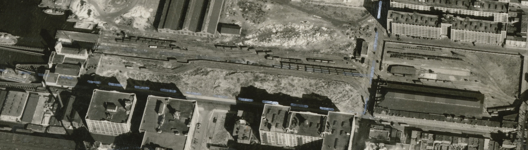
South Brooklyn Railway - 39th Street Yards between bulkhead and Third Avenue - January 16, 1931
Facing north.
New York Municipal Archives - Image ID: REC 0028 20 14 1674-1
Department of Records and Information Services (DORIS)
annotated image - © 2026 by author
added 24 July 2026
I have included two additional crops of the above image to show the fantastic detail. First and Second Avenue Yards, 39th Street runs along the dashed line:
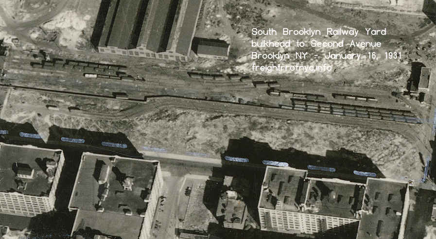
Zoom in on fence line separating trolley R.O.W and SBK yard trackage.
North is up.
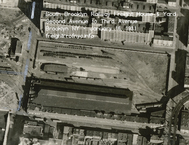
One block to the east: 39th Street - Third Avenue Yard and Freight House (to become Davidson Pipe) - January 16, 1931
Note freight cars at front of freight house.
North is up.
.
This next image, dated ca. 1934; shows the relative (lack of) development of the land formerly occupied by US Navy Fleet Supply Base or the Ferry Terminal / Trolley area waterfront area; but a new building (with peaked roof) has been constructed towards the middle of Third Avenue Yard, and tracks and freight cars fill the railyard portion of the property. The Fifth Avenue Shuttle Elevated is still present, curving from 38th Street to Third Avenue.
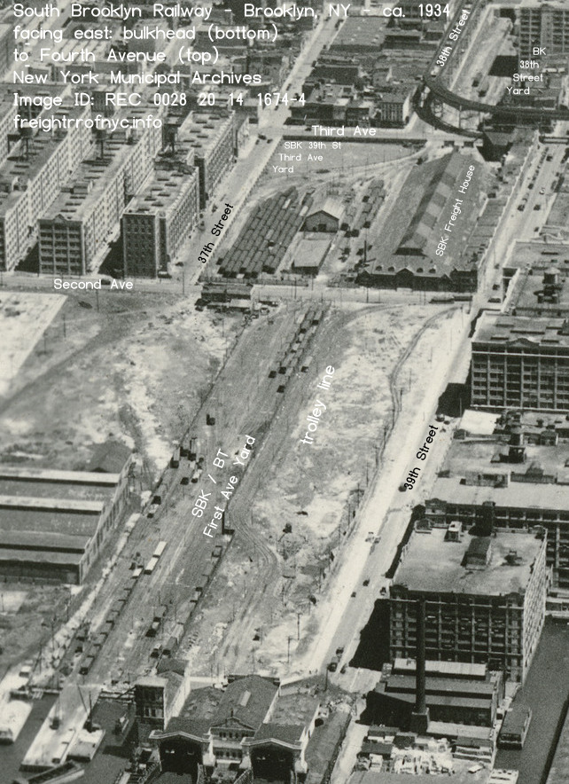
South Brooklyn Railway - 39th Street Yards between bulkhead and Third Avenue - January 16, 1931
Facing east.
New York Municipal Archives - Image ID: REC 0028 20 14 1674-1
Department of Records and Information Services (DORIS)
annotated image - © 2026 by author
added 24 July 2026
.
.
The closest item that has surfaced to date that reflects the track structure of the South Brooklyn Railway at this location in the 1940's, is a Port Facilities & Terminals Map dated 1942. As the property between Second & Third Avenues that would become Davidson Pipe Yard was still in fact owned and part of the South Brooklyn Railway during the time of this map, it is shown here for continuity.
Note the hourglass configuration (ooh la la!) of the First Avenue Yard. This appears to be a remnant of some of the track layout from the Fleet Supply Base.
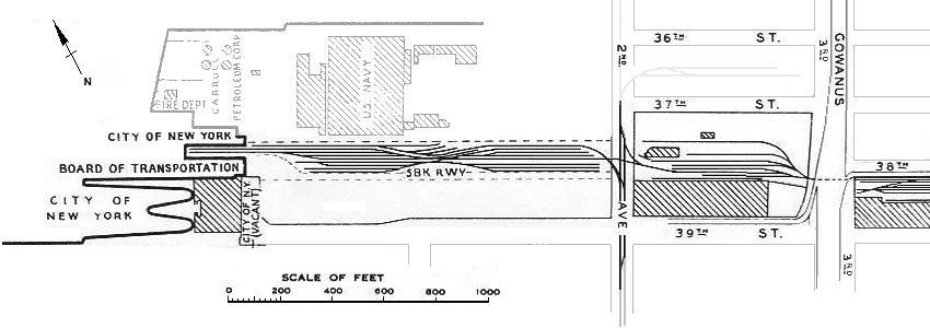
Port Facilities & Terminals Map - 1942
US Army Corp of Engineers
authors collection
added 02 January 2010
.
.
Looking west at SBK #9 in the First / Second Avenue Yard South Brooklyn Railway / Bush Terminal Interchange Yard
about to cross Second Avenue - ca. 1948
D. Klepper photo
added 22 September 2026
.
.
It is April 3, 1952, and the Brooklyn Dodgers defeated the New York Yankees 11 to 1 in Spring Training today! Meanwhile, back in Sunset Park; an Fairchild Aerial Survey airplane is flying over the South Brooklyn Railway facilities around noon (note the shadows of the poles - they make great sundials!). This image shows how the half the Third Avenue Yard trackage has been removed, and this area has been re-purposed as a bus yard and it appears to have been paved. However the trolley poles still stand with their bases now painted alternating black and white; while the bases of the trolley poles in the tracked portion are all white bases. (Black bands to contrast from snow during those months for the bus drivers?) We can see the very tip of the Gowanus Express in the bottom right corner.
What is most interesting is the Paramount Station is in operation. Note the tractor trailers and trucks backed up to the team track siding with that cut of four box cars; and we can even make out Trolley Motor #9980 - its one man cabs on either end are easy to spot! Derricks 9006 and 9007 at the west end of the yard trackage, with two trolley gondola motor to the east and up track from them. A little harder to discern, but that might be a Trolley Box Motor on their east end. No Diesel-electrics or steeple cabs are present.
The land in front of the US Navy Fleet Supply Base has been graded, but is still vacant. By the storehouses, a lumber yard appears to have take up residence; but the dwindling number of freight cars in the yards is not a good sign.
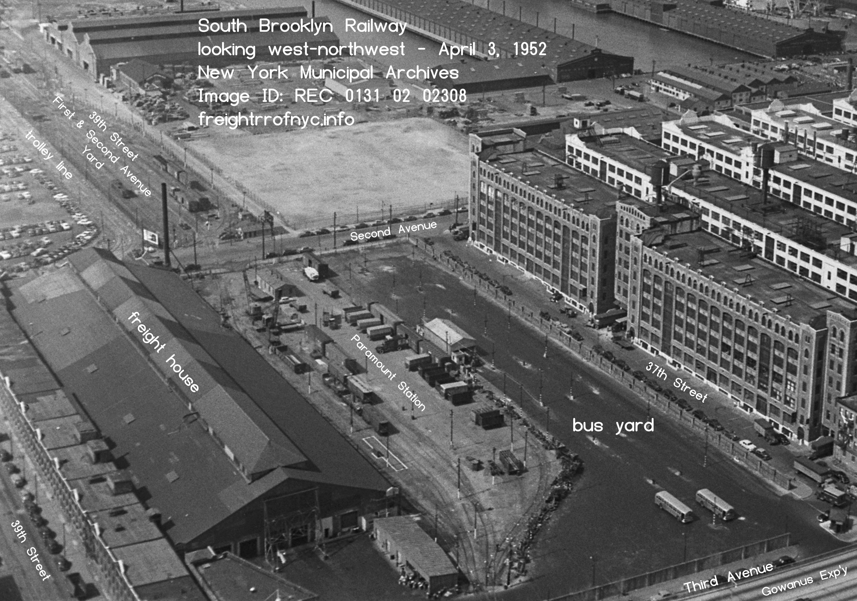
.
.
When passenger service ended on the Norton's Point Trolley Line in Coney Island in 1948, the South Brooklyn Railway became strictly freight. One can see the Church Avenue trolley line (#8 which later became #35) to the 39th Street Ferry (formerly operated by Brooklyn & Queens Transit and now the New York City Transit Authority) is still in service as we can see three PCC cars on the loop that ran to the ferry house.
To be clear, this line was not operated by the South Brooklyn Railway (their Norton Point trolley service in Coney Island ended in 1948.) This line trolley was not going to be in service much longer from the date of this image, as all trolley service in Brooklyn would cease in less than six months (that fateful day being October 31) from the date of this image May 15th.
The First Avenue Yard is very
empty: you can count the amount of freight cars on one hand: five
cars. Three gondolas (one loaded and two empty) and a boxcar at each
end of the yard. A new space frame building with a long loading dock
(lightly sloped roof) has been built on the former Fleet Supply Base
property and a wide thoroughfare added to the street grid. A larger
high resolution version of this can be opened by clicking on the image
below.
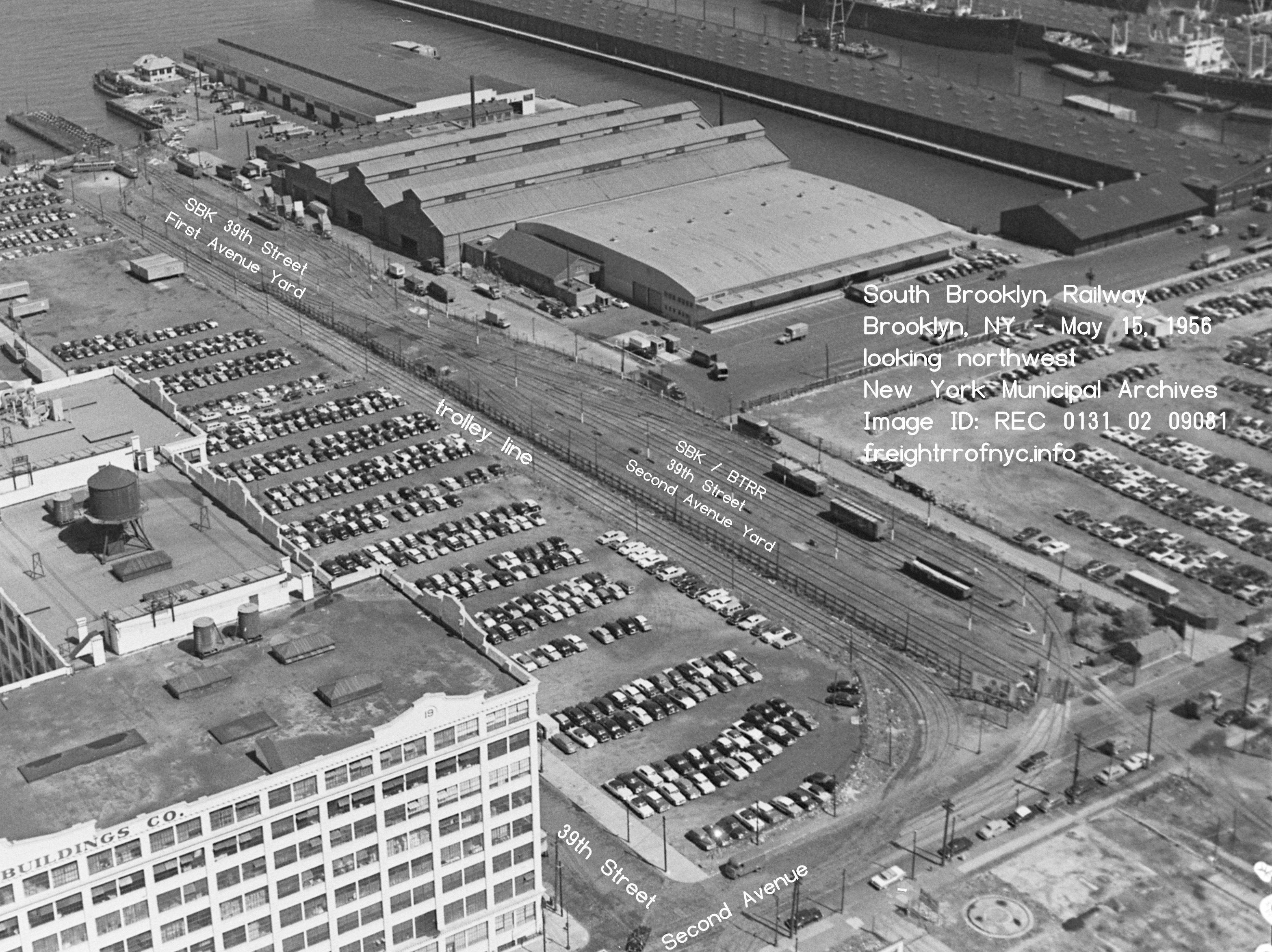
South Brooklyn Railway - First Avenue Yards between bulkhead and Third Avenue - May 15, 1956
Facing west-northwest.
New York Municipal Archives - Image ID: REC 0131 02 09081
Department of Records and Information Services (DORIS)
added 24 July 2026
.
.
Taken a few moments before (or after) from the above image; this image below was taken on the same date but is now facing due west, but also was taken from further east, capturing the Third Avenue Yard in the view.
By this date, the South Brooklyn Railway freight house has been torn down, the internal tracks now visible, but Davidson Pipe has now taken up residence in the former Bus Yard. We can still make out Trolley Motor 9980 at the east end, and Paramount Station truck delivery service still looks active but not quite as busy.. A larger high resolution version of this can be opened by clicking on the image below.
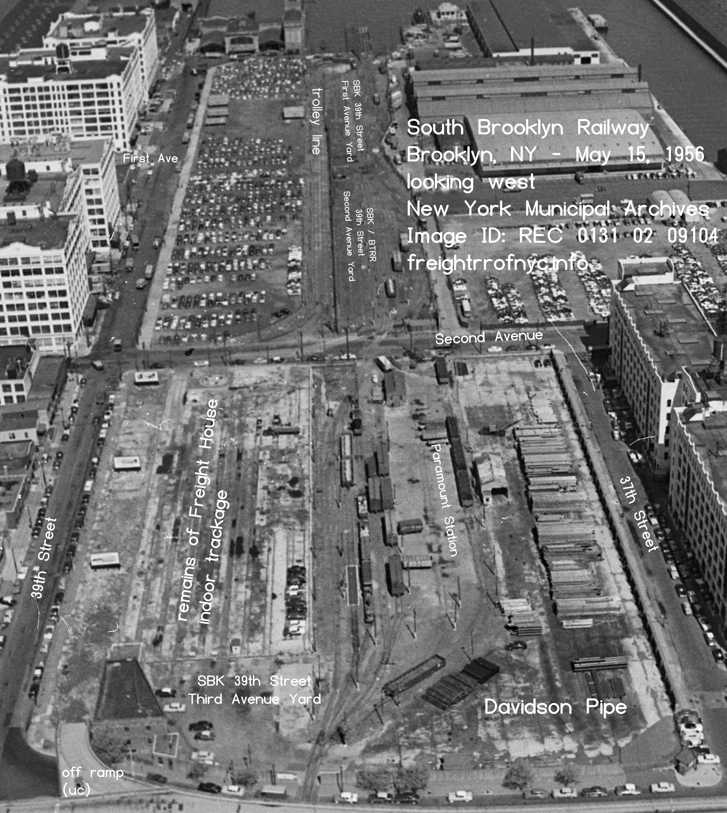
South Brooklyn Railway - First Avenue Yards between bulkhead and Third Avenue - May 15, 1956
Facing west. The freight house has been razed.
New York Municipal Archives - Image ID: REC 0131 02 9104
Department of Records and Information Services (DORIS)
added 24 July 2026
.
.
This image is nowhere as clear as the above images, but I would not be thorough if I did not include it in the chapter. The date December 8, 1960. Davison Pipe has filled out the Thrid Avenue Yard nicely, taking up the area formerly occupied by the freight house. That's about all that could be discerned from that image. There is a bit more freight cars in the First Avenue Yard than in the 1956 images above, but I surpise this may be more as a result of SBK having to relocate from the Third Avenue Yard due to the piles of pipe!
South Brooklyn Railway - First Avenue Yards between bulkhead and Third Avenue - May 15, 1956
Facing east.
New York Municipal Archives - Image ID: REC 0131 02 17646
Department of Records and Information Services (DORIS)
added 24 July 2026
.
.
Commencing in 1959, the 39th Street Ferry House was torn down, and the basin to the west of the existing bulkhead was landfilled for the construction of the Northeast Marine Terminal Company; of which the anchor tenant for the property would be to Mitsui Shipping. The trolley loop and trackage leading to the ferry house from Second Avenue would also be removed (with all trolley service in Brooklyn having ceased in on October 31,1956); and the property is now being used as a parking lot. Not much in the way of railroad cars can be seen in the Yard.
At some point over the next few years, the location would become known as the South Brooklyn Marine Terminal.
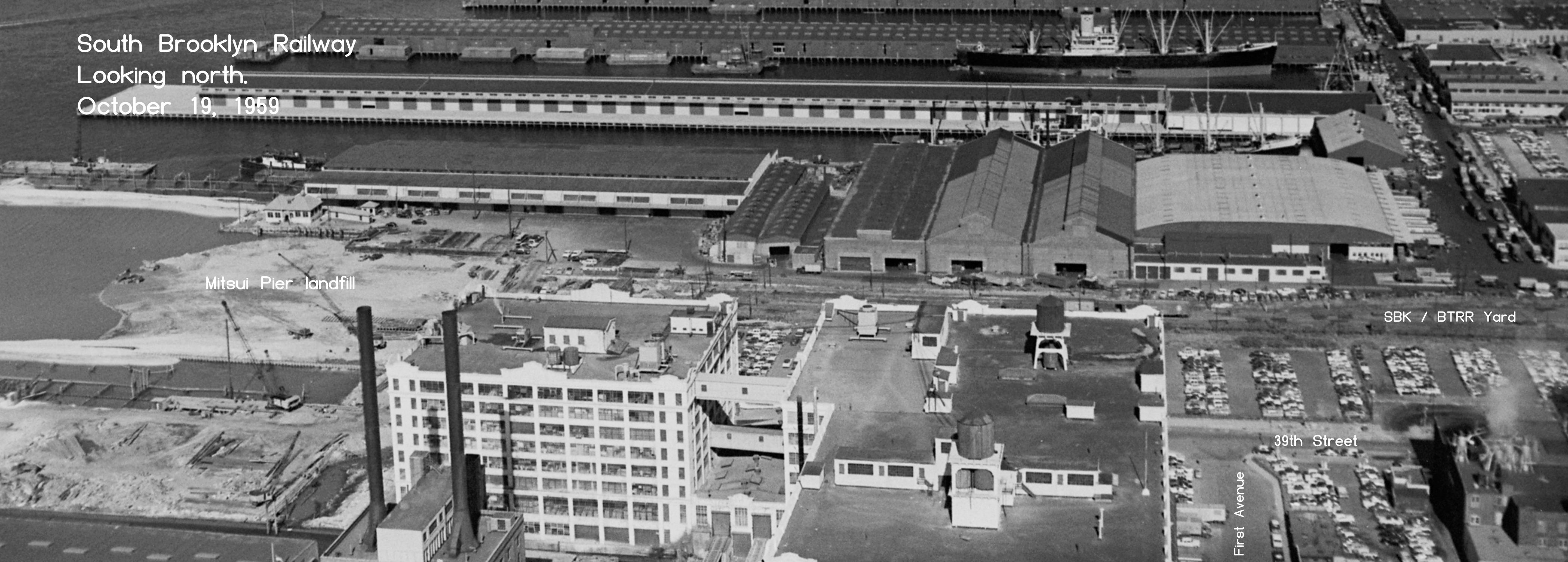
South Brooklyn Railway - First Avenue Yard between bulkhead and Second Avenue - October 19, 1959
Facing north
New York Municipal Archives - Image ID: REC 0131 02 16245
Department of Records and Information Services (DORIS)
added 24 July 2026
.
.
No where near as glamorous or information packed as the obliques are, I would be remiss if I did not include it. These were part of a survey. It clearly shows by this dates, how Davidson Pipe has pretty much taken over the Third Avenue Yard, leaving just the running tracks and one or two sidings unimpeded.
February 28, 1962
New York Municipal Archives - Image ID: REC 0131 02 18982
.
.
April 8, 1970 - the Mitsui Pier has been finished since 1963 (out of view to the left). There are plenty of tractor trailers backed into the area loading docks; and very few rail cars. One must wonder if rail traffic to / from the new pier did not materialize has one might have hoped. In the coming years, this is where retired subway cars would be placed for interchange to New York Dock Railway for carfloating to New Jersey.
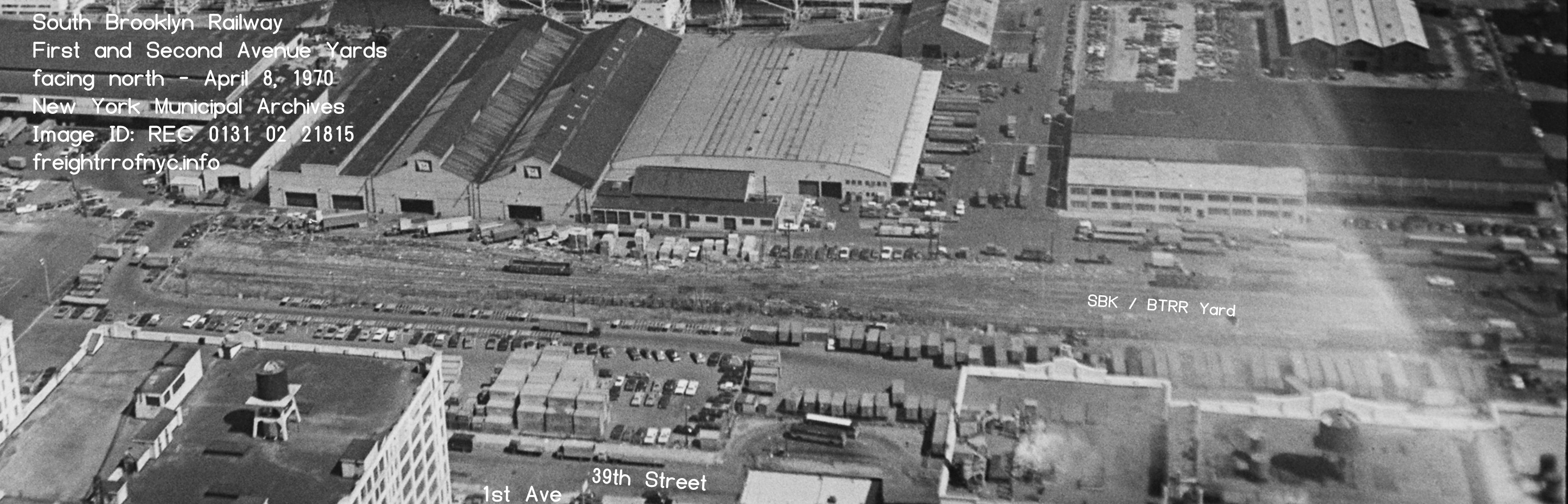
April 8, 1970
New York Municipal Archives - Image ID: REC 0131 02 21815
Department of Records and Information Services (DORIS)
From 1970 until the 1990's, very little change regarding the trackage took place. By this era, the South Brooklyn Railway saw no freight and any haulage was either inbound new subways cars, with an occasional gondola of tie plates; or outbound subway cars for scrap.
The outbound subway cars would be positioned in the 39th Street Yard between First and Second Avenues; until a shipment to the scrapper was ready to be interchanged with New York Dock Railway (1972-1983) or its successor, New York Cross Harbor RR (1983-2006)
In 1994, the "Bush Junction" interchange trackage was reconstructed; and in 2000 the First / Second Avenue Yards itself would be reconstructed. The diagram below is representative of both of those changes and shows the track configuration.
A gate on the west border of the 39th Street Yard allows two tracks to exit the yard and enter the South Brooklyn Marine Terminal (no affiliation with the South Brooklyn Railway). These two tracks merge and form a single track which services a set of loading docks located along the north wall of the pier shed. This pier shed was formerly Mitsui, and now was the location of American Stevedoring. This location is situated upon the site of the old 39th Street Ferry Terminal.
Oddly, the South Brooklyn Railway did not service this customer, but in fact the New York Cross Harbor Railroad would.
Unfortunately, this Marine Terminal would sit vacant and it understood it did not see rail service. As of 2010, the area went under extensive reconstruction to it's present configuration; which will be shown further in this text..
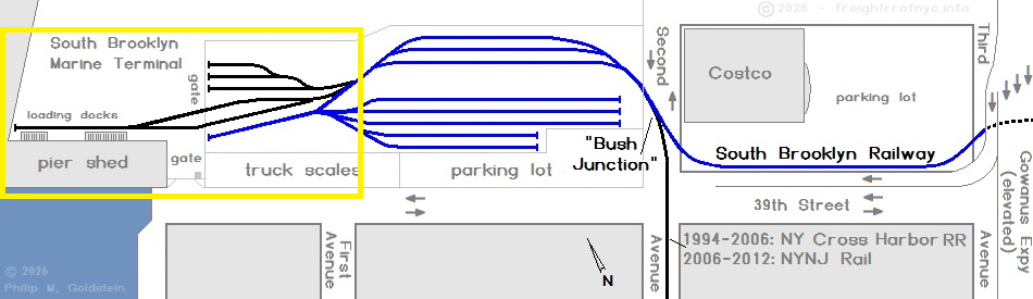
South Brooklyn Marine Terminal trackage - 1994 -
2010
.
.
Readers Please Take Note:
It is now understood from documents located on the web, that the 39th Street Yard is now part of the South Brooklyn Marine Terminal property which is owned by the Port Authority of New York & New Jersey, and operated by Axis Group; and the 39th Street Yard is no longer owned or operated by the South Brooklyn Railway / New York City Transit Authority / Metropolitan Transportation Authority.
As current information reflects that the South Brooklyn Railway / New York City Transit Authority / Metropolitan Transportation Authority no longer has and owning interest in the 39th Street Yard. As such, all updates pertaining to this particular location, will be posted in the South Brooklyn Marine Terminal chapter of the New York New Jersey Rail page of this website.
.
.
| Location List | Main Index |
.
2) Bush Terminal / South Brooklyn
Railway Interchange a/k/a "Bush Junction"
.
On Second Avenue, there was interchange with the Bush Terminal Railroad until 1972, at which time New York Dock Railway assumed operation of the Bush Terminal properties and trackage.
In August 1983, the New York Cross Harbor Railroad was organized (absorbing the New York Dock Railway and Brooklyn Eastern District Terminal operations.) The New York Cross Harbor RR operated until 2006.
At this time, the operation was renamed New York New Jersey Rail, and taken over by Port Authority of New York & New Jersey and the operation became a government subsidiary.
It is this location, that is referred to as "Bush Junction" and is shown below.
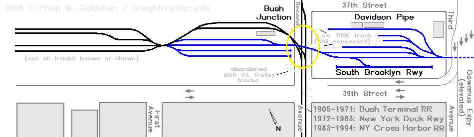
"Bush Junction" 1960 - 1994
.
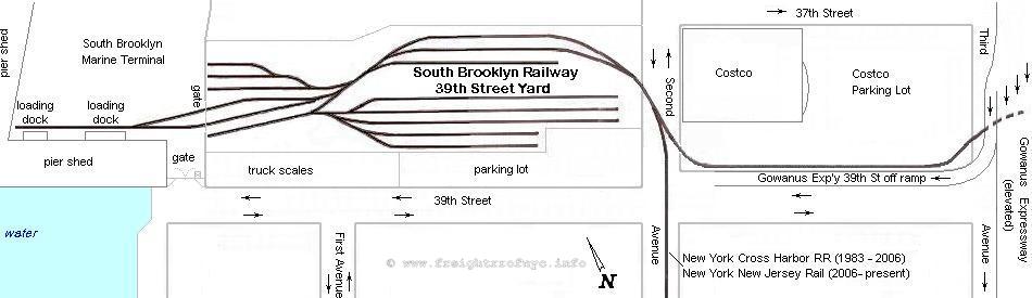
39th Street Yard & "Bush Junction" - 1994 -
2012
First / Second Avenue Yard reconstructed in 2000.
.
Before we go any further, it is imperative to understand that the Bush Terminal Railroad (and likewise its successors) had a significant involvement in South Brooklyn Railway history. For it was at Bush Terminal where freight cars destined for and from the South Brooklyn Railway customers had arrived and departed from Brooklyn via the Bush Terminal float bridges at 50th Street.
Without the float bridges at Bush Terminal, the South Brooklyn Railway would not have been able to received or ship freight cars, nor would it have lasted long as it has.
Throughout the decades, countless new subway cars arrived at, and many obsolete subway departed via carfloats at the 50th Street float bridges of the Bush Terminal Railroad:
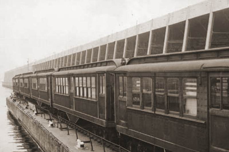
Bush Terminal 50th Street Floatbridge - April 24,
1950
"Seagoing subway cars - Somewhat out of their natural element, cars being
transferred
from Queens IRT line to Bronx shops make detour through Brooklyn by way of
Bush Terminal dock."
Brooklyn Eagle Newspaper archives
Brooklyn Public Library
added 22 Dec 2009
.
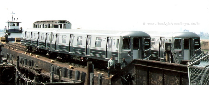
Bush Terminal 50th Street Float Bridge "Bush 1" (southern
float bridge) - ca. 1985 - 1987
R68's arriving on left and right tracks with an R32 loaded on flat car on center
track.
unknown photographer
added 22 Dec 09
.
SBK #9980 on Second Avenue.
Looking north, #9980 is pushing into the South Brooklyn Railway / Bush Interchange Yard.
The SBK brakeman on the ground is waiting for #9980's truck to clear the points
for the Church Avenue trolley, then using the prybar, move the switch point into alignment for the trolley right of way.
The trolley can be seen waiting to come out of the trolley right
of way.
SBK freight house on right edge of image.
D. Klepper photo
added 22 September 2026
.
.
Once incoming subway cars bound for SBK arrived at Bush Terminal, they would then be moved by Bush Terminal locomotives to Bush Junction. They were either immediately handed off to the South Brooklyn Railway, or placed in the yard at 39th Street and Second Avenue. From here, South Brooklyn Railway locomotives would bring the subway cars to either the NYCTA 36th Street Yard or Coney Island Yard.
Freight cars however, would be distributed to the various customers (when they existed) along the South Brooklyn Railway route by South Brooklyn Railway locomotives.
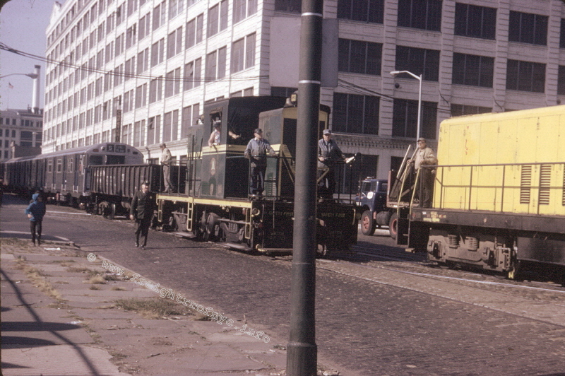
Bush Terminal RR #2 and South Brooklyn Railway #13
- September 28, 1965 - Second Avenue & 38th Street
Brand new R32's arriving at the BTRR/ SBK Interchange.
BT #2 on northbound track, SBK #13 on southbound track.
G. Landau photo
authors collection
added 22 Dec 09
.
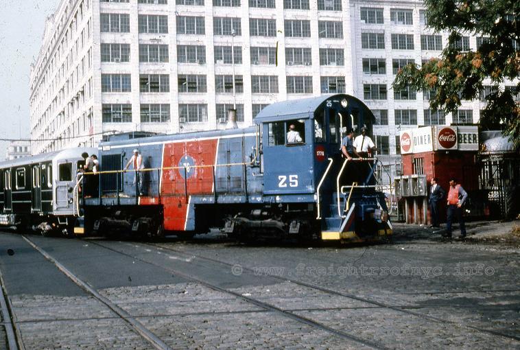
New York Cross Harbor RR #25 - 1983 - Second Avenue
& 38th Street
Brand new R62's arriving at the BTRR / SBK Interchange.
NYCH #25 is ex-BEDT #25 ALCo S1 coming off northbound track and
is about to enter the South Brooklyn Railway's 39th Street Yard.
unknown photographer
P. F. Strubeck
collection
added 22 Dec 09
.
.
This image, posted by the New York Transit Museum on their Facebook page; shows the Bush Junction scene somewhat. The S curves of the 39th Street trolley (abandoned) are in the foreground.
Towards the background, to the right of the diner, the turnouts of the Bush Terminal Railroad can be seen. The crossing diamond and track of the South Brooklyn Railway is obscured.
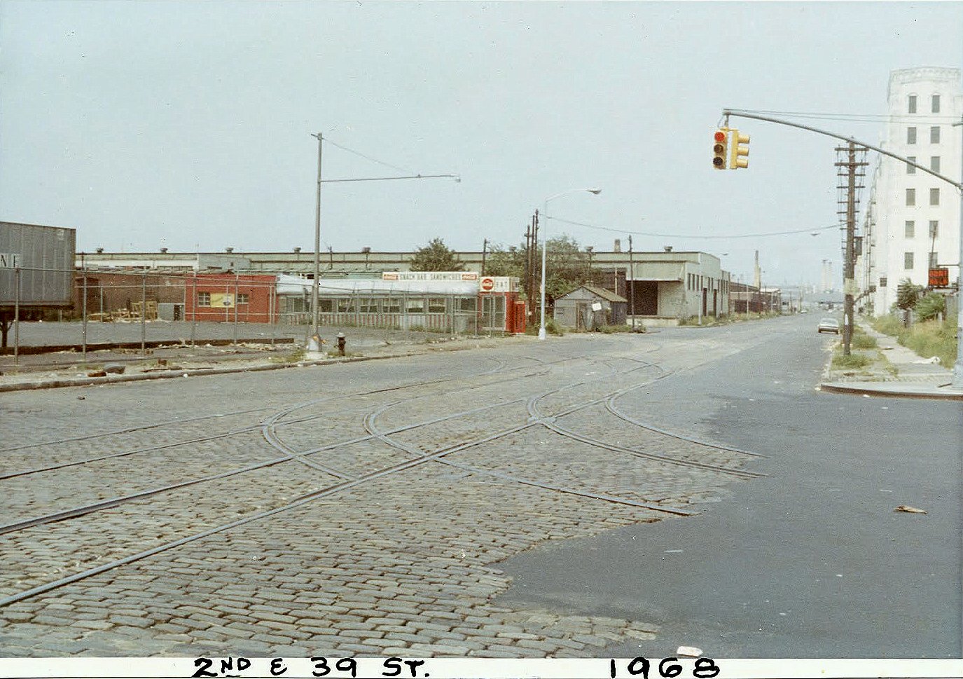
New York Transit Museum archives
| Reportedly, when delivery
of the first R68's was made on February 4th, 1986, they failed to negotiate
a sharp curve on South Brooklyn Railway trackage on 38th Street in Brooklyn.
According to railfan lore, supposedly this curve had to be rebuilt and the radius eased somewhat; with delivery finally occurring on February 26th, 1986. An inquiry made to Fred Briemann, locomotive engineer on the New York Cross Harbor Railroad at that time (and Bush Terminal Railroad prior to that); relates that no trackage or curve was realigned for the delivery of these subway cars, nor were any delays incurred on a delivery of subway cars to the South Brooklyn Railway. He recalls that the turnout (highlighted in red in diagram to right) on the northbound track of Bush Terminal RR trackage on Second Avenue into the South Brooklyn Railway 39th Street Yard was temperamental; with many freight cars over the years "picking the points" and derailing. It should be kept in mind, trackage at this location was quite aged, located in a main thoroughfare and therefore abused by heavy commercial vehicular traffic; as well as NYC Department of Sanitation snowplows during snow removal. Another contributing factor, was that the turnout was a "single point" or "tongue & mate" switch (designed primarily for streetcar / trolley use), see Glossary. Corroborating this explanation, Joe Roborecky (also locomotive engineer also familiar with the route and railroad) added: this switch point was held in position by a wedge; and the roadbed was "soft", with the rail flexing in a vertical direction under load, which contributed to the point moving under load. Fortunately, train speeds were slow and either the "minor derailment" or "unintentional reroute" was remedied quickly with a portable rerailer. Therefore, in appears this "point picking" problem has been misinterpreted by the novice railfan as a "curve radius" issue. Furthermore, copies
of documents acquired by this author in a FOIA request, reflect that
poor trackage conditions at this location were confirmed by internal
South Brooklyn Railway documents in 1982 and 1989 and may be read here. In 1994 the Junction was reconstructed with double point (conventional) heavy rail turnouts and the issue eliminated. |
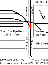 |
¹ It is presumed (but not confirmed) that the removal of the street trackage on Second Avenue (#2 and 3 above) took place upon rebuilding of the interchange in response to the new trackage alignment for Costco property.
"Bush Junction" 1994 - 2012 - with new 39th Street
yard constructed in 2000.
.
The contracting firm for this reconstruction was T. Glennon of Piscataway, NJ.
The South Brooklyn Railway 39th Street Yard was last used by NYCTA in 2007, as a location for asbestos removal from obsolete subways cars that were outbound and prior to reefing. After this date the remained unused.
Commencing in 2011, the construction and new alignment of trackage of New York New Jersey Rail along First Avenue from 41st Street to 39th Street, as well as the reconstruction of the South Brooklyn Marine Terminal; required the "Bush Junction" interchange being abandoned and removed. The existing property of the South Brooklyn Railway 39th Street Yard was relinquished to the Marine Terminal property and subsequently demolished.
.
Current Interchange
The new interchange between New York New Jersey Rail and South Brooklyn Railway was relocated to First Avenue and 39th Street, and is reflected by the lime green & orange line segments in the map below. The purple line segments reflect the old yard and alignment.
This took place in 2012 with major redevelopment of the South Brooklyn Marine Terminal property.
This new trackage eliminated the dilapidated street trackage, including the two 90 degree curves: one at First Avenue and 41st Street and the other at Second Avenue & 41st Street; as well as the 1994 rebuilt Bush Junction turnout (#1, the junction of the red & black striped / orange and yellow line segments in diagram below).
This new construction also allowed for the installation of conventional dual point turnouts as those normally used for heavy freight railroad service (as opposed to the lightweight single point tongue & mate switch for streetcars.)
2012 - present: South Brooklyn Railway / New York New Jersey Rail Interchange
and South Brooklyn Marine Terminal track layout.
diagram by author
.
.
This new interchange remains in service as of 2026.
Contrary to erroneous statements and assumptions made in railfan groups on social media, and with utmost thanks to my access to internal sources within the MTA, the delineation line of the South Brooklyn Railroad and New York New Jersey Rail is established at the Second Avenue crossing at 39th Street, in which the legal documents states:
|
"WHEREAS, the 2nd Avenue Grade Crossing at 39th Street is the point of delineation between NYNJR rail territory and operations and SBK Rail territory and operations, and; WHEREAS, the Parties desire to establish an interchange agreement, to formalize and accurately reflect how interchange traffic emanating from both Parties' facilities will be handled, with the primary interchange activity to be NYNJR delivering rail cars to the SBK Connection Track (as hereinafter defined); and WHEREAS, the parties are willing to enter into this Agreement on the terms and conditions provided herein for so long as the Parties tender rail cars to each other..." |
Therefore, it is now clear and simple: west of Second Avenue crossing is NYNJ
Rail, east of the crossing is South Brooklyn Railway. Not Third Avenue,
not the Bush Terminal Yard, and not 65th Street Yard. Precisely where
it is shown on the map below.
2012 - present: South Brooklyn Railway / New York New Jersey Rail Delineation Point
North is to the right.
annotated map by author
not to be reused or reproduced without consent.
added 18 April 2021
.
.
.
.
| Location List | Main Index |
.
.
Traveling east from Second Avenue and Bush Junction, the tracks ran through a two block parcel bordered by 39th and 37th Streets, Second and Third Avenues.
The following scan states the location of the South Brooklyn Railway to be at 370 Jay Street, (which is the Headquarters of the New York City Transit Authority) the other address shown is 990 Third Avenue.
Research shows this 990 Third Avenue location to be the address of the freight house and yard.
The large structure that was located here, was repurposed several times over its life.
First, from its initial build date in 1888 to 1926, it was "home" to the 39th Street Shops of the South Brooklyn Railway, Brooklyn Rapid Transit. It was a repair and refit shop for all the equipment operated, mostly passenger cars and trolleys, but the electric locomotives as well.
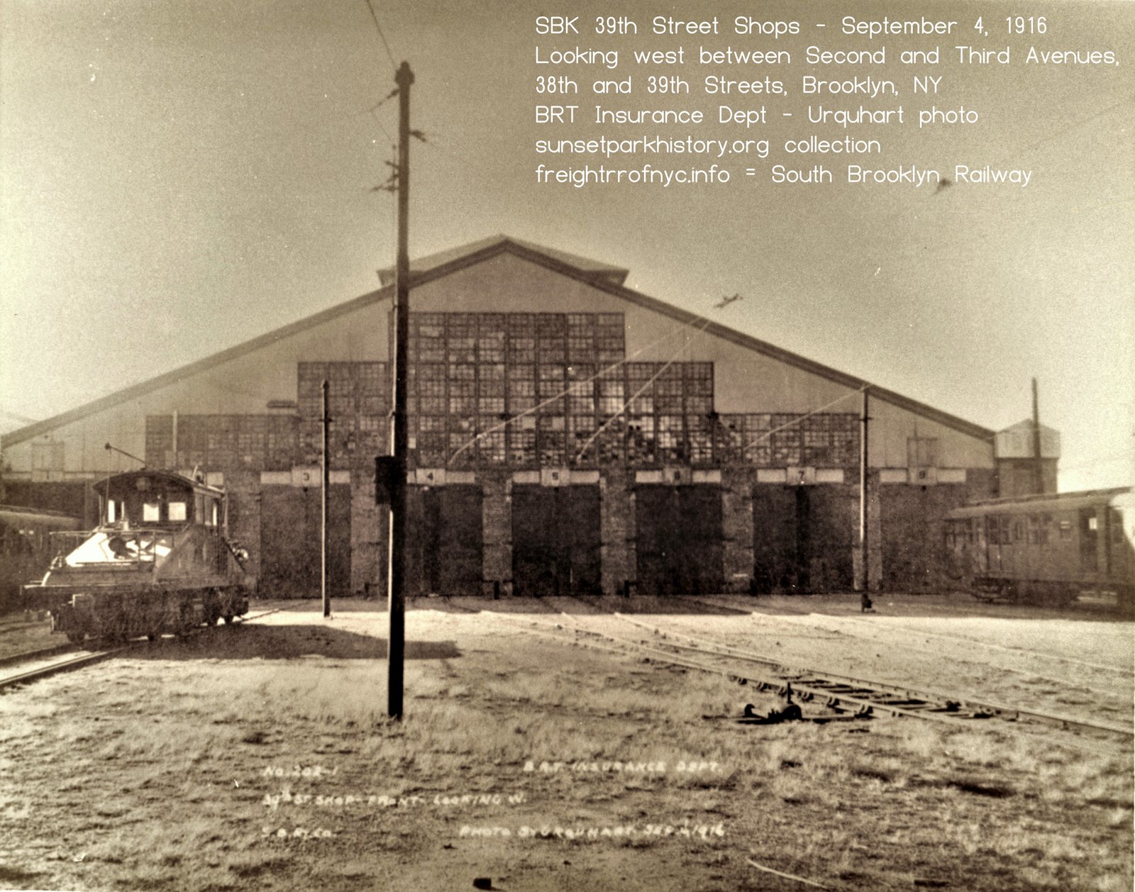
39th Street Shops - September 4, 1916
Front of building looking west.
Photo by Urquhart for Brooklyn Rapid Transit Insurance Department.
sunsetparkhistory.org archives
added 02 October 2026
When the Coney Island Yards opened in 1926, the repair shops and work forces were to the new location. At this time, the building became the freight house for the freight side of South Brooklyn Railway operations.
As freight handling dwindled on the SBK and sometime around 1939, the structure was repurposed yet again; this time being converted into a bus garage and repair facility. This lasted until sometime between 1952 and 1956, when it was razed.
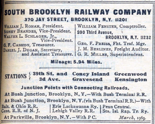
In the years prior to circa 1959; this was another modestly sized railyard of the South Brooklyn Railway and was the location of their freight house. Aerial photos located in the 2026 in the New York Municipal Archive, show the yard in great detail.
South Brooklyn Railway - Third Avenue Yard Front Gate - unknown date
W. H. Lundin photo
New York Transit Authority archives - Image ID: 2004.20.9.1273
added 21 September 2026
.
.
South Brooklyn Railway - 39th Street Yards between bulkhead and Third Avenue - January 16, 1931
Facing north. Note freight cars in front of freight house.
New York Municipal Archives - Image ID: REC 0028 20 14 1674-1
Department of Records and Information Services (DORIS)
annotated image - © 2026 by author
.
.
South Brooklyn Railway - freight house between Third Avenue (foreground) - 1939
after being converted to bus garage. Facing southwest.
W. H. Lundin photo
New York Transit Authority archives - Image ID: 2004.20.9.568
added 21 September 2026
.
.
South Brooklyn Railway - Freight yard between Third Avenue Bus Yard (foreground) and Second Avenue - 1939
Paramount Station & team tracks on left. Facing west.
W. H. Lundin photo
New York Transit Authority archives - Image ID: 2004.20.9.56
added 21 September 2026
.
.
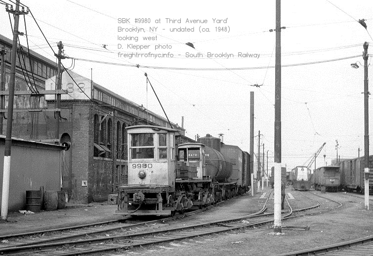
#9980 shoving next to the freight house. The cornerstone of the freight house reads 1888.
D. Klepper photo
added 21 September 2026
.
.
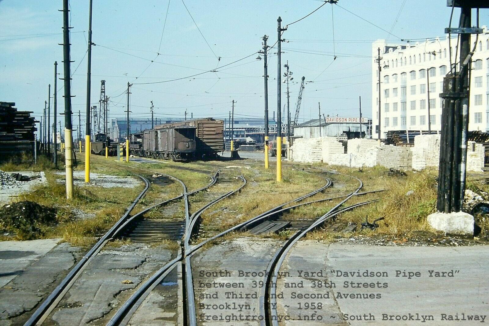
South Brooklyn Railway Yard - 1958
Looking west from Third Avenue at "Davidson Pipe Yard" between 39th & 38th Streets and Third & Second Avenues.
unknown photographer
added 31 October 2022
.
.
Third Avenue Yard, after the freight house has been demolished. -
unknown date (but post 1959, as Davidson Pipe appears to be on premises.
#9980, cranes #9006, #9007
D. Klepper photo
added 22 September 2026
According to Peter Davidson, this location was briefly the site of a brickyard, prior to Davidson Pipe moving here. After the freight house and team trackage was removed, Davidson Pipe would occupy the entire location, and the location was known simply as the "Davidson Pipe Yard". Tall stacks of pipe of many types and varieties were stored in this yard for commercial resale.
Eventually, Davidson Pipe purchased the property from the City of New York.
Davidson Pipe was a large and very significant customer for the South Brooklyn Railway and countless gondolas were brought in by the South Brooklyn Railway for unloading here. Davidson Pipe would also be South Brooklyn Railway's last "non-Transit Authority" customer.
It appears that the piles of pipe was simply stacked on the trackage, rendering it out of service.
However several tracks would remain unblocked for railroad use: the northern track, effectively made a dead end siding by a pile of pipe (the track continued under this pile to a 90 degree street crossing on Second Avenue); a middle "through track" that ran straight through the yard; and the southern "runaround track", but also a through track. A siding to the south, may or may not have been in use at the end of this yards life.
With the trackage located within a heavy industrial yard, engaged in the receipt and sales of large diameter steel pipe (which obviously were quite heavy), the tracks in this yard were subject to intense abuse. Trucks, truck cranes, forklifts operating during business hours, which required crossing the various running tracks and stub sidings hundreds of times a day undoubtedly took a toll on the track condition.
As one can compare the various images taken over the year, one can see the degradation of the conditions happen visually.
In consideration of this, the Davidson Pipe yard was one place where the track could not be regularly maintained, unless their business was disturbed, like at the First / Second Avenue Yard to the west or the Unloading Yard to the east, and where the SBK / NYCTA could maintain the track regularly. Replacing a track or even a switch in the Davidson Pipe Yard, required mounds of pipe to be relocated, and would block used of their trucks and cranes.
As track speeds were slow, this really wasn't too much of a factor on going through the yard, but eventually that track reached a state of dilapidation, that if SBK operations were to continue, it would have to be reconstructed, which could be read in the condition report.
Fortunately for the SBK, Davidson sold their property to Costco in 1994, and it understood (but not confirmed) that Costco paid to have line relocated to the south edge of the property the following year..
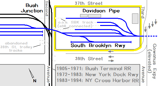
Davidson Pipe Yard: ca. 1960 - 1994
.
.
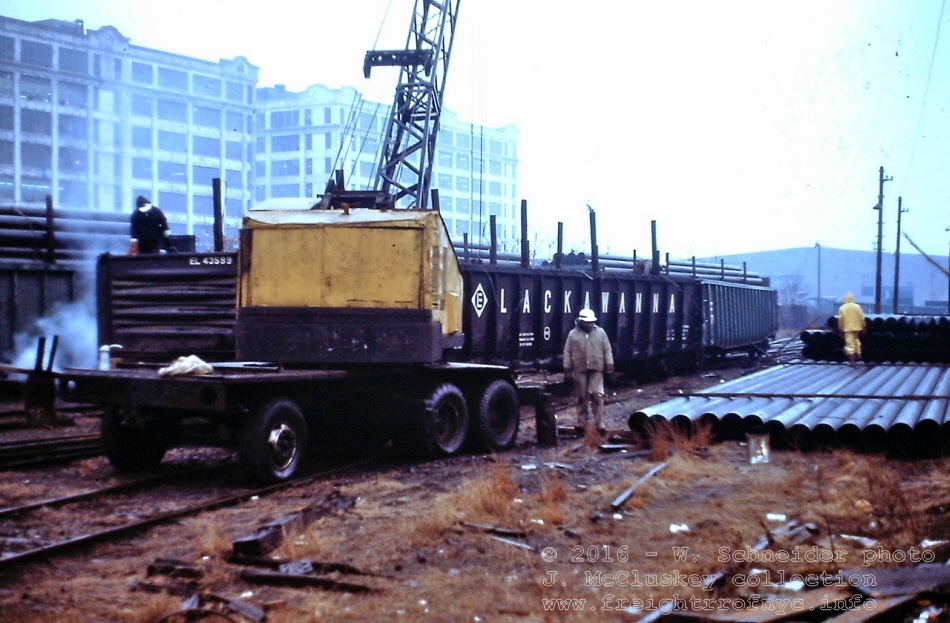
Davidson Pipe unloading Erie Lackawanna gondola #43599 on a rainy day.
Looking
west in First Avenue Yard, Bush Terminal buildings 26 and 24 background
left behind crane, Mitsui piershed in background right.
W. Schneider photo
J. McCluskey collection
added 07 November
2016
.
.
On 28 December 2009, I contacted Mr. Peter Davidson, of Davidson
Pipe; which is still located in the Sunset Park area of Brooklyn. Mr. Davidson
was gracious enough to take some time out of his busy schedule to answer
a few questions regarding their occupancy of the property at 39th Street
& Third Avenue:
.
Prior to Davidson Pipe's occupancy, there was a brickyard
located at this location. It was not in business long, and Davidson Pipe
took over the property circa 1959.
During their presence, Davidson Pipe would receive
between 5 and 10 carloads of pipe per week (which was brought in from New
Jersey by the Bush Terminal Railroad and subsequently New York Dock
Railway and then New York Cross Harbor Railroad). These cars would be placed
in the South Brooklyn Railway Yard at 39th & Second Avenue, and
the South Brooklyn Railway would spot the carloads of pipe within the
Davidson Pipe property.
At this yard was a main building; which housed the Davidson Pipe yard office, the freight offices of the South Brooklyn Railway (which explains why the locomotives were stored in the yard) and another city agency.
As far as Mr. Davidson recalls in the later years, other than Davidson Pipe themselves; there was only one other "non-NYCTA" customer (a cocoa warehouse), but they did not receive freight traffic often.
Mr. Davidson might have some images of the Davidson Pipe Yard operation, but needs some time to locate them, so stay tuned for further updates.
In 1994, Davidson Pipe closed this yard. Again, they were the last non-NYCTA customer for the South Brooklyn Railway.
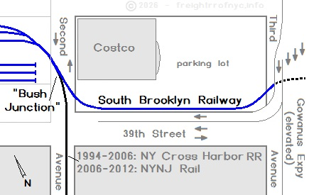
Costco: 1994 - present
Exiting east out of the Davidson Pipe Yard (and now Costco), the tracks would cross Third Avenue.
Prior to the construction of the Gowanus Expressway, the tracks crossed Third Avenue, which was a "simple" two way avenue. When the Gowanus Expressway (elevated) was constructed in the 1940's, Third Avenue would be widened to accommodate the elevated superhighway, and this became a "major" crossing, with tracks now having to cross 3 lanes of southbound traffic, a wide island in the middle, (in which the supports for the Gowanus Expressway are located) and then three lanes of northbound traffic.
Because of the infrequency of activity, this crossing was manually flagged (no automatic flashing lights or crossing arms.) Oddly, this crossing remains manually flagged into the current era of operations.
.
.
| Location List | Main Index |
.
4) 38th Street between Third &
Fourth Avenue Yard - "Unloading Yard" a/k/a "Public Tracks"
.
East of the Third Avenue crossing would be another small yard. Through all the images of this yard to date, this yard appears to have been lightly used throughout its history.
However, the early history of this location may have been an industrial siding before being a yard. According to "The Elevated Railways of Brooklyn and the BMT Subway, Volume 1, p. 67" (Eric Oszustowicz, ERA 2022) is the following:
"Armour Packing built a distribution plant with a private siding at 38th Street and Third Avenue
The earliest visual references I can find showing a railroad siding in or at this location, is 1906 G. W. Bromley Property Atlas - Plate 33 shown highlighted in yellow below. Whether this was Armour Packing remains to be confirmed; which was a few moments later by referencing the 1903-1907 edition of the E. Belcher Hyde Property Atlas - Plate 33 (coincidentally!) The location os clearly marked Armour Packing.
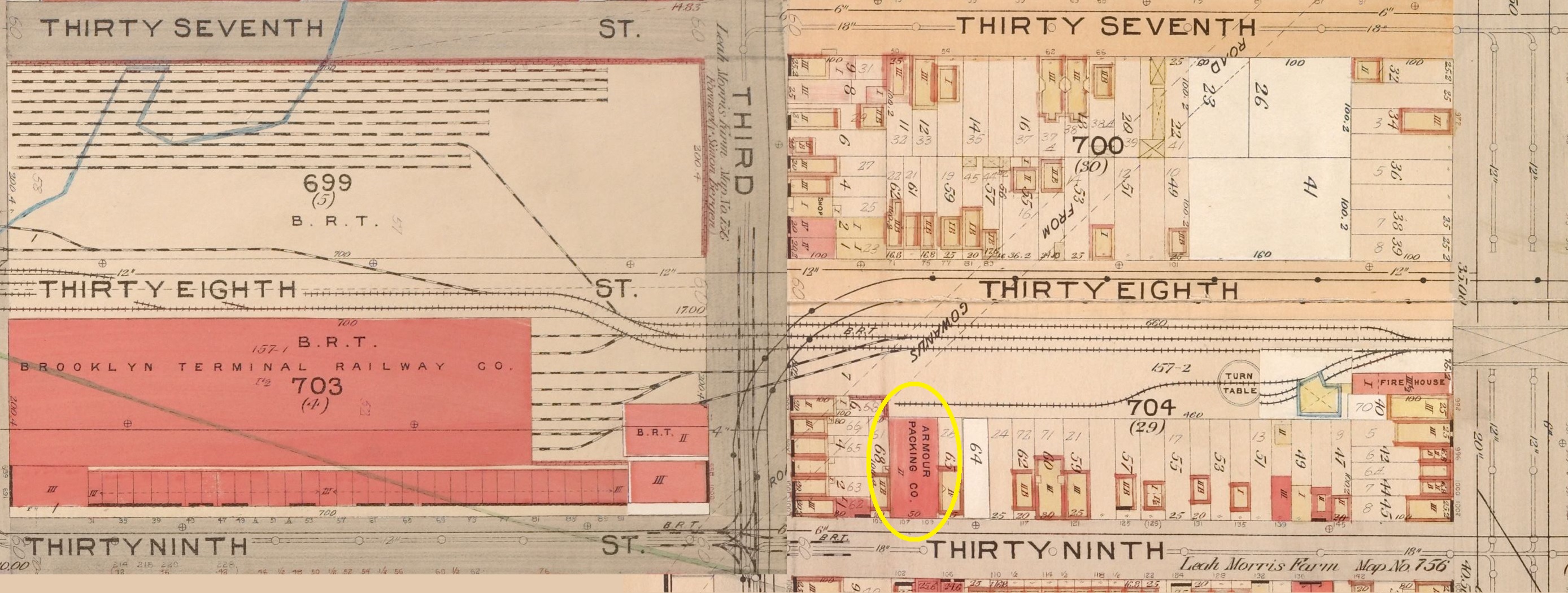
Quite obviously, we know the property underwent changes over the
next few decades., especially when Third Avenue was widened
Upon the demolition of the Bay Ridge / Fifth Avenue elevated commencing September 15, 1941 and the construction of the Gowanus Expressway, an off ramp was needed. The yard would be reconfigured (narrowed) to accommodate this. These two images below shows the yard before said reconfiguration.
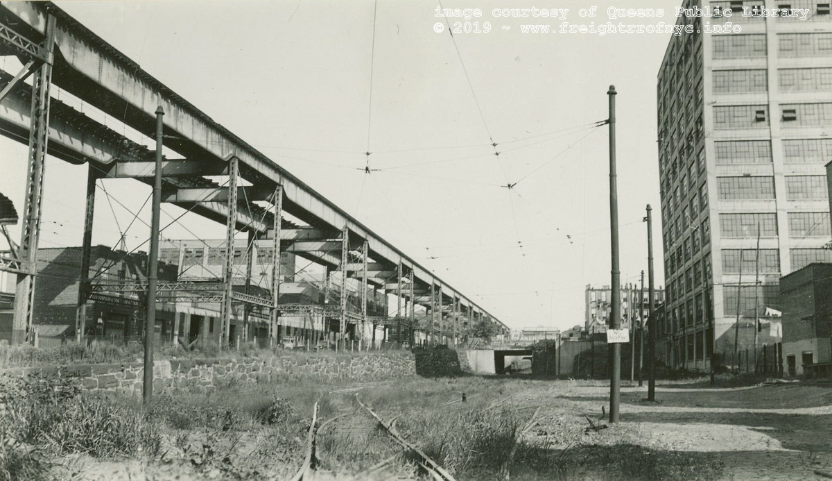 .
.
38th Street Yard - "Unloading Yard"- 1935
Looking east from Third Avenue, with the Bay Ridge - Fifth Avenue Shuttle elevated on left.
Note the subway train through the overpass and about to turn north up the Fourth Avenue Line over 38th Street.
William J. Rugen photo
image courtesy of Queens Public Library Digital Archives
color corrected by author
added 21 May 2019
.
.
.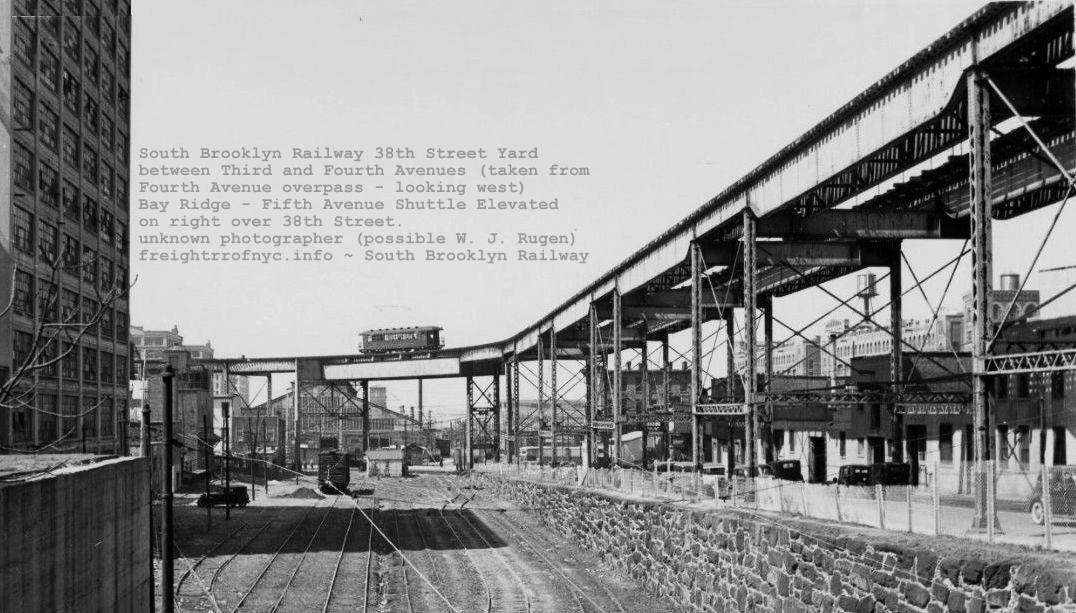
South Brooklyn Railway "38th Street Yard" a/k/a "Public Tracks Yard" - 1940
Looking west from Fourth Avenue overpass, with the Bay Ridge - Fifth Avenue Shuttle elevated over 38th Street.
The South Brooklyn Railway freight house with peaked roof can be
discerned through the girder supports at the far end of the yard.
unknown photographer (possibly a William J. Rugen photo)
courtesy of New York Historical Society archives
added 31 October 2022
.
.
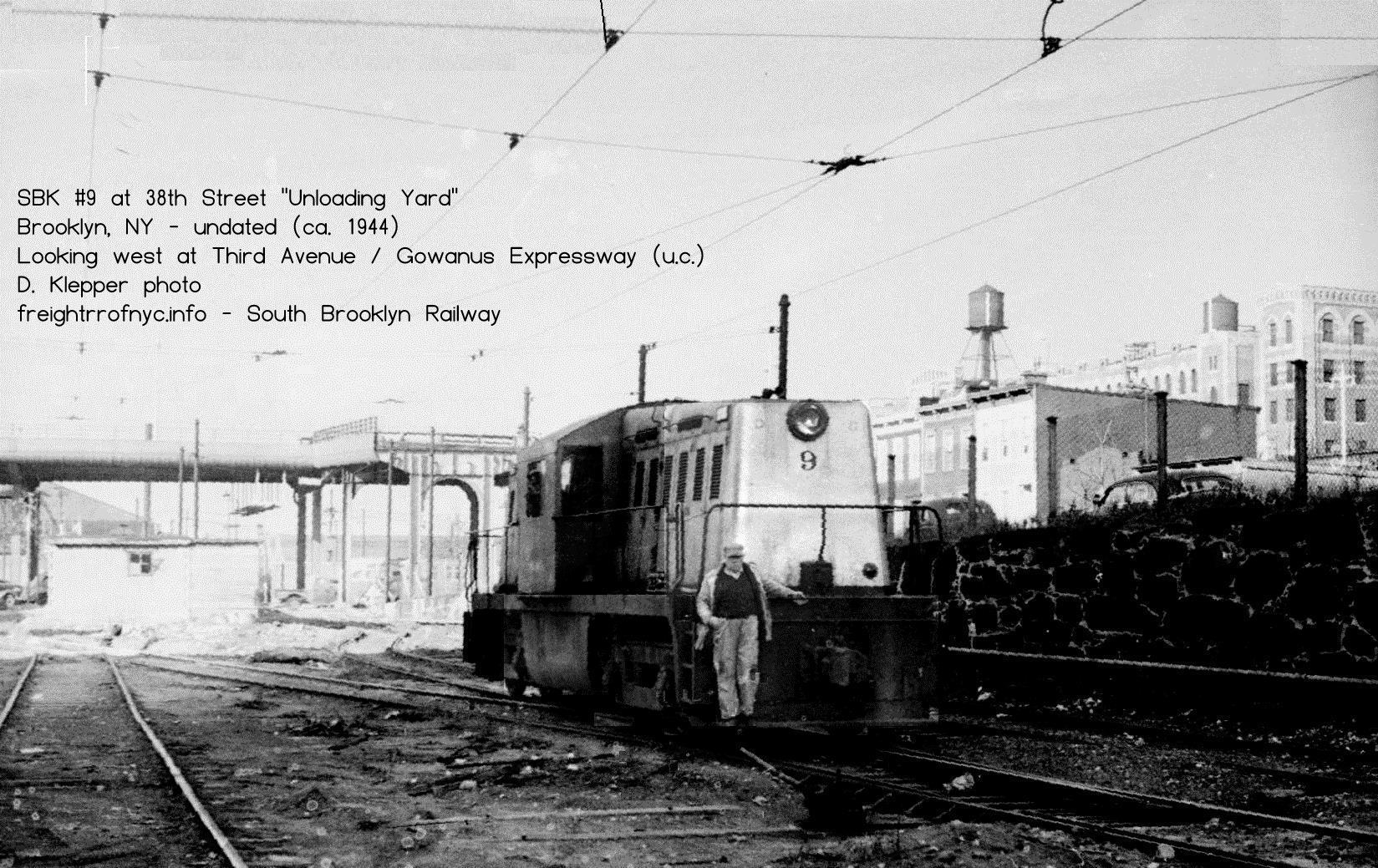
SBK #9 in 38th Street Yard - "Unloading Yard"- ca. 1944
Looking west from midyard. The
Fifth Avenue Elevated has been demolished, and the Gowanus Expressway
is built, however the 38th Street off ramp has not been completed.
D. Klepper photo
added 22 September 2026
.
.
.
.
South Brooklyn Railway "38th Street Yard" - Fourth Avenue overpass - ca. 1948
Looking east.
D. Klepper photo
added 22 September 2026
..
.
.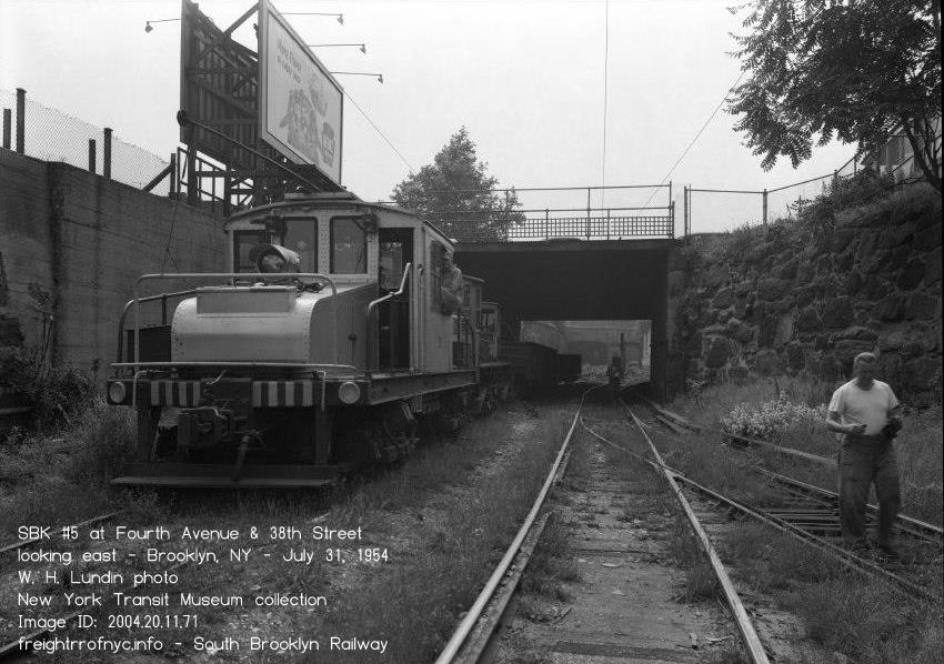
South Brooklyn Railway "38th Street Yard" - Fourth Avenue overpass - July 31, 1954
Looking east.
W. H. Lundin photo
New York Transit Authority archives - Image ID: 2004.20.11.71
added 21 September 2026
In the map contained in Operations Manual, this yard is listed as "3rd Avenue Public Tracks"; and was used for public unloading of freight from railway car to truck, also known as team tracks.
At this location in later years, a ramp built of railroad ties with steel rectangular structural tubing laid upon it and kept in gauge by welded cross braces. This ramp was used to load / unload subway cars that were transported on top of flat cars. Hence the location gaining it's colloquial name "the Unloading Yard."
With thanks to Dave Pirmann, I was finally able to secure images of this ramp in use, and these photos may be seen in the N1 / N2 section on Locomotive Photos page.
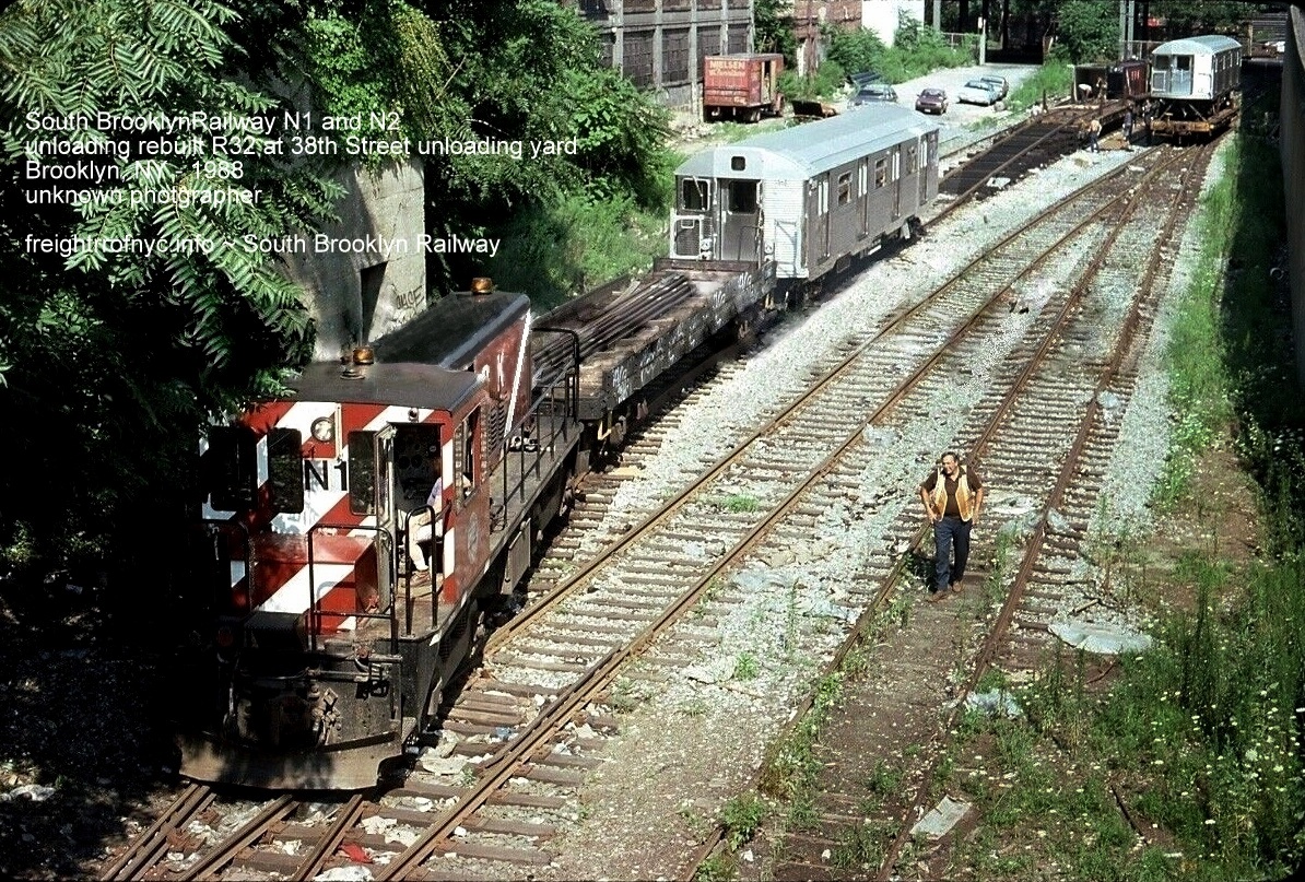
Looking west from Fourth Avenue overpass - 1988
courtesy of D. Pirmann - nycsubway.com
.
At the east end of this yard, the right
of way begins to run subgrade under Fourth Avenue (actually the land contour
rises). This tunnel entrance can be seen by the chain link gates and interlocking
signals in the photo below. The South Brooklyn Railway enters the former
Brooklyn Manhattan Transit "BMT" West End
 line (current NYCTA
&
line (current NYCTA
&
 subway lines) at this
point.
subway lines) at this
point.
From this point, it runs for about half a block in open subgrade, and then enters a tunnel until Seventh Avenue. Due to the restrictive nature of the subway tunnels encountered to Seventh Avenue; no freight cars with a red "no clearance" tag can proceeded east of this yard.
After the last of the non-NYCTA customers ceased receiving service from the SBK, only subway cars and subway track maintenance equipment would use this yard.
.
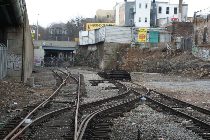
South Brooklyn Railway "38th Street Yard" between Third and Fourth Avenues
and 38th Street - April 13, 2008
looking southeast, showing the subway car unloading ramp.
Fourth Ave and interchange with subway interchange in background.
P. F. Strubeck
photo
added 16 Dec 2009
..
.
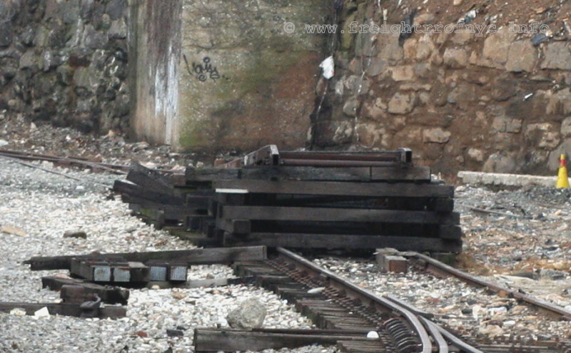
Close up of unloading ramp. Yes, this is what the New
York City Transit Authority used
to unload subway cars that were transported on top of flatcars.
P. F. Strubeck
photo
added 16 Dec 2009
.
.
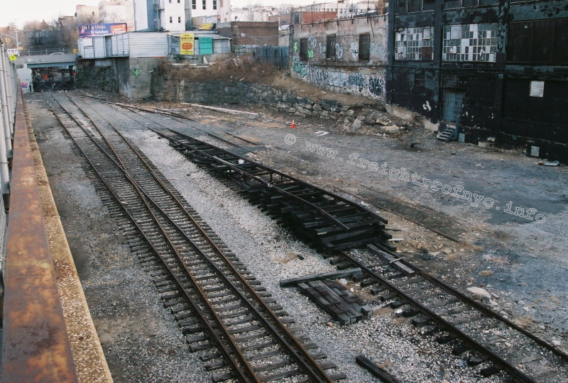
South Brooklyn Railway "38th Street Yard" between Third
and Fourth Avenues and 38th Street - January 26, 2010
Looking east toward Fourth Avenue and subway interchange
with subway car unloading ramp.
P. M. Goldstein photo
added 03 May 2012
.
.
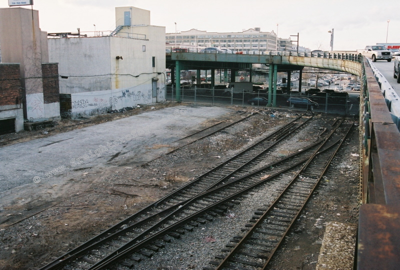
South Brooklyn Railway "38th Street Yard" between Third and Fourth Avenues
and 38th Street - January 26, 2010
Looking west toward Third Avenue grade crossing and
CostCo parking lot (under Gowanus Expressway).
P. M. Goldstein photo
added 03 May 2012
.
.
As of late April 2012, this yard has been cleaned up of rubbish. The original subway car unloading ramp seen in the above images has been removed, it was replaced with a new heavier constructed unloading ramp, for the new NYCTA work locomotives that were scheduled to arrive.
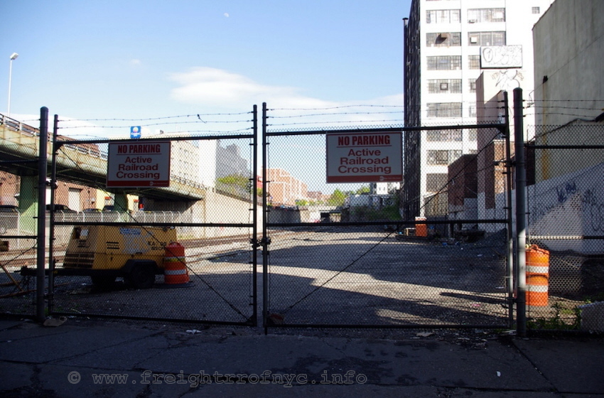
South Brooklyn Railway "38th Street Yard" between Third
and Fourth Avenues and 38th Street - May 1, 2012
New signs on vehicle entrance gate.
J. McCluskey
photo
added 03 May 2012
.
.
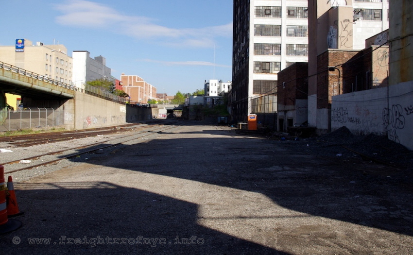
South Brooklyn Railway "38th Street Yard" between Third
and Fourth Avenues and 38th Street - May 1, 2012
J. McCluskey
photo
added 03 May 2012
.
.
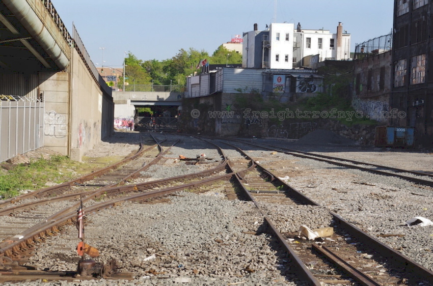
South Brooklyn Railway "38th Street Yard" between Third
and Fourth Avenues and 38th Street - May 1, 2012
Showing lack of unloading ramp.
J. McCluskey photo
added 03 May 2012
.
.
The new ramp built at NYCTA Linden Shops, and brought to this location for the intended unloading of the R156 work locomotives. However, after the third locomotive arrived; the ramp was relocated to New York New Jersey Rail's Bush Terminal Yard, where it remained until the construction of the Car Inspection Shop.
.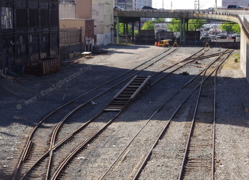
South Brooklyn Railway "38th Street Yard" between Third
and Fourth Avenues and 38th Street - May 12, 2012
Showing new unloading ramp recently relocated from Linden Shops for the unloading of R156 work locomotives.
J. McCluskey photo
added 12 May 2012
.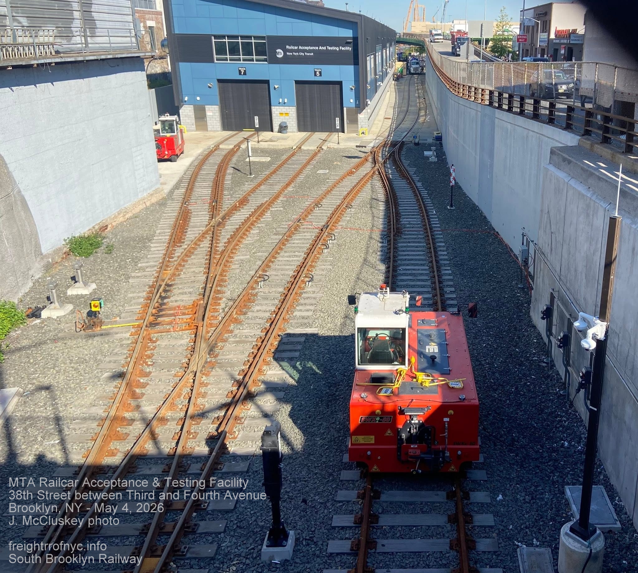
MTA Railcar Acceptance & Testing Facility - May 4, 2026
Looking west from Fourth Avenue overpass. Facility was built on former "Unloading Yard".
J. McCluskey photo
.
.
| Location List | Main Index |
.
.
Beginning in 1914 with the construction of the BMT Fourth Avenue Subway to replace the Fifth Avenue Elevated; this would become the location of the south portals of the subway tunnels as well as the interchange where South Brooklyn Railway would enter upon signaled territory.
Once this was completed, from this point to the 36th Street Yard, South Brooklyn Railway movements would have to get clearance from the BMT dispatcher normalize the derails (these were not manual and were controlled by the tower) and unlock the switch and align for entrance into the signaled territory. Once this was complete, the signal changed to clear (green) and train movement could proceed, beginning the 1.72% climb towards Ninth Avenue.
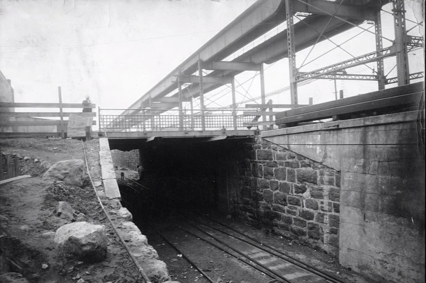
Fourth Avenue overpass - 1914
Looking west prior to Fourth Avenue Line construction.
unknown photographer
unknown repository
added 09 September 2026
.
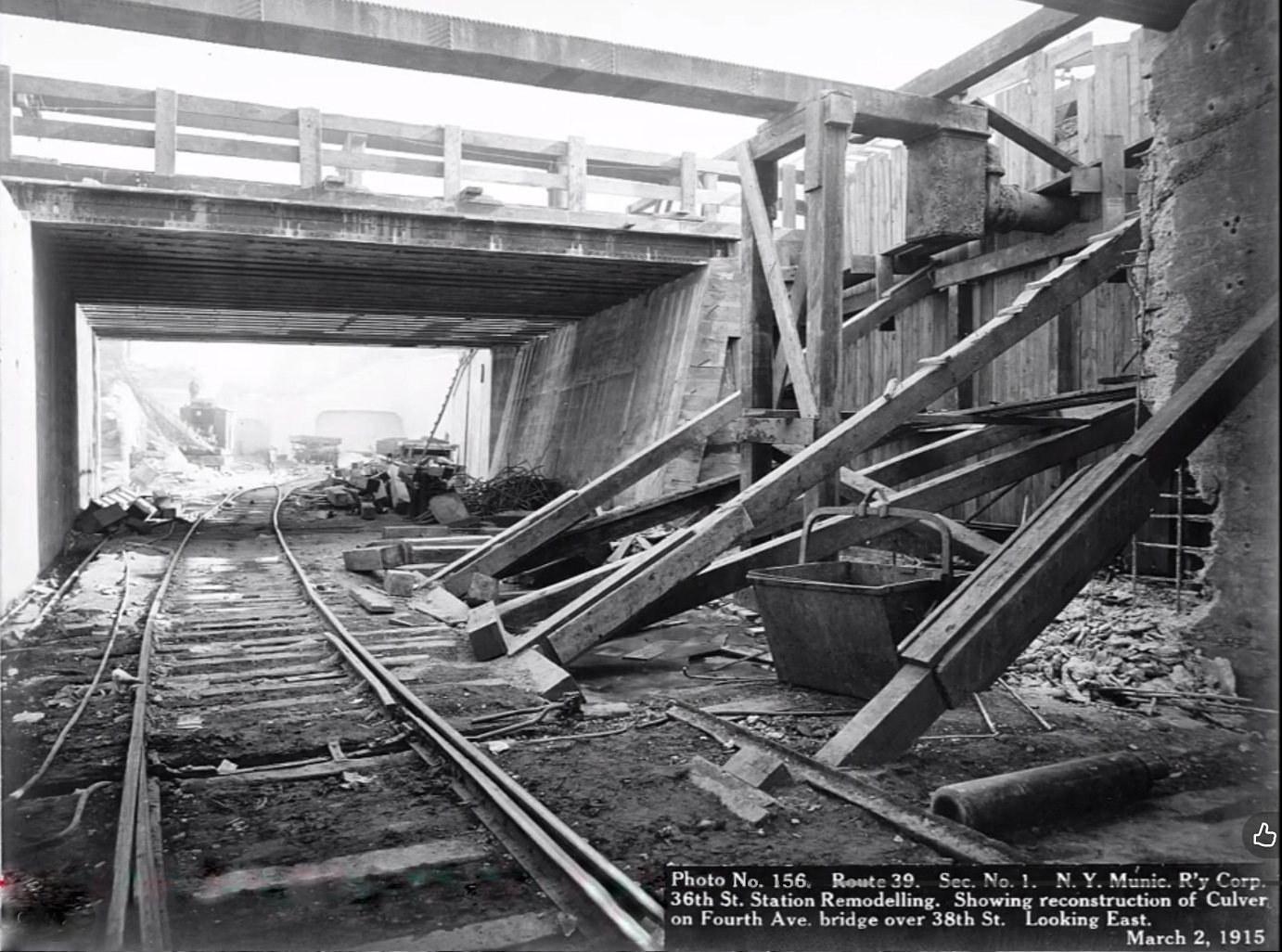
Fourth Avenue overpass - March 2, 1915
Looking east. Note bellmouths already erected.
unknown photographer
unknown repository
added 09 September 2026
.
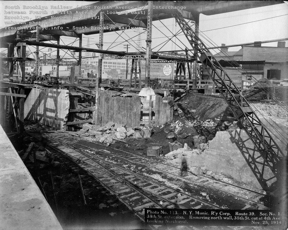 .
.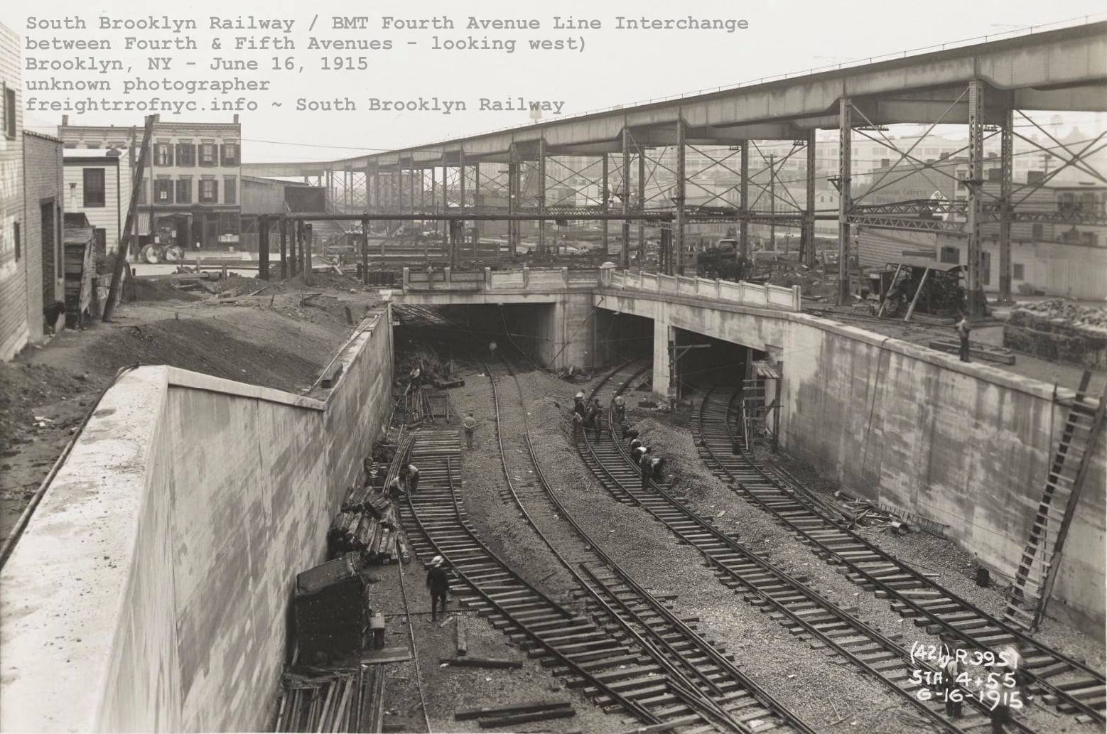
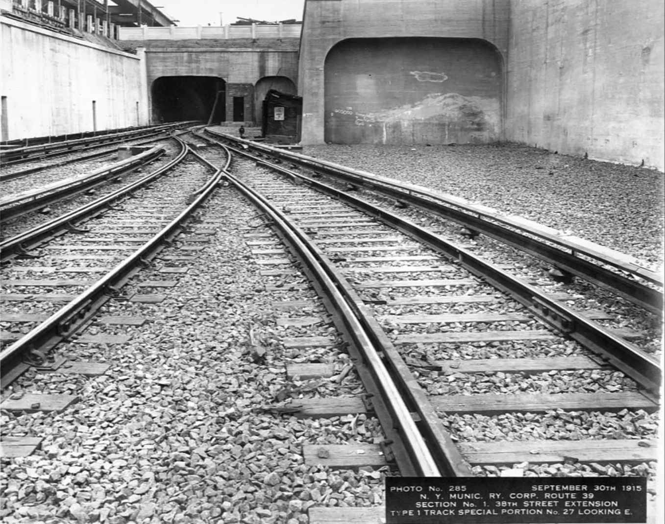 .
.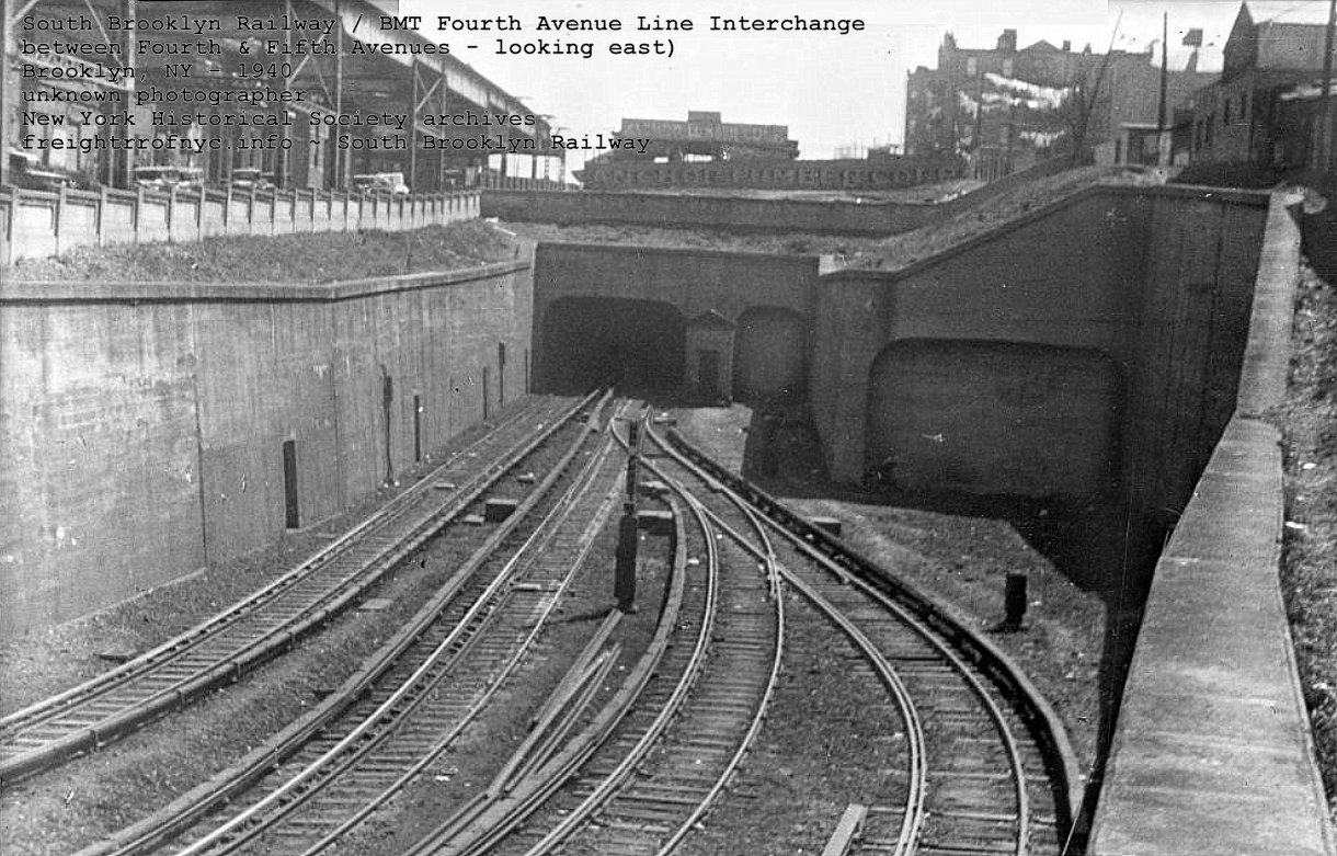
.
.
| Location List | Main Index |
.
6) BMT 36th-38th Street BMT
Yard (west portion) - SBK 37th Street Yard (west portion) "Materials Yard"
Exiting eastbound from the tunnel
from Fifth Avenue, the tracks open up into the combined "36th-38th Street Yard" of
the New
York City Transit Authority (NYCTA) and former Brooklyn Manhattan
Transit "BMT". This facility is the present day MTA 38th Street Train Yard & Facility.
This is a rather decent sized railyard, but nowhere on the
magnitude of say; the Coney Island Yard & Shops Complex. The
northern perimeter
of the yard is bordered by 37th Streets on the north, and the BMT West
End Line tracks on the south, Fifth Avenue to the west and Ninth Avenue
on
the east.
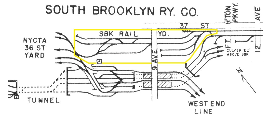
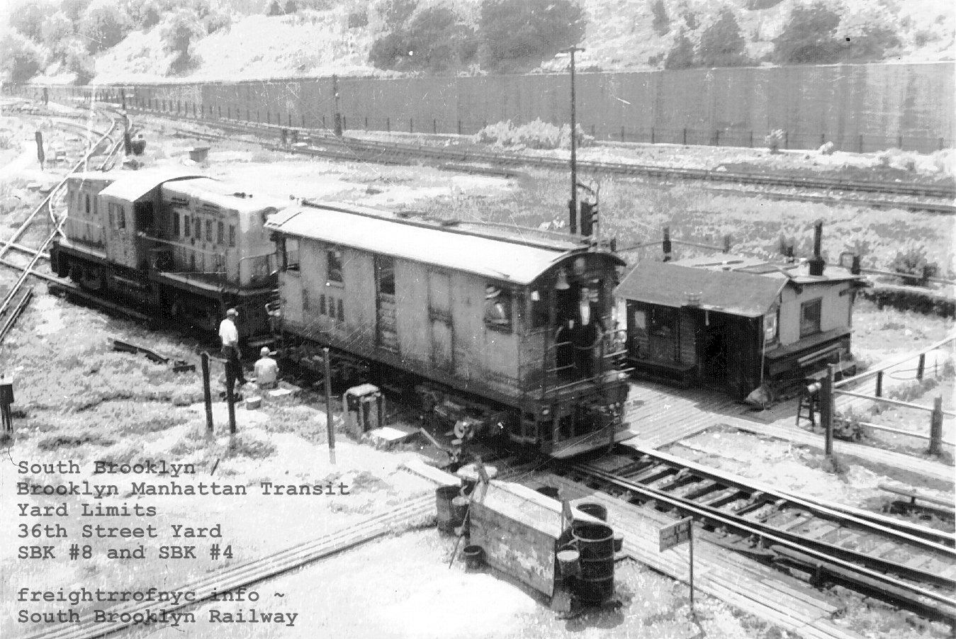 |
 |
| Looking southeast at the "diamond" at 36th Street Yards. SBK 36th Street Yard to left, BMT 36th Street Yard to right. Ramps down to Coney Island bound and Manhattan bound local tracks of West End Line at top left corner. |
zoom and crop of sign: YARD LIMIT THIRD AVE |
Due to the topography of Brooklyn, the area is sub-grade to the thoroughfares and and surrounding neighborhood. The BMT West End Line is at the lowest level, this work yard and facility is mostly is one level above that, hence the ramps as the west end of the Ninth Avenue Station. The surrounding streets and neighborhood are one level above that - street level.
.
.
| Location List | Main Index |
.
7) South Brooklyn Railway 36th
Street (center portion - between Ninth and Seventh Avenues) - "Materials Yard"
.
This area was used for the storage of track components and right of way maintenance supplies: rail, ties, timbers, kegs of spikes and rail anchors, and piles of tie plates, wood planking for the subway platforms and other parts of rail infrastructure necessary to maintaining the subway tracks.
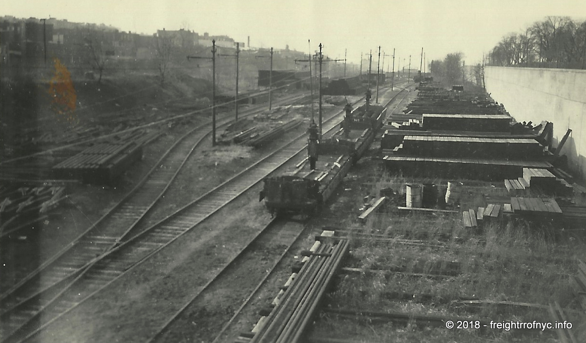
South Brooklyn Railway - 36th Street Yard (east area - between Ninth and Eighth Avenues) - unknown date
Taken from the Ninth Avenue overpass, looking northwest.
unknown photographer
authors collection
added 20 July 2018
.
.
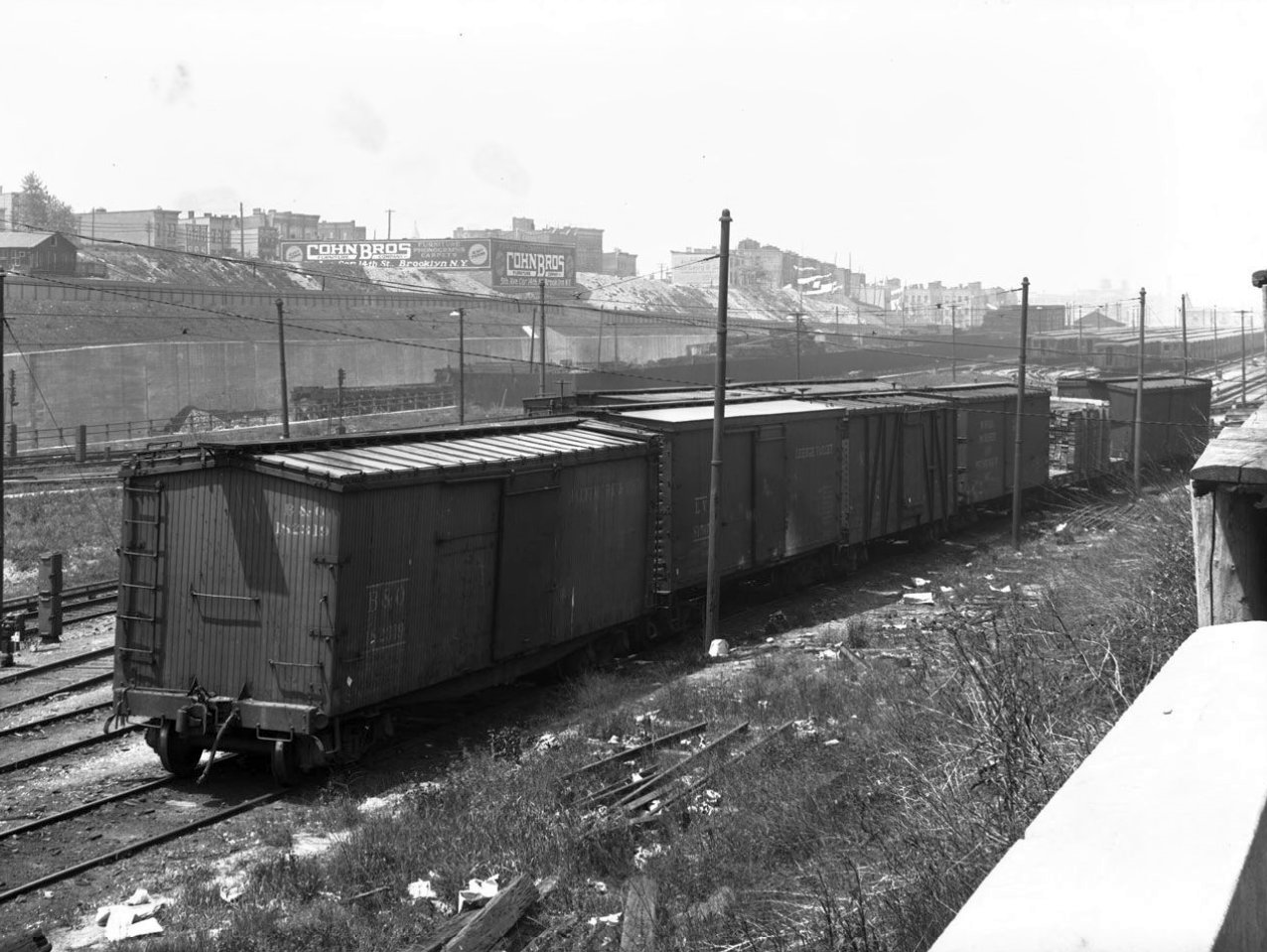
South Brooklyn Railway Materials Yard (west area - between Seventh and Eighth Avenues) - unknown date
Taken from 37th Street retaining wall at Seventh Avenue, looking west.
Take note of the early wood sheathed and outside braced wood boxcars
between later steel boxcars,
and a flat car of lumber undoubtedly on its way to one of the building
material suppliers located along th 37th Street right of way: Klein's
Building Materials, Culver Lumber, et al.
In the background, the Brooklyn Manhattan Transit 36-38th Street Yard can be seen.
unknown photographer
authors collection
added 20 July 2018
.
.
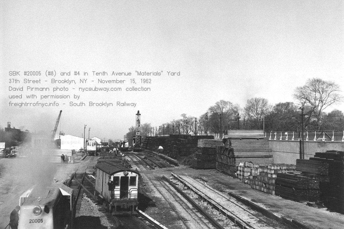
"Materials Yard" at Ninth Avenue (east area) - November 15, 1962
Looking northwest. NYCTA 20005 (#8) and SBK #4.
unknown photographer
D. Pirmann collection / nycsubway.com archives
added 21 September 2026
.
.
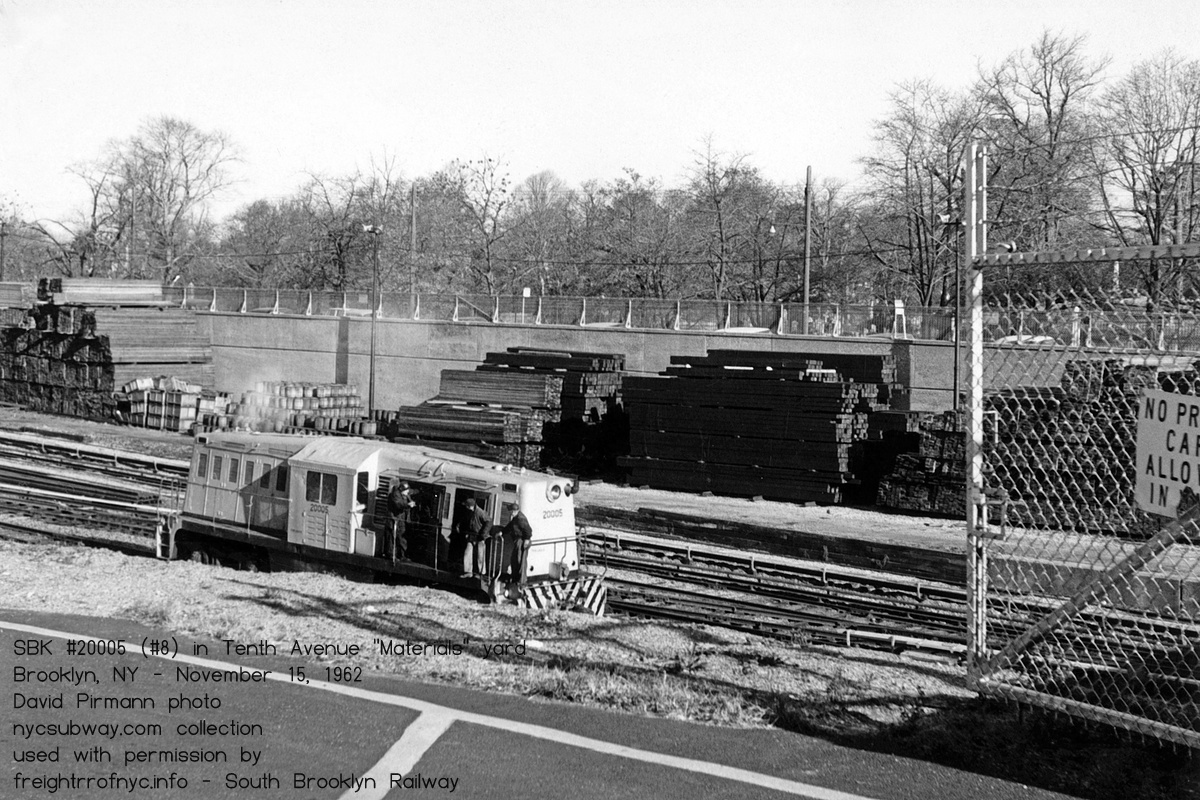
"Materials Yard" at Ninth Avenue (east area) - November 15, 1962
Looking north from yard driveway entrance at NYCTA 20005 (#8).
unknown photographer
D. Pirmann collection / nycsubway.com archives
added 21 September 2026
.
.
South Brooklyn Railway 36th Street (eastern portion - between Fort Hamilton Parkway and Ninth Avenue) - "Tenth Avenue Yard"
The following image is circa 1940, and is looking west towards the South Brooklyn Railway Tenth Avenue Yard and the Ninth Avenue overpass, from atop the ramp that connected the BMT Culver Line (lower level) to the BMT West End Line (upper level) at Ninth Avenue Station. Towards the bottom of the images, the South Brooklyn Railway tracks can be seen disappearing under the Culver el and both would follow the same route to McDonald Avenue.
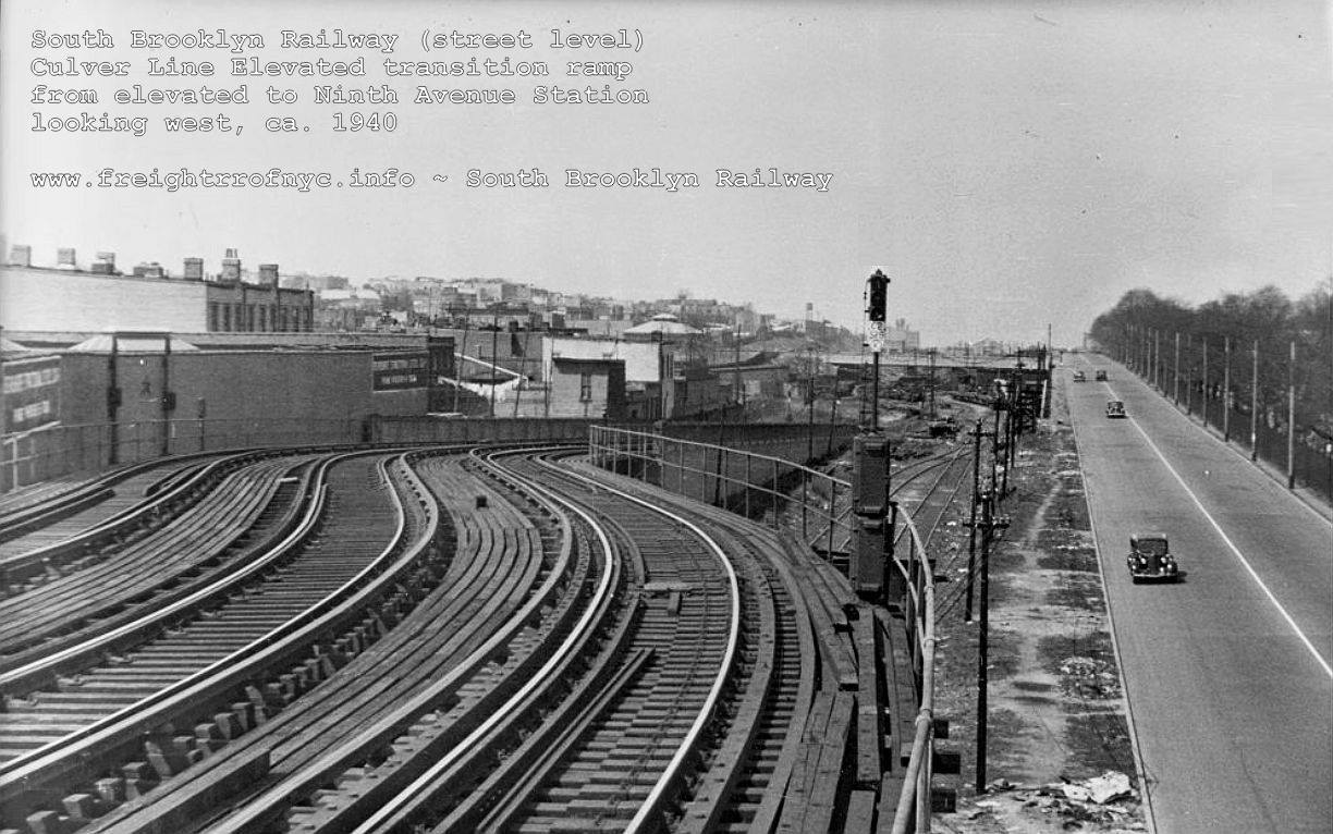
Culver Elevated ramp - ca. 1940
Looking northwest. Note the gradual rise in terrain looking west and the yard becoming subgrade.
South Brooklyn Railway tracks at street level and enter under the
elevated at this point. The Ninth Avenue overpass can be seen directly
under the signal head.
added 18 April 2021
...
.
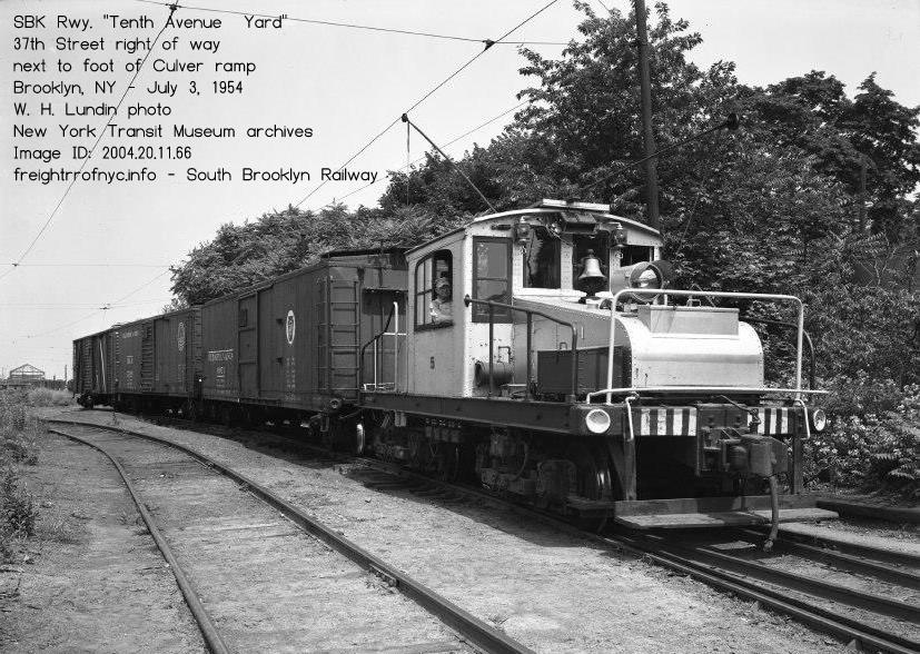
South Brooklyn Railway "Tenth Avenue Yard" - July 31, 1954
Looking west. Train is about to enter 37th Street right of way (on right side of trees).
Foot of ramp up to Culver Elevated out of view to left.
W. H. Lundin photo
New York Transit Authority archives - Image ID: 2004.20.11.66
added 21 September 2026
.
.
.
| Location List | Main Index |
.
8) 37th Street & Ninth Avenue
Delivery Station
.
According to the book "Brooklyn - A National Center of Commerce & Industry", published by the Committee on Industrial Advancement of the Brooklyn League in 1914; in the chapter "Freight Depots, Piers & Stores" on page 42, lists this location for deliveries of freight on the South Brooklyn Railway.
Referencing the 1916 series of E. Belcher Hyde Property Maps, no discernible structure seems to be present at 37th and Ninth Avenue that would represent a freight station as there is at 37th Street and Thirteenth Avenue. As the east end of the 36th Street Yard facility falls at 9th Avenue, perhaps at one point something was here but specifics elude us.
Referencing 1924 Fairchild Aerial Survey Photograph and shows a structure between the tunnel portals for the Culver Line and 37th Street with two stub tracks. This might be the delivery station being referenced. By the time the 1951 Aerial Photo was taken some of those structure are gone with most of this particular area open.
Judging from the 1961 Raudenbush Map, it appears these two sidings are what the earlier publication is referring to.
By the next aerial photograph available to us to examine (dated 1996) the NYCTA has constructed a long slightly curved building on this land utilizing those two stub tracks. This is an unloading platform for trash / rubbish collection in the subways.
This is where the original South Brooklyn Railway trackage returned to street level. After the elevateds were built; the South Brooklyn Railway would retain its right of way at street level. The BMT "Culver Shuttle" would have its transition incline to its elevated at this location. It should be noted from this location, the BMT "Culver Shuttle" line followed the same route as the South Brooklyn Railway,
albeit on an elevated structure. The Culver Shuttle last ran on May 10, 1975, with South
Brooklyn abandoning their street running February 1, 1978. The
elevated structure and the SBK tracks underneath stood until demolition of the elevated began in August 1985.
line followed the same route as the South Brooklyn Railway,
albeit on an elevated structure. The Culver Shuttle last ran on May 10, 1975, with South
Brooklyn abandoning their street running February 1, 1978. The
elevated structure and the SBK tracks underneath stood until demolition of the elevated began in August 1985.Continuing east out of the yard at street level however, South Brooklyn Railway trackage paralleled 37th Street for about three quarters of a mile to Dahill Road; and it is this route that we shall continue.
.
.
| Location List | Main Index |
.
.
As there were so many customers and set out locations within a five block stretch, this chapter is subdivided into those sidings and occupants:
occupants in gray: names are confirmed but rail service is not.
light blue dashed lines are tracks suspected to have existed but removed or are unconfirmed
| 8 | Ninth Avenue Delivery Station | 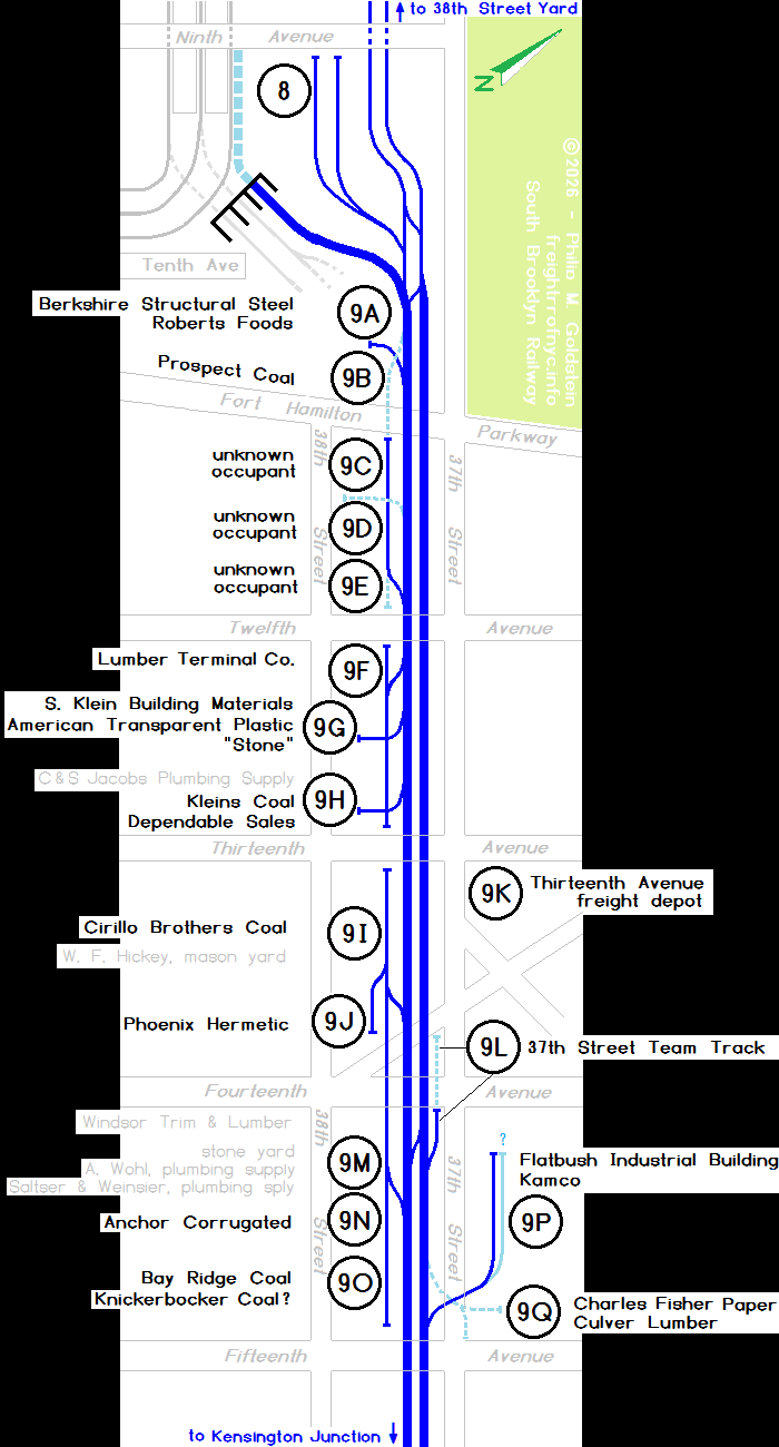 |
| 9A | Berkshire Steel Roberts Foods |
|
| 9B | Prospect Coal Yard, vacated, track removed; date? | |
| 9C | unknown occupant | |
| 9D | unknown occupant, track removed? | |
| 9E | unknown occupant | |
| 9F | Lumber Terminal Co.? | |
| 9G | S. Klein Building Materials Klein Coal American Transparent Plastic |
|
| C & S Jacobs Plumbing Supply (service unconfirmed) | ||
| 9H | Kleins Coal Dependable Sales |
|
| 9I | Cirillo Brothers Coal & Ice | |
| W. F. Hickey, mason supply (service unconfirmed) | ||
| 9J | Phoenix Hermetic | |
| 9K | Thirteenth Avenue freight depot, removed ca. 1929? | |
| 9L | 37th Street Team Track, cut back ca. 1950 | |
| Windsor Trim & Lumber (service unconfirmed) | ||
| 9M | unnamed stone yard | |
| 9N | Anchor Corrugated Steel | |
| 9O | Bay Ridge Coal Knickerbocker Coal |
|
| 9P | Flatbush Industrial Building Corp Kamco |
|
| 9Q | Fisher's Paper Culver Lumber - out ca. 1945? |
The 1960 ERA and 1961 Raudenbush SBK track maps shows several sidings in close proximity to one another in this general area, to both the south and the north of the right of way.
For clarity, we will address the property in order from west to east (Ninth Avenue to Fifteenth Avenue) with oldest map on top for a given area. Due to the different map plates, and having been stitched together for display, some images below overlap. Also, attempts has been made to scale the maps to one another, but this is not always the case. Please exercise caution when reviewing.
I also became aware of a discrepancy in the street grid in the Raudenbush Map. It shows the alignment of 37th Street to jog north between Old New Utrecht Avenue and Fifteenth Avenue. This was not the case, and 37th Street is straight without any jog, as evidenced by the 1906, 1916 and 1929 E. Belcher Hyde Property Maps as do the 1924 Fairchild Aerial and 1951 Aerial Photos.
While I will on occasion and quite frequently question track and siding layout on the property maps, I rarely question the street grid and I certainly won't dispute actual images. Needless to say, the 37th Street curbline of block 5349 remained in line with the blocks to the east (5368) and west (5301). So I have corrected the applicable segment of the Raudenbush Map below to reflect this.
Contained within "The Elevated Railways of Brooklyn and the BMT Subway, Volume 1, p. 67" (Eric Oszustowicz, ERA 2022) is the following:
"As soon as the BHRR started handling the Culver Line freight in 1905, General Freight Agent C. R. Van Etten of the BHRR made arrangements to expand the freight operation. The Nassau Electric's old yard at 37th Street and 13th Avenue was utilized and a freight siding was installed as soon as tenants were obtained from the adjacent buildings.
Sixteen companies installed private freight sidings on the portion of the Culver Line between 10th Avenue and 14th Avenues. At the head of of the 38th Street Cut near Greenwood cemetery, a siding was installed for delivery of stone used in the erection of mausoleums."
.
.
.
| Greenwood Industrial Sidings List | Location List | Main Index |
.
.
From west to east, the first siding encountered in the 1906 E. Belcher Hyde Property Map was between Ninth Avenue and Fort Hamilton Parkway on the southern side of the right of way. This siding is for the coal yard (Lot 57).
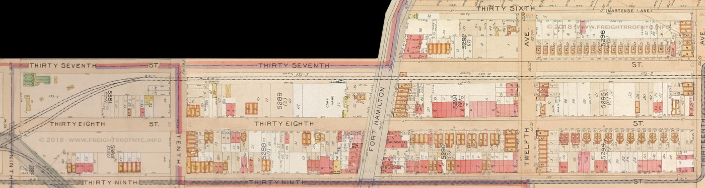
.
.
This same siding is also encountered in 1916 edition of the E. Belcher Hyde Property Map. If there is any degree of accuracy for the trackage shown in the property maps (and I almost always doubt it) the siding appears to be lengthened west to mid block to the Lot 74 property line.
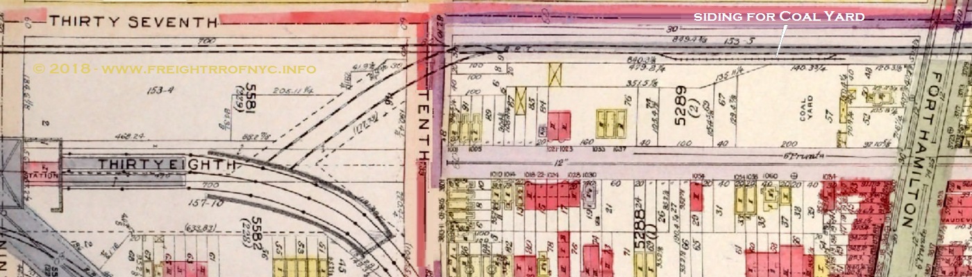
E. Belcher Hyde Property Map - 1916
Volume 2, Plate 12
courtesy of New York Public Library Digital Archives
annotated version ©2018 by author
.
.
By 1929, the adjoining property west of the Prospect Coal Yard (Lot 57) was built up and is now shown to be occupied by Berkshire Structural Steel (Lot 67). It is not confirmed that South Brooklyn Railway actually delivered to them; but they were located on the siding, and it is almost certain they did. Note the shape of that building. That building, property would become home to Roberts Foods.
The siding is not shown,
but believed to be hidden under the Culver Line elevated which opened
to service on March 1919.
We also see that a pair of sidings now joins the street trackage west of Tenth Avenue (Block 5581 - Lot 153-4) with a hoist engine at the end of the northern siding.
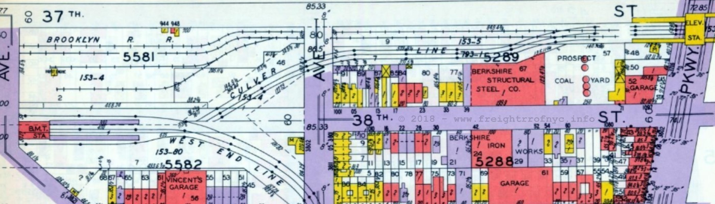
E. Belcher Hyde Property Map - 1929
Volume 3, Plate 57
courtesy of Historic Map Works
annotated version ©2018 by author
.
.
9A - Berkshire Structural Steel / Roberts Foods Siding
.
|
Roberts
Foods siding was the first customer siding east of the "Tenth Avenue
Yard" and on the 37th Street right of way going east. Until these photos below were obtained, it could not be appreciated what tight confines the siding was located at. The Culver El at this location was already sloping down to meet the concrete ramp, and was barely elevated enough in height to get a boxcar under it, but it was enough. That is where the business was, so that is where the siding was. Since a standard height 40' boxcar was 13' (Plate B) and 50' box car was 15' 6" (Plate C) it is doubtful, a 50' box car could be used at this location. As such, 50' box cars couldn't make it through the tunnel to get to this location, so the thought is moot. And because of that location, the siding turned 90 degrees into the building in a short length. This explains why the SBK Operations Manual states:
Looking at the first image below, one can see by the trolley wire trough mounted to underside of elevated, and by partially buried rails in dirt; there was in fact another track that crossed at a diamond here. |
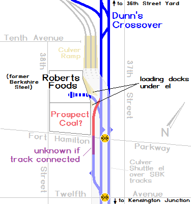 |
It is this track, that is now believed to have connected through to the stub siding at Twelfth Avenue (purple track in diagram above right), and when it was in place, it served Prospect Coal (shown in red in diagram above right), but the tracks appears to have been removed sometime before 1950 as it's obviously disconnected by the date of the image; and the 1960's era maps do not reflect this tracks presence.
.
South Brooklyn Railway - 37th Street right of way - July 3, 1954
Looking west, train is spotting cars on the Roberts Foods siding. Very sharp curve and tight squeeze
as the Culver Elevated abutment ramp is in close proximity.
W. H. Lundin photo
New York Transit Authority archives - Image ID: 2004.20.11.68
added 21 September 2026
.
.
South Brooklyn Railway - 37th Street right of way - July 3, 1954
Looking
west, train is spotting cars on the very sharp curve to Roberts Foods
siding. Culver Elevated abutment ramp is in close proximity.
W. H. Lundin photo
New York Transit Authority archives - Image ID: 2004.20.11.64
added 21 September 2026
..

Berkshire Structural Steel - 1032 38th Street - ca. 1939-1940
To become Roberts Foods.
New York Municipal Archives Tax Photos
added 24 September 2026
.
.
9B - Propect Coal
.
Prospect Coal is known to have received railroad service, but it appears they ceased operations quite early (between 1929 - 1950) as the various property atlases after these dates no longer reflect their presence at this location.
.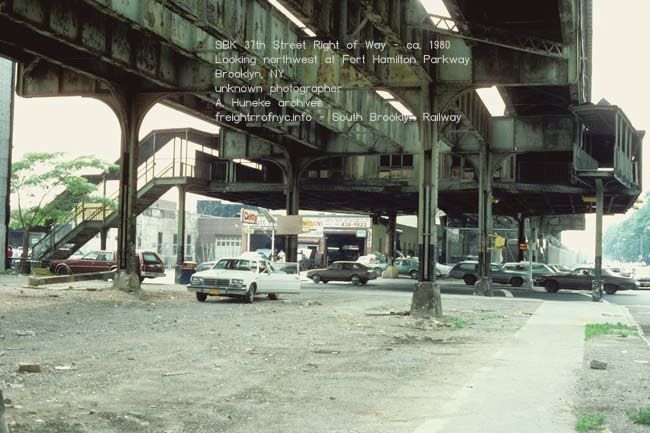
37th Street Right of Way - ca. 1980
Looking northwest at Fort Hamilton Parkway.
unknown photographer
A. Huneke archives
added 02 October 2026
.
.
| Greenwood Industrial Sidings List | Location List | Main Index |
.
Fort Hamilton Parkway to Twelfth Avenue and Twelfth Avenue to Thirteenth Avenue
Blocks 5291 and 5295
.
Resuming at Fort Hamilton Parkway, the 1908 property lists no names and is omitted.
The1929 Belcher Hyde Property Map shows the running tracks continue without any note of sidings. But the orientation of east-west building (Block 5291 - no lot number shown one story (looks like an exclamation point between the numerals 5 and 2) and the large spaces to either side, leads me to believe it may have had rail service. A siding is shown here in the 1960 Raudenbush Map.
The next block to the east, S. Klein Building Materials (Block 5295, Lot 60) is next.
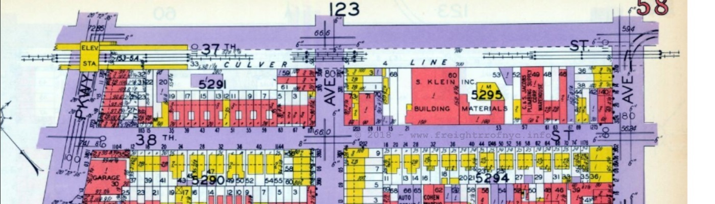
.
.
Block 5291 - Lot 20
Upon examining the 1924 Fairchild Aerial Survey Image in this area, it shows a unique shaped building here. The building corner is notched at an angle, like many others that received rail service (S. Kleins Building Supplies, Flatbush Coal.)
Who or when did this parcel receive railroad service remains to be learned.
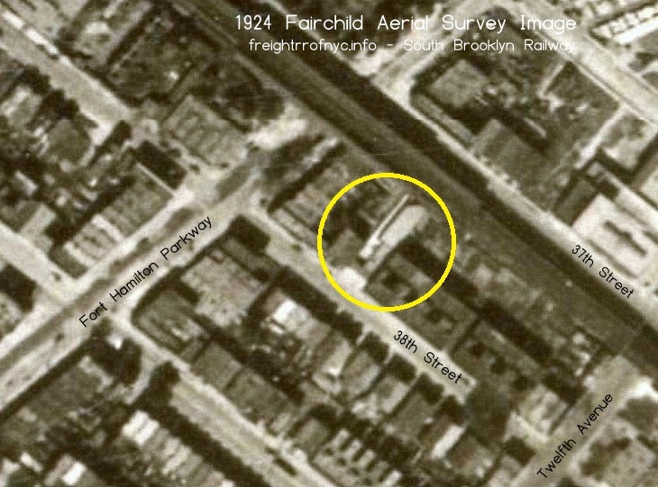
.
.
.
These images were taken as part of the hauling the American Refrigerator Transport refrigerated boxcar to the 37th Street Team Track, taken by D. Klepper; of which can be seen farther below.
However, the image below left shows an unused siding leading into the vacant lot, behind the wood slat fence. The occupant (or former occupant) is unknown at this time.
9F - unknown business with possible siding
Terminal Lumber Co., a multi-parcel occupant of the west end of the block between Thirteenth and Fourteen Avenues. Lot 65, 70, 72, 74 and 8, gives this firm a large footprint; and a high likelihood of rail service, but this is not confirmed.
9G - S. Klein Building Materials / Klein Coal / American Transparent Plastics / "Stone"
.
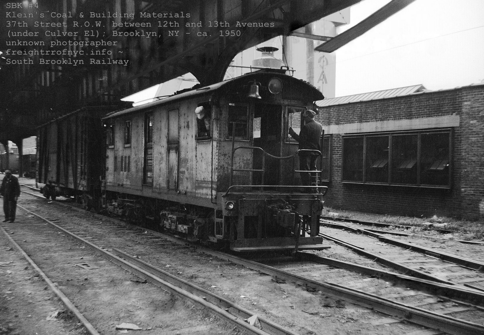
American Transparent Plastic and Klein Coal - ca. 1950
Looking southeast on 37th Street Right Of Way between Twelfth (behind photgrapher) and Thirteenth Avenues
unknown photographer
added 01 November 2022
.
I cannot remember the source for the above images; so please contact me if they are yours so they can be attributed. They appear to be out of a book or magazine.
In this image above, we are witness to SBK #4 moving an outside brace wood boxcar on the southbound running track. The turnout to American Transparent Plastics Inc and their brick building can be seen to the right of the locomotive.
S. Klein Inc. was confirmed to have a siding and accompanying rail service, despite not being shown in the 1929 E. Belcher Hyde map above, hence the angled buildings and alleyway through to 38th Street. Klein is also listed as being a coal dealer as well.
On the 1968 "Official" SBK track map, the customer here was list as "Stone." It is unknown if meant this was the location of a stone yard, or the name of the customer was Stone.
.
.
9H - S. Klein / Dependable Sales
Block 5295 - Lot 60 (possibly others)
Klein is shown in two locations over the series of maps. It is unknown if they relocated, expanded, or simply owned multiple parcels.
First, in the property atlases, it is shown mid-block occupying Lot 60. This is believed to be their coal silos.
In the 1968 track map, their name appears further east, almost to Thirteenth Avenue and this location is marked as Dependable Sales - Kleins.
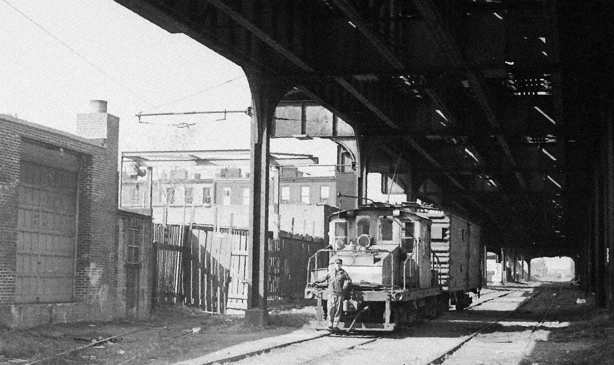 Looking northwest between Twelfth Avenue and Fort Hamilton Parkway - ca. 1945 SBK #5 heading southeast on southbound running track under Culver Line (shuttle) elevated. D. Klepper photo added 22 September 2026 |
.
.
.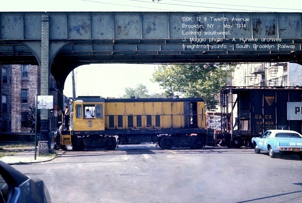
Twelfth Avenue and 37th Street looking southwest.- May 1974
J Maggio photo
A. Huneke archives
added 02 October 2026
..
.
.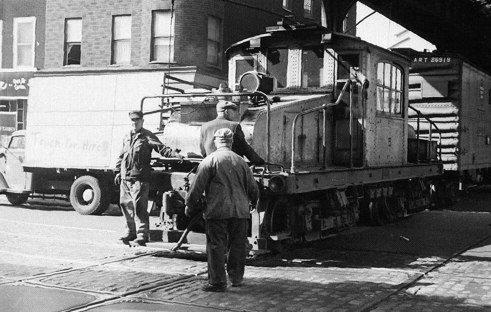
Looking northwest. Flagging the crossing at Thirteenth Avenue - ca. 1945
Intersection with Church Avenue trolley line - diamonds visible
SBK #5 heading southeast with ART boxcar crossing Thirteenth Avenue.
D. Klepper photo
added 22 September 2026
.
.
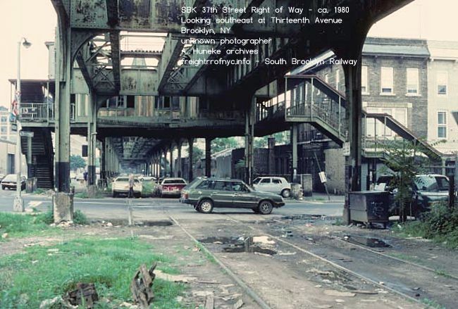
37th Street Right of Way - ca. 1980
Looking southeast at Thirteenth Avenue.
unknown photographer
A. Huneke archives
added 02 October 2026
.
.
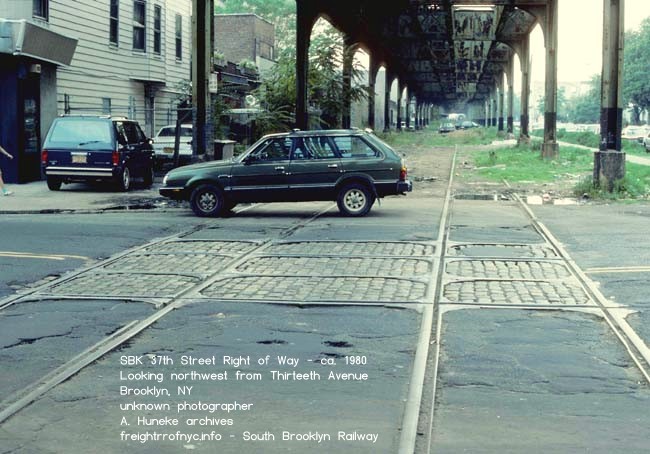
37th Street Right of Way - ca. 1980
Looking southeast at Thirteenth Avenue.
unknown photographer
A. Huneke archives
added 02 October 2026
.
.
| Greenwood Industrial Sidings List | Location List | Main Index |
.
Thirteenth Avenue to Fourteenth Avenue and Fourteenth Avenue to Fifteenth Avenue
Blocks 5301, 5349, 5300, 5348
.
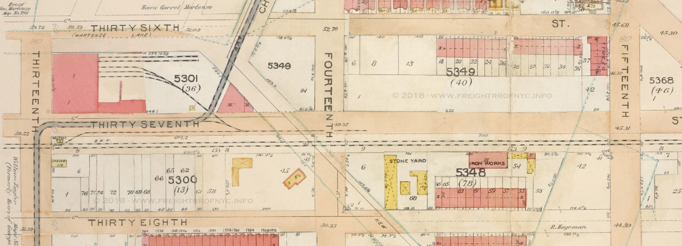
1906 E. Belcher Hyde Property Atlas
Volume 5, Plate 29
Block 5301: Thirteenth Avenue Freight Depot,
Block 5348: Stone Yard, Iron Works
courtesy of New York Public Library Digital Archives
annotated version ©2018 by author.
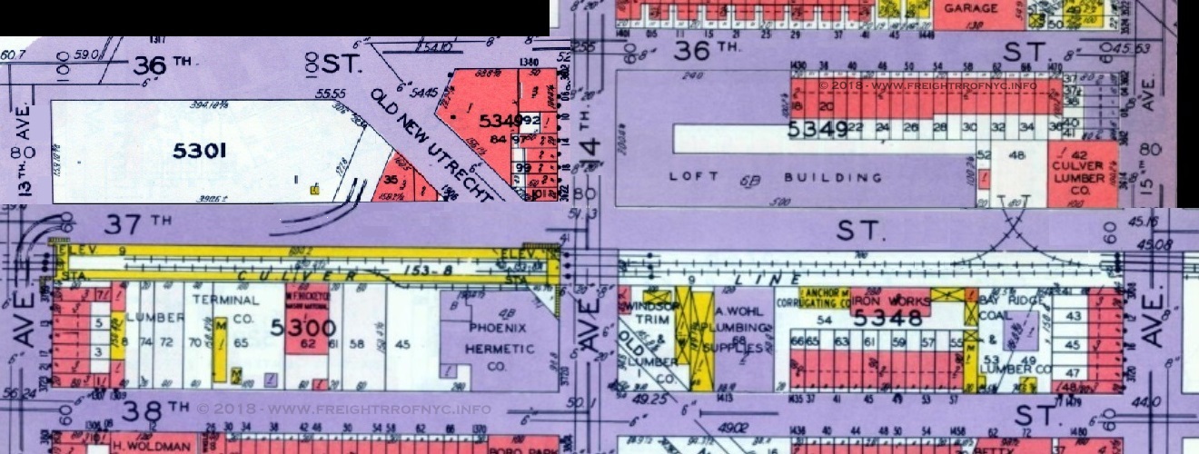
1929 E. Belcher Hyde Property Atlas
Volume 3 - Plates 58, 59, 60, 123
Block: 5300: Lumber Terminal Co., W. F. Hickey Mason Material, Phoenix Hermetic,
Block 5349: Flatbush Industrial Building, Culver Lumber (Charles Fisher Paper)
Block 5358: Windsor Trim & Lumber, A. Wohl Plumbing Supplies,
Anchor Corrugating Co. Iron Works, Bay Ridge Coal & Lumber Co.
courtesy of New York Public Library Digital Archives
stitched version ©2018 by author
added 06 July 2018
9I - Cirillo Brothers Coal
Cirillo Brothers was another of the coal dealers along the 37th Street stretch, but made the transition from coal to fuel oil, when coal fell out of favor in the metropolitan area as a heating fuel.
Their truck garage remained at the same location long after South Brooklyn Railway service ending in 1978; and it is in front of this truck garage that the Bocce games were played in the right of way.
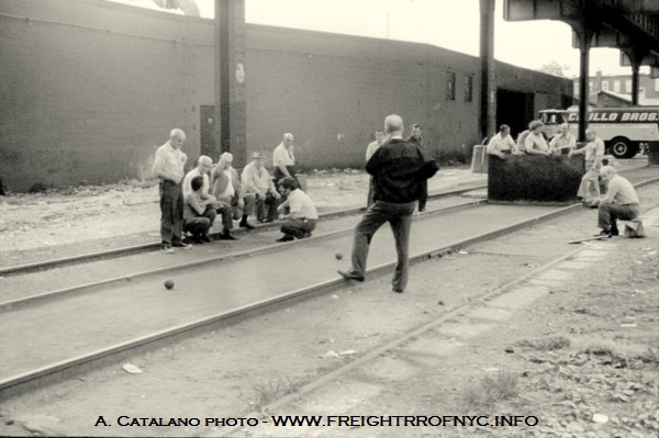 |
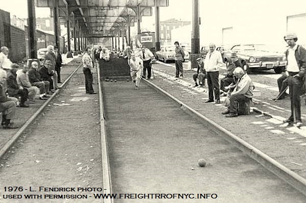 |
| Phoenix Hermetic which was engaged in the
metal crafting trades. Their siding is shown in the 1929 edition of the property atlas. I have found many references to them making items such as metal covers and caps for glass jars (both screw top and clamped with rubber seal such as those used for canning and preserves, and storing foods, and other metal canning and closing items. Not only did the manufacture these items, they also printed upon them. Phoenix-Hermetic pioneered the field in closure design, capping machinery, cap sealing, metal forming and lithography of same. Innovations included the development of the modern continuous thread (CT) cap in 1922. In an effort to better describe the business, the company changed its name in 1932 to The Phoenix Metal Cap Company. Phoenix-Hermetic remains in business today, but is now known as Phoenix Closures, and they are still making caps for bottles containers in both metal and plastic; including scoops for drink mixes (lemonade, ice tea, fruit punch, Tang), squeeze bottle tops (lotions). |
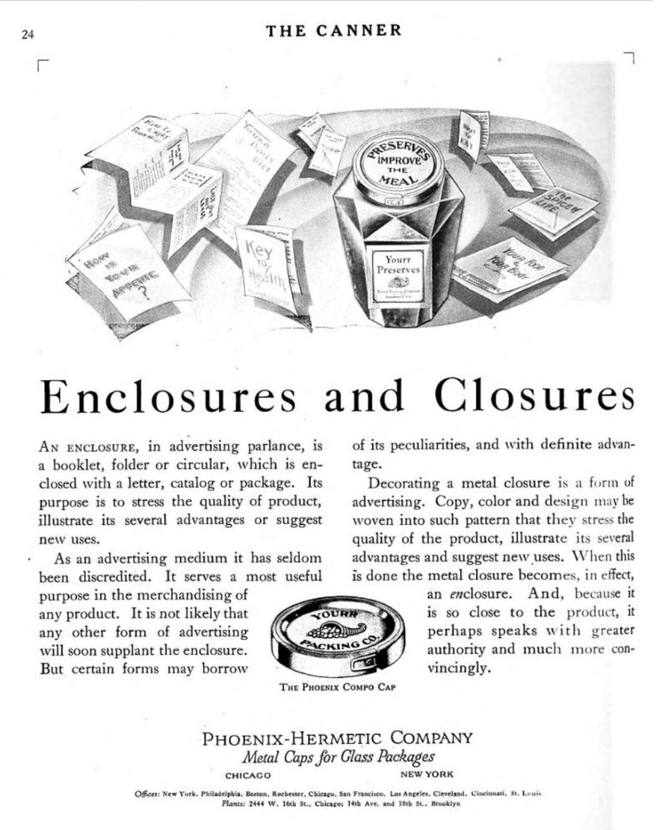 |
.
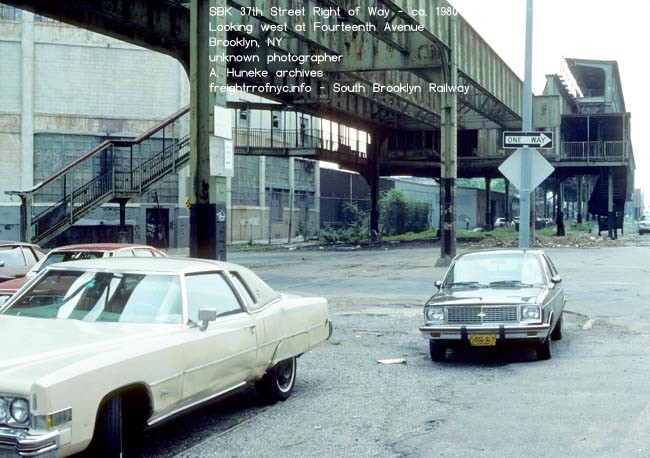
37th Street Right of Way - ca. 1980
Looking northwest at Fourteenth Avenue. Phoenix Hermetic building on left.
unknown photographer
A. Huneke archives
added 02 October 2026
.
.
.9K - Thirteenth Avenue Freight Depot
Block 5301
.
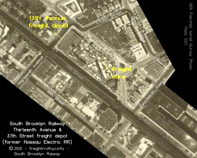 |
According to the book "Brooklyn - A National Center of Commerce & Industry", published by the Committee on Industrial Advancement of the Brooklyn League in 1914; in the chapter "Freight Depots, Piers & Stores" on page 42, lists the location of 37th Street & Thirteenth Avenue for deliveries of freight on the South Brooklyn Railway. While not shown on either the ERA map of 1960 or the Raudenbush Map in 1961, there was in fact a freight station located in Block 5301 (bound by 37th and 36th Streets and Thirteen and Old New Utrecht Avenue Avenues. This structure is shown on both 1906 and the 1916 E. Belcher Hyde Property Maps with trackage to the building. Note that there a connection for the Church Avenue trolley line to the South Brooklyn Railway trackage as well, which is not surprising given the knowledge of the early SBK streetcar delivery network. From Eric Oszustowicz's books on the BMT; Vol 1, p. 67, is was learned that this facility was originally a freight depot of the Nassau Electric Railroad, which of course makes perfect sense being connected to the trolley network:
|
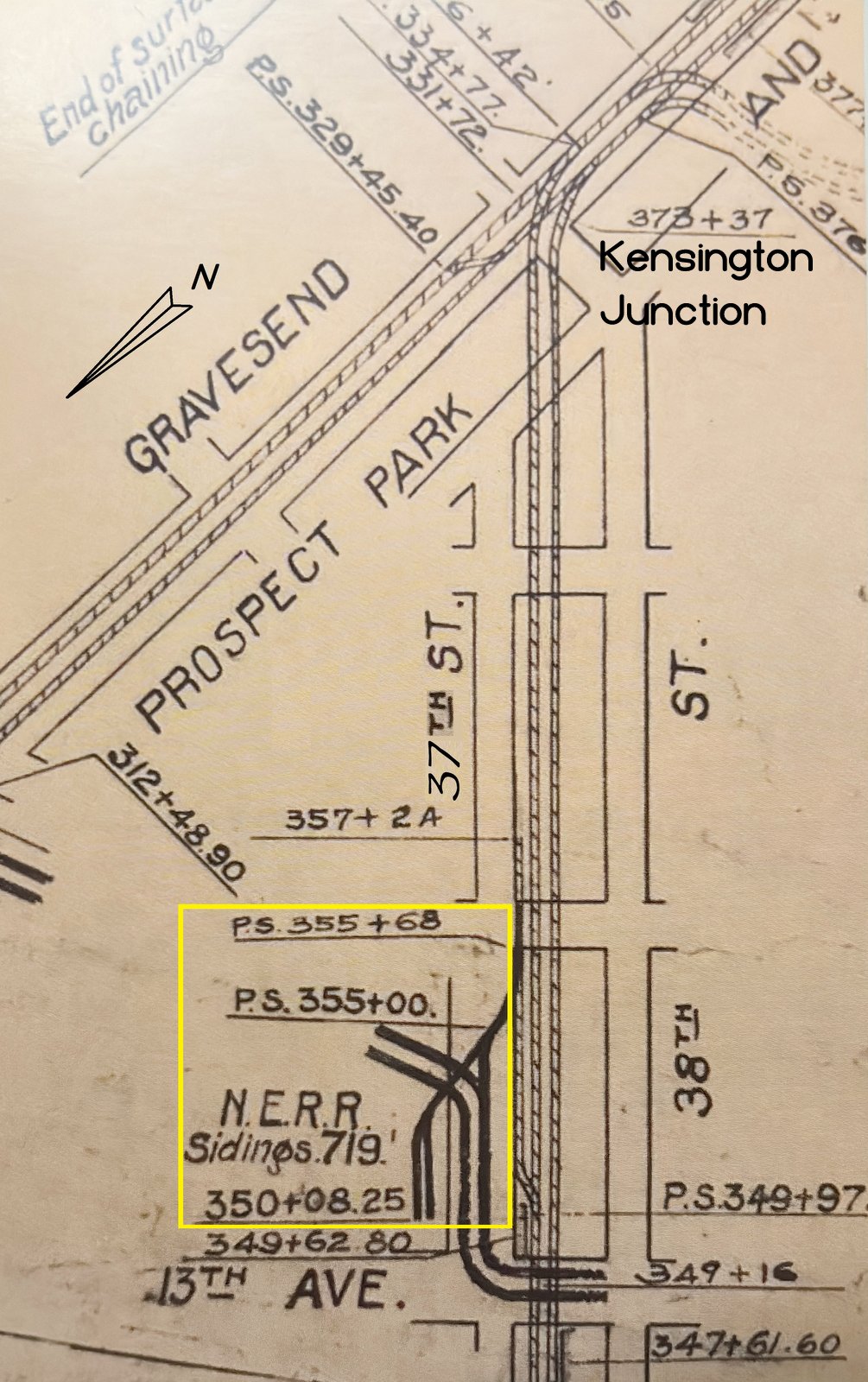 BRT track schematic - ca. 1908 North is bottom right. collection of B. Linder courtesy of E. Oszustowicz added 27 September 2026 |
|
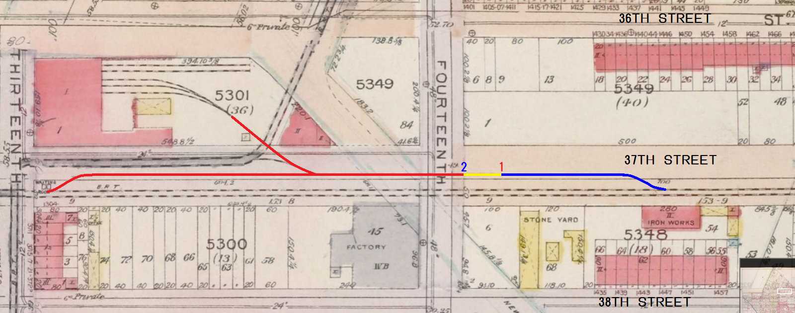
|
By the 1929 edition of the E. Belcher Hyde Property Map, Block 5301 appears to be one large empty lot. Its connection to the Church Avenue trolley line is also believed to have been eliminated at this time. Tax photographs in the New York Municipal Archives reveal the Knickerbocker Ice Company built a huge multi-story concrete ice house on this plot. In the photo at right, the lot identifier sign board is set up on northbound running track of the South Brooklyn Railway; and the Culver El, can be seen overhead in the top left corner. There does not appear to be any rail service to this property. |
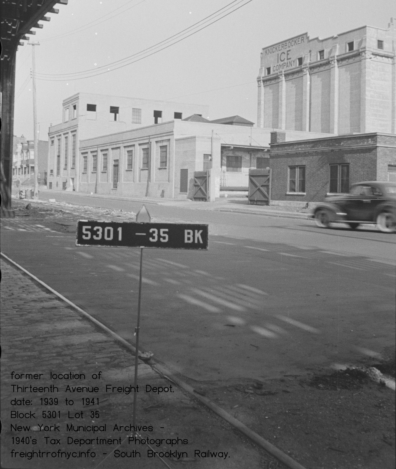 |
.
.| Not shown in the sequence
of images, but at this point in its travel; #5 and its boxcar will travel down the
southbound running track (in the images above) until it passes clear of the trailing point
(in this direction of travel) of the running track crossover, located between
Fourteenth and Fifteen Avenues. Then, after the points are set for the crossover, #5 will reverse direction and head northwest onto the northbound running until clear the crossover points. Here the points of the crossover will be "normalled" (set straight for the running track). #5 will then proceed southeast again on the northbound running track (wrong railing) about a hundred feet past the trailing points (for this direction of travel) of the turnout for the 37th Street stub siding located between Fifteenth and Fourteenth Avenues. After coming to a stop, the points of the turnout will be set for the siding, and #5 will reverse direction once again, heading northwest; and push the boxcar into the siding and uncoupling from it.. Basically, the locomotive and car are performing a double switchback move to access to the 37th Street stub siding. In the diagram at right, blue denotes southeast travel, red denotes northwest (reversing move) travel. By this point in time, wrong railing was not the hazard it once was, as the tracks of this route were now strictly freight and the freight moves were assigned to crews of the same company. |
|
| . | |
|
|
|
| . | |
|
.
|
|
|
In this image below, a completely different boxcar: ART 17221 is being unloaded Author
believes this location to be the northeast side of the Culver Line
Elevated, just north of the Thirteenth Avenue Station, as the platform
which is visible over the truck and as 37th Street appears off nose of
truck.
|
9M - unnamed stone yard, to A. Wohl Plumbing Supplies, to Saltser & Weinsier Plumbing?
Block 5348 - Lot 68
.
As seen in the 1906 Hyde Property Atlas above, a stone yard was located here. While it appears to have been serviced by the SBK, the name of the operator has not been learned yet. |
|
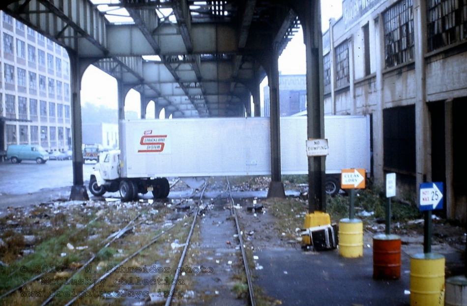 #13 - 37th Street Right Of Way at Saltser & Weinsier - March 1972 Looking southeast between Fourteenth and Fifteenth Avenues; northbound / southbound running track crossover in foreground, Flatbush Industrial Building on left. W. Schneider photo J. McCluskey collection |
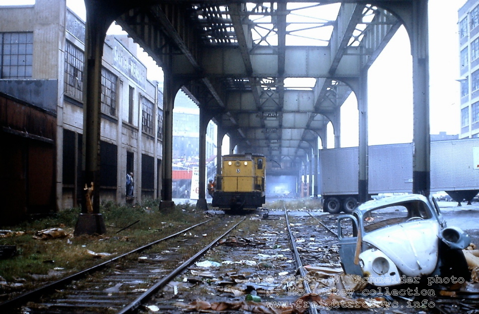 #13 - 37th Street Right of Way at Saltser & Weinsier - March 1972 Looking northwest. They got the truck to move. But does anyone wanna buy a VW bug? W. Schneider photo J. McCluskey collection |
9N - Anchor Corrugating - Iron Works?
Block 5348 - Lot 54
.
Anchor Corrugating received rail service as it is marked 1968 SBK Track Map (in Oszustowicz's book.)
As they were in the business of manufacturing metal shed and buildings, it seems logical rolls or sheets of steel would arrive via rail, but this is unconfirmed.
The adjacent building to the east is simply marked "Iron Works", and was present in the 1912 Property Atlas and before the Anchor building but it is unconfirmed if the two lots were part of Anchor.
.
.
9O - Knickerbocker Coal - Ice - Oil (formerly Bay Ridge Coal & Lumber)
Block 5348 Lots 49 & 53
.
Conflicting data show the use of two different names for this property. It is not clear which came first.
Bay Ridge Coal & Lumber did receive rail service and is shown in the 1960 ERA as well as 1961 Raudenbush Maps. Research shows Bay Ridge Coal & Lumber was incorporated by January 1922 as reported in a coal trades newsletter.
In the 1939-1940 Tax photos, this was the facility of Knickerbocker Coal Ice & Oil.
It should be noted that while not shown, an extended storage siding and runaround track to service and switch out the customers in the area extended for two blocks between Thirteenth and Fifteenth Avenues on the south side of 37th Street and was located between the Phoenix Siding and the running tracks.
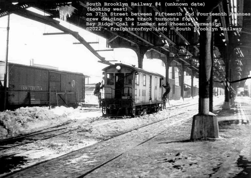
The crew of SBK #4 climbs down to help clear the track turnouts of ice and snow in front of Bay Ridge Coal & Lumber.
on the 37th Street Right Of Way; looking west from Fifteenth Avenue and Fourteen Avenues.
unknown photographer
added 02 November 2022
..
.
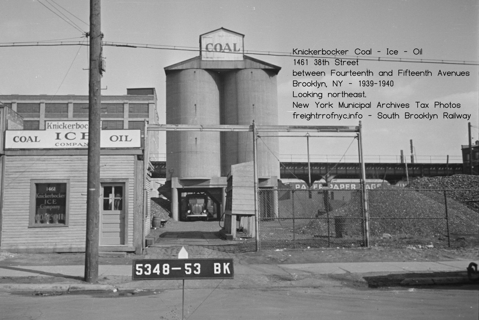
Knickerbocker Coal Ice Oil Co. - 1461 38th Street - ca. 1939-1940
Formerly Bay Ridge Coal.
New York Municipal Archives Tax Photos
added 24 September 2026
.
.

..
.
1929 E. Belcher Hyde Property Atlas
Volume 3 - Plates 58, 59, 60, 123
courtesy of New York Public Library Digital Archives
stitched version ©2018 by author
added 06 July 2018
|
The Flatbush
Industrial Corp. Building siding and "Fisher's Siding" occupied by Culver Lumber were both located
on
the northern side of 37th Street west of Fifteenth Avenue with the turnout for the Flatbush
Industrial Building facing points west and the turnout for
the Fischer
Siding points facing points east.
Due to the confines of the property, the Fisher switch was encountered first going eastbound then the Flatbush Industrial Building switch and the tracks crossed each other on a diamond into the properties. This was a popular arrangement for rail service in tight confines. While not shown, the siding for Flatbush Industrial in fact curved back west, crossed Lot 52 and ran through the open central corridor of the structure. By the 1961 Raudenbush Map, the Fisher Siding is shown as a broken line and thereby assumed to be out of service by that date. Research has revealed the the original occupant of the Flatbush Industrial Building was H. W. Cotton and his business was the fabrication and assembly of machinery such as lathes, mills and the like. Found online is an agreement between the South Brooklyn
Railway and H. W. Cotton dated September 24, 1920 for the SBK to
construct and provide rail service to the building (see above). By the issue of the 1929 E. Belcher Hyde Property Map, the Flatbush Industrial Building (Lot 68) is now shown along with Culver Lumber (Lot 42). Culver Lumber is listed as "Fisher's Siding" in the 1960 ERA Map. Research shows a Charles Fisher at this location engaged in the paper & allied trades in a 1963 trade journal. Learned from a Facebook post by a former employee that worked in the Flatbush Industrial Building, there were two sidings in the back alley. At the present, I have no confirmation of this. This is the reason behind the light blue second track in the Greenwood Sidng Map. |
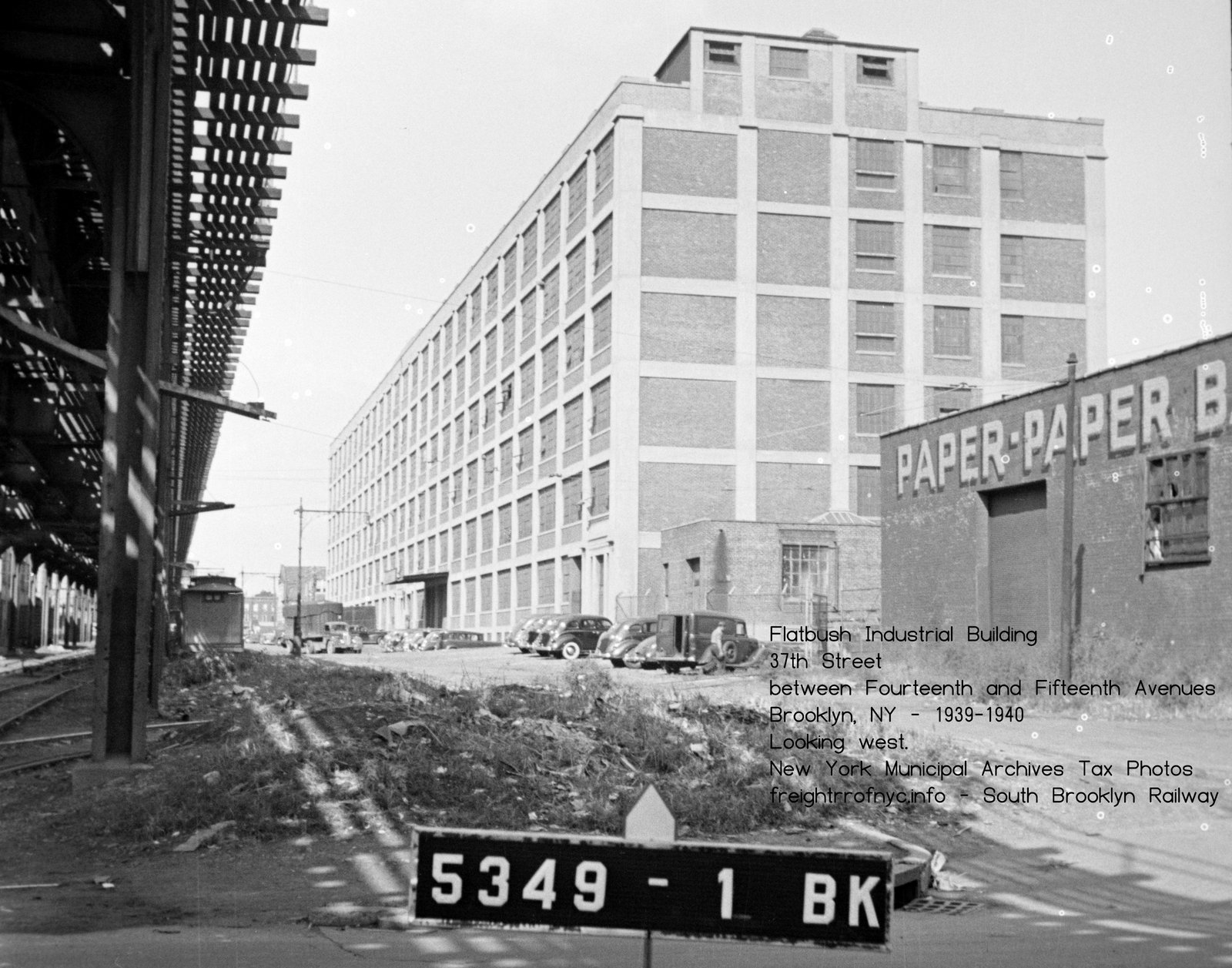 Flatbush Industrial Building - 37th Street - ca. 1939-1941 New York Municipal Archives Tax Photos - BBL 3-5349-1 added 24 September 2026 |
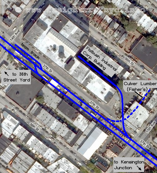 |
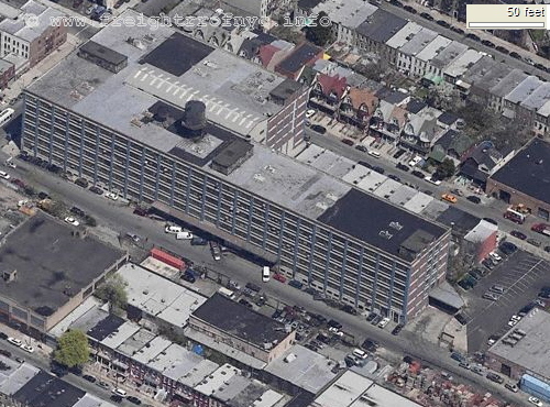 |
.
The track segment for the South Brooklyn Railway from Fort Hamilton Avenue to Thirteenth Avenue that parallels the south side of 37th Street has been pretty much obliterated, with residential townhouses having been built on what was once the right of way.
.
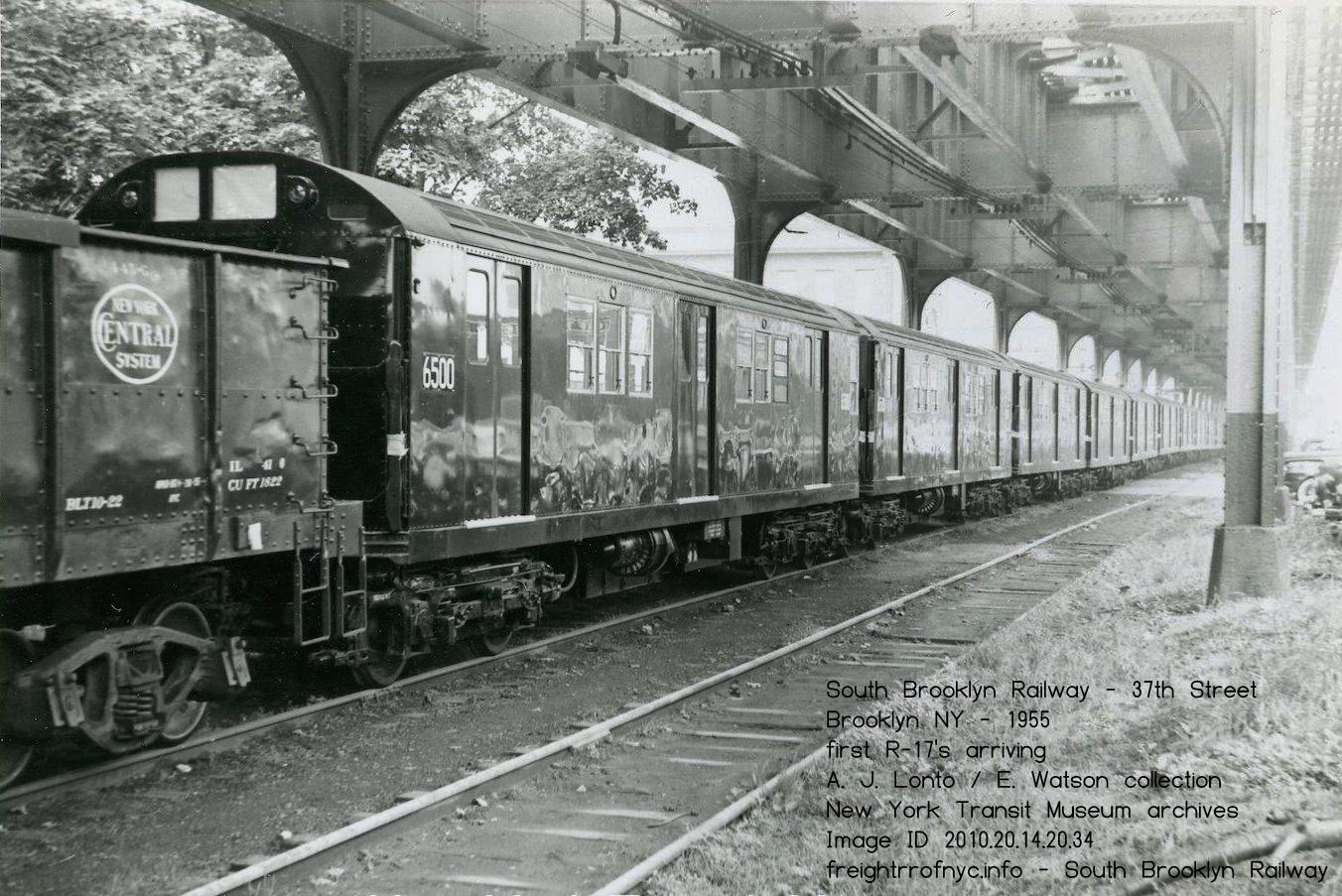 .
.
New incoming R17's on the 37th Street right of way - 1955
37th
Street, but unknown location. That is the Knickerbocker Ice building
over the second and third cars, and that was located on Old New Utrecht
Road;
which makes thisbetween Fourteenth and Fifteenth Avenues
A. J. Lonto / E. Watson collection
New York Transit Museum archives
Image ID: 2010.20.14.20.34
added 21 September 2026
.
.
9Q - "Fisher's Siding" - Culver Lumber, then Charles Fisher Paper Products
Block 5349 - Lot 42
In the 1912 property atlas, this parcel is shown as Culver Lumber.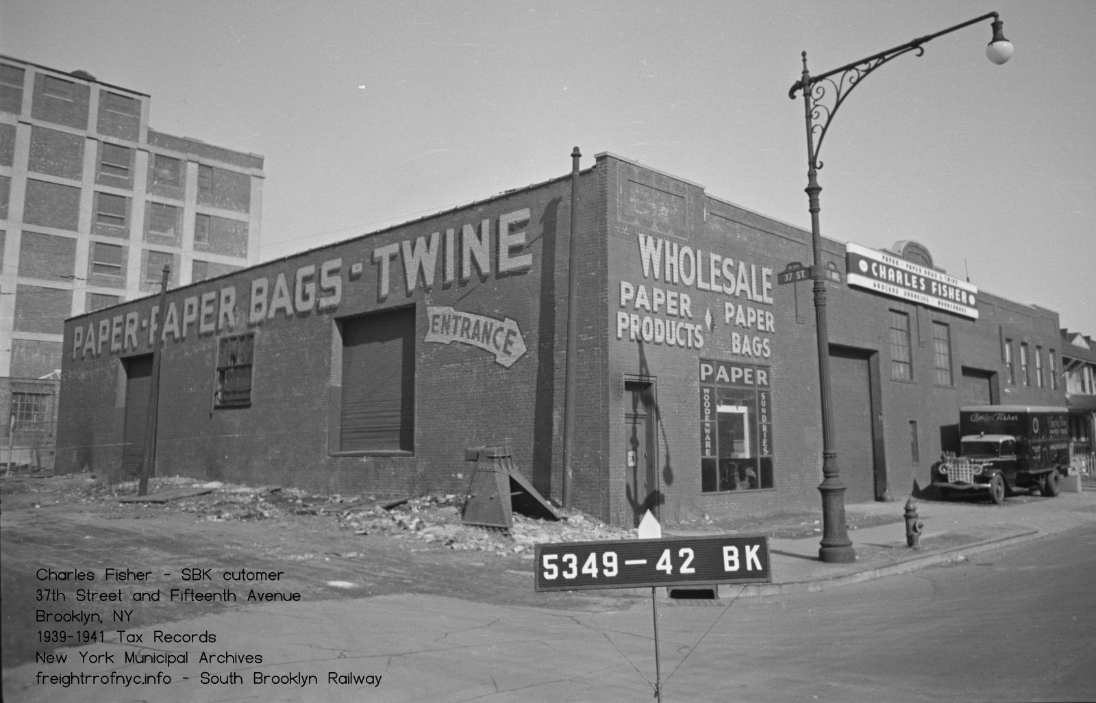
Charles Fisher Wholesale Paper Products - 37th Street and Fifteenth Avenue - ca. 1939-1941
New York Municipal Archives Tax Photos BBL 3-5349-41
added 24 September 2026
.
.
.
| Greenwood Industrial Sidings List | Location List | Main Index |
.
.
| Upon arriving at Dahill Road, the right of way begins to curve
to the south, diagonally cutting the northeast corner of Cortelyou and Dahill
Roads and the southeast corner of Cortelyou Road and McDonald Avenue, and
finally entering the centerline of McDonald Avenue.
This location was known as "Kensington Junction." It was here that trains could be switched to the 37th Street routing, or streetcars could continue north up Gravesend Avenue (see #10 below to the trolley barn at Ninth Avenue and 20th Street. Prior to South Brooklyn Railway freight service, steam trains operated by the Prospect Park & Coney Island RR and the Long Island Railroad would turn south here to go to Coney Island, with special excursions to the Brooklyn Jockey Club, Please note that McDonald Avenue was originally known as Gravesend Avenue, and had been renamed in 1933. It is here at Kensington Junction, that the South Brooklyn Railway private right of way along 37th Street ended, and the tracks entered upon the public avenue for street running |
|
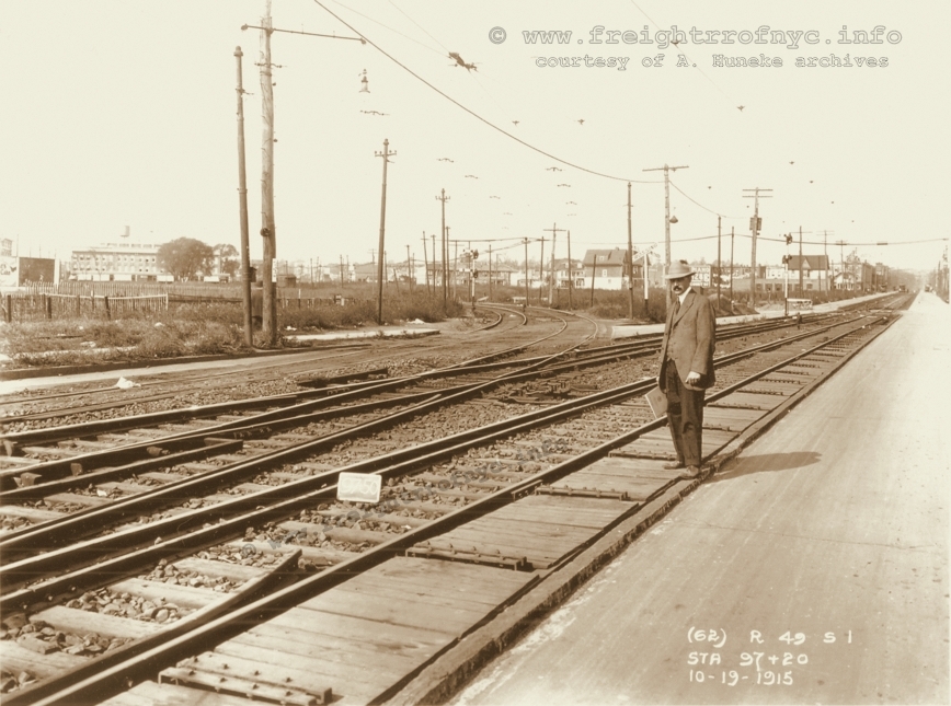
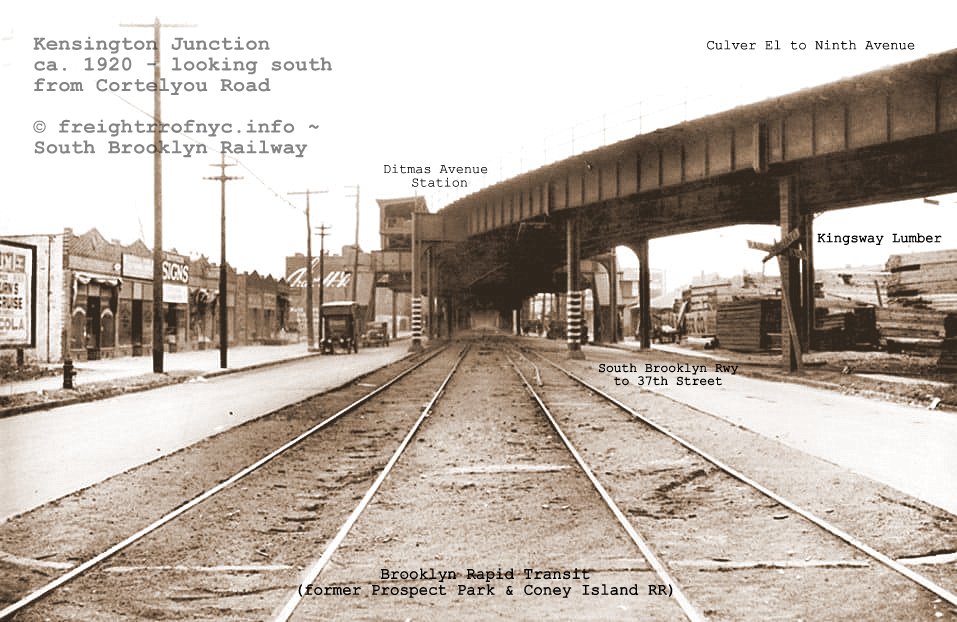
South Brooklyn Railway / Brooklyn Rapid Transit - Kensington Junction - ca. 1920
Looking south along Gravesend Avenue. South
Brooklyn Railway right of way curving to right to 37th Street in center of image.
BRT
(Prospect Park & Coney Island) trackage in center of image to
behind photographer leads north along Gravesend Avenue to 20th Street.
Taken shortly after completion of construction of the Culver Line elevated structure.
added 03 November 2022
.
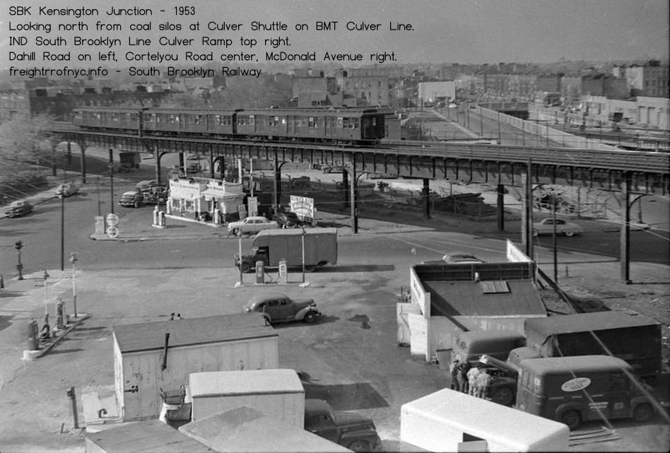
Looking north at Ditmas Avenue (left), Cortelyou Road (center) and McDonald Avenue (right) - 1953
Kensington Junction - Kings Highway siding visible through Cortelyou Road and right edge of image.
Believed to have taken from stairs of coal silos.
added 04 October 2026
.
.
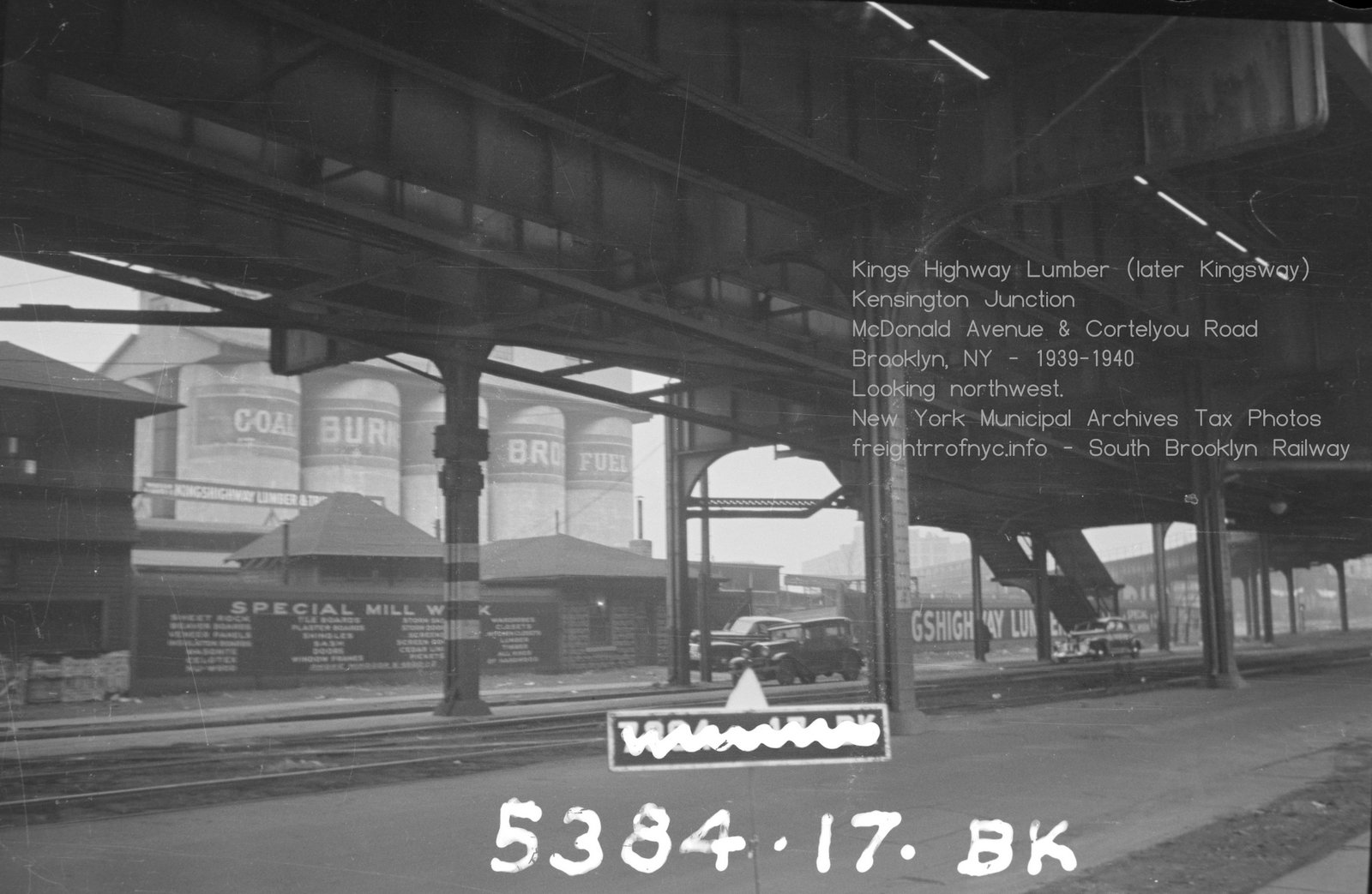
.
.
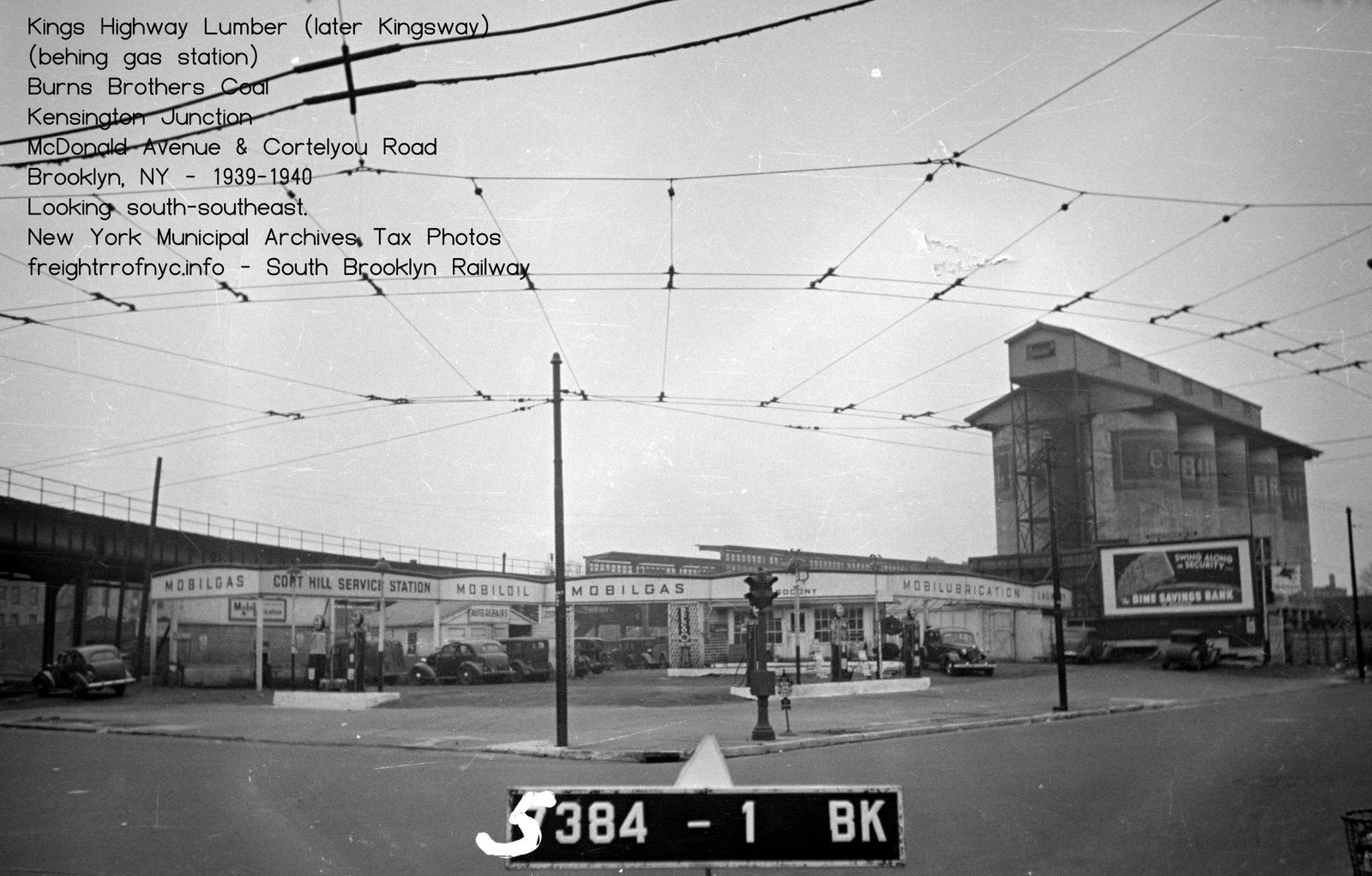
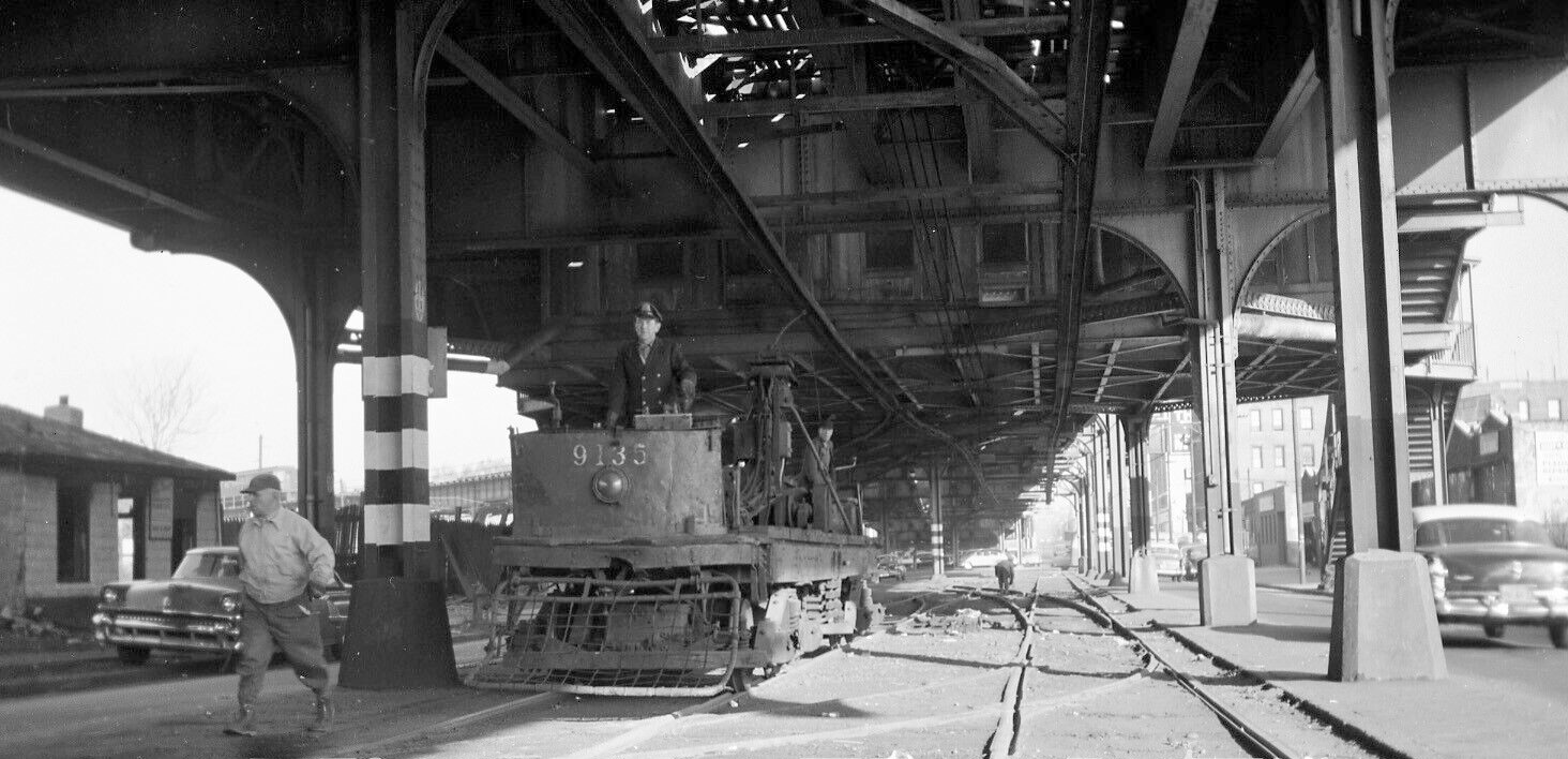
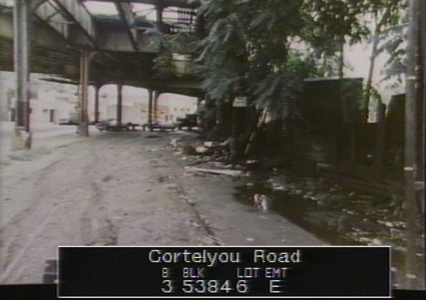
|
|
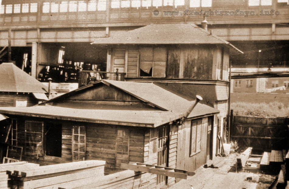 South Brooklyn Railway - Kensington Junction Tower - date? Linder / Eppler article states this structure removed in 1920. This appears to be an error. Looking east at the back (west) wall and elevated over Gravesend Avenue. courtesy of P. Matus added 13 July 2010 |
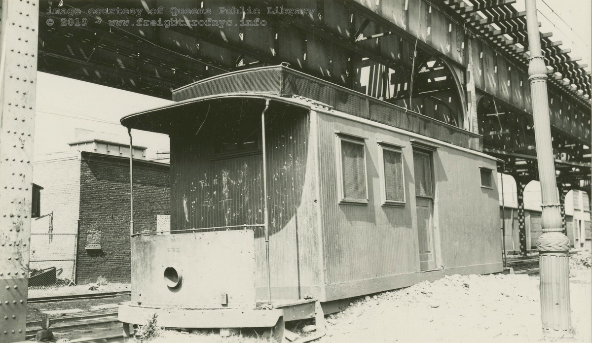 The "new" Kensington Junction freight house! August 9, 1936 According to notes accompanying the image in the Queens Public Library; the body of BRT #222 (US Mail Trolley) was located at Kensington Junction for uses as a freight house. William J. Rugen photo image courtesy of Queens Public Library Digital Archives color corrected by author added 21 May 2019 |
| . . |
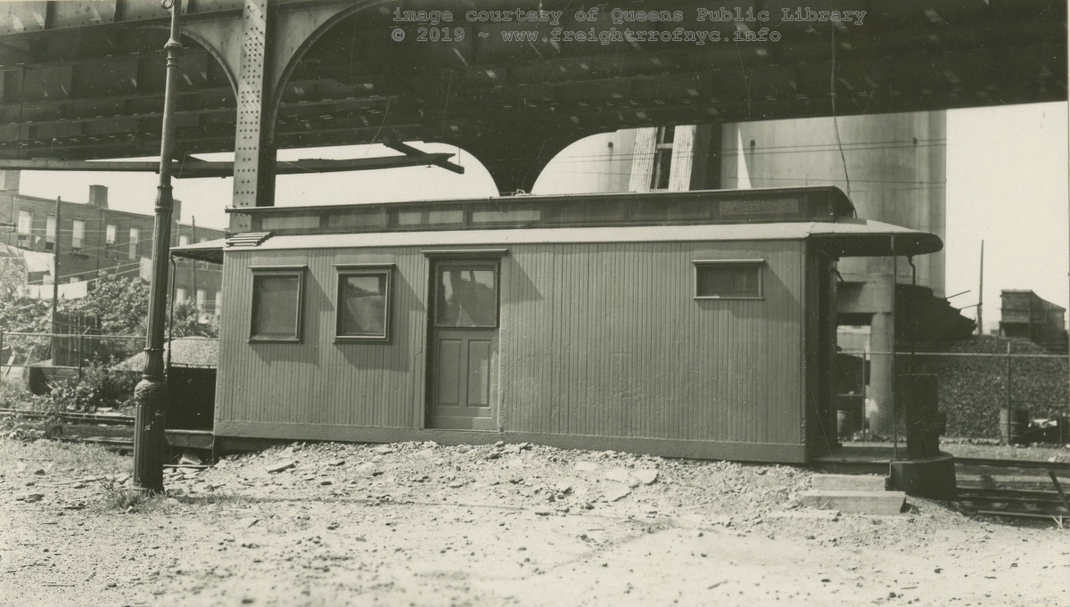 The "new" Kensington Junction freight house! August 9, 1936 According to notes accompanying the image in the Queens Public Library; the body of BRT #222 (US Mail Trolley) was located at Kensington Junction for uses as a freight house. William J. Rugen photo image courtesy of Queens Public Library Digital Archives color corrected by author added 21 May 2019 |
.
.
Also at this location, the BMT "Culver
Shuttle"
line elevated (now demolished) connected with and had its eastern
terminus across the platform from the Independent Subway / IND "Sixth Avenue
Line"  Line and also an elevated (which still exists).
The South Brooklyn Railway (and Prospect
Park & Coney Island RR) right of way would continue to run under this IND
el in later years, which is now the NYCTA
 line.
line.
In the early years and up to at least the mid-1950's, photographs show the tracks were not embedded in the street as we have come to expect, but in fact the trackage between intersections was typical rails on ties construction (and apparently covered in dirt) and the automobile traffic drove to the outsides of the elevated structure (where automobiles park in the present day). Presumably as railroad freight traffic decreased and automobile traffic increased, girder rail (rail with a built in flangeway made for street use, see Glossary) was laid and the right of way paved so it can be shared by train & automobile alike.
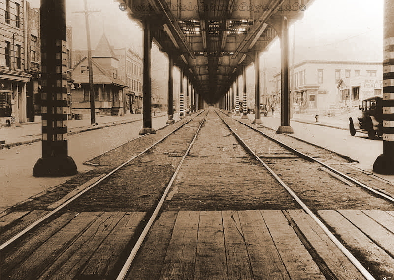
Gravesend Avenue - December 16, 1924
Looking south from Ditmas Avenue. Kensington Junction is half a block behind
photographer.
Under the IND "Culver / Sixth Avenue" line.
E. E. Rutter photo
B. Merliss archives
added 29 December 2009
..
.
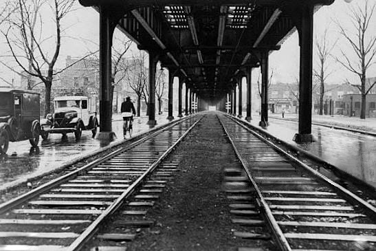
Gravesend Avenue - unknown date
Looking south - under the IND "Culver / Sixth Avenue" line.
added 29 December 2009
Viewing the 1929 edition of the E. Belcher Hyde Property Map, there appears to have been two customers located at Kensington Junction, one confirmed, and the highly likely.
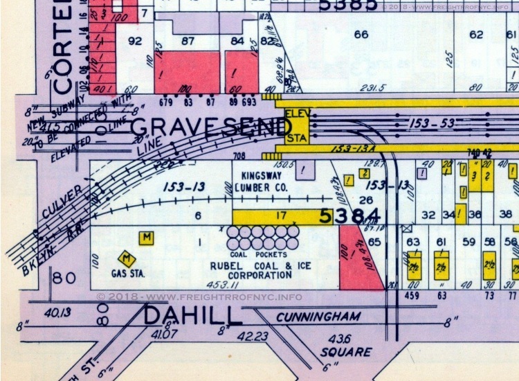 E. Belcher Hyde Map Co. Inc., 1929 Volume 3, Plate 134 North is left. courtesy of Historic Map Works added 11 July 2018 |
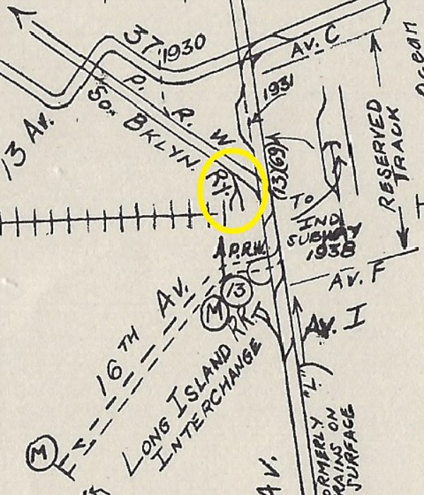 Electric Railroaders Association - June 1946, reissue 1950 North is up. added 15 September 2026 |
.
The first of these customers, is confirmed to have received rail traffic from the South Brooklyn Railway, and this customer is Kings Highway Lumber. Several maps reflect a siding in place. Research shows Kings Highway Lumber filed for bankruptcy in 1932. It may have been reorganized as Kingsway Lumber.
Personally, I also recollect a building supply / lumber yard was located at this location throughout my years living in Brooklyn 1969-1998.
The second of these customers appears to be more elusive. South Brooklyn Railway for service Rubel Coal & Ice (which had other locations throughout Brooklyn and Queens as well) has been difficult to ascertain.
The only reference I have encountered that Rubel might have had a railroad siding, is 1946 Streetcar Map of Brooklyn that was published by the ERA (Electric Railroaders Association) seen above right. This map distinctly shows a second siding parallel to the one for Kings Highway Lumber; but none of the "official" maps by South Brooklyn Railway, or period property atlases reflect the presence of a siding for Rubel Coal.
Ironically, the railroad may be long gone, but a brickyard and a small concrete mixing plant occupies this very same location in 2018.
.
.
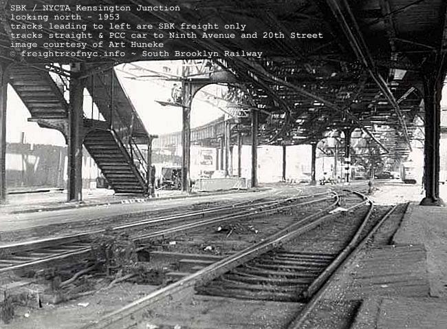
Kensington Junction - 1953
Looking north along McDonald Avenue (Gravesend Avenue) and under the
IND "Culver Shuttle" (to left) and "Sixth Avenue" line (straight).
with South Brooklyn Railway tracks branching to left, former Prospect Park
& Coney Island RR to right on surface.
Note "L MB letters under staircase. That is Kings Highway Lumber. Compare with 1915 photo above.
unknown photographer
A. Huneke archives
added 29 December
2009
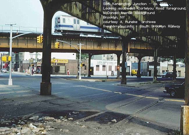
.
| Location List | Main Index |
.
11) Ninth Avenue & 20th Street
Depot
.
A set of tracks also ran north from the Kensington Junction, up Gravesend Avenue (McDonald Avenue), turning northwest at 20th Street and ending at the Ninth Avenue & 20th Street Depot, which was the northern terminus of the Prospect Park & Coney Island RR.
The PP&CI was the passenger carrying railway that originally used this trackage, until Brooklyn Rapid Transit was organized.
Within "The Elevated Railways of Brooklyn and the BMT Subway, Volume 1, p. 67" (Eric Oszustowicz, ERA 2022) is the following:
"Carload freight deliveries made at 9th Avenue and 20th street, which is the highest street elevation in Brooklyn at 175 feet above sea level, served the Maltine Co. and Ansonia Clock Co.."
This was about 1910. These passenger carrying streetcars shared the trackage with the South Brooklyn Railway until 1958 when trolley service was discontinued.
The carbarns at Ninth Avenue and 20th Street would be demolished circa 1960 and the property developed into Bishop Ford High School. It is now a NYC Board of Education facility. No traces remain.
The August 27, 1915 issue of Railway Age Gazette (Volume 59, No. 9) lists this location as a freight station for the South Brooklyn Railway, and from the Eppler / Linder article we now know two customers received freight here: Ansonia Clock and Maltine, Co. but little more is known about this location.
Continuing south from Kensington Junction, the South Brooklyn Railway right of way heads almost due south towards Coney Island.
.
.
.
.
| Location List | Main Index |
.
12) Parkville
Interchange:
South Brooklyn Railway with Long Island Railroad (1900 - 1968), Penn Central (1968 - 1976), Conrail (1976)
.
At Gravesend (McDonald) Avenue and Avenue
I, there was an interchange with the Bay
Ridge Branch of the Long
Island Rail Road.
The Bay Ridge Branch was owned by the Long Island Rail Road, but by 1916; an arrangement was entered into with the New York, New Haven & Hartford RR to provide through train service from the newly constructed transfer bridges at the foot of the 65th Street - Bay Ridge Yard to the Bronx. However, LIRR performed the local switching between Bay Ridge and Fresh Pond; providing service to the many freight stations along the Bay Ridge Branch: 5th Avenue, New Utrecht Yard, Bath Junction, Parkville, Vanderveer, and many private sidings along the route: Rubel Coal, Brooklyn Ash Removal, just to name two.
As the South Brooklyn Railway tracks running north/south were street trackage, as were the LIRR tracks running east/west, both crossed each other at grade. This photograph is courtesy of Bob Diamond:
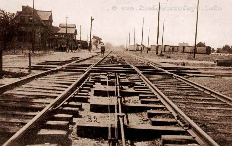
South Brooklyn Railway / Prospect Park & Coney
Island Railroad crossing with Long Island Rail Road - 1903
Parkville, Brooklyn, NY
Looking south (towards Coney Island) on Gravesend (now McDonald) Avenue at
Parkville Interchange.
Long Island Bay Ridge Branch tracks crossing from left to right.
Note string of wood freight cars in right background - they are on LIRR /
SBK interchange. Parkville Station on left.
R. Diamond archives
added 24 Dec 2009
.
.
The Long Island Rail Road embarked on a grade crossing elimination project beginning in 1905. As part of this, the railroad excavated the Bay Ridge Branch and after 1906, the South Brooklyn Railway would now run over the subgrade LIRR & NYNH&H tracks:
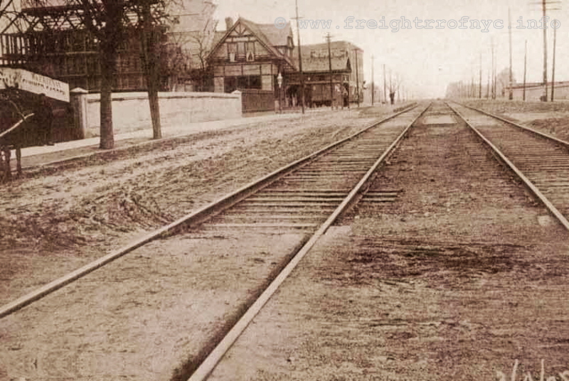
South Brooklyn Railway / Prospect Park & Coney
Island Railroad - 1906 - Parkville, Brooklyn, NY
Looking south (towards Coney Island) on Gravesend (now McDonald) Avenue at
Parkville Junction.
Long Island Bay Ridge Branch now subgrade (out of view) evidenced by bridge
wall on left of photo.
R. Diamond archives
added 24 Dec 2009
.
The turnout for the interchange was south of this overpass at the "triangle" intersection of McDonald Ave (a/k/a Gravesend Avenue), Avenue I and 20th Avenue. This track connected the south and west legs of the interchange. (There was another leg connecting the south and east legs of this interchange but this was removed in 1917.)
According to the State of New York Transit Commission of New York First Annual Report of 1921, the South Brooklyn Railway razed the Parkville Station (built in 1885, 2 1/2 story, 20' x 40' for the cost of $5,200.00.
This location, according to Robert Emery maps of the Bay Ridge Branch courteously furnished by Steve Lynch, show the last remnants of a freight yard that existed until 1959. It was in the middle of the lead tracks for this yard that the South Brooklyn Railway would interchange at this location.
It also appears that South Brooklyn Railway access to this location was limited to the southern most portion of the twin interchange leads, and that the South Brooklyn did not service this yard or adjacent industry spurs.
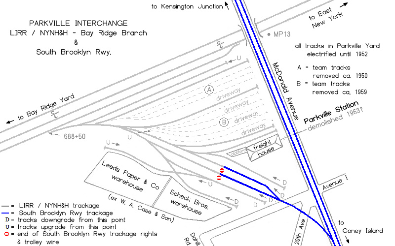
ca. 1920 - ca. 1959
R. Emery map
courtesy of S. Lynch
(modified by author and reoriented for
north)
added 11 Dec 2009
.
.
|
LIRR / SBK Parkville Interchange - ca. 1948 |
||
| The taller of the two poles with large terminating insulators carry the LIRR / NYNH&H 11,000 volt AC current. The lower of the two poles carries the NYCTS / BMT 600 volt DC current. |
top sign reads: END OF LIRR TROLLEY WIRE LIRR LOCOMOTIVES STOP HERE |
smaller sign reads: NOTICE CARS MUST NOT BE PLACED SO THAT THEY SPAN ACROSS THE INSULATED JOINTS |
| In the image, the subway cars are spanning the insulated joints. D. Klepper photo added 22 September 2026 |
||
.
.
Close up of the signage.
D. Klepper
added 22 September 2026
.
.
|
LIRR / SBK Parkville Interchange - ca. 1948 |
||
| D. Klepper photo added 22 September 2026 |
.
.
|
LIRR / SBK Parkville Interchange - ca. 1948 |
||
| The taller of the two poles with large terminating insulators carry the LIRR / NYNH&H 11,000 volt AC current. The lower of the two poles carries the NYCTS / BMT 600 volt DC current. |
top sign reads: END OF B.M.T. TROLLEY WIRE B.M.T. LOCOMOTIVES STOP HERE |
smaller sign reads: NOTICE CARS MUST NOT BE PLACED SO THAT THEY SPAN ACROSS THE INSULATED JOINTS |
| In the image, the subway cars are spanning the insulated joints. D. Klepper photo added 22 September 2026 |
||
.
In 1976, Penn Central itself would dissolve after filing for bankruptcy back in 1970. This in turn partially led to the formation of Conrail, of which would necessitate Conrail to run what little local freight service on the Bay Ridge Branch existed.
In 1984, the Long Island Rail Road would purchase the Bay Ridge Branch from Conrail, thereby returning LIRR presence to where it had been once before.
In 1997, the Long Island Rail Road reached a decision to privatize its freight operations. The "New York & Atlantic Railway" was organized in May 1997, and contracted with the LIRR to provide freight service in Brooklyn, Queens, Nassau & Suffolk counties.
On May 21, 1999, the City of New York awarded Bay Ridge Yard to the New York & Atlantic Railway and it is the New York & Atlantic Railway that operates the Bay Ridge Branch to this day.
So, what does all this have to do with the South Brooklyn Railway?
It appears from several photos (not shown here) dated January & February 1972 seen on Dave Pirmann's website www.nycsubway.org, that even during the Penn Central owned years, LIRR would transport subway cars along the Bay Ridge Branch to Parkville Interchange for interchange with South Brooklyn Railway.
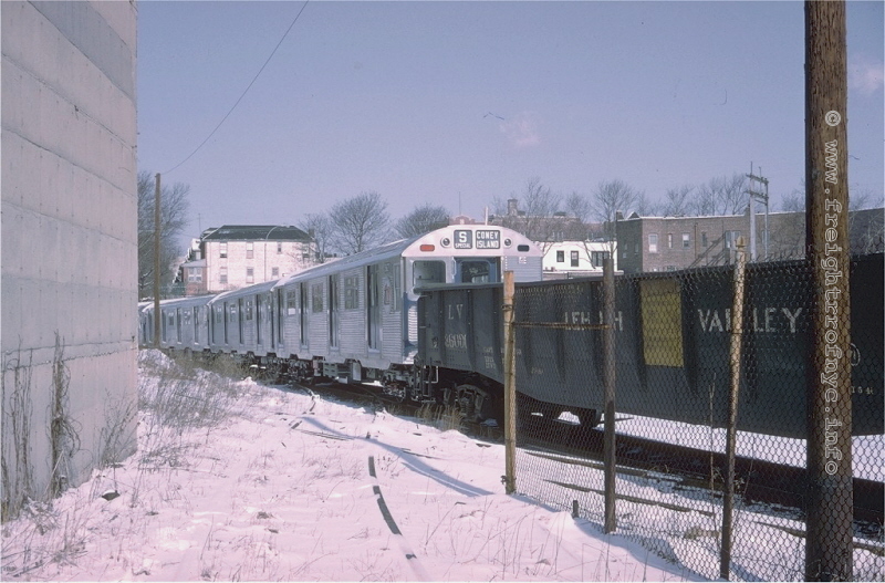
Parkville Interchange - Brooklyn NY - March 21, 1965
Looking north. Photographer is standing on Scheck Brothers Warehouse siding.
The crossing diamond is barely discernible under the snow next to the R32
and gondola.
The siding leading to the Leeds Paper Warehouse can be seen between the chain
link fence and Lehigh Valley gondola.
D. Grotjahn photo
J. Testagrose
collection
added 19 Dec 2009
.
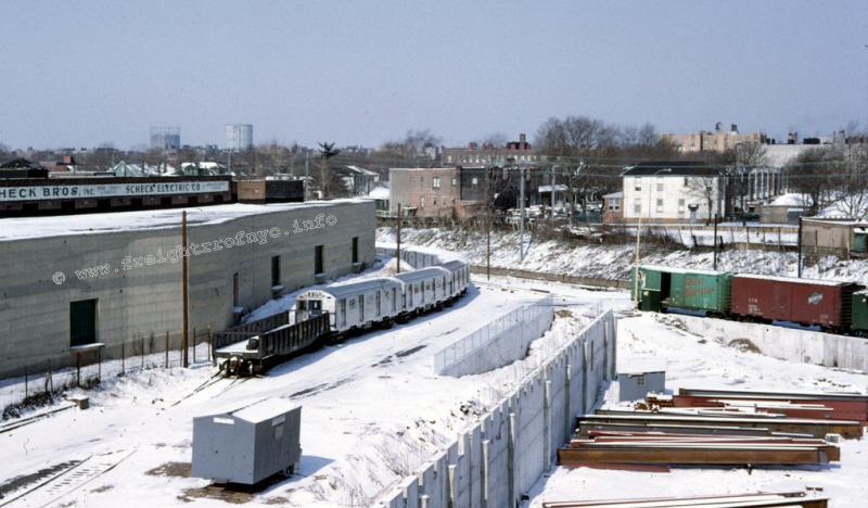
Parkville Interchange - Brooklyn NY - March 21, 1965
Looking northwest. Subway cars and gondola on interchange track. Boxcars
are on Bay Ridge Branch freight lead.
Property to left of concrete foundation is former location of LIRR Parkville
Station Freight Yard.
D. Grotjahn photo
D. Pirmann collection
added 19 Dec
2009
.
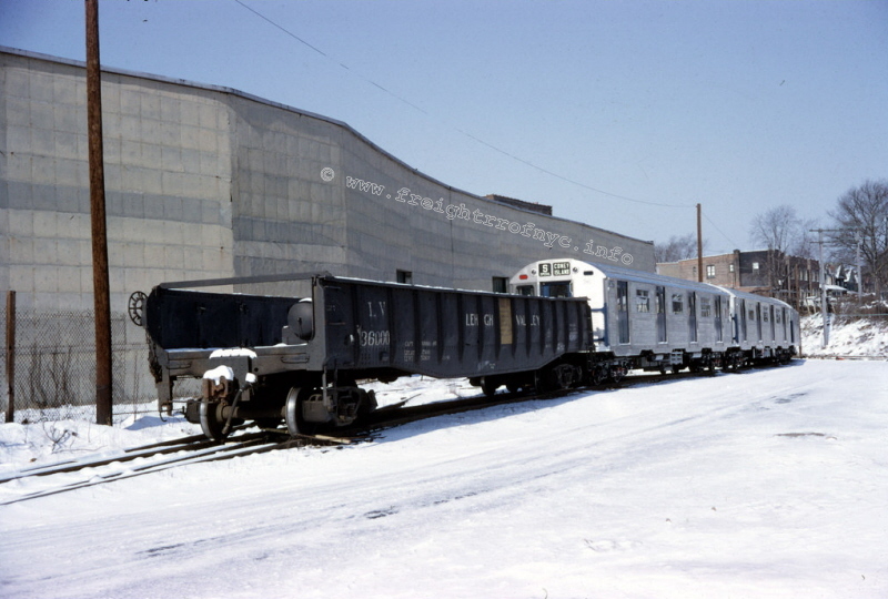
Parkville Interchange - Brooklyn, NY - March 21, 1965
Looking northwest. Note the air reservoir in the gondola. This Lehigh Valley gondola was modified
for use in hauling subway cars on Lehigh Valley trackage on mainland U.S.
Why it is seen here is not known,
(considering SBK has it's own transition cars) but apparently it is capable
of transition use between
standard AAR couplers (on Class 1 and SBK Diesels) and the H2A type couplers
on the R32's.
D. Grotjahn photo
D. Pirmann collection
added 19 Dec
2009
.
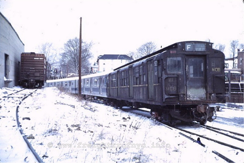
Parkville Interchange - Brooklyn, NY - February 18,
1972
Looking north. New R44's being delivered with R1 transition car (Note end
of transition car is marked "MCB" for MCB coupler.
Other end of transition car will have Form 70 Walton electric coupler). Box
car on left edge of photo is on Leeds Paper warehouse.
Points and turnout under lead truck of subway car lead to Scheck Brothers
siding.
S. Zabel photo
J. Testagrose collection
added 19 Dec
2009
.
.
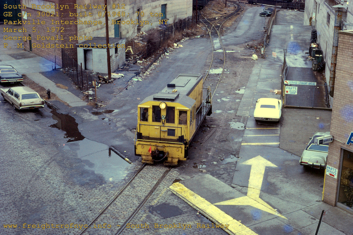
Parkville Interchange - Brooklyn, NY - March 5, 1972
Looking north-northwest and taken from the elevated platform of the Avenue
I station of the IND 'F' (Sixth Avenue Local) line.
#12 on interchange track at curbline of Avenue I with Penn Central Bay Ridge
Branch (ex-NYNH&H / LIRR) tracks in background.
Note boxcar at top center of photo is on "Leeds Paper" siding and gondola
with pipe is on Bay Ridge Branch freight lead.
Also note the single interchange track (as opposed to twin interchange tracks
and other parallel trackage) shown in Emery map above.
Telephoto compression makes length of track appear shorter than actual.
G. Povall photo
authors
collection
added 18 December 2009 - rescanned 18 April 2021
.
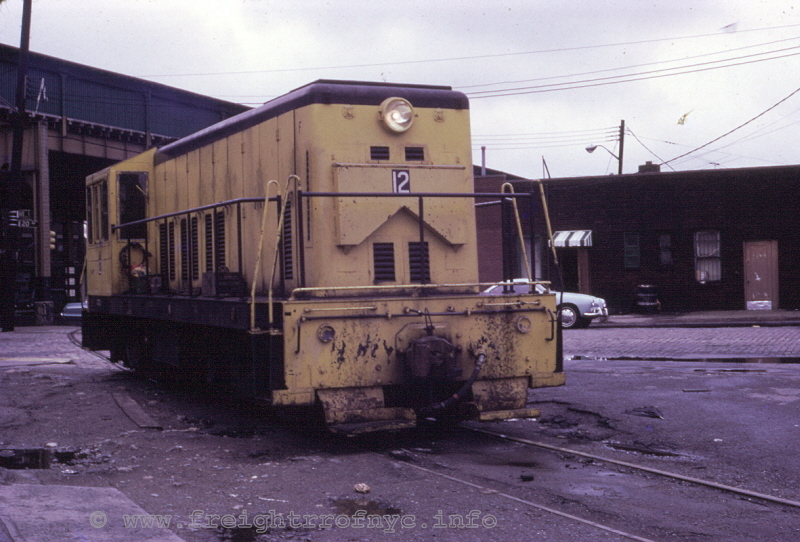
Parkville Interchange - Brooklyn, NY - March 5, 1972
Looking south-southeast. #12 on interchange track at curbline of Avenue I
with
McDonald Avenue (IND "Culver / Sixth Avenue"
elevated line) in
background.
G. Povall photo
authors
collection
added 18 Dec 2009
.
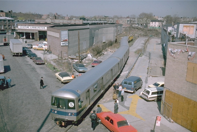
Parkville Interchange - Brooklyn, NY - April 23, 1975
Looking north-northwest and taken from the elevated platform of the Avenue
I station of the IND 'F' (Sixth Avenue Local) line.
Unidentified NYCTA Diesels at head of train of R46's. The red Plymouth Valiant
is the official "SBK escort" car for street running.
S. Zabel photo
D. Pirmann collection
added 19 Dec
2009
.
It is also inferred (but not confirmed) that South Brooklyn Railway would also provide occasional freight service to the tenants of that weirdly shaped building (Leeds Paper & Scheck Brothers) at the Parkville Interchange, as photos taken in 1972 exist of freight cars on these sidings with an South Brooklyn Railway locomotive in view and apparently performing switching services..
This Leeds / Scheck structure is quite unique and the north wall was gull winged, as the walls actually curved to accommodate the unique "criss cross" arrangement of the siding tracks. The curved walls may be seen in a bing.com aerial photo:
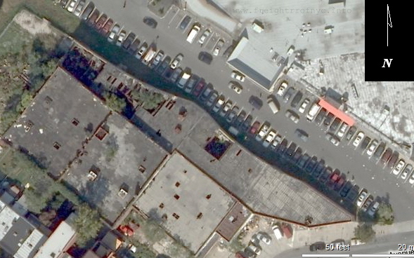 |
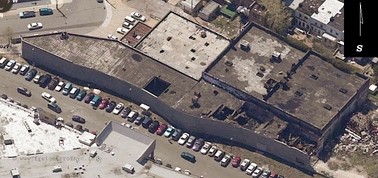
|
.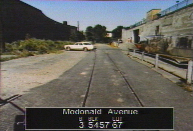
NYC Tax Photo - 1980
Looking northeast at
Parkville Interchange. Auto dealership to right, Leeds Paper &
Scheck Brothers building (in shadow) to left.
Avenue I behind photographer.
added 27 September 2026
.
.
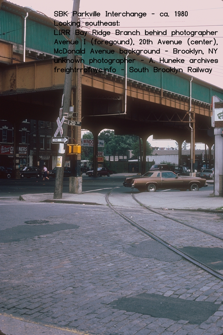
Parkville Interchange - ca. 1980
Looking southeast at
Avenue I (foreground) Twentieth Avenue (center), McDonald Avenue background
LIRR Bay Ridge Branch behind photographer
unknown photographer
A. Huneke archives
added 02 October 2026
.
.
As of January 26, 2010; this structure was in the process of being razed (see photo in remnants chapter.)
Conrail ceased using Parkville Interchange around 1976 and upon takeover of the Bay Ridge Branch from Penn Central. Having taken over the line, Conrail was casting off as much of the unused or under-utilized properties as they can. Anything a railroad owns is taxed, regards of being in service or not. Every inch of trackage, every square foot of property.
With South Brooklyn Railway having embargoed their McDonald Avenue right of way, there simply was no interchange partner remaining at Parkville Interchange. So, Conrail abandoned their portion of Parkville Interchange trackage. Any freight traffic on the line was now through routed using Fresh Pond, Queens with 65th Street Yard no longer being an origin point, and simply being a (light used) storage yard and a location to "turn trains" back to Fresh Pond.
In 1980, when the South Brooklyn Railway themselves were investigating in ceasing freight service altogether, they of course explored the possibility of of acquiring new customers along the line as part of a feasibility study. Conrail stated they would not reactivate Parkville Interchange even if South Brooklyn Railway did find any customers; which for all intents and purposes, sealed the fate for location. Conrail wouldn't service it, South Brooklyn had no customers that needed interchange through it via the McDonald Avenue right of way; so it was cast off for redevelopment.
The Conrail interchange and runaround tracks were removed, and the Bay Ridge Branch "straight railed" (switches removed). The Parkville Interchange Yard was cleared and a large Ford automobile dealership with a service department and body shop; was built on the land. The back half of it can be seen in the 1972 photo above. After the dealership left, the building would become home to the Avenue I Flea Market in 1976, and this was an indoor 600-stall bazaar and market with shops and small food vendors - pickles, hot dogs, knishes, hot pretzels, burgers, fries and such. Parking was either on the old interchange tracks or on the roof. The Avenue I Flea Market lasted until 1992, and the building became home to "Rock Bottom" a discount / surplus / bulk lot outfit. They vacated in property in 1996 and the property sat vacant until 1998 when the site was redeveloped, and is now a Shop-Rite supermarket. During that period, the Interchange Track area was paved over and now utilized as a parking lot.
This next street crossing I have images from, is Avenue P.
Avenue P
Looking north along McDonald Avenue at Avenue P - July 31, 1947
New York Transit Museum archives
Image ID: 2004.20.9.194
added 21 September 2026
.
.
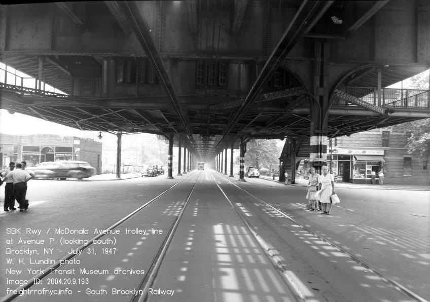
Looking south along McDonald Avenue and Avenue P - July 31, 1947
W. H. Lundin photo
New York Transit Museum archives
Image ID: 2004.20.9.194
added 21 September 2026
McDonald Avenue & Billings Court (between Kings Highway & Avenue S)
Returning to the "mainline" of the South Brooklyn Railway, the right of way would continue south towards Coney Island following McDonald Avenue to Kings Highway, where both the McDonald Avenue and the South Brooklyn Railway jogs a little to the west.
.
Looking north along McDonald Avenue at Billings Court. December 31, 1942
Kings Highway in background where elevated curves to left.
Flatbush Coal to left of photographer, and Avenue S behind photographer.
W. H. Lundin photo
New York Transit Museum archives
Image ID: 2004.20.9.1235
added 21 September 2026
| Location List | Main Index |
.
.
13) Avenue S & McDonald Avenue
- Voorhee's Grain Silo / Flatbush Coal & Oil - Gravesend
.
Heading south on the southbound track (west side of the street), the train would encounter a trailing point turnout and a short stub track located just north of Avenue S. This would be the location of one of the very few actual customer stub tracks on the Gravesend Avenue segment of trackage (currently only two are known - this one and one at Kensington Junction for the lumber yard).
This turnout's arrangement was so a locomotive and train heading south (on the southbound track) could pull past the turnout with a cut of cars, where a trainman would throw the point and then the locomotive could then reverse direction and push the railcar into the spur and onto the property. Presumably there was a "between the rails" pit, where the feed or grain could then be offloaded and a conveyor would carry the feed/grain to the top of the silos where it could be dispensed.After researching 1916 E. Belcher Hyde Property Maps, I was able to learn that this location was originally William K. Voorhee's Grain Elevator. A track connection is not seen on the property map, but thanks to survey images for construction of the BMT Culver Elevated taken in 1915 and again in 1917, the spur is evident.
It is also understood that Voorhee's Grain Elevator had been a
supplier for feed for the horses for the Brooklyn Jockey Club and the
Gravesend
Race Track which was pretty much diagonally across Gravesend Avenue and
the stables one and a half blocks south. Voorhees would also sell to the public as well..
On the property map dated ca. 1890, the property plot was listed
as being owned by "Van Sicklen, Voorhies and Stryker". By 1899, the
property only bears the name W. K. Voorhies. Please note
the spelling of
Voorhies vs. Voorhees changes between those seen on the property maps
and that of
which is actually painted on the side of the silos. As I'm more
inclined to believe the person actually knew how his own name was
spelled, I'll conclude Voorhees was the correct spelling. Also note
that the alignment of Lake Street is proposed and not yet actually
constructed.
|
|
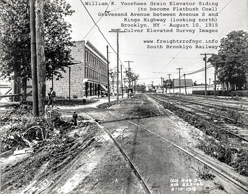 |
| E. Belcher Hyde - Atlas of Brooklyn, NY - 1899 Volume 3, Plate 2 - Brooklyn NY (note Kings Highway incorrectly identified as Avenue R - further west on this map this thoroughfare bears the Kings Highway name) annotated image by author added 08 May 2021 |
August 10, 1915
Note trolley wire extending into spur. unknown provenance annotated image by author added 08 May 2021 |
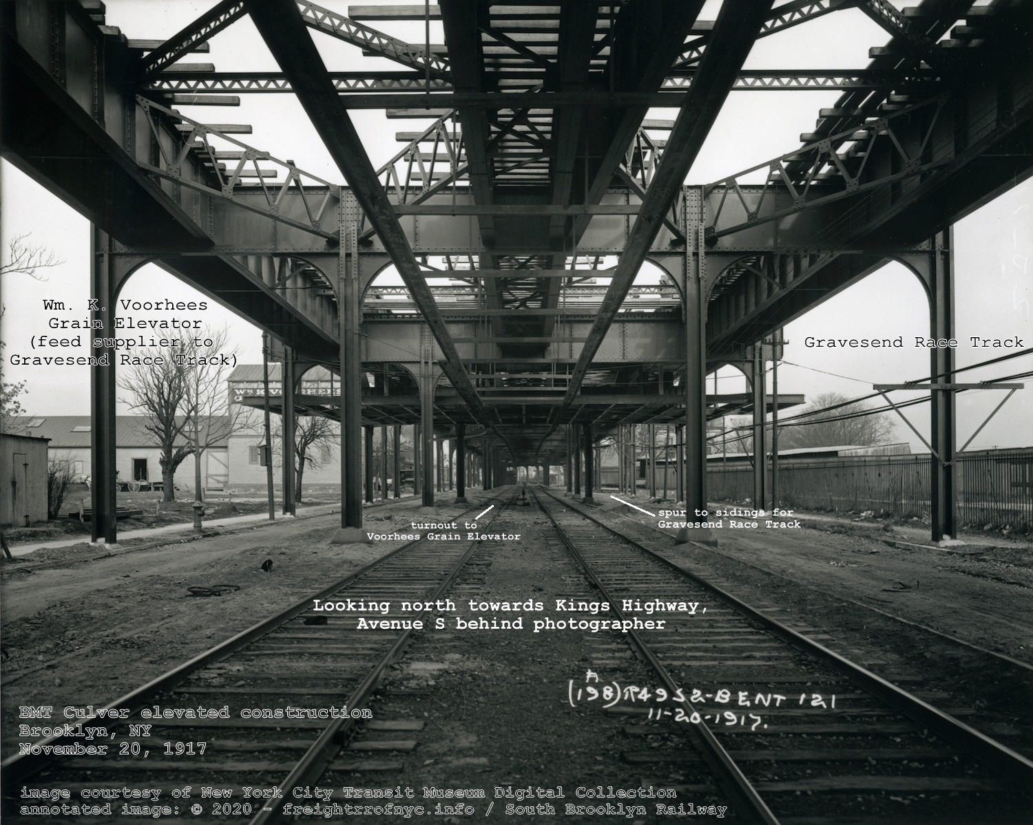
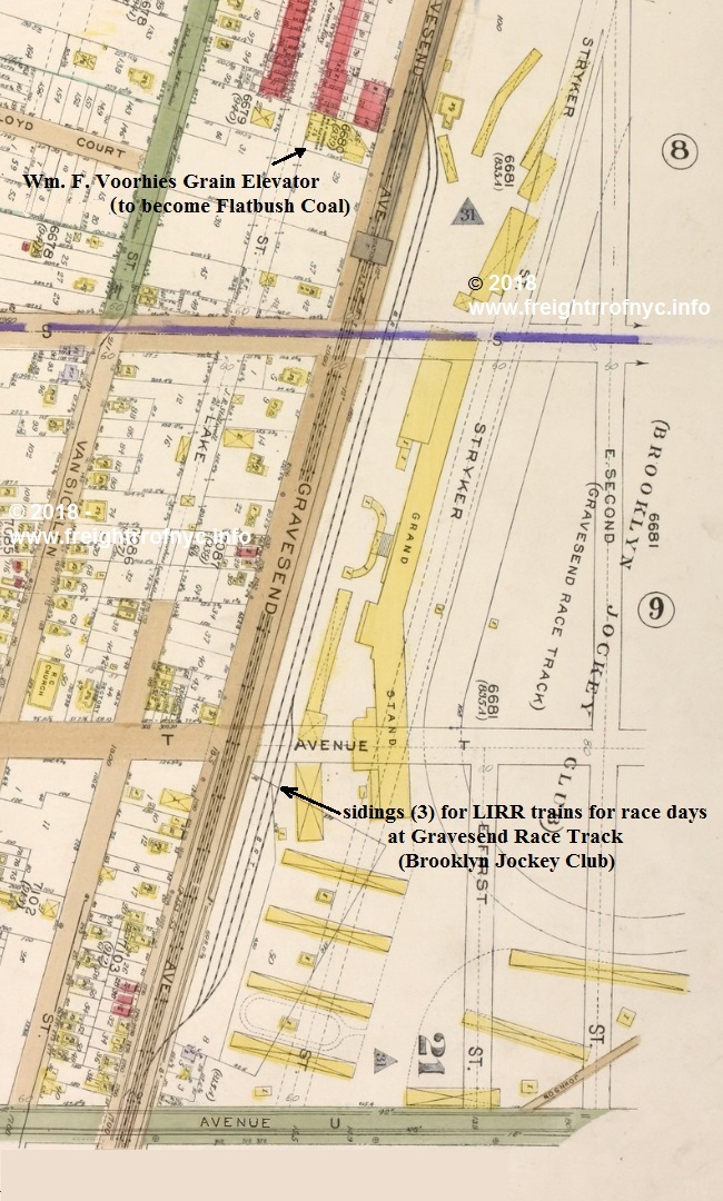 E. Belcher Hyde Property Map - 1916
.Volume 3, Plate 10 (spur to grain elevator not shown but known to exist) courtesy of New York Public Library Digital Archives annotated version ©2018 by author added 11 July 2018 . |
|
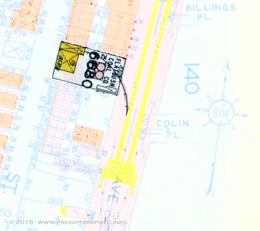 E. Belcher Hyde Property Map - 1929
Volume 4, Plate 137 courtesy of Historic Map Works annotated version ©2018 by author added 11 July 2018 |
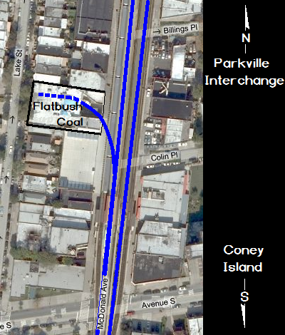 |
As some point in time, but specific date unknown; the property changed hands as well as commodities, and concrete coal silos built and a coal dealer would conduct business there.
I am deeply indebted to Ben Schaeffer for recording the name of the industry, as for many years now it has bothered me that I could not remember for myself! As I lived just a few blocks away, I was always intrigued with the operation, but the short-sightedness of my youth precluded me from taking note of the name. I distinctly recall seeing the "4 pack" coal silos looming above the Avenue S entrance/exit of the Kings Highway Station of the F train. As I lived on Avenue S (and East 8th Street), this was my stop and I used it frequently.
Presumably there was a "between the rails" pit, where the coal could then be unloaded and a conveyor would carry the coal to the top of the silos where it could be dispensed by gravity.
With deepest apologies, I cannot recall who sent me the following images
some time ago, so if you see them, please give me a shout so I can
credit your contribution. In these next series of images, taken ca.
1940 are from the New York City Property Assessment Images Series.
These photos show Flatbush Coal between Avenue S and Kings Highway on
Gravesend Avenue with the rail spur leading into underneath the silos;
and the backside of the building from Lake Street showing the tops of the silos.
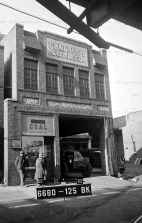 Flatbush Coal Co. - 1940
front left of facility taken from Gravesend Avenue courtesy of NYC Department of Records and Information Services added 18 April 2021 |
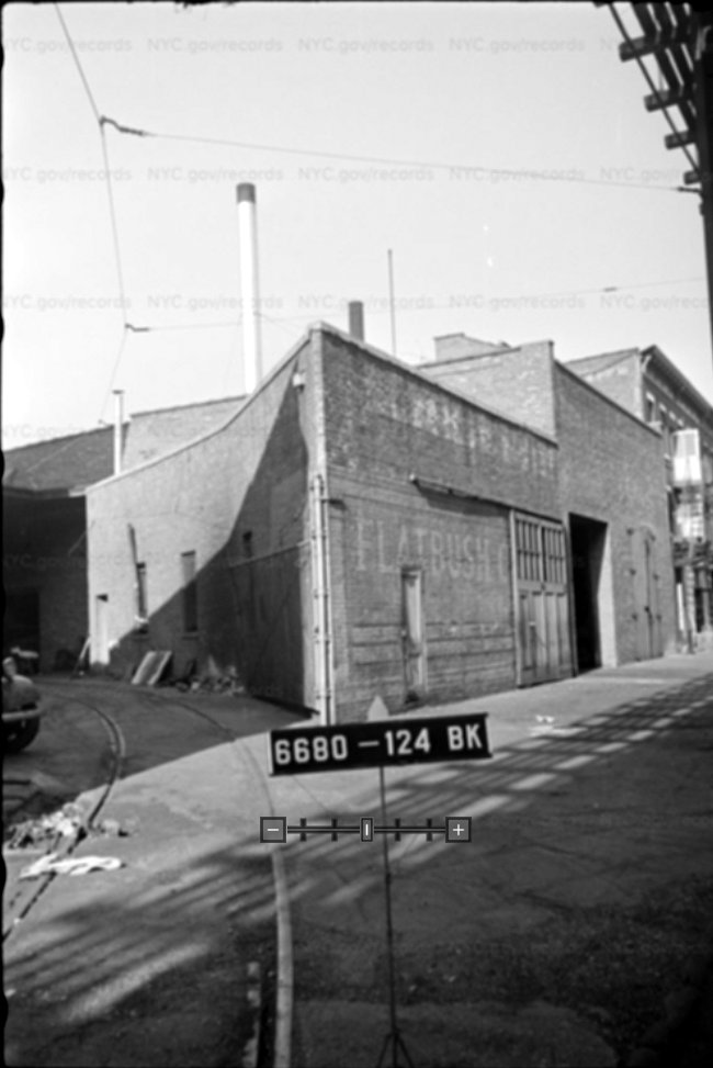 Flatbush Coal Co. - 1940
front right of facility taken from Gravesend Avenue courtesy of NYC Department of Records and Information Services added 18 April 2021 |
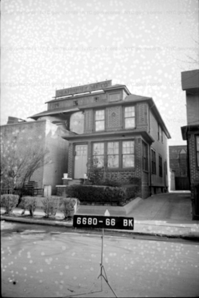 Flatbush Coal Co. - 1940 rear side of facility taken from Lake Street courtesy of NYC Department of Records and Information Services added 18 April 2021 |
|
| . . |
|
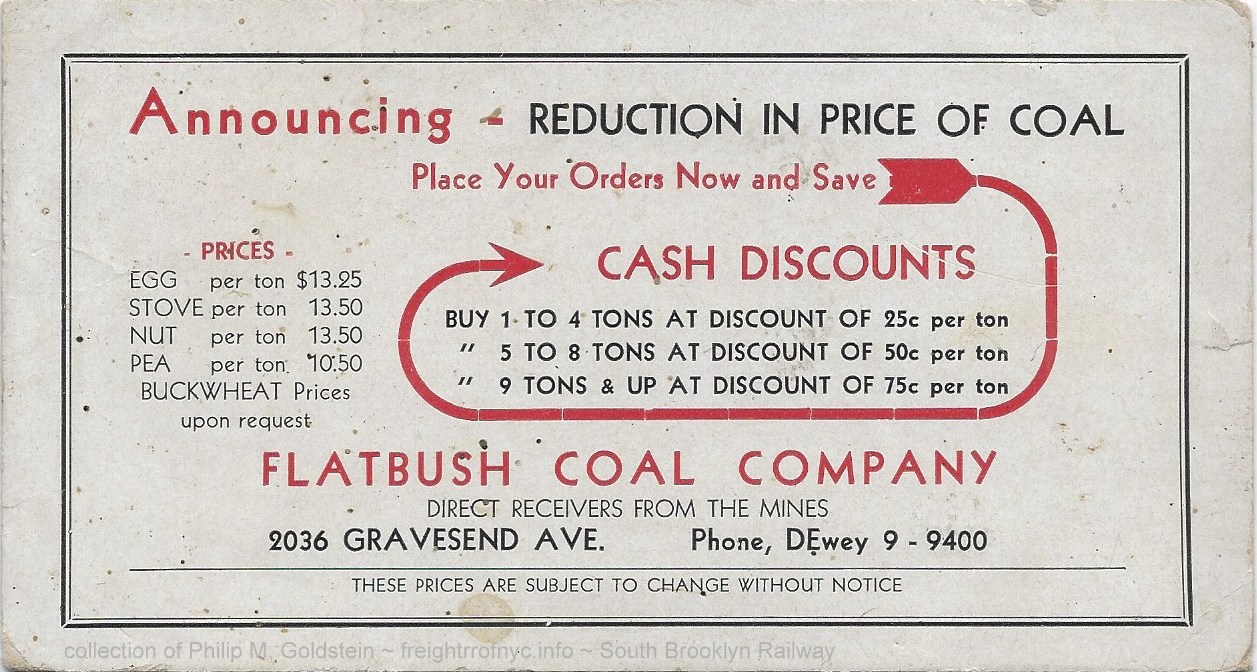 Flatbush Coal advertising ink blotter - pre-1931 (Gravesend Avenue) collection of the author added 07 November 2022 |
|
.
.
.
| Location List | Main Index |
.
14) Avenue U & Gravesend (McDonald)
Avenue Delivery Station - Gravesend
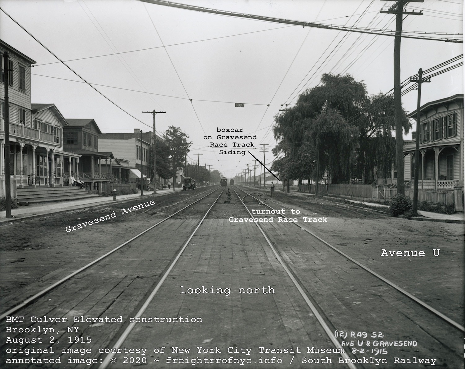
August 2, 1915
Looking north along Gravesend Avenue from Avenue U.
courtesy of the New York City Transit Museum Digital Collection
annotated image © 2020 by author
added 15 June 2020
.
.
|
According to the book "Brooklyn - A National Center of Commerce & Industry" as published by the Committee on Industrial Advancement of the Brooklyn League in 1914; in the chapter Freight Depots, Piers & Stores on page 42, lists this location for deliveries of freight on the South Brooklyn Railway. At the time this was read, it was unclear if this location hosted a team track, a platform or a full freight station. By the issue date of the 1961 Raudenbush Map does not reflect any presence here, so we might conclude it was long gone by that date. In referencing the 1916 E. Belcher Hyde Property Maps for this area (seen at right); it was then learned there were rather lengthy sidings between Kings Highway and Avenue U along Gravesend Avenue for the "lay up" of the "Brooklyn Jockey Club Specials" that the Long Island Rail Road ran to bring passengers and spectators to the Gravesend Race Track events. These trains are well documented on Art Huneke's website: Brooklyn Jockey Club / Gravesend Race Track
Interestingly enough, one of the three sidings (the east most) is
dramatically shorter than the others. Whether this is of any
significance remains to be seen.
After viewing this map, this author had a epiphany. What if (and this
is strictly conjecture here), the Brooklyn Jockey Club itself was the
delivery station?
It is very doubtful there could have been any type of outgoing
freight from a horse racing track per se other than the passengers at
the end of the events, except for maybe manure and perhaps the 'has
been' mounts enroute to the glue or dog food factories. Just
kidding! By the next series of E. Belcher Hyde property atlases are issued in 1929 (excerpt shown below), the entire Gravesend Race Track is gone and the street grid being built to plan. But yet, two of sidings show in the 1916 Map have been cut back to stub tracks ending at Avenue T. Perhaps this would be the impetus to install a delivery station at this location? According to the Linder / Eppler article, "part of the Gravesend Race Track siding at Gravesend Avenue south of Kings Highway was removed" in 1923. Fortunately, we can see in the 1924 Fairchild Aerial Photo, several freight cars shown on the sidings. This was after the Gravesend Race Track was demolished, the street grid completed and residential housing being constructed, as we can still see the turf oval of the racetrack in quite a few of the unimproved and empty lots. Further reference to the Linder / Eppler article states the Gravesend Race Track siding was completely removed in 1925. Lapse forward two years, and the discovery of an image in the digital collection of the New York City Transit Museum. The image is part of a survey series taken for the construction of the Culver Elevated over Gravesend Avenue. One of these images, dated August 1915, is marked "Avenue U & Gravesend" and in it we can clearly see the turnout for the southend of the Gravesend Race Track sidings.
1924 Fairchild Aerial Survey Photo
original photo courtesy of New York City Department of Information, Technology & Telecommunications annotated version ©2018 by author annotated by author added 11 July 2018 |
... | E. Belcher Hyde Property Map - 1916
Volume 2, Plate 12 courtesy of New York Public Library Digital Archives annotated version ©2018 by author added 30 June 2018 . 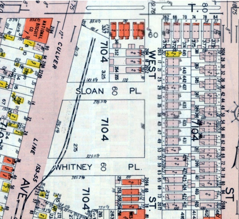 E. Belcher Hyde Property Map - 1929 Volume 4, Plate 138 courtesy of Historic Map Works annotated version ©2018 by author added 30 June 2018 |
.
.
| Location List | Main Index |
.
15) Prospect Park & Coney Island RR / SBK Culver Yard & Depot Coney Island freight house
.
Over the course of its history, the South
Brooklyn Railway would come to have at least three different locations in Coney
Island that it would call home to its freight house, and we will address them in chronological order.
The first of
these would be located at the Prospect Park & Coney Island
Railroad's Culver Station. This
streetcar depot also had a yard
and turning loops for the trolleys. We know by viewing both the 1907
Hyde Property Map below and the 1924 Fairchild Aerial photo that this
location also had various sidings for local industries throughout its
existence.
I think it can be safely surmised that the South Brooklyn Railway (as freight agent for the Brooklyn Rapid Transit and owner of the PP&CI) serviced this industries.
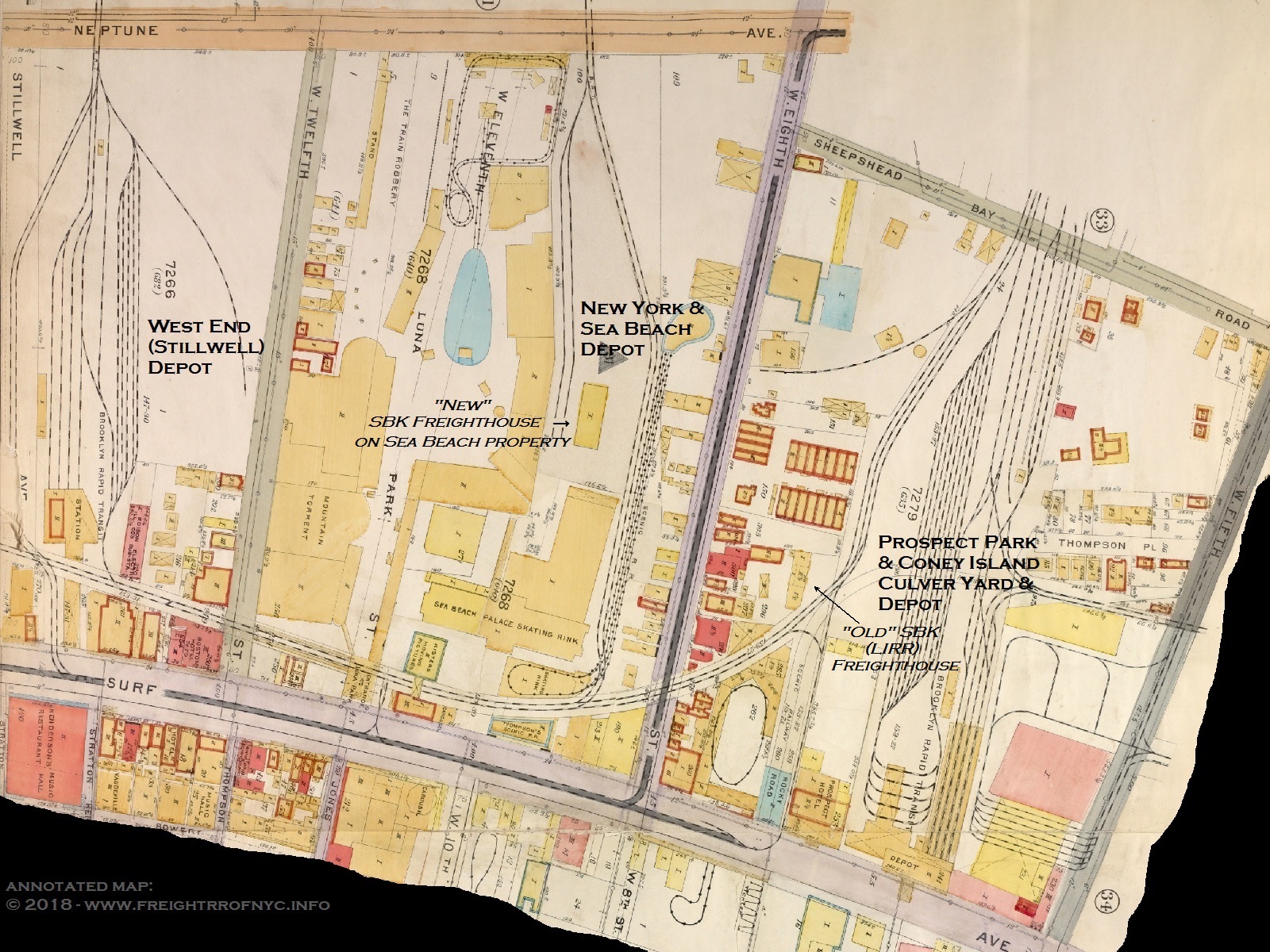
1907 E. Belcher Hyde Property Atlas
courtesy of New York Public Library Digital Collection
annotated version ©2018 by author
added 11 July 2018
.
.
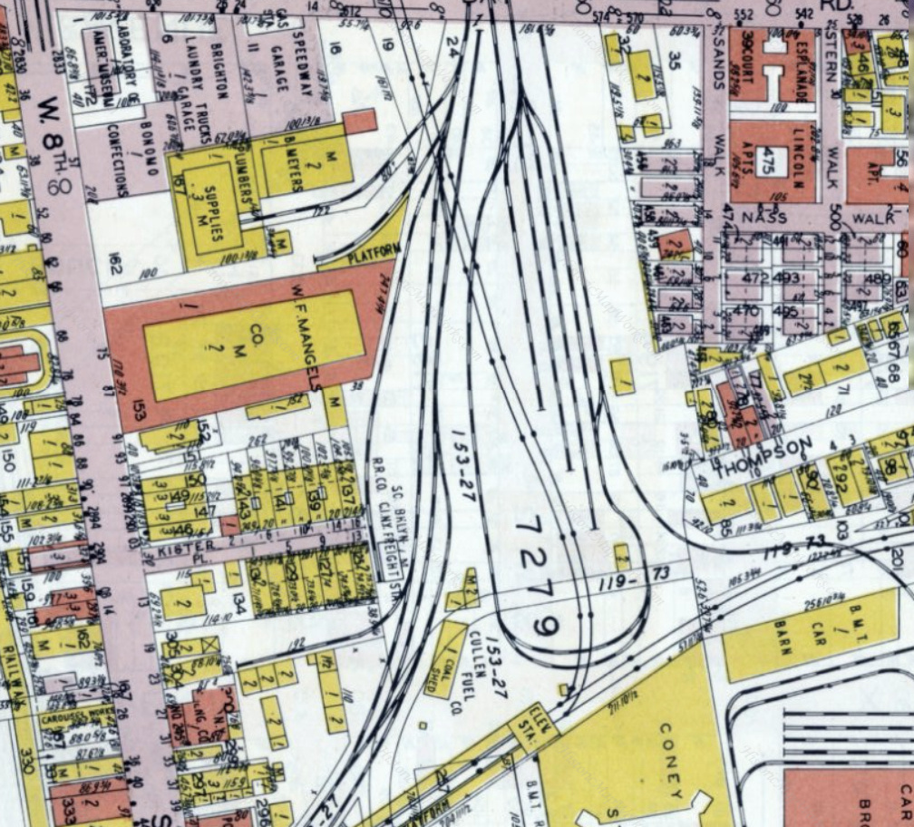
.
.
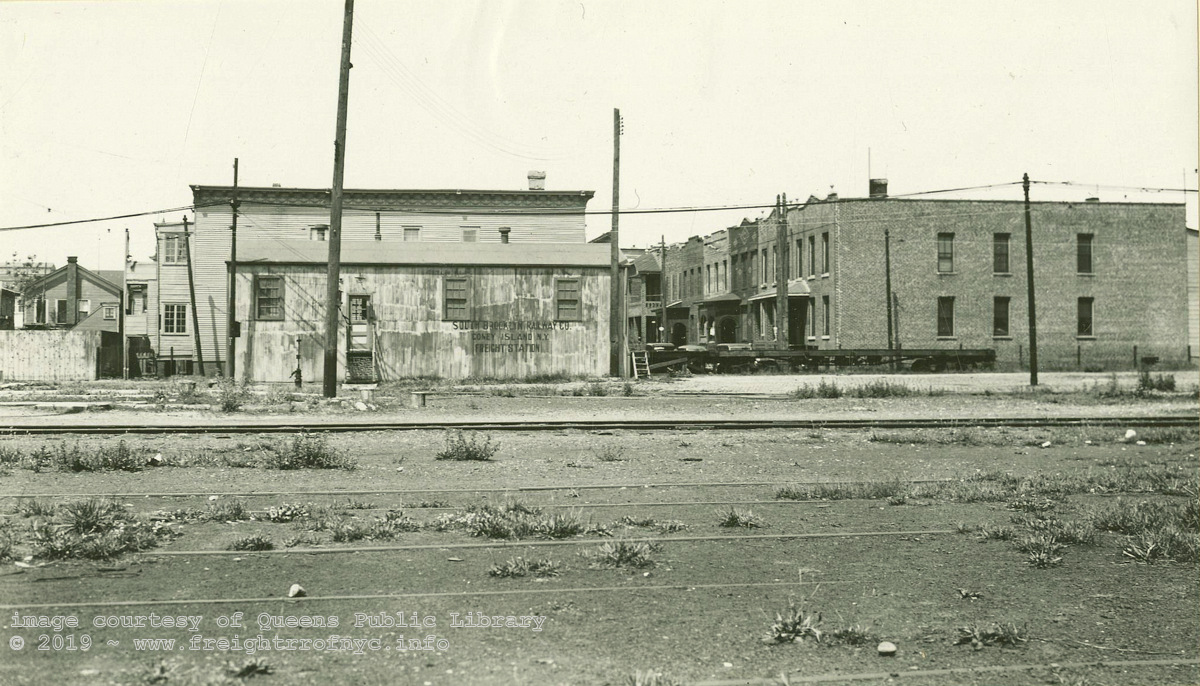
.
.
In 1909, the South Brooklyn Railway filed an application with the Public Service Commission to discontinue using the freight building at the Culver Yard, Coney Island. This freight station, which was owned by the Long Island Rail Road and operated the PP&CI RR; and was stated to be in dilapidated condition. As a result, the South Brooklyn Railway wished to relocate about 1000 feet to a new freight house on the property of the Sea Beach Railway between West 8 and West 12th Streets:
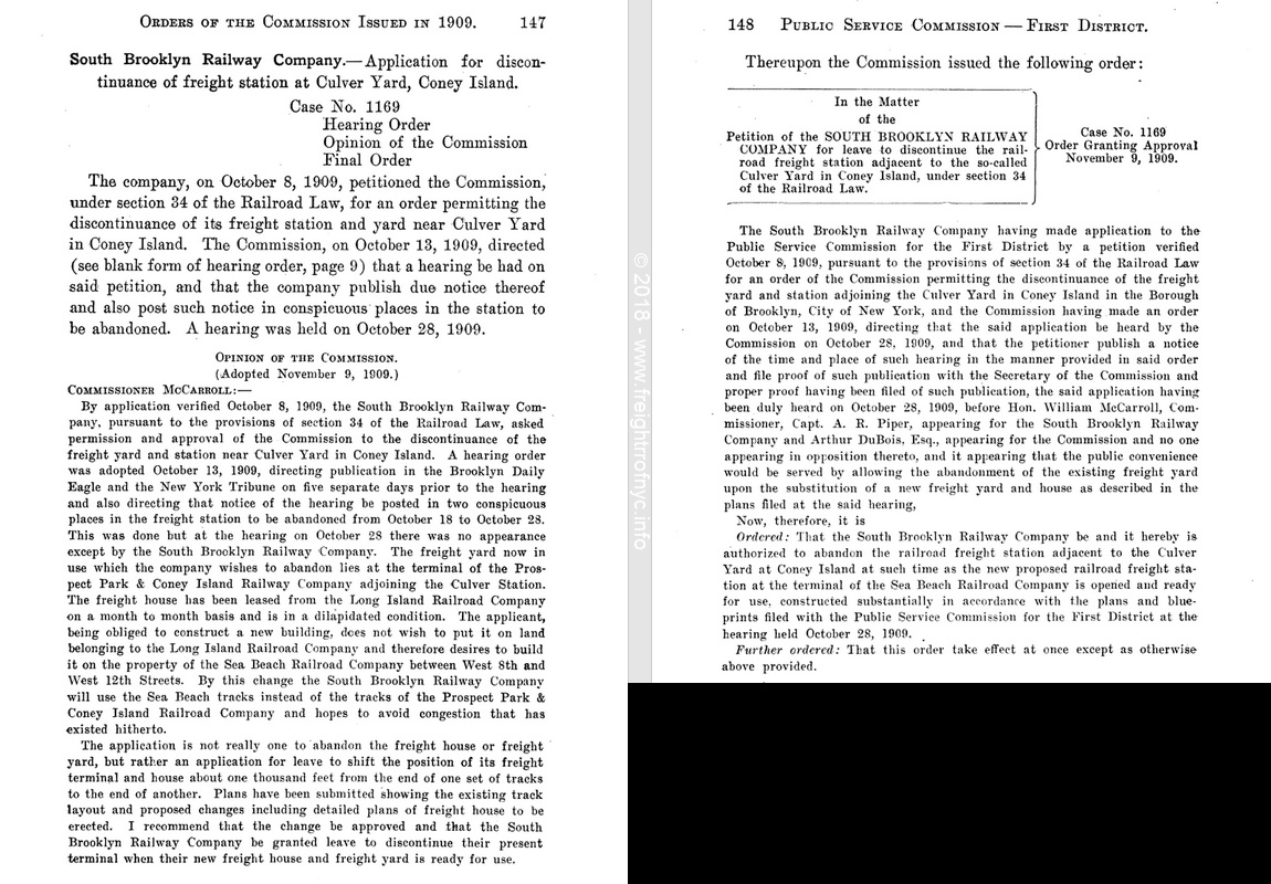
.
.
The SBK relocated to the West Eighth Street Terminal adjacent to Luna Park. Therefore this makes the West 8th Street location, the second Coney Island location of the SBK.
The right image below, reflects the trackage on the Culver Terminal from the June 11, 1904 trade journal "Street Railway Journal". While not specifically mentioned, it gives us an a detailed visual reference of the 'new' Culver Yard & Depot. It is believed that the "dilapidated freight house" in question is on the spur marked "To Long Island RR Freight Yard" on the left edge just south of the Sheepshead Bay Road grade crossing, but this is not confirmed.
The left image is the 1924 Fairchild Aerial Survey Photo below (annotated by the author). This image, while showing more than the basic area pertaining to the South Brooklyn Railway, was deemed beneficial as it shows the various locations used throughout the history of operations of the South Brooklyn Railway in relationship to one another and in one image.
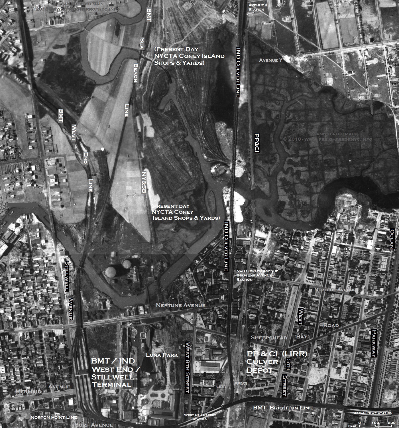 1924 Fairchild Aerial Survey Photo courtesy of New York City Department of Information, Technology & Telecommunications annotated by author added 11 July 2018 map to right:
June 11, 1904 Street Railway Journal Google Books added 11 July 2018 |
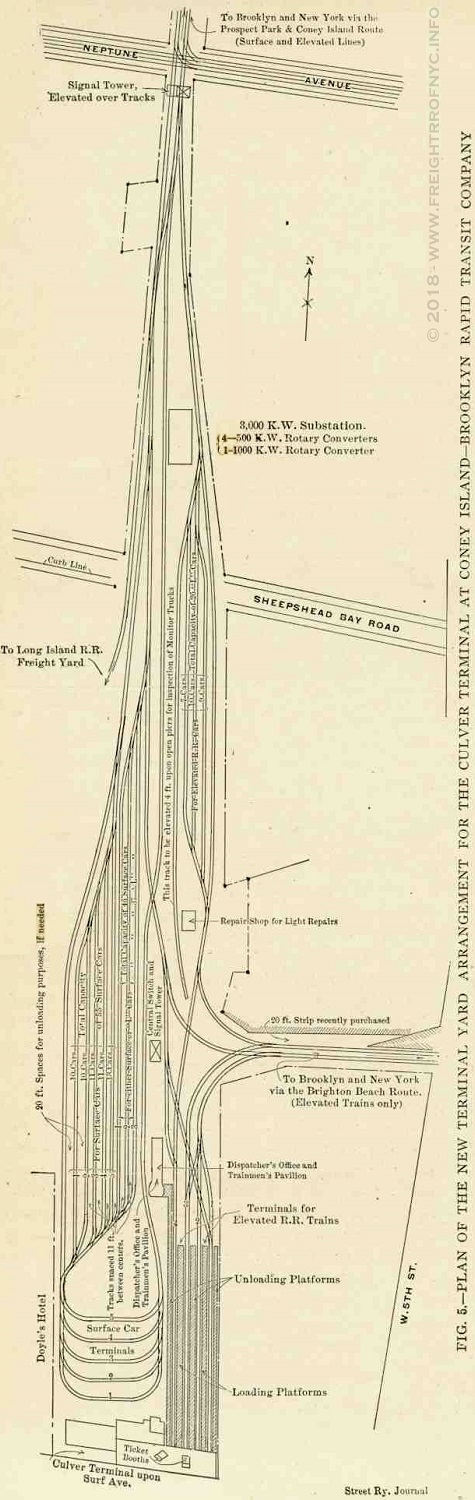 |
When completed in 1920, the BMT "Culver" elevated line and (now the present ) would come to dissect the Prospect Park & Coney Island Railroad's Culver Yard in Coney Island.
| As originally built, the
Prospect Park & Coney Island Railroad right of way (and with it the
route that South Brooklyn Railway followed) veered a bit to the east at
Avenue X and Gravesend Avenue and came out from under the Culver
elevated structure. The Culver El remained on Shell Road, but the trolley route took it through the area on its own private right of way, through undeveloped land and tidal marsh back in those days. Upon reaching the Coney Island Creek, and it was built upon fill with a small trestle crossing the Coney Island Creek. This scene in the image at right falls geographically in the vicinity of Colby Court just north of Shore Parkway. This little bit of geography and history has been obliterated, as Coney Island Creek now ends at Shell Road. |
|
|
The Coney Island Creek and its tidelands, from Shell Road all the way to Shore Boulevard by the west end of Sheepshead Bay; had been steadily filled partially due to urban expansion of central Brooklyn, and a location was need for the dumping of excavated material from small hills that were flattened; but dumping was also in part in due to the construction of Shore Parkway (also known as the "Belt Parkway") which began in 1934, and to expand this area. Basically, the early development of Brooklyn geography was "take dirt from here and move it there."
Upon the construction of Shore Parkway / Belt Parkway, and as the tidal marshes were filled in to the east of Shell Road and the land earmarked for residential development, the private trolley right of way was "in the way." It would be realigned a few hundred feet to the west to follow the Shell Road right of way (and which would continue under the Culver el for another few blocks south).
This was shortly followed by the extensive construction of residential housing in the adjacent areas.
| Location List | Main Index |
.
Also, at the intersection of Gravesend Avenue (to become McDonald Avenue in 1931) and south of Avenue X, the name of the changes to Shell Road. And, upon being built in 1926, the southwest corner of this intersection begins the Coney Island Shops of the New York City Transit Authority.
The McDonald Avenue / Shell Road running tracks veer a little to accommodate the wider thoroughfare which allowed for the inclusion of a traffic island.
R10's (and a transition car) on Shell Road at Avenue X heading southbound to Coney Island Yard - ca. 1948
D. Klepper photo
added 22 September 2026
.
.
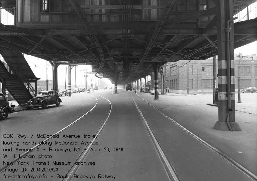
Looking south along McDonald Avenue at Avenue X - April 20, 1948
This side of intersection is McDonald Avenue - the other is Shell Road.
The brick building is the NYCTA e.lectrical equipment shop
W. H. Lundin photo
New York Transit Museum archives
Image ID: 2004.20.9.623
added 21 September 2026
.
.
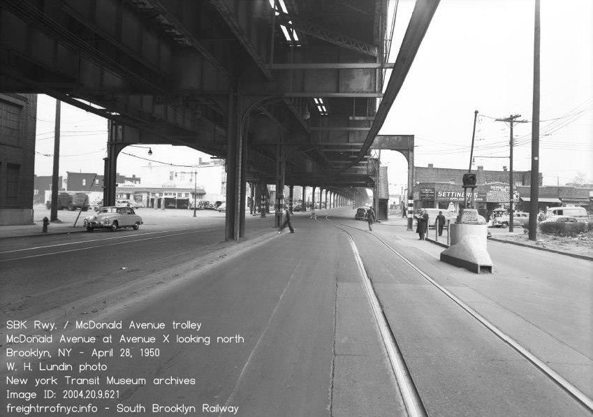
Looking north along Shell Road at Avenue X - April 28, 1950
This side of intersection is Shell Road - the other is McDonald Avenue.
W. H. Lundin photo
New York Transit Museum archives
Image ID: 2004.20.9.621
added 21 September 2026
.
At some point between the construction and opening of the Coney Island Yards & Shops in 1926 and 1929, the South Brooklyn Railway relocated to this location.
By the publication of the 1929 edition of the E. Belcher Hyde Property Maps; the BMT Coney Island Yards are shown. But more importantly, a subyard is shown connected to the Shell Road street trackage. And this would become the South Brooklyn Railway Culver Yard, if it is not already. I have also seen it referenced as the "City Yard".
While a great deal of traction and Brooklyn industrial railroad enthusiasts are more than familiar with the SBK's freight operation at the west end (38th Street, First Avene) and Greenwood Industrial sidings), there is little recollection for this location.
Sure, the images of SBK locomotives hauling subway cars into Coney Island Yard leads are famous, the freight station adjacent to it was hardy noticed. Even in Facebook groups, the "new generation" of fans "there was no South Brooklyn Railway freight depot in Coney Island Yard. It was all by 37th Street.." After I post a "WADR, I beg to differ"... and drop this images; shortly following is a mea culpa "I never knew."
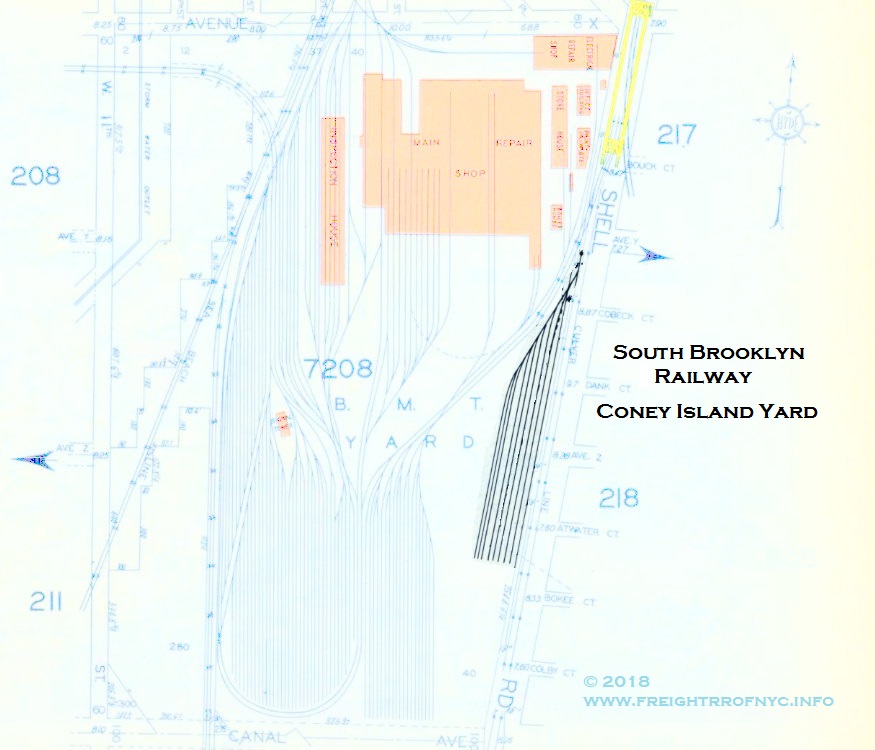
1929 E. Belcher Hyde Property Map
courtesy of Historic Map Works
annotated version ©2018 by author
added 11 July 2018
.
.
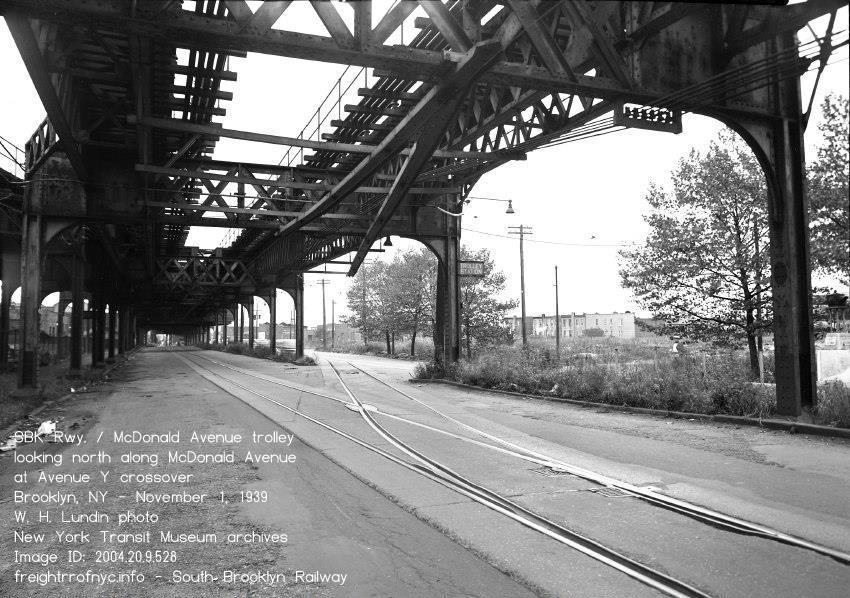
Looking north along Shell Road at Avenue Y - November 1, 1939
Here the southbound running track splits and the crossover to the
northbound running track veers to the east a little, until reaching
Avenue X.,
at which point it resumes running side by side with the other running track.
W. H. Lundin photo
New York Transit Museum archives
Image ID: 2004.20.9.528
added 21 September 2026
.
.
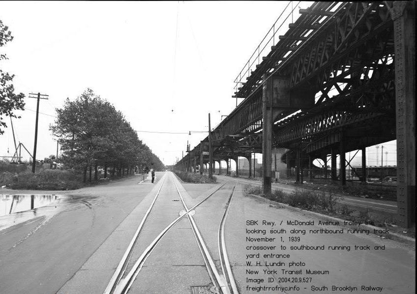
.
.
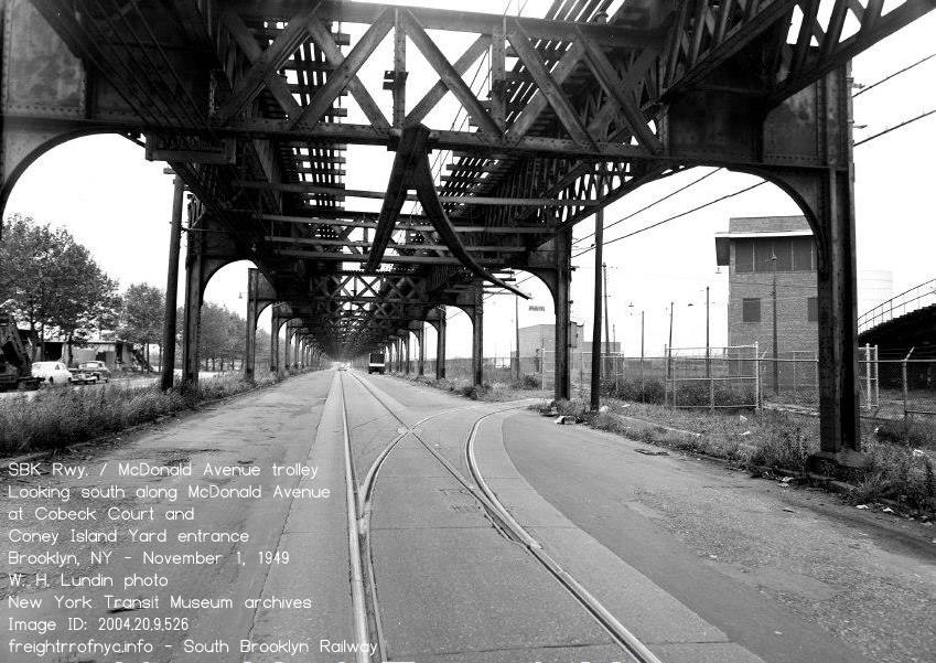
Looking
south along Shell Road and southbound trolley track at Coney Island
Yard entrance gate for South Brooklyn Railway - November 1, 1949
Tower
C is on right side of image, with cluver ramp decending from the Culver
Elevated down to the Coney Island Yard at ground level.
W. H. Lundin photo
New York Transit Museum archives
Image ID: 2004.20.9.526
added 21 September 2026
.
.
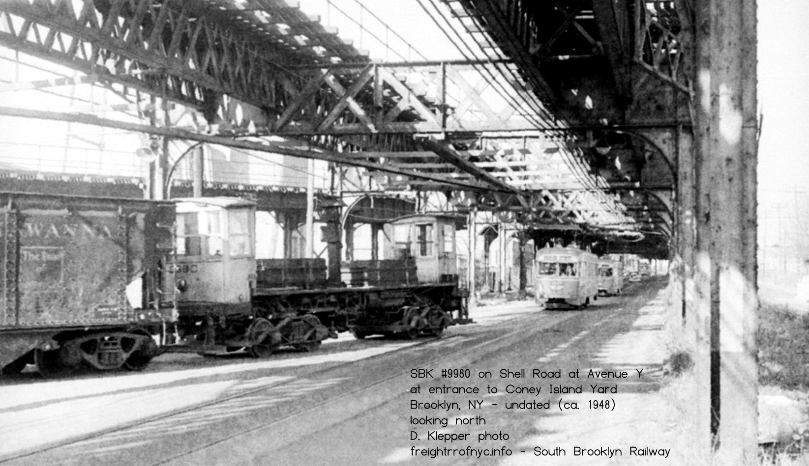
Looking north along Shell Road and southbound trolley track with #9980 trailing train (unpowered)
at Coney Island
Yard entrance gate for South Brooklyn Railway - ca. 1948
Side note: this is the first image where the author has seen #9980 this
far south. All other images have it Fourth Avenue or west.
D. Klepper photo
added 22 September 2026
.
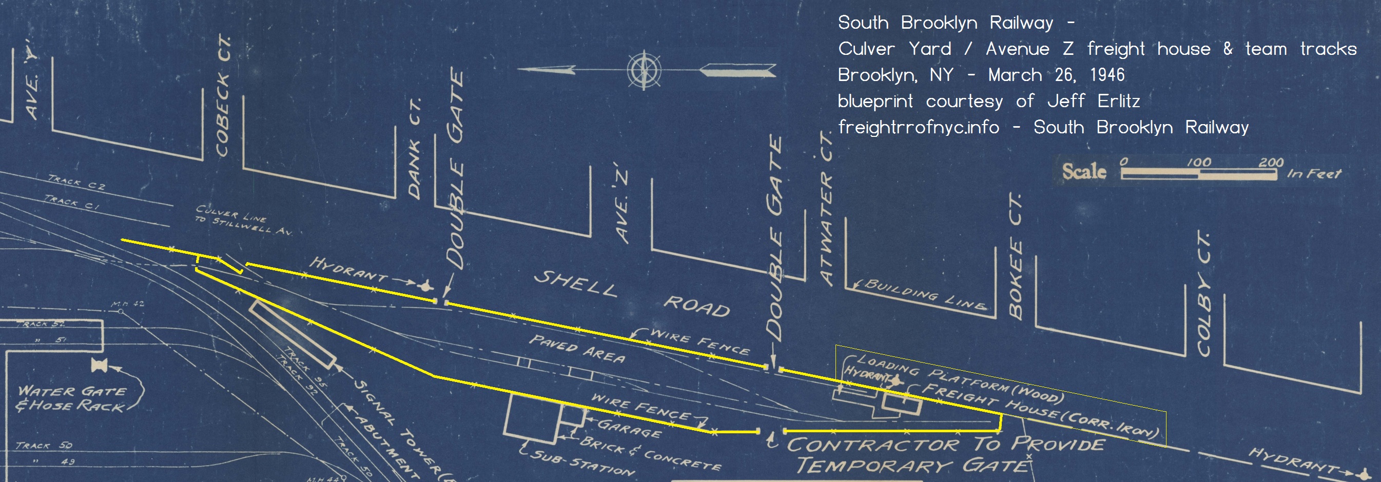
South Brooklyn Railway - Culver Yard / Avenue Z freight station & team tracks.
excerpt of New York City Transit System - March 26, 1946
Coney Island Yard - BMT Division Brooklyn
Site for disposal of r.r. cars - Contract Drawing Map A3
courtesy of J. Erlitz
added 26 September 2026
In this next image, the 1951 Aero Service Corp Aerial Photo; we can see the Coney Island Shops and Yards and where the SBK would have its southern terminal. We can also compare the topography of the area, namely the filling in of the tidal marshes and the truncation of the Coney Island Creek allowing the Coney Island Shops to be built.
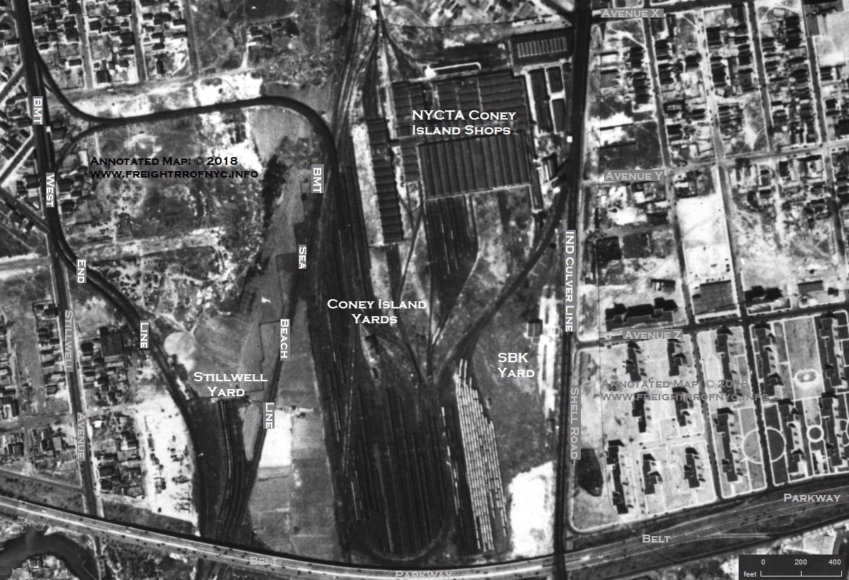
1951 Aero Service Corp Aerial Photo
annotated by author
added 11 July 2018
..
.
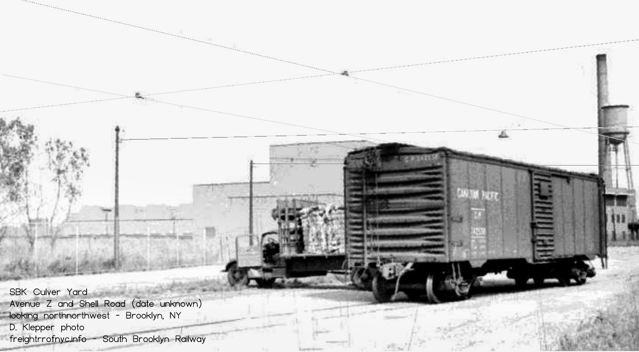
team track use inside SBK "Culver Yard" along Shell Road between Avenue Y and Avenue Z - ca. 1948
Looking north.
D. Klepper photo
added 21 September 2026
.
.
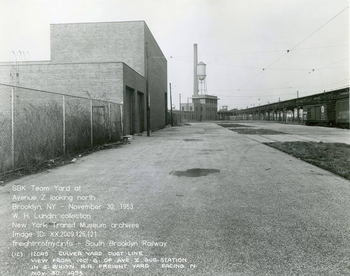
Looking north inside SBK Team Yard along Shell Road between Avenue Y and Avenue Z - November 30, 1953
Coney Island behind photographer
Avenue Z conduit & breaker room on left, Tower C directly in front on photographer in background.
Coney Island Yard over fence to left.
W. H. Lundin photo
New York Transit Museum archives
Image ID: XX.2009.125.121
added 21 September 2026
.
.
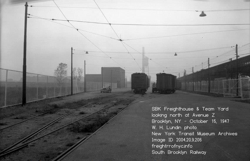
Looking north inside SBK Team Yard along Shell Road at Avenue Z entrance gate - October 15, 1947
Avenue Z to right, Coney Island behind
Avenue Z conduit & breaker room on left, Tower C directly in front of photographer in background.
Coney Island Yard over fence to left.
W. H. Lundin photo
New York Transit Museum archives
Image ID: 2004.20.9.206
added 21 September 2026
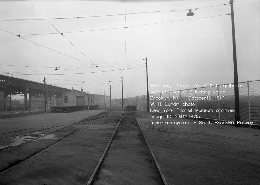
Looking south inside SBK Team Yard at freight house and forwading firm (Wm. Pinsker) - October 15, 1947
Shell Road and Avenue Z entrance gate out of view to left.
Coney Island Yard over fence to right
W. H. Lundin photo
New York Transit Museum archives
Image ID: 2004.20.9.207
added 21 September 2026
.
.
Once the South Brooklyn Railway train has entered their yard and passed over turnout #3, this turnout would be thrown and the train would reverse direction and proceed north into the Coney Island Shop trackage. This "switchback" maneuver is shown in the left image below.
Please take note: the track work of the South Brooklyn Railway Yard seen in the left image was partially "reconstructed" from examining a 1954 aerial photo seen on historicaerials.com. It appears a significant amount of trackage was "in the dirt" and barely viewable, so the possibility of more trackage at this location exists.
In the right image below, the original South Brooklyn Railway yard lead track into the Coney Island Shop track can be seen, and it is represented by the number 4 in the diagram at left. The resurfacing of Shell Road and subsequent reconstruction and expansion of the Coney Island Facility, made this location in the photo the ad hoc end of track.
|
|
|
|
"switchback" track arrangement for |
.
.
One of the more significant movements of the South Brooklyn Railway to the Coney Island Shops, was the U. S. Department of Transportations "State Of The Art Car" heavy rail mass transit demonstrator set. Built by St. Louis Car Company, and after testing at the DOT's High Speed Ground Test Center in Pueblo, Colorado, the SOAC set was demonstrated on six rapid transit systems throughout five cities in the United States, to include additional testing and public ridership and response. The first of these cities was to be New York City.
Each of the cars had different seating configurations for study; low density and high density. The high density car had transverse and longitudinal seating with a total seated capactiy of 72, allowing more standing passengers and this allowed a total of 300 poassengers total. The low density car has 62 seats in three sections: one with transverse seating (like MetroNorth or Long Island Rail Road), the second with a mix of seat types and the third section a mix of seat arrangements and two tables. Both cars were 'A' cars with operators cabs at the ends, so the set could be operate in either direction.
The SOAC Cars and two transition cars (converted gondolas) at each end with a coupler for the SOAC set on one end and MCB coupler on the other end to allow conventional locomotives to tow the set to the next demonstration location.
The SOAC cars and transition cars were carfloated from Greenville, NJ into Bush Terminal by New York Dock Railway, then interchanged with the South Brooklyn Railway at 38th Street and Second Avenue Yard, and the SBK which brought them to the Coney Island Shops for inspection and preparation for service on the NYCTA Rapid Transit (Subway) system.
Revenue service began on May 17, 1974 and would operate on the A, D, E and N lines with the two car set restricted to Independent Division (IND) routes. Demonstration was completed on July 19 of the same year, and the two car set and transition car (a converted gondola) were shipped out the way they came in to the next city. These cars survive and are located at the Seashore Trolley Museum in Kennebunkport, ME.
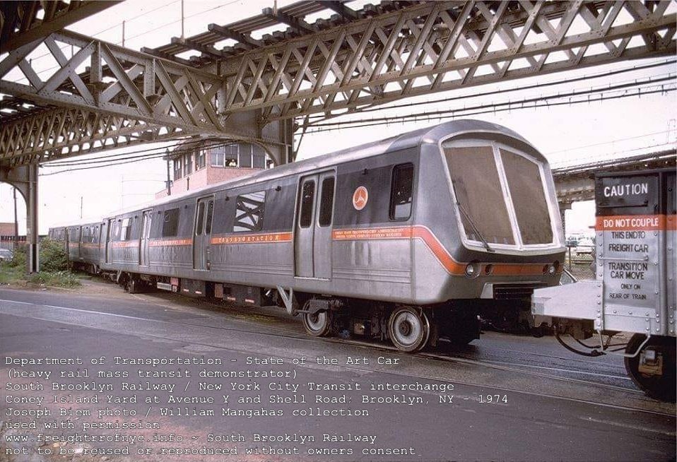
| Greenwood Industrial Sidings List | Location List | Main Index |
.
17) Bedford Car Load Freight Station
.
On 10 July 2010, I was doing research for the Union Inland Freight Station in Manhattan. I took out my 1943 Map of Railroad & Terminal Facilities in the Port of New York, and after referencing the Union Inland Freight Station, I began to "explore".
I took note of a solitary facility way out in the middle of Bushwick, Brooklyn. It shows simply "Bedford, S. Bklyn" and the location is noted as being Car Load Delivery. The problem here is, there is no trackage to this location!
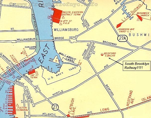
1943 Map of Railroad & Terminal Facilities in the
Port of New York
authors collection
added 10 July 2010
.
When this page was first composed; there was no reference to this location anywhere else and as far as I had researched. At that time, I could only come to the following hypothesis as to the purpose of this location:
|
1) it was served by electric streetcar, or |
Research conducted in 2018, revealed some interesting information on this location. As it would happen, this location was the premises of Arabol Manufacturing at 56 Nostrand Avenue, Brooklyn, NY.
Upon reading a very lengthy testimony transcript contained within the Notice of Appeals for the Appellate Division of the New York Supreme Court; Brooklyn Heights Railroad v. Alfred Steers dated March 1912, it was revealed that the Arabol Manufacturing Company acted as freight agent (as well as being a customer themselves) for several local businesses in conjunction with the South Brooklyn Railway.
According to photographs contained in the exhibits, this location had a sign "Bedford Freight Station - South Brooklyn Railway" and businesses that utilized this "freight station" include Amid Duron (located in the same building with Amadol), Charles Froeb (wholesale distributor of wines & liquors) and J. W. Oelerich (food packaging).
Upon reading this transcript, it appears this Mr. Steers had brought suit against the South Brooklyn Railway / Brooklyn Heights Railroad for blocking the sidewalk with freight cars on a spur that ran into the Amadol property. It is both sad and refreshing to see that "NIMBYism" dates way back and is not particular to this modern era of litigiousness!
So at least we now know something about this Bedford Freight Station and are slightly relieved that we were correct with out first option above.
And, I think it can be safely concluded that service to this location would have concluded with the cessation of streetcar traffic.
.
.
.
.
| Location List | Main Index |
.
..
Most Brooklyn railroading enthusiasts are already aware that a vast majority of the South Brooklyn Railway trackage - 4.5 miles worth: south of Fort Hamilton Parkway to Coney Island Yard; was taken out of service February 1, 1978.
Out of a railroad that operates only 6 miles of trackage, this was a huge bite. Granted, the only customer remaining on this segment was the NYCTA Coney Island Yard, at the extreme south end. The coal dealers along the route either switched to home heating oil, or natural gas (the Texas Eastern pipeline which opened in 1955 was instrumental in this) or closed period.
Other industries at the very least, were turning to interstate trucking. All the railroads were losing to this growing method of freight transportation. By 1978, there were only two "non-NYCTA customers": those being Davidson Pipe at Third Avenue and Roberts Foods at 37th Street and Fort Hamilton Parkway.
While the February 1978 embargo and subsequent 1980 abandonment of the rest of the line has not have received its fair share of coverage, and there are details that have gone unknown until now. Most rail enthusiast accounts simply end at the 1978 date.
But there was life after this date for the South Brooklyn Railway, and we shall get to that shortly.
After several Freedom of Information Act requests over the past decade or so, the author was fortunate to finally receive copies of several documents forwarded to him.
The first of these documents, including the resultant memos to and from various officers of the NYCTA;
.
This report, spelled out the potential shutdown of the South Brooklyn Railway's freight operations - particularly those east of Ninth Avenue.
In
a proposal drafted May 12, 1980, there were but six employees (one
freight manager, one administrative assistant and four crew members) of the South Brooklyn Railway.
There were three customers remaining and being served by the South
Brooklyn Railway:
"would not be willing to purchase and property or equipment."
a) Because the necessary freight moves to Roberts Foods required "wrong-railing" (train movement against the regular flow of subway traffic) the necessary safety measures had to be installed on
New York Dock's locomotives, (trip cocks for the signal stop arms) unless New York Dock purchased South Brooklyn Railway locomotives N1 and N2 (which were only 6 years old as of this
date);
b) Even if New York Dock Railway were to change their mind and purchase the South Brooklyn Railway locomotives, the charter of the New York City Transit Authority prevented an outside,
privately held operation from operating on subway trackage; hence why the South Brooklyn Railway was kept in operation: it was a subsidiary of the NYCTA.
"The question arises, do we want trains, without protective tripping devices, manned by crews under the jurisdiction of an outside agency, operate and make complex moves on tracks used for passenger service? The Rapid Transit Transportation Department feels this is a totally unacceptable risk.
.
.
"Reference is made to your request for comments on the above proposal, the Power Department has in the recent past made a comprehensive investigation of electrolysis in the McDonald Avenue - Avenue T and Ave I areas.
This investigation determined that substantial current was flowing on the rails along McDonald Avenue.
This current was flowing in both directions; additionally, it was found that the resistance between the elevated structure and the surface rails was low.
The exact contact point(s) could not be identified. This "large" situation coincides with the number of faults on two Power High Tension Cables running parallel with the rails and out to Brighton - West 8th Street Substation.
There is evidence that these rails are a conduit for return current going from Coney Island Yard to Avenue T substation.
It is believed that this problem cannot be solved by cutting the rails at certain points to isolate and eliminate the flow of current from the structure. There appears to be too many areas of contact between the rails and the structure."
Therefore the Power Department recommends that the rails be removed from the roadbed and be replaced with a foundation of concrete and a topping of asphalt. Is it further recommended that consideration be given to resorting to a scrap contract to have the work done at little or no expense to the South Brooklyn Railway.
Track Conditions at Second Avenue / Bush Junction
At the expense of my saying "I told you so," we now have documentation of why freight and subway cars were derailing at Bush Junction. All cars, not just subway cars.
And again; no, it wasn't because the radius of the curve was too tight as "railfan lore" has stated.
This document, from A. DeLuca, Freight Traffic Manager, South Brooklyn Railway; to C. Kalkhof, Vice President and General Manager, Rapid Transit and dated January 15, 1982:
Subject: Second Avenue Track Area
Subject matter has deteriorated to an extent where derailments by the New York Dock Railway occur on each interchange of cars. In some track areas, guard rails is non-existent and wide gauges prevail creating dangerous conditions.
Unless the City or State grant funding for rehabilitation, the South Brooklyn Railway will shorty [sic] cease to be viable railroad.
I am continually subjected to complaints and threats of embargoes from the New York Dock Railway Company due to track condition. Spoke to Mr. Tony Riccio and advised him of the seriousness of the situation. He informed me that a meeting was scheduled between his office and representatives of the New York State Department of Transportation. I once again stressed the urgency for some positive action by either the City or the State.
Should any program be formalized by private contractor and the Transit Authority which would include the utilization of 2nd Avenue tracks, under present conditions I would strongly urge that program find another location.
I will be on top of this situation and any changes for the better will be reported to your offices.
Field Report
Reason for Inspection / Field Survey
A visual inspection of the track. While being conducted on a tour thereof by A. DeLuca, Freight Traffic Manager, South Brooklyn Railroad.
Observations:
(i) The guard portion of many lengths of girder (trolley) rails is missing, having corroding away and been broken across the entire top of the rail from field side to gauge side,
(ii) Some rails have corroded across the entire top of the rail from field to gauge side.
(iii) Some of the rails are twisted outwards, thus widening the gauge to intolerable dimensions
(iv) The gauge side of the rails varies sharply in horizontal alignment at various rail joints where (iii) above exists
(v) The switch-point of the turn-out to the Yard is loose and well nigh inoperable.
(vi) As a consequence of all the above there have been repeated derailments of trains much to the embarrassment of South Brooklyn Railroad and the unbearable inconvenience of its customers
"This refers to the memorandum dated January 5, 1952, from A. DeLuca, Freight Traffic Manager, South Brooklyn Railway, and our memorandum dated April 23, 1981, to you on the subject trackage .
The trackage on Second Avenue, between 28th and 41st Street is presently owned by the City of New York .
The tracks were inspected on January 7, 1982, by engineers from this department in the company of Andrew DeLuca, to determine the degree of deterioration and to come up with a cost estimate for corrective action.
Corrective action, within the limits of 38th and 41st Streets, is required on the north bound track, which is the only track in use, to keep it operative for the next three to four years, after which time, according to Mr. DeLuca, traffic will be rerouted through First Avenue.
The cost of this rehabilitation work by T. A. forces, based on work being performed on overtime, so as not to disrupt the normal maintenance schedules, is estimated at $275,000.
One of the switch points of the turnout, leadinq from Second Avenue into the South Brooklyn lower yard was changed on Saturday, January 9, 1982, by T.A. personnel, using a modified point."
.
Condition Survey - March 22, 1989
Another highly detailed document is this written survey of the track conditions from the eastside sidewalk of Third Avenue through to the Yard at Second Avenue.
We all know the SBK infrequently used the line - and we all know how dated it was. But this survey reflects how poor the trackage was west of Third Avenue.
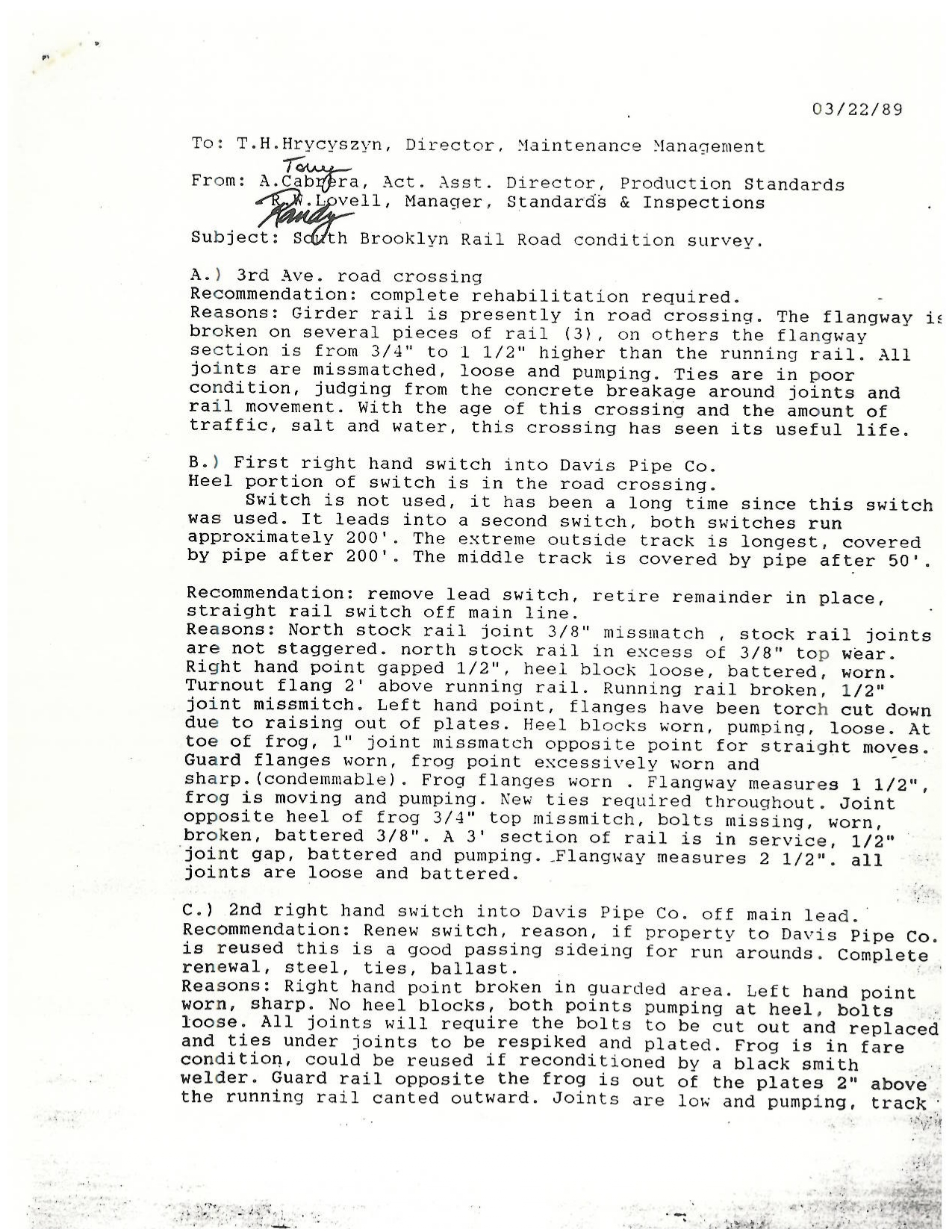 |
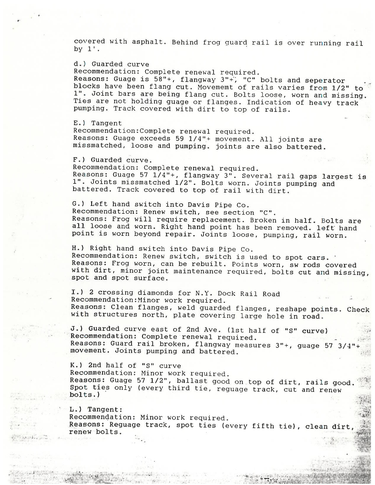 |
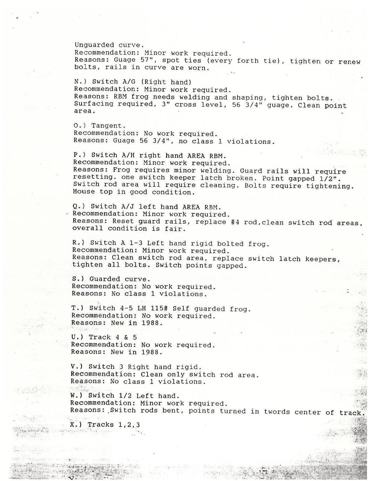 |
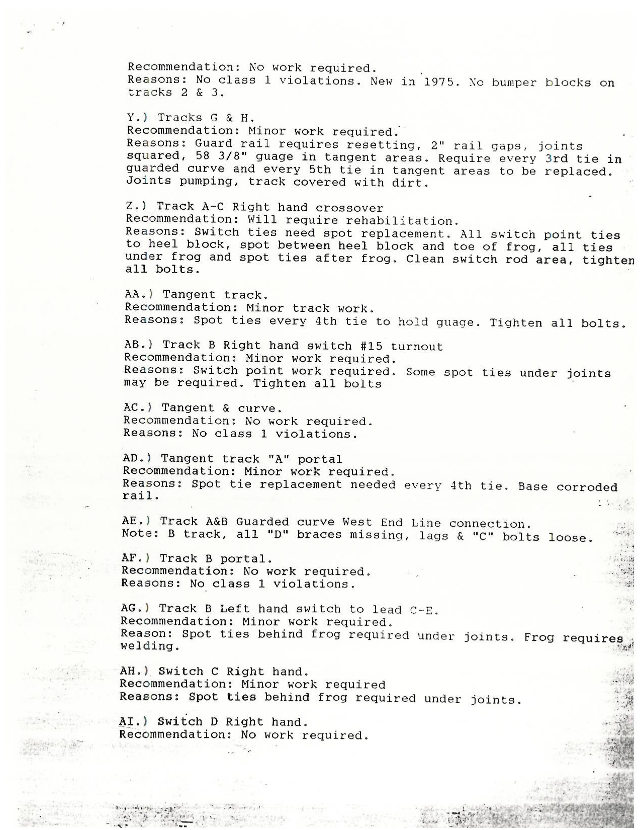 |
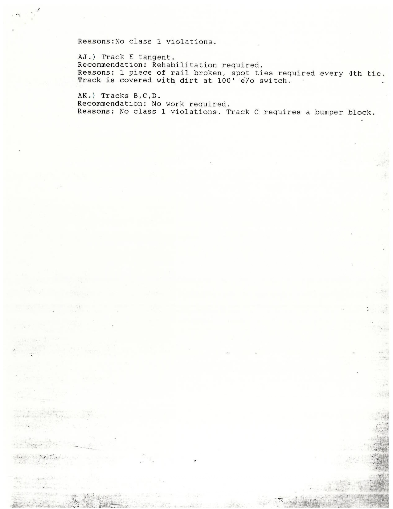 |
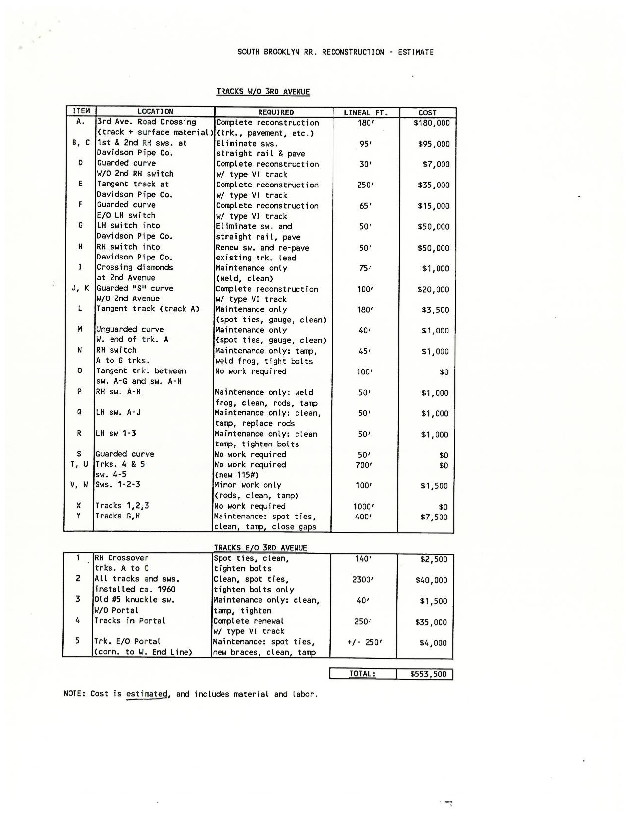 |
.
| Main Index |
.
Please note: For this chapter, more recent events are listed first.
.
This update is long overdue, and I apologize to my loyal readers for my lack of timely attention.
Since 1994, and with the closing of the Davidson Pipe Yard between Second and Third Avenues, the South Brooklyn Railway has had no other general freight customers other than the New York City Transit Authority; if you could even call the NYCTA "a customer". It is, for all intents and purposes; the parent organization for the South Brooklyn Railway.
As the freight subsidiary to the New York City Transit Authority, the SBK (as an operation) has not hauled new inbound subway cars or outbound obsolete subway cars for scrapping or rebuilding to or from either Bush Terminal Yard (or the NYCTA East New York Shops via the LIRR Bay Ridge Branch) for long period of time, leaving the South Brooklyn Railway theoretically a "paper only" operation.
For a great deal of time, all new subway cars arrived via highway upon lowboy trailer / tractor trailer and over the George Washington Bridge.
Unless
other new subway equipment is scheduled to arrive via New York New
Jersey Rails'
carfloats, or via New York & Atlantic Railway at 65th Street; the
South Brooklyn Railway has no work other than internally with the NYCTA
System, and its two
locomotives N1 and N2 now are assigned to work alongside the myriad of other work equipment of the
NYCTA.
Sadly, their unique maroon and silver paint was
fading and
peeled, and it was uncertain if due to their age if they were even worth the NYCTA in repainting
them in
distinctive SBK colors. The GE 47 tonners quite simply, are tired. They were built in
1975, and have
been rebuilt at least once since then.
It was believed, more likely than not, what with the arrival of the new R156's, they would be retired. But, if there is any justice in the world - and someone of authority in the NYCTA reads this; please save one (or both!) and keep it with SBK steeplecabs #6 & 7 in Coney Island Yard!
That aside, what does the future hold for the South Brooklyn Railway? This is a good question and without a definitive answer. Until now.
Please note - from here events will be listed most recent first.
.
N1 & N2 rebuilt, repainted - 2024
Someone listened, for N1 and N2 received new Tier 4 emissions compliant prime movers - I believe they are Cummins QSK models, but this needs confirmation. So, at the very least, N1 and N2 will be with us for a while longer.
They were however repainted into the now standard C Division
yellow livery, with green safety stripes (to denote they are low
emissions hybrid work trains and / or battery-electric locomotives
introduced in recent minimize underground emissions during track
maintenance. The only "classic touch" is they wear the old two tone  logo, and not the current
  ..
..
.
Petition to have Ben Schaeffer's name applied to one of the locomotives in honor
There was a petition circulating that one of the locomotives should carry Ben Schaeffer's name in memoriam and to honor his untimely passing the day after his birthday; on April 28, 2020. Ben is one of the first New York City Transit employee fatalities from CoVid-19. I don't think this petition garned enough signatures, but regardless; it should be done to honor Ben - a stalwart long time Transit employee, with several commendations for heroism on the job. Also consider that Ben was solicited by John Johnson, NYCTA management; to create a logo for South Brooklyn Railway, to which he did so.
After all, the NYCTA has its own sign shop - what would it cost to create and affix vinyl lettering?
.Inbound Traffic:
Various new non-revenue MOW equipment, as well as new revenue R211T's passenger cars are arriving for the NYCTA, and it cannot be said the South Brooklyn Railway doesn't see service!
There is one caveat: disappointingly locomotives N1 and N2 are no longer assigned to their home trackage, so other NYCTA work locomotives of the equipment pool are hauling the equipment from and to the Second Avenue interchange. Well, at least the SBK trackage is still seeing use!
New inbound equipment is now arriving via two methods; either by:
.
|
Regards of arrival via either method, the new rolling stock was then offloaded onto tits own wheels at Second Avenue and 39th Street in the South Brooklyn Marine Terminal. Once offloaded, NYCTA work locomotives then brought the new equipment into the Transit System for inspection and testing at the appropriate facility Work equipment, and revenue passenger cars go to different facilities for final acceptance, prior to entering service. However, on November 25, 2025; the NYCTA opened their new Railcar Acceptance and Testing Facility located between Third and Fourth Avenues at 38th Street (the former SBK 38th Street Yard.) It is at this location that all new rolling stock undergoes preliminary inspection (for any damage incurred in transit) and testing; before being brought to the appropriate NYCTA shop, and prior to entering service. Note there is no third rail at this facility, and battery powered SWXe-50 Shuttlewagons are used for moving equipment and cars. image at right: MTA Railcar Acceptance & Testing Facility - May 4, 2026
38thstreet between Third and Fourth Avenues (former SBK 38th street Yard) John McCluskey photo added 09 July 2026 |
|
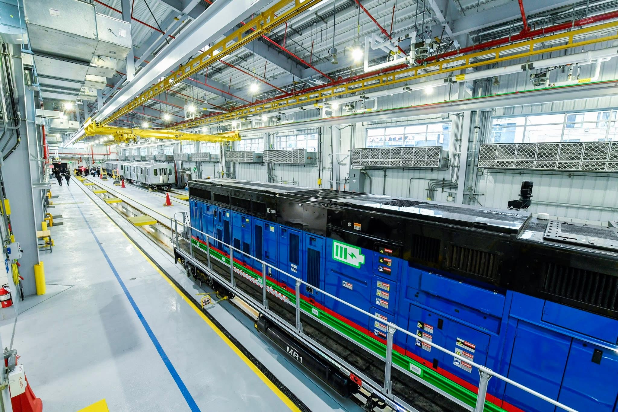 |
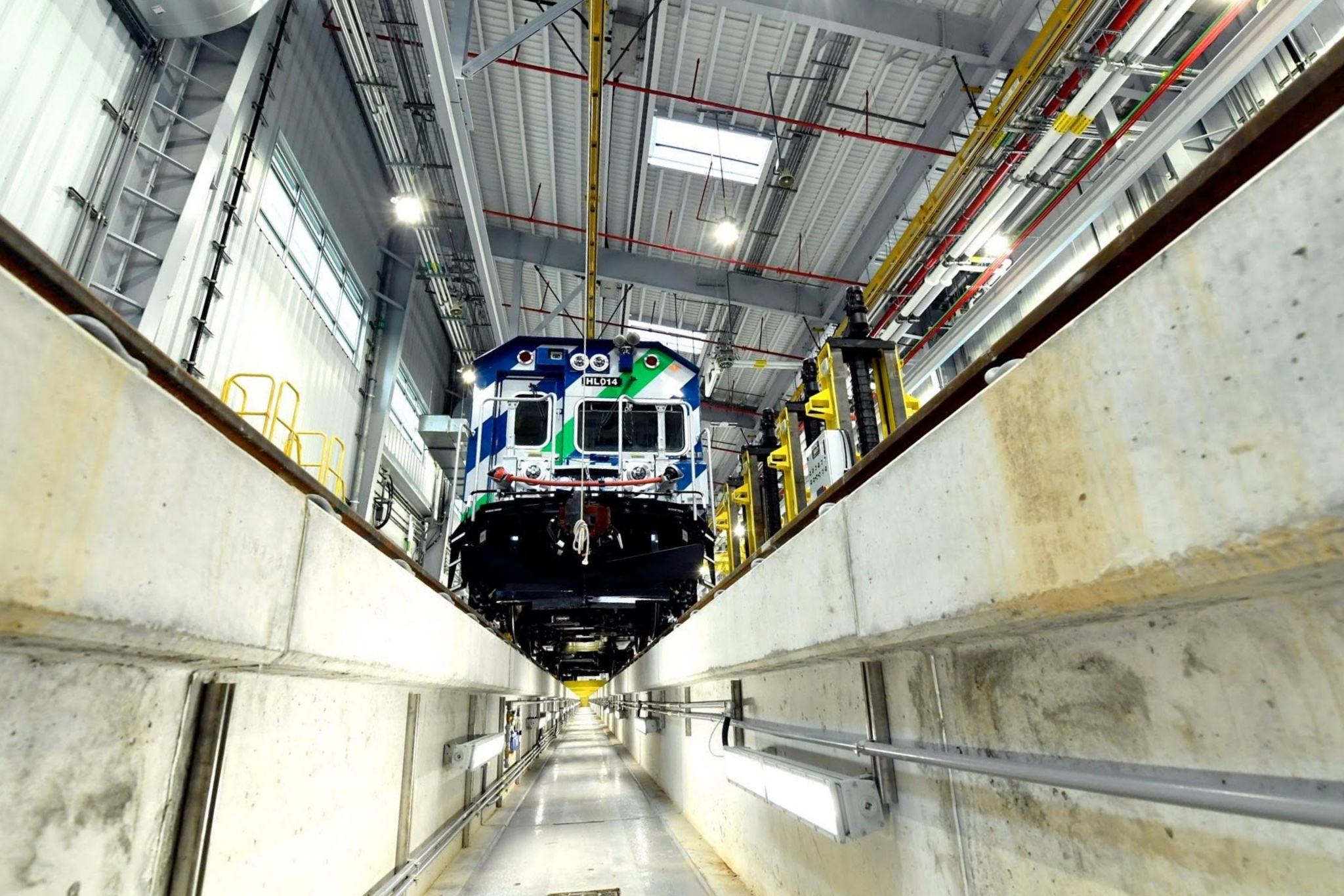 |
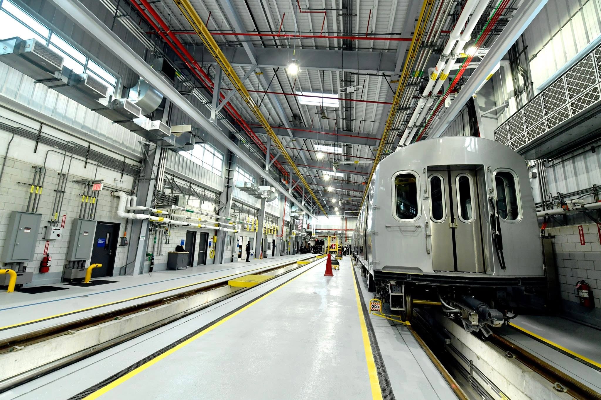 |
images above and to left: courtesy of the MTA added 09 July 2026 |
.
Outbound Traffic: 2022
After having served dutifully and reached the end of their service life; R32, R44 and R46 subway cars are being retired and sent out for scrap.
|
There are two methods were outgoing cars are being shipped; and this is dependent
on who received the contract for scrapping. For the R32's that required shipping to Frontier Metals, a scrapping and recycling outfit in Ohio; the NYCTA via the South Brooklyn Railway dropped the cars at the Second Avenue Interchange between First and Second Avenues. Here, they would be picked up by a NYNJ Rail locomotive and crew, and brought to the NYNJ Rail 65th Street Yard, via the First Avenue running track. Once at 65th Yard, the R32s were placed on the northern most trackage in the yard (former LIRR lumber tracks) out of the way from yard activity. The R32's would then be lifted off their trucks, and the car-bodies set on specially equipped flatcars (pedestal flats) for transit. A private contractor (not NYNJ Rail) completed the securing of the subway cars to the pedestals via chains and welding for the trip. Once this was completed, the cars were carfloated to Greenville, NJ; and sent on their way west.
|
|
For subway cars going to SIMs Metal Management (scrapping and recycling), the scrapper located in Jersey City, they remained on their wheels sets and hauled dead in tow. Since SIMs is located directly adjacent to the railyard at Greenville NJ, (the western terminus of NYNJ Rail carfloats) these subway cars could remain on their wheels for the very short journey.
.
(Most recent movements first).
.
In June of 2019, the first of the new R252 Contract MOW flatcars - OF801; began arriving. It appears to have arrived via highway on a low boy road trailer but was offloaded at the Second Avenue Interchange. (Why not directly at 38th Street Yard remains to be learned.)
The following link is to a video taken by "DJ Hammers", and is available on YouTube. Here NYCTA 897 [GE SL50] (with unique green and yellow safety stripes) arrived to haul it east to 36th Street Yard. How many more flatcars will arrive this way, remains to be seen.
Delivery of the first R252 Flatcar on the South Brooklyn Railway
| Main Index |
.
.
On May 1, 2012, the first locomotive in the 28 unit order for a new low emission Diesel-electric work locomotive that had been placed by New York City Transit / Metropolitan Transportation Authority was delivered to the NYCTA Linden Yard is Brooklyn., NY
The locomotive was transported on her own trucks, but loaded upon
an TTX Corp 64' specialty flat car HTTX #91796, and transported from
MotivePower Inc.; in Boise, Idaho. It should be noted that HTTX 91796 is a 64' flatcar
(which was specified by the NYCTA for delivery of these locomotives). This length
flat car (or lack there) of would come into play in a future delivery.
Two interesting tidbits, for this locomotive not SBK related:
John Dooley posted the following image confirming this locomotives arrival in Bush Terminal via New York New Jersey Rail carfloat and subsequent haulage down First Avenue to the NY&A / LIRR interchange at 65th Street / Bay Ridge: http://www.nycsubway.org/perl/show?133502.

First Avenue & 53rd Street, Brooklyn, NY - May 1, 2012
NYNJ Rail
#1133 w/ NYCTA OL912 enroute to 65th Street / Bay Ridge Yard interchange
with New York & Atlantic Rwy.
John Dooley photo
used with permission
added 03 May 2012
.
.
NYNJ Rail brought the locomotive into Brooklyn via carfloat at their 50th Street float bridge and hauled it along First Avenue, through the Brooklyn Army Terminal to the 65th Street / Bay Ridge Yard. Here it was interchanged with the New York & Atlantic Railway who picked it up in 65th Street / Bay Ridge Yard and made final delivery at NYCTA Linden Shops via the Bay Ridge Branch.
From there, South Brooklyn Railway locomotives N2, N1 and NYCTA rider car RD411 brought 0L912 through the BMT system to the NYCTA Coney Island Shops for final calibration and testing. Click on screenshot below to watch video:
SBK #N2, NYCTA #0L912, NYCTA Rider Car #RD411 and SBK
#N1
coming through DeKalb Avenue Station in Brooklyn, being push (N1) / pull
(N2) South Brooklyn Railway locomotives
video by Trevor Logan, all rights reserved. Used with
permission.
added 03 May 2012
.
.
A new unloading ramp was constructed and installed at Linden Shops to unload 0L912 from its flatcar. After 0L912 was unloaded, the unloading ramp was relocated from Linden Shops to the Third Avenue & 38th Street "Unloading" Yard by May 20, 2012. The new unloading ramp was placed where the old subway car unloading ramp once stood.
Before delivery of the next locomotive however (and as previously mentioned above), a notable event took place: the new interchange turnout between SBK and NYNJ Rail (now located at First Avenue and 39th Street) was tested January 2013 and activated. This "reconnection" allowed rail traffic to be directly interchanged between NYNJ Rail and the SBK once again and without involvement on the New York & Atlantic Railway.
0L913 arrives - February 7, 2013
The next locomotive to arrive: 0L913 arrived in Brooklyn on February 7, 2013. It too came in via carfloat by NYNJ Rail and was brought to Bush Terminal Yard. Here South Brooklyn Railway locomotives N1, N2, a transition car and a flatcar were dispatched to haul the 0L913 on its flatcar to the unloading ramp at Third Avenue and 38th Street, where 0L913 was then unloaded.
After unloading, the empty flat car was returned to NYNJ Rail. Incidentally and according to Ben Schaeffer, that flat car has the honor of being the last interchanged freight car to cross Third Avenue on the South Brooklyn Railway as of the June 2018 update to this website.
.
0L914 arrives (twice!) - March 21, 2013
On March 21, 2013, the third locomotive of the order: 0L914 arrived. And here was where a problem arose. Remember in previous chapters above it being mentioned that the locomotives were specified to be shipped on 64' flatcars?
Well, 0L914 came in on a 89 footer XTTX 14278 due to the unavailability of a 64 footer. NYNJ Rail unloaded the flatcar from the carfloat with the locomotive on it and brought it to Bush Terminal Yard, where a NYCTA crew was waiting to take delivery using two standard R52 TA work locomotives [GE 45ton]: #77 and 76 (and not SBK N1 or N2) as well as two idler flatcars: OF616 and OF609.
The load was spotted by NYNJ Rail, the NYCTA crew coupled onto the load and away they went, enroute to the unloading ramp at Third Avenue and 38th Yard. Lo and behold, the flatcar would not navigate the curve approaching Third Avenue! And this being on the fairly recently installed (ca. 1995) trackage around Costco property perimeter... This new trackage was designed and tested to handle 75' subway cars, and it was not anticipated that very long modern freight cars would need to traverse the line.
Upon this discovery, the NYCTA crew calls the NYCTA MOW Department, who rushed
over to the Third Avenue and 38th St "Unloading" Yard, disassembled the new unloading ramp,
transported it (disassembled) to NYNJ Rail's Bush Terminal Yard and reassembled it.
Once that was accomplished, the NYCTA train crew returned to Bush Terminal
Yard with the flatcar and locomotive load and they proceed to unload
it. And thanks to this, 0L914 would become the first new R156 to be "delivered" on its
own wheels via the South Brooklyn Railway!
It was
at this time that the powers that be wisely decided it would be best to
keep unloading the subsequent locomotive deliveries at Bush Terminal
Yard, and thereby eliminating the possibility of a repeat of this situation as well as the necessity of having the
following locomotives shipped only on 64' flatcars.
We are fortunate to now share a video of this particular move. The video was filmed by Zack Summer and posted on YouTube:
.
| Main Index |
.
LIRR caboose C60 move by South
Brooklyn Railway - April 4/5, 2009
.
On April 4, 2009; the Twin Forks Chapter of the National Railway Historic Society lent their recently restored Long Island Rail Road N22a "C60" caboose to the New York City Transit Museum located in downtown Brooklyn.
The New York City Transit Authority's Transit Museum held an exhibit: "The Route of the Dashing Commuter: The Long Island Rail Road at 175" (celebrating the 175th anniversary of the LIRR - and this exhibit ends at the end of March 2010).
The Long Island Rail Road handled transportation of C60 from Twin Fork's Riverhead, Long Island location to New York & Atlantic Railway's Fresh Pond Yard. From there New York & Atlantic Railway took the caboose to the NYCTA's Linden Avenue Shops in East New York.
However, the South Brooklyn Railway handled the rest of the move from that location to the Transit Authority's 207th Street Yard in the Inwood neighborhood of Manhattan, as C60 needed final preparation for display in the Transit Museum.
The following is an itinerary of the move:
Long Island Rail Road / New York & Atlantic
Railway:
April 4, 2009 - 6:00 am - 8:00 pm
14 hours time in transit
Due to LIRR speed restriction of 15 mph along entire route. This special
move also was required to take a siding to allow revenue trains to
pass.
.
Long Island RR picked up the LIRR C60 caboose at Riverhead, LI at 6:00 am on April 4th, 2009
LIRR recrew at Hillside Support Facility, Hillside, Queens.
arrival at New York & Atlantic Railway Fresh Pond Yard at 7:00 pm with a change to NY&A motive power.
from NY&A Fresh Pond Yard to NYCTA Linden Shops, East New York, Brooklyn arriving at 8:00 pm.
South Brooklyn Railway:
April 4, 2009 - 10:30 pm / April 5, 2009
- 7:00 am,
9.5 hours time in transit
This move of LIRR C60 on NYCTA trackage was quite convoluted due to
trackwork,
forcing the South Brooklyn Railway to take the following route from Linden
Shops:
.
changeover to South Brooklyn Railway motive power at Linden Shops, East New York, Brooklyn.
2 hour layover for NYCTA prep work.
departing Linden Shops, Brooklyn at 10:30 pm to Manhattan via the Williamsburg Bridge,
south through Manhattan and back to Brooklyn via the Montague Street tunnel,
to 36th Street Yard, Sunset Park, Brooklyn (with South Brooklyn Railway recrew),
36th Street Yard to Coney Island Yard,
Coney Island Yard north to and over the Manhattan Bridge back into Manhattan,
continuing north in Manhattan and arriving at 207 St / Inwood, Manhattan at 7:00 am April 5th 2009.
The total time C60 spent in transit encompassed 25 hours, roughly 100 miles (of railroad travel), three railroads, and five counties: Suffolk, Nassau, Queens, Kings [Brooklyn] and New York [Manhattan].
The restoration of C60 and the subsequent move, and here are several outstanding photographs pertaining to the South Brooklyn Railway portion of the move:
LIRR C60 w/ SBK N2, NYCTA "rider car" RD411 and SBK
N1 in background.
April 4, 2009 - NYCTA Linden Shops, Brooklyn, NY
P. F. Strubeck
photo
added 24 Dec 2009
.
NYCTA "rider car" RD411 and SBK N1 - April 4, 2009
- NYCTA Linden Shops, Brooklyn, NY
P. F. Strubeck
photo
added 24 Dec 2009
.
SBK N2 (foreground) with NYCTA "rider car" RD411 and
SBK N1 - April 4, 2009 - NYCTA Linden Shops, Brooklyn, NY
P. F. Strubeck
photo
added 24 Dec 2009
.
SBK N2 & LIRR C60 - April 4, 2009 - NYCTA Linden
Shops, Brooklyn, NY
Note airline extension and coupler extension (which according to Paul Strubeck
it weighs approximately 200 pounds,
is over 75 years old and was originally from the Boston & Maine RR).
P. F. Strubeck
photo
added 24 Dec 2009
.
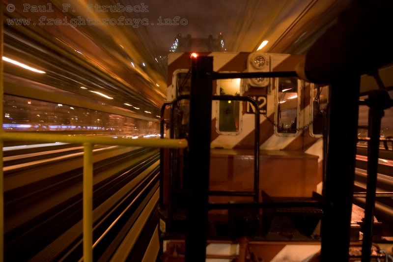
SBK N2 & LIRR C60 - April 4, 2009 - westbound on
the "BMT Jamaica / Broadway Line"; now NYCTA
 lines
lines
crossing the Williamsburg Bridge; East River, NY
P. F. Strubeck
photo
added 24 Dec 2009
.
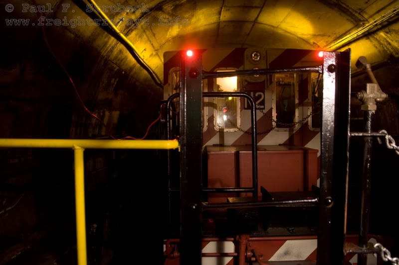
SBK N2 & LIRR C60 - April 4, 2009 - Subway Tunnel;
Manhattan, NY
P. F. Strubeck
photo
added 24 Dec 2009
.
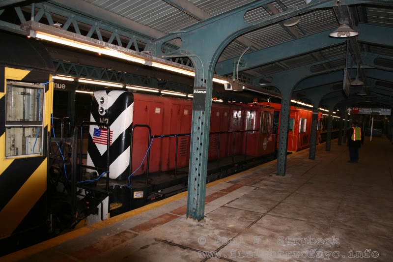
SBK N2 & LIRR C60 - April 4, 2009 - BMT "West End
Line" / now NYCTA
line - Ninth Avenue Station
Sunset Park, Brooklyn, NY
P. F. Strubeck
photo
added 24 Dec 2009
.
.
|
|
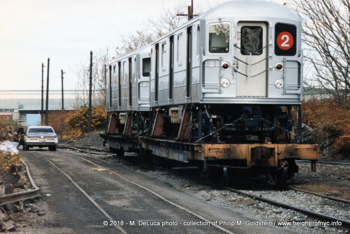 Bombardier R62A Subway Cars ('A' Division - IRT ) at 39th Street Yard (between
First and Second Avenues waiting to be brought to the 38th Street "Unloading" Yard.
Brooklyn, NY M. DeLuca photo collection of P. M. Goldstein / P. F. Strubeck added 02 July 2018 |
.
.
.
| Main Index |
.
Original Right Of Way
Remnants
.
On 26 January 2010, a long time friend and fellow New York rail enthusiast and myself traced the original route of the South Brooklyn Railway to commit as many of the remnants we could find to record before being completely obliterated.
We began our journey at the Coney Island Yards of the New York City Transit Authority. Unfortunately, shadows and a chain link fence make a good image difficult of the track that led out onto McDonald Avenue:
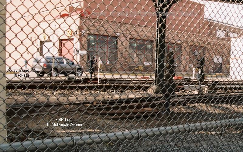
South Brooklyn Railway track (foreground) at Coney
Island Yard - January 26, 2010
authors photo
.
.
The next location north that we could locate and knew of, was that of the coal supplier located between Avenue S and Kings Highway. While the concrete coal silos were torn down many years ago, the ground floor entrance still remains as does tracks embedded in the sidewalk.
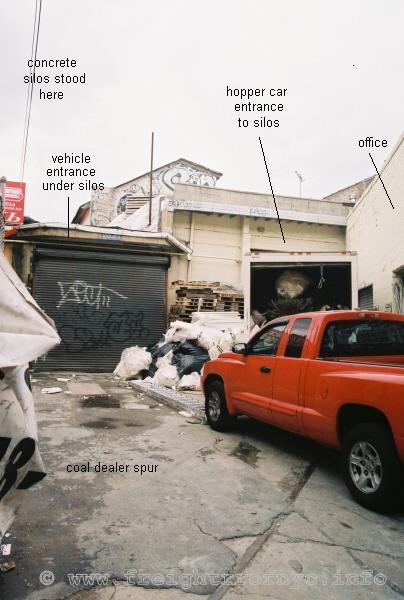
South Brooklyn Railway spur into former Flatbush Coal at Avenue
S and McDonald Avenue - January 26, 2010
authors photo
.
.
South Brooklyn Railway Spur into former Flatbush Coal at Avenue
S and McDonald Avenue - January 26, 2010
authors photo
.
.
Our next stop traveling north was Parkville Interchange. Nothing remains of the trackage, but the ironically the unique curved wall warehouse of Leeds Paper / Scheck Brothers was in the process of being demolished that very day! We were a little too late for the Scheck portion of the wall, but the Leeds wall was still standing. So, we took pictures. You can barely make out the curved wall at the middle of the left edge of the photo.
Oh, and that driveway is the former right of way connecting the South Brooklyn Railway with the New York New Haven & Hartford & Long Island Railroads:
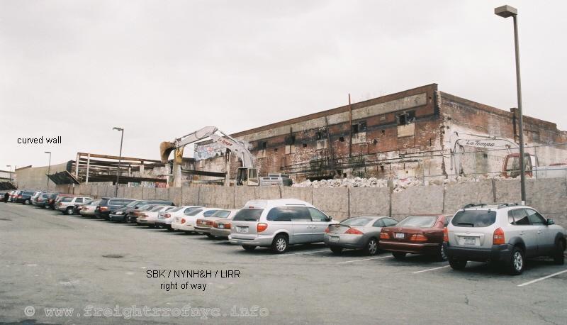
Leeds Paper / Scheck Brothers Warehouse - SBK &
NYNH&H / LIRR Parkville Interchange - January 26, 2010
authors photo
.
.
The next stop was Kensington Junction, but truly nothing remained and while we able to identify the right of way; new structures, a gas station canopy and a red moving truck occupied the scene. Just under the station canopy, the sea-green Culver Elevated can be seen:
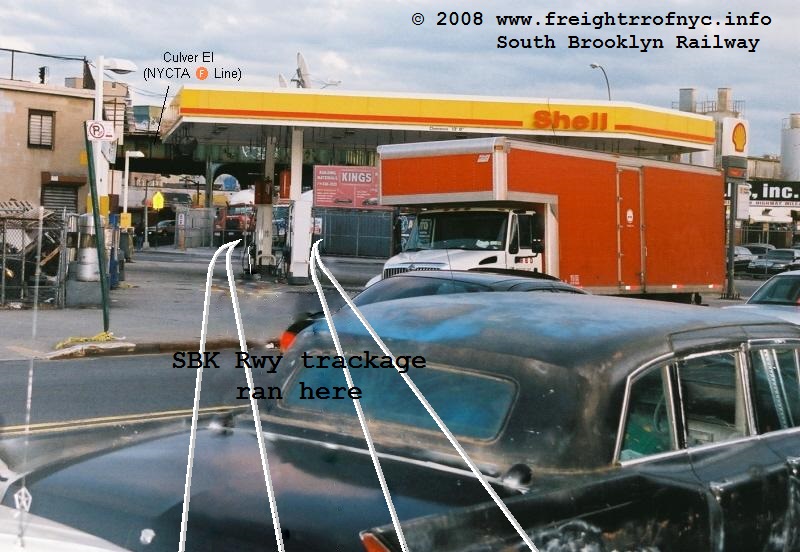
looking southeast at McDonald Avenue - January 26,
2010
authors photo
.
.
Now, while we continuing north, 37th Street ran against us, so we circumvented this portion and proceeded to Second Avenue and 39th Street, to back track. But I am posting the images of 37th Street here to keep the continuity of our "journey" north / westward.
At Fifteenth Avenue, a rail can be seen peeking out of the concrete of a parking lot for cement mixers:
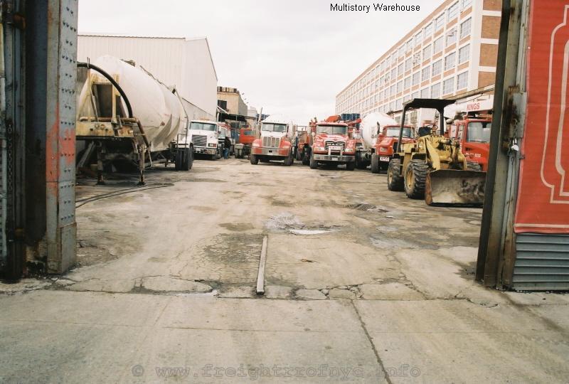
Looking west from 15th Avenue - January 26, 2010
authors photo
.
.
In the photo above, the large multistory warehouse can be seen. Upon first examination, we could find no remnants of trackage leading to the warehouse. Hopping back in my truck we circled around the block and I had to wait for the traffic light. I looked down at the pavement and saw a crease in the asphalt. A few feet further, I could barely make out another crack. Lo and behold, the creases were as wide as railroad track!
I immediately put my truck in reverse and backed into a parking spot to examine a little closer. The beige Nissan SUV in the image below is actually parked upon the tracks and the creases in the asphalt can be seen leading out towards the middle of the street from the two front tires:
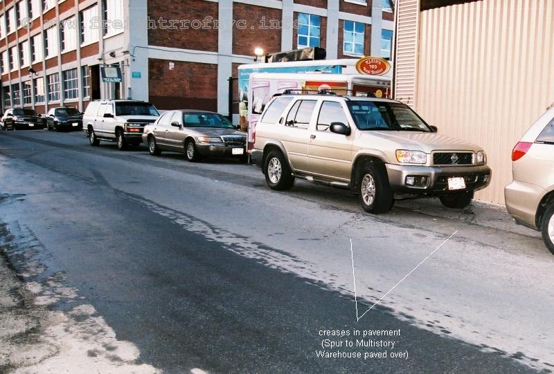
Looking northwest on 37th Street between Fourteenth
and Fifteenth Avenues - January 26, 2010
authors photo
.
.
The next photo was taken from the other side of the Nissan, and the rails can be clearly seen in the pavement:
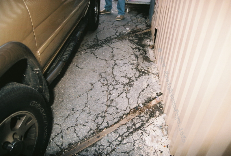
Looking west - January 26, 2010
authors photo
.
.
Now the tracks in the photo above run under that beige corrugated structure and would have led into the parking lot of that multistory warehouse. No trackage can be seen in the parking lot but upon walking through the parking lot to the center alley, revealed tracks still embedded in the pavement:
Judging from the location of the track, (about 8 feet away from the wall and where the left row of cars are parked), leaves us to wonder if there was a loading dock running the length of the wall.
Looking west - January 26, 2010
authors photo
.
.
Here is a closer look at the loading door and wall:
Looking west - January 26, 2010
authors photo
.
.
Turning around and facing east is this view:
Looking east at parking lot of multistory warehouse
with trackage curving towards 37th Street.
Visible trackage ends under the dumpster - January 26, 2010
authors photo
.
.
Another block west, we were at the intersection of Fourteenth Avenue, Old New Utrecht Road and 37th Street. Again, rails could be seen peeking out of the pavement:
Looking east - January 26, 2010
authors photo
.
.
Looking west from centerline of Fourteenth Avenue -
January 26, 2010
authors photo
.
.
Looking north at west curb line of Old New Utrecht
Road - January 26, 2010
authors photo
.
.
We could find no remnants from Old New Utrecht Road to Tenth Avenue, which begins the 36th Street Yard of the New York City Transit Authority. At this point a fine chain link fence (2" squares instead of the standard 4") is in place and really prevents photography. So, we made our way to Fourth Avenue. This begins the infrequently used but serviceable portion of the South Brooklyn Railway.
I had to walk up the 38th Street exit ramp of the Gowanus Expressway to get past the chain link fence seen on the left edge of the photo. Doing so put me at a higher perspective and yielded unobstructed views of the 38th Street Yard between Fourth and Third Avenues.
Looking east toward Fourth Avenue and subway interchange
with subway car unloading ramp - January 26, 2010
authors photo
.
.
Looking west at Third Avenue - January 26, 2010
authors photo
.
.
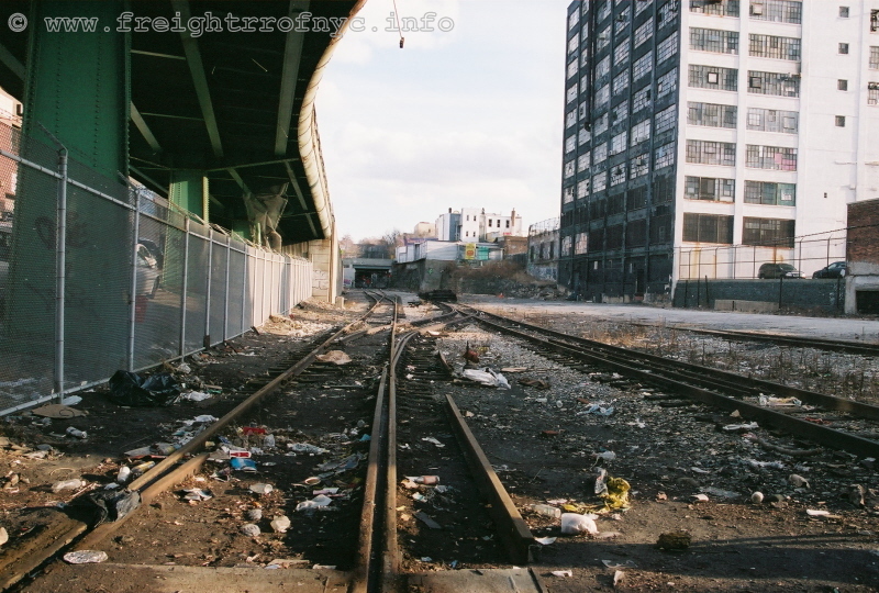
Looking west from Third Avenue entrance gate - January
26, 2010
authors photo
.
.
From this point down, the trackage was reconstructed. So, while not original trackage, it is the continuation of the original route as close as we can get in the present day.
These first images are of the crossing at Third Avenue:
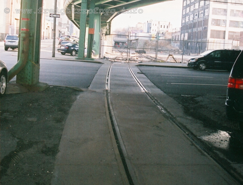
Looking east from the center island (parking lot) of
Third Avenue (northbound lanes) - January 26, 2010
authors photo
.
.
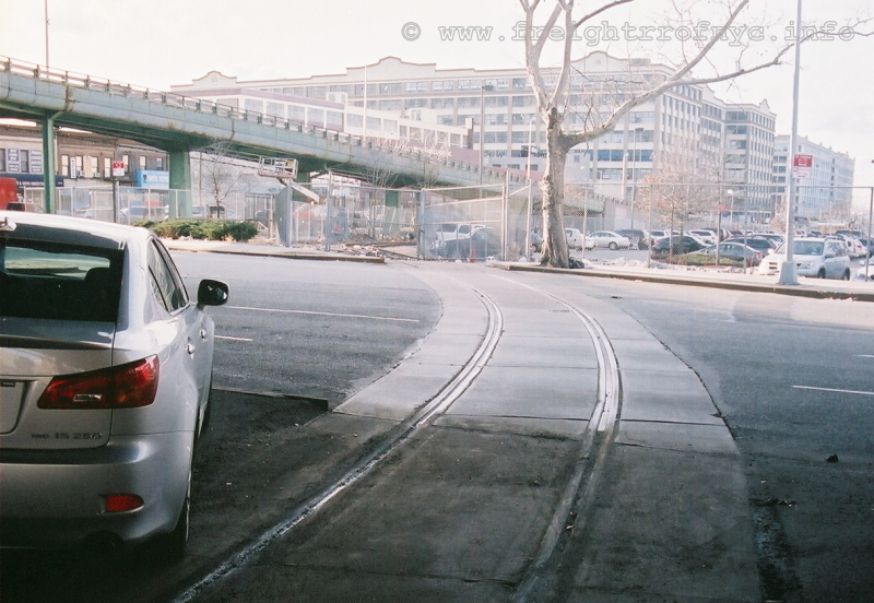
Looking west from the center island (parking lot) of
Third Avenue (southbound lanes) - January 26, 2010
Costco parking lot on right behind fence.
authors photo
.
.
We then proceeding to Second Avenue and parked between 39th and 37th Streets. This portion of the trackage was rebuilt to a new alignment in 1994.
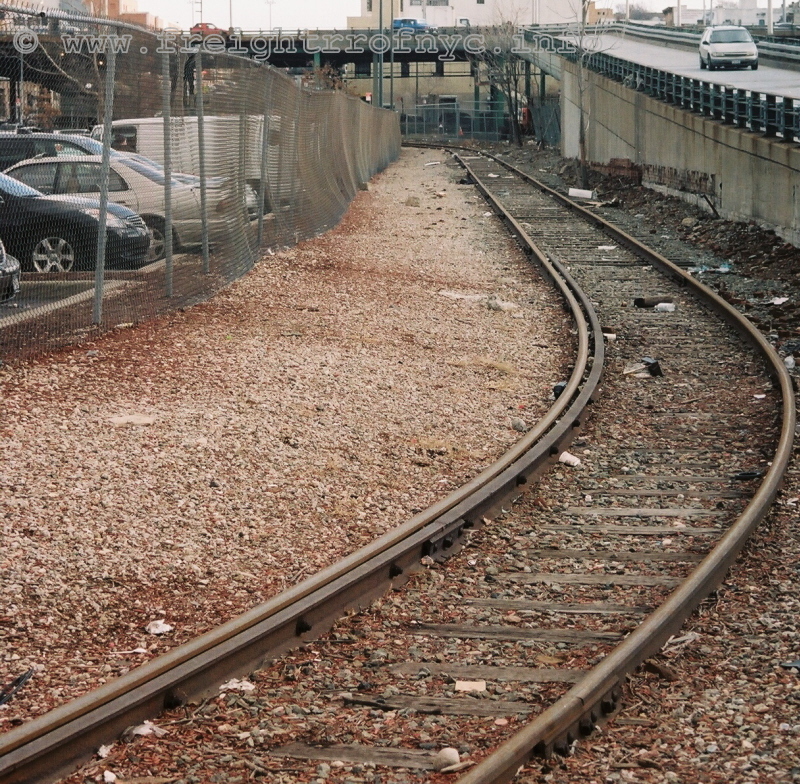
Looking east from Second Avenue - January 26, 2010
Costco parking lot on left behind fence.
authors photo
.
.
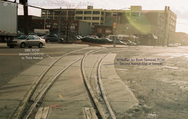
Looking southeast from west curb of Second Avenue (and
from the entrance of the SBK 39th Street Yard) - January 26, 2010
Note the gouges in the cement parallel to the rails from a minor derailment.
authors photo
.
.
This is the original location of the Yard, but the track configuration has changed dramatically over the last two decades. This is the view after turning 180 degrees and after taking the image above:
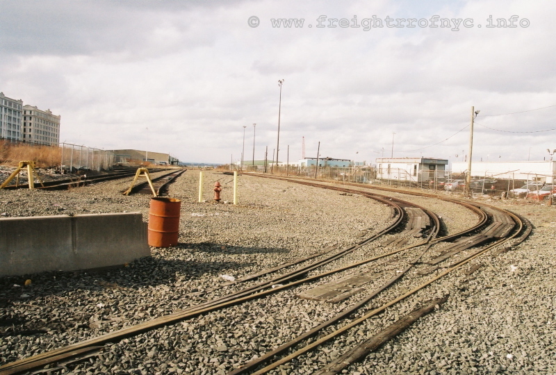
Looking west at 39th Street Yard - January 26, 2010
authors photo
.
.
At this point we made a U-turn and drove to 39th Street and Second Avenue and made a right and headed past First Avenue. To our good fortune, the gate to the South Brooklyn Marine Terminal was open.
This is the view of the 39th Street Yard from the Terminal looking east:
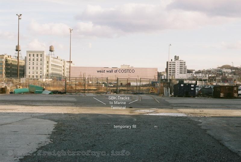
Looking east at South Brooklyn Railway 39th Street
Yard from Marine Terminal - January 26, 2010
authors photo
.
.
Now, this location was serviced by New York Cross Harbor Railroad when American Stevedoring occupied the premises. Currently, there is is a lot of reconstruction under way. Notice the tracks in the image above are cut short. These two tracks come together and the track ran parallel to the Pier Shed servicing loading docks seen in the image below. Also note the pavement has been torn up and temporary fill is in place. Obviously, this portion of the right of way is currently being reconstructed and appears it will be placed back in service for a new tenant.
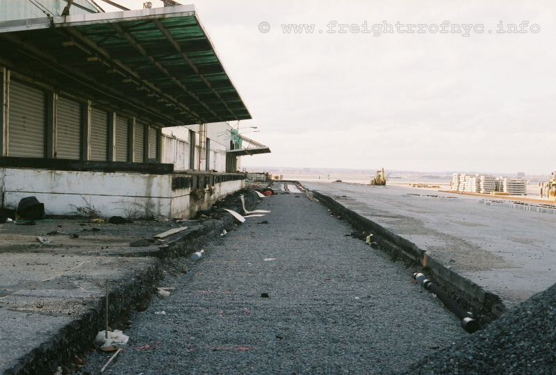
Looking west at loading docks of South Brooklyn Marine
Terminal - January 26, 2010
authors photo
.
.
Of particular interest is the fact that the track is being rebuilt using lengths of welded rail (not standard 39 footers) and concrete ties:
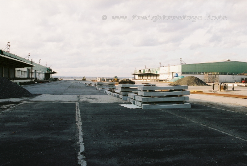
looking west - January 26, 2010
authors photo
.
.
.
| Main Index |
.
.
Due to the large and growing amount of images accrued of locomotives and
equipment operated by the South Brooklyn Railway; it has been deemed
necessary to place the collection of images on their own page, like
what I have done previously with Brooklyn Eastern District Terminal,
Bush Terminal and New York Dock:
Page 2: South Brooklyn Railway - Locomotives & Equipment Images & Rosters
.
.
| Main Index |
While we are discussing the routing of the South Brooklyn Railway, it should be also be noted that it shared a portion of its route with four different subway lines over its history. Adding confusion for a lot of non-Brooklyn railfans as well as modern era NYC Transit buffs, was that these four different subway lines used various or the same parts of the Culver Elevated over its the history. While this technically has nothing to do with the actual operation of the South Brooklyn Railway, it does reflect why subway cars on the elevated lines in those photos taken throughout the decades have different route letters displayed. Further confusing matters on Transit Maps was that the line "bullets" (the colored circles) changed colors throughout the years.
 |
 |
 |
 |
 |
 |
 |
| Culver Line | Culver Line | Culver Line | Culver Line | Culver Shuttle | Culver Shuttle | Culver Shuttle |
| 1925 - 1954 | 1954-1967 | 1967-1979 | 1979-present | 1954-1960 | 1960?-1967 | 1968-1975 |
Beginning in 1925, with the delivery of the BMT D Type or "Triplex" cars and the IND R1 cars in 1931, head end destination signs were incorporated into the design. The line that followed the South Brooklyn Railway routing was known as the BMT 5 or Culver Line.
Commencing from the lower level of the Ninth Avenue Station at 37th Street, the BMT took
to an elevated structure directly over the South Brooklyn Railway
right of way. This elevated line turned south at Kensington Junction
and
continued over Gravesend Avenue. This elevated was completed in
several stages throughout 1919 until gradually reaching Coney Island in
1920.
In 1932, Gravesend Avenue would be renamed McDonald
Avenue, in honor of John. R. McDonald, chief clerk of the Brooklyn
Surrogate’s Court, who died suddenly.
In 1954, with the construction of the IND Culver Ramp between
Church Avenue and Ditmas Avenue completed, the BMT Culver Elevated was
transfered to the IND Division, becoming the IND Culver Elevated, but
the BMT
train began running upon the Culver Elevated over McDonald
Avenue from Ditmas Avenue to Coney Island. Also on this
date, the BMT
route was truncated. This now shortened route operated
between Ninth Avenue (lower level) and Ditmas Avenue and was designated
the Culver Shuttle .
In 1960, the Culver Shuttle was given the new graphics route bullet: which in turn became the
in 1968. These new bullets appeared only on the maps because in fact
the older equipment relegated to the actual shuttle service was not
equipped with the new graphics.
On November 26, 1967 with the opening of the Chrystie Street Connection in Manhattan, the operating over the Culver Elevated was replaced with the Culver Line / Sixth Avenue Local.
On May 11, 1975, the Culver Shuttle service was abolished.
In 1979, the color of the subway line bullets were changed
to reflect and color coordinate their primary Manhattan routing. Therefore the became the (with the orange color denoting Sixth Avenue routing regardless of being express or local)
The Culver Shuttle
elevated structure would not be demolished until the mid 1980's, well after the South
Brooklyn Railway right of way under the el had been abandoned in 1978. The still operates on the elevated over McDonald (formerly Gravesend) Avenue.
And if this didn't help you figure it out, nothing will.. My head still spins trying to figure it out too. So let us get back to the SBK, shall we? ☻
.
| Main Index |
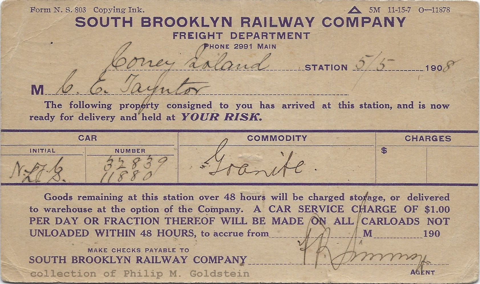 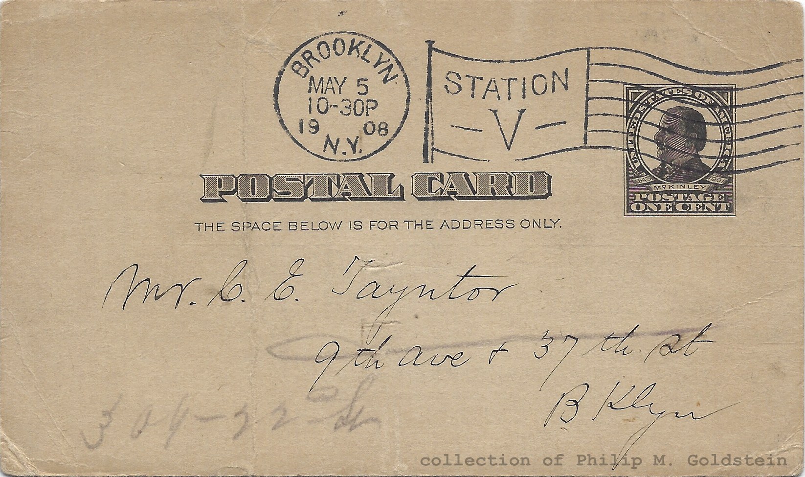 Arrival Notice - May 5, 1908 3 1/4" x 5 1/2" authors collection added 25 July 2021 |
||||||||||||||||
| .
. |
||||||||||||||||
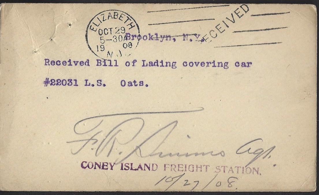 #6 Envelope - postmarked October 1908 authors collection added 02 July 2018 |
||||||||||||||||
| .
. |
||||||||||||||||
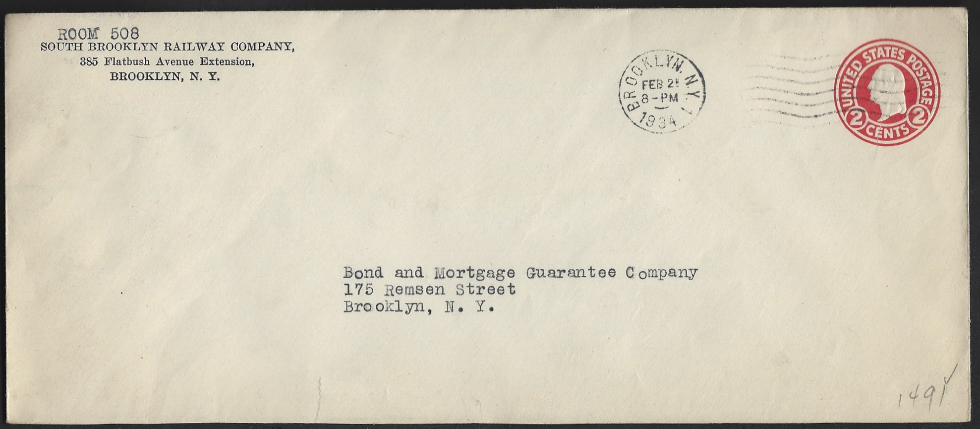 #11 Envelope - postmarked February 1934 authors collection added 02 July 2018 |
||||||||||||||||
| .
. |
||||||||||||||||
|
|
||||||||||||||||
| .
. |
||||||||||||||||
Car Clearance Tags formerly Benjamin W. Schaeffer collection authors collection added 25 July 2021 |
||||||||||||||||
| .
. |
||||||||||||||||
|
|
||||||||||||||||
| .
. |
||||||||||||||||
|
|
||||||||||||||||
| .
. |
||||||||||||||||
|
|
||||||||||||||||
| .
. |
||||||||||||||||
|
|
||||||||||||||||
| .
. |
||||||||||||||||
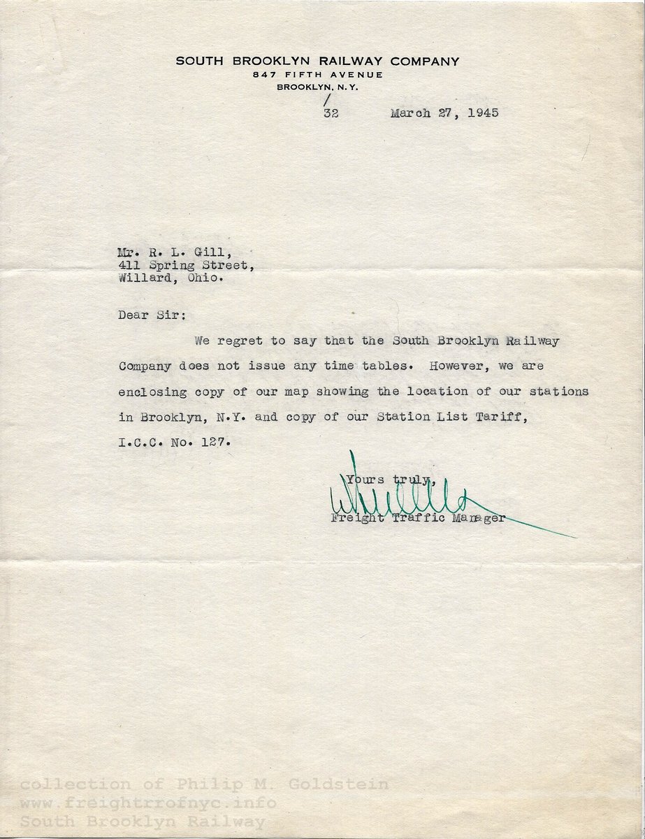 ..... .....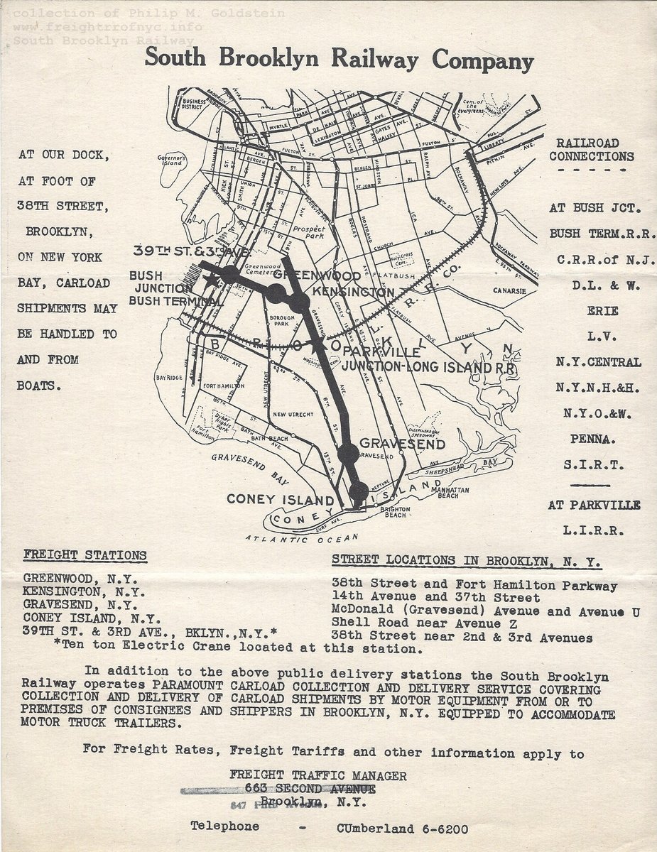 |
||||||||||||||||
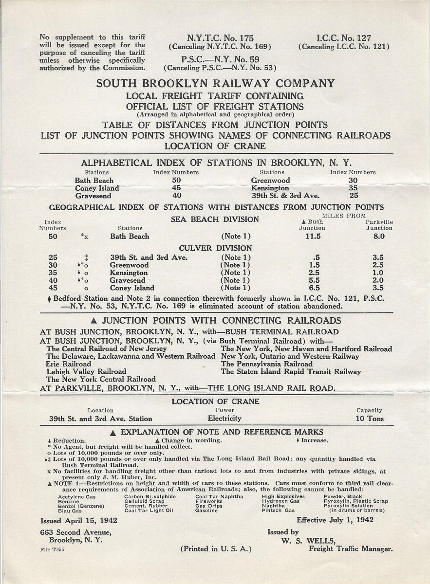 Cover letter, system map & station list, (8 1/2" x 11") 1942 tariff sheet (8" x 11") 1945 authors collection added 18 August 2021 |
||||||||||||||||
| .
. |
||||||||||||||||
|
|
||||||||||||||||
| .
. |
||||||||||||||||
|
|
||||||||||||||||
| .
. |
||||||||||||||||
 (may or may not be South Brooklyn Railway) authors collection added 02 July 2018 |
||||||||||||||||
| .
. |
||||||||||||||||
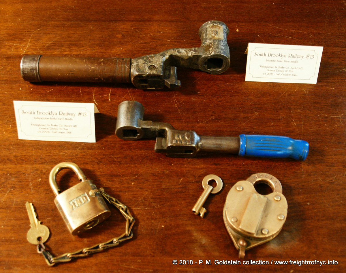 South Brooklyn Railway #13 Automatic Brake Handle
South Brooklyn Railway #12 Independent Brake Handle brass Yale lock - NYCTS / IND brass Wilson Bohannon lock - NYCTA Both brake handles were gifted to the author by M. DeLuca, of who's images grace this page. authors collection added 02 July 2018 |
||||||||||||||||
| .
. |
||||||||||||||||
|
||||||||||||||||
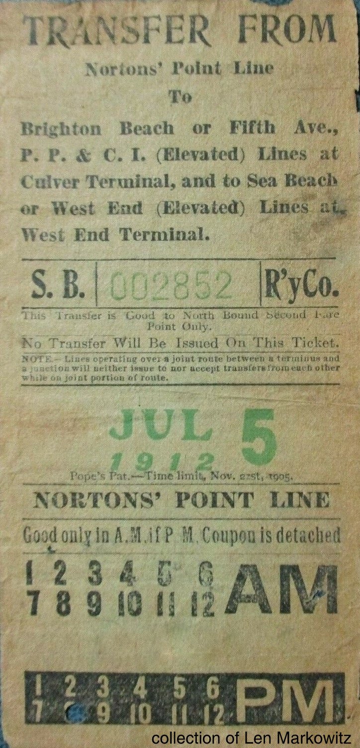 |
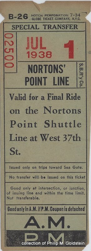 |
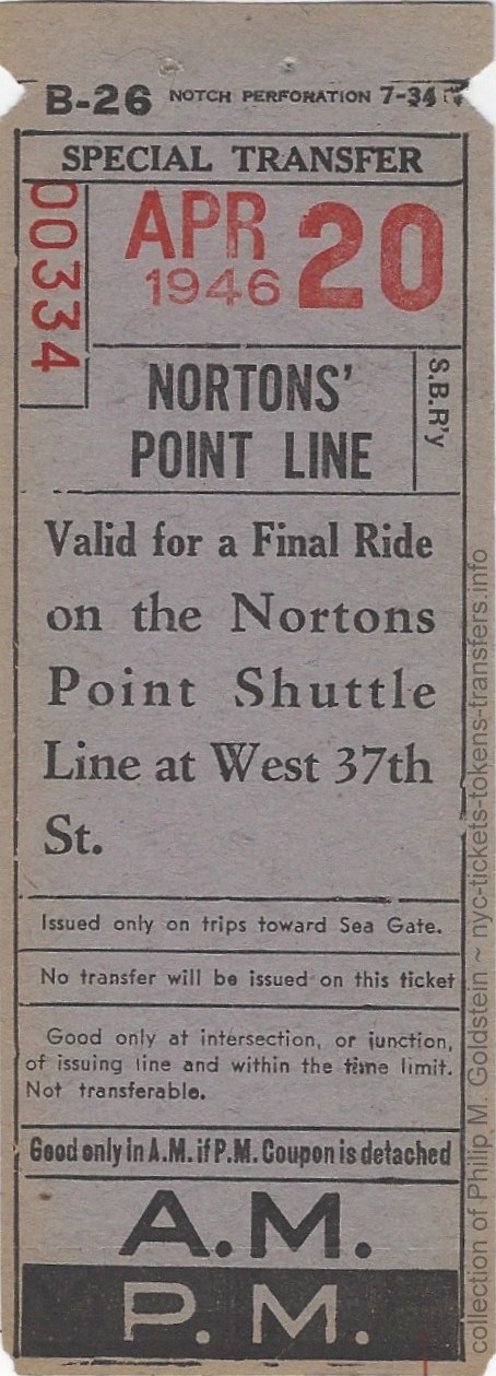 |
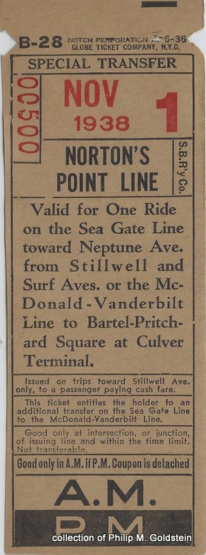 |
| collection of Len Markowitz | authors collection | ||
.
Flatbush Avenue Coal Ink Blotter
6 1/4" x 3 3/8"
authors collection
..
.
| Main Index |
Some of the fondest memories some South Brooklyn Railway fans have, is
of the bocce courts on the right of the way along 37th Street.
Never to forget their heritage and the old country, some of the neighborhood Italian elders used the South Brooklyn Railway tracks north of Kensington Junction as a bocce court. The dirt and mud between the two running tracks was leveled and packed, and it was found to be ideal for playing bocce, with the rails serving as boundary bumpers.
These bocce courts were even appointed with removable backstops, so that when that occasional train would venture down the line, the elders would simply remove the backstop to allow the train to pass. As train speeds were only a few miles an hour and as the elders had long since established a relationship with the locomotive crews, there were never any issues. Note the bocce court is between the north and southbound tracks and not between the track gauge itself.
In the photo below left, we can see and home heating oil tank truck marked for Cirillo Brothers. Cirillo was a customer of the South Brooklyn Railway, which had delivered coal to their silos located at 13th Avenue and 38th Street (just out of view top left of image. When coal fell out of favor as a home heating source, Cirillo (as many other fuel suppliers) transitioned to heating oil.
The date of these photos are 1976, which also means these tracks would only see railroad activity for approximately two more years - 37th Street right of way was embargoed February 1978, after which no more trains would use the trackage.
|
|
The Avenue I Flea Market / Parkville Interchange
As mentioned in the Parkville Interchange Chapter, the location became the home to the Avenue I Flea Market in 1976, a 600 stall indoor flea market and food venue. Parking in the "back lot" was on top of the old South Brooklyn Railway / Penn Central railroad tracks of the interchange, still in place but now hard packed dirt or Belgian block.. I always wondered as a kid what would happen if the train needed to through, and all those cars needed to move - but I was too young to know that the Parkville Interchange had been abandoned by Conrail in 1976.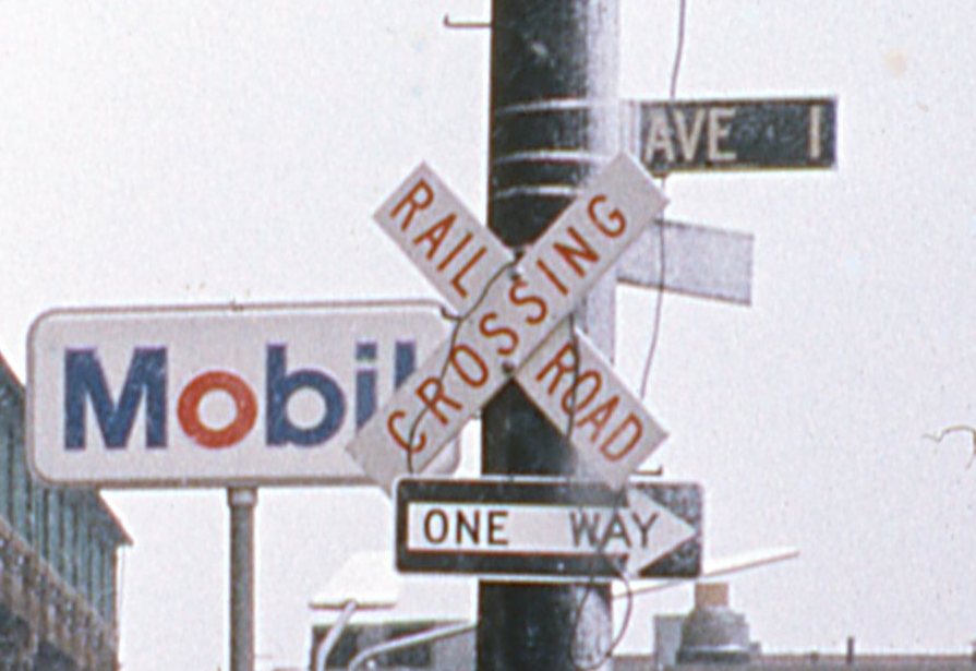 |
More than that, I vividly
remember the red letters on white Railroad Crossing crossbuck on the
utility pole at the corner of 20th Avenue and Avenue I. I always wondered the significance of it being red on white as opposed to the DOT / FHWA standard black lettering on white background. After going through the FHWA (Federal Highway Administration) website and searching the internet for over an hour, I find no reference to this version of railroad crossing sign. Since the railroad crossing was hardly used, I think it may me an early "exempt" railroad crossing sign; which meant school buses, commercial buses and vehicles hauling hazardous materials do not need to stop; as opposed to the black lettered version which denoted a standard active crossing. I always wanted to procure that particular and unusual crossing sign; but alas one day it was gone; but it lives on in my memory. January 1976 M. DeLuca photo collection of author added 20 Oct 2026 |
A Trip Along the Bay Ridge Branch and a Chance Encounter with SBK
Being a Brooklyn resident of the Gravesend neighborhood, and living within walking distance to South Brooklyn Railway's McDonald Avenue trackage, I remember when the first portion of the McDonald Avenue trackage was removed from service, and then the second.
At least on one occasion many years before, I remember vividly as a child, sitting in the family car waiting for a traffic light to change when a big bellowing Diesel-electric locomotive sauntered by, running the street trackage on McDonald Avenue. Instead of trying to outrun it to avoid being inconvenienced by it, my father would pull over to watch it with me. This didn't happen often, so it was a treat to see.
Many year later, with me out of high school, and sometime in 1991 or 1992, my friends Dave, John, my sister Randi and I decided to go "exploring" the Bay Ridge Division tracks, now operated by Conrail. We took the subway (F Train) from Kings Highway to Avenue I, where we knew we could get onto the Bay Ridge Division right of way through the South Brooklyn Railway / LIRR Parkville Interchange at Avenue I and McDonald Avenue.
Not long after we started walking, about 1/4 of a mile west of Parkville Interchange / McDonald Avenue and Avenue I; we found a Nolan TS-1 tool cart from the Transit Authority laying off to the side of the tracks. Well, since riding is always better than walking, and we set the cart on the rails, loaded our gear on the cart and set off towards Owls Head. After a few hundred feet, we discovered our stuff kept wanting to slide off the deck, so we looked through the debris and rubbish thrown into the right of way, and we found some wire that we used to tie our stuff down with. We then took turns sitting on the back of the tool cart pushing with our feet. When we would come to an incline, two of us would push. On our first down grade, the cart picked up speed to the point of making us nervous; and when the cart finally stopped, we found a 2" x 3" piece of wood, and we would jam it between a wheel flange and the frame to slow the cart down when going down the next hill. Don't kid yourself; Brooklyn isn't as flat as you think and that cart would pick up some pretty decent speed heading downhill and that "jam" brake was necessary.
About 30 minutes later, (about 1.5 miles) the right of way really opened up, into the former "NU" Yard (New Utrecht) and we arrived at Fort Hamilton Parkway. Here, we took a well needed rest break and took the time to inspect an old position signal left over from the Long Island Railroad's days of ownership of the Bay Ridge Division. After watching some subway trains on the adjacent Sea Beach Line, we started off again. Once we started on our way again, we found the line started going downhill again to go under the subway tracks at Eighth Avenue and we picked up speed again.
We arrived at the Fourth Avenue underpass about another 15 minutes later. The underpass actually stretches for a couple of city blocks, so it is more of a wide multi-track tunnel than a simple overpass, and it gets dark under there. We were about half way through, when I caught movement in front of us and to our right, and behind the concrete support pillars. For a change, I wasn't pushing (it did seem like I was the one always pushing...) I said something to my friends John and Dave about it, (and of whom couldn't care less). Lo and behold 2 seconds later, here comes a headlight out from behind the pillars and onto our track!
Well, we all panicked with visions of a Casey Jones type wreck, or the scene out of Stand By Me; so in an adrenaline fueled fright, we picked the tool cart up and literally threw the cart a good 15 feet off the tracks. Mind you with all our stuff still tied down on it: backpacks with clothes, my camera, and a large ice chest full of sandwiches and soda, and including the weight of the cart, we're talking several hundred pounds! My sister and friends ran behind the pillars and like the railfan I am, I stood off the tracks and watched the loco approach us. It wasn't going very fast (we didn't know that when we first saw it) and about a minute later the locomotive stops with the cab right next to me. It was South Brooklyn Railway N1 hauling some subway cars eastbound out of the Brooklyn Army Terminal trackage and Bush Terminal.
By this time my friends and sister came out from hiding and the engineer had stuck head out the cab window and asked what we were doing. I told him we were heading to the Owl's Head Yard for a picnic, and to take pictures. He smiled, said "no problem" but to be careful. He told us he would be returning westbound around 2 p.m., so if we were to be on the track outside the yard, we were to keep an eye out for him heading towards us. He also told us vandals had broken into the firehose lockers in the Bay Ridge Yard and hose was stretched across the tracks, so that if we really wanted to get all the way to the water with the cart, we'd have to clean up some hoses.
He told us his name, but my memory fails to recall it (somehow Angelo seems familiar) and he headed east. We rerailed our tool cart and headed west. We then came to a turnout where the tracks diverge for the Brooklyn Army Terminal to the right and the Bay Ridge Yard straight ahead, and the switch was thrown for the BAT, so we threw the switch, ran the cart through, and returned the switch to its original position. Then we came across a derail that was locked and we had to "hump" the cart over the derail (it's funny how the cart felt heavier now than in the moment of panic when we threw it off the tracks!)
Once in the yard, we picked up and rolled quite a few rolls of firehose that morning to clear "our track" and finally made it to the water. I remember seeing a tug with the BEDT herald on its stack tied up along the wharf, and I went to get my camera. But, like a schmoe, I forgot to bring film! All that way, all that railroad history and memories, and I forget the film!
After a few hours, and after some lunch and some exploring, we decided to head back to McDonald Avenue. We decided to take a roll of fire hose with us and one of the hose nozzles and we set off. We had to hump the tool cart over the derail (now it felt even heavier) and play with the switch again. We didn't encounter N1 all the way to McDonald Avenue, and when we went to unload, we realized we lost the hose nozzle somewhere along the way. We split the cart into two parts (as it was designed to) and buried the tool cart under some old tires and debris under an overpass for a future trip. A few months later when we returned (with film this time) to get the tool cart, the tool cart was gone.
For what its worth, looking back upon it, that was one of my best days of "railfanning"!
I also recall a moderately sized coal retailer (long since out of business during my years) with four 3 story concrete coal silos next to the Kings Highway Station, that I couldn't remember the name of. I saw it every morning I went to work, and every night I came home from work. Did I ever think to commit it to film? Of course not.
One day, after creating this website, and while on the phone with Ben Schaeffer, I happened to mention it, and damn if Ben didn't know it off the top of head - "Flatbush Coal"! Flatbush Coal was located between Avenue S and Kings Highway, adjacent to Colin Place & Billings Place. In the street was a turnout, off the southbound running track (trailing points heading south). The siding track entered under the silos.
This sight frequently greeted me as I disembarked from the "F" Train on my way home from work, and I was saddened to see that these coal silos were torn down several years ago during a visit to my old neighborhood.
.
.
| Main Index |
.
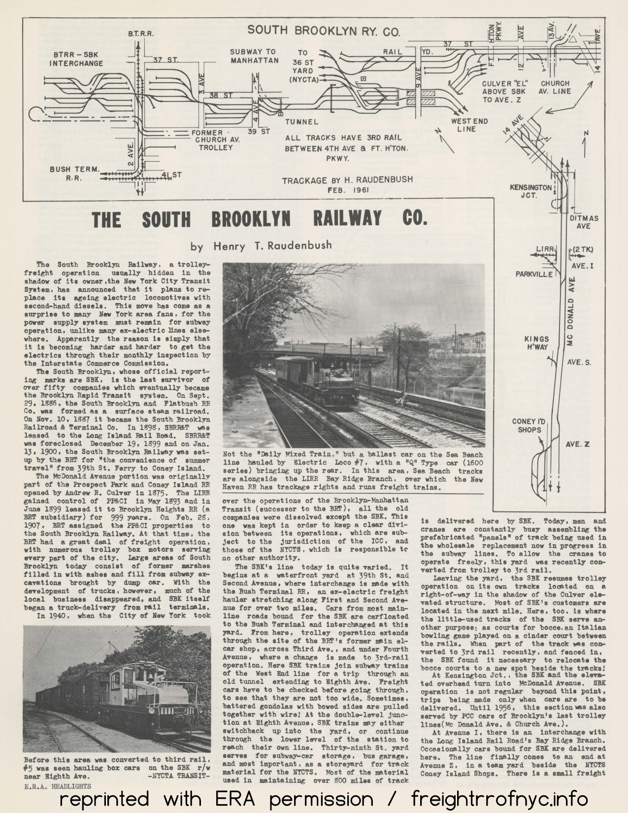 |
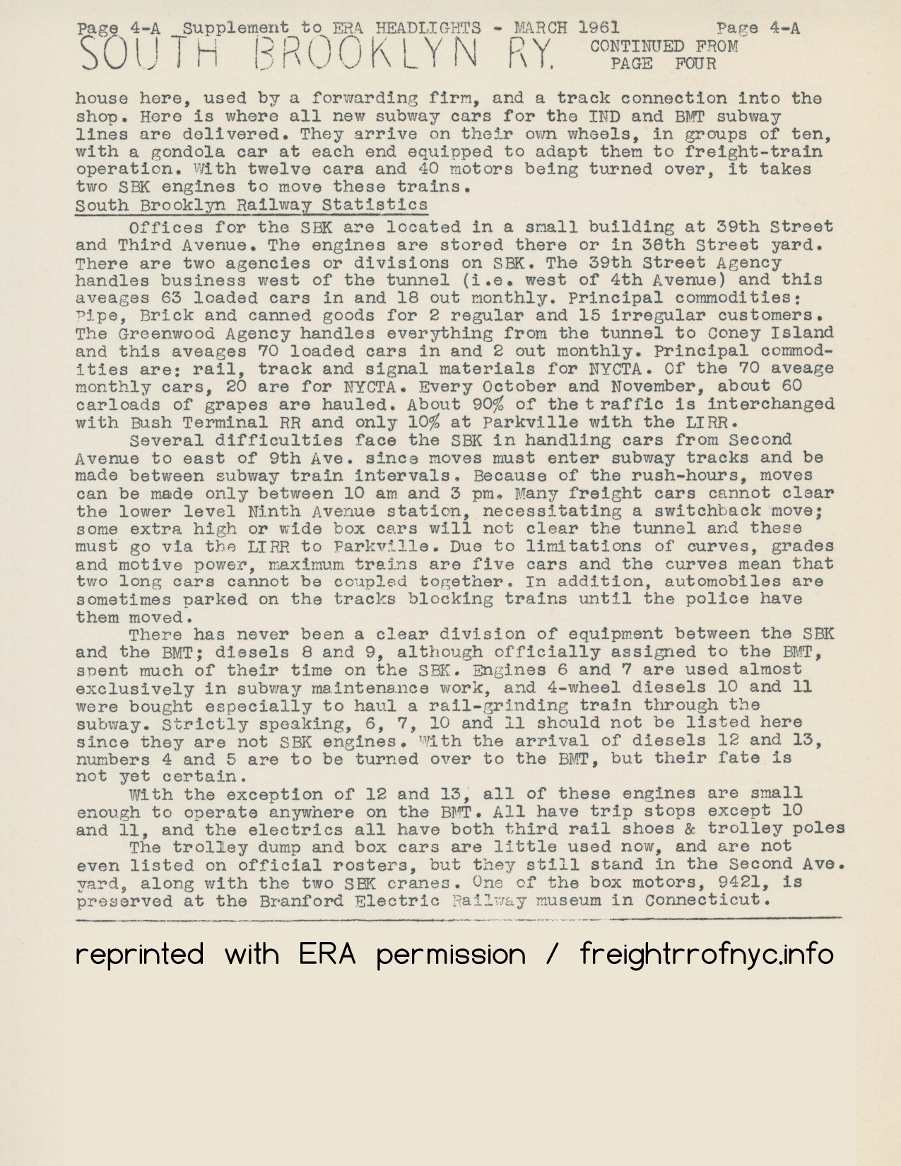 |
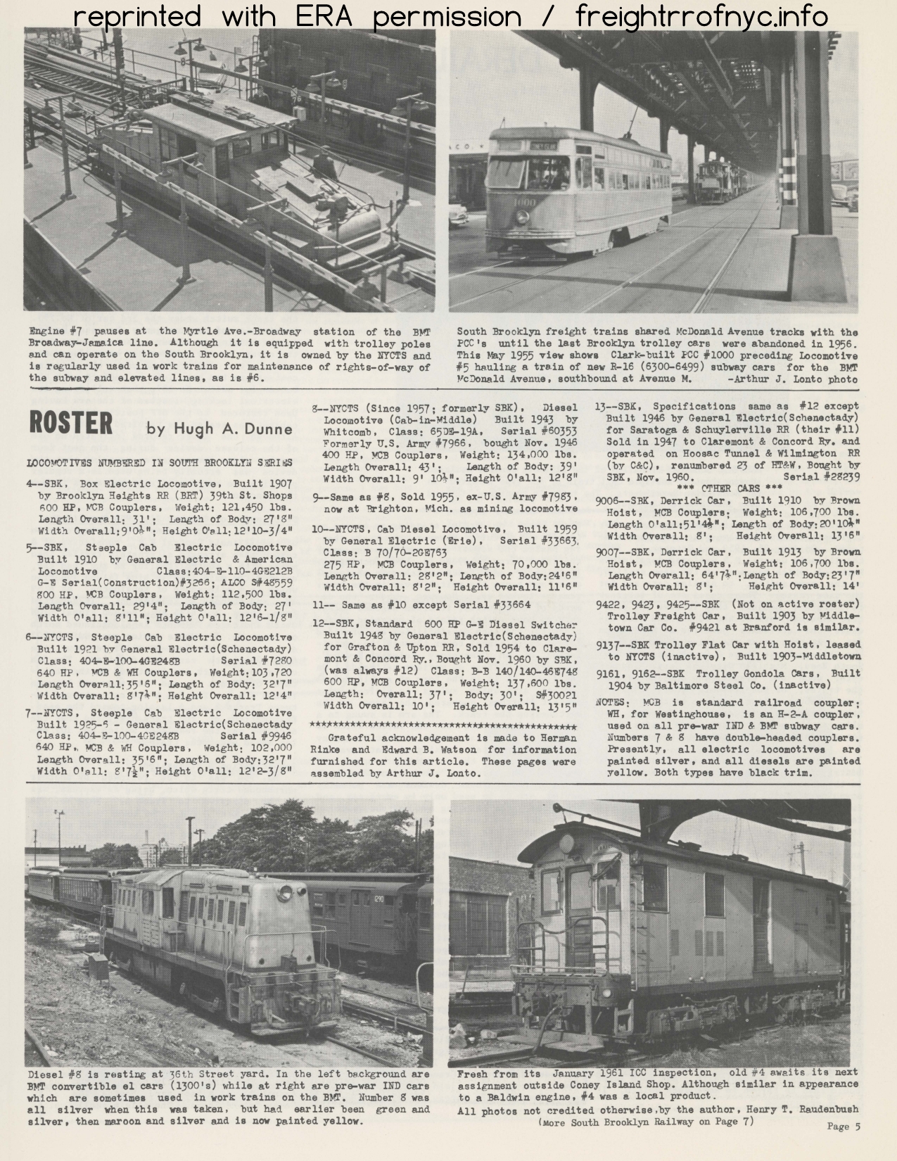 |
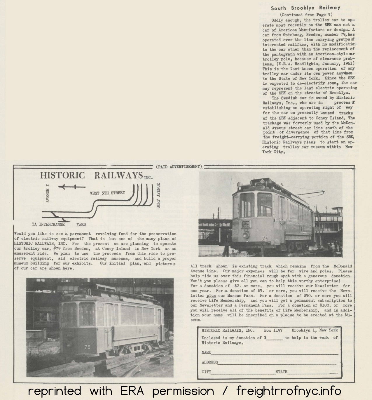 |
 |
 |
 |
 |
 |
 |
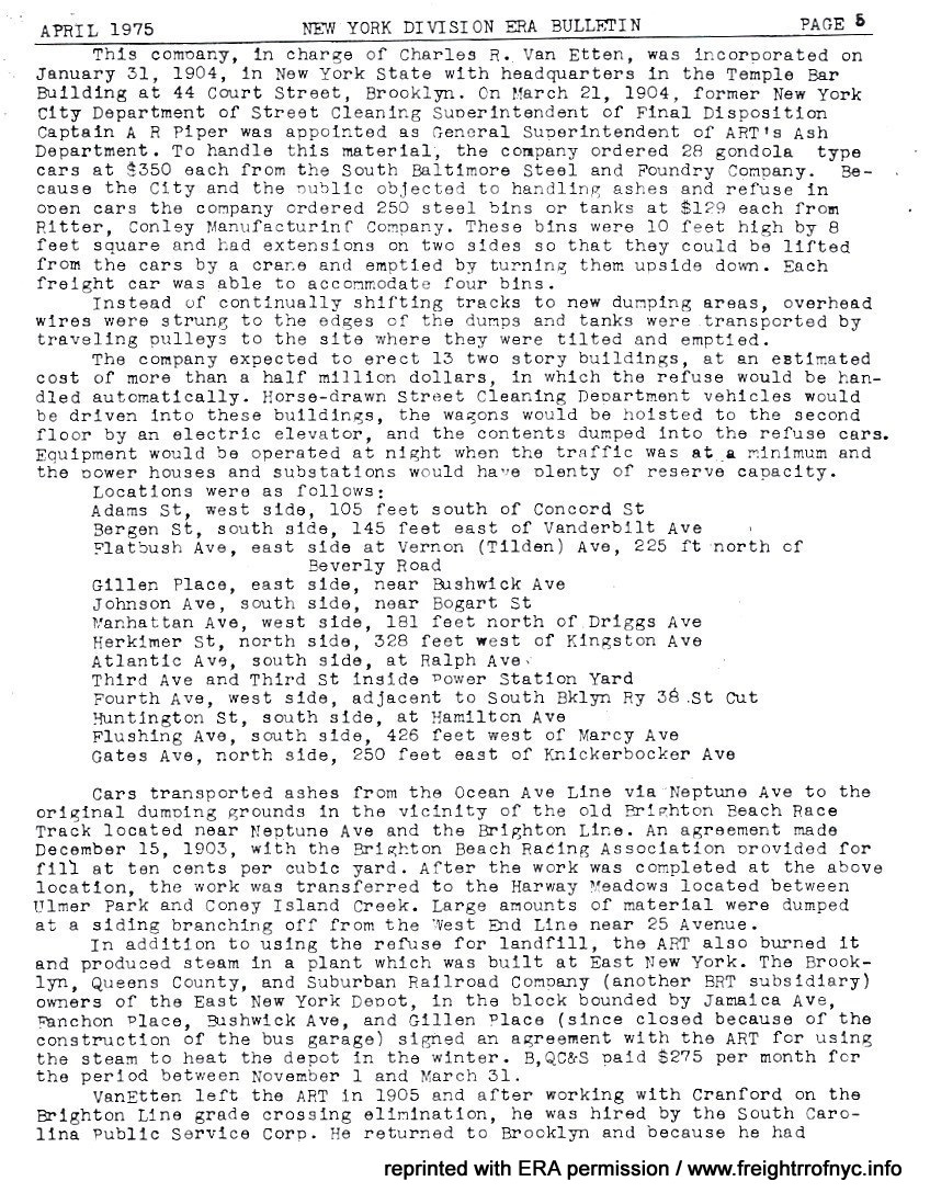 |
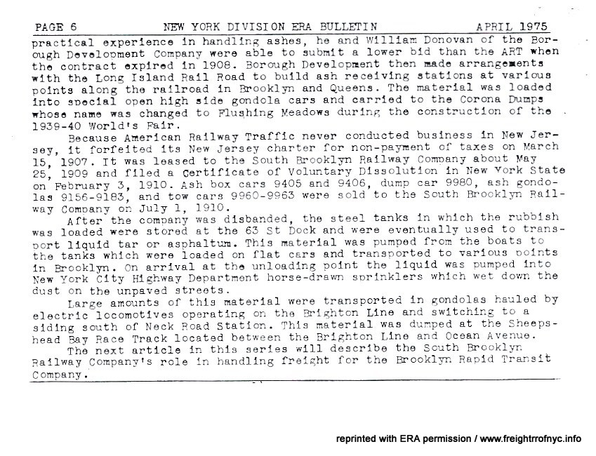 |
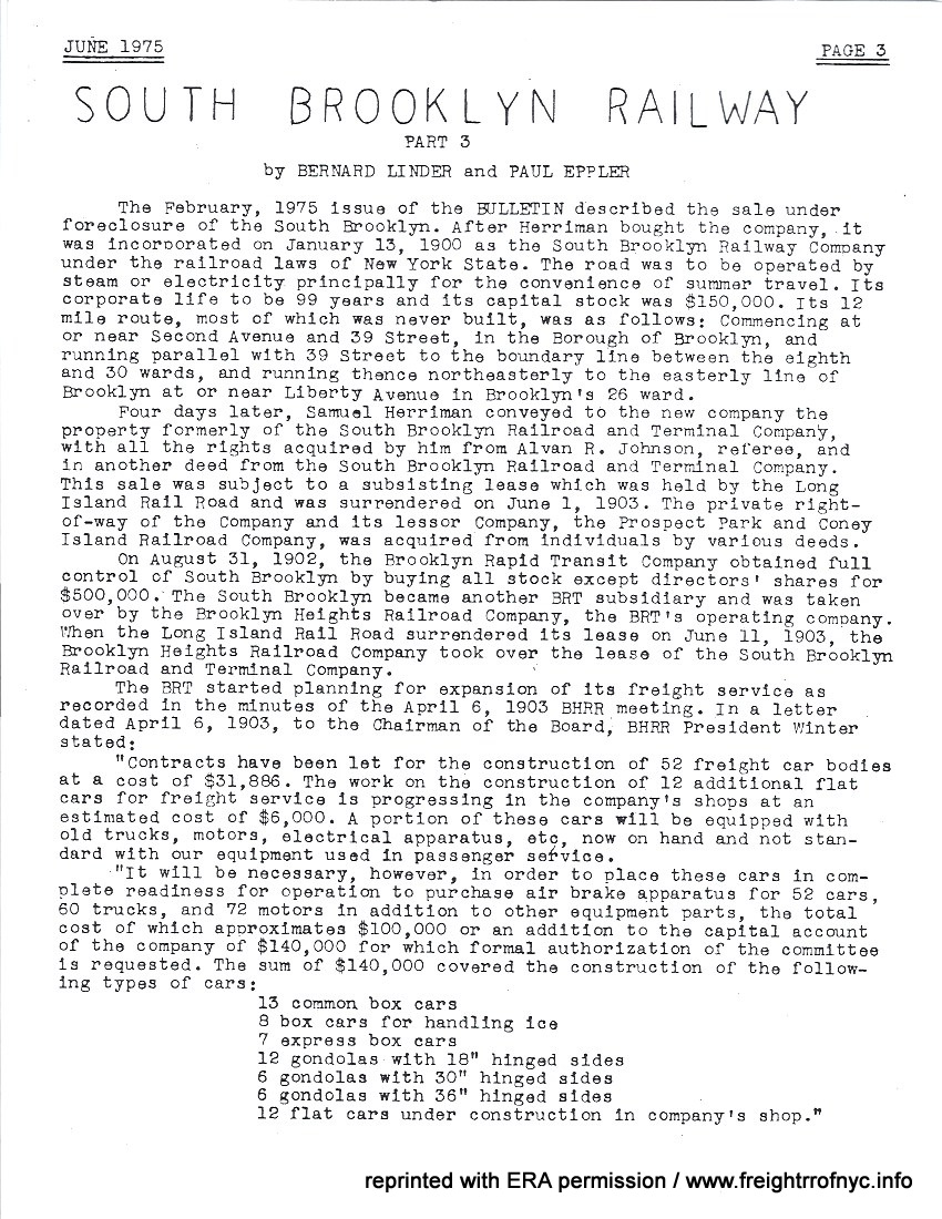 |
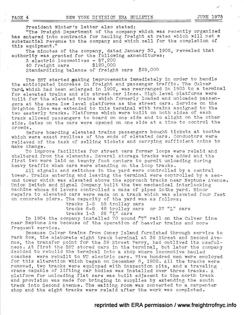 |
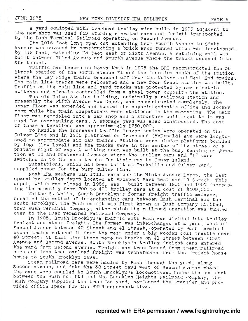 |
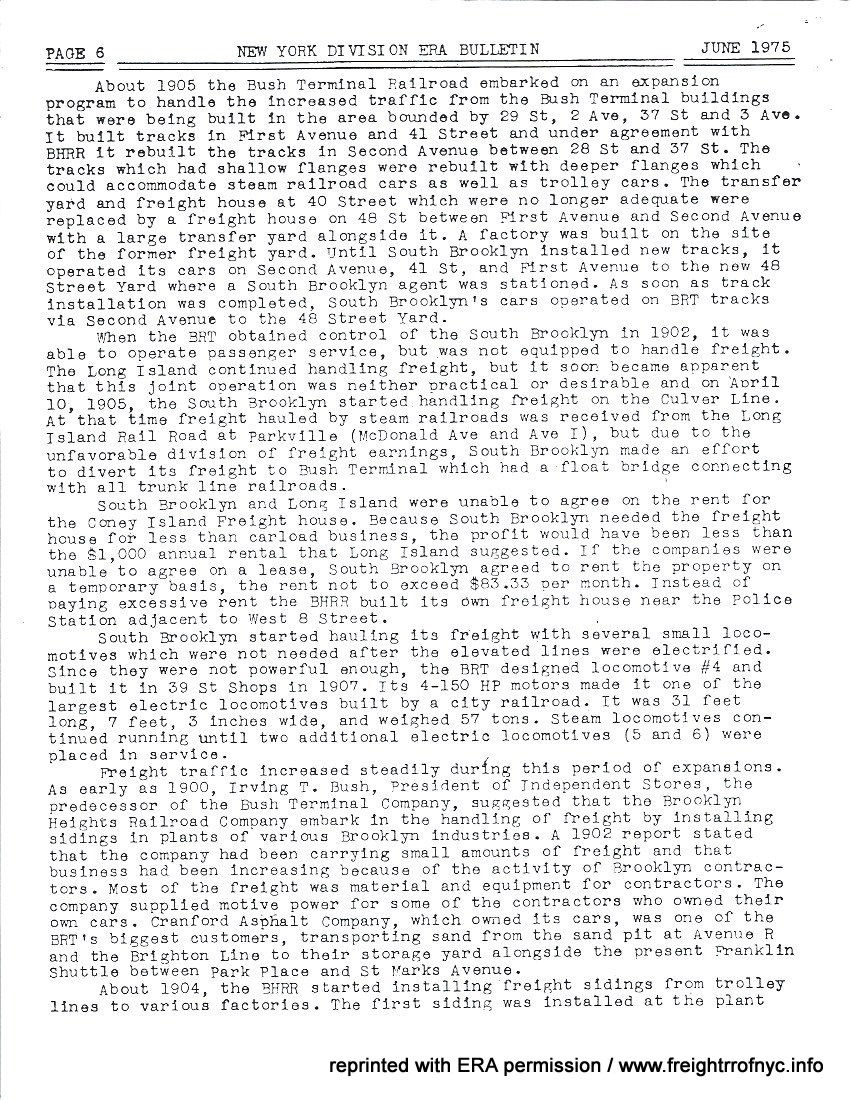 |
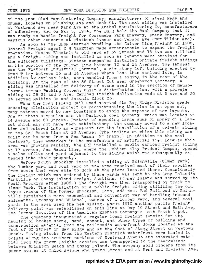 |
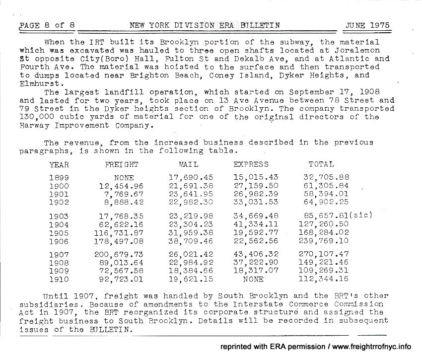 |
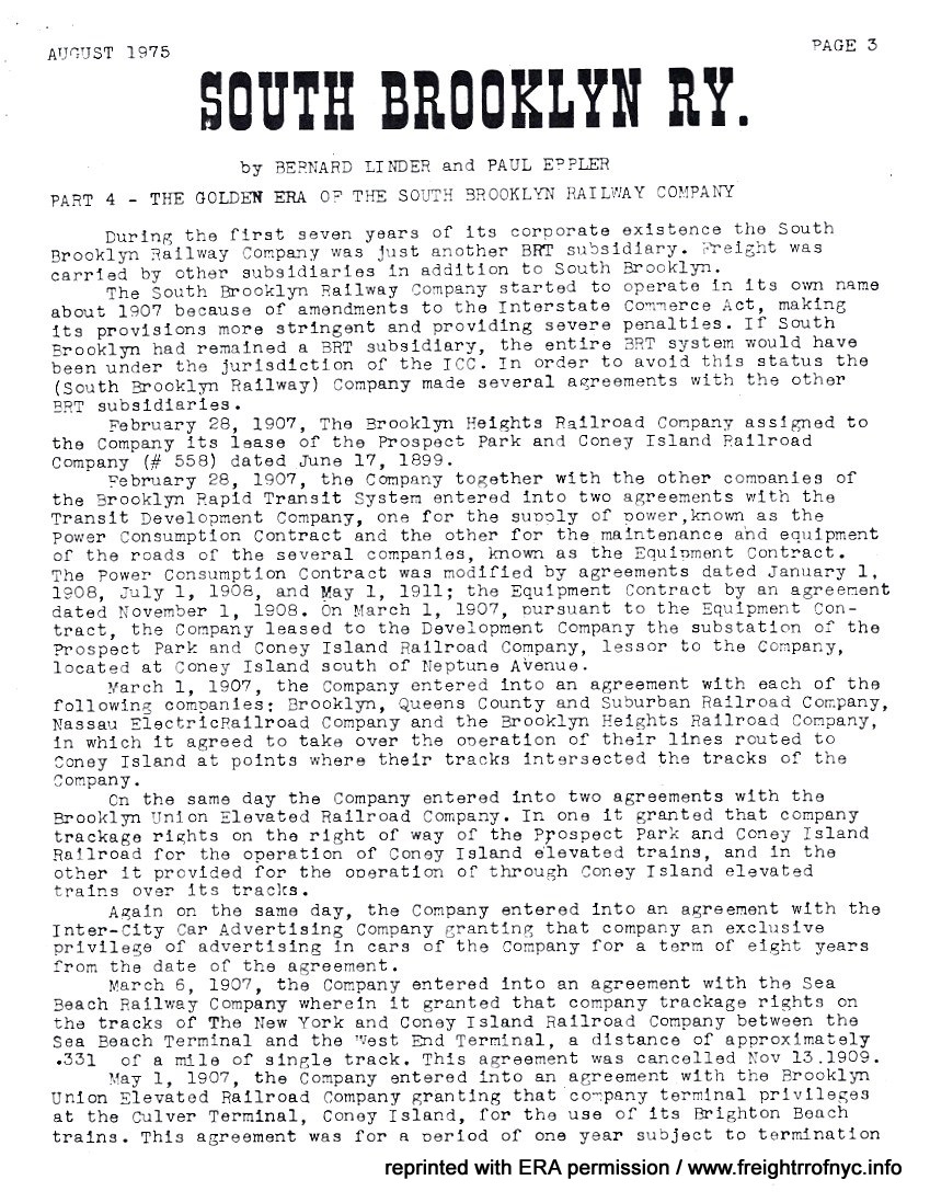 |
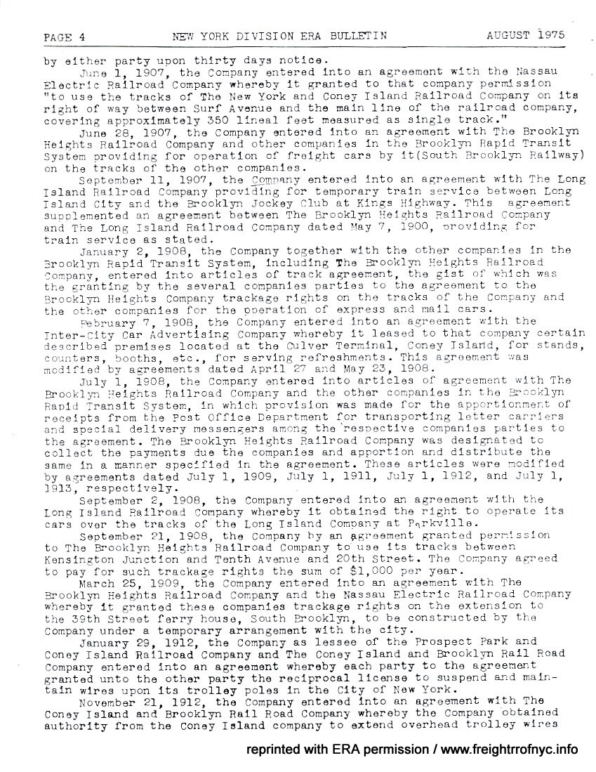 |
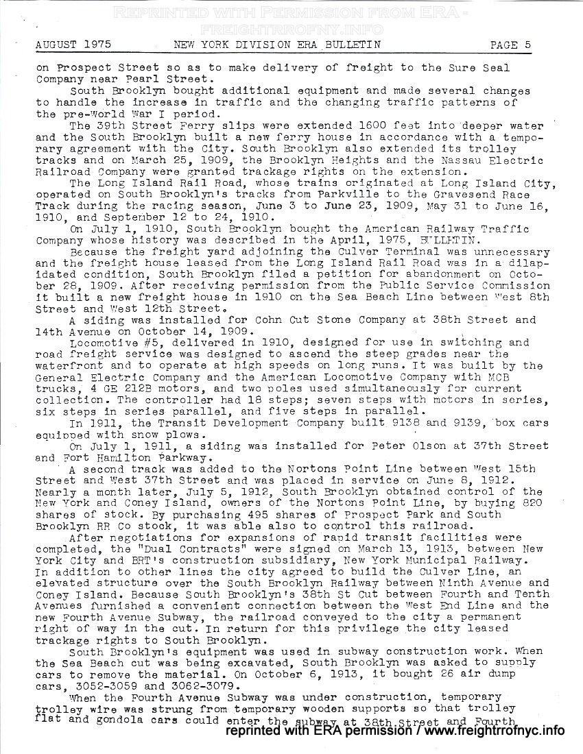 |
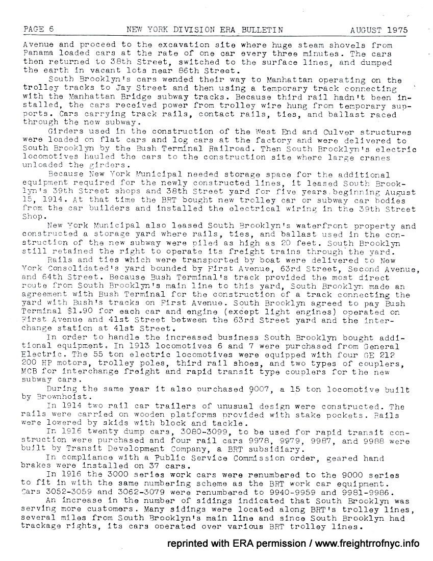 |
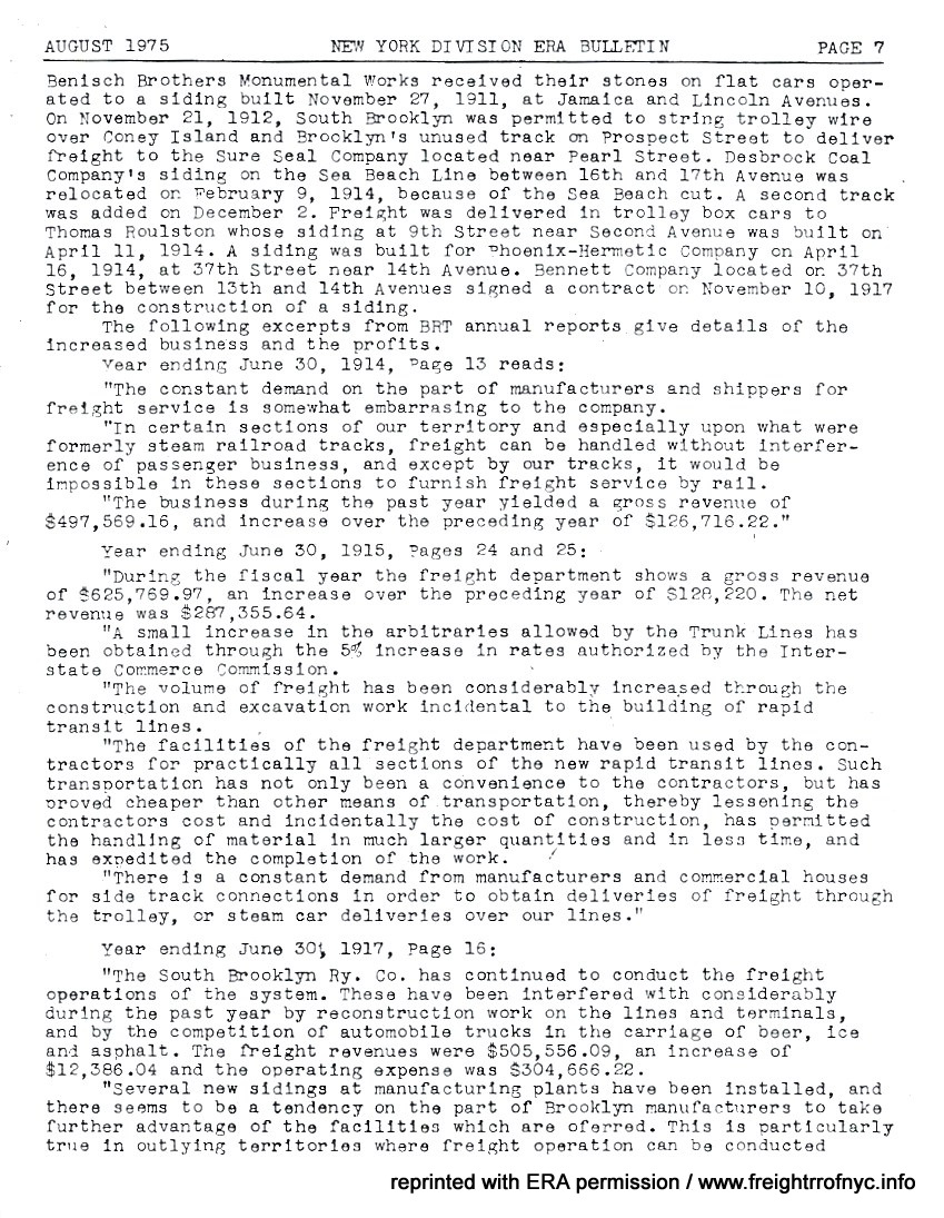 |
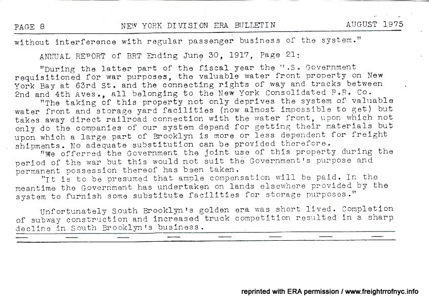 |
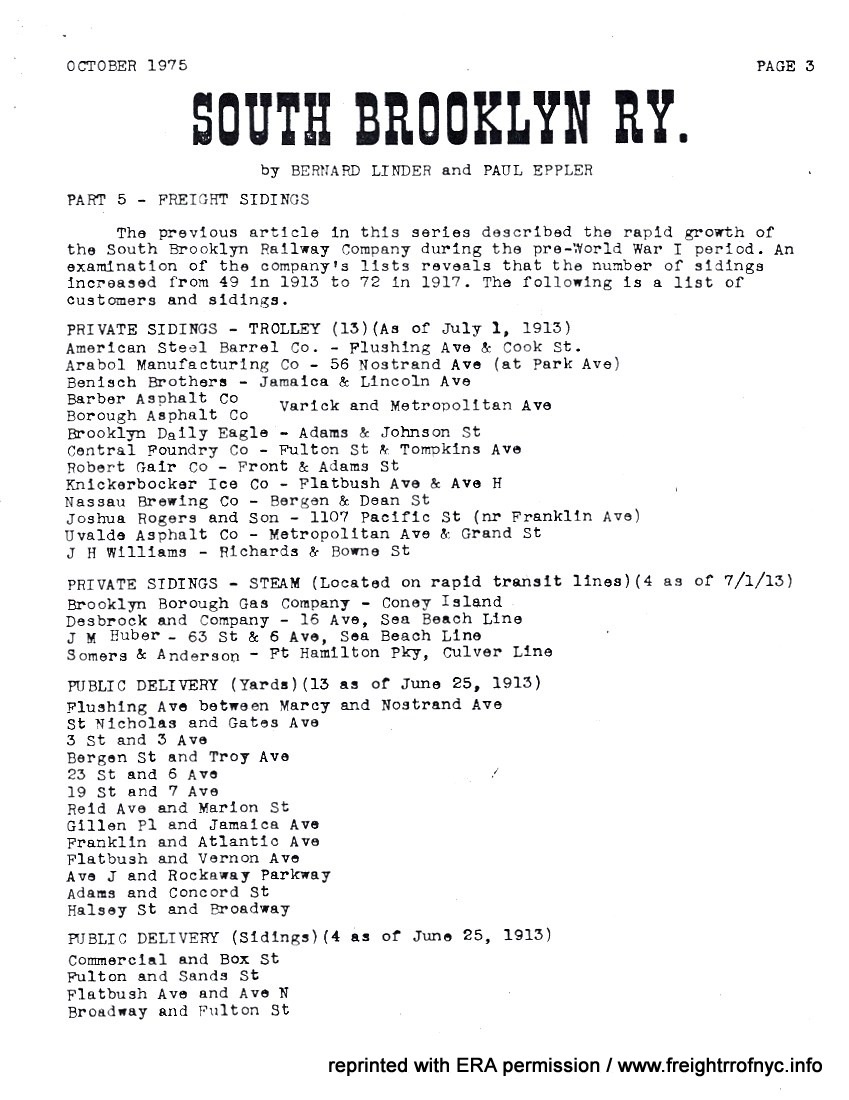 |
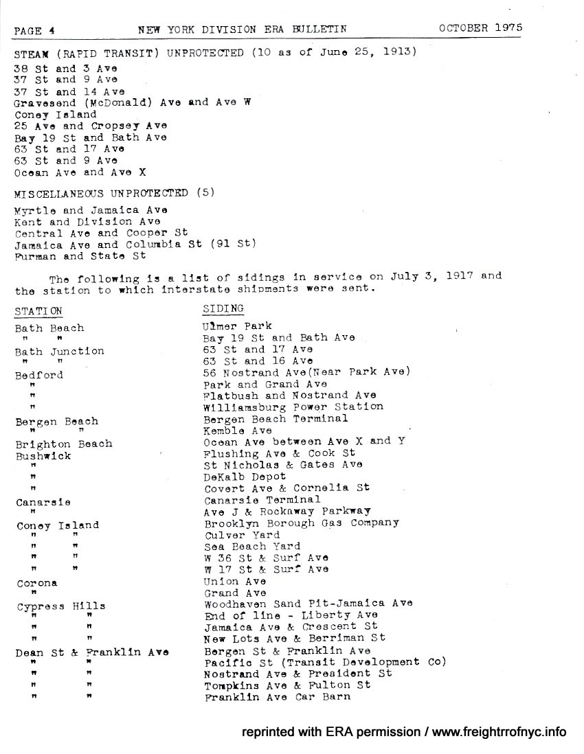 |
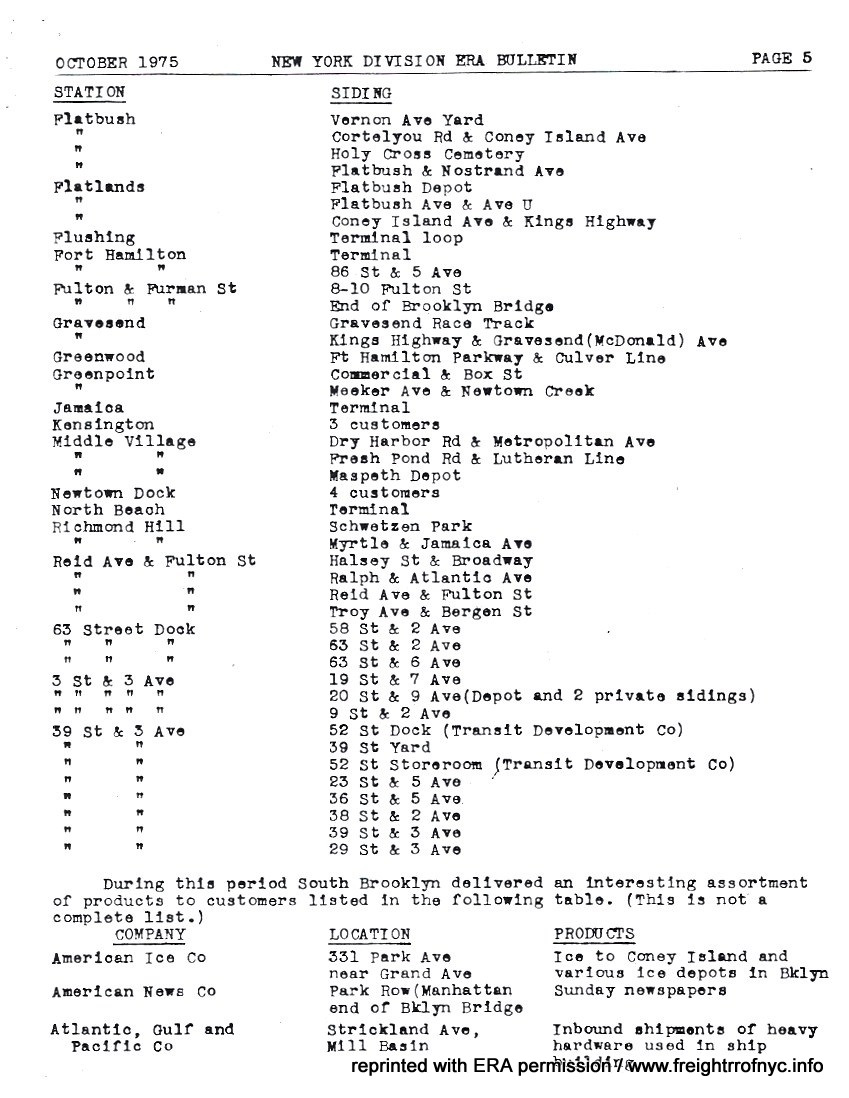 |
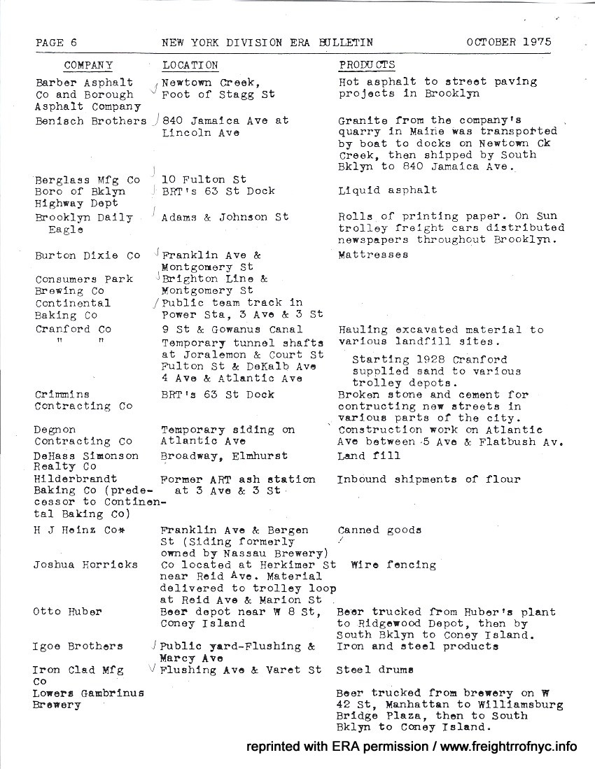 |
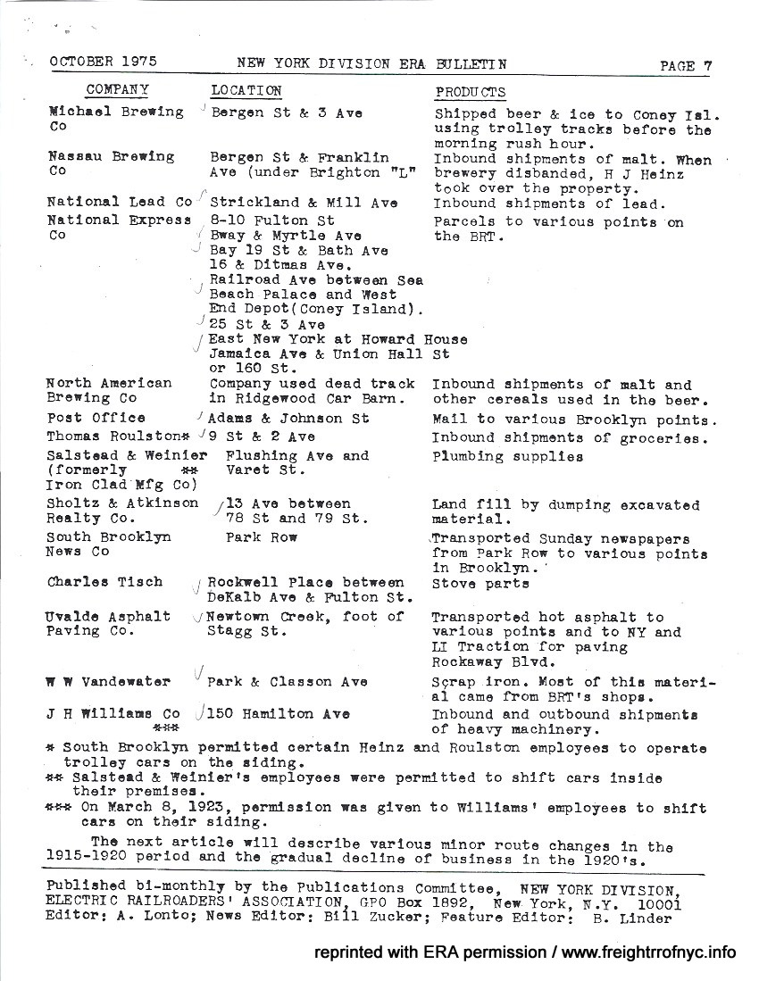 |
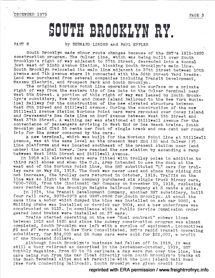 |
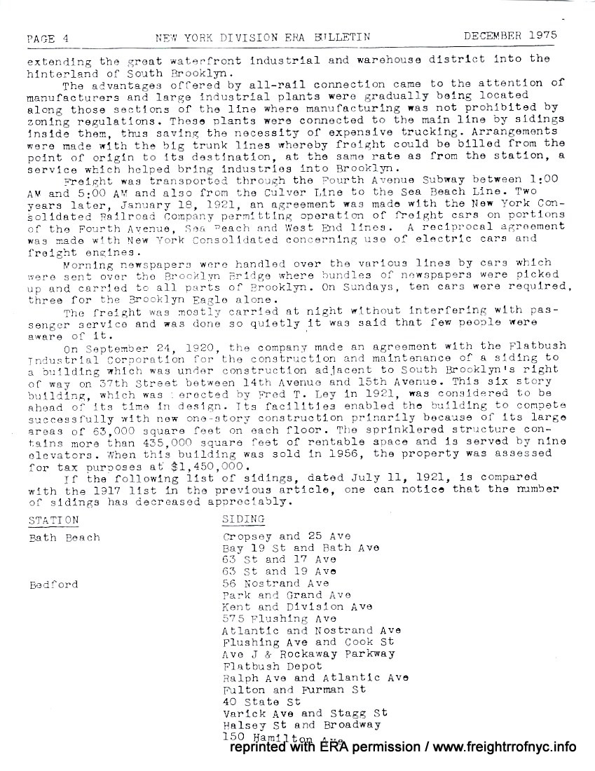 |
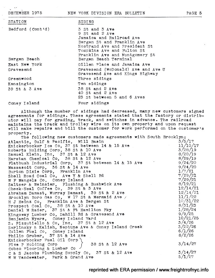 |
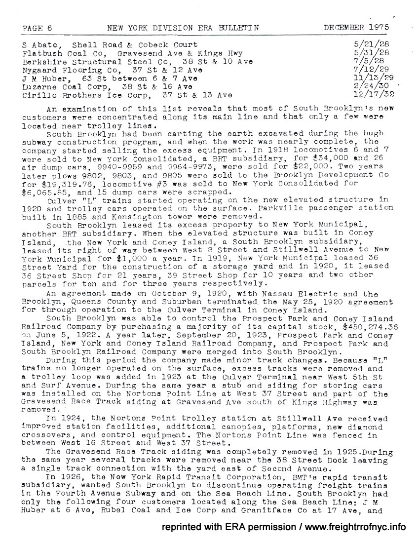 |
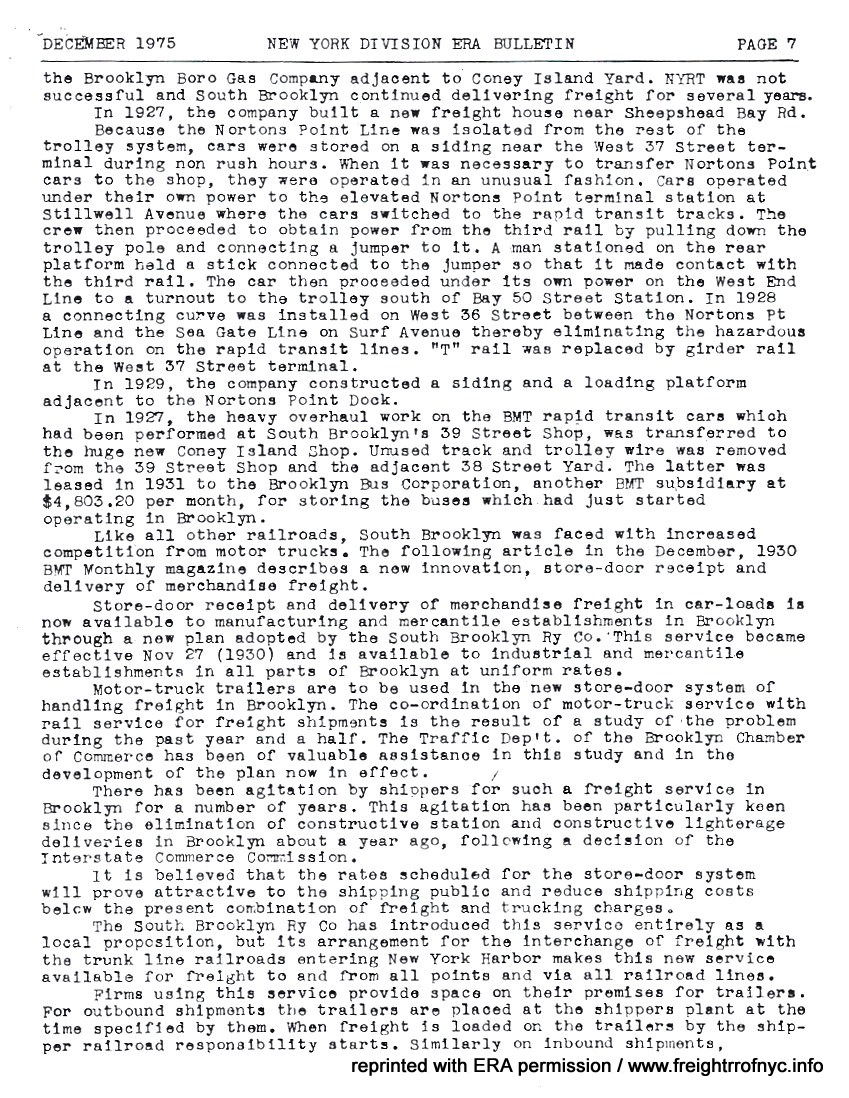 |
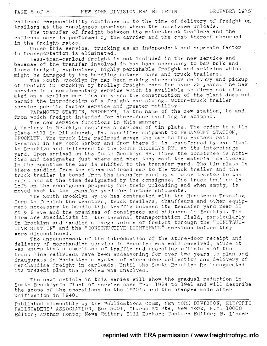 |
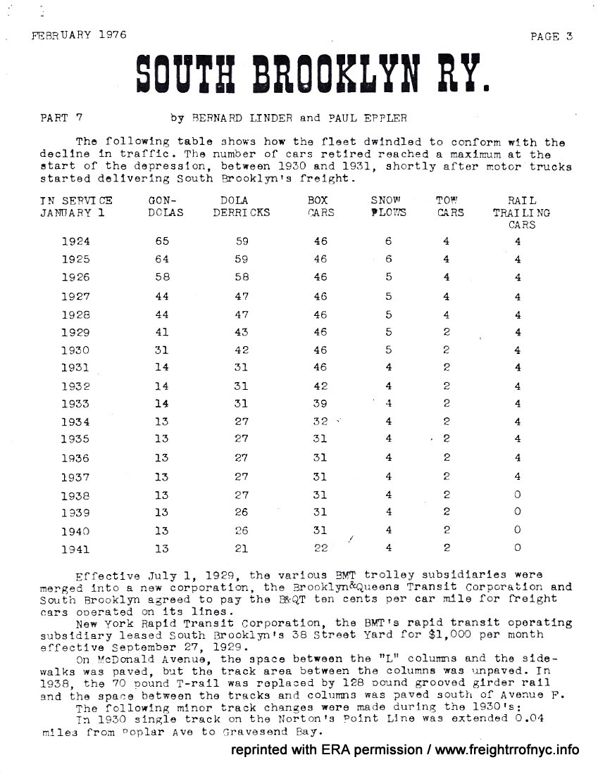 |
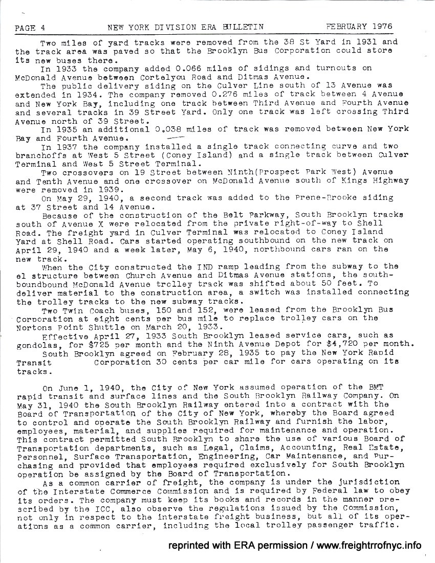 |
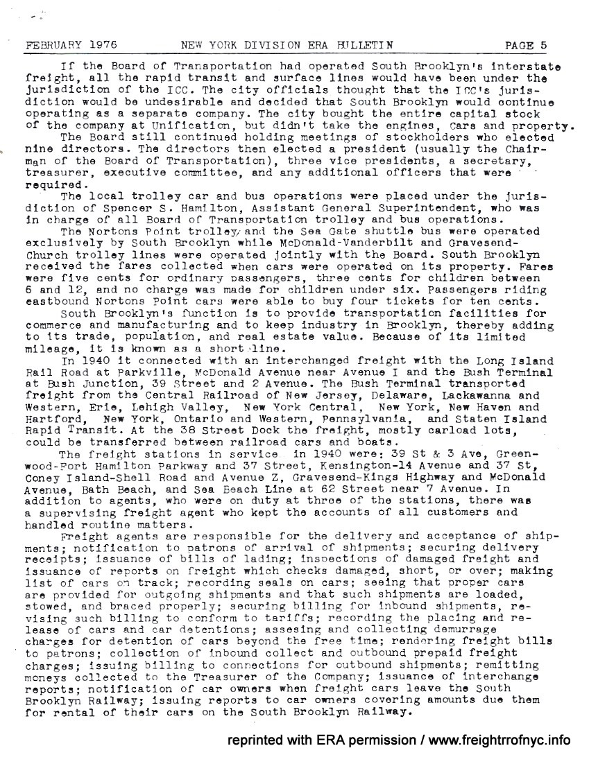 |
 |
 |
 |
 |
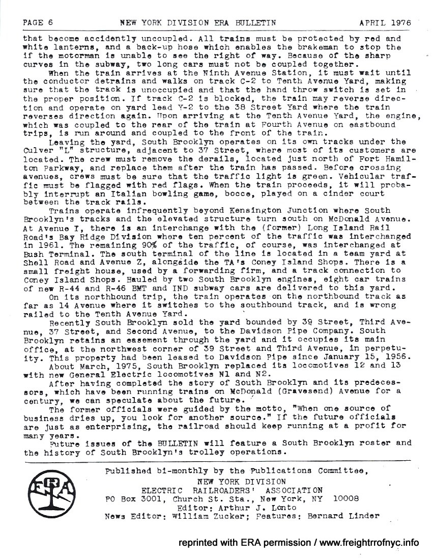 |
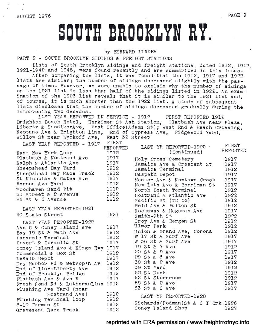 |
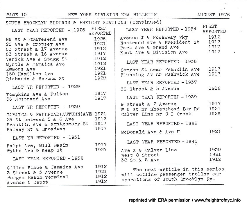 |
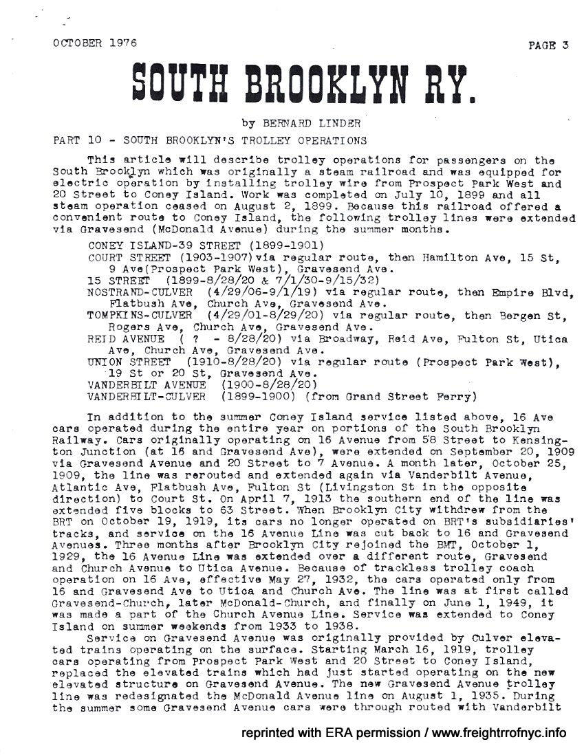 |
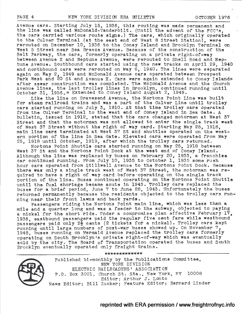 |
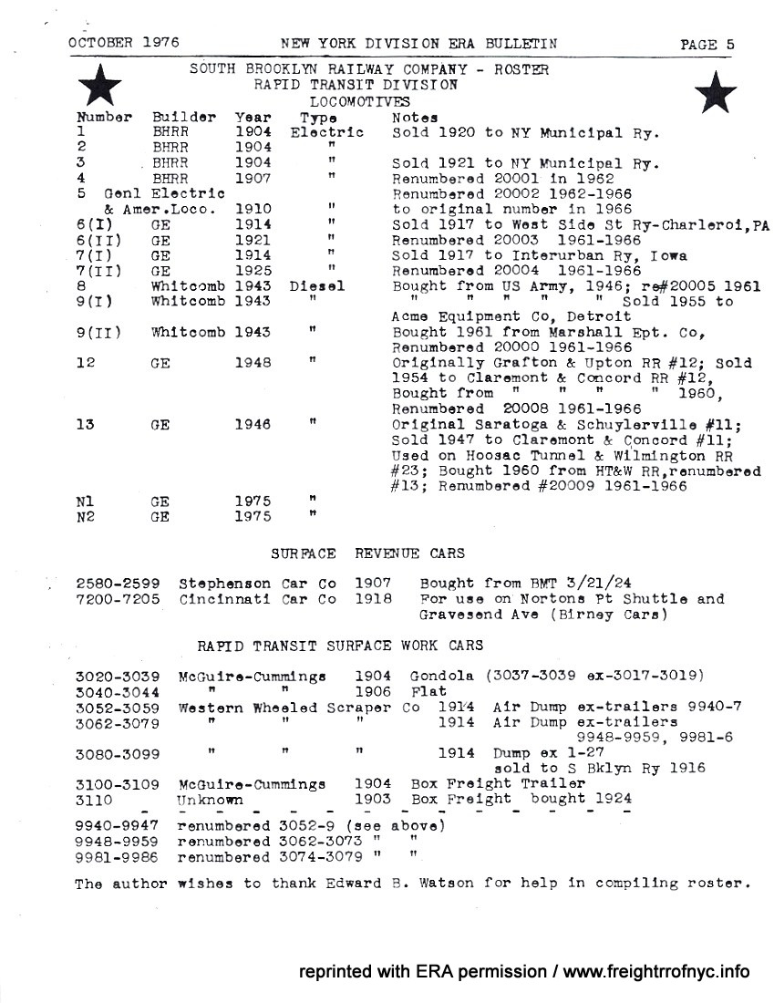 |
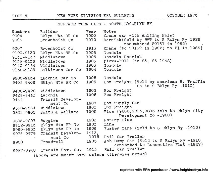 |
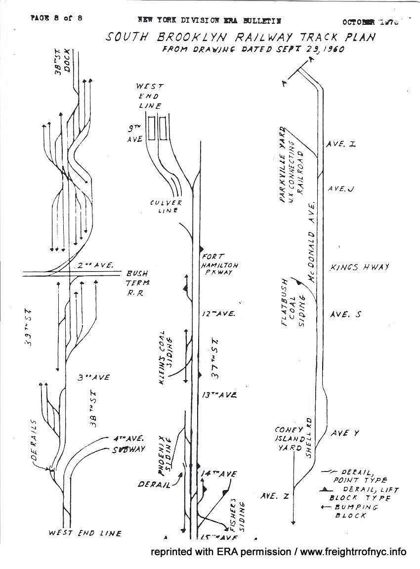 |
.
.
| Main Index |
.
.
.
| Main Index |
.

As this particular webpage deals with an active railroad, viewers should be aware that:
this webpage or the author is not affiliated with:
.
South Brooklyn Railway,
New York City Transit Authority,
Metropolitan Transit Authority,
City of New York,
South Brooklyn Marine Terminal,
New York City Economic Development Corporation,
New York New Jersey Rail,
Davidson Pipe Supply Company, or
Costco Wholesale Corporation;
.
or any of their subsidieries, holding companies or parent organizations,
employees or otherwise;
and no affliation or connection with those companies or municipalities is
suggested or implied.
This website and the information contained
within has been compiled for the use of reference only, and any inaccuracies
are purely accidental.
This webpage sees revision for the purpose of the addition of information,
or correction of inaccurate data.
Suggestions or corrections should be sent directly
to:
bedt14@aol.com
.
.