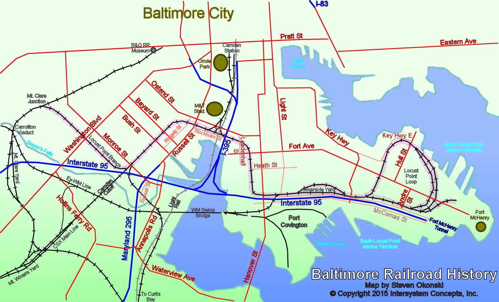
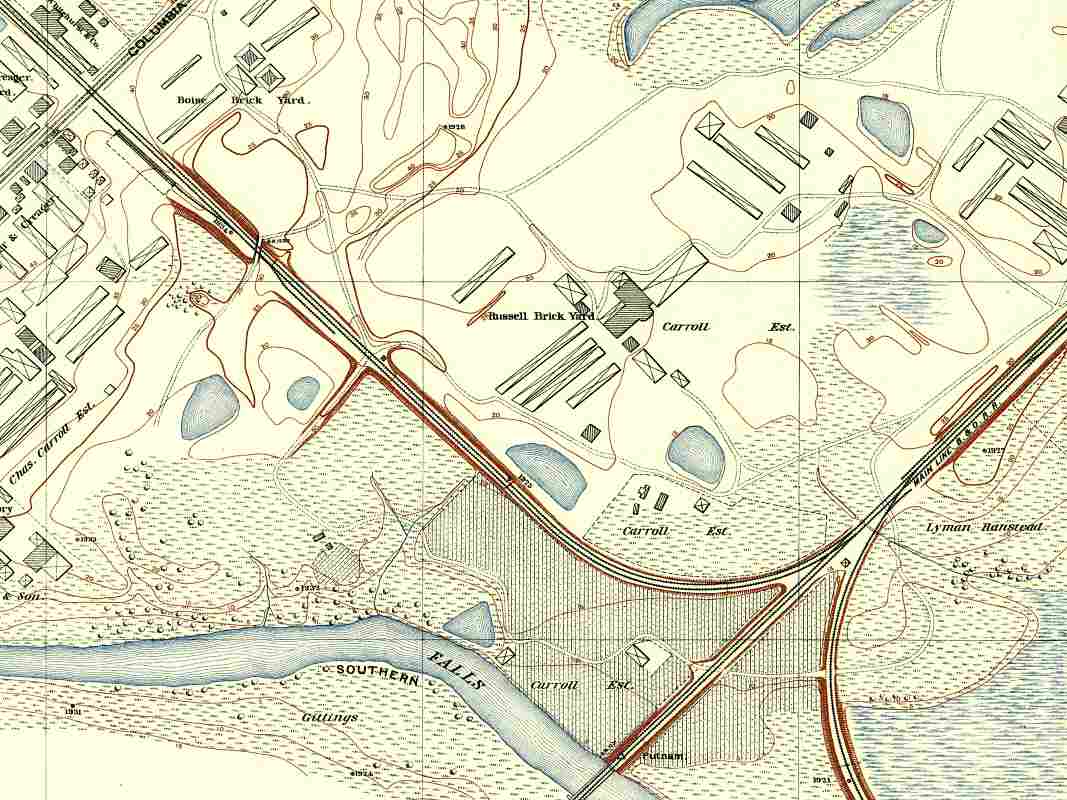
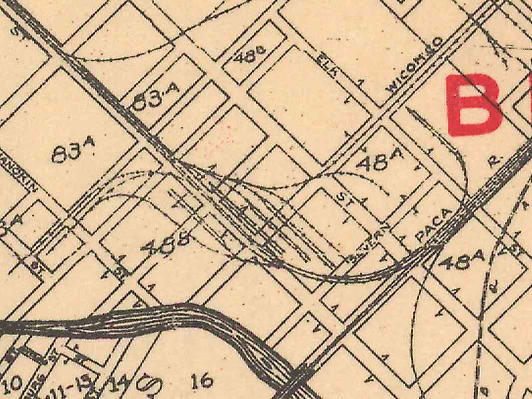
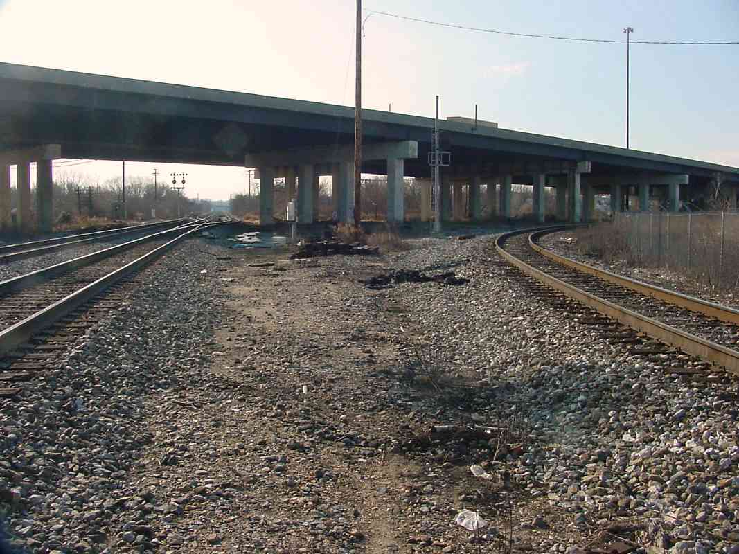
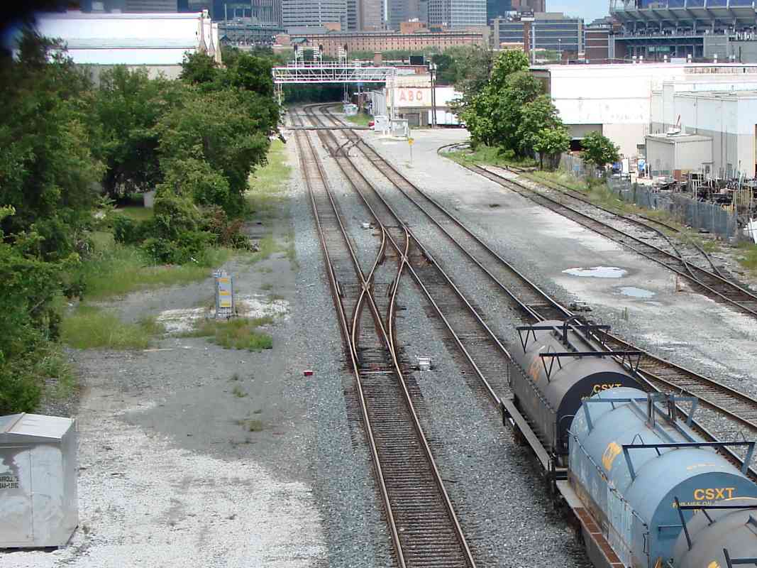
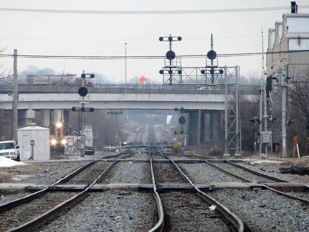
Visit the TrainWeb.org Fan Page on Facebook!
B&O Photo Tour

B&O Locust Point Branch
Modern day photo tour

Accompanying each photo below are:

Click a photo to see a larger view. Please send your comments and corrections to Steve.


Brief Historical Background: Locust Point Branch

Mt. Clare Junction

Mt. Clare Junction
Mile: 0.0 Date: Apr 2001
Ease: B View: NE
Area: D IC2: 217
Map: Ba 42 G 2 Topographic Maps

This new Locust Point Branch peeled off from the main line at Mt. Clare Junction, pictured here, just northeast of the Carrollton Viaduct. From here, it snaked its way generally east to the new waterfront facilities.

In this photo, B&O Museum engine Pere Marquette switcher 11 sits about a mile from the museum and watches a CSX freight roll past onto the Locust Point Branch.


SE View

SE View
Mile: 0.1 Date: Jan 2001
Ease: B View: SE
Area: C IC2:
Map: Ba 42 G 2 Topographic Maps

Here's the view from the other side of the freight, looking southeast in the general direction of Locust Point. The road sign in the distance is that for the Russell Street exit from Interstate 95.


LMS 700

LMS 700
Mile: 0.5 Date: Jan 2001
Ease: A View: NW
Area: C IC2:
Map: Ba 42 H 3 Topographic Maps

Heading this same freight is Locomotive Management Services engine 700 which pauses at Washington Boulevard for the OK to move ahead. Immediately behind the lead engine is a Union Pacific diesel, an uncommon sight this far east. The train stretches back past Mt. Clare Junction to the Carrollton Viaduct.

That's the former Montgomery Ward warehouse in the background.


Old Signals
NEW! Jan 2004

Old Signals
Mile: 0.6 Date: Dec 2003
Ease: A View: NW
Area: C IC2:
Map: Ba 42 H 3 Topographic Maps

This grade crossing is of note because it may be Baltimore city's oldest one that remains in use. The crossing spans busy Washington Blvd., the main road to the nation's capital at the time the tracks of the Locust Point Branch were laid in the 1840s.

Appropriately, an elderly signal guards the crossing. The pole and support design makes me think a wig-wag style signal had been mounted here before the lights.

Links: Pic of Wig Wag at B&O Museum, Dan's Wig Wag Site


Carroll

Carroll
Mile: 0.9 Date: Dec 2001
Ease: B View: E
Area: C IC2: 143
Map: Ba 42 J 3 Topographic Maps

Here at Carroll, the Locust Point Branch (on the left) bends to join with the Camden Cutoff and Curtis Bay Branch for the trip toward downtown Baltimore.

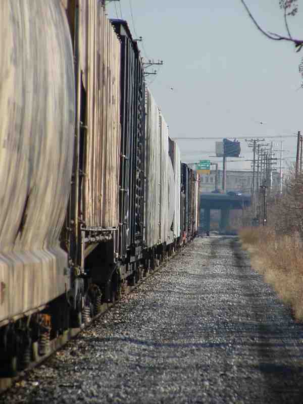
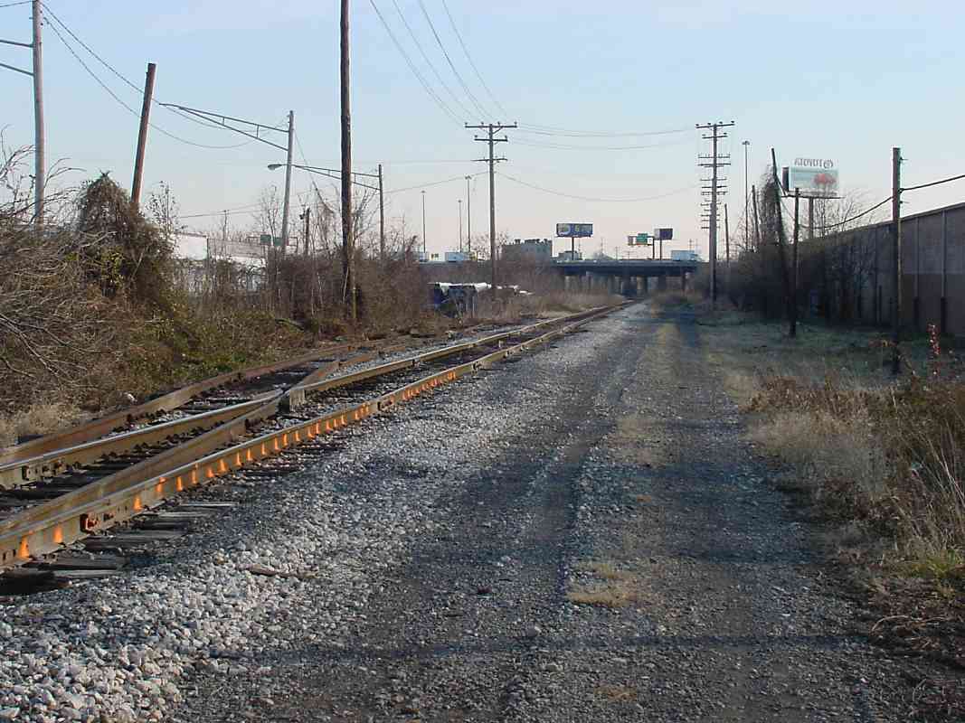
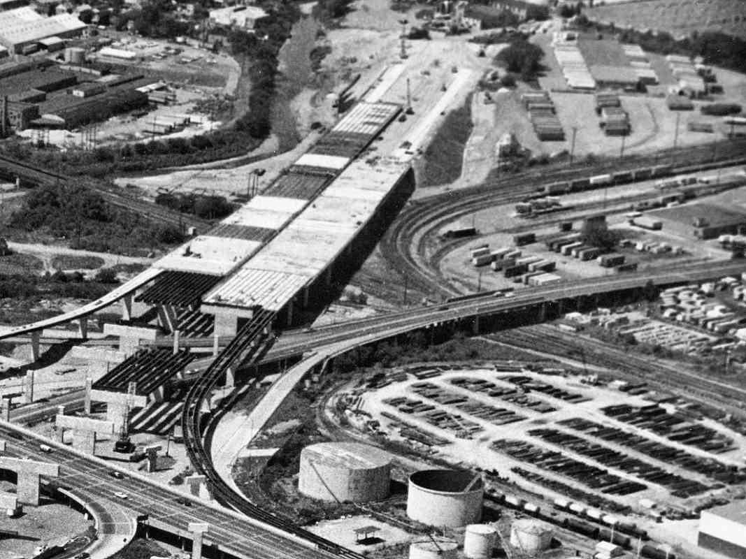
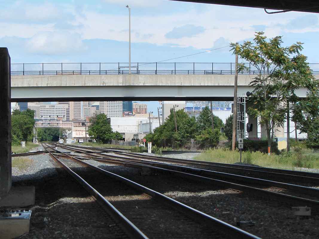
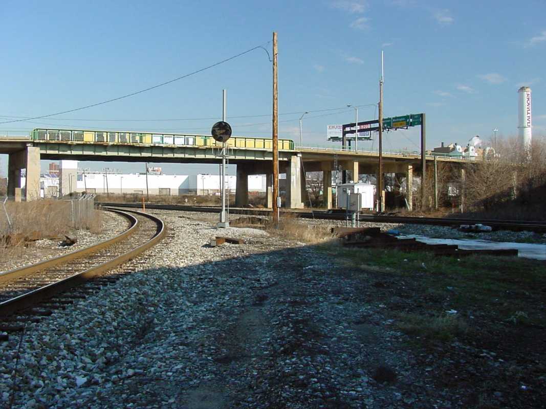
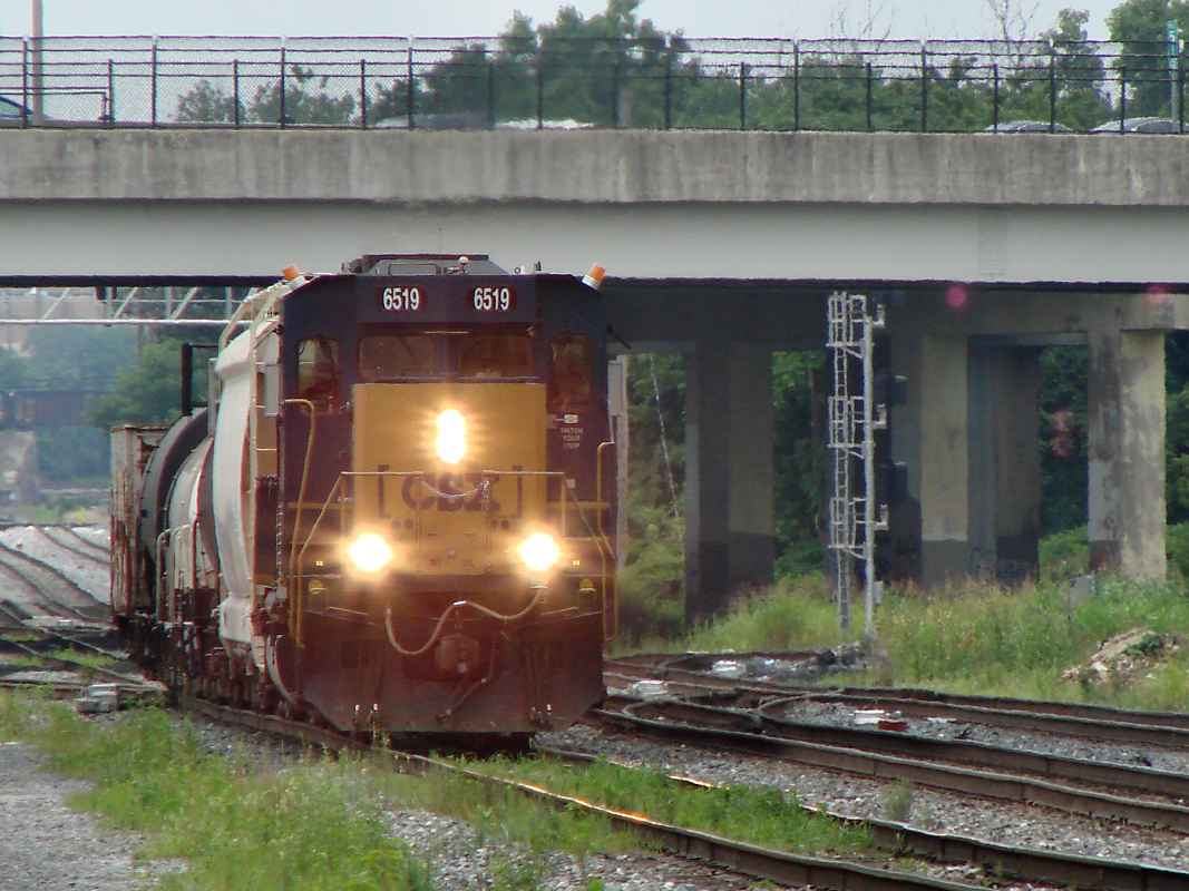
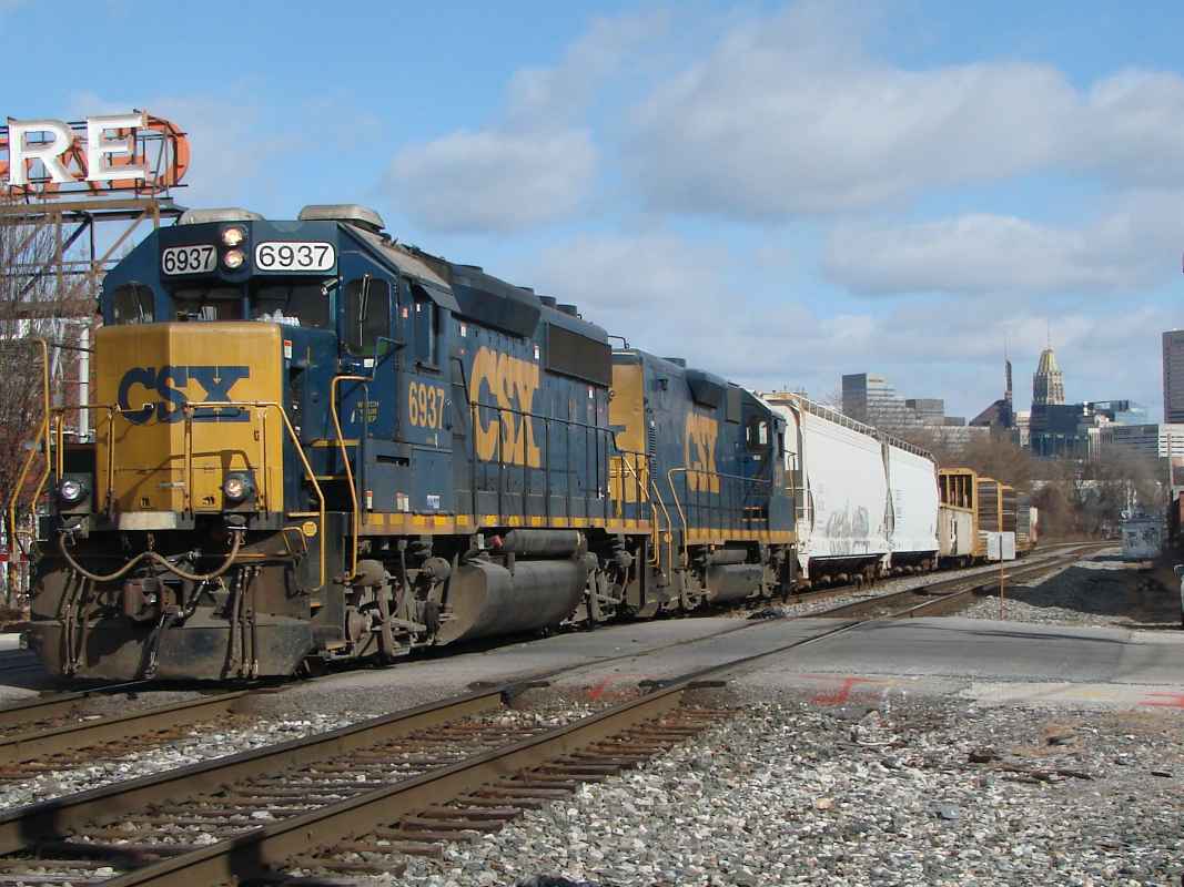
Casting the shadow at our feet is I-95. The yellow/green bridge visible carries Monroe Street over the tracks. Acting as a convenient landmark near the right edge is the "Baltimore" stack which can be seen readily from I-95 near the I-395 interchange.
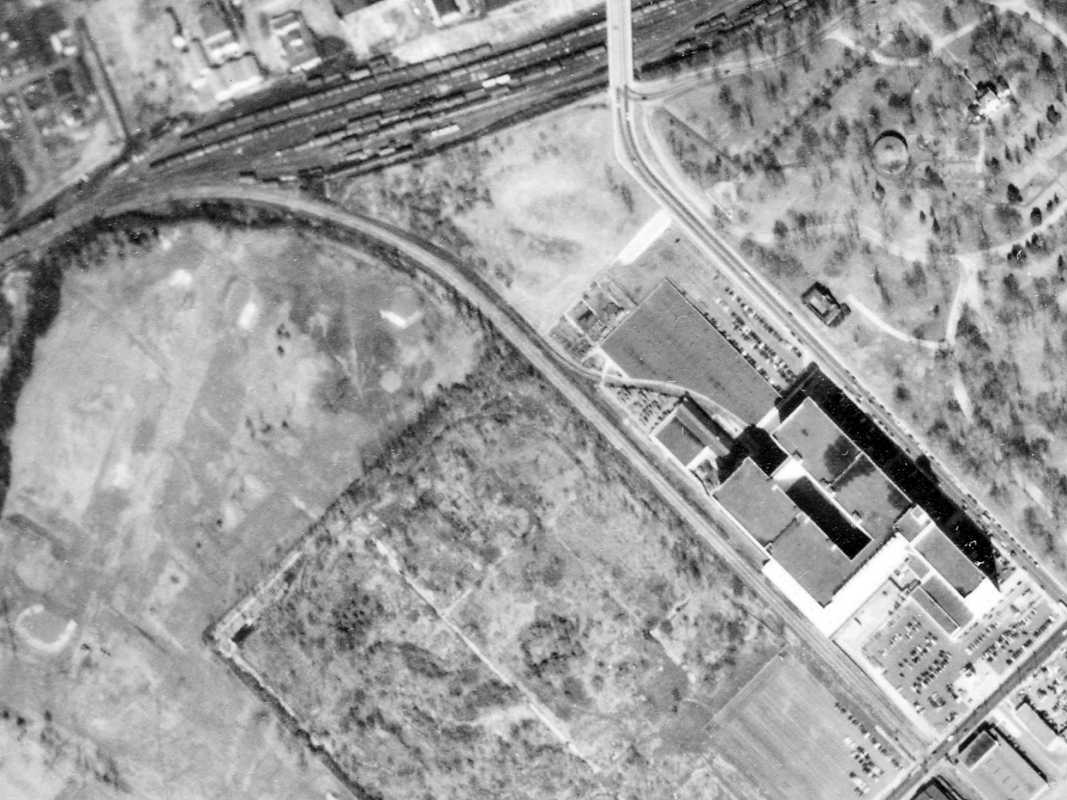
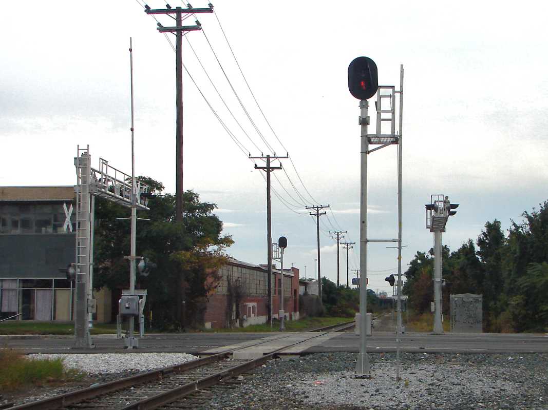
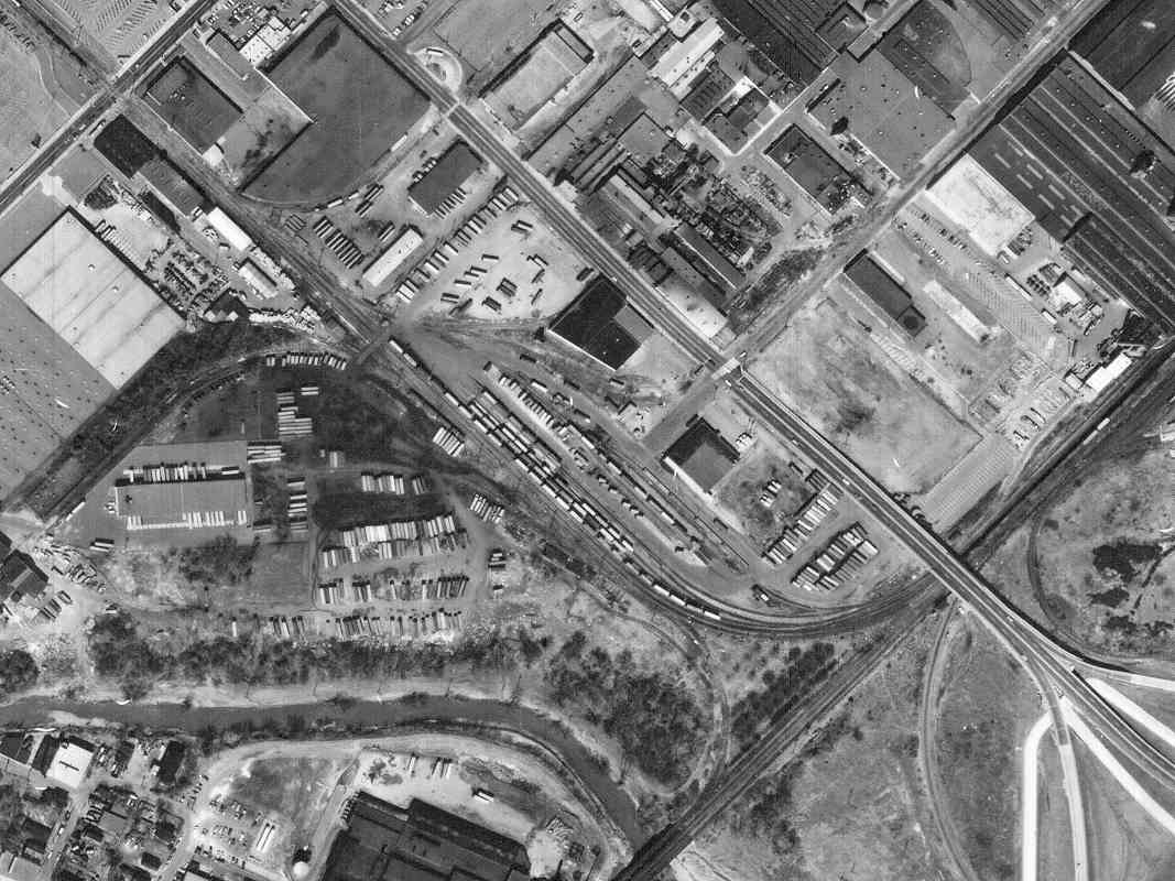
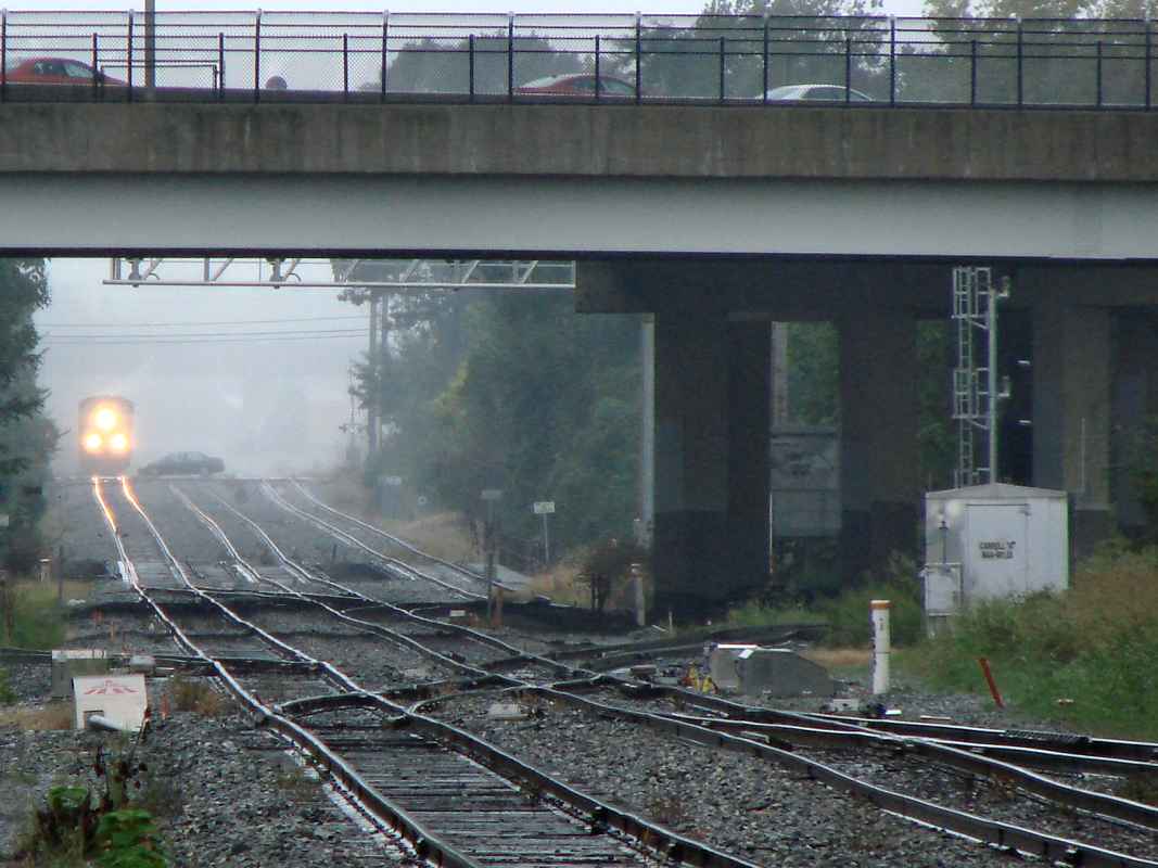
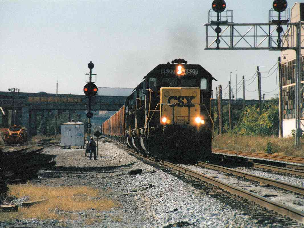

Bush Street

Bush Street
Mile: 1.3 Date: Oct 2000
Ease: A View: SW
Area: C+ IC2: 143
Map: Ba 42 J 3 Topographic Maps

A crewman waits near the signal to throw the switch as CSX 8527 turns on the Wye near the Bush Street grade crossing. In this photo, we're looking back toward the Monroe Street bridge.

"Turning on the Wye" is the technique used to turn a train around when there are no faster ways. It requires a track arrangement generally shaped like the letter Y. Imagine the train coming from the bottom of the Y. The track switches are set so that the train is pulled up the left branch of the Y. Next the switches are reset so that the train can back up onto the right branch of the Y. Finally, the switches are set so the train can be pulled down to the bottom of the Y. It is now headed in the opposite direction than when it started the process.


City View

City View
Mile: 1.3 Date: Oct 2000
Ease: A View: NE
Area: C+ IC2:
Map: Ba 42 J 3 Topographic Maps

Here CSX 8527 has crossed Bush Street, and has a nice view of part of downtown Baltimore's skyline. That's the Bayard Street grade crossing a short distance away.


Camden Cutoff

Camden Cutoff
Mile: - Date: Apr 2001
Ease: B View: NE
Area: B IC2:
Map: Ba 42 G 5 Topographic Maps

This is a similar view as prior photo, but from about a mile further southwest. The tracks seen here are not part of the Locust Point Branch, but rather the so-called Camden Cutoff, an 1868 shortcut that bypassed the Carollton Viaduct loop and led more directly to Camden Station.

Oriole Park at Camden Yards is the wide, low brick structure seen in the distant foreground.


Ridgely Street
Photo courtesy Adam Paul

Ridgely Street
Mile: 1.6 Date: 2001
Ease: A View: W
Area: B IC2:
Map: Ba 42 K 2 Topographic Maps

CSX 6249 makes the turn at Scott Street heading for the Ridgely Street grade crossing. Behind us is the Russell Street highway bridge and Bailey's Y.


Bailey's Wye

Bailey's Wye
Mile: 1.8 Date: Mar 2001
Ease: B View: S
Area: B+ IC2: 141
Map: Ba 43 A 2 Topographic Maps

Like coal, the B&O's passenger business was expanding rapidly too. In 1852 the railroad began construction of a new station at Camden Street. To reach the station, it built a spur from the Locust Point Branch at a location known as Bailey's, a short distance south the station.

By 1875, the rapidly expanding railroad had outgrown not only the facilities at Mt. Clare, but also those associated with Camden Station. Bailey's was centrally located within the busiest B&O branches, and was therefore selected for the shops known as Bailey's Roundhouse. For about the next 75 years, countless trains would pass by or be serviced here.

Today, courtesy construction of I-395, the Light Rail, and the stadiums, little more than the tracks survive. In this view south, the Locust Point Branch is hidden behind the mound in the center, over which the Ostend Street highway bridge crosses.


Bailey's Wye

Bailey's Wye
Mile: 1.8 Date: May 2001
Ease: A View: E
Area: B IC2: 141, 316
Map: Ba 43 A 2 Topographic Maps

Stockholm Street, on the opposite (south) side of the Bailey's mound, is a good spot from which to view the action. Here, a light rail train climbs over a CSX mixed freight which is headed to the right: south from Camden Station or the Howard Tunnel, and bending east onto the Locust Point Branch. The elevated highway in the background is I-395.

The track in the lower left is the route we've been following from Mt. Clare Junction. From here, the branch wanders east rather uneventfully until it reaches the Locust Point area.


CSX 8513

CSX 8513
Mile: 3.6 Date: May 2001
Ease: A View: E
Area: B IC2:
Map: Ba 43 F 3 Topographic Maps

At the Hull Street grade crossing, CSX 8513 backs carefully into the North Locust Point Marine Terminal, part of which can be seen in the background left.

The tracks at Locust Point form a large loop. This photo is near the northernmost point of the loop.


North Locust Point

North Locust Point
Mile: 4.0 Date: May 2001
Ease: A View: N
Area: B IC2: 80
Map: Ba 43 F 4 Topographic Maps

This is the North Locust Point Marine Terminal, as viewed from the bridge over the easternmost part of the track loop. The terminal dates to 1845 and was built to ease the congestion at Baltimore's original port at its inner harbor. The railroad line to here was completed in 1849.

Baltimore's Inner Harbor area is at distant left. Barely discernable in the full-size version of this picture, left of the steam exhaust, is the back of the Domino's Sugar sign.

Link to older picture: 1920s


Sluisgracht

Sluisgracht
Mile: 4.1 Date: May 2001
Ease: A View: NE
Area: B IC2: 362
Map: Ba 43 F 4 Topographic Maps

A large cargo ship registered in Amsterdam makes the rail tankers parked in the foreground look like models. Little spurs like that seen here extend to the various piers to facilitate unloading and loading.

A short walk to the right (but not seen here) is Fort McHenry, "Home of The Star-Spangled Banner".

Links: old port picture, track the Sluisgracht


South Locust Point

South Locust Point
Mile: 4.4 Date: May 2001
Ease: A View: SW
Area: B IC2:
Map: Ba 43 F 4 Topographic Maps

South Locust Point Terminal appears to handle even larger ships, such as that in the distant right. In the foreground, oversized (extra height) "Big Blue" boxcars have little to do but work on their tan.

By 1880, the B&O was hauling in almost 2 million tons of coal annually for export from Locust Point. Shortly after that, the Pennsylvania RR opened a competing terminal across the harbor at Canton and split off some of the B&O's coal business.

Link to older picture: Pic


Caboose

Caboose
Mile: 4.4 Date: May 2001
Ease: A View: S
Area: B IC2:
Map: Ba 43 F 4 Topographic Maps

A Seaboard caboose makes an appropriate endpoint for the Locust Point Branch tour.


Return to main page for other tours


Copyright Notice
Visit the TrainWeb.org Fan Page on Facebook!
Create your own free Rail Blog or Website!

Advertise | About Us | Contact Us | Sign up for our Newsletter | TrainWeb.com