TrainWeb.org Facebook Page
B&O Photo Tour


B&O Locust Point Branch
Modern day photo tour

Accompanying each photo below are:

Click a photo to see a larger view. Please send your comments and corrections to Steve.


<< Previous (west) | THIS PAGE: Ridgely to Riverside | Next (east) >>

Ridgely Street
Photo courtesy Adam Paul

Ridgely Street
Mile: 0.1 Date: 2001
Ease: A View: W
Area: B IC2:
Map: Ba 42 K 2 Topographic Maps

Just past the bend is this Ridgely Street grade crossing about to be negotiated by approaching CSX 6249.

CSX uses the letters BAM to refer to its Locust Point Subdivision. You'll see BAM on mileage signposts that uniquely identify each grade crossing. For CSX, BAM begins at this curve then proceeds behind the photographer.


Aerial 1927
NEW! Jan 2023

Aerial 1927
Mile: 0.3 Date: winter 1926/1927
Ease: View: N (up)
Area: IC2:
Map: Ba 43 A 2 Topographic Maps

Ridgely Street's grade crossing is at the LM at this photo's left edge, and ST appears at Russell Street, which was not yet grade separated. The eye-catching circular structure was B&O's Bailey Roundhouse where equipment was serviced.


Tangle

Tangle
Mile: 0.1 Date: Oct 2010
Ease: A View: E
Area: B IC2:
Map: Ba 42 K 2 Topographic Maps

The view east from Ridgely Street grade crossing finds a tangle of four tracks. Let's untangle them.

From left to right: the two leftmost tracks beyond the shadow (that cast by Russell Street, MD 295) serve Camden Station, less than a mile away. The next to the right leads to the single-tracked Howard Street Tunnel, the south portal of which is less than a mile away on the left.

The rightmost track is the one that carries traffic between here and Locust Point; it's the one this tour page will continue to follow. The bridge in the distance is part of Baltimore's light rail system. The pedestrian at center is strolling across Warner Street, the next grade crossing.


Warner Street
NEW! Jan 2023

Warner Street
Mile: 0.2 Date: Sep 2018
Ease: B+ View: E
Area: B- IC2:
Map: Ba 42 K 2 Topographic Maps

East of the 4-track Warner Street grade crossing, the Camden Cutoff and LPB go their separate ways. The LPB (the rightmost track) predates the Cutoff by about 10 years. An ad-wrapped light rail train cruises overhead.

Links: 1996, 1996
Change for: Camden Cutoff tour at this site


Round Houses
NEW! Jan 2023

Round Houses
Mile: 0.3 Date: May 2001
Ease: B+ View: N
Area: F IC2:
Map: Ba 43 A 3 Topographic Maps

Long before the Ravens did, B&O had its own round stadium here on the right, well, actually a roundhouse named Bailey's. By 1875, the rapidly expanding railroad had outgrown not only its facilities at Mt. Clare, but also those associated with Camden Station, so B&O chose the spot the right for shops known as Bailey's Roundhouse. For about the next 75 years, the roundhouse sat within the wye formed by the Camden Cutoff and LPB.

After 1928's Fair of the Iron Horse but before the B&O Museum opened in 1953, the B&O's collection of early locomotives was stored within the roundhouse. The LPB is at photo bottom.

Links 1996, 1996


Bailey's Wye
Updated Jan 2023

Bailey's Wye
Mile: 0.3 Date: May 2001
Ease: A View: E
Area: F IC2: 141, 316
Map: Ba 43 A 2 Topographic Maps

with light rail 
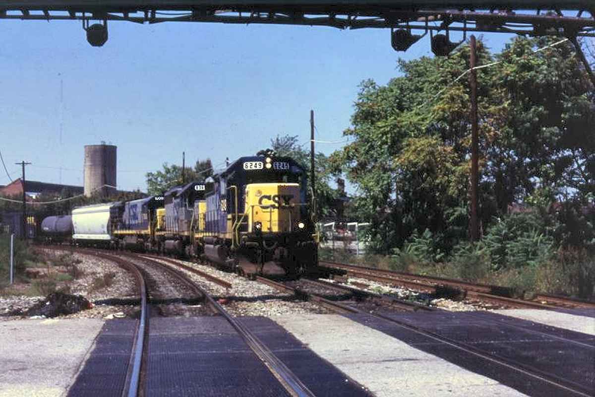
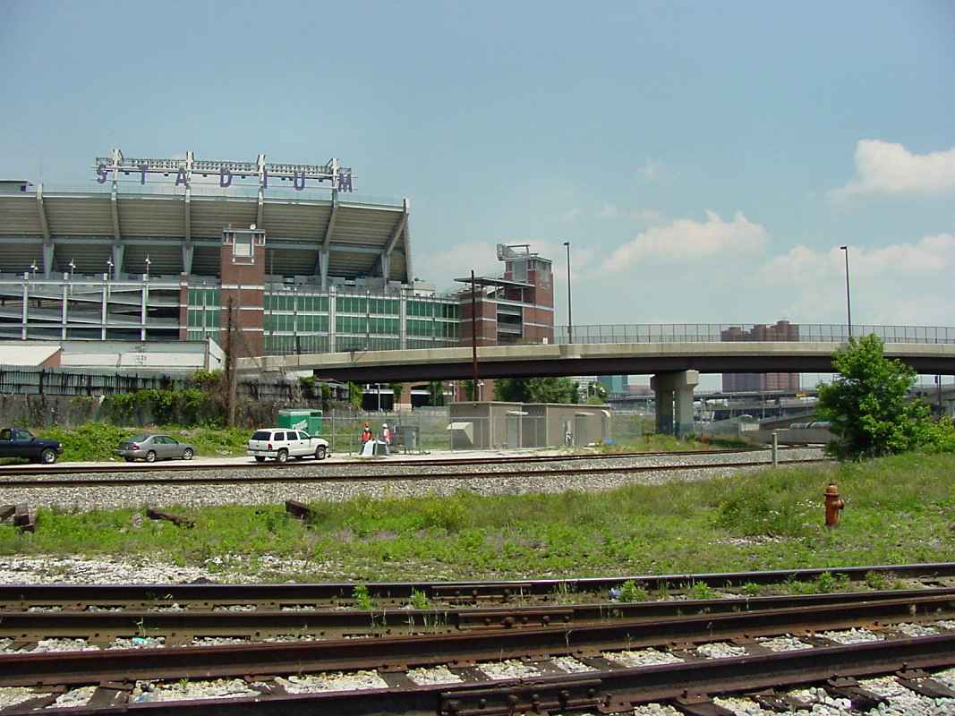
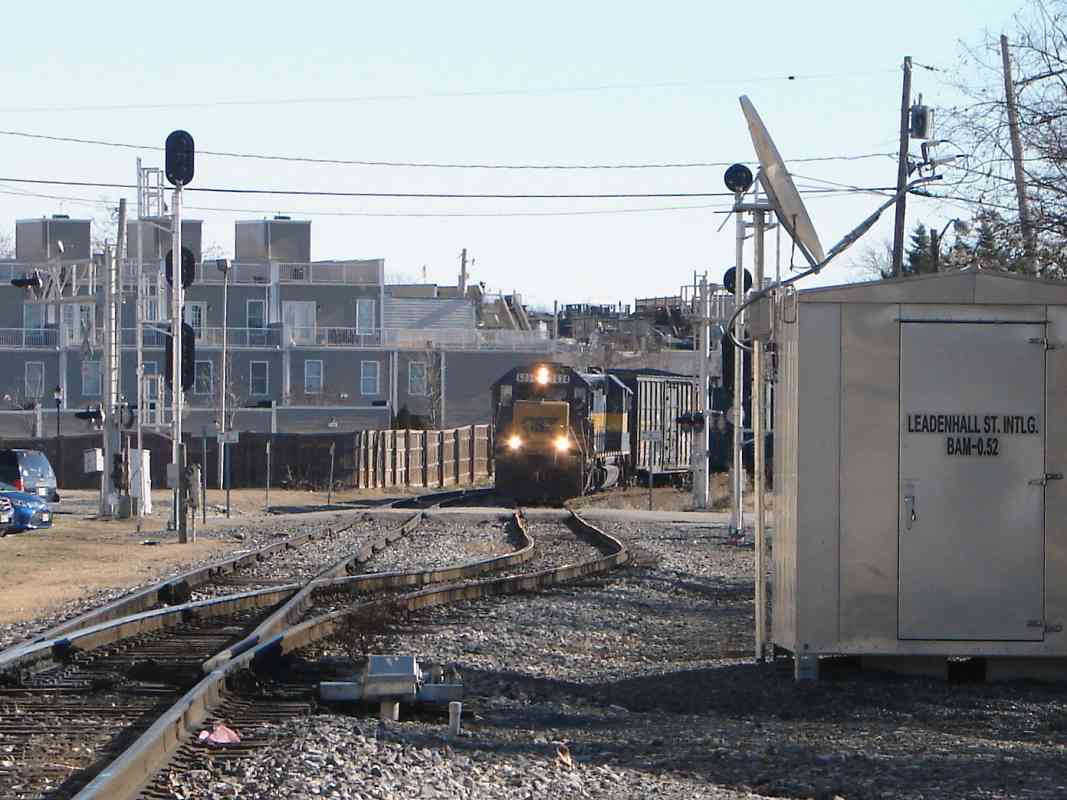
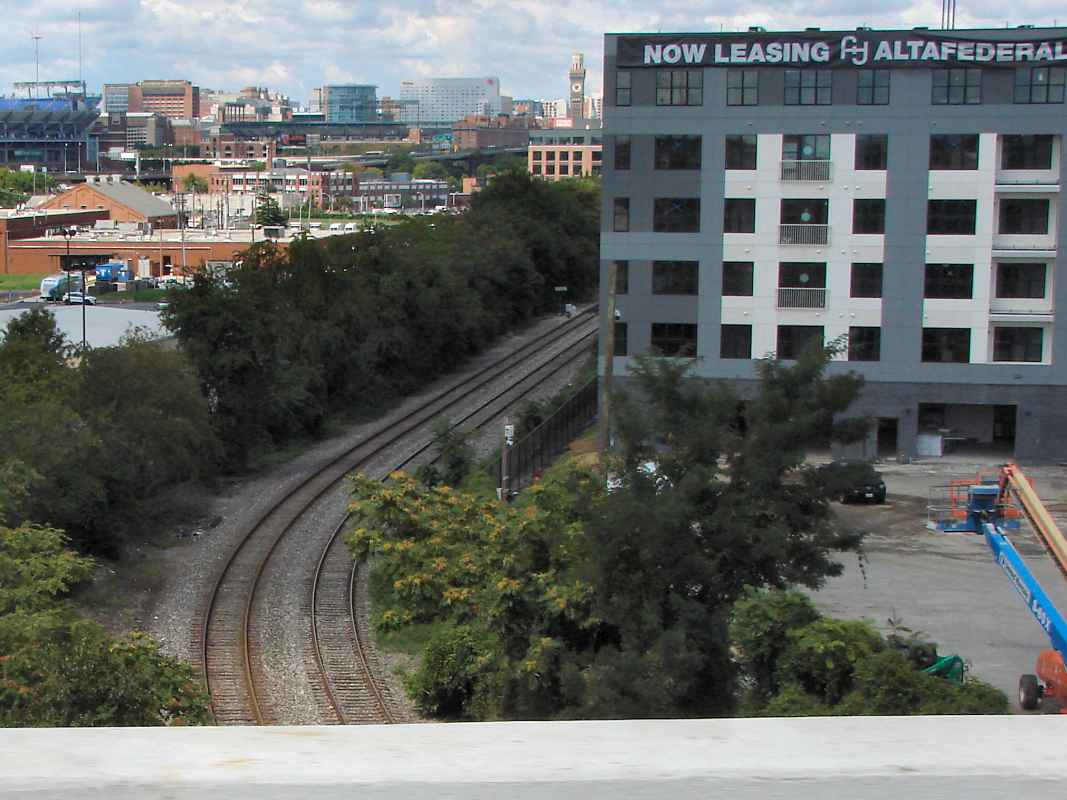
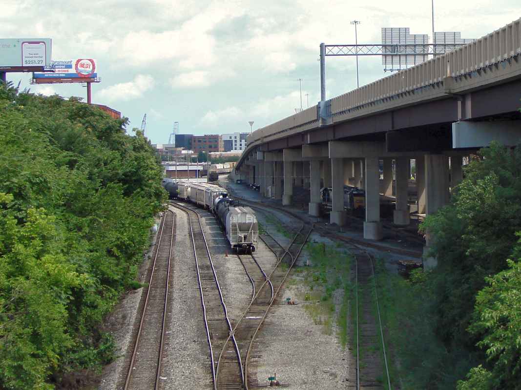
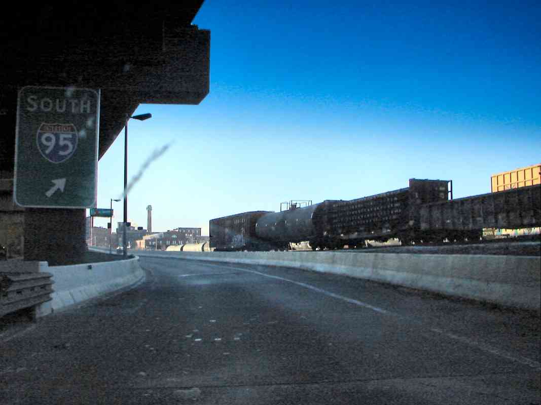
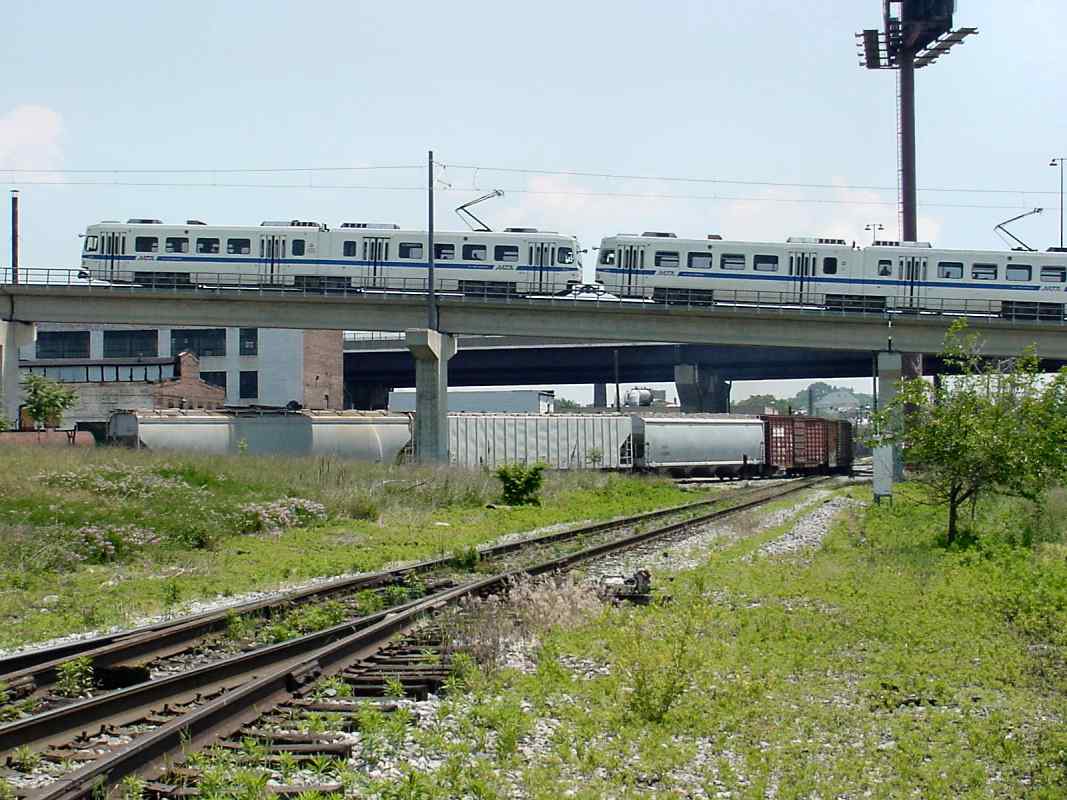
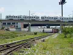
Stockholm Street, unseen on the right, had been a great spot from which to view the action before it was fenced off during 2014. Prior to the fences, these photos captured CSX 680, followed by a light rail train climbing over its mixed freight consist that is headed to the right: south from the Howard Street Tunnel, and bending east 
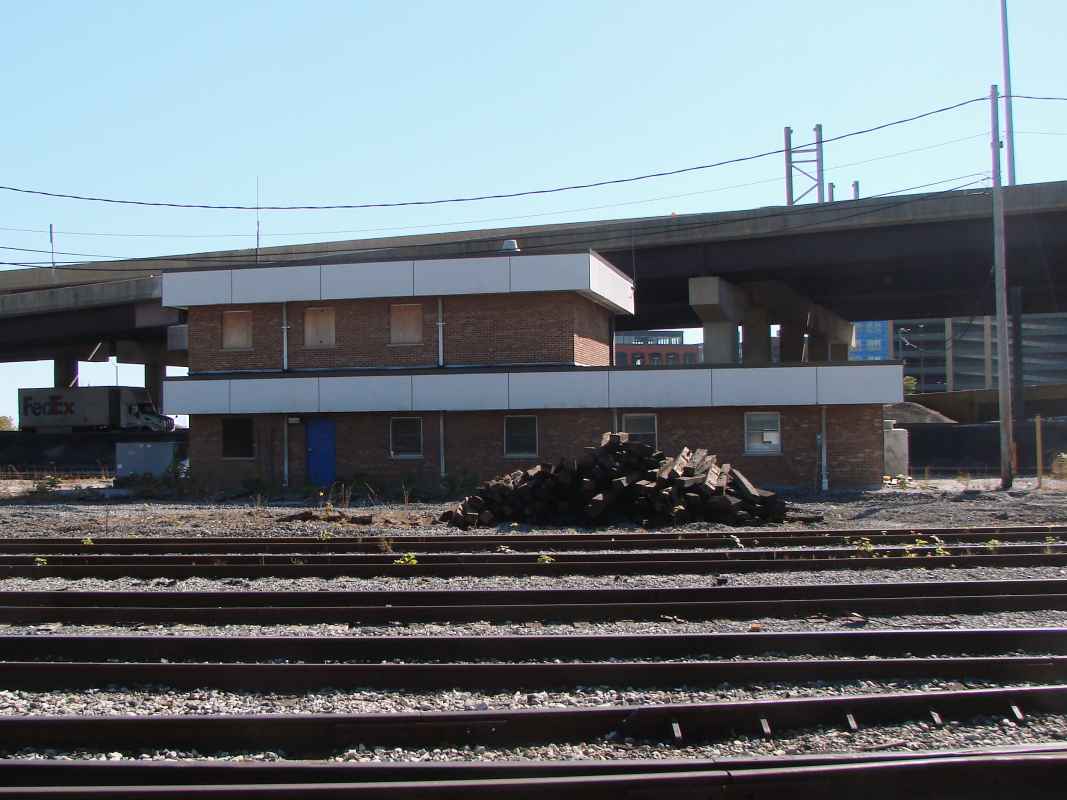
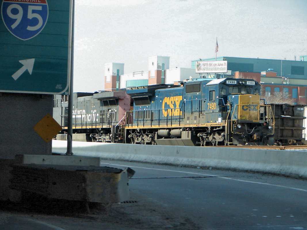
toward Locust Point. The elevated highway in the background is I-395.
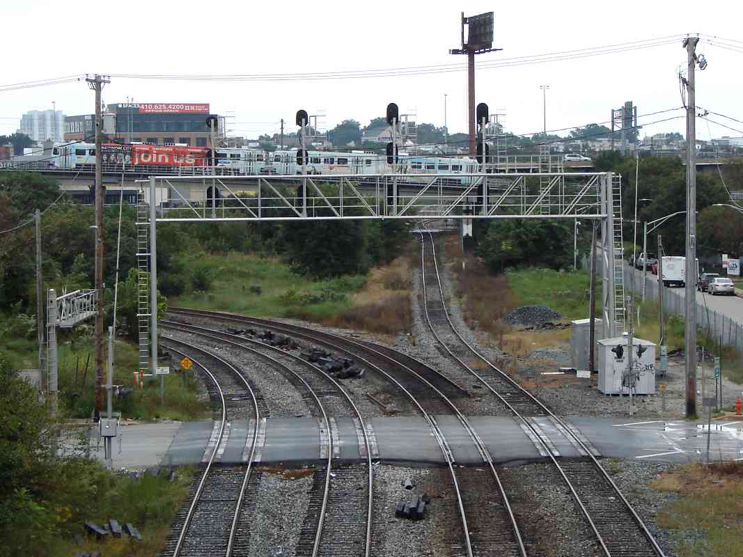
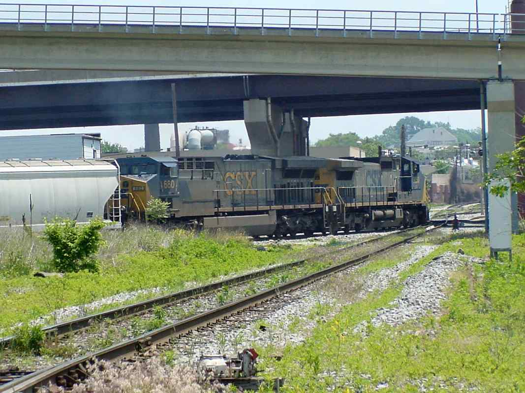
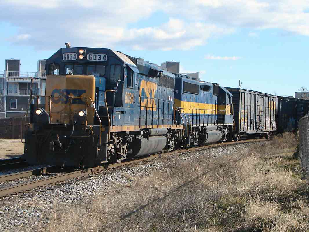
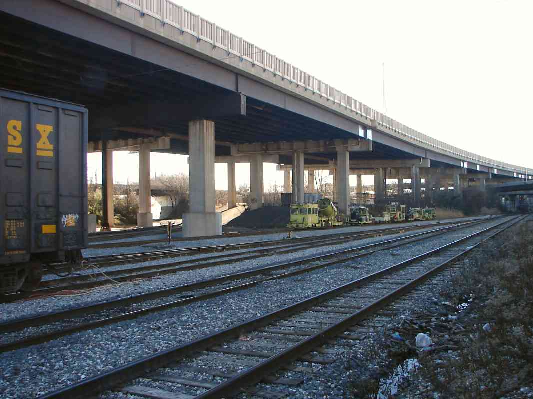
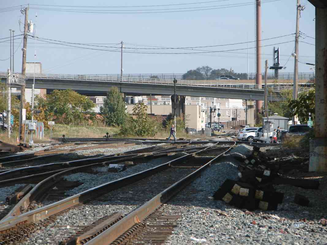
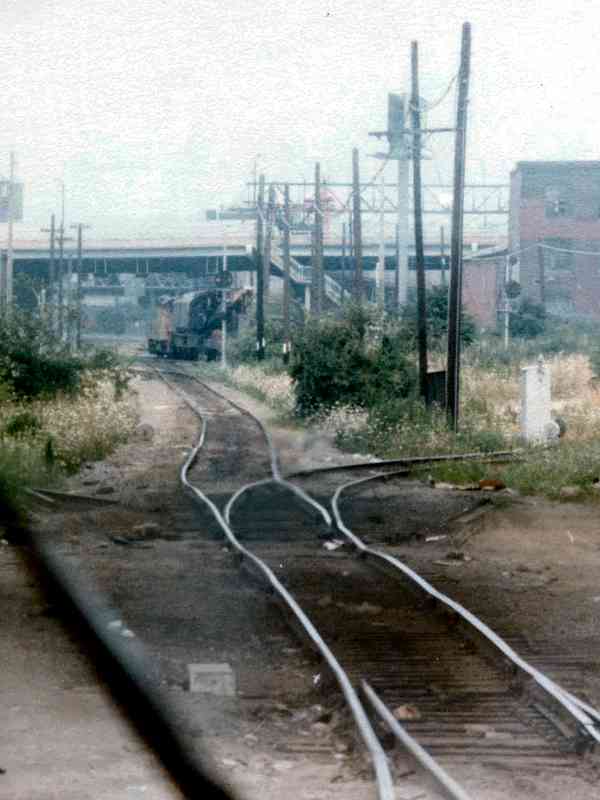
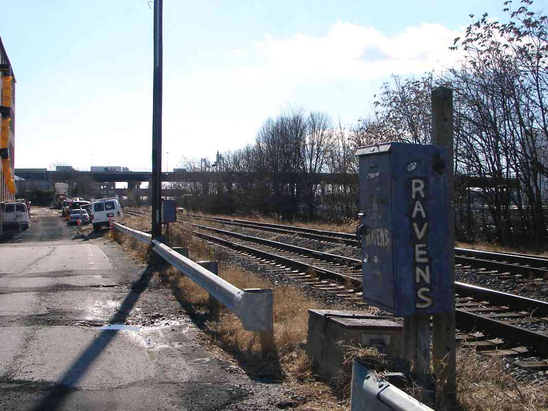
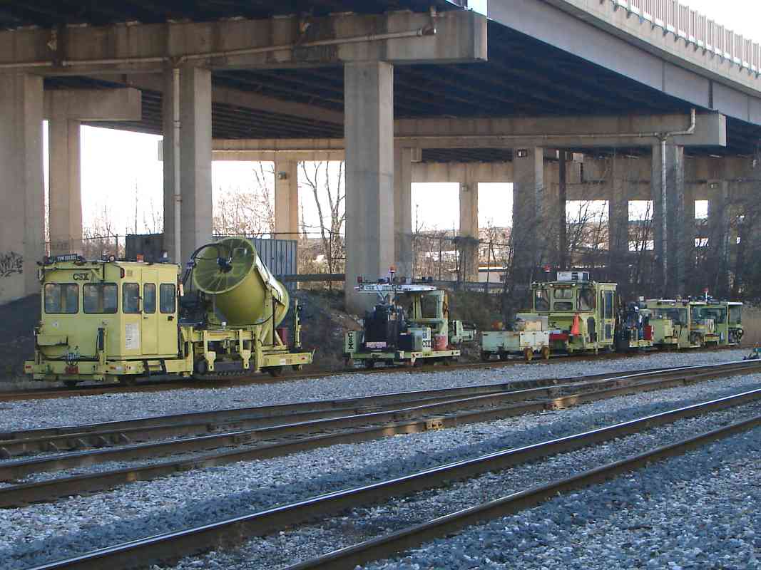
Note hidden in the weeds are various manholes, some of which have been found to lack a cover. Stepping into one unexpectedly would be Not Good.

Links: 1990, 1991, Bailey's pics with CPLs, 2008


Wye 1894
Image courtesy Johns Hopkins University
NEW! Jan 2023

Wye 1894
Mile: 0.5 Date: 1894
Ease: View: N (up)
Area: IC2:
Map: Ba 43 A 3 Topographic Maps

In 1894, the area around what is called the Middle Branch, which includes Bailey's Wye and Roundhouse, was either swampy or industrial. Numerous short sidings Topgolf, Oct 2022 had extended off the LPB, most of which are now gone. Note that the labels for Stockholm and Ostend Streets are swapped.

Topgolf's triple-decked driving range opened during 2022 to let you hit a ball east to what had been McCullough's Coal Pier. The photo at right looks southwest from Stockholm Street. The LPB is but a chip shot away, so tall nets protect the trains. I can hit a baseball, and a tennis ball, but golf? Let's just say that if I hit a bucket here, CSX would want me to warn them in advance.


Sidings 1948
Image courtesy Johns Hopkins University
NEW! Jan 2023

Sidings 1948
Mile: Date: 1948
Ease: View: N (up)
Area: IC2:
Map: Ba 43 D 4 (center) Topographic Maps

This tour page is following the blue line from number 8 (Bailey's) to 9 (Riverside). This 1948 map captures the area near its peak rail service, with B&O in blue, Western Maryland in green, and various port railroads in amber. As of the 2020s, only a small percentage of the sidings depicted remain extant, and only some of those remain active.


Crane
Photo courtesy Art Campbell

Crane
Mile: 0.5 Date: ~1980
Ease: A View: W
Area: B IC2:
Map: Ba 43 A 3 Topographic Maps

This is the view west from Sharp Street operators enjoyed circa 1980. In the distance is a Chessie engine shuttling a maintenance of way crane.


After Light Rail
Photo courtesy Art Campbell
NEW! Jan 2023

After Light Rail
Mile: 0.5 Date: Apr 2021
Ease: A View: W
Area: B IC2:
Map: Ba 43 A 3 Topographic Maps

A similar view about 40 years later finds light rail has bridged overhead. The track that bends to the right is the northeast leg of Bailey's Wye.


Flying Trains
Photo credit HH Harwood

Flying Trains
Mile: 0.5 Date: Apr 1993
Ease: B+ View: SW
Area: B BLR: 85
Map: Ba 43 A 3 Topographic Maps

Light rail seems to fly over the eastern part of Bailey's Wye.

Change for: Light rail tour at this site


Interlocking

Interlocking
Mile: 0.5 Date: Jan 2015
Ease: A View: E
Area: B IC2:
Map: Ba 43 A 3 Topographic Maps

The northeast leg of Bailey's Wye joins the LPB behind the photographer who looks east from the Sharp Street grade crossing to the interlocking at Leadenhall Street. Shiny signal hardware means B&O-era CPLs were not long gone here. Will those signals stay red until we can get closer to the waiting locomotive?

Link: 1986


CSX 6034

CSX 6034
Mile: 0.6 Date: Jan 2015
Ease: A View: E
Area: B IC2:
Map: Ba 43 A 3 Topographic Maps

Yes. Pausing east of Leadenhall Street and posing solely for our benefit (uh huh) are CSX 6034 and HLCX 4215.

Link: 1996


W Fort Avenue

W Fort Avenue
Mile: 0.7 Date: Jan 2015
Ease: A View: NW
Area: B IC2:
Map: Ba 43 B 3 Topographic Maps

Then CSX 6034 and kin kindly moved along so as to not block our view back to M&T Stadium from the now-closed Fort Avenue grade crossing at which the LPB turns once again to head south for a short stint.

One can turn around and follow Fort Avenue about 2 miles east to Fort McHenry, "Home of The Star-Spangled Banner". Francis Scott Key's poem from the War of 1812 became America's National Anthem on March 3, 1931.


Heath Street

Heath Street
Mile: 0.9 Date: Jan 2015
Ease: A View: S
Area: B IC2:
Map: Ba 43 B 3 Topographic Maps

South Federal Hill is regentrifying, or rerailfanning, or reRavensfanning, or perhaps all of the above, because the old houses are being fixed up and increasing in price here. The weedy tracks suggest disuse, but this is the only way in and out of Locust Point. I-95 towers in the distance with truck traffic where the LPB will turn sharply left (east) to parallel it.


Schuster Concrete
NEW! Jan 2023

Schuster Concrete
Mile: 1.2 Date: Feb 2016
Ease: A View: S
Area: B- IC2:
Map: Ba 43 B 4 Topographic Maps

One track, a disused spur, does not turn at I-95, and instead continues south into Schuster Concrete, one of many customers in this vicinity that B&O served.


From I-95
NEW! Jan 2023

From I-95
Mile: 1.2 Date: Aug 2021
Ease: A View: N
Area: B- IC2:
Map: Ba 43 B 4 Topographic Maps

As seen from I-95, trains bound for Locust Point will approach the camera. B&O's first alignment into Locust Point curved to the right at the base of the "Now Leasing" building, then followed what became Wells Street. A later alignment did similarly one block south along what would have been Winaer Street. Both routes continued in railroad use into the 1960s, at which time the older route was disused. As location references, the stadiums and Bromo Seltzer tower can be seen at upper left.

Link: 2022


From Ramp
Updated Jan 2023

From Ramp
Mile: 1.2 Date: Aug 2021
Ease: A View: E
Area: B- IC2:
Map: Ba 43 B 4 Topographic Maps

The ramp from Hanover Street that spirals up onto southbound I-95 permits a glimpse of the now-interstate-paralleling LPB where it is about to open into Riverside Yard. This is the Winaer Street alignment, with Wells Street off photo left.

Link: MARC 92 in 2004


Light Street

Light Street
Mile: 1.3 Date: Jan 2015
Ease: B View: SW
Area: B- IC2:
Map: Ba 43 B 4 Topographic Maps

From the former Light Street grade crossing we can look back to the ramp from which the prior photo had been snapped (far right). I-95 arrived here during the 1980s. The track at left center that curves away had been an interchange route with the Western Maryland (WM) lines. It continues in use to provide access to remaining industry along the Port Covington waterfront previously served by WM.


MoW

MoW
Mile: 1.3 Date: Jan 2015
Ease: B View: SW
Area: B- IC2:
Map: Ba 43 B 4 Topographic Maps

Various Maintenance of Way equipment, such as TVM 201301, was caught napping.


Riverside Yard

Riverside Yard
Mile: 1.4 Date: Jan 2015
Ease: B View: E
Area: B- IC2:
Map: Ba 43 C 4 Topographic Maps

In Riverside Yard both freight and bi-level MARC passenger cars await their call to duty.

Before WM's arrival at Port Covington, B&O maintained a spur from here to waterfront docks on the south (right).

Link: 2020


Map 1876
Image courtesy Johns Hopkins University
NEW! Jan 2023

Map 1876
Mile: 1.5 Date: 1876
Ease: View: N (up)
Area: IC2:
Map: Ba 43 D 4 Topographic Maps

B&O's first Riverside roundhouses were located directly south of Riverside Park, the green block on this 1876 GM Hopkins map. From there a spur ran southeast to Winan's Depots at the waterfront, where later the Gould Street Generating Station would match their northwest-southeast orientation. This map predates Western Maryland's Port Covington, and postdates the all-but-forgotten Fort Covington that was previously known as Fort Patapsco and Fort Wadsworth.

A 1927 aerial shows the roundhouses relocated east, and their turf repurposed as Riverside Yard.

Links: Fort Covington, General Covington


Aerial 1948
Photo courtesy Johns Hopkins University
NEW! Jan 2023

Aerial 1948
Mile: 1.5 Date: 1948
Ease: View: N (up)
Area: IC2:
Map: Ba 43 C 4 Topographic Maps

When Bailey's Roundhouse closed during the 1950s, these two half-doughnut roundhouses at Riverside picked up the slack. Key Highway is on the right. Part of WM's Port Covington facilities appear at lower left. Elevated I-95 now crosses left-to-right through photo middle. The dark block at bottom center is the Gould Street Generating Station.

Link: generating station interior


Aerial 1964
Photo courtesy Johns Hopkins University
NEW! Jan 2023

Aerial 1964
Mile: 1.5 Date: 1964
Ease: View: N (up)
Area: IC2:
Map: Ba 43 C 4 Topographic Maps

Riverside's two roundhouses had been reduced to one by 1957. During the next decade, the remaining one would make room for I-95. In place of both, one turntable, seen later in this tour, would be added adjacent on the north.


CSX 1214
NEW! Jan 2023

CSX 1214
Mile: 1.5 Date: Mar 2015
Ease: A View: N
Area: B IC2:
Map: Ba 43 C 4 Topographic Maps

Two switchers look for a place to have lunch. Fortunately, a picnic table is available. A yard office is off photo right.


Yard Office
NEW! Jan 2023

Yard Office
Mile: 1.5 Date: Oct 2022
Ease: B View: S
Area: B IC2:
Map: Ba 43 C 4 Topographic Maps

This building resembles what had been HB Tower within Camden Yards, but is a successor to RV Tower. Until around then, Riverside was where B&O crews would board their assigned engine, get a caboose, if needed, then head to the train they were to move.

Links: HB Tower 1974, RV Tower 1978, HB Tower 1979, 1986


McComas Street
Updated Jan 2023

McComas Street
Mile: 1.6 Date: Jan 2015
Ease: A View: W
Area: B IC2:
Map: Ba 43 D 4 Topographic Maps

CSX 7490 Where Riverside Yard begins to neck down to its east end, this ramp from paralleling McComas Street up to I-95 provides a glimpse of equipment such as CSX 7490 and a former Southern Pacfic engine.


MARC 4145
NEW! Jan 2023

MARC 4145
Mile: 1.7 Date: Oct 2022
Ease: A View: E
Area: B IC2:
Map: Ba 43 D 4 Topographic Maps

MARC 4145 is an ex-New Jersey Transit model GP40PH-2, here doing time at the Riverside Heavy Maintenance Facility.

Link: 2020


RV Tower
NEW! Jan 2023

RV Tower
Mile: 1.9 Date: Mar 2015
Ease: B View: SW
Area: B IC2:
Map: Ba 43 D 4 Topographic Maps

Perhaps the system's only windowless tower, RV was more an office than a true control tower. During the 1970s, it took the place of the former RV Tower, the yard office seen above. The second RV Tower's functions were transferred to Halethorpe's HX Tower in 1990, and around 2020 the building was replaced by one for the Riverside Heavy Maintenance Facility.

Link: RV Tower


Heavy Maintenance
NEW! Jan 2023

Heavy Maintenance
Mile: 1.9 Date: Oct 2022
Ease: A View: SW
Area: B IC2:
Map: Ba 43 D 4 Topographic Maps

Rail King RK285 The Riverside Heavy Maintenance Facility at right took the place of RV Tower.

At right, a newish Rail King unit stands ready to tote materials as needed.

Link: Rail King RK285


Turntable
NEW! Jan 2023

Turntable
Mile: 1.9 Date: Mar 2015
Ease: A View: SW
Area: B IC2:
Map: Ba 43 D 4 Topographic Maps

MARC 8055 With Riverside's roundhouses gone, this turntable made by The Nichols Engineering Company of Chicago spins equipment like MARC 8055 to the desired track and direction.

Link: 1979


Key Highway
NEW! Jan 2023

Key Highway
Mile: 1.9 Date: Feb 2016
Ease: A View: N
Area: B IC2:
Map: Ba 43 D 4 Topographic Maps

At Key Highway, the tracks are almost sandwiched between I-95 above and the old, local roads below.


Roundhouses 1938
Photo courtesy Baltimore Sun
NEW! Jan 2023

Roundhouses 1938
Mile: 2.0 Date: 1938
Ease: View: NW
Area: IC2:
Map: Ba 43 E 5 Topographic Maps

Looking back, that's the same Key Highway underpass at lower right in 1938 while Riverside's dual roundhouses were still years from retirement. The Gould Street Generating Station is at left, and the Bromo Seltzer tower at distant center. WM's Port Covington facilities are at bottom.

The next tour page continues to the east (right).

Link: source photo

Change for: Western Maryland tour at this site


<< Previous (west) | THIS PAGE: Ridgely to Riverside | Next (east) >>

Or, return to main page

Copyright Notice