TrainWeb.org Facebook Page
Northern Central Railway Photo Tour


Northern Central Railway
Modern day photo tour

Accompanying each photo below are:

Click a photo to see a larger view. Please send your comments and corrections to Steve.


<< Previous (south) | THIS PAGE: Mt. Washington to Hollins | Next (west via branch) >>

From Northern Parkway

From Northern Parkway
Mile: 5.4 Date: Nov 2019
Ease: B View: N
Area: B T6:
Map: Ba 26 G 13 Topographic Maps

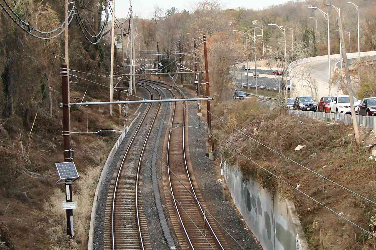
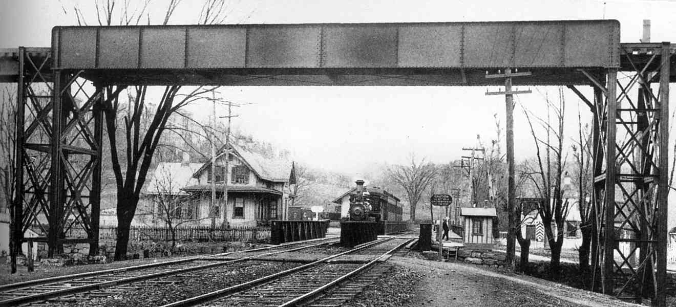
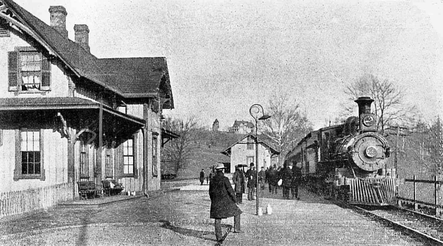
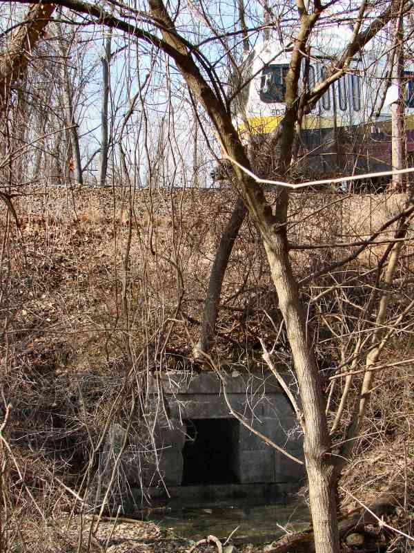
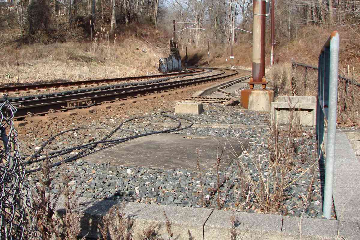
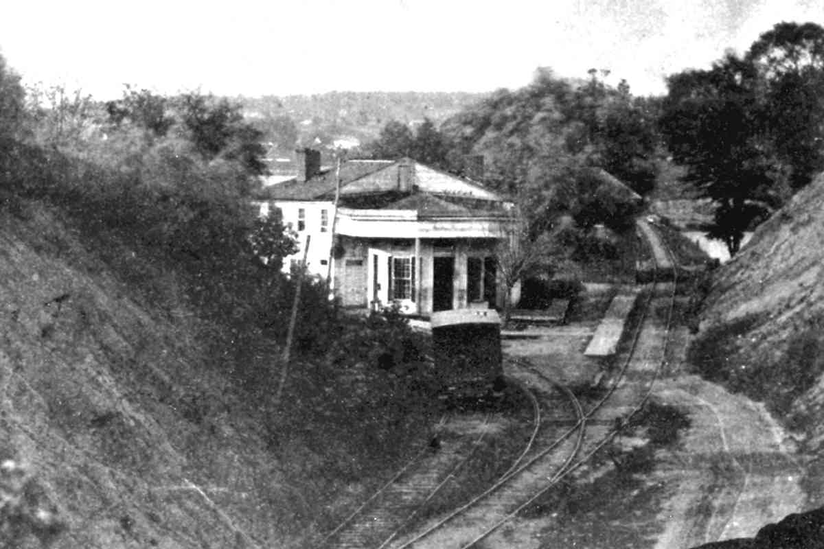
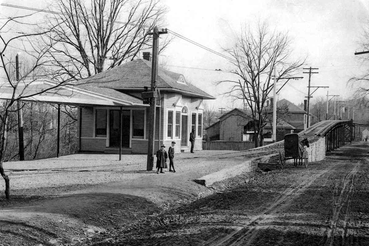
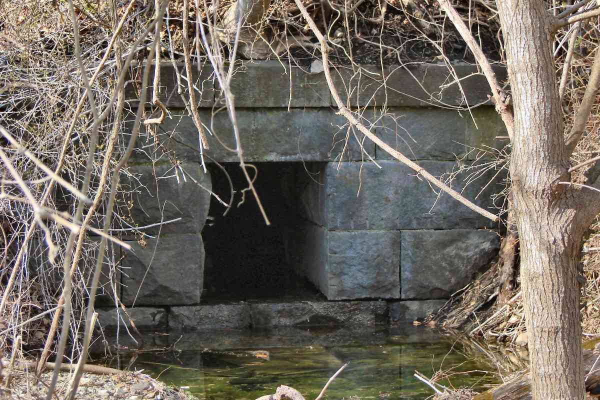
During the early 1900s, about 500 feet behind the photographer one could find 
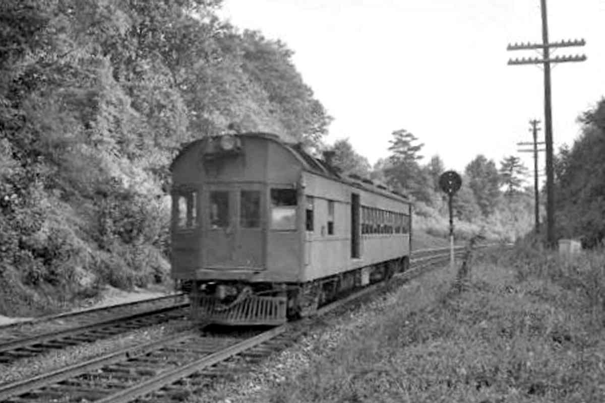
Cylburn Station, essentially a private stop for the Tyson family that had owned the estate above. That estate became Cylburn Arboretum, now a city park. Stories say a few hardy other souls who did not mind climbing up and out of the valley also used this stop because it was NC's closest to Pimlico Race Course.

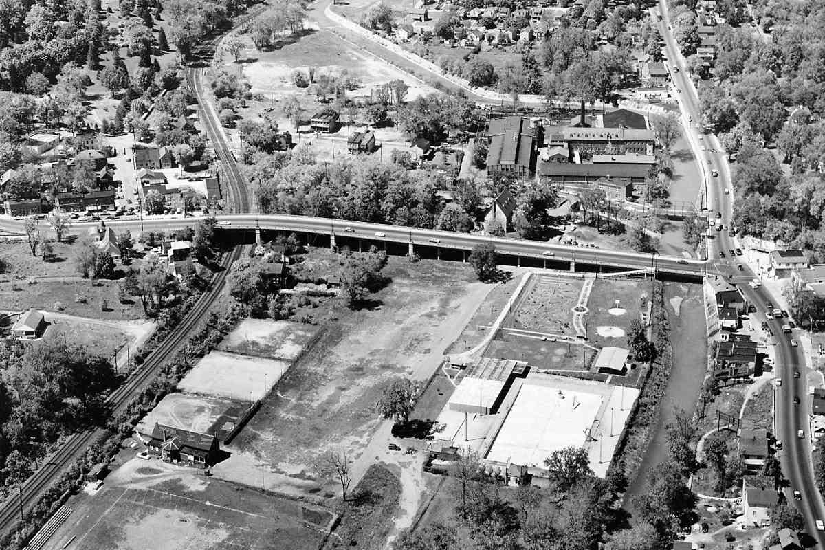
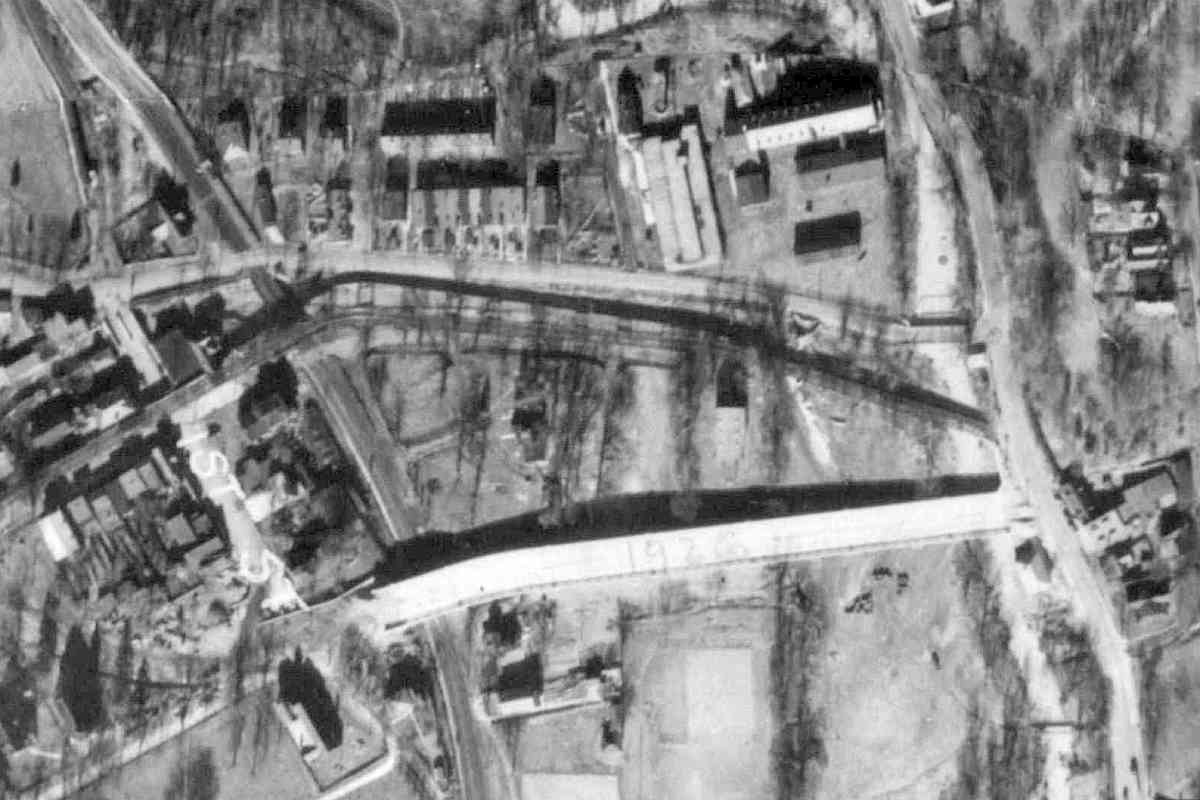
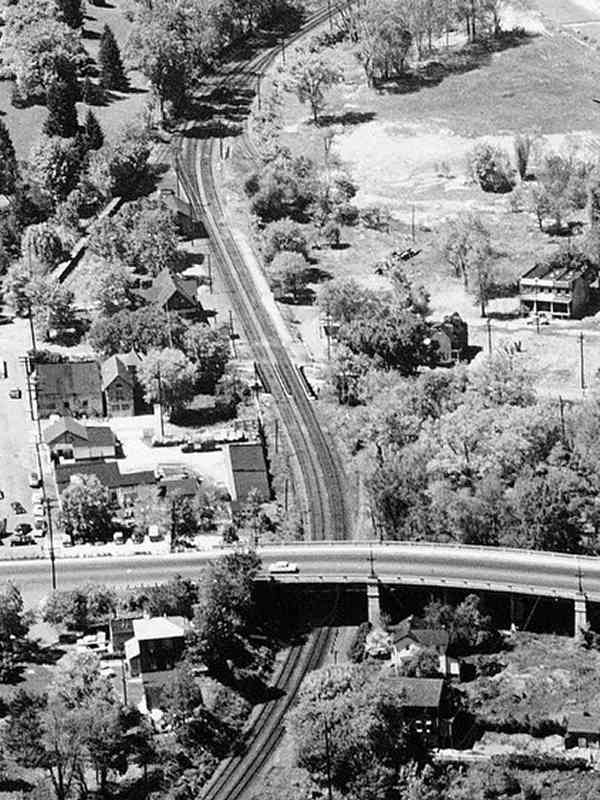
Pimlico visitors would have followed Belvedere Avenue, Northern Parkway's predecessor, east. The intersection of Belvedere with Falls Road hosted the first traffic light operable by car horn. Don't like to wait at the red? Just honk.

The Cylburn Arboretum was, and may still be, an inveterate issuer of PSAs (Public Service Announcements) they hoped would be broadcast for free. The spelling of Cylburn is etched in my memory because during my early days in Baltimore radio I announced it as "Clyburn," and wondered why my station mates were giving me funny looks.

Links: Cylburn Station 1888, 1928 traffic signal


MTA 5012

MTA 5012
Mile: 5.8 Date: Dec 2019
Ease: A- View: S
Area: B+ T6:
Map: Ba 26 G 12 Topographic Maps

The stretch north of Northern Parkway is one of the easiest along which to spot a train from a car on I-83, and vice versa.


Mt. Washington 1958
Photos courtesy Baltimore Sun

Mt. Washington 1958
Mile: 5.7 Date: 1958?
Ease: View: N
Area: T6:
Map: Ba 26 G 12 Topographic Maps

At photo time, the lovely Baltimore suburb of Mount Washington was bracing for skewering by the JFX. The town is itself partly responsible for the JFX/I-83 zoom because purportedly it is the second-oldest, planned housing development for commuters in the United States (with nearby Lutherville, Maryland the first). That commuting happened initially via Baltimore & Susquehanna Railroad, followed by Northern Central. Those commuters later bought automobiles, and, well, you know the story.

The bright rectangle at lower right of the main photo is the North Baltimore Aquatic Club swimming pool that would be frequented by Olympian Michael Phelps. In the zoom at left, note in the foreground the Kelly Avenue viaduct over the railroad, then a small railroad bridge near photo center over Western Run. Beyond that bridge the first building on the left was NC's Mt. Washington Station, then just a year or two from being torn down.

Links: source photo, North Baltimore Aquatic Club


Mt. Washington 1927
Photo courtesy Johns Hopkins University

Mt. Washington 1927
Mile: 5.9 Date: 1926/1927
Ease: View: N (up)
Area: T6:
Map: Ba 26 G 12 Topographic Maps

The Kelly Avenue viaduct opened during 1926, making it less than a year old at the time of this photo. The grade separation would obviate NC's at-grade crossings of Sulgrave and Smith Avenues immediately north. Milling began here in 1796, followed in 1810 by the Washington Cotton Manufacturing Company when the area was called Washingtonville.

The dark line sandwiched between Sulgrave and Smith Avenues is a stream called Western Run, and paralleling it is a streetcar line. We'll look more closely at both via the photos below.


MTA 5040

MTA 5040
Mile: 5.9 Date: Dec 2019
Ease: A- View: S
Area: B+ T6:
Map: Ba 26 G 12 Topographic Maps

So MTA 5040 (and a few other trains) could cross Western Run, light rail refurbished NC's bridge.


Western Run

Western Run
Mile: 5.9 Date: Dec 2019
Ease: A- View: W
Area: B+ T6:
Map: Ba 26 G 12 Topographic Maps

Here's another view of the bridge. Since there exists another Western Run further north, this stream is sometimes called the Western Branch of the Jones Falls.

This disused concrete block at bottom left is a relic of the B&N's streetcar bridge over the NC.

Link: Jones Falls 1912


Baltimore + Northern
Photos courtesy HH Harwood collection

Baltimore & Northern
Mile: 5.9 Date: 1897
Ease: View: N
Area: T6:
Map: Ba 26 G 12 Topographic Maps

looking east ~1900 Immediately south of Western Run, a then-new Baltimore & Northern (B&N) streetcar line climbed high over NC. B&N would join forces with Consolidated Railway within two year to form United Railways and Electric Company. Commuters could then choose NC or the streetcar to downtown Baltimore. The main photo captures an NC train pausing at Mt. Washington Station.

The elevated trackage section would see use for 30 years until the streetcars were rerouted atop the Kelly Avenue Viaduct.


Baltimore + Northern Station
Photos courtesy HH Harwood collection

Baltimore & Northern Station
Mile: 5.9 Date: 1897
Ease: View: W
Area: T6:
Map: Ba 26 G 12 Topographic Maps

B+N station ~1900 As was experienced in many US cities, demand for passenger rail service declined as more automobile roads opened after World War II. Both the NC and streetcars ended service to Mt. Washington about 1960, on the eve of the arrival of the Jones Falls Expressway.

As of 2020, the B&N's passenger station (photo at left, looks east) was in use as an animal hospital.


Aerial 1972
Photo courtesy Johns Hopkins University

Aerial 1972
Mile: 5.9 Date: Mar 1972
Ease: View: N (up)
Area: T6:
Map: Ba 26 G 12 Topographic Maps

This is the same view as in the 1927 aerial above. the JFX/I-83 was woven under Kelly Avenue Viaduct and over Western Run during the 1960s. The viaduct would be refuribished in 1979.


Mt. Washington Station
Photo courtesy HH Harwood collection

Mt. Washington Station
Mile: 6.0 Date: 1950s
Ease: A- View: NW
Area: A- T6: 244
Map: Ba 26 G 12 Topographic Maps

NC's Mt. Washington Station, seen here not long before it was removed, was built in 1875.


Mt. Washington Express
Photo courtesy Baltimore Sun

Mt. Washington Express
Mile: 6.0 Date: ~1900
Ease: A- View: N
Area: A- T6:
Map: Ba 26 G 12 Topographic Maps

The Baltimore Sun reports the trip on NC to Union (Penn) Station took 9 minutes, and to Calvert Station 13 minutes. As PRR gained more control of NC -- including a lease through the year 2913 -- the NC name faded. Service peaked during the 1910s when upwards of 50 trains per day either ran through or stopped at Mt. Washington.

Commuter service named "Parkton Local" and "Ruxton Rocket" operated for the last time on June 27, 1959.

Links: source photo, Parkton Local


Mt. Washington 2019

Mt. Washington 2019
Mile: 6.0 Date: Dec 2019
Ease: A- View: N
Area: A- T6:
Map: Ba 26 G 12 Topographic Maps

MTA 5024 This is a similar view to that of the prior photo. MTA 5024 is not as fast as NC steam engines, requiring 12 minutes to reach the closest stop to Penn Station.

Light rail double track arrived here in 2005.

Extra: 1945 Schedule courtesy Paul family


Looking Ahead
Photo courtesy Baltimore Sun

Looking Ahead
Mile: 6.0 Date: 1958?
Ease: View: N
Area: T6:
Map: Ba 26 F 12 Topographic Maps

At photo middle, where the railroad and Jones Falls snuggle up together, one finds Baltimore City's current northern border. That's also where I-83 would cross over the railroad when built a few years after this photo. Thr bridge visible at top is that for Falls Road.

Link: source photo


Under I-83

Under I-83
Mile: 6.2 Date: Dec 2019
Ease: B View: NW
Area: B T6:
Map: Ba 26 F 11 Topographic Maps

The Jones Falls was during the 1930s directed into a concrete channel where the photographer is standing. That channel was later shifted east (right) to facilitate construction of the elevated roadway.


City Line

City Line
Mile: 6.2 Date: Dec 2019
Ease: B View: N
Area: B T6:
Map: Ba 26 F 11 Topographic Maps

Google draws the Baltimore city/county boundary left-right through light rail's dark gray-blue-green utility box near photo center.


Cable Runways

Cable Runways
Mile: 6.2 Date: Dec 2019
Ease: B View: NE
Area: B T6:
Map: Ba 26 F 11 Topographic Maps

MTA manhole cover Assorted light rail cables run near the surface in most places.

Not many of these custom MTA manhole covers are to be found.


If You Insist

If You Insist
Mile: 6.5 Date: Dec 2019
Ease: A View: SW
Area: A- T6:
Map: Ba 26 G 11 Topographic Maps

Veni, vidi, video.

The disused Falls Road grade crossing is below, and the grade-separated Falls Road above.


Conflict

Conflict
Mile: 6.5 Date: Dec 2019
Ease: A View: NE
Area: A- T6:
Map: Ba 26 G 11 Topographic Maps

No Trespassing - Violators Will Be Prosecuted -- but maybe not if they Look Both Ways Before Crossing.

The old Falls Road grade crossing, closed since about 1930, was prepped to reopen to provide access to light rail's Falls Road station, but local residents prevailed at keeping it in a disused state.


Falls Road Station

Falls Road Station
Mile: 6.5 Date: Dec 2019
Ease: A View: NE
Area: A- T6:
Map: Ba 26 G 11 Topographic Maps

For northbound light rail trains, this is the first station in Baltimore County. A 1915 atlas places the NC's Bare Hills Station here on the left side. The Bare Hills name comes from a nearby copper and chromium mine. The Tyson family (of the Cylburn estate seen earlier) enjoyed profits from the mining here.

Links: Bare Hills info, Cylburn history


Enigmatic Culvert

Enigmatic Culvert
Mile: 6.9 Date: Dec 2019
Ease: B View: N
Area: B+ T6:
Map: Ba 26 G 10 Topographic Maps

culvert This box culvert's dry fit and precise stonework suggest original B&S construction of the 1830s, but one of the stones on the right exhibits scars of drillbits not typically used until decades later. That stone might be a replacement made as part of light rail refurbishing. If so, it indicates a thoughtful approach to preserve some original B&S work.


MTA 5053

MTA 5053
Mile: 6.9 Date: Dec 2019
Ease: B View: SW
Area: A- T6:
Map: Ba 26 H 10 Topographic Maps

Northbound MTA 5053 shows off the LED headlights it gained during recent overhaul (OH). OH units carry the blue-stripe paint of original light rail cars, at least until the next paint scheme or advertising wrap is applied.


NC Signal Base

NC Signal Base
Mile: 6.9 Date: Dec 2019
Ease: B View: NE
Area: A- T6:
Map: Ba 26 H 10 Topographic Maps

The utility box foundation, signal base, and backup battery box are all NC leftovers.


Aerial 1927
Photo courtesy Johns Hopkins University

Aerial 1927
Mile: 6.9 Date: 1926/1927
Ease: View: N (up)
Area: T6:
Map: Ba 26 H 10 Topographic Maps

The resolution is too low to see the signal, but utility box is visible below and left of photo center. Beyond is a cut through a small hill, and at the top is Green Spring Junction.


Cut

Cut
Mile: 6.9 Date: Dec 2019
Ease: B View: NE
Area: A- T6:
Map: Ba 26 H 10 Topographic Maps

The cut's retaining wall at left likely dates to the NC era.


PRR 4662
Photo courtesy HH Harwood collection

PRR 4662
Mile: 7.1 Date: 1940s
Ease: B View: S
Area: B+ T6:
Map: Ba 26 H 10 Topographic Maps

This self-propelled Pennsylvania Railroad doodlebug is a J.G. Brill Gas-Electric Model 660 built in 1929. It is passing through the cut to/from Hollins Station. Unit 4662 was restored during the 1980s and later operated on Delaware's Wilmington and Western Railroad.

Sibling unit 4666 has also been preserved and, as of 2019, operated in tourist excursion service with the Allentown and Auburn RR in Pennsylvania.

Hollins Station had been in the open area on the right.

Links: 4662 restored, PRR 4666


Hollins Station
Photo courtesy FA Wrabel collection

Hollins Station
Mile: 7.0 Date: ~1870
Ease: B View: N
Area: B+ T6: 245
Map: Ba 26 H 10 Topographic Maps

The cut opens at Green Spring Junction where once was Hollins Station. Service, with trains pulled by horses, began between Baltimore and Relay House, as this spot was then known, on July 4, 1831. The depicted version of Hollins Station was replaced in 1876 by one that remained in service until about 1930 (sources vary on the exact year).

The State of Pennsylvania delayed the B&S's request to build north to York, so the railroad here instead made Westminster, Maryland its goal. It got as far as Owings Mills in 1832. After the B&S finally received permission and built to York, Pennsylvania, in 1838 it declared that new route be its main line. That's the trackage in the photo that passes to the right of the station. The B&S route to Owings Mills (track curving left at the station) became its Green Spring Line. However, there was little demand for such a branch line until the 1850s when the Western Maryland Railway found it a handy way to access Baltimore.

Link: area rail history (PDF)


The Green Spring Branch tour follows next.

<< Previous (south) | THIS PAGE: Mt. Washington to Hollins | Next (west via branch) >>

Or, return to main page

Copyright Notice