TrainWeb.org Facebook Page
Northern Central Railway Photo Tour


Northern Central Railway
Modern day photo tour

Accompanying each photo below are:

Click a photo to see a larger view. Please send your comments and corrections to Steve.


<< Previous (south) | THIS PAGE: Bolton | Next (north) >>

Aerial 1974
Photo credit Library of Congress

Aerial 1974
Mile: Date: 1974
Ease: View: NW
Area: T6:
Map: Ba 35 B 10 Topographic Maps

As we leave Penn Station behind, this view looks upstream. We'll tour the NC's yard route first; its surviving bridge over Jones Falls is labeled NCRY at bottom left.

Link: LoC source photo


Over NC

Over NC
Mile: 1.3 Date: Sep 2016
Ease: B View: N
Area: C T6:
Map: Ba 35 A 10 Topographic Maps

As MTA 5035 departs Penn Station, at this curve it crosses over the disused NC yard route. These articulated light rail units are considered a single transit car. This spur to Penn Station opened during 1997.

The colorful arch ar upper left carries Howard Street over the Jones Falls Valley. The water of the Jones Falls can be glimpsed below where it is flowing toward the camera; when it reaches I-83 (photo bottom) it will enter over a mile of tunnels that lead it to Baltimore Harbor. panorama north Immediately before doing so, where you see gray fencing, the water passes under a survivor of the five NC Jones Falls bridges in this vicnity.

The main photo, and the three in the poorly-stitched panorama at right, were snapped seconds apart, so that's the same light rail train in each photo.

Link: 1947


Main Line

Main Line
Mile: 1.3 Date: Sep 2016
Ease: B View: NW
Area: C T6:
Map: Ba 35 A 10 Topographic Maps

Light RailLink's central main line roughly follows the old NC route to/from Bolton Yard, but unlike NC, it must go over B&O/CSX, which it does before sharply curving to dip under I-83. This was part of the first section of Light RailLink when the system opened in 1992.


Aerial 1964
Photo courtesy Johns Hopkins University

Aerial 1964
Mile: Date: Apr 1964
Ease: View: N (up)
Area: T6:
Map: Ba 35 A 10 Topographic Maps

Fresh, bright pavement highlights a then-new JFX, Maryland's first road incorporated into the US Interstate Highway System.

Left of photo center is Bolton Yard.


Bolton Yard
Photo credit Detroit Publishing Company,
via Shorpy

Bolton Yard
Mile: 1.0 (photog's location) Date: 1917
Ease: View: W
Area: T6:
Map: Ba 35 B 10 Topographic Maps

Bolton Yard dates to 1838 as part of the Baltimore & Susquehanna. Prior to the yard, the B&S had followed a route through land that had been only sparsely developed at that time, a route more or less parallel to the Jones Falls. That route crossed what would become the intersection of Maryland and Mount Royal Avenues. Harwood's Baltimore Light Rail book has some nice maps of this.

Link: source DPC photo


Bolton 1910s
Public domain photo

Bolton 1910s
Mile: 1.5 Date: 1910s
Ease: View: S
Area: T6: 239
Map: Ba 35 A 9 Topographic Maps

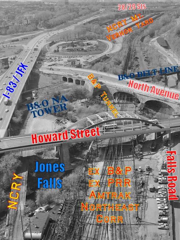
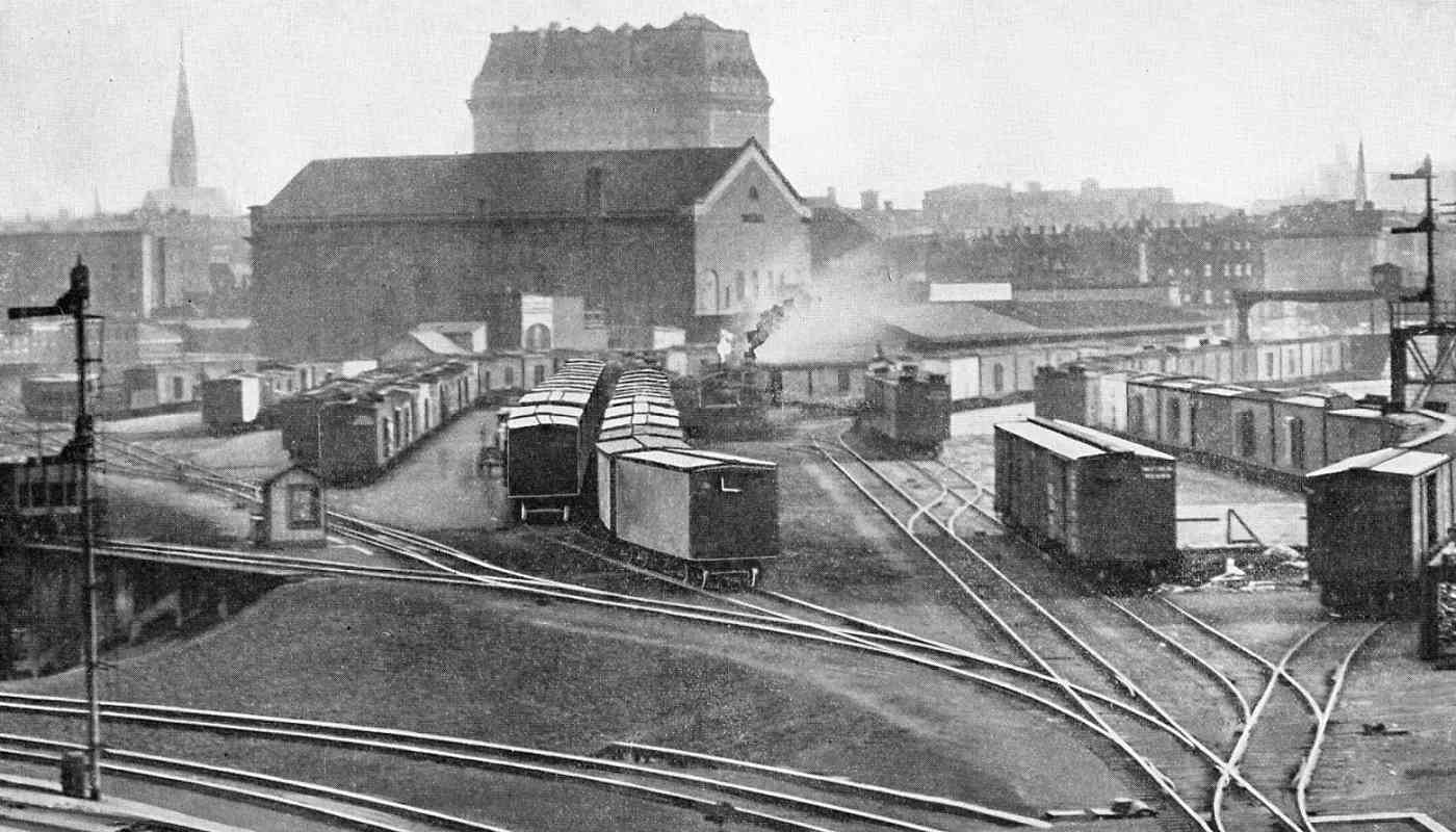
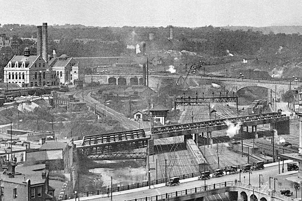
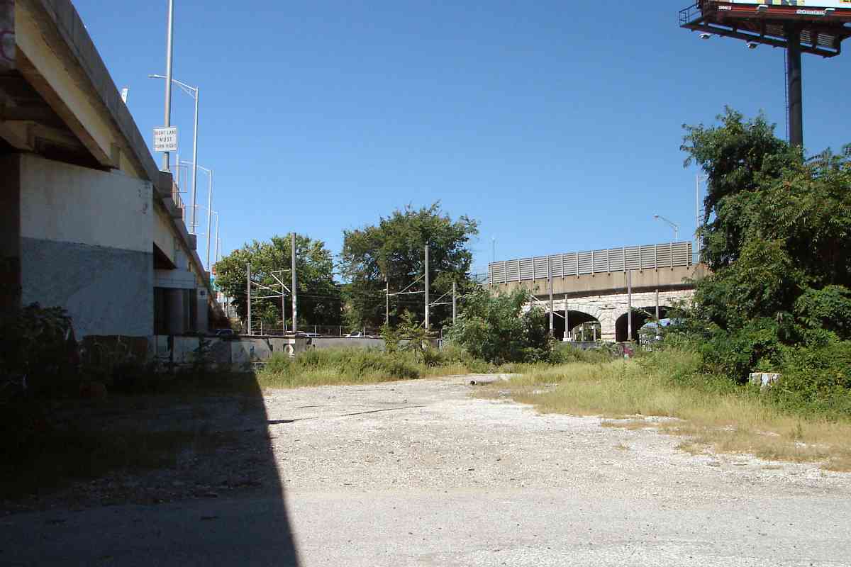
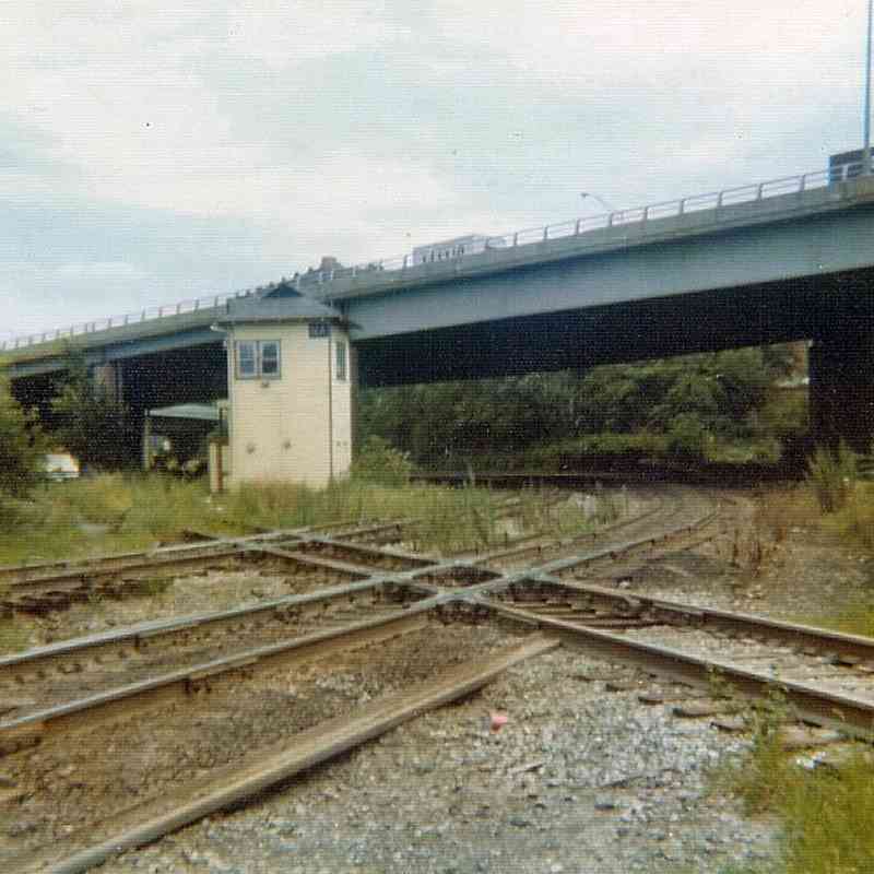
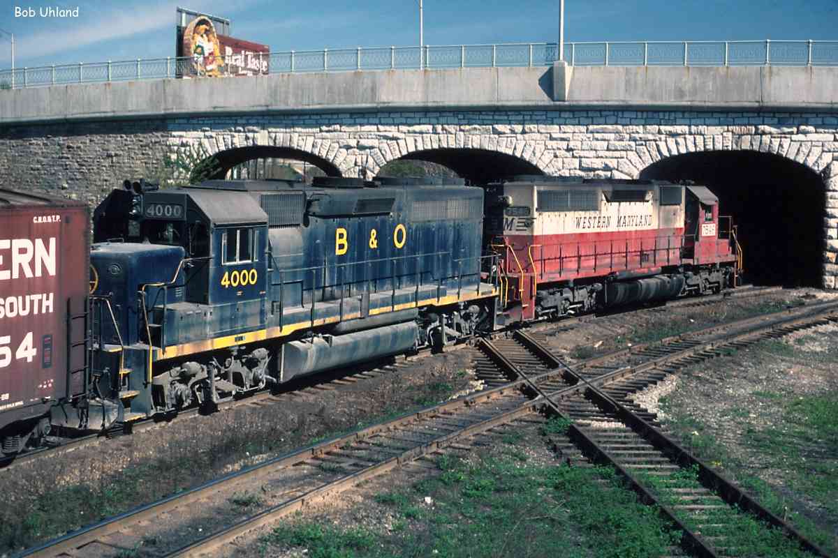
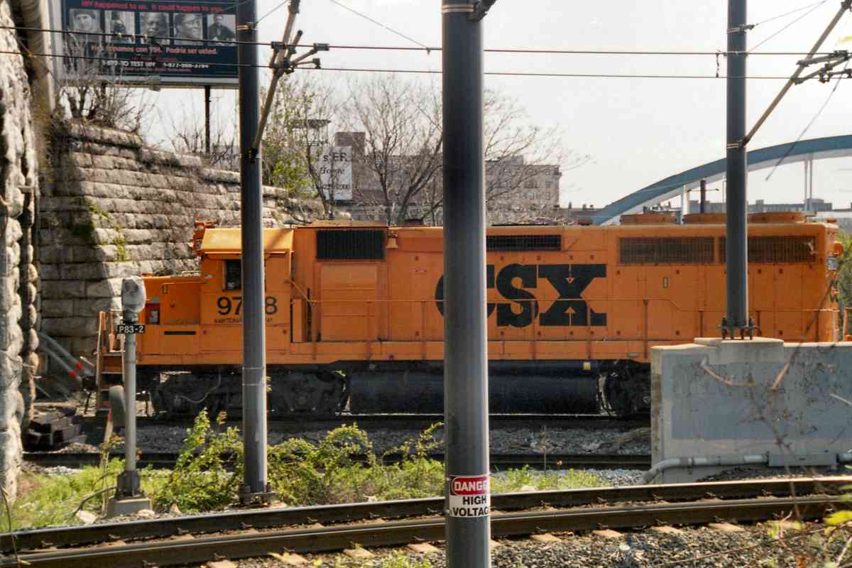
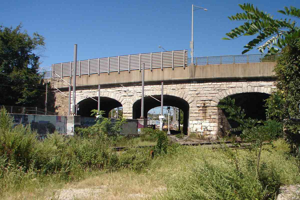
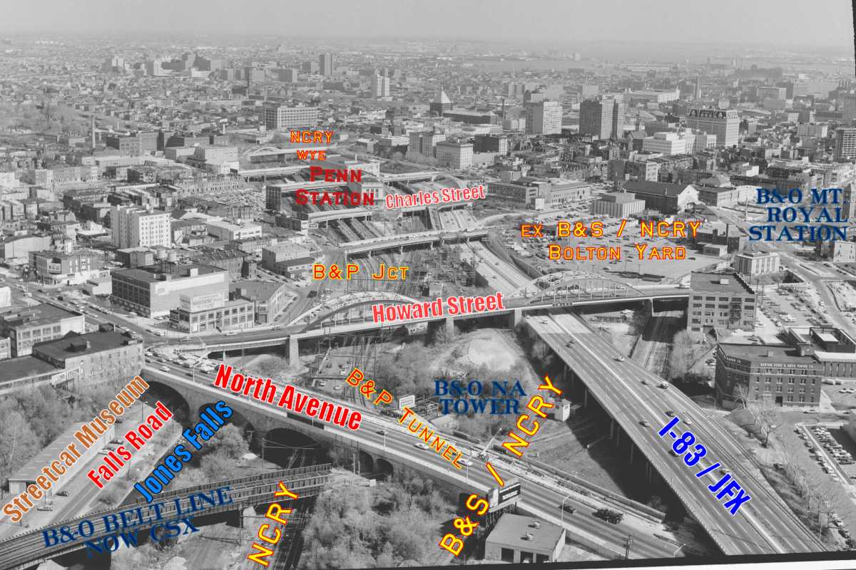
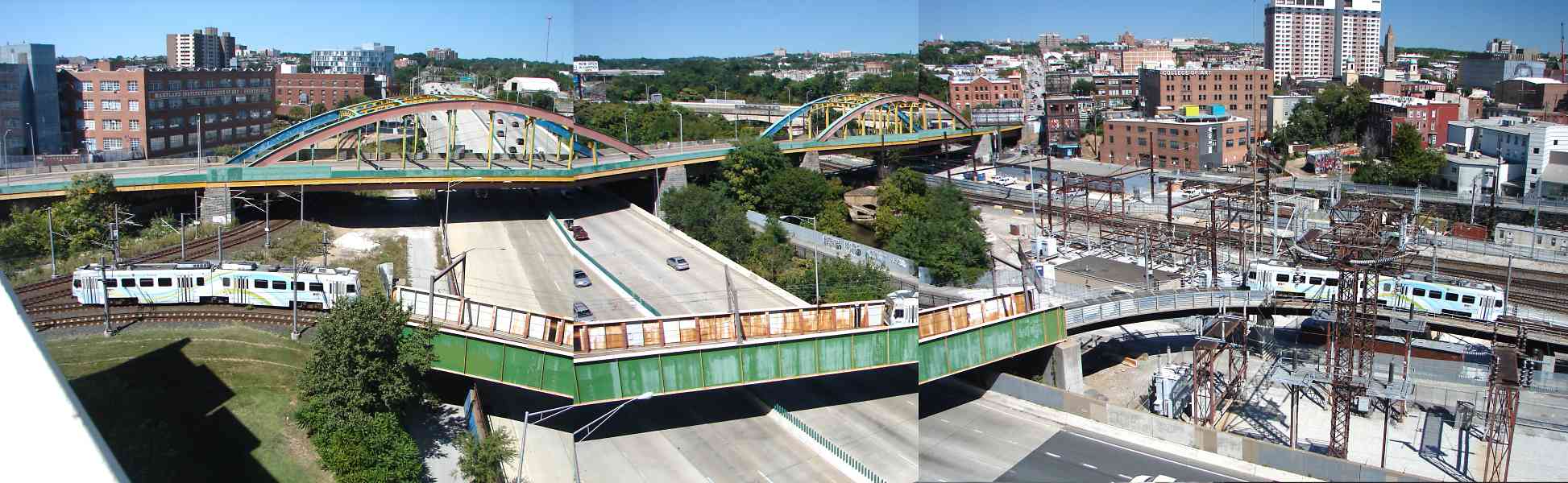
This is the yard as seen from North Avenue.

At the yard, but gone by the time of this photo, was an original NC bridge built circa 1870 by the Keystone Bridge Company of Pittsburgh. About 1885 that bridge was disassembled, then reassembled for the Stewartstown Railroad as its Valley Road Bridge. As of 2020 it remains extant.

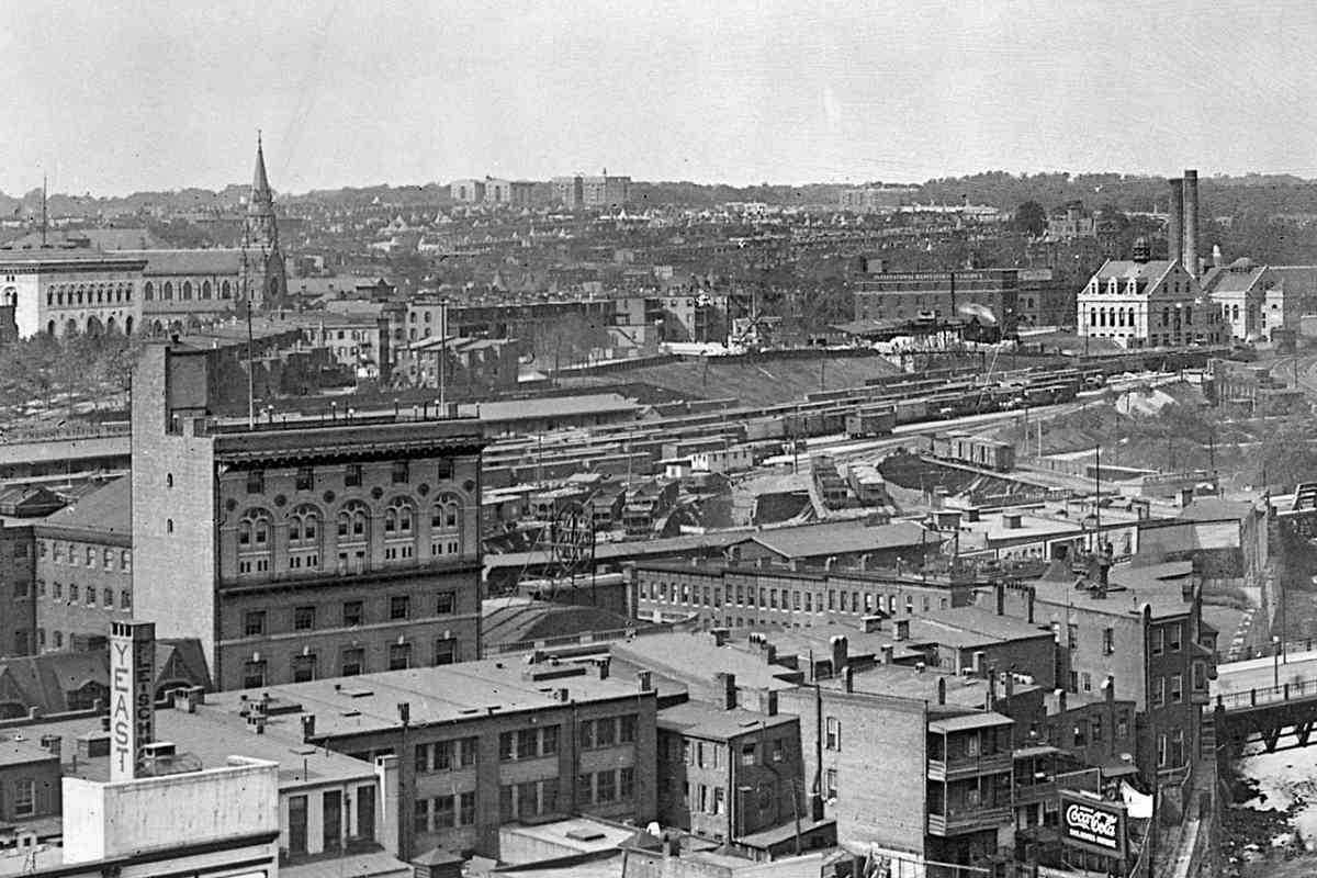
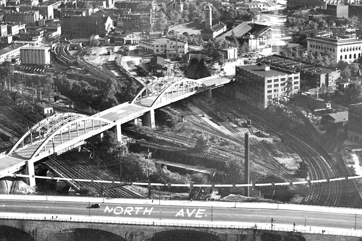
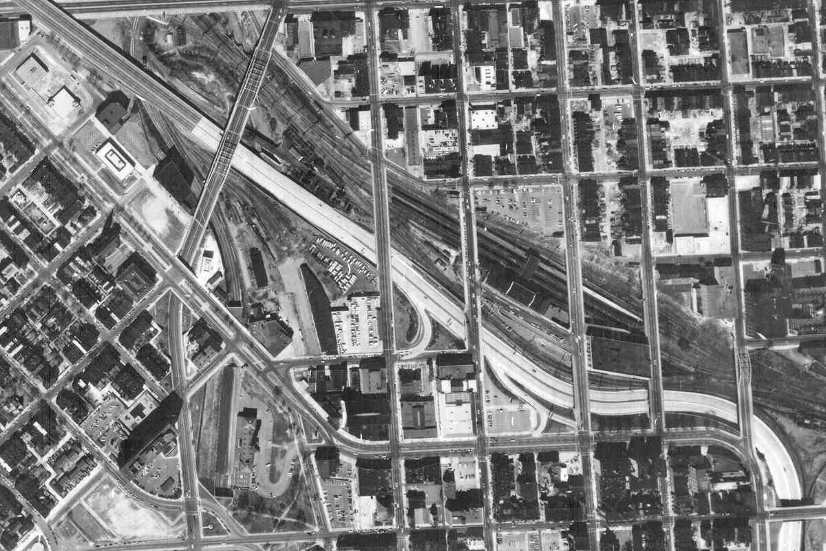
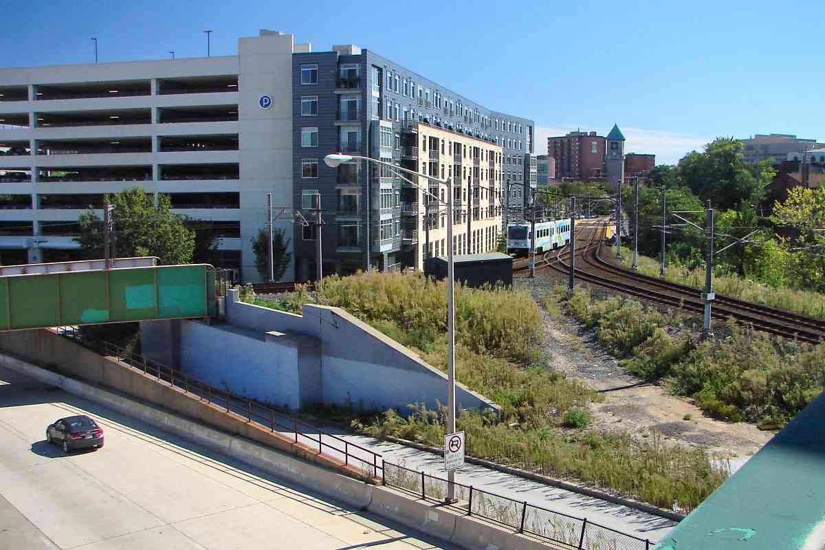
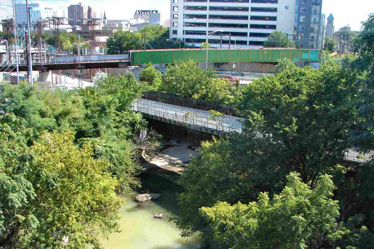
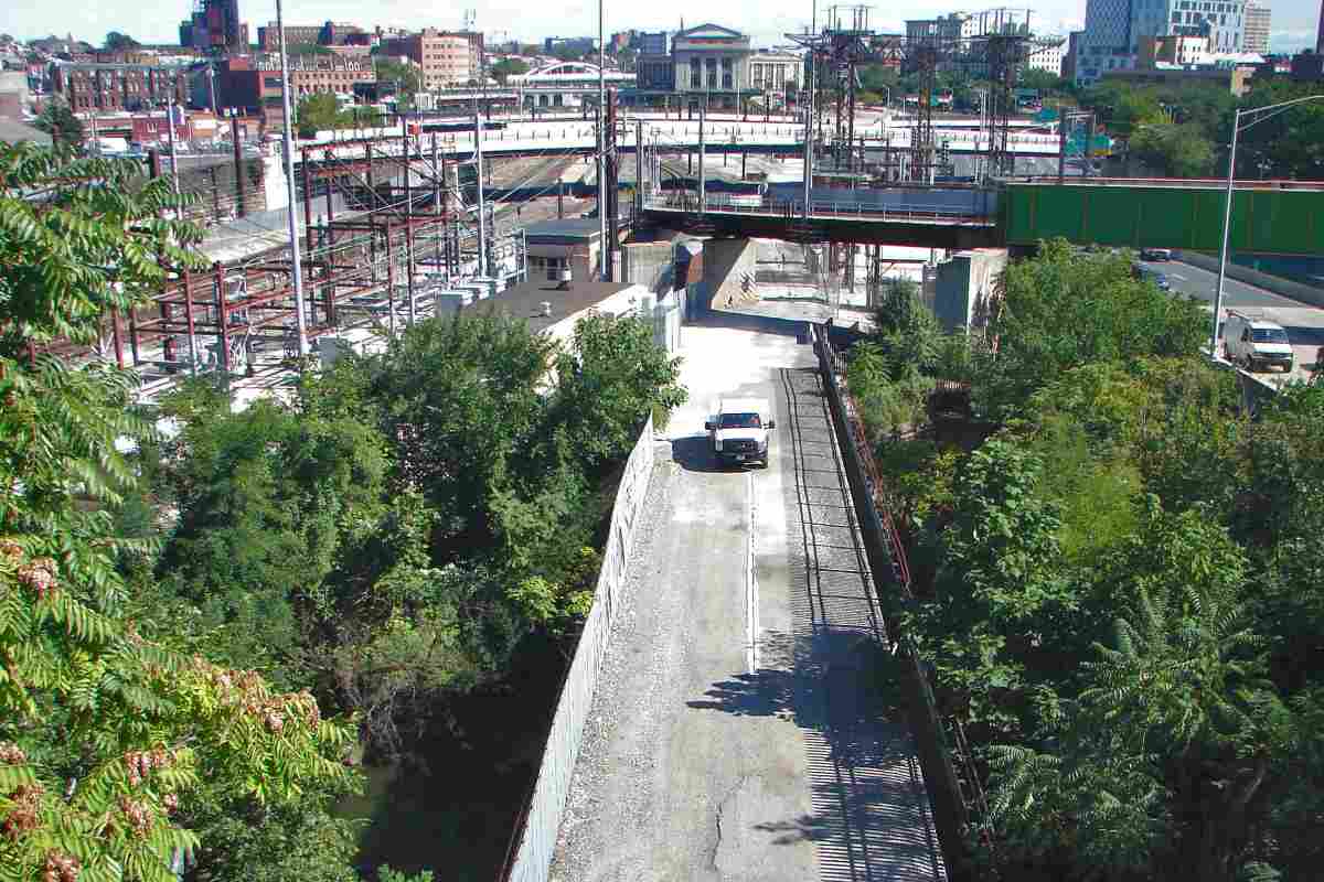
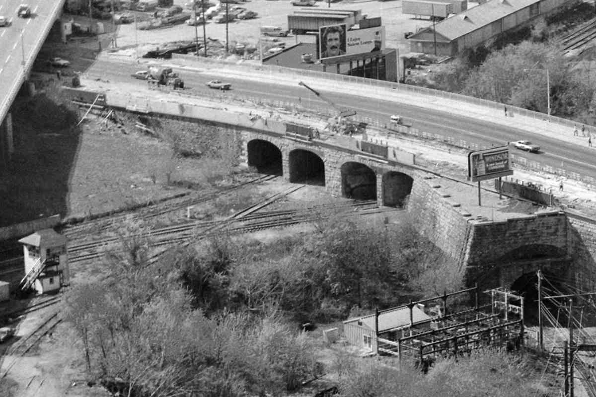
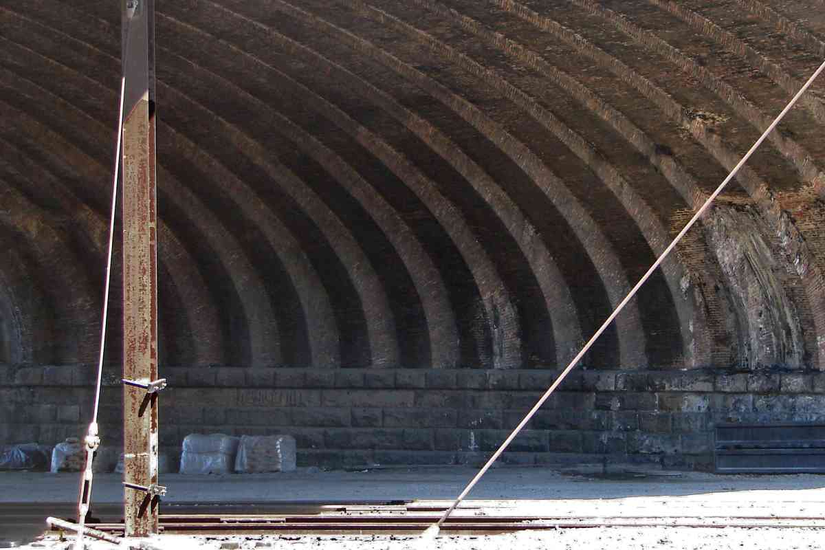
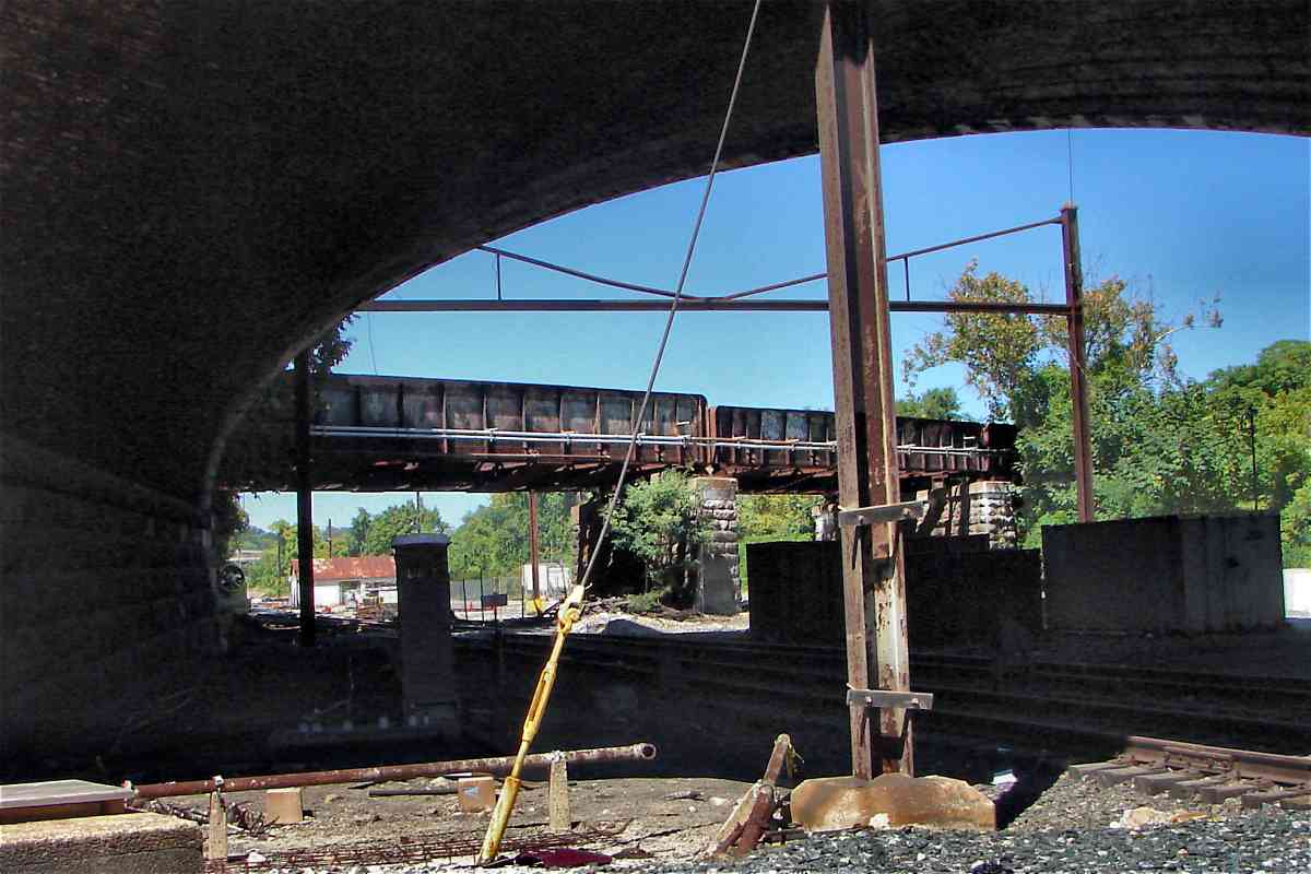
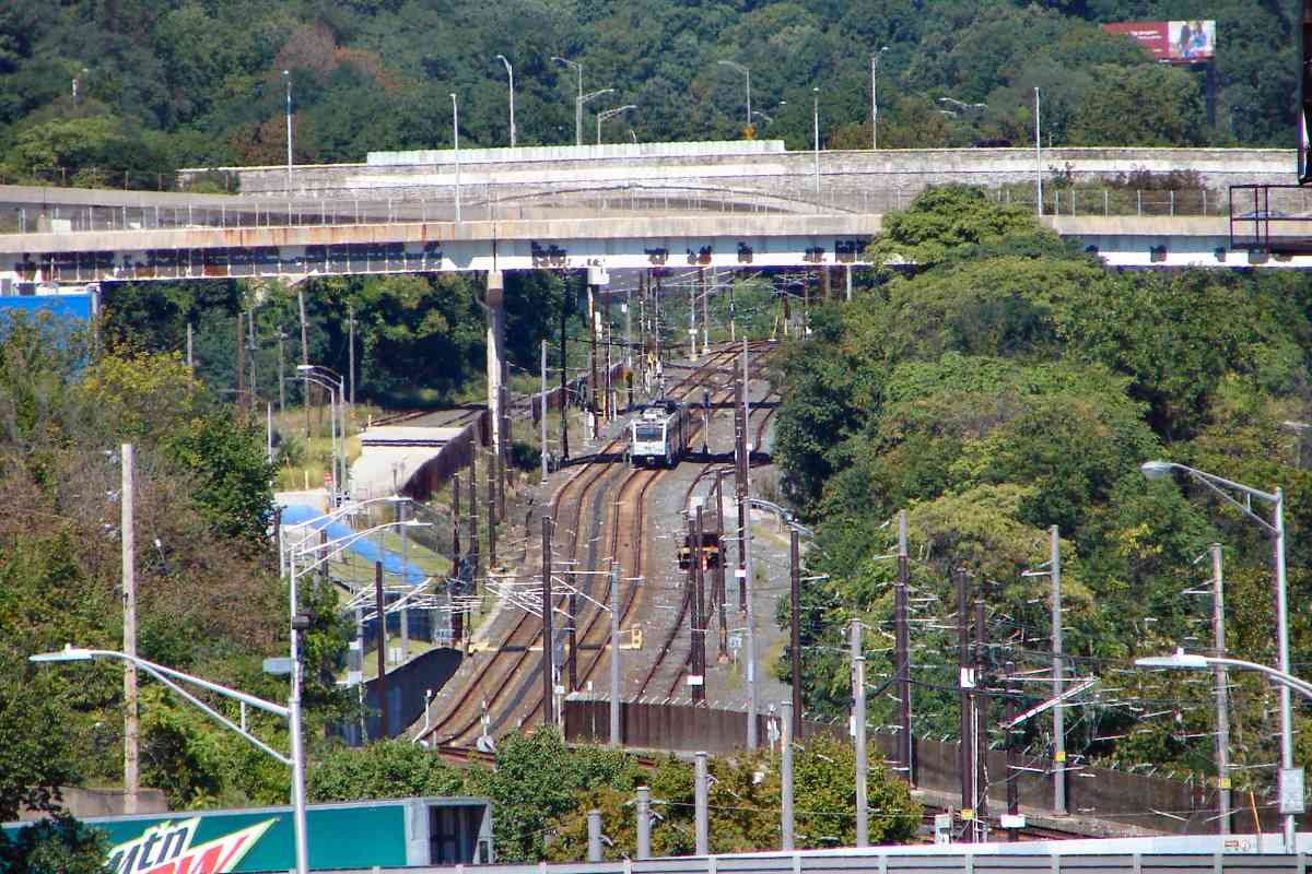
As with this 1910 view, the Bolton views below dating from 1940, 1974, and 2016 all look generally south into the Bolton Yard area, albeit from slightly different vantage points.

Link: original in Stewartstown


Bolton 1940
Photo courtesy Baltimore Sun

Bolton 1940
Mile: Date: ~1940
Ease: View: S
Area: T6:
Map: Ba 35 A 9 Topographic Maps

This is a similar view into Bolton Yard as the prior, except later and from the air.

The tall clock tower at B&O's Mt. Royal Station, top center in this view, makes for a handy reference point in the photos below.

Link: source photo


Aerial 1972
Photo courtesy Johns Hopkins University

Aerial 1972
Mile: Date: Mar 1972
Ease: View: N (up)
Area: T6:
Map: Ba 35 B 10 Topographic Maps

As of March 1972, Bolton Yard still had railcars.


Bolton 1974
Photo courtesy Library of Congress

Bolton 1974
Mile: 1.4 Date: 1974
Ease: View: S
Area: T6:
Map: Ba 35 A 9 Topographic Maps

By 1974 those railcars, and the yard itself, were gone. Note that LoC dates this photo to 1977 but there are no automobile models newer than 1974.

As passenger service declined, the B&O sold its Mt. Royal Station at below-market price to the Maryland Institute College of Art (MICA). MICA has preserved the station into the 21st century while repurposing it for college needs.


Bolton 2016

Bolton 2016
Mile: 1.4 Date: Sep 2016
Ease: A- View: S
Area: C+ T6:
Map: Ba 35 A 10 Topographic Maps

As seen from Howard Street over I-83, a multi-story mixed-use facility built during the 2010s now occupies Bolton Yard. The light rail train approaching the camera is entering the spur to Penn Station.


Beyond Bolton and Penn
Photo credit Detroit Publishing Company,
via Shorpy

Beyond Bolton and Penn
Mile: 1.0 (photog's location) Date: 1917
Ease: View: NW
Area: T6:
Map: Ba 35 B 10 Topographic Maps

Zooming into the wonderful 1917 photo, past Union/Penn Station, finds B&P Junction tower at center. The NC employed routes both left (south) and right of that tower. The distant multi-arched stone structure is the North Avenue Viaduct that as of 2020 remains extant and in use for people and automobiles to cross the Jones Falls Valley.

Some NC trains followed a route to the left at the group of four "tunnels" under North Avenue. Make visual note of that group of four since they will appear in many photos below. Other NC trains followed a route under one of the larger viaduct arches on the right. To help distinguish the two routes, we'll call the one on the left the yard route, and the one on the right the bypass route since trains following it skipped past Bolton Yard. The two routes join together a short distance upstream. Both routes will be toured, the yard route first.

Link: source DPC photo


NC Bridge

NC Bridge
Mile: 1.4 Date: Sep 2016
Ease: A- View: S
Area: C+ T6:
Map: Ba 35 A 10 Topographic Maps

In this vicinity, this is one of two surviving NC bridges across the Jones Falls, and the only one of steel. The other, along NC's bypass route, is of masonry construction.


Over Jones Falls

Over Jones Falls
Mile: 1.4 Date: Sep 2016
Ease: A- View: SE
Area: C+ T6:
Map: Ba 35 A 10 Topographic Maps

As seen from Howard Street, the surviving NC steel bridge has been relegated to maintenance access.


Ex-RoW

Ex-RoW
Mile: 1.4 Date: Sep 2016
Ease: A- View: NW
Area: C+ T6:
Map: Ba 35 A 10 Topographic Maps

This view is also from Howard Street, but looking opposite direction. I-83 is on the left while the parallel dirt path below is the ex-NC alignment.


Under I-83

Under I-83
Mile: 1.4 Date: Sep 2016
Ease: B- View: N
Area: C T6:
Map: Ba 35 A 9 Topographic Maps

Trains to/from Bolton Yard squeezed under I-83 here. What appear to be rails on the left are merely tire tracks through now-dried mud. A forgotten trailer waits for its next coat of rust proofing (spray paint).


Headchopper

Headchopper
Mile: 1.4 Date: Apr 2000
Ease: B View: N
Area: C T6:
Map: Ba 35 A 9 Topographic Maps

A little north of the forgotten trailer, Light RailLink squeezes under I-83, purportedly with one inch to spare. four tunnels

Of the four tunnels under North Avenue in the distance, light rail inherited the two on the left from Northern Central while CSX received the two on the right from B&O. A CSX maintenance of way train is working the rightmost with a group of articulated gondolas. This activity might have been cleanup after installation of a billboard pole.


1974 Aerial
Photo courtesy Library of Congress

1974 Aerial
Mile: Date: 1974
Ease: View: NW
Area: T6:
Map: Ba 35 B 10 Topographic Maps

In 1974, B&O's NA Tower was still overseeing where NC (at this time part of Penn Central) and B&O crossed paths.

On the right, the thumb protruding from North Avenue marks the north portal of the West Baltimore tunnel opened by the Baltimore & Potomac (B&P) Railroad during 1873, now part of Amtrak's Northeast Corridor.

If you look closely at the "thumb" you'll see a smaller stone arch is contained within a larger one. The smaller is the actual B&P tunnel while the larger arch redirects the weight of North Avenue around it. The North Avenue Viaduct was built during the 1890s when this was the northern boundary of Baltimore City.

Link: LoC source photo
Change for: PRR tour at this site


NA Tower (Site)

NA Tower (Site)
Mile: 1.4 Date: Sep 2016
Ease: B- View: NW
Area: C- RBL: 89
Map: Ba 35 A 9 Topographic Maps

Before removal during the 1980s, NA Tower oversaw the action from a spot near the center of this photo. That's the JFX casting shadows from the left.

Link: 1985


Diamond
Photo credit Steve Martin

Diamond
Mile: 1.4 Date: ~1980
Ease: B- View: SW
Area: C RBL: 149
Map: Ba 35 A 9 Topographic Maps

Before proceeding under North Avenue (behind photographer) the NC and B&O met coldly here at track diamonds, up to eight of them at one time. The yellowish structure is B&O's NA Tower.

Link: source photo courtesy Todd Sestero


From NA Tower
Photo credit Bob Uhland

From NA Tower
Mile: 1.4 Date: 1970s
Ease: B- View: N
Area: C T6:
Map: Ba 35 A 9 Topographic Maps

During the Chessie System era, WM 7546 and BO 4000 lead the way under North Avenue, as seen from NA Tower.

NA Tower was one of only three B&O towers in the region that employed an electropneumatic switch system, rather than armstrong levers, and the only one in the region that used air pressure supplied by the NC/PRR. Note the lack of armstrong levers in the interior photo linked below.

Links: source photo courtesy North American Interlockings, interior


CSX 9718

CSX 9718
Mile: 1.5 Date: Apr 2000
Ease: B+ View: E
Area: C T6:
Map: Ba 35 A 9 Topographic Maps

Since the time of this photo CSX has stopped painting its maintenance of way engines orange. The closer track, that of light rail, follows where NC had previously.


West North Avenue

West North Avenue
Mile: 1.5 Date: Sep 2016
Ease: B- View: N
Area: C T6:
Map: Ba 35 A 9 Topographic Maps

North Avenue This is the ground view from the site of NA Tower. Light RailLink's North Avenue Station can be glimpsed beyond the viaduct.


Butter's Run

Butter's Run
Mile: 1.5 Date: Sep 2016
Ease: C View: SE
Area: C T6:
Map: Ba 35 A 9 Topographic Maps

Hidden between NC's yard and bypass routes is this small, disused bridge cobbled together from rail components. It probably provided maintainance access across the all-but-forgotten Butter's Run creek.


East North Avenue

East North Avenue
Mile: 1.5 Date: Jun 2018
Ease: A- View: N
Area: C+ T6: 230
Map: Ba 35 A 9 Topographic Maps

North Avenue has more than just the previously-seen four underpasses. There's also one for the B&P Tunnel (left), and a larger one (right) that had been used by NC trains that bypassed Bolton Yard. The planned route of the B&P Tunnel's replacement, should it ever be built, takes Amtrak trains under this wider, taller arch.

In the shadow of Howard Street, at the photographer's feet is yet another NC crossing of the Jones Falls, making for a total of five such crossings within less than one track mile. The B&P also used this crossing but records indicate the NC was the first here.

Link: 1980
Change for: B&P Tunnel tour at this site


Shed

Shed
Mile: 1.5 Date: Sep 2016
Ease: C View: E
Area: C T6:
Map: Ba 35 A 9 Topographic Maps

One person reports this had been a station for Maryland & Pennsylvania Railroad passengers and that a stairway led down to it from North Avenue. Ma&Pa's Oak Street Station had stood not far from this spot, but was demolished during the 1930s to make room for the Howard Street bridge. After Ma&P ceased operation in Maryland during the 1950s, this building was likely used by NC/PRR as a tool shed. That's the same shed at the right edge of the 1952 photo linked below.

Link: 1952


Brick Arches

Brick Arches
Mile: 1.5 Date: ~2000
Ease: C View: NE
Area: C T6:
Map: Ba 35 A 9 Topographic Maps

The North Avenue Viaduct was built in 1895, and modified during the 1970s to expand from four auto traffic lanes to six.

To the east are two additional arches of this size and style. One permits the Jones Falls to flow under and, for a period, had done the same for one more NC track. Falls Road passes under the easternmost arch, as had the Ma & Pa Railroad in the past.


Baltimore Belt Line

Baltimore Belt Line
Mile: 1.5 Date: Sep 2016
Ease: C View: N
Area: C T6:
Map: Ba 35 A 9 Topographic Maps

Immediately north of North Avenue, the B&O's Belt Line route also spans the Jones Falls. It opened during the 1890s shortly before the North Avenue Viaduct did.


Look Back
Photo credit Library of Congress

Look Back
Mile: Date: 1974
Ease: View: SE
Area: T6:
Map: Ba 35 A 9 Topographic Maps

To review, this tour page started at the NCRY wye in the distance and proceeded toward the camera.


Look Forward

Look Forward
Mile: 1.3 Date: Sep 2016
Ease: B View: N
Area: C T6:
Map: Ba 35 A 10 Topographic Maps

The train is partly in the shadow of the 28th Street bridge. From here Baltimore Light RailLink closely traces the NC's main alignment north along the Jones Falls, and then into Cockeysville, Maryland.

On the next tour page, we'll continue to follow the NC to and beyond its Mount Vernon Yards where now is found a light rail repair shop, the blue building at distant left.


<< Previous (south) | THIS PAGE: Bolton | Next (north) >>

Or, return to main page

Copyright Notice