TrainWeb.org Facebook Page
PRR / Amtrak Photo Tour


PRR / Amtrak in Maryland
Modern day photo tour

Accompanying each photo below are:

Click a photo to see a larger view. Please send your comments and corrections to Steve.


Special Note: >>> The places described on this page host quiet, high-speed trains. Stay well clear! <<<

<< Previous (north) | THIS PAGE: Odenton | Next (south) >>

Deep Zoom
NEW! Nov 2022

Deep Zoom
Mile: 113.2 Date: Apr 2022, T-1:15
Ease: B View: SW
Area: B T6:
Map: AA 12 H 2 Topographic Maps

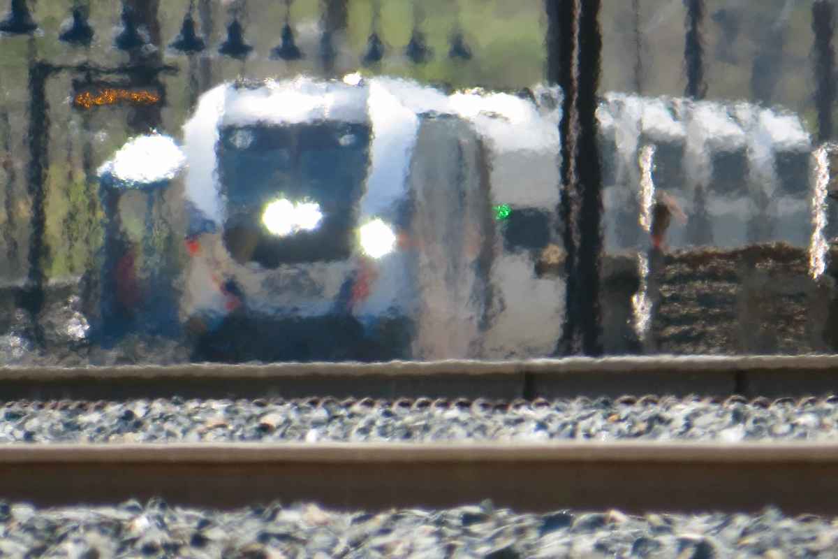
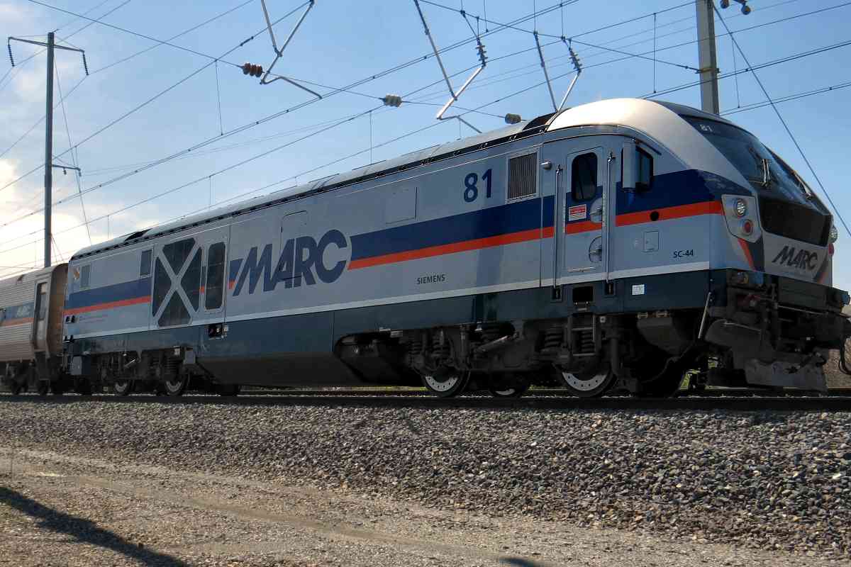
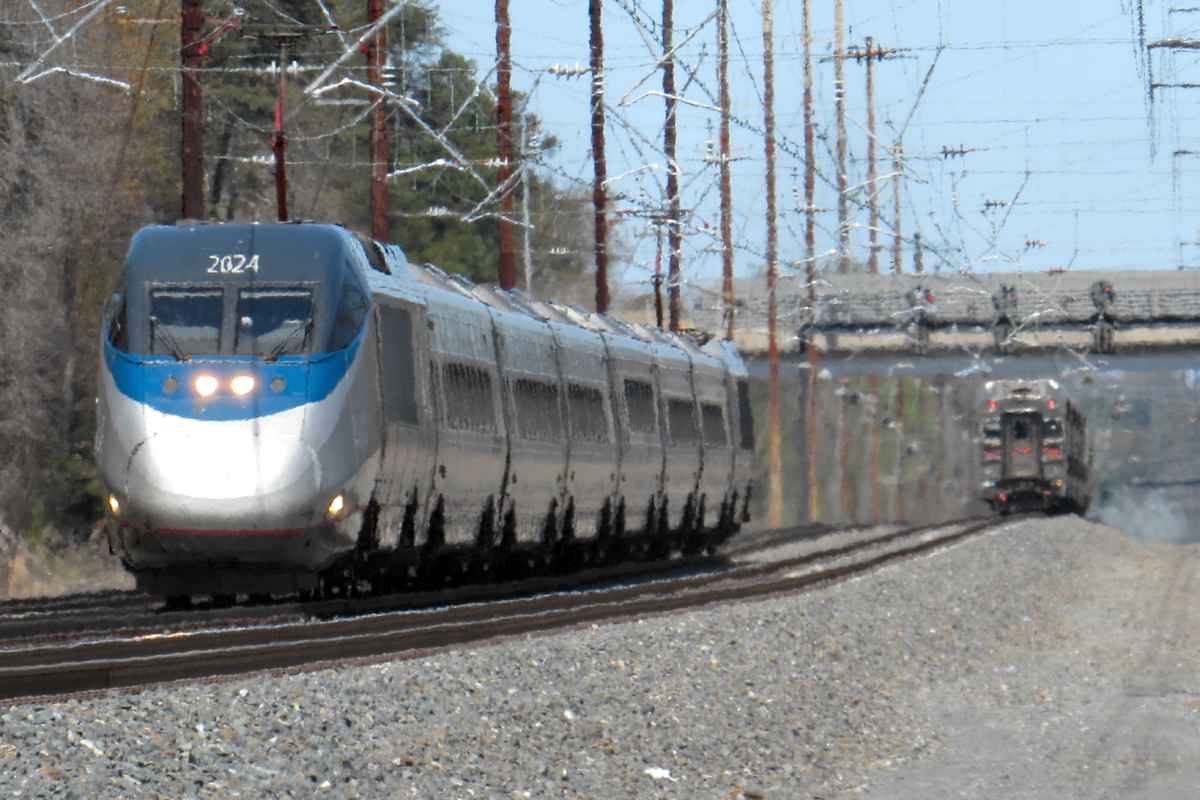
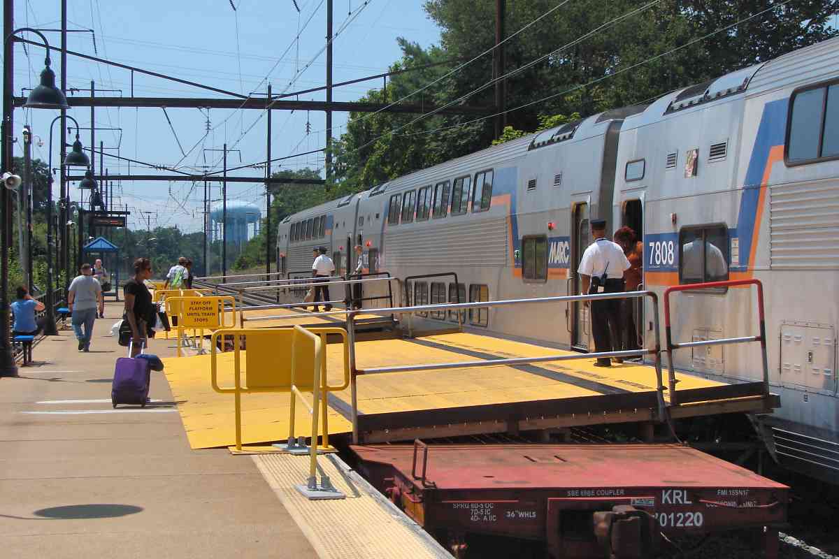
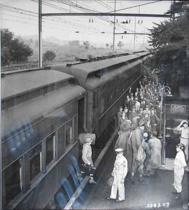
A spring day provided the opportunity to try a big zoom camera, in this case, the 50x optical zoom of a Canon SX50. As others had told me, the 
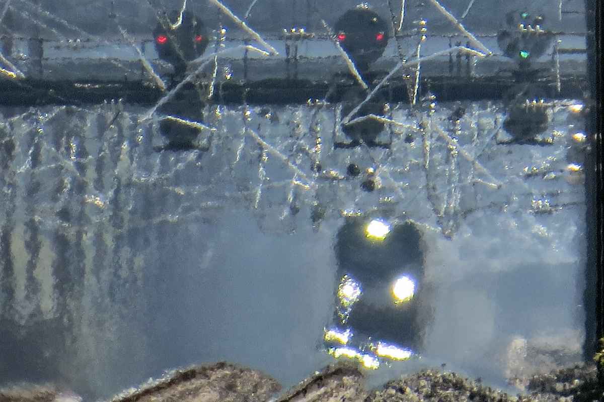
more zoom you use, the more heat distortion you get, as demonstrated by this image that was shot from almost a half mile away from MARC 81 as it pulled into Odenton Station. Unfortunately, the SX50 does not include the focal length (zoom amount) within the image file's EXIF, so I don't know whether this was at max zoom. The SX50 will go from 50x to 200x zoom digitally. Moon Canon SX50

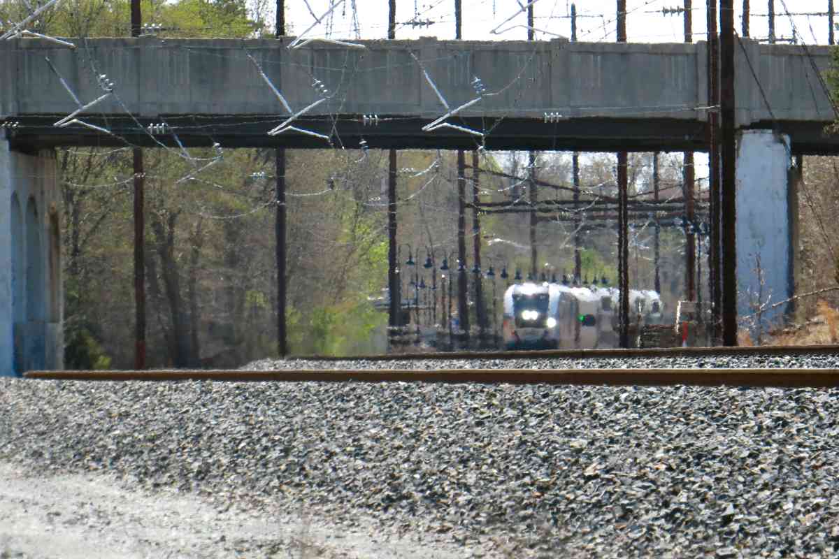
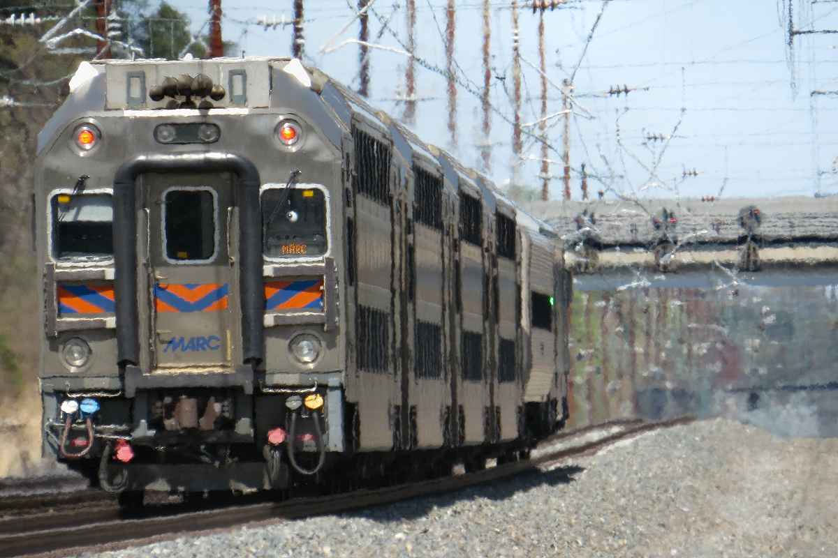
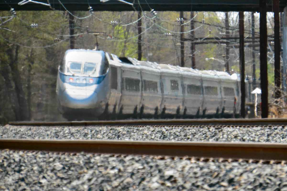
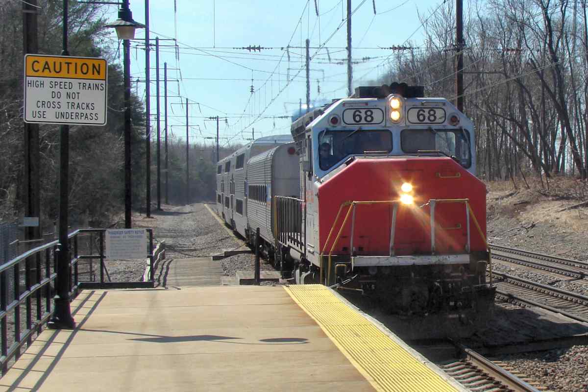
For typical rail photography, about 20x is the max useful zoom. Beyond 20x, you need to be shooting through less track-top heat distortion, for 
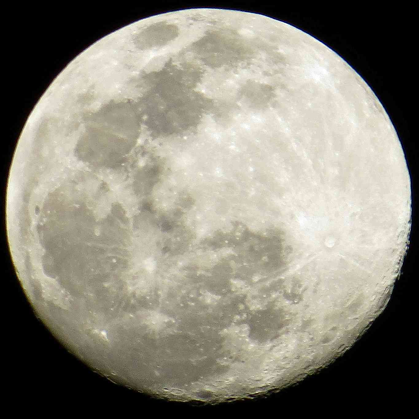
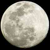
example, from a high vantage point. Larger zooms can be more useful with other subjects, such as the Moon. The sample at right was shot with the same camera as this group of April 2022 RR pics, plus a tripod. The exposure time was 0.00625 seconds at ISO 160, both chosen automatically.


Four in Four
NEW! Nov 2022

Four in Four
Mile: 113.2 Date: Apr 2022, T 0:0
Ease: B View: SW
Area: B T6:
Map: AA 12 H 2 Topographic Maps

As expected, less zoom includes less heat distortion. One benefit of zoom is the photog can stay at a safe distance. Lokus Road had crossed here at grade before MD 175 first bridged in the distance around 1940.

Looking toward a bright sky, as several of these photos do, is a challenge for both any camera and human eye. If you've done any railroad photography, you know the choice of vantage points is limited and that often results in subpar lighting. The SX50 handled the poor lighting about as good as can be expected.

Let's now start the clock (time 0:0) because four trains will roll by within the next four minutes.


AMTK 631
NEW! Nov 2022

AMTK 631
Mile: 113.2 Date: Apr 2022, T+0:12
Ease: B View: SW
Area: B T6:
Map: AA 12 H 2 Topographic Maps

Twelve seconds later, AMTK 631 has blown past the station where MARC 81 is still pausing. Via a carefully choreographed sequence, this northbound needs to get around the MARC train because an Amtrak southbound is approaching rapidly on the same middle track.


Departure
NEW! Nov 2022

Departure
Mile: 113.2 Date: Apr 2022, T+1:44
Ease: B View: SW
Area: B T6:
Map: AA 12 H 2 Topographic Maps

About a minute later, the MARC train departs the station and slowly rolls north, reaching us after about 40 seconds. Less zoom this time, and less heat distortion.


MARC 81
NEW! Nov 2022

MARC 81
Mile: 113.2 Date: Apr 2022, T+1:51
Ease: B View: SW
Area: B T6:
Map: AA 12 H 2 Topographic Maps

Minimal zoom yielded this shot, which the Canon handled decently. The SX50 creates less purple fringing than my equivalent Sony cameras which means the Canon's lens has fewer chromatic aberrations. Chromatic aberrations cause various frequencies of light to spread apart much like a crystal prism does.


No Hurry
NEW! Nov 2022

No Hurry
Mile: 113.2 Date: Apr 2022, T+2:38
Ease: B View: NE
Area: B T6:
Map: AA 12 H 2 Topographic Maps

The MARC train was in no hurry because AMTK 631 had recently switched ahead of it via the crossovers at Grove's distant signals. The overpass, that of MD 32, is almost a half mile away from the camera.


Passing 113
NEW! Nov 2022

Passing 113
Mile: 113.2 Date: Apr 2022, T+3:26
Ease: B View: NE
Area: B T6:
Map: AA 12 H 2 Topographic Maps

Before MARC can reach the signals at Grove, a southbound appears on Track 3 (the far track). Deep zoom exposes heat distortion again, even when looking away from the sun, smushing the digits of milepost 113 at left.


AMTK 651
NEW! Nov 2022

AMTK 651
Mile: 113.2 Date: Apr 2022, T+3:31
Ease: B View: SW
Area: B T6:
Map: AA 12 H 2 Topographic Maps

It's AMTK 651. Some heat distortion from this distance and angle is unavoidable even during winter.


AMTK 2024
NEW! Nov 2022

AMTK 2024
Mile: 113.2 Date: Apr 2022, T+3:42
Ease: B View: SW
Area: B T6:
Map: AA 12 H 2 Topographic Maps

Ten seconds later, AMTK 2024 sails south on the recently-vacated middle track.


Through Odenton
NEW! Nov 2022

Through Odenton
Mile: 113.2 Date: Apr 2022, T+3:56
Ease: B View: SW
Area: B T6:
Map: AA 12 H 2 Topographic Maps

About 15 second later, that train, the fourth in four minutes, breezes through Odenton Station.

Looking toward the sun, with deep zoom, and a swiftly moving train... that's a recipe for a poor photo; this is about as good as any consumer-level camera will do under such conditions. The main problem with the Canon SX50, however, is its lack of a "high speed shutter" setting that nudges its automatic choices toward a shorter exposure time. Some Sony cameras have such a feature, and it's enormously helpful for getting non-blurred pics of moving trains that I regard it as the single most important feature.


Two Miles
NEW! Nov 2022

Two Miles
Mile: 111.4 Date: Oct 2022
Ease: B View: S
Area: A T6:
Map: AA 6 J 10 Topographic Maps

From even farther away, the distortion effects amplify to the point photos are not good for any purpose except an artistic one. The clutter of newish catenary holders also amplifies. As seen from almost two miles away, with the SX50 hand held at roughly 100x zoom, AMTK 649 appears to float above the rails. It appeared the same to the naked eye.


Odenton Map
NEW! Nov 2022

Odenton Map
Mile: 113.8 Date: ~1990 (Oct 2017)
Ease: View: NW (top)
Area: T6:
Map: AA 12 H 3 Topographic Maps

The photos above originate from off the top-right corner of this map that identifies several buildings in Odenton. That marked "Pennsylvania Railroad station" (Odenton Station) is this tour's next photo stop.


A&ER RR

A&ER RR
Mile: 113.5 Date: Oct 2018
Ease: A- View: S
Area: B+ T6:
Map: AA 12 H 3 Topographic Maps

At Odenton Station, decades before the Baltimore & Potomac built north-south, the Annapolis & Elk Ridge RR (A&ER) had built east-west. A&ER had connected Maryland's state capital with B&O's Washington Branch, what is now CSX's Capital Subdivision. During the early 20th century, A&ER was acquired by the Washington, Baltimore and Annapolis (WB&A) that electrified the line as its South Shore division.

During the 1860s when B&P's route was being planned, land developers here christened the location "Odenton" for B&P President Oden Bowie, who was also Maryland governor from 1869 to 1872. Coincidentally (or not) B&P chose to intersect with A&ER in Odenton. Connections between the two systems were built in at least three of the four intersection quadrants; only the one seen on the left has survived into the 21st century.

Change for: A&ER tour at this site


Amtrak 615

Amtrak 615
Mile: 113.6 Date: Oct 2018
Ease: A- View: S
Area: B+ T6:
Map: AA 12 H 3 Topographic Maps

Amtrak last stopped in Odenton during 1983.


MARC 83

MARC 83
Mile: 113.6 Date: Oct 2018
Ease: A- View: S
Area: B+ T6:
Map: AA 12 H 3 Topographic Maps

MARC picked up the slack, on the left with a model SC-44 unit only a few months old.


MARC 4912
Photo courtesy Dave Hiteshew

MARC 4912
Mile: 113.6 Date: Jul 2010
Ease: A- View: S
Area: B+ T6:
Map: AA 12 H 3 Topographic Maps

These HHP-8 units had wheel slip problems on wet rails, and were not-so-affectionately nicknamed Hippos. MARC favors diesel units even though they are slower, ostensibly because MARC's other lines (Brunswick, the ex-B&O Metropolitan Branch, and Camden Line, the ex-B&O Washington Branch) do not have catenary to supply electric.

Adjacent parking lots at Odenton have room for about 2000 cars, and pre-COVID generally filled to capacity.

Links: retired HHP8s, 2001


MARC 24
Photo courtesy Dave Hiteshew

MARC 24
Mile: 113.6 Date: Aug 2010
Ease: A- View: S
Area: B+ T6:
Map: AA 12 H 3 Topographic Maps

MARC's MP36PH-3C engines were less than a year old at photo time.

Odenton's rail stop is the Penn Line's closest to Fort Meade and NSA. On the Camden Line, Savage Station is even closer.

Change for: B&O tour at this site
Links: 1992, 1992


Amtrak 926
Photo courtesy Dave Hiteshew

Amtrak 926
Mile: 113.6 Date: Nov 2009
Ease: A- View: N
Area: B+ T6:
Map: AA 12 H 3 Topographic Maps

AMTK 926 trails on track 1. In the distance Maryland 175 bridges overhead. Amtrak retired all its boxy AEM-7 engines, nicknamed toasters, by 2016; many had been in use since 1980.

Links: 1976, 1977, 1978, 1980, 1981, 1981


Amtrak 2018
Photo courtesy Dave Hiteshew

Amtrak 2018
Mile: 113.6 Date: Nov 2009
Ease: A- View: N
Area: B+ T6:
Map: AA 12 H 3 Topographic Maps

On track 2 AMTK 2018 is doing the trailing this time.


Amtrak 2039
Photo courtesy Dave Hiteshew

Amtrak 2039
Mile: 113.6 Date: Feb 2010
Ease: A- View: NE
Area: B+ T6:
Map: AA 12 H 3 Topographic Maps

Odenton can be a decent train watching spot.


turntable
Photo credit GM Leilich

Turntable
Mile: 113.7 Date: 1935
Ease: A- View: N
Area: B+ T6: 345
Map: AA 12 H 3 Topographic Maps

The B&P/PPR and A&ER/WB&A lines crossed at a diamond immediately north of the existing Odenton Station. An engineering issue arose when B&P/PPR electrified: PRR's power system and WB&A's power system were not compatible. The wires of each system could not be allowed to touch, but all trains needed a power supply across the intersection.

Railroad historian Herb Harwood shared info about the solution:

    "When the PRR electrified its line in 1935, the ex-A&ER crossing at Odenton became an engineering problem, since a 1200-volt DC line had to cross a (then) double-track 11,000-volt AC line. The solution was to place the 1200-volt WB&A wire at a lower level than the PRR catenary with a break over the PRR tracks. This break was bridged, when needed, by a form of turntable placed at the bottom of an overhead bridge over the Pennsy track.

    "When a WB&A train needed to cross, the turntable was lowered and rotated to form the 1200-volt bridge across the Pennsy track. I'm not sure I've made this clear, but maybe you can get a crude idea. The device only lasted a few months before the WB&A quit, and I doubt if it was used too much, since the Annapolis passenger trains terminated at Naval Academy Junction and normally wouldn't cross the PRR. I suppose there was some interchange freight to/from the B&O and Fort Meade, though."


Turntable Remnant

Turntable Remnant
Mile: 113.7 Date: Jul 2019
Ease: A- View: N
Area: B+ T6: 345
Map: AA 12 H 3 Topographic Maps

This 2019 photo roughly replicates the view of Leilich's photo above.

WB&A bracket The turntable's structure and machinery are long gone, but almost a century later two special wiring brackets still hang on. The one in the zoom view at left can also be found in the 1935 photo. These brackets appear to no longer serve a purpose, but in 1935 might have facilitated a common electrical ground sharable between the two otherwise independent power systems. A similar pair of brackets can be found at Catonsville and Landover where two branches met/meet.

Note the horizontal wires at the top of the photo. Where such wires are found, usually a crossing of some sort had once existed. In this case that crossing was the A&ER, in other cases a road's grade crossing. Once present, the passage of such wires is often grandfathered.

Link: 1975


Bi-Level

Bi-Level
Mile: 113.7 Date: Oct 2017
Ease: A- View: NE
Area: B+ T6:
Map: AA 12 H 3 Topographic Maps

The two lines had crossed here, at the south end of the present-day passenger platform. This MARC bi-level car is acting as control cab for an engine pushing at the back of this train.

Link: 1981


First Station

First Station
Mile: 113.7 Date: ~1900 (Oct 2017)
Ease: A- View: NE
Area: B+ T6:
Map: AA 12 H 3 Topographic Maps

This photo was snapped a century earlier from slightly south of the 2017 view above. The A&ER track appears to cross left-right at diamonds found between B&P's original Odenton Station and tower on the right. Waiting shacks for passemgers stand along the west side of the tracks. This circa 1900 photo hangs inside the current Odenton Station that opened during 1943.

Until the former A&ER tracks were torn up during the 1980s, there had been a connection from here west to the ex-B&O Washington Branch at Annapolis Junction. Three of the four possible connections existed; the one never built was at the southwest quadrant.

Change for: A&ER tour at this site


Station Site
NEW! Nov 2022

Station Site
Mile: 113.7 Date: Sep 2019
Ease: A- View: NE
Area: B+ T6:
Map: AA 12 H 3 Topographic Maps

A&ER's alignment had passed on the far side of what is now a MARC maintenance shed. Some sources report this building sits where B&P's tower had, however my careful measuring says this is instead where its station had stood. The current railroad station is on the opposite (left) side of the tracks.


Odenton Station

Odenton Station
Mile: 113.7 Date: Oct 2017
Ease: A- View: N
Area: B+ T6: 347
Map: AA 12 H 3 Topographic Maps

When nearby Fort Meade was active for World War II, Odenton received this PRR station, built where the waiting shacks of the circa 1900 photo had been.

Link: 1975


Odenton

Odenton
Mile: 113.7 Date: Apr 2003
Ease: A- View: N
Area: B+ T6:
Map: AA 12 H 3 Topographic Maps

Odenton's adopted Pennsy heritage is proudly displayed in bright red at the rail station.

Video: watch Amtrak engines 88 and 134 fly through the station at about 80 mph; shot Apr 2003; 320x200 resolution, 15 seconds; 1.4M file size MPEG.


Odenton Station Interior

Odenton Station Interior
Mile: 113.7 Date: Oct 2017
Ease: A- View: SW
Area: A- T6: 346
Map: AA 12 H 3 Topographic Maps

1945 The station's interior is ordinary mid-20th Century.

Hanging inside is a WW II era photo, apparently snapped from the station's roof. The sign at right reads "Use Subway - To Northbound Trains - Baltimore Wilmington - Philadelphia New York". No, Odenton did not have a subway, the word refers to the new-at-that-time passageway under the tracks the opened about when Odenton Road's grade crossing closed circa 1940.

Link: 1975


Platforms On Flat Cars

Platforms On Flat Cars
Mile: 113.7 Date: Jul 2019
Ease: A- View: SW
Area: B+ T6:
Map: AA 12 H 3 Topographic Maps

No chromatic aberrations this time, just lots of different colors. While track work was underway during the summer of 2019, these platform extensions were rolled into place. Flat cars such as KRL 701220 make the temporary extensions easy to position as needed.

KRL is the reporting mark of Kasgro Rail Lines, a short line common carrier whose trackage is less than the total length of its railcars, i.e. it's mostly a railcar leasing company.

Links: ~1975, ~1975


MARC 68
Photo courtesy Dave Hiteshew

MARC 68
Mile: 113.7 Date: Mar 2010
Ease: A- View: SW
Area: B+ T6:
Map: AA 12 H 3 Topographic Maps

What was a subway is now called an underpass. The addition of a fourth track will require the platform(s) to be moved. Odenton may receive a new station at the same time.

Since the time of this photo number 68 was retired from revenue service. It hung around as the last survivor of MARC's GP40WH-2 units, spending its final years in maintenance of way duty.

Links: 1981, 1981


<< Previous (north) | THIS PAGE: Odenton | Next (south) >>

Or, return to main page

Copyright Notice