TrainWeb.org Facebook Page
PRR / Amtrak Photo Tour


PRR / Amtrak in Maryland
Modern day photo tour

Accompanying each photo below are:

Click a photo to see a larger view. Please send your comments and corrections to Steve.


Special Note: >>> The places described on this page host quiet, high-speed trains. Stay well clear! <<<

<< Previous (northeast) | THIS PAGE: Middle River to Bay View | Next (branch) >>

Middle River Station
Photo courtesy Kilduffs
NEW! early-Nov 2022

Middle River Station
Mile: 85.3 Date: ~1970
Ease: B View: SW?
Area: B T6:
Map: Ba 37 H 5 Topographic Maps

Middle River Station had been located near Harrison Avenue. It is no longer extant.

Link: Kilduffs source


Stemmers Run Station
Photo courtesy Dave Hiteshew

Stemmers Run Station
Mile: 87.0 Date: Apr 2010
Ease: A- View: NW
Area: B+ T6: 140
Map: Ba 37 C 6 Topographic Maps

This edition of the Stemmers Run Station is a product of the Philadelphia, Baltimore and Washington Railroad (PB&W) circa 1900. It was preceded at this site by a wooden depot built in 1838 by the similar-sounding Philadelphia, Wilmington and Baltimore Railroad (PW&B), a successor company of the Baltimore and Port Deposit Rail Road (B&PD).

Link: 1997


Station 2018

Station 2018
Mile: 87.0 Date: Aug 2018
Ease: B View: NE
Area: B+ T6:
Map: Ba 37 C 6 Topographic Maps

After passenger service ended during the 1950s, PRR and Amtrak used the structure for MoW and storage purposes.

Links: info at RailroadForums, 1997


Interior
Photo credit George Pitz

Interior
Mile: 87.0 Date: 2012
Ease: ? View: S?
Area: B+ T6:
Map: Ba 37 C 6 Topographic Maps

As Amtrak's need for the old station declined, so did the general condition of the structure. With its roof collapsing, the station's end is near unless resources can soon be found for restoration.

Link: Save Stemmers Run


Northeast Creek

Northeast Creek
Mile: 87.1 Date: Aug 2018
Ease: B View: W
Area: B T6:
Map: Ba 37 C 6 Topographic Maps

In this vicinity Stemmers Run becomes Northeast Creek. Judging by appearance this quad-track bridge dates to around 1930 when the line was being electrified.

In the distance, a short spur had peeled off to the right to serve Locust Grove Furnace. Race Road now follows the spur.

Link: 1997


Amtrak 2010

Amtrak 2010
Mile: 88.0 Date: Nov 2018
Ease: B- View: S
Area: B+ T6:
Map: Ba 37 A 7 Topographic Maps

As dusk approaches, northbound AMTK 2010 leans into the start of one of the sharpest turns in the area. That's the I-695 Baltimore Beltway in the distance.


Stone Arch
Updated early-Nov 2022

Stone Arch
Mile: 88.0 Date: Nov 2018
Ease: C+ View: NW
Area: B+ T6:
Map: Ba 37 A 7 Topographic Maps

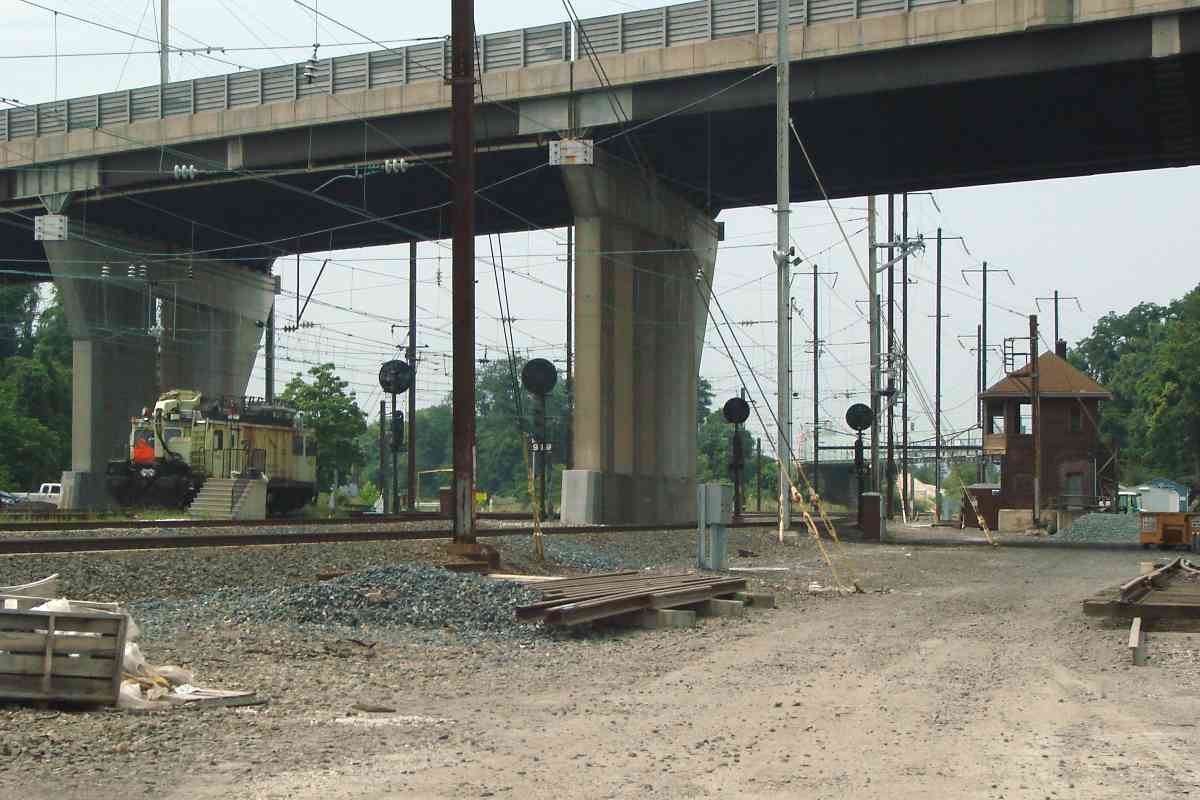
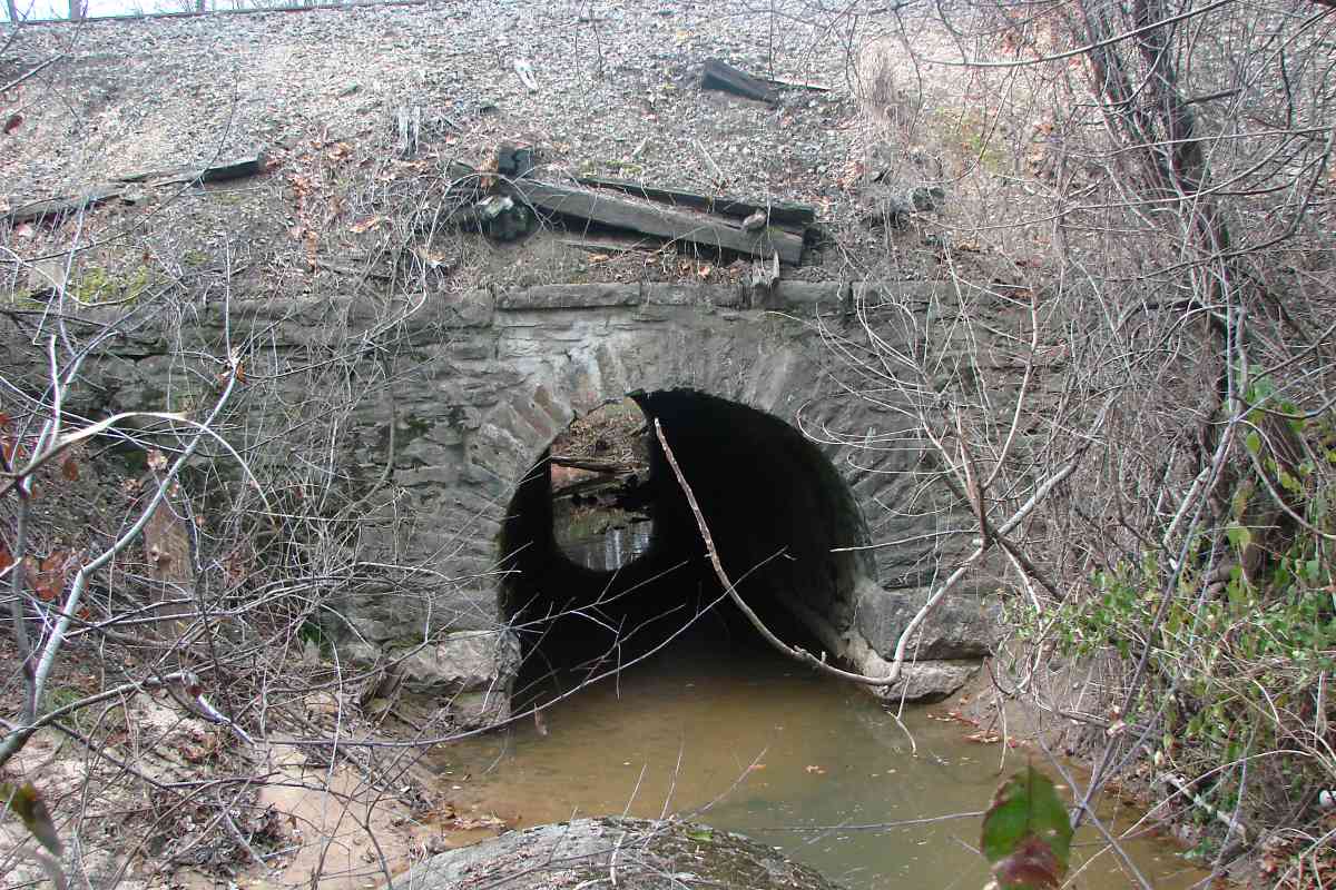
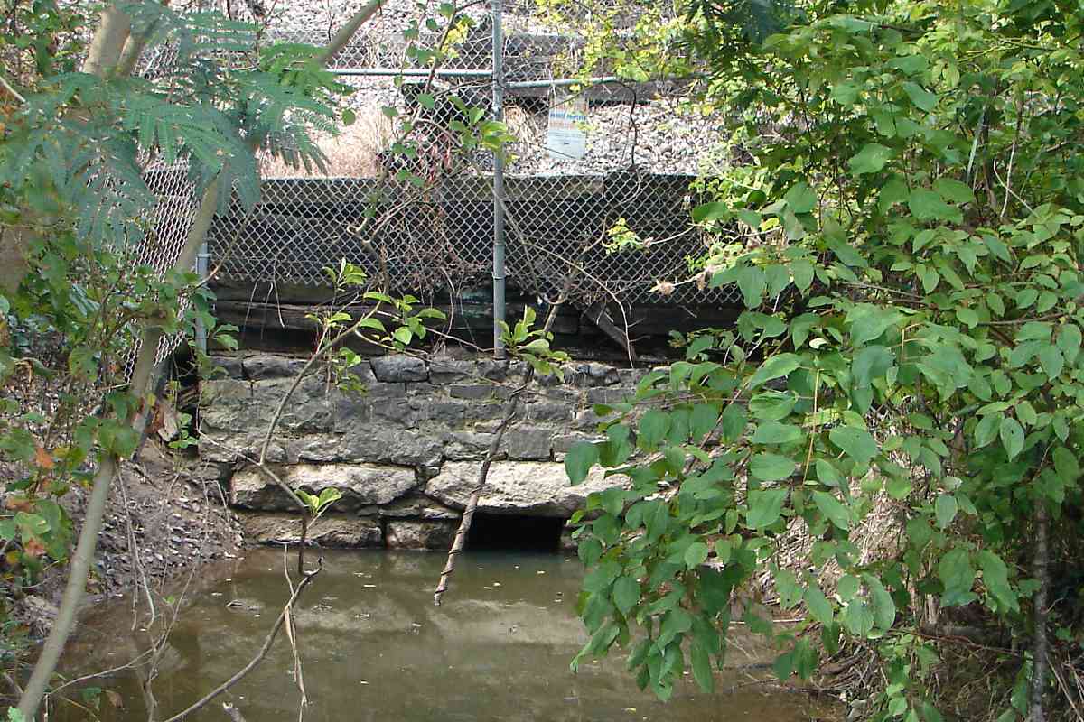
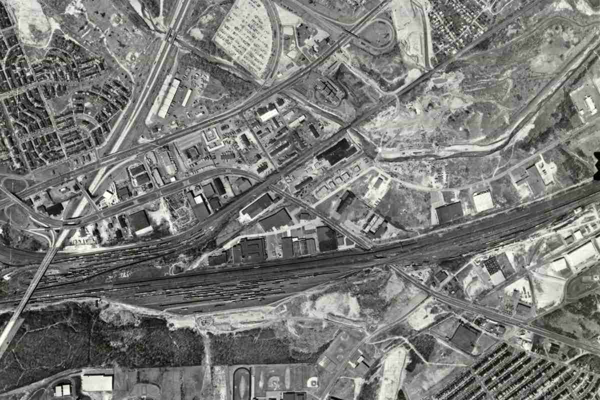
This right of way dates to the 1830s as part of the Baltimore and Port Deposit inlet 
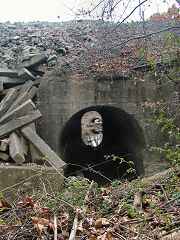
Rail Road (B&PD) chartered to build from Baltimore to the Susquehanna. The B&PD built little if anything before in 1836 being reorganized into the Philadelphia, Wilmington & Baltimore RR (PW&B). PW&B built southwest from the Susquehanna River to Baltimore, meaning this arch likely dates to the late 1830s. It is the oldest stone arch survivor I have found 
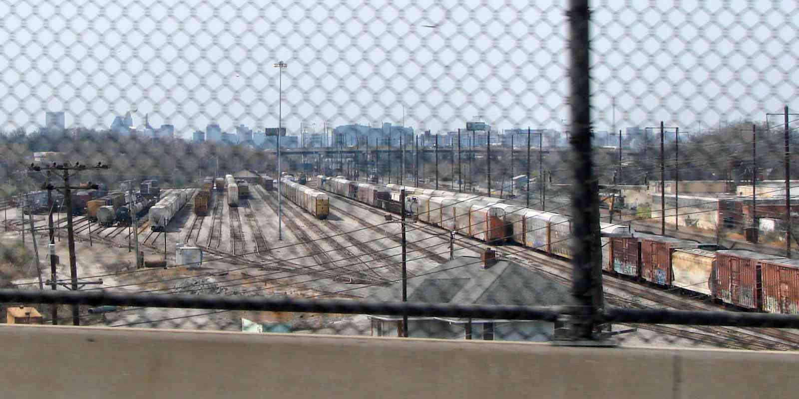
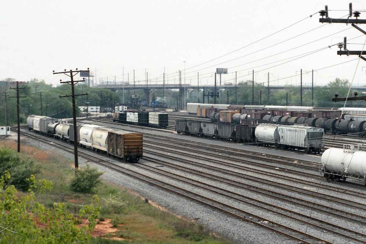
along the line. It was widened about 1930 to carry more tracks via the addition of a concrete arch on its inlet side (right). The concrete strips and larger rubble on left probably shore up erosion.

The masonry skill demonstrated here is not as refined as in B&O's stone arches of the same period. B&O emphasized, some would say overemphasized, stonework engineering and architecture possibly because the company's organizers were Freemasons.


Amtrak A63446

Amtrak A63446
Mile: 88.4 Date: Nov 2018
Ease: B View: N
Area: B T6:
Map: Ba 36 K 8 Topographic Maps

Some days it's difficult to keep the shiny side up. Chesaco Park Station had been located in this vicinity.


Amtrak 652

Amtrak 652
Mile: 88.7 Date: Nov 2018
Ease: B View: SW
Area: B T6:
Map: Ba 36 K 9 Topographic Maps

Like B&O, during the 1830s PW&B was less concerned about curves than about grade. Now Amtrak is stuck with these track curves, or is it? With CSX it could swap alignments between Susquehanna and Bayview. CSX's route is much straighter, thanks to having been built by B&O after railroads had learned to minimize curves.

The Severn Avenue bridge rises behind, a grade-separation project of 1975.


Culvert

Culvert
Mile: 89.0 Date: Aug 2017
Ease: A View: NW
Area: B T6:
Map: Ba 36 J 10 Topographic Maps

PW&B (or B&PD) built box culverts too during the 1830s. This is one of few that has not later been totally replaced by concrete or steel.


Amtrak 611

Amtrak 611
Mile: 89.3 Date: Aug 2017
Ease: B View: NE
Area: B T6:
Map: Ba 36 J 10 Topographic Maps

This Baltimore-bound train has just passed under the I-695 Beltway for the second time in less than a mile. I-695 bobs and weaves its way through this area as a compromise combination of the ill-fated Windlass Freeway and Patapsco Freeway. Back River Station had been located near the overpass.

Link: Amtrak 650 in 2010


Amtrak 2004

Amtrak 2004
Mile: 89.3 Date: Aug 2017
Ease: B View: SW
Area: B T6:
Map: Ba 36 J 10 Topographic Maps

For an unknown reason, the de-icing lamps are lit on this stiflingly hot August day as a northbound is about to complete a trip through Bay View Yard and cross the quad-track Moores Run bridge. Moores Run feeds into the Back River, so sometimes this is called the Back River bridge.

Link: Amtrak 653 in 2010


Pole Signals

Pole Signals
Mile: 89.9 Date: Aug 2018
Ease: B View: E
Area: B- T6:
Map: Ba 36 G 10 Topographic Maps

zoom Three versions of signals are all saying nothing but Stop to traffic exiting Bay View yard trackage. In fact, with just two lamps the leftmost signal always displays Stop. Stop can be modified into something less restrictive by lights below it.

Along the NE Corridor in Maryland, pole signals like these are greatly outnumbered by overhead signal bridges. The leftmost signal is a PRR original. The small signal in the middle employs the Pennsy dwarf style on a pedestal. The rightmost signal, with a characteristic array of bright bolts, is a newer model manufactured by Safetran.

Link: Todd's page about PRR signals


PRR Keystone

PRR Keystone
Mile: Date: Dec 2016
Ease: A View: N
Area: B T6:
Map: Ba 45 E 8 Topographic Maps

keystone When during the 1940s iron ore deliveries via boat to Baltimore's shipbuilders were being sunk by Nazi Unterseeboots (U-Boats), ore was instead hauled in from the midwest via train.

A spur was rushed into service from Bay View Yard to Bethlehem Steel at Sparrows Point. The spur likely met North Point Boulevard at grade until this bridge was built after the war (1948 according to the builder's plaque). Note the Pennsy Keystone emblazoned at the center. The spur remains operational.

Change for: PRR Sparrows Point Branch tour starting at Sparrows Point


Amtrak 2021

Amtrak 2021
Mile: 89.9 Date: Aug 2018
Ease: B View: W
Area: B- T6:
Map: Ba 36 G 10 Topographic Maps

Amtrak shares Bay View Yard with NS. Tracks near the middle are kept clear for trains not stopping, such as this northbound.

Links: NS Interstate Heritage unit in 2012, NS leaving yard


North Point Boulevard

North Point Boulevard
Mile: 91.0 Date: Dec 2016
Ease: A View: NW
Area: B- T6: 295
Map: Ba 36 D 12 Topographic Maps

1927 aerial Bay View Yard is oriented east-west. The south side of the yard is Norfolk Southern turf, easily seen from North Point Boulevard. The pole line on the left still follows the route of the original grade crossing.

The 1927 aerial at left shows grade separation underway for what had been Back River Road. As part of expansion to handle World War II rail traffic, during 1943 a second bridge was added parallel on the south side of the first. In the view above, NS 7571 is crossing the newer of the adjacent bridges.

Link: 1931


Mailbox

Mailbox
Mile: 91.4 Date: Aug 2018
Ease: A View: SW
Area: C T6:
Map: Ba 36 C 11 Topographic Maps

There's something incongruous about this style mailbox at a rail yard.


From Lombard Street

From Lombard Street
Mile: 91.5 Date: Jun 1999
Ease: B View: W
Area: C T6:
Map: Ba 36 C 12 Topographic Maps

A steep climb up from Lombard Street nets this view of the Norfolk Southern side of the yard.


LMIX 506
NEW! early-Nov 2022

LMIX 506
Mile: 91.6 Date: Aug 2018
Ease: A- View: E
Area: C T6:
Map: Ba 36 B 11 Topographic Maps

Tha Amtrak side of the yard hosts various maintenance of way equipment. Loram's LMIX 506 Railvac (left) cleans ballast.

The red RWP sign is a new one on me. "Roadway Worker Protection" was all I could dredge up online.


NS 8057

NS 8057
Mile: 91.6 Date: Aug 2018
Ease: A- View: SW
Area: C T6:
Map: Ba 36 B 11 Topographic Maps

yard office A couple NS horses rest within view of the Johns Hopkins Bayview Medical Center in the distance.

To the right is Norfolk Southern's Bay View Yard Office.


Under I-895

Under I-895
Mile: 91.9 Date: Aug 2018
Ease: A- View: W
Area: C T6:
Map: Ba 36 B 11 Topographic Maps

With height limited by I-895, instead of a signal bridge this location gets four signals on poles.


Amtrak 16507

Amtrak 16507
Mile: 91.9 Date: Aug 2018
Ease: A- View: S
Area: C T6:
Map: Ba 36 B 11 Topographic Maps

This catenary maintenance vehicle has been named in honor of Dave Johnson. It has been parked here since around 2005. There is a Dave Johnson that has been MARC's Chief Transportation Officer, but I do not know if it is the same person.

Link: 2013


Bay Tower

Bay Tower
Mile: 91.9 Date: Aug 2018
Ease: A- View: E
Area: C T6:
Map: Ba 36 B 11 Topographic Maps

A lack of windows in PRR's Bay Tower suggests it is being allowed to deteriorate.

Links: 1953, 1974, 1975. 1975. from tower 1975, 1995. 2010, 2011


Signals

Signals
Mile: 91.9 Date: Aug 2018
Ease: A- View: S
Area: C T6:
Map: Ba 36 B 11 Topographic Maps

a closeup of some of the previously-mentioned signals...

Links: 1978, 2003


1974 Aerial
Photos credit Library of Congress

1974 Aerial
Mile: ~92 Date: 1974
Ease: View: E
Area: T6: 294
Map: Ba 36 A 11 Topographic Maps

B&O also had a Bayview Yard, now used by CSX. In this view from above, it's the yard on the left. In the adjacent Amtrak/NS yard on the right, it appears only one electrified track is clear for Amtrak service.

Bay View Yard is sandwiched between I-895 on the west (bottom) and I-95 on the east (top).

Link: LoC source photo
Change for: B&O Philadelphia Branch tour starting at Bayview


From I-895

From I-895
Mile: 91.9 Date: Nov 2016
Ease: A View: E
Area: B T6:
Map: Ba 36 B 12 Topographic Maps

When zooming in, that's Amtrak under the wires on the left, NS on the right.

Link: Todd's Bayview page


<< Previous (northeast) | THIS PAGE: Middle River to Bay View | Next (branch) >>

Or, return to main page

Copyright Notice