


The HG&B ran along the north side of Lawrence Rd, from Gage Ave all the way to the Red Hill Creek. Road widenings have eliminated all traces of the line to the east of Kenilworth Ave, but between Gage and Kenilworth Lawrence Rd is still only two lanes, as it was when built. The very wide paved shoulder/bike lane on the north side of Lawrence Rd is the former HG&B right of way.
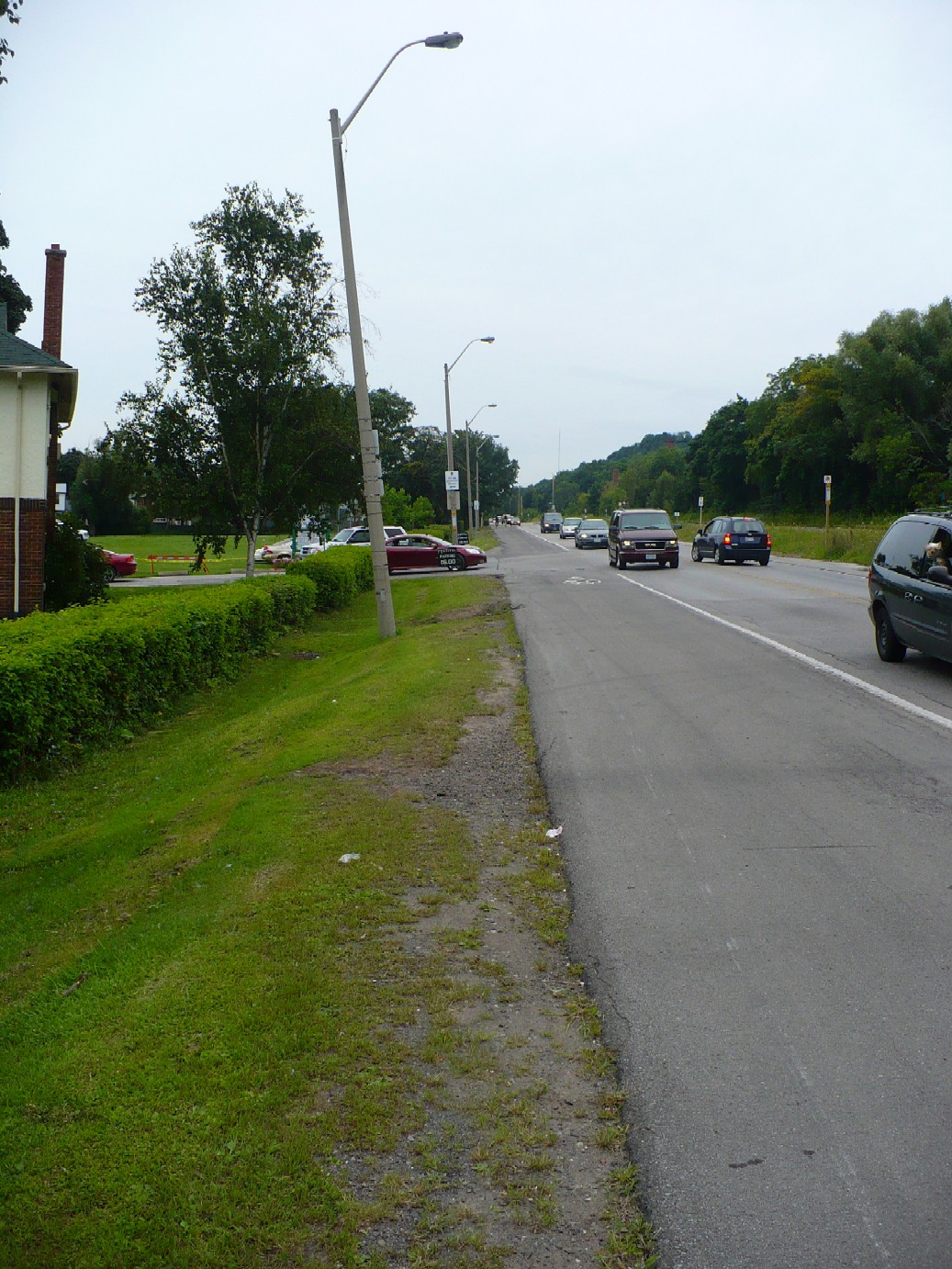
Lawrence Rd entrance to Gage Park. It's along the south edge of Gage Park that the profile of the old HG&B right of way is most easily seen, such as at the Roselawn Bowling Clubhouse.
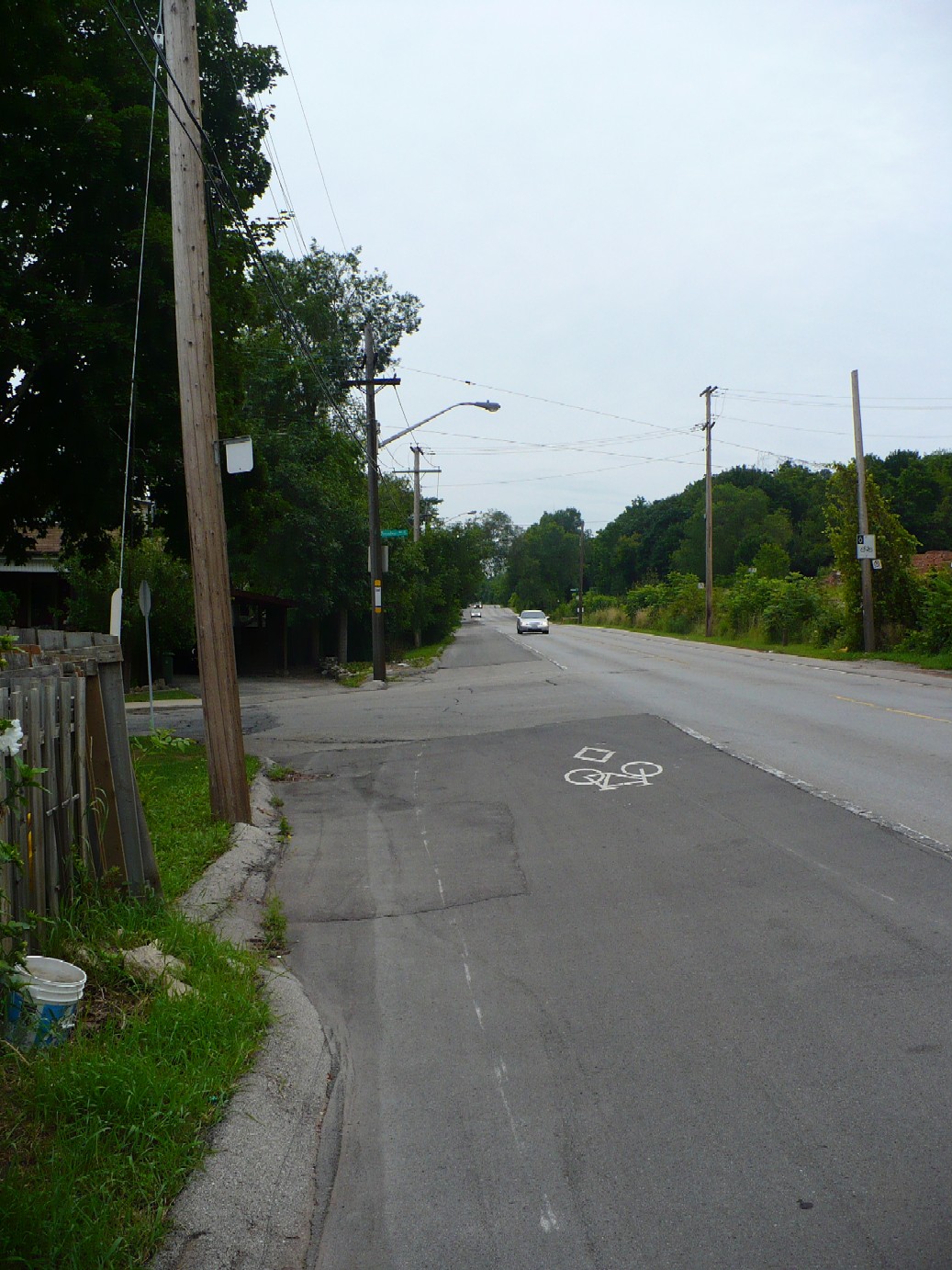
Lawrence Rd & Kensington Ave S, looking west. All along the north side of Lawrence Rd are small pieces of old concrete and stones, but there's no way to know if any of this is from the HG&B.
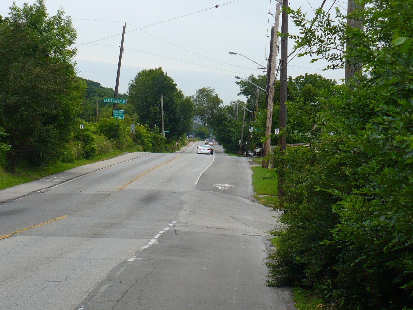
Lawrence Rd & Rosslyn Ave S, looking east. As a result of the edge of the right of way, at spots along Lawrence there is quite a steep drop down to the adjoining backyards. On the northwest corner of Lawrence and Balmoral is a small house that has a very long and rather high concrete porch, and large windows, rather like an old station.
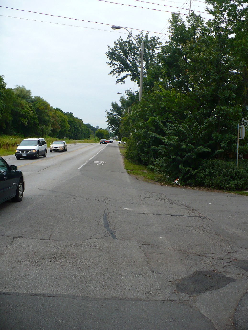
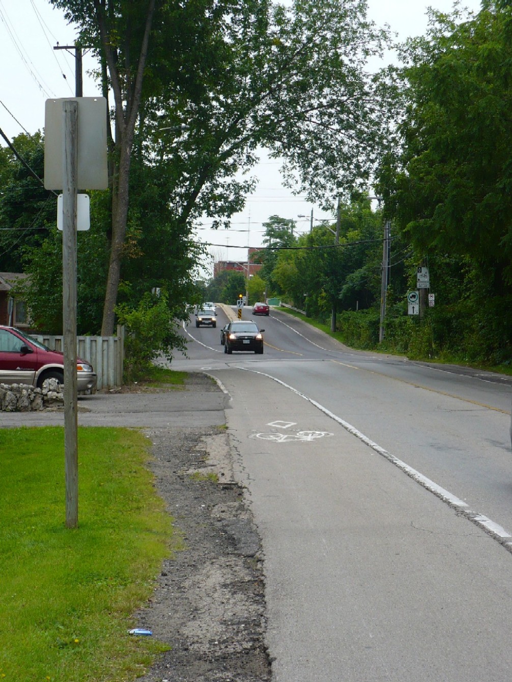
Lawrence Rd & London Ave S, looking west. You can easily see the difference in the bike lanes on either side of Lawrence Rd. Also, judging by all the little hills on Lawrence Rd, this part of the HG&B must have been a fun ride.
Lawrence Rd & Wexford Ave S, looking east. The construction of the bridge over Kenilworth Ave and the widening of Lawrence Rd east of the bridge has destroyed any additional traces of the HG&B.
One spot in East Hamilton where Lawrence Rd is not overtop the old HG&B is the large S-curve that Lawrence Rd makes just west of Cochrane. Years ago, Cochrane Rd was not a continuous road, and did not run between King St & Lawrence Rd as it does today. Instead, there was a section of road that ran north-south where the large power lines are now. Lawrence Rd made a very sharp S-curve at this point, and rather than make a sharp curve the HG&B broke away from Lawrence near Ipswich Rd, cut across a field, and then met up again with Lawrence where Cochrane is today. Lawrence Rd was eventually rebuilt with a wider S-curve (this is why there are two sidewalks on the south side at Samuel Rd, the one following Lawrence Rd is the newer of the two) but the road is not over the HG&B, the radial would be just north of the sidewalk on the north side. However, there is no trace of it.
The majority of the HG&B's route was either along the centre or the edge of various roads. An exception to this was the HG&B's crossing of the Red Hill Creek. For decades after the abandonment of the HG&B, anyone driving along King St East in Hamilton would have seen a ridge and a pair of crumbling bridge supports as they crossed the Red Hill Creek. These remains were demolished as part of the construction of the Red Hill Creek Parkway. I took these photos in December of 2003.
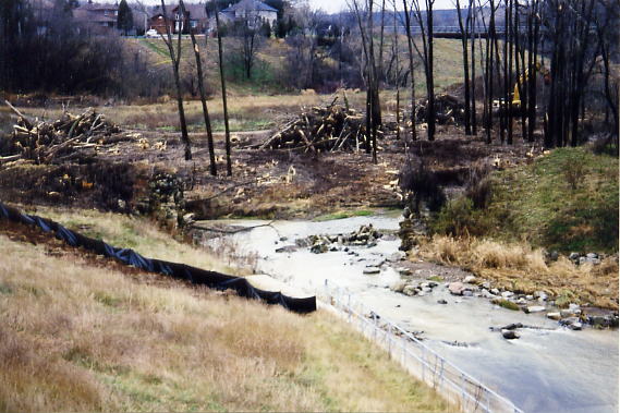
The remains of the HG&B bridge over the Red Hill Creek. In the background are construction vehicles removing trees for the Expressway construction
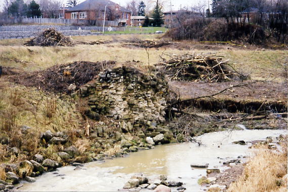
The east bridge support. The houses in the background are on Mt. Albion Rd.
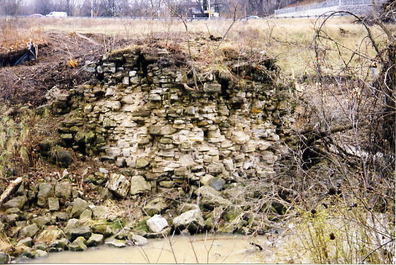
Closeup of the east bridge support.
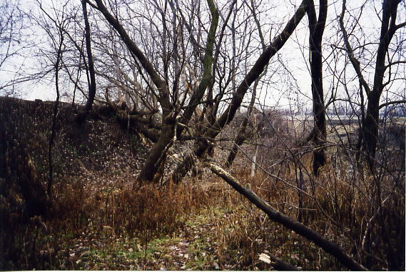
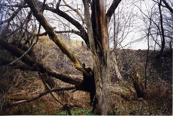
The old HG&B roadbed on the west side of Red Hill Creek
The HG&B roadbed splits away from Lawrence Rd
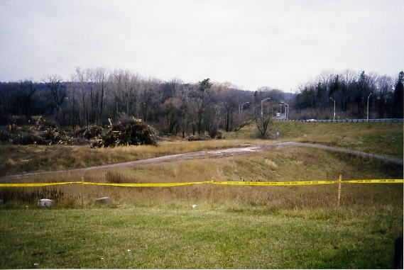
Looking west across the Red Hill Creek. Lawrence Rd, which the HG&B travelled along, is in the background. The police tape was placed all along the length of the Red Hill Creek valley, in order to prevent protestors from interfering with construction (and me taking photos)
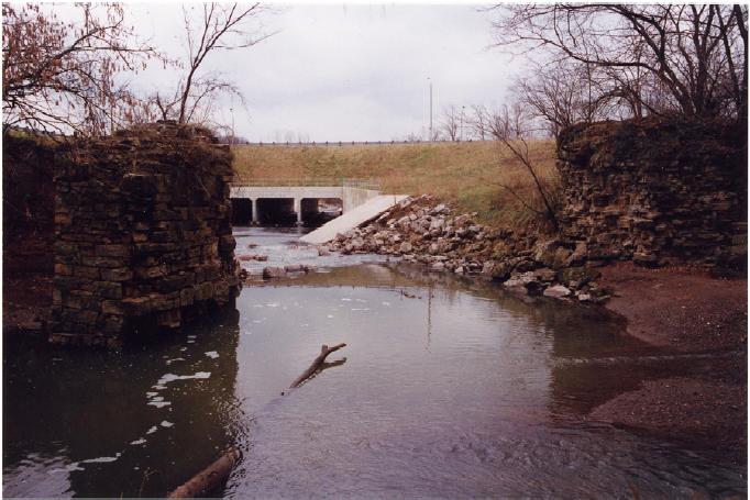
This 1996 photo shows the remains of the HG&B bridge piers over the Red Hill Creek. King St East is in the background
The HG&B required electrical generating stations along its route to supply the power for its cars. One of the first such stations was built alongside the Stoney Creek, at what is now King St West and Jones St in Stoney Creek. Water from the Stoney Creek was boiled in two 150 HP Corliss-type steam engines, which were connected to electric generators.
On December 12, 1893 it was announced that the powerhouse would be located in Stoney Creek. Construction began the following spring, with the building completed by August 14, and all equipment installed shortly afterwards The first power tests were performed in late September.
From the Hamilton Spectator, September 29, 1894: At Stony [sic] Creek is situated the company's power house-a neat, commodious brick building to the north of the road and at the east of the village. It is in size 40 feet by 95 feet, and contains, in readiness for operation, two large compound condensing engines made by Inglis & Son, two boilers and two powerful Westinghouse electrical generators, one of which will give all the power required to run the road. There are larger and more costly power houses in Canada, but there are none more thoroughly equipped and handily situated.
Shortly after opening in 1894, it was discovered that the Stoney Creek would be unable to supply a reliable amount of water to ensure operations, especially during the summer months. The creek ran dry in 1895, resulting in the HG&B deciding to purchase electricity from the Cataract Power Company when the DeCew Falls generating station opened in 1898. The Stoney Creek generating station remained in use, and had its capacity upgraded when the HG&B opened its Vineland extension in 1904.
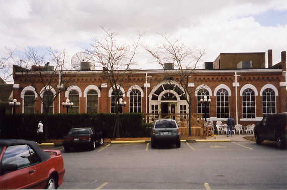
After the sale and closure of the HG&B in 1931, the powerhouse was used by Ontario Hydro as a storage facility until 1980. It was sold and restored, and is now The Old Powerhouse restaurant. (www.theoldpowerhouse.com) The interior of the restaurant has been decorated with many photographs and memorabilia of the HG&B, along with several other interesting historical items, such as a chandelier that was owned by Mark Twain and items from the set of the movie Casablanca.
(All photos © Tom Luton, except where noted)
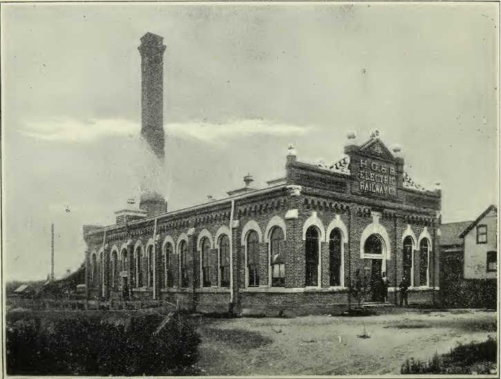
The HG&B Powerhouse in Stoney Creek in the Summer of 1898. (Photo from "Through the Garden of Canada" an HG&B brochure published in the Fall of 1898, available online from Archive.org
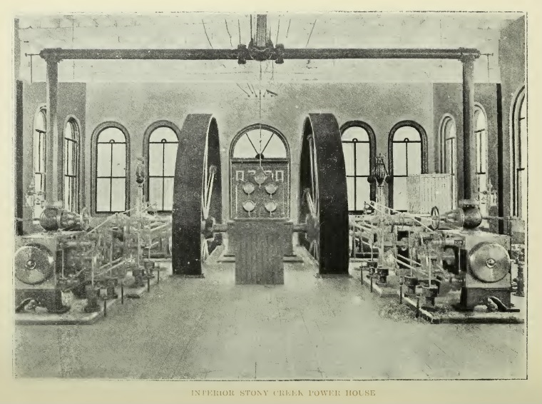
Inside the HG&B Powerhouse in Stoney Creek in the Summer of 1898. (Photo from "Through the Garden of Canada" an HG&B brochure published in the Fall of 1898, available online from Archive.org
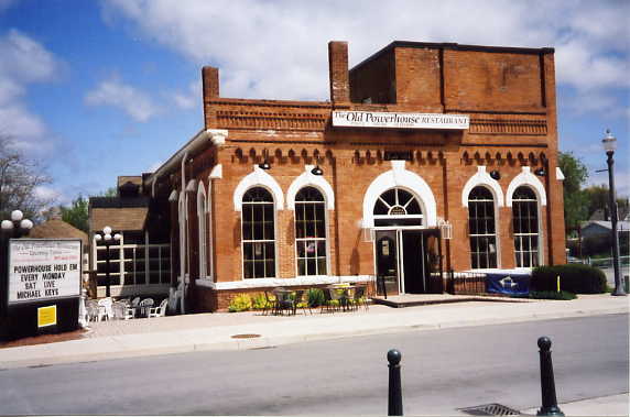
The front of the powerhouse
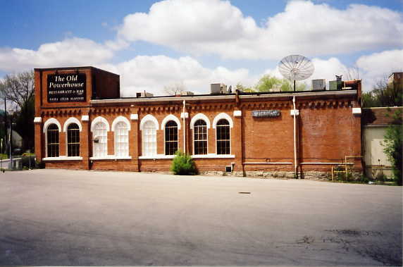
The east side of the powerhouse
The west side of the powerhouse
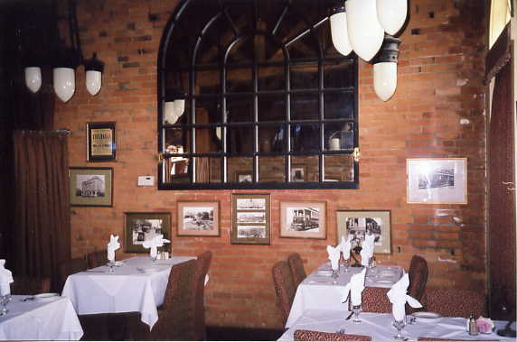
The interior of the powerhouse. Shown are a few of the several photos of the HG&B that The Old Powerhouse restaurant has placed on its walls.
When the HG&B was abandoned, not all of the rails were removed. In Beamsville on King St, the tracks were entombed in concrete. In the summer of 2001 the tracks were unearthed between Cresent Ave and William St as part of road reconstruction. They were removed and scrapped.
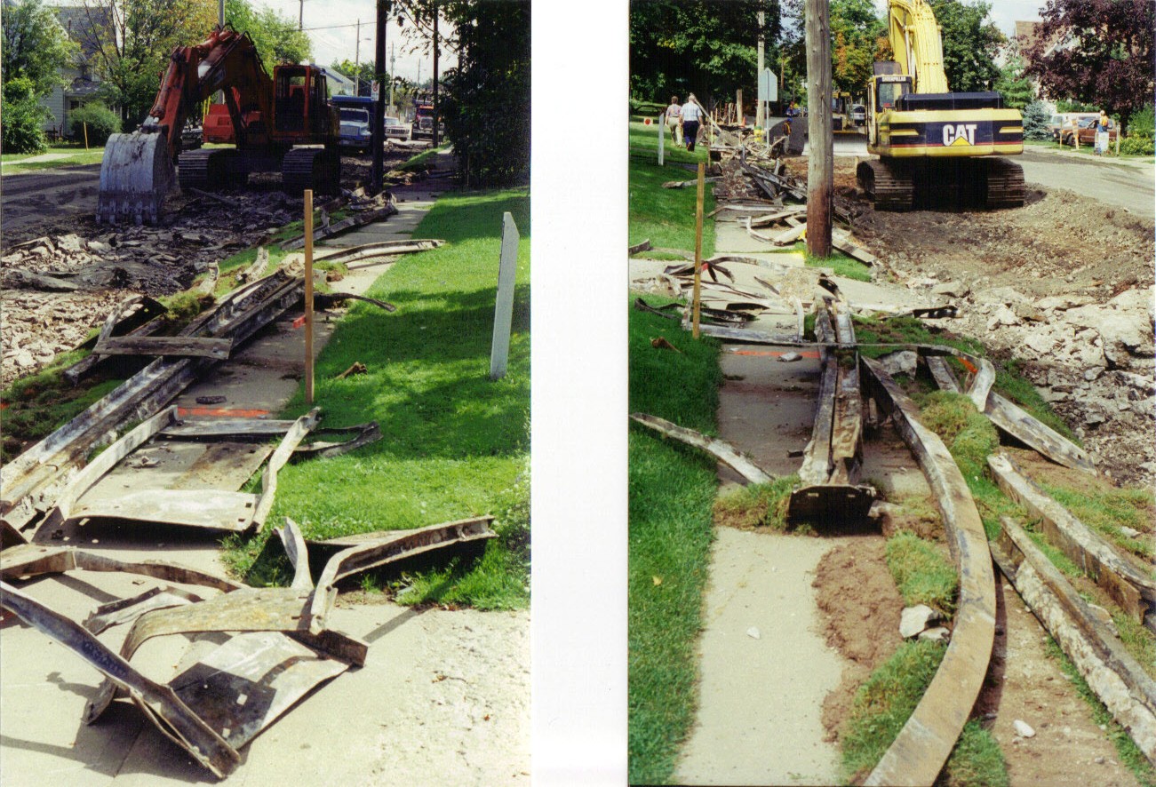
These are old HG&B rails that have been removed as part of road reconstruction in Beamsville, The left photo is looking west, the right photo is looking east. After 70+ years the tracks were in excellent shape. (Photo by Dave Sherlock, used with permission)
Built in 1896, the Beamsville car barn was in use until the final day of the HG&B in 1931. Afterwards it sat vacant until it was converted into a General Motors dealership and garage under the name of Inglehart & Gledhill Motors, opening on March 1, 1935. It became Sutherland Motors on September 15, 1947, and then Beamsville Motors on March 1, 1960. Starting in October 1965, it became the home of Mac Lawn Spray, a lawn care company. The front of the building was leased to XL Service Station at some point in the early 1970s.
On August 20, 1984 workers in the garage were using a cutting torch to cut a hole in the floor of a truck when the heat ignited a nearby object setting the garage on fire and causing extensive damage. The burnt ruins of the old car barn would be torn down in July 1986.
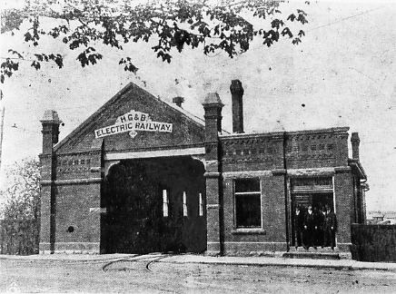
The original Beamsville car barn on the HG&B, circa 1900.
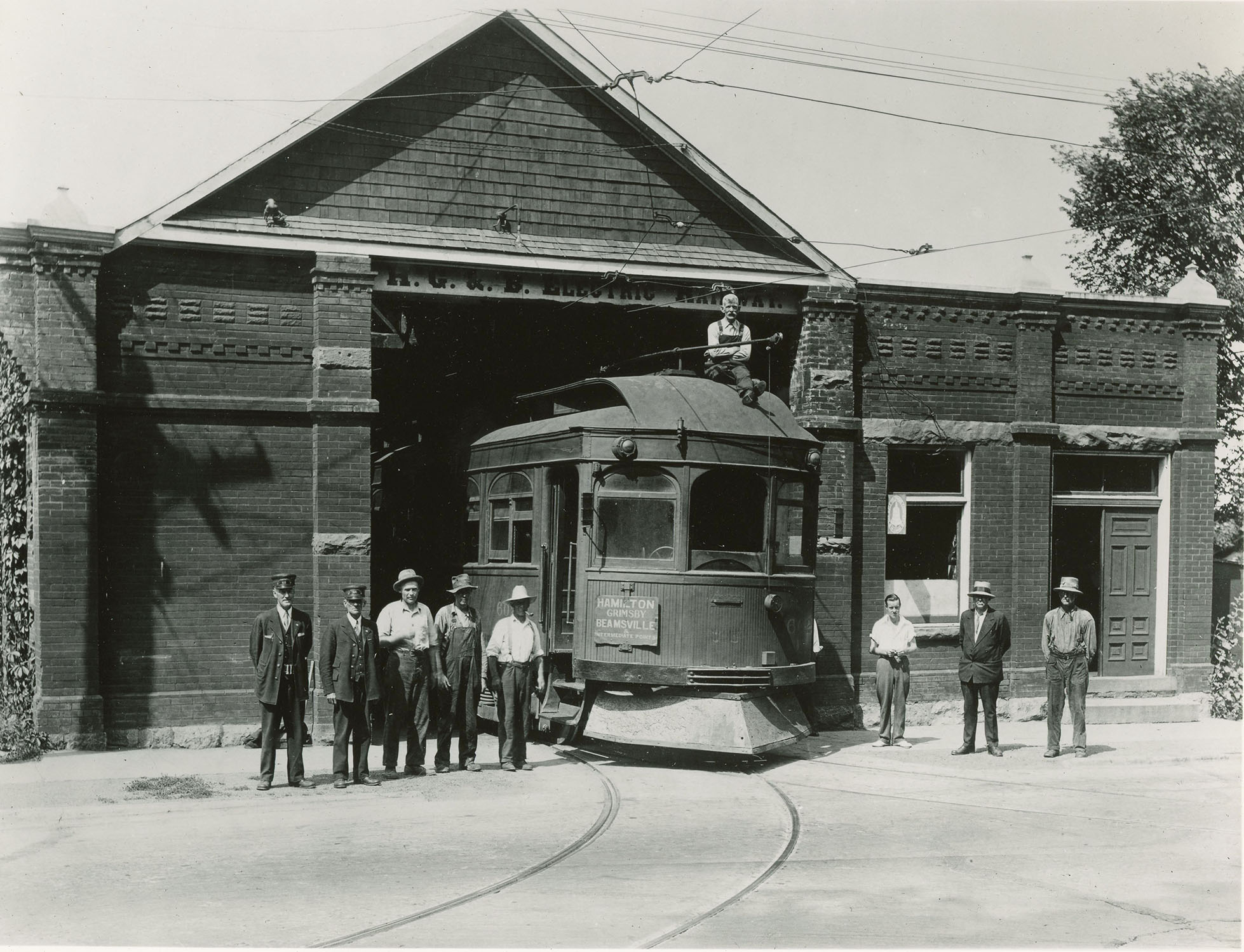
HTC #602 pokes out of the Beamsville car barn on the last day of service, June 30, 1931. From left to right is Conductor Omar Cosby, Motorman Jim Steven, Earl Spencer, Bill "Greeny" Greenfield, unknown, unknown, Albert Dipper, unknown, with Harry Barnes on top of #602. (Photo from the James McFarlane Collection, courtesy Trevor Parkins-Sciberras used with permission)
Built in 1904 for the Vineland extension of the HG&B from Beamsville, the station was only in use for a little more than a year. The station was sold in 1907 and eventually converted into a garage. Over the years it hosted a number of owners including Page & Williams Home Appliances, Harold Davy Electrical and Refrigeration, with the final owner being Reliance Oil. The station was demolished during the week of July 13, 1953.
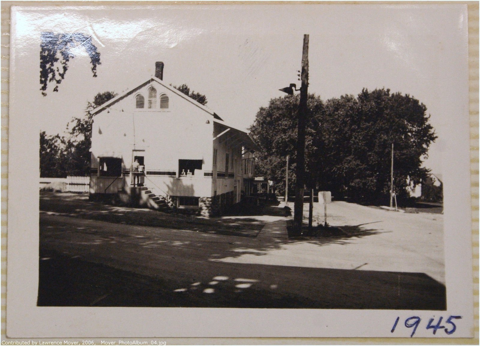
This is the former HG&B Vineland station on the northwest corner of Victoria Ave & King St in 1945. (Photo by Kenneth Moyer, courtesy of the Lincoln Public Library, used with permission)
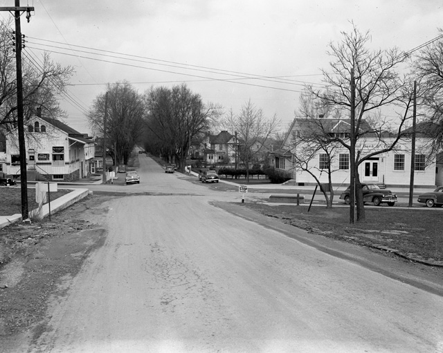
The intersection of Victoria Ave & King St, looking north. The former HG&B Vineland station is on the left. Photo taken on 14 April 1951 by Bruce Murdoch. (Photo courtesy of the Hamilton Public Library, Local History & Archives)


