TrainWeb.org Facebook Page
Baltimore Light Rail Photo Tour


Baltimore Light Rail
Modern day photo tour

Accompanying each photo below are:

Click a photo to see a larger view. Please send your comments and corrections to Steve.


<< Previous (north) | THIS PAGE: Stadiums to Westport | Next (south) >>

Depart
Photo credit HH Harwood

Depart
Mile: 0.5 Date: Jun 1993
Ease: A- View: SE
Area: B BLR:
Map: Ba 43 A 1 Topographic Maps

With its trip down Howard Street now in the rear view mirror, light rail faces other challenges ahead. First, this is a crowded area, with MARC (near) and I-395 (far), so light rail departing Camden Station must squeeze between the two.


Autoracks

Autoracks
Mile: 0.6 Date: Jun 1999
Ease: A- View: S
Area: B BLR:
Map: Ba 43 A 2 Topographic Maps

Plus, CSX emerges from the ex-B&O Howard Street Tunnel, and at the right side of this photo adds autoracks to the mix.


Howard Street Tunnel

Howard Street Tunnel
Mile: 0.7 Date: Mar 2001
Ease: B View: N
Area: B BLR:
Map: Ba 43 A 2 Topographic Maps

In this reverse view, that's the Howard Street Tunnel portal on the left. When I-395 and Oriole Park were being constructed, a quarter-mile extension was built from the tunnel's original portal south to the location seen here.

Red-over-yellow on the signal at right is how light rail depicts the "restricted speed" instruction - that trains should proceed slowly enough to be able to stop before any track obstruction visually spotted by the operator. Here it can warn northbound trains that pedestrians are likely near the tracks at Camden Station.


MTA 5034

MTA 5034
Mile: 0.7 Date: Oct 2016
Ease: B View: S
Area: B BLR:
Map: Ba 43 A 2 Topographic Maps

This pedestrian is safely behind the southbound train departing Hamburg Street Station, and is appropriately checking for hidden northbounds.


Hamburg Street
Photo credit HH Harwood

Hamburg Street
Mile: 0.7 Date: 1990s
Ease: B View: S
Area: B BLR:
Map: Ba 43 A 2 Topographic Maps

Hamburg Street Station is the one nearest M&T Bank Stadium. The pedestrian ramps seen here extend from the station to the stadium.


Freight

Freight
Mile: 0.8 Date: Mar 2001
Ease: B View: S
Area: B BLR:
Map: Ba 43 A 2 Topographic Maps

At photo time, the stadium was still named for flash-in-the-pan Internet service provider PSINet, hence the purple letter P at upper right.

Ahead, light rail must navigate its way to the south side of the Middle Branch of the Patapsco River. Before that, however, it must leapfrog CSX's freight line to the port of Locust Point, so light rail rises onto its longest stretch of elevated trackage, here still in its original single-track form.


MTA 5043

MTA 5043
Mile: 0.8 Date: Sep 2018
Ease: B View: S
Area: B BLR:
Map: Ba 43 A 2 Topographic Maps

Around 2002, a second track was added on the west side, hence the brighter, newer concrete on the right.


Ascent

Ascent
Mile: 1.0 Date: May 2001
Ease: A View: NE
Area: B- BLR:
Map: Ba 43 A 3 Topographic Maps

This ascent would be too steep for freight trains.


Waiting for a Sign
Photo credit HH Harwood

Waiting for a Sign
Mile: 0.9 Date: Jan 2000
Ease: A View: W
Area: B BLR:
Map: Ba 43 A 2 Topographic Maps

What had been Ravens Stadium at Camden Yards got its first naming contract in 1999, but at photo time PSINet's name had not yet been affixed to the structure.


Dwarfs

Dwarfs
Mile: 0.9 Date: Mar 2021
Ease: A View: W
Area: B BLR:
Map: Ba 43 A 2 Topographic Maps

When the whole (now M&T Bank) stadium is in view, it dwarfs the trains.


Think Tundra
Photo credit HH Harwood

Think Tundra
Mile: 0.9 Date: Jan 2000
Ease: A View: SW
Area: B BLR:
Map: Ba 43 A 2 Topographic Maps

Turning to look south of the stadium can yield a Siberian scene suitable to enjoy on a hot summer afternoon.


Disneyesque
Photo credit HH Harwood

Disneyesque
Mile: 1.0 Date: Jul 1993
Ease: B+ View: N
Area: B BLR: 85
Map: Ba 43 A 2 Topographic Maps

The skyward climb and uncluttered appearance of the original elevated single-track evokes a theme park ride.


Room for More
Photo credit HH Harwood

Room for More
Mile: 1.0 Date: 1990s
Ease: A View: NE
Area: B- BLR: 41
Map: Ba 43 A 3 Topographic Maps

The undulating route is tailor-made for photography. The Ostend Street bridge was getting a makeover at photo time. This section of light rail opened for revenue service August 30, 1992, which was about five months after the Timonium-Camden section had.

Link: 1991


Clean
Photo credit HH Harwood

Clean
Mile: 1.0 Date: 1990s
Ease: A View: N
Area: B BLR:
Map: Ba 43 A 3 Topographic Maps

Before fences were added to both sides of elevated portions, Harwood captured the system's clean appearance via upward-looking photos. The top of the Bromo Seltzer tower can be seen at bottom center.


Small Flags

Small Flags
Mile: 1.0 Date: Feb 2011
Ease: A View: E
Area: B- BLR: 41
Map: Ba 43 A 3 Topographic Maps

Before being adorned with large-size Maryland state flags, some cars had these smaller ones. The track at bottom is CSX's connection to port facilities at Locust Point.

Change for: Locust Point Branch tour at this site


Big Flags

Big Flags
Mile: 1.1 Date: Jun 2021
Ease: A- View: E
Area: B BLR:
Map: Ba 43 A 3 Topographic Maps

It's not the pictures that got small, instead the flags have become bigger than the railcars.


Take a Dip
Photo credit HH Harwood

Take a Dip
Mile: 1.0 Date: Apr 1993
Ease: B+ View: SW
Area: B BLR: 85
Map: Ba 43 A 3 Topographic Maps

Next, light rail reaches the Middle Branch, and one of the most scenic rides available via any local public transit system.

Link: 1986


MTA 5032

MTA 5032
Mile: 1.1 Date: Apr 2021
Ease: B View: SW
Area: B- BLR:
Map: Ba 43 A 3 Topographic Maps

As seen from the Middle Branch's north shore, MTA 5032 is ready for its closeup. In the background is the "Baltimore" stack readily visible from I-95.


Morning Reflections
Photo credit HH Harwood

Morning Reflections
Mile: 1.1 Date: 1990s
Ease: B View: SW
Area: B- BLR: 53
Map: Ba 43 A 3 Topographic Maps

Technically, the Middle Branch is part of the Patapsco River, but by this point it has sufficiently blended with the harbor / Chesapeake Bay to exhibit no obvious sign of water flow. That stillness can make for attractive reflections. The three stacks visually behind the train belong to the Westport Generating Station, which this tour will soon reach.


Afternoon Reflections
Photo credit HH Harwood

Afternoon Reflections
Mile: 1.1 Date: 1990s
Ease: B View: S
Area: B- BLR: 34, 52
Map: Ba 43 A 3 Topographic Maps

In the afternoon, the sun sets on these boulevards.

The Annapolis Short Line (ASL), the first interurban in this area, avoided a long water crossing, choosing a mostly-land alignment that would later become part of Russell Street. In Baltimore's Light Rail, Harwood explains that alignments near the ASL's former route were prohibitively expensive for light rail circa 1990 due to the cost of traversing wetlands. The over-water route seen here ended up being less expensive.


MTA 5050

MTA 5050
Mile: 1.1 Date: Sep 2018
Ease: A- View: E
Area: B BLR:
Map: Ba 42 K 3 Topographic Maps

After 1990, many factories along the former ASL alignment crumbled apart in slow motion, and Horseshoe Casino moved in. I would think the casino would welcome delivery of gamblers by the trainload, so perhaps someday they might fund a light rail reroute to their doorstep. This would-be-disused route over the water could then be repurposed into a scenic hiking/biking trail.


Single Track

Single Track
Mile: 1.2 Date: Jun 1999
Ease: View: S
Area: B BLR:
Map: Ba 43 A 3 Topographic Maps

It's a pretty view from the front and back of the train. Double track arrived here before digital cameras became ubiquitous, so single-track photos like this are tougher to find.

Link: 1997


MTA 5029

MTA 5029
Mile: 1.1 Date: Apr 2021
Ease: B View: S
Area: B- BLR:
Map: Ba 43 A 3 Topographic Maps

In this more recent photo, from this angle it's tough to see the double track.


MTA 5025

MTA 5025
Mile: 1.1 Date: Jun 2021
Ease: B View: S
Area: B- BLR:
Map: Ba 43 A 3 Topographic Maps

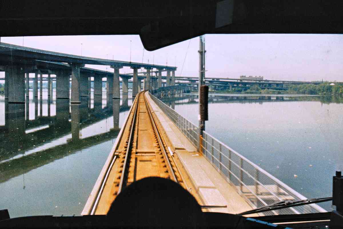
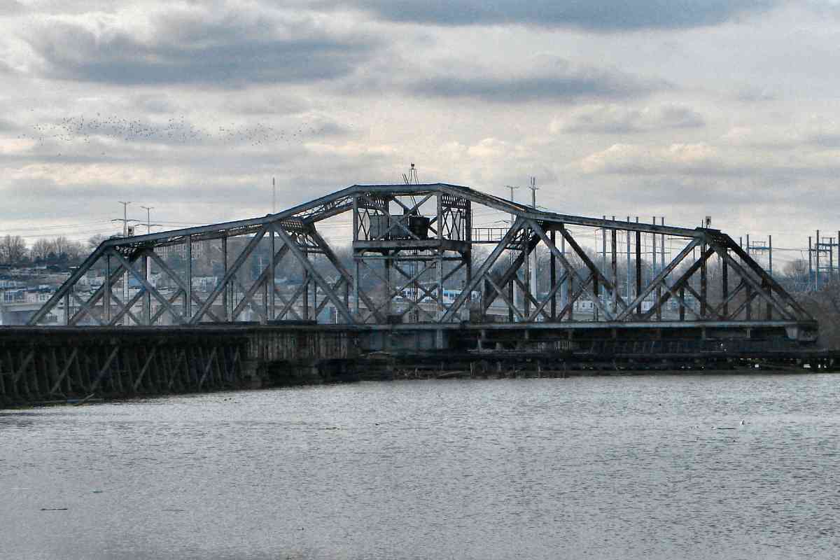
With casino expansion underway during 2021, it's also tougher to get to the shoreline for views like this.

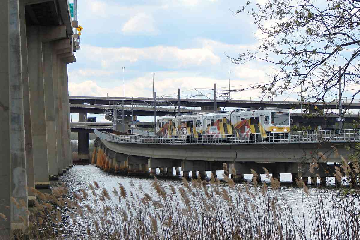
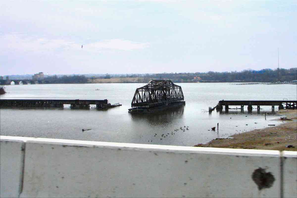
Assuming that this century countries work together to fertilize oceans (enhancing nature's own atmospheric CO2-removal process) and thereby limit rising ocean levels, I can imagine someone wanting to fill this otherwise stagnant, shallow basin to create more land. It's already silting up on its own.

The ultimate solution to the human-caused portion of climate change involves population control, but that's too difficult for countries to agree upon. Some estimates suggest Earth can sustainably support 3 billion humans, but the quantity reached 8 billion during the 2020s. Though by 2020 the human population has stabilized in most contries, according to the UN most population increae through 2050 will happen in just eight countries: Congo, Egypt, Ethiopia, India, Nigeria, Pakistan, the Philippines, and Tanzania.

Link: Wikipedia on ocean fertilization


MTA 5010

MTA 5010
Mile: 1.3 Date: Aug 2021
Ease: A View: SW
Area: B BLR:
Map: Ba 43 A 3 Topographic Maps

Seeing a train while driving on I-395 is easy -- if you have the right timing.


Tanks

Tanks
Mile: 1.1 Date: Jun 2021
Ease: A- View: SE
Area: B BLR:
Map: Ba 43 A 3 Topographic Maps

These holders had been painted plain white until around 2015 when someone had an inspiration. In addition to the Fort McHenry and crab themes, a third tank depicts horses. Left to right are MTA 5037 and MTA 5020.


Ramps

Ramps
Mile: 1.1 Date: Jun 2021
Ease: A- View: S
Area: B BLR:
Map: Ba 43 A 3 Topographic Maps

Despite being huge and man-made, the interstate ramps manage a certain graceful charm. MTA 5025 traverses below, all by itself.


Come Ashore

Come Ashore
Mile: 1.1 Date: Jun 2021
Ease: A- View: S
Area: B BLR:
Map: Ba 43 A 3 Topographic Maps

MTA 5037 and MTA 5020 are close to the south shore. The piers behind, visually above the train and below the highway ramps, are part of the ex-Western Maryland Railway's disused Spring Garden bridge.


Add-a-Track
Photo credit HH Harwood

Add-a-Track
Mile: 1.5 Date: ~2002
Ease: A View: N
Area: B BLR:
Map: Ba 43 A 4 Topographic Maps

Barges float the necessary machines and materials into place for the double tracking. Given that in this view the fenced, emergency walkway is on the left side of the rails, one might expect the second track would be added on the right, but no, instead it was added on the left along with new fences along both exterior sides.

Link: Todd's LR page for this stretch


Tangle
Photo courtesy Google

Tangle
Mile: Date: Oct 2002
Ease: View: N (up)
Area: BLR:
Map: Ba 43 A 4 Topographic Maps

Looking from above, light rail is the line beneath the tangle of I-95 (left-right) and I-395 (top-bottom) ramps. The aerial dates to the double-tracking period, hence the adjacent barges. The stream that flows from the left edge of this photo is the Gwynns Falls.


Reverse View

Reverse View
Mile: 1.5 Date: Apr 2021
Ease: B View: N
Area: B- BLR:
Map: Ba 43 A 4 Topographic Maps

This view north from the south bank includes Baltimore's skyline above MTA 5047.

The billboard ad reminds me of something in the Steven Wright style of comedy. A true story: once I called Geico, and told the woman who answered, "I'm calling for an insurance quote, and because I like your gecko." She paused as if I had made a lewd remark to her.


Racing

Racing
Mile: 1.5 Date: Apr 2021
Ease: B View: NE
Area: B- BLR:
Map: Ba 43 A 4 Topographic Maps

This is one of a handful of places that trucks and trains can race side-by-side.


MTA 5030

MTA 5030
Mile: 1.5 Date: Apr 2021
Ease: B View: NE
Area: B- BLR:
Map: Ba 43 A 4 Topographic Maps

MTA 5030 and MTA 5032 are approaching the south shore. The trackage over water is almost a half mile long.


Every Which Way But Up
Photo credit HH Harwood

Every Which Way But Up
Mile: 1.5 Date: 1990s
Ease: B- View: N
Area: B- BLR:
Map: Ba 43 A 4 Topographic Maps

Near the south shore, the line executes a gentle S-curve. Light rail's weaving job may not be as impressive here as under the Howard Street bridge, but it's still visually interesting.


Emergence

Emergence
Mile: 1.7 Date: Apr 2021
Ease: B+ View: NE
Area: B- BLR:
Map: Ba 42 K 4 Topographic Maps

Southbound MTA 5036 is ready to steer clear of the ramps...


MTA 5050

MTA 5050
Mile: 1.7 Date: Apr 2021
Ease: B+ View: S
Area: B- BLR:
Map: Ba 42 K 4 Topographic Maps

... while northbound MTA 5050 has recently begun negotiating the S-curve.


Atlas 1915
Image courtesy Johns Hopkins University

Atlas 1915
Mile: Date: 1915
Ease: View: N (up)
Area: BLR:
Map: Ba 42 K 4 Topographic Maps

That S-curve is north of what had been the Lauer and Harper Iron Works, a bridge building company served in 1915 by a B&O spur. At that time, the depicted east-west (right-left) rail line belonged to the Western Maryland Railway. Before Lauer and Harper, the Baltimore Glass Manufacturing Company had operated on the site. Now, light rail parallels Kloman Street.


Clare Street

Clare Street
Mile: 1.8 Date: Apr 2021
Ease: A View: S
Area: C BLR:
Map: Ba 42 K 4 Topographic Maps

The line's return to land means a return to grade crossings, such as this one for MTA 5019 at Clare Street. In an unusual application, only one red warning light faces this direction.


Power
Photo credit HH Harwood

Power
Mile: 1.9 Date: 1990s
Ease: A View: N
Area: C BLR:
Map: Ba 42 K 4 Topographic Maps

For about a quarter mile, light rail follows what had been a B&O spur along the west side of the Westport Generating Station. Over time, the station's facilities have been whittled back to those seen in the background.

The photographer is standing at the former location of the Western Maryland Railway's east-west running connection with its facilities at Port Covington which were off photo right. What remained of that disused connection was dismantled around 1990 in preparation for light rail's generally north-south track here.


Swing Bridge

Swing Bridge
Mile: 1.9 Date: Feb 2016
Ease: A- View: W
Area: C BLR:
Map: Ba 43 A 4 Topographic Maps

If one looks closely, light rail trains in Westport can be seen from the Port from i-95 Covington side of the water. Discussions about reopening the ex-Western Maryland Spring Garden Swing Bridge for a light rail spur east to Port Covington, or maybe simply for a walking trail, have not progressed far. At right is what you can see of this bridge when looking south from northbound I-95.

Link: bridge ideas
Change for: Western Maryland tour at this site


Westport Generating Station
Photo courtesy Baltimore Sun

Westport Generating Station
Mile: 2.0 Date: ~1930
Ease: View: E
Area: BLR:
Map: Ba 42 K 4 Topographic Maps

This was the Westport Generating Station (power plant) approaching peak expansion. Dual cranes at the shore suggest most fuel coal was delivered by ship rather than by train, but there appear to be three railcars on a short, curved siding near the pile of coal. Before the power plant moved in, this had been the location of Harmon's boat house.

The building's disused remains served as a filming location of the movie 12 Monkeys. During the silent film era, the station had been Consolidated Gas & Electric's biggest star.

Links: 1996, aerial photo, interior, interior, interior


BASL 10
Photo courtesy HH Harwood collection

BASL 10
Mile: 1.9 Date: 1908
Ease: A View: E?
Area: D+ BLR:
Map: Ba 42 K 4 Topographic Maps

Information with this photo reports it was made at Westport. Assuming that location is correct, what appear to be stacks in the background likely belong to the Westport Generating Station. That means this Baltimore and Annapolis Short Line (BASL) locomotive was close to the trees at the bottom of the previous photo, hence the foliage in this photo. Despite the newer BASL name, most people continued to refer to the railroad by its former Annapolis Short Line name, or simply Short Line.

At the time of this photo (1908), BASL was revamping from steam to electricity, so this might be one of the railroad's last steam-powered runs prior to switching on the juice. Even though BASL then renamed itself Maryland Electric Railways Company, most people continued to call it the Short Line which, with the line's electrification, became a pun of sorts. Initially, the railroad employed a then-uncommon alternating current system, but within six years switched to direct current. The catenary visible in the photo was the first of its kind here, a precursor to that now used by light rail.


The Wires

The Wires
Mile: 1.8 Date: Apr 2021
Ease: A View: S
Area: C BLR:
Map: Ba 42 K 4 Topographic Maps

Over a century later, there's still plenty of wiring here. Light rail does the rollercoaster thing one final time, this to safely span CSX's South Baltimore Industrial Track. Don't worry, that train is planning a comeback.

The Westport Generating Station had stood off photo left. It was the filming location for The Wire's final drug bust.


<< Previous (north) | THIS PAGE: Stadiums to Westport | Next (south) >>

Or, return to main page

Copyright Notice