TrainWeb.org Facebook Page
B&O Photo Tour


B&O Camden Cutoff
Modern day photo tour

Accompanying each photo below are:

Click a photo to see a larger view. Please send your comments and corrections to Steve.


<< Previous (west) | THIS PAGE: Bush Street to Bailey's Wye | Next (east) >>

Skyline
NEW! mid-Aug 2021

Skyline
Mile: 1.5 Date: Jun 2021
Ease: A- View: NE
Area: B- IC2:
Map: Ba 42 J 3 Topographic Maps

The extra width on the right is a remnant of the Washington, Baltimore and Annapolis (WB&A) interurban whose elevated trackage was built there during the first decade of the 1900s. The bright patch below center might be the remains of a concrete footer of one of the elevated's steel supports.


Reverse View

Reverse View
Mile: 1.0 Date: Feb 2011
Ease: B View: SW
Area: B- IC2:
Map: Ba 42 K 2 Topographic Maps

Each of the three tracks here has a corresponding signal. The center track shows the rarely-found maximum CPL lamp configuration: 8 lamps on the head, plus 3 marker lamps above and 3 below. Some of the marker lamps were added just a few years before CSX retired all these CPL signals. To reduce energy consumption and extend lamp life, the lamps are lit only when a train is near, something called "approach activated".

Link: details of CPLs in this area


ASL 5
Photo courtesy HH Harwood collection

ASL 5
Mile: 1.2? Date: ~1900
Ease: B View: SW
Area: B- IC2:
Map: Ba 42 J 3 Topographic Maps

ASL 5 zoom 
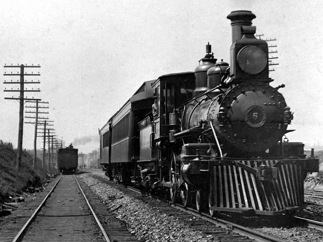
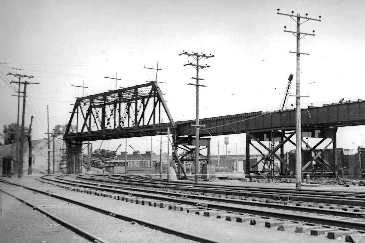
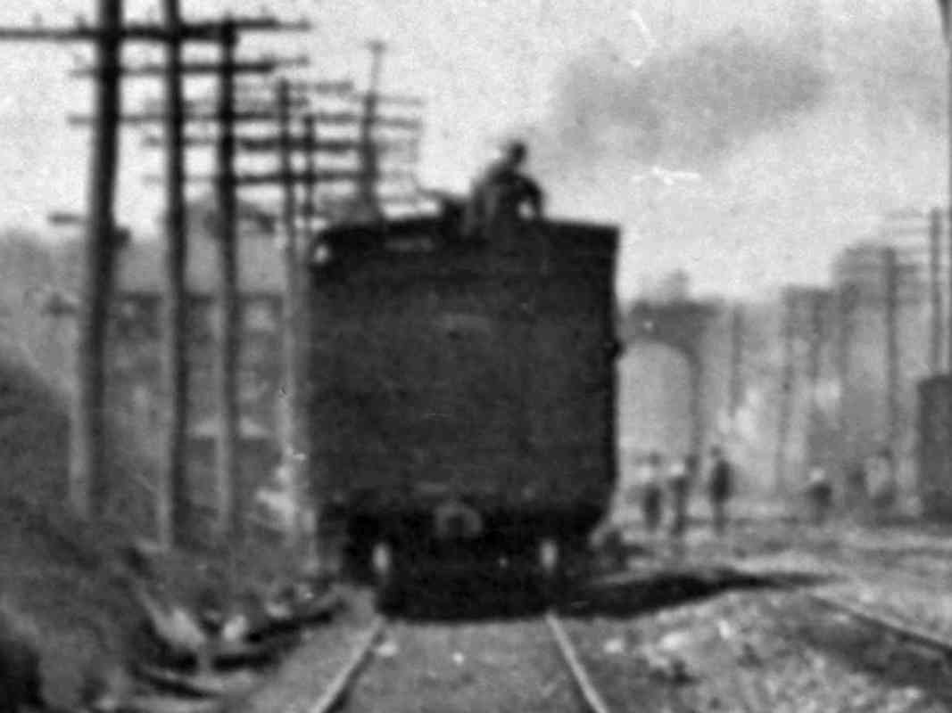
This photo came labeled as the Annapolis Short Line (ASL) engine 5 at Cliffords. Both Herb Harwood and I believe that location is incorrect. 
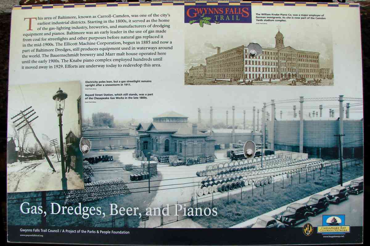
For a period around 1900, ASL followed B&O's South Baltimore Branch plus Camden Cutoff to reach into Baltimore city.

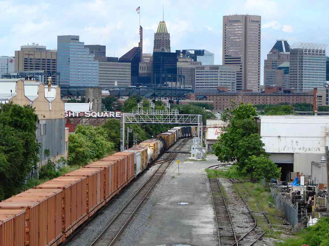
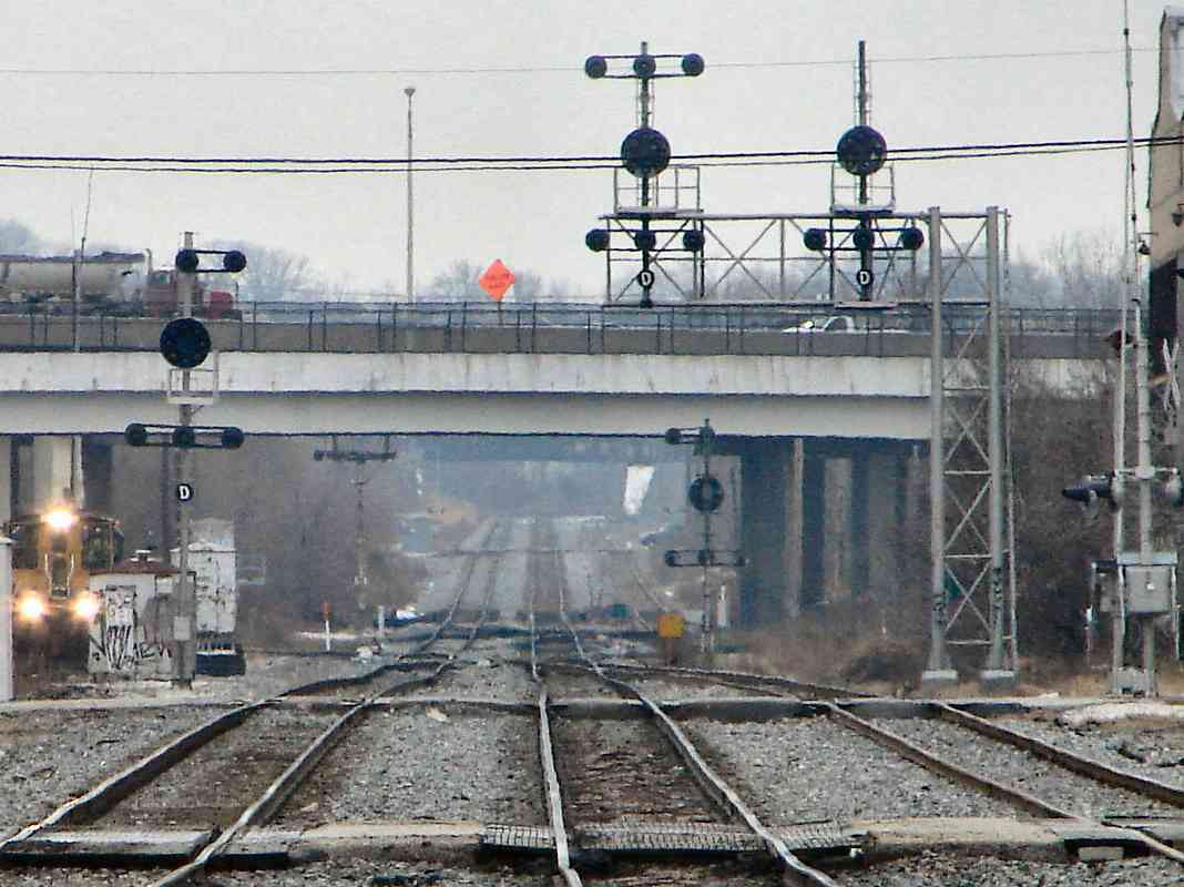
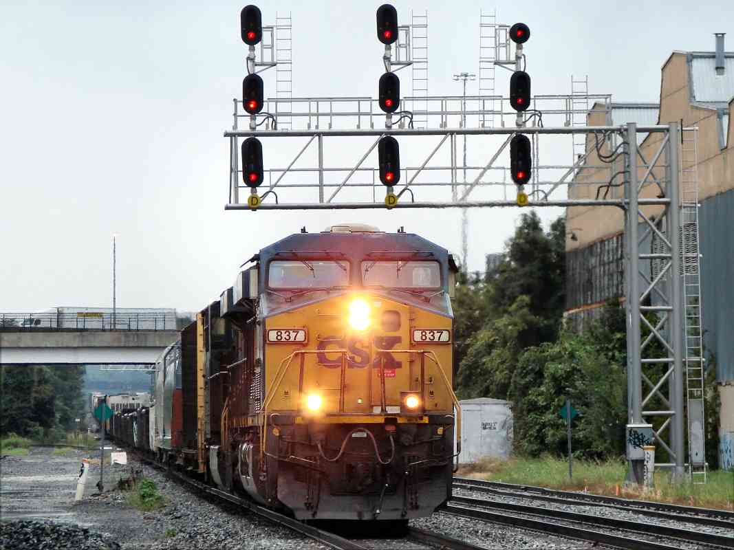
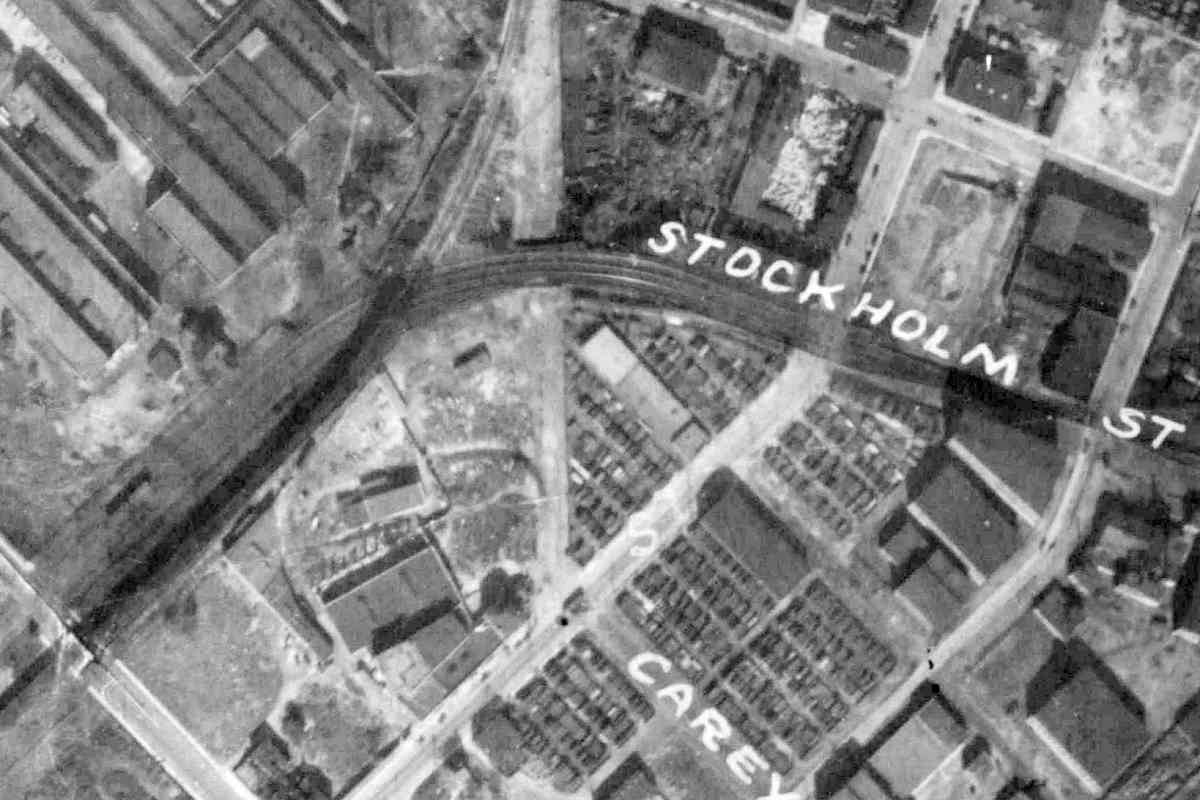
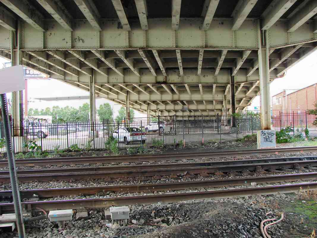
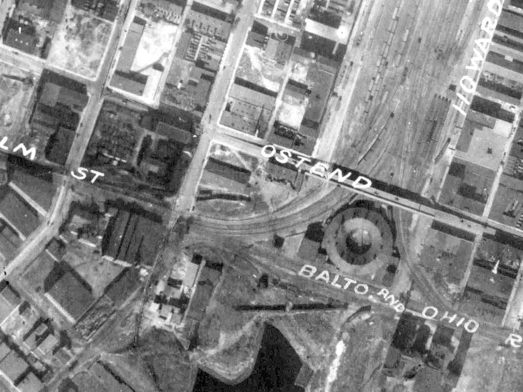
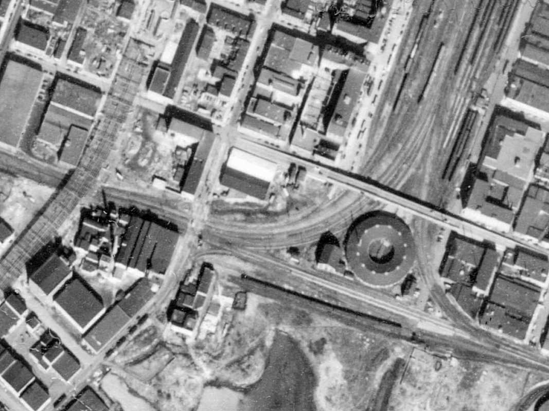
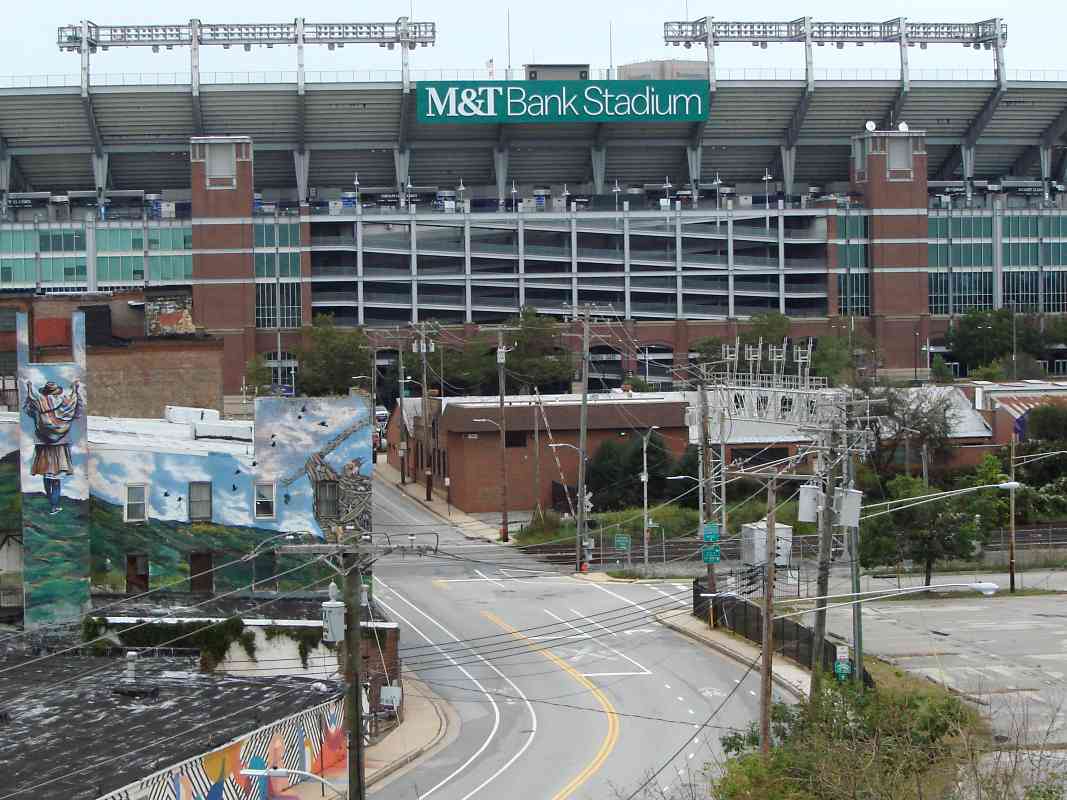
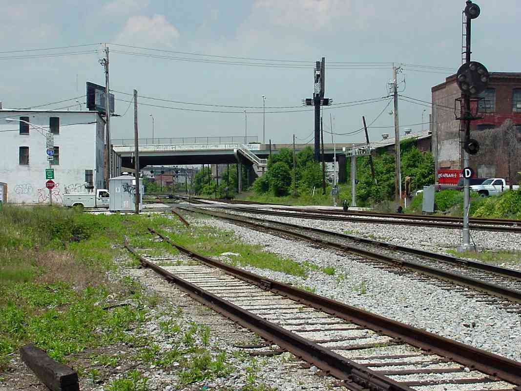
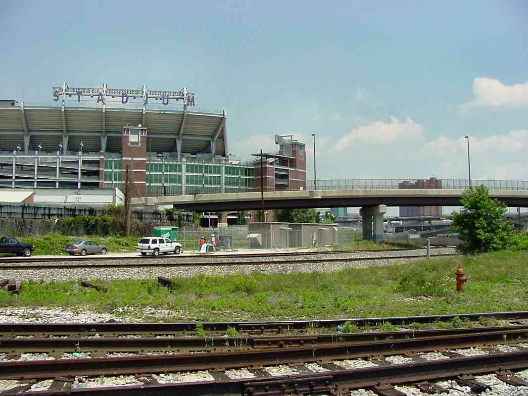
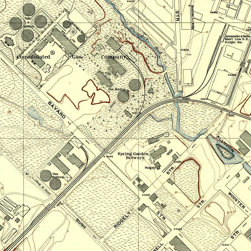
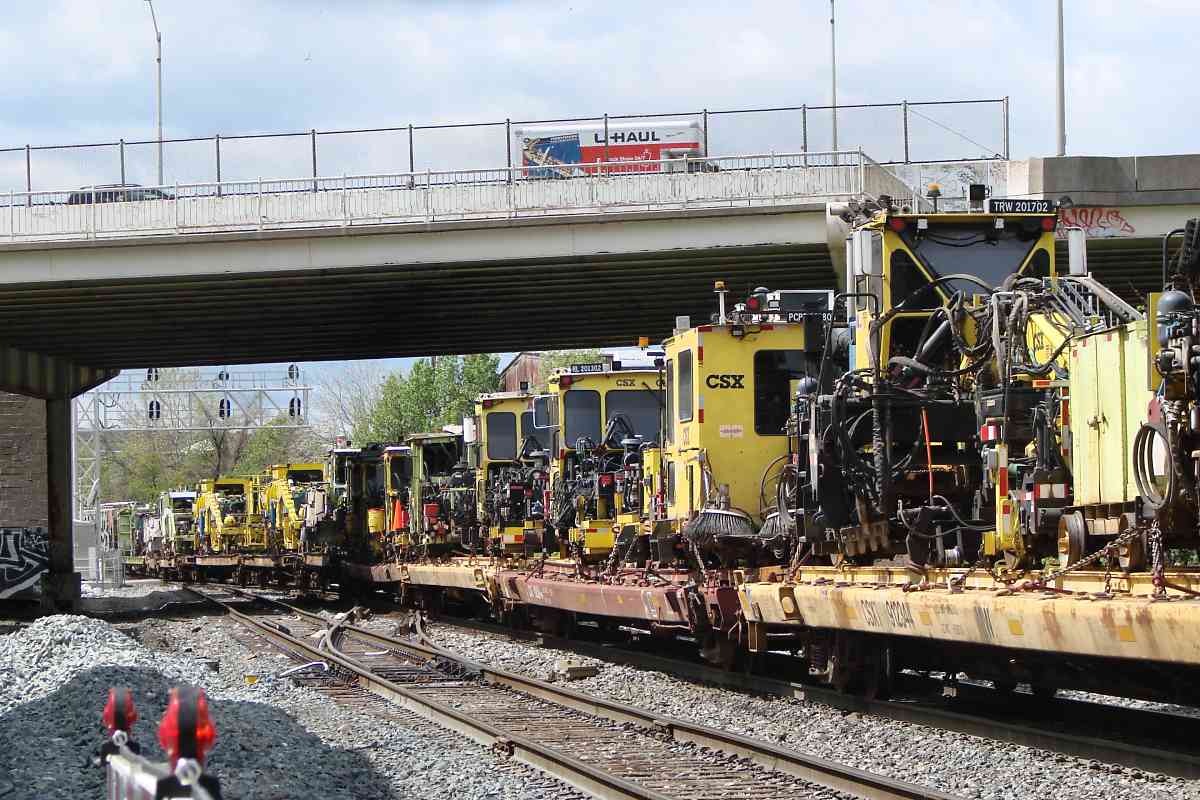
One candidate location is near Bush Street, looking southwest. In the distance there appears to be a structure on the left, about where Carroll Tower had been. That could be a bridge over the tracks at distant center, which might correspond to Curtis Bay Junction where the Curtis Bay Branch crosses over the Camden Cutoff.

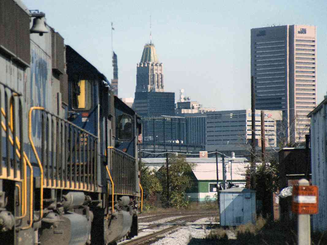
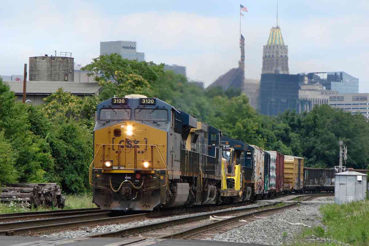
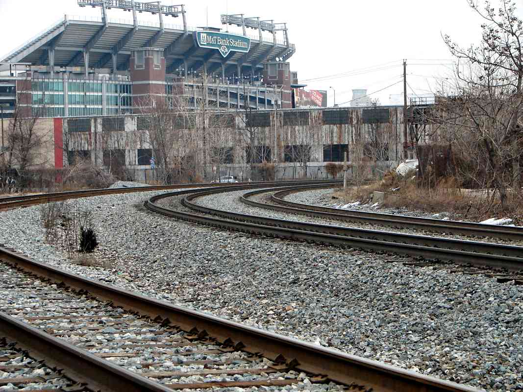
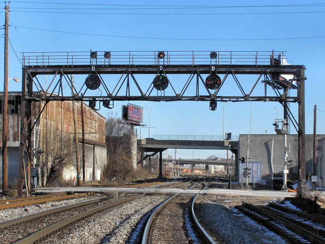
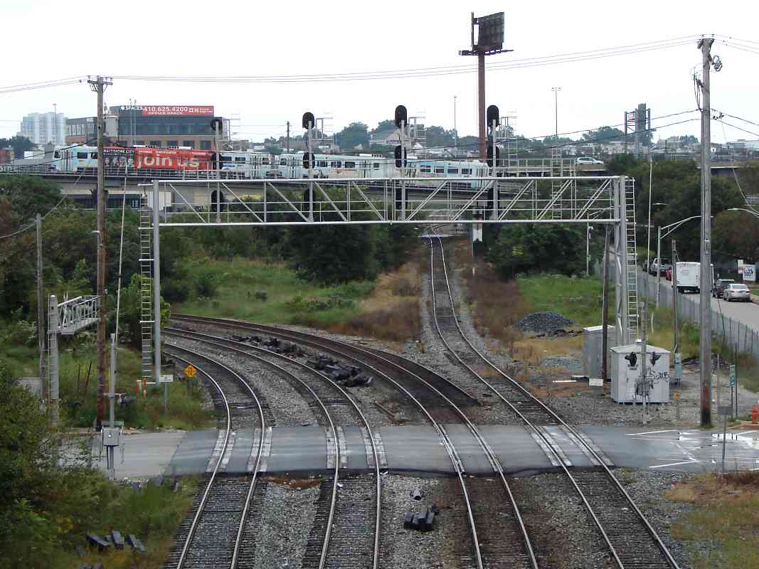
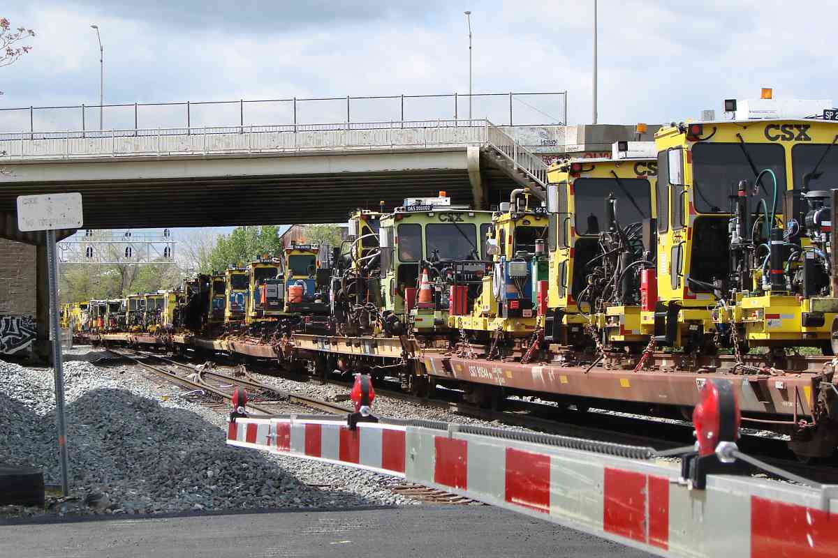
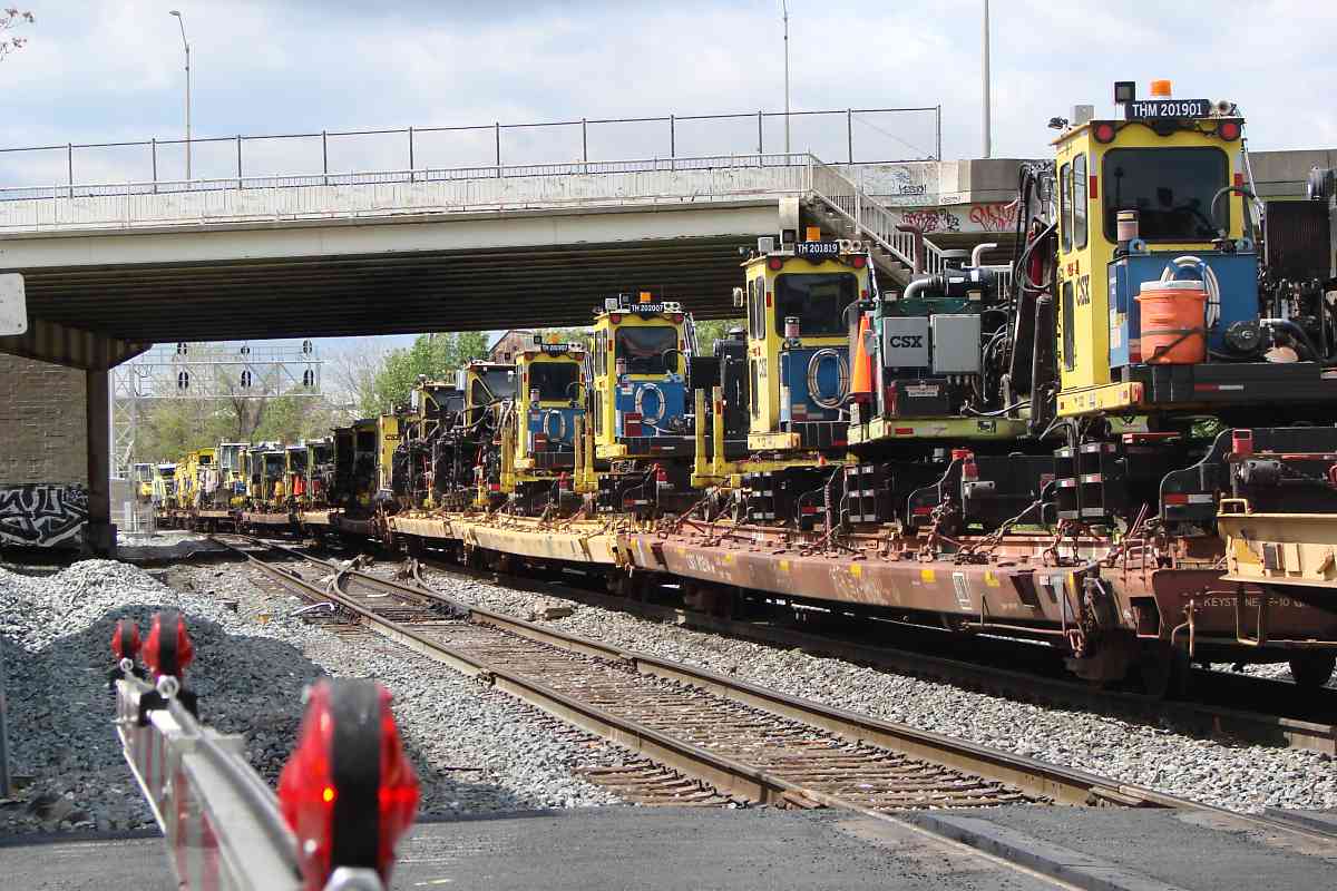
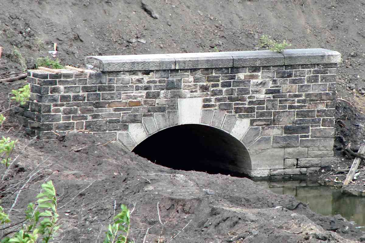
The modern photos below capture a similar view, with Monroe Street and I-95 the close bridges and the Curtis Bay Branch in the distance. If you believe a different location is a better fit, please let me know.

Detour: help with the Unknown Photos page
Change for: this site's ASL tour at Cliffords


CSX 6481
NEW! mid-Aug 2021

CSX 6481
Mile: 1.2 Date: Jan 2021
Ease: A View: SW
Area: B- IC2:
Map: Ba 42 J 3 Topographic Maps

CSX 581 As sunset approached on a January afternoon, CSX 6481's departure after a local delivery was delayed by several of its cousins. First, on the right a short train of gray hoppers would be pushed onto the South Baltimore Branch (now South Baltimore Industrial Track) with CSX 581 at the end. Meanwhile, back at Zepp's bridge, another trainload of coal was headed for Curtis Bay. Visually below it and waiting in the distance, green trash empties led by CSX 785 would roll through ahead of CSX 6481.

Covid or not, people still need and want stuff, so transportation is essential. The Amazon Prime truck is southbound on Interstate 95; Amazon containers began appearing on railroads during 2020, reporting mark AZNU.

Links: AZNU containers, 2005


Customer
NEW! mid-Aug 2021

Customer
Mile: 1.4 Date: Aug 2016
Ease: A View: N
Area: B- IC2:
Map: Ba 42 J 4 Topographic Maps

As seen from I-95, CSX 6481's delivery was to this rail customer, one of the few left along this stretch.


CSX 837

CSX 837
Mile: 1.2 Date: Sep 2018
Ease: A View: SW
Area: B- IC2:
Map: Ba 42 J 3 Topographic Maps

CSX replaced the CPLs with these signals, as seen from the Bush Street grade crossing.


City View

City View
Mile: 1.2 Date: Oct 2000
Ease: A View: NE
Area: B- IC2:
Map: Ba 42 J 3 Topographic Maps

Turning around at Bush Street yields this view toward downtown Baltimore. The grade crossings at Bush and Bayard (the next) are the region's two most proximate.


CSX 3120
NEW! mid-Aug 2021

CSX 3120
Mile: 1.2 Date: Jul 2021
Ease: A View: NE
Area: B- IC2:
Map: Ba 42 J 3 Topographic Maps

CSX 60 It's not often one sees a flatcar sandwiched between the lead engines.

This one carried two MoW units, CBH 202001 and CBH 202002, between CSX 60 and CSX 3360.


Gaslight Square
NEW! mid-Aug 2021

Gaslight Square
Mile: 1.1 Date: Sep 2018
Ease: A View: W
Area: B- IC2:
Map: Ba 42 J 3 Topographic Maps

Gaslight Square's appropriately-neon sign was first lit during 2006 as part of private redevelopment of this industrial area into mixed use.

Consolidated Gas 1894 The 1894 topo map at left depicts the large area then devoted to conversion of coal to coal gas (town gas) by Consoliated Gas Company. Two no-longer-extant Consolidated Gas 1894 spurs peeled from the main to provide coal delivery via railroad. Manufacture of gas from coal largely ended when sufficient inexpensive natural gas (methane) supplies were discovered.

Consolidated formed from the merger of several gas supply companies in Baltimore, the oldest of which, the Gas Light Company of Baltimore, was founded in 1816. Consolidated changed its name to Baltimore Gas and Electric in 1955, a company that as of 2021 still provides utility service to many customers in the region.

Link: 1937 electricity bill


Aerial 1927
NEW! mid-Aug 2021

Aerial 1927
Mile: 1.0 Date: winter 1926/1927
Ease: View: N (up)
Area: IC2:
Map: Ba 42 K 2 Topographic Maps

By 1927 some of the gas holder tanks were gone. The Bayard Street grade crossing is at lower left. Parallel B&O on its southeast side was elevated trackage of the WB&A.

Where B&O turns to the east, shadows say Scott Street, the vertical line at center, had been dug under the B&O. A poor-quality aerial photo from 10 years later appears to show the Scott underpass filled back in, and one from 20 years later shows a new siding installed there along the south side of the main. Sidings came and went based on the service demand of trackside customers.


over
Photo credit R.K. Henry

Over
Mile: 1.0 Date: May 1936
Ease: B+ View: E
Area: B- IC2: 217
Map: Ba 42 K 2 Topographic Maps

One of the spurs to Consolidated is visible at the bottom left of this 1936 photo. Ahead, the B&O main line turns east (right).

The WB&A eschewed grade crossings to further its goal of providing high-speed passenger service between its namesake cities.

The automobile conspired with the Great Depression to undo the WB&A: this photo captures the railway's structure being dismantled to be sold as scrap. Had this bridge survived, one would now be able to see M&T Stadium, home of the Baltimore Ravens, behind it, as in the next photo.


turn east

Turn East
Mile: 1.0 Date: Feb 2011
Ease: B+ View: E
Area: B- IC2:
Map: Ba 42 K 2 Topographic Maps

Much the same view as the prior finds B&O / CSX tracks still turn to the east here. Schroeder's Run, seen on the 1894 topo map, now is remembered only by white-painted ties ahead (not visible in this photo).


Ridgely Street
Photo credit Jersey Mike
NEW! mid-Aug 2021

Ridgely Street
Mile: 0.9 Date: ~2010
Ease: A- View: E
Area: B- IC2:
Map: Ba 42 K 2 Topographic Maps

Around the bend, the BAILEY CPL signal gantry since the 1930s had stood adjacent the Ridgely Street grade crossing until succumbing to CSX's relentless signal replacement project around 2012. Ahead next, Russell Strete bridges over.


Under Russell Street

Under Russell Street
Mile: 0.9 Date: Sep 2018
Ease: A View: S
Area: C IC2:
Map: Ba 42 K 2 Topographic Maps

Incredibly, even after the B-W Parkway had connected to it, busy Russell Street continued as a grade crossing during the early 1950s. This is a rare example of a grade separation bridge being built directly over the grade crossing it replaced.


Aerial 1927
NEW! mid-Aug 2021

Aerial 1927
Mile: 0.6 Date: winter 1926/1927
Ease: View: N (up)
Area: IC2:
Map: Ba 43 A 2 Topographic Maps

At photo time, the Russell Street grade crossing was near the white ST label. The eye-catching circular structure was B&O's Bailey Roundhouse where equipment was serviced.


Aerial 1953
NEW! mid-Aug 2021

Aerial 1953
Mile: 0.6 Date: Feb 1953
Ease: View: N (up)
Area: IC2:
Map: Ba 43 A 2 Topographic Maps

Russell Street's grade separation was under construction at photo time. The roundhouse sits within Bailey's Wye, a track structure that, unlike the roundhouse, has survived in use into the 21st century.


Bailey's Wye

Bailey's Wye
Mile: 0.9 Date: Sep 2018
Ease: B+ View: E
Area: B- IC2:
Map: Ba 42 K 2 Topographic Maps

Beyond the 4-track Warner Street grade crossing the main bends left at Bailey's Wye. Bailey's had been an important locomotive repair area for B&O. After 1928's Fair of the Iron Horse but before the B&O Museum opened in 1953, B&O's collection of early locomotives was stored within.

Links 1996, 1996


M&T Bank Stadium

M&T Bank Stadium
Mile: 0.8 Date: Sep 2018
Ease: A View: N
Area: B- IC2:
Map: Ba 42 K 3 Topographic Maps

Looking at the same Warner Street grade crossing from a different angle reveals M&T Bank Stadium. If you hear train horns during a Ravens football game, this is likely the grade crossing for which those horns were sounded.

Link: 2016


MOW Parade
NEW! mid-Aug 2021

MOW Parade
Mile: 0.7 Date: Apr 2021
Ease: A View: W
Area: B- IC2:
Map: Ba 43 A 3 Topographic Maps

DAS 201002 THM 201901 TRW 201702 RL 201302
What began innocently enough at Warner Street with eastbound CSX 5433 and CSX 3224 turned into the longest parade of Maintenance of Way equipment I have witnessed. The train was moving between 20 and 30 mph, and based on photo timestamps, took 4 minutes to pass. That makes the total length of the supporting flatcars at least 1 mile. MOW equipment is specialized, and therefore pricey: there was perhaps $100 million worth of equipment rolling, a total value not often exceeded by one train.
MT 201904 BST 201303 BR 201406
MOW flatcars are one of the primary places you can still find the C&O reporting mark, such as CO 920870 and CO 920652 pictured above.


SRS 770

SRS 770
Mile: 0.8 Date: Sep 2018
Ease: A View: NE
Area: B- IC2:
Map: Ba 42 K 3 Topographic Maps

SRS 770 is rounding Bailey's wye and headed for the Howard Street Tunnel. Sperry handles track defect detection work for many railroads.

Links: defect detection at work, defect detection at work 2, more SRS 770 pics


Roundhouse Site
NEW! mid-Aug 2021

Roundhouse Site
Mile: 0.8 Date: Jun 2021
Ease: A View: NE
Area: B- IC2:
Map: Ba 42 K 3 Topographic Maps

A light rail train adorned with red, yellow, and black Maryland state flag colors surveys the greenery at center that has filled in the site of Bailey's Roundhouse. The automobile ramps in the background storn_sewer belong to I-395.

In the foreground, bulldozers working toward a TopGolf driving range uncovered the long-hidden stone arch culvert near bottom right. Though it resembles culverts built by B&O, this one is the outlet of the Eutaw Street and Fremont Avenue storm sewer. The bulldozers later buried it, and extended the land outward to a new concrete culvert.

Change for: Baltimore light rail tour starting at Cockeysville


Warner Street

Warner Street
Mile: 0.7 Date: May 2001
Ease: B View: W
Area: B- IC2:
Map: Ba 43 A 3 Topographic Maps

At ground level along the southern leg of Bailey's wye, one can look back to the Warner Street grade crossing. This view came adjacent Stockholm Street, but is now obstructed by fencing. The leftmost track is a disused relic of a siding that had extended south along Warner Street. It was pulled up around 2009.

When rails first arrived here during the 1840s, they only continued east to Locust Point behind the photographer.

Link: 1991


Stadium

Stadium
Mile: 0.7 Date: May 2001
Ease: A View: N
Area: B- IC2: 141, 385
Map: Ba 43 A 3 Topographic Maps

Same spot as the prior photo. During the 1850s, a wye with spur was added (the far tracks) so trains could reach the then-new Camden Station, which in this view is about a half mile north. Bailey's Roundhouse had been on the right.

Links: 1977, 1990, Circus Train 2004
Change for: Locust Point Branch at this site


<< Previous (west) | THIS PAGE: Bush Street to Bailey's Wye | Next (east) >>

Or, return to main page

Copyright Notice